RabbiTRAILS is now AD FREE We hope you enjoy the less-cluttered format!
Balloons…
We spent three nights in the Albuquerque area during the Balloon Fiesta (2025 Balloons and Beyond Ep 6, Ep 7, Ep 8). Despite several balloon launches and glows cancelled due to rain, Friday was a perfect day with a spectacular morning ascension and wonderful evening glow-flicker, drone show and fireworks. It was the highlight of our trip!
And Beyond!
We left Albuquerque headed east on I-40 and spent the night in Tucumcari, NM.
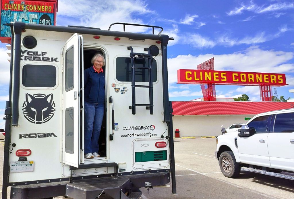
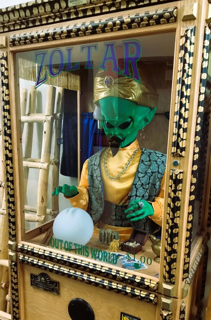
We ate lunch at Clines Corners, a gas station/kitschy tourist store a couple hours east of Albuquerque on I-40In addition to souvenir T-shirts, caramel nuts and toy slingshots, Clines Corners has several old-fashioned fortune-telling vending machines like Love Tester and Zoltar. Zoltar’s advice? Don’t drive truck campers through tunnels!
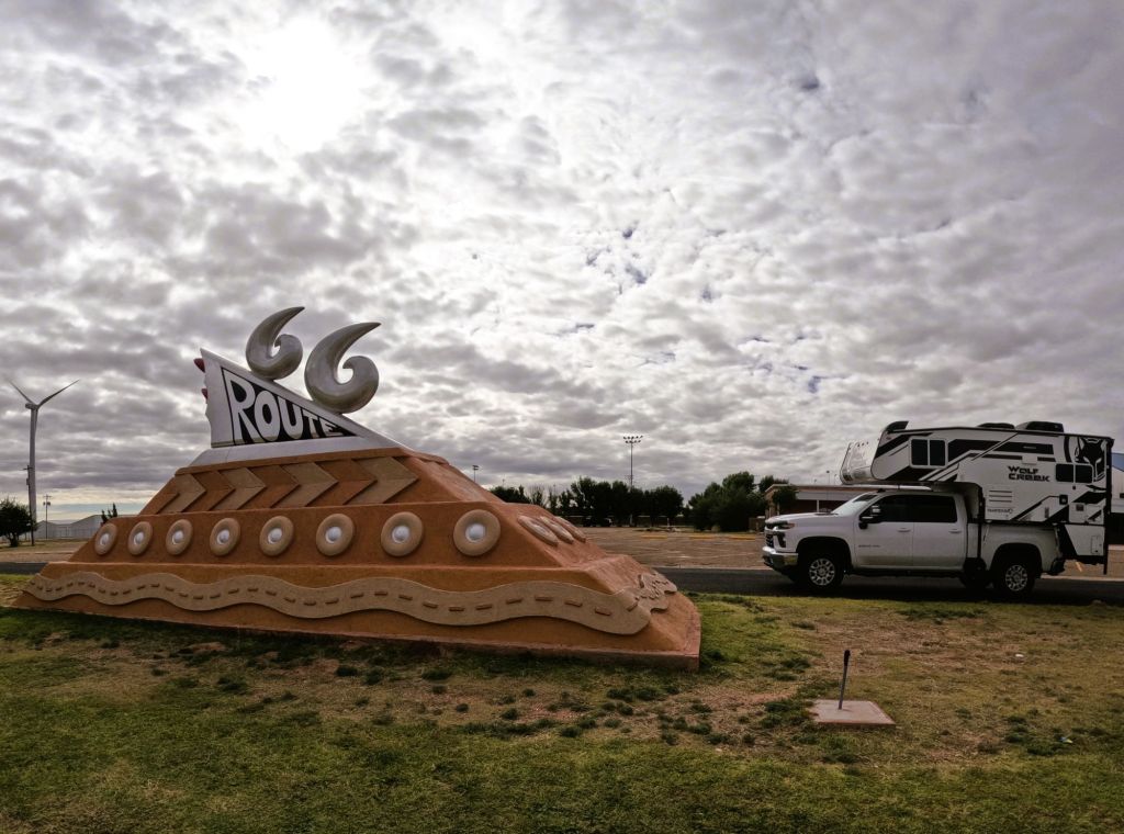
Tucumcari was once a major stop for travelers on Route 66, America’s Mother Road. On the edge of town there’s a whimsical Route 66 monument with a sloped sandstone base inscribed with tires and serpentine two-lane highway. It is topped with stylized sixes atop a 1950s tail fin and lights.
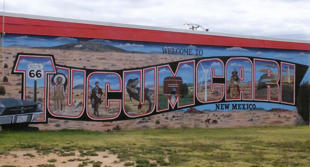
Tucumcari’s monument to Route 66, the Mother RoadMany towns have welcome murals like this one in Tucumcari
There are lots of small motels with names like Palomino Motel, Roadrunner Lodge, Relax Inn, Motel Safari, Pow Wow Inn and Buckaroo Motel that are closed or repurposed. A few remain open to offer lodging to nostalgic travelers.
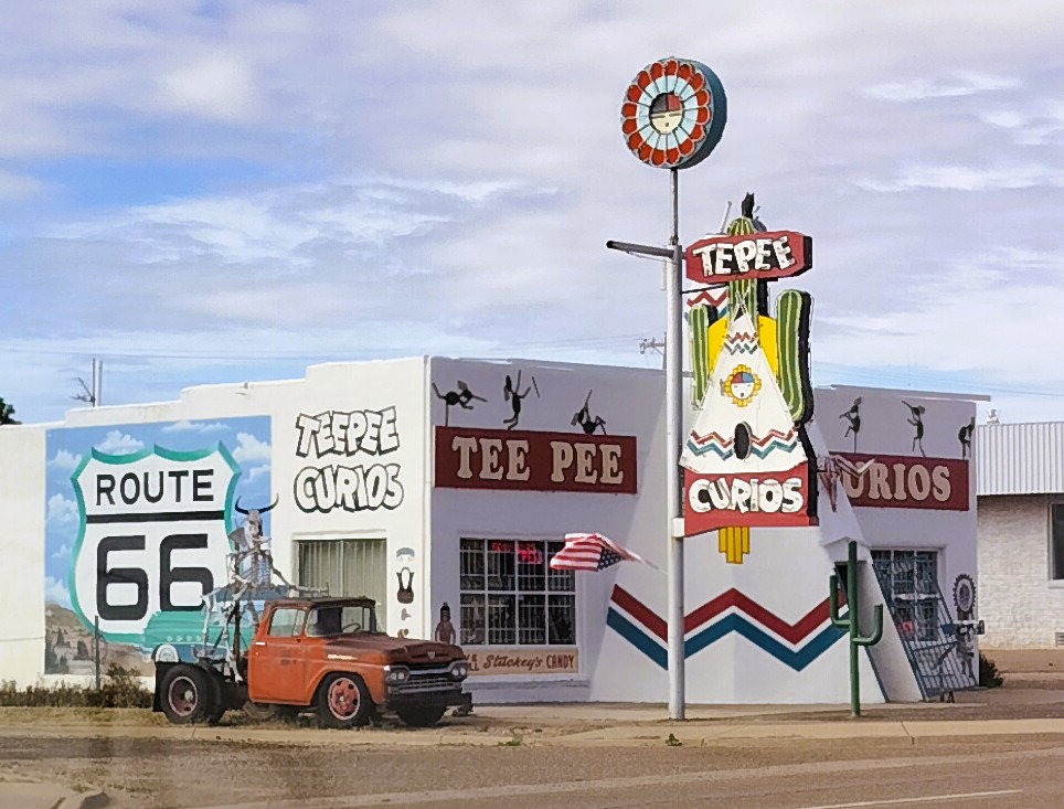
Tucumcari also has a variety of curio shops
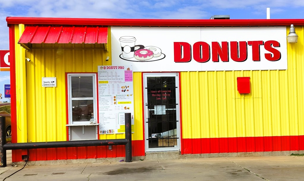
Cambodian Donut Cartel?
At Tucumcari Donuts we learned an interesting piece of the American story.
Tucumcari Donuts – part of the Cambodian Donut cartel?
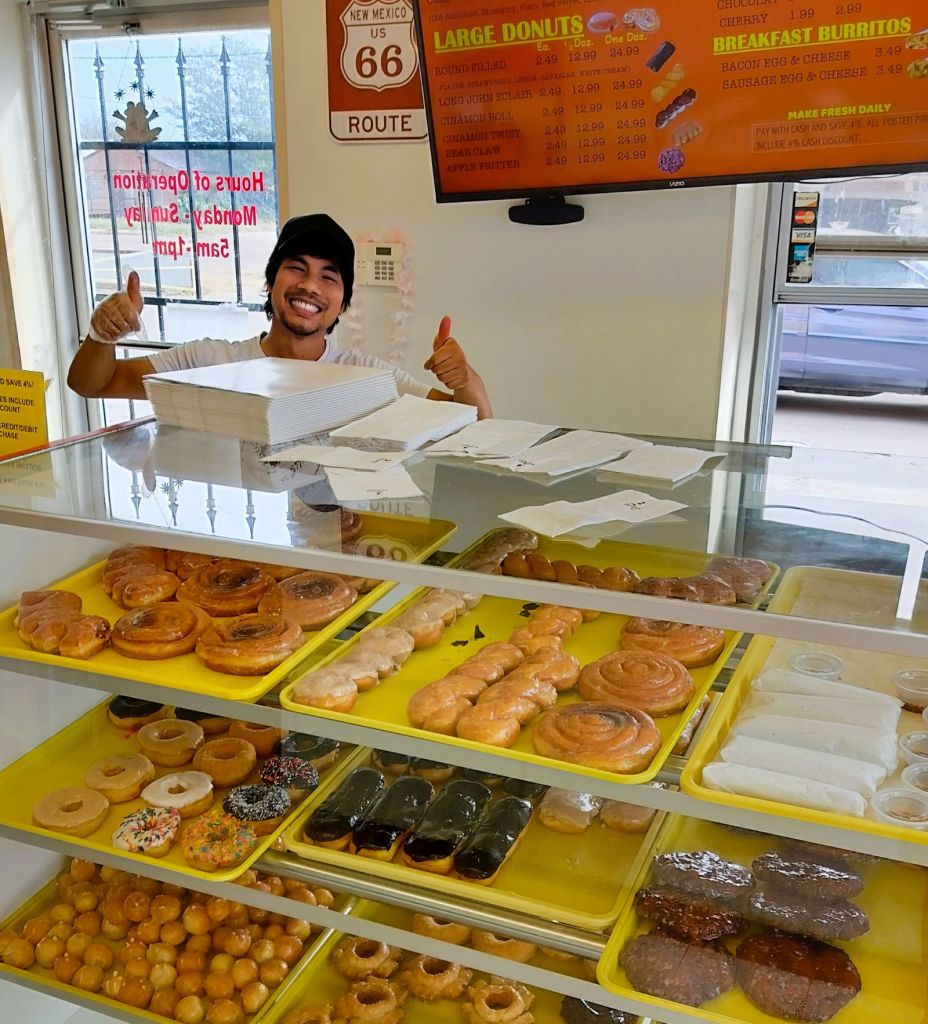
A young Asian man served us donuts and coffee and told us his family was from Cambodia. At similar donut shops in Missouri, Colorado and east Texas we learned the employees were also of Cambodian descent.
This friendly fellow with Cambodian heritage poses with amazing donuts!
Cambodian-owned donut shops are a huge part of the American donut scene, many stemming from refugees finding opportunity in America in the 1980s. The shops were pioneered by Cambodian Ted Ngoy (the Doughnut King), who helped fellow refugees start their own businesses.
Not Up to the Challenge
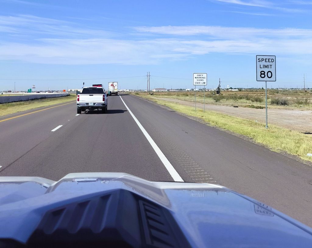
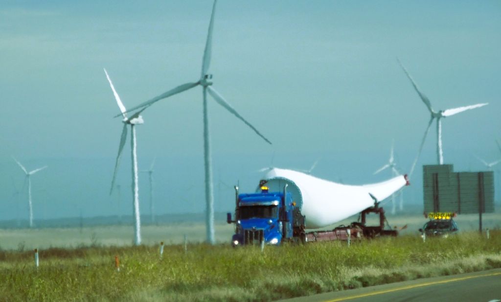
Trucks and cars zipped by us on Texas I-40. We poked along at 60 mphA long windmill blade traveling along I-40 will be added to one of the thousands of already-installed windmills on the Texas panhandle
We continued east to the Texas panhandle. The flat terrain was punctuated with THOUSANDS of Texas-sized spinning windmills.
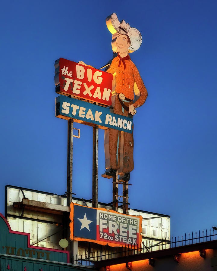
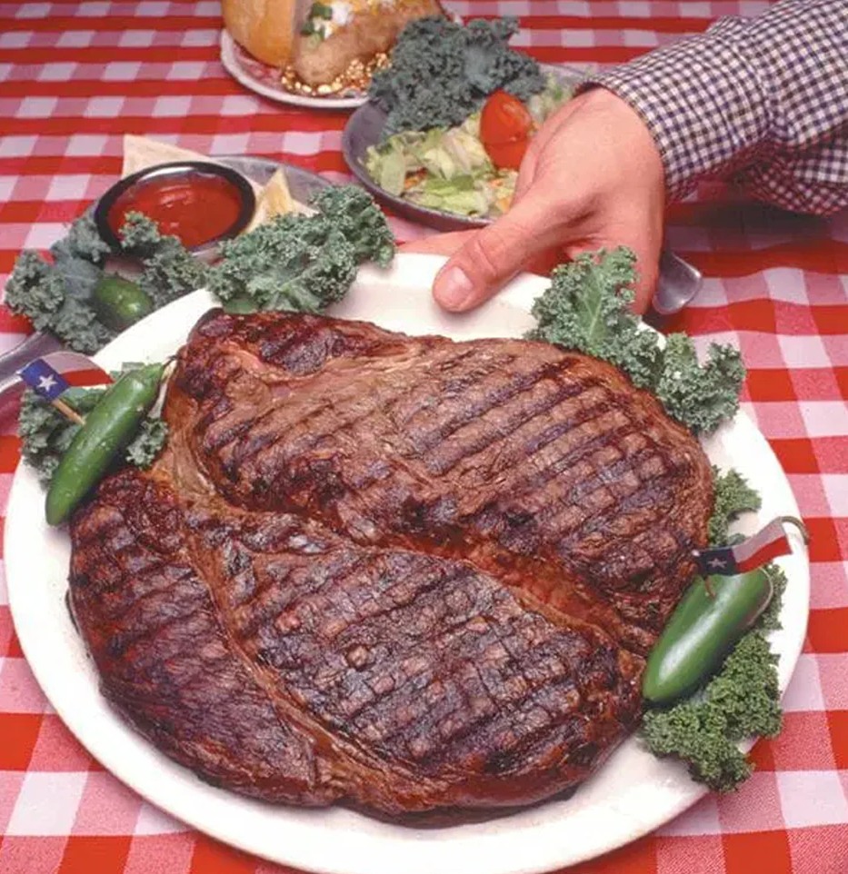
Like the omnipresent Buc-ee’s signs on interstate highways elsewhere, there were frequent signs encouraging a stop at The Big Texan Steak Ranch in Amarillo. The steakhouse is home of the world famous 72-ounce steak challenge: eat a 4½ pound steak and fixings in less than an hour and it’s free. Otherwise, the belly-busting meal will set you back $72!
Eat the 72-ounce steak at the Big Texan Steak Ranch in less than an hour and it’s free!
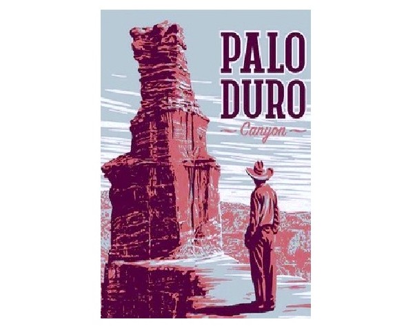
We weren’t up to the challenge. Full of our mid-morning donut snack, we passed by and turned south toward the second largest canyon in the United States.
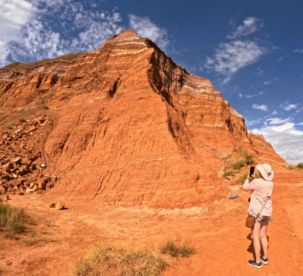
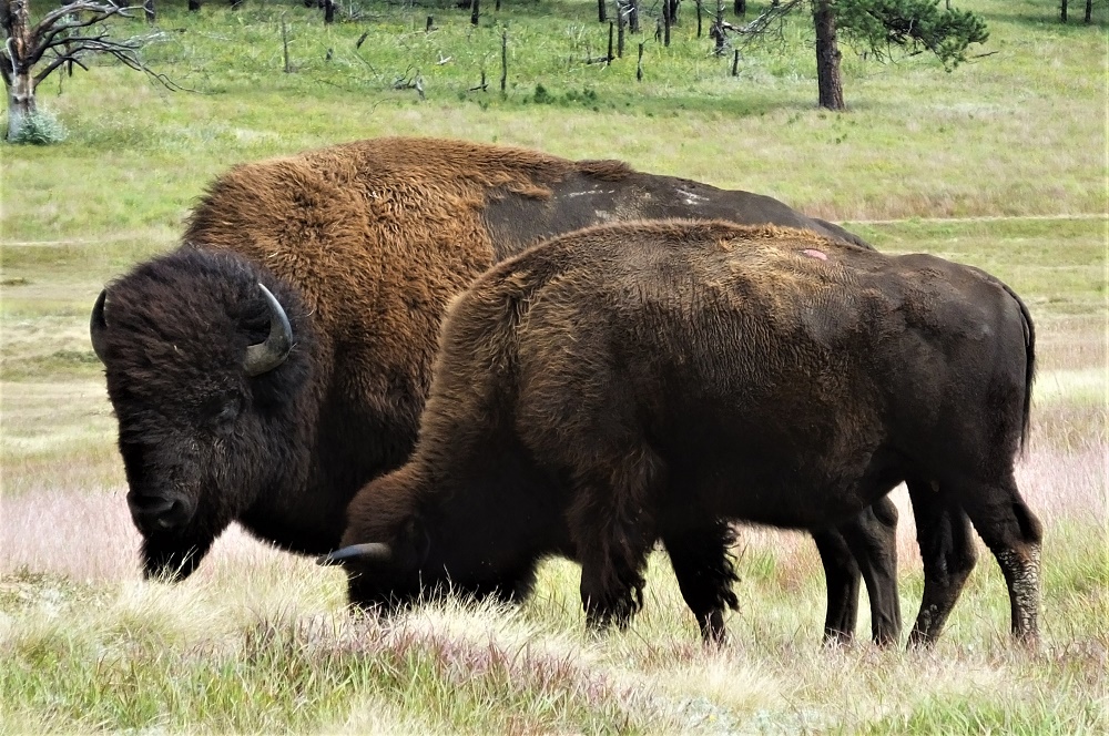
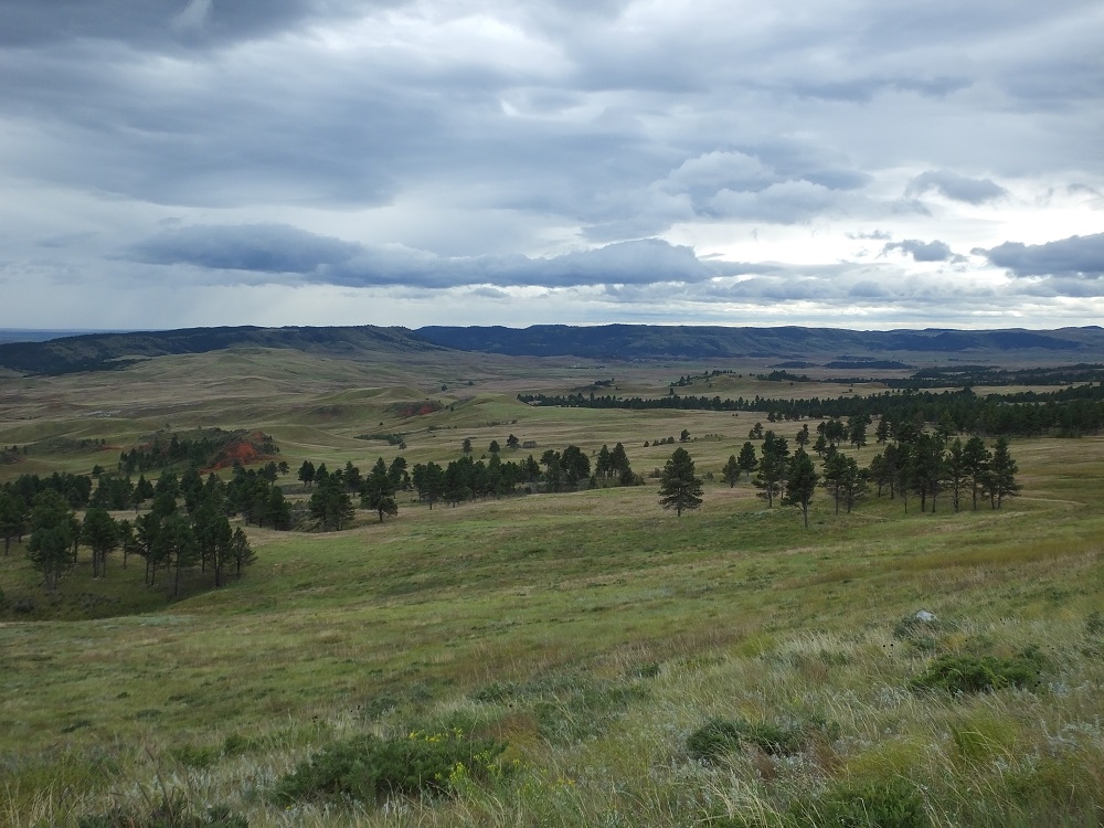
Palo Duro Canyon
Nicknamed “The Grand Canyon of Texas” both for its size and dramatic multicolored rock layers and steep mesa walls, Palo Duro is about 40 miles long, six miles wide (20 miles wide at places) and 800 feet deep.
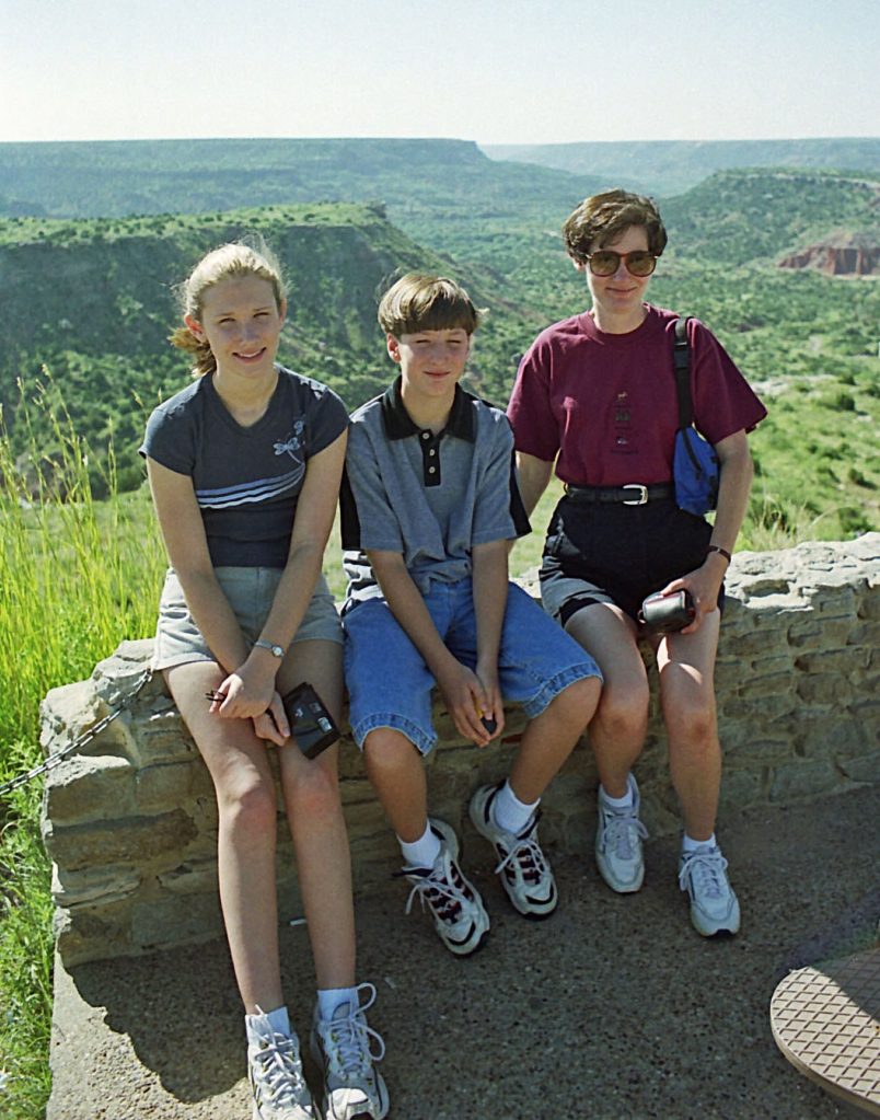
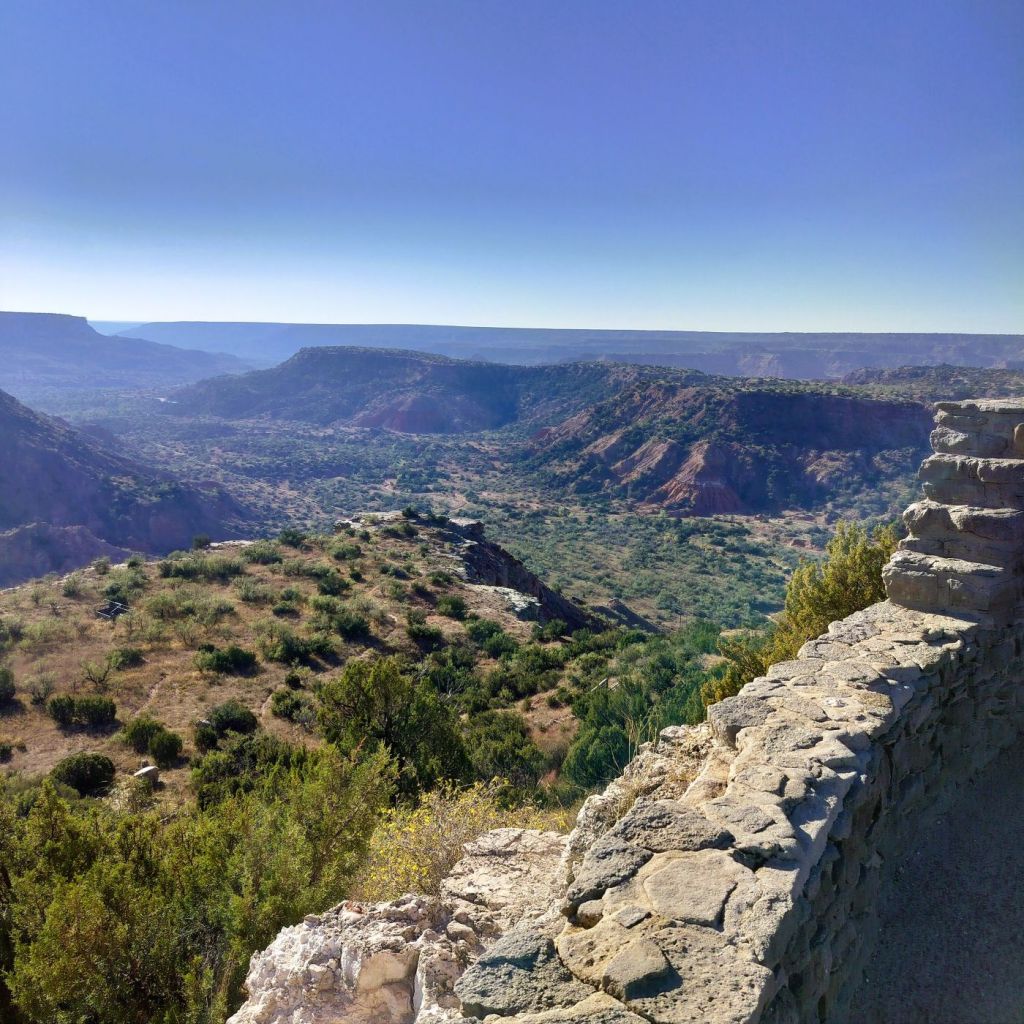
Liz, Phil and Pat during a 1999 visit to Palo Duro Canyon.2025 view of Palo Duro Canyon from same rock wall as 1999 family photo
Much of the canyon is contained within a Texas state park. The visitor center at the canyon’s rim has sweeping canyon views and in 1999 I took the family photo above as we enjoyed our first view of the canyon. How time flies!
From the viewpoint, the road quickly descends to the bottom of the canyon. The layered and multicolored canyon framed the road as we drove to the campground where we would stay for the next two nights.
Photographing the colorful layered canyon wall at Palo Duro State Park
We were greeted by Bullet (his real name), a campground host originally from Amarillo. He was a rodeo cowboy in his teens and later owned an Amarillo copier service business. Now retired, he has been a fulltime volunteer at three different Texas state parks for more than a dozen years.
He helped us set up and provided useful details about the campground and things to do in the park.
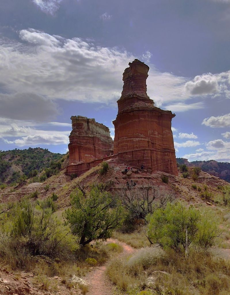
Pat carefully hikes into a low area along the Lighthouse TrailZoom this photo to see people on the ledge between the two formations – the Lighthouse is on the right
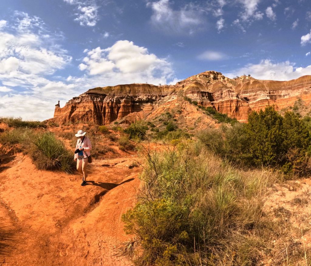
Six miles = Muscle Aches?
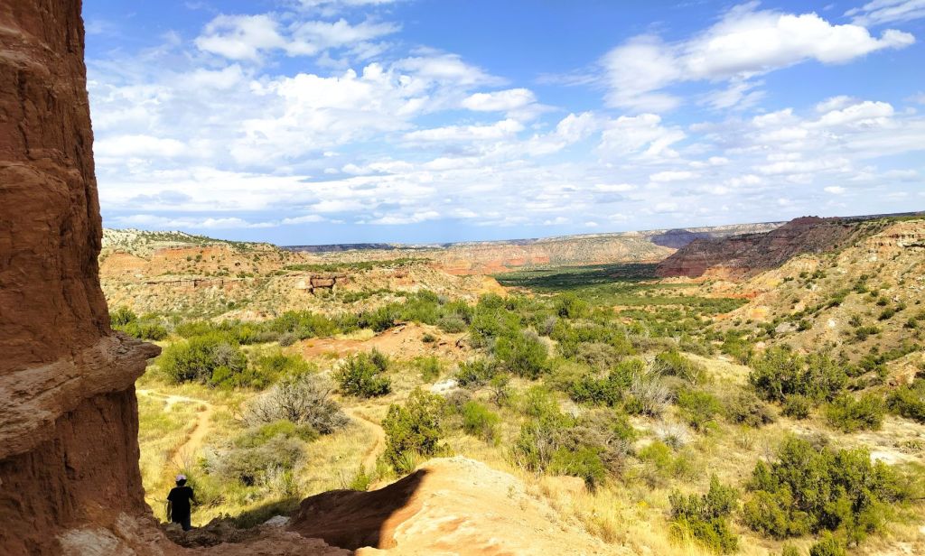
We decided to hike three miles to the iconic Lighthouse formation, prominently displayed in park promotional brochures. The mostly flat trail weaves through several canyons before the steep quarter-mile climb to the Lighthouse. After a precarious scramble to the base of the formation, we had great views of the broad canyon.
Sweeping view of Palo Duro Canyon from the Lighthouse
The hike was worth a few minor muscle aches!
Balloons and Beyond – Wrap-up
Palo Duro was our first Texas state park during our fall 2025 Balloons and Beyond travels. Next episode we wrap up the series with visits to five more Texas state parks as we cross the state on our way home.
Don’t forget to LIKE our blog posts and to SUBSCRIBE for future updates
We left New England enjoying the warm, hazy days and cool nights of mid-August.
We endured several days of heavy rainfall as we crossed Vermont and New York. While camping on the St. Lawrence River, we watched big ships and wondered if any would be traveling nearly 2500 miles across the Great Lakes to Duluth, MN, a stop we made earlier this summer.
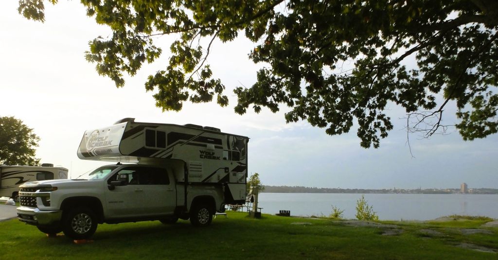
Camping on the St Lawrence River. The far shore is Ontario, Canada.
The next night we camped close to where the St Lawrence flows out of Lake Ontario. Our campground was covered with large puddles and the ground was squishy everywhere. We left our shoes on the back step of Pap to avoid tracking mud into the camper!
Fishes and Falls
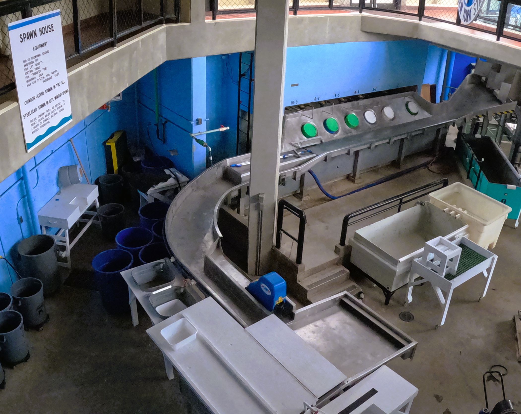
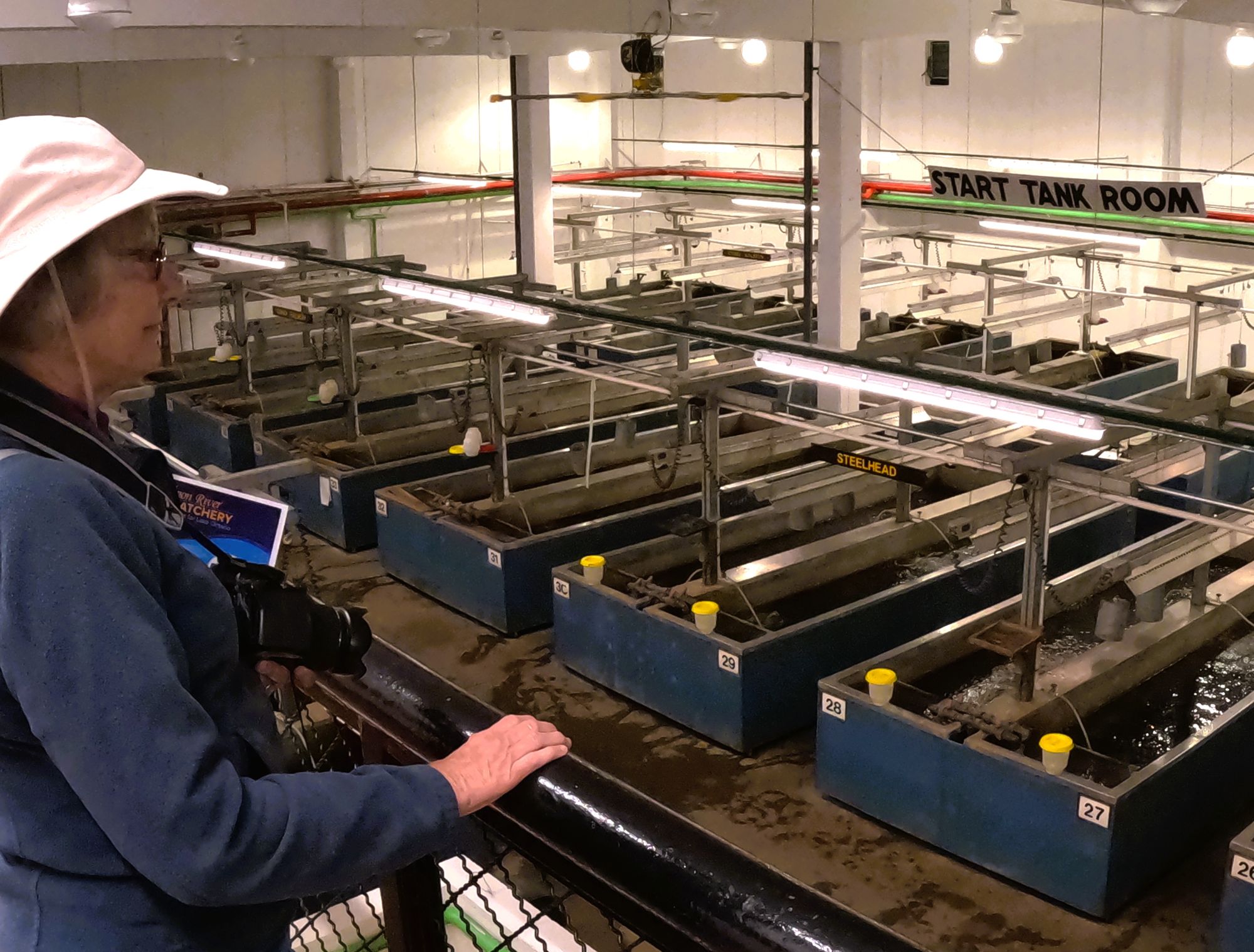
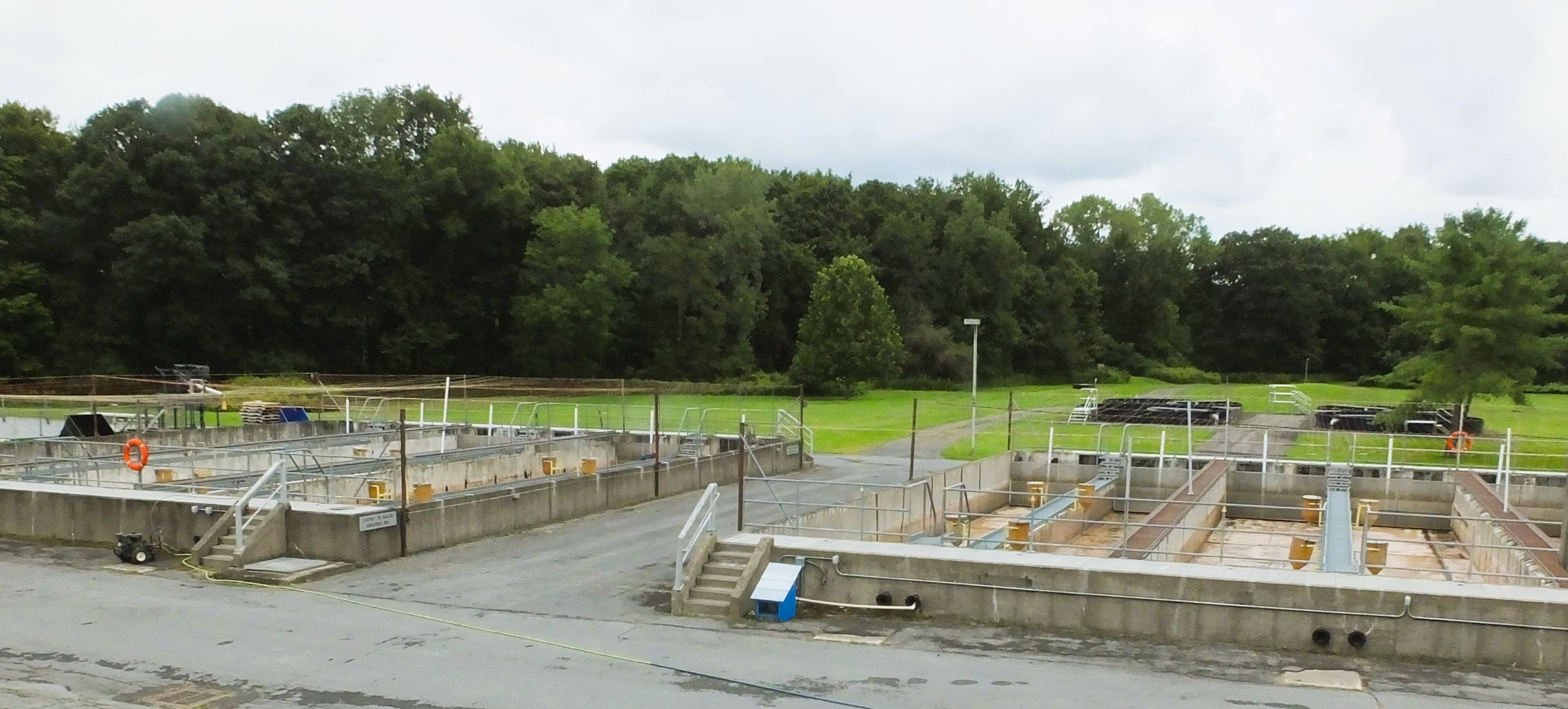
The next morning, we visited a fish hatchery nearby on the Salmon River. The hatchery was opened in 1981 to raise king and silver salmon and trout.
Salmon River Fish hatchery: stream where fish are directed to fish ladder, room where eggs and milt are harvested, developing fish are raised in indoor tanks and then transferred to outdoor tanks before being released
Millions of eggs are collected from adult fish, hatched, raised and released throughout New York’s Great Lakes and the rest of the state. Egg harvesting takes place in the spring and fall, so it was quiet during our visit (mid-August). We were reminded of hatcheries visited on past trips to Alaska and Oregon.
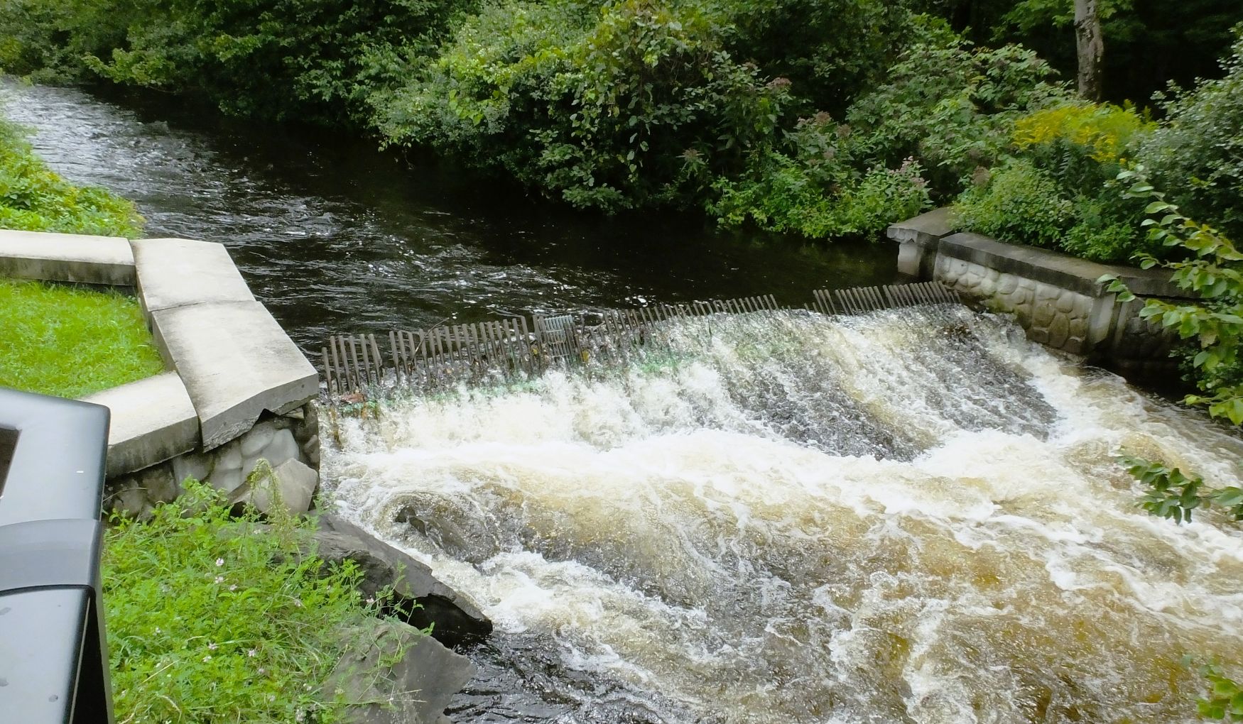
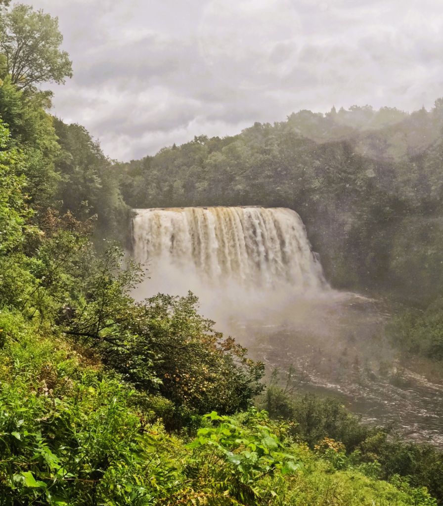
The Salmon River Falls were nearby, and we decided to check them out.
Salmon River Falls, swollen by the recent heavy rains
The falls were amazing! Swollen from the recent rains, we could hear the falls nearly a mile away. We carefully walked down a steep trail towards the base of the 110-foot falls but had to turn back to avoid being soaked by the falls’ mist cloud!
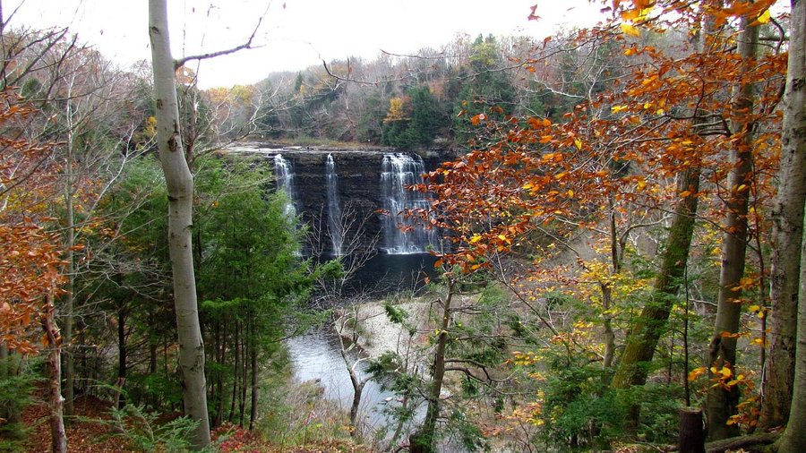
Salmon River Falls at normal water levels
More Waterfalls
Our travels continued south into Pennsylvania, enroute to Ricketts Glen State Park.
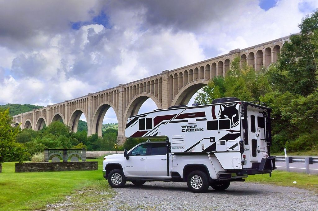
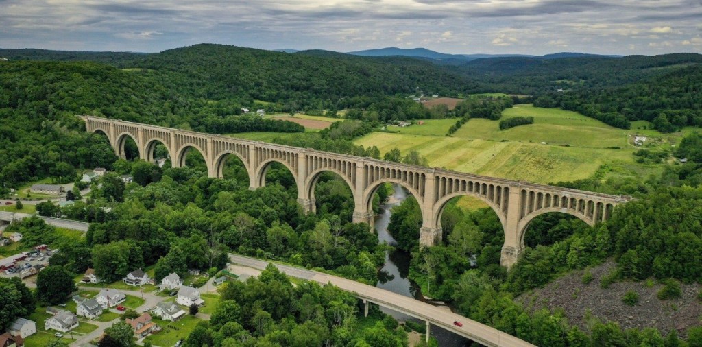
Percy and Pap posing at Tunkhannock Creek ViaductAerial view of the viaduct (image from Google)
Passing through Nicholson, PA, we stopped at the Tunkhannock Creek Viaduct. Completed in 1915, the half-mile long viaduct was the largest concrete bridge in the world at the time and regarded by some as the ninth wonder of the world. The impressive structure is nearly 300 feet tall and still in use by Norfolk Southern freight trains.
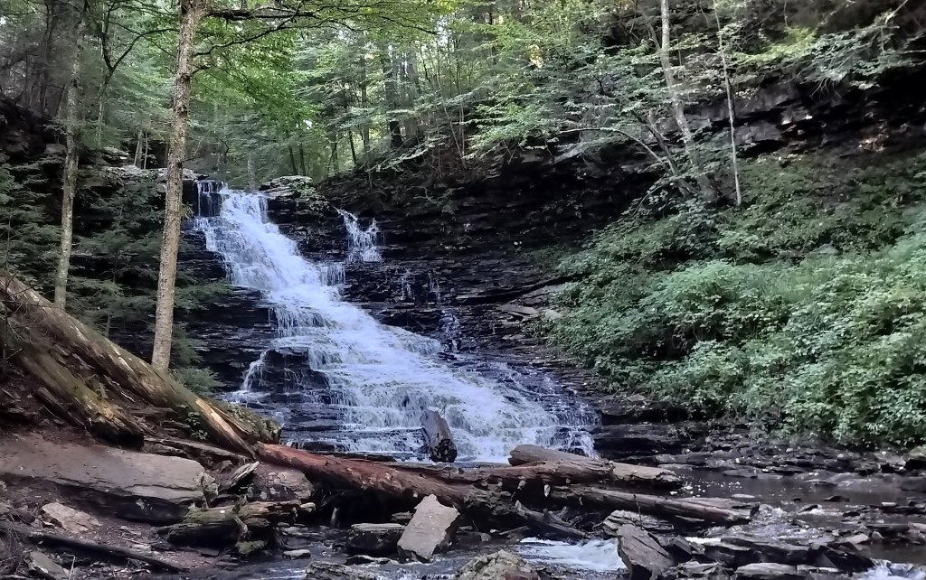
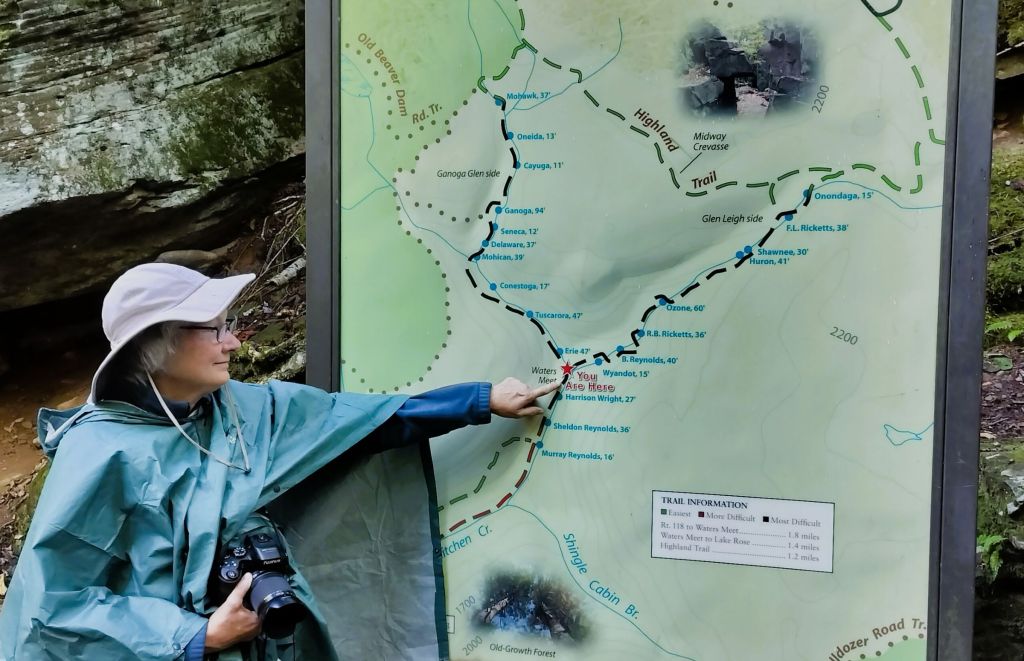
22 Falls at Ricketts Glen
If you have a wish to see waterfalls, Ricketts Glen SP is the place for you. In just over five miles of rocky, steep trails you can view 22 named waterfalls. At 94 feet, the park’s tallest waterfall isn’t the size of Niagara (or Salmon River) Falls, but it and the other falls are beautiful.
Waterfall hiking at Ricketts Glen
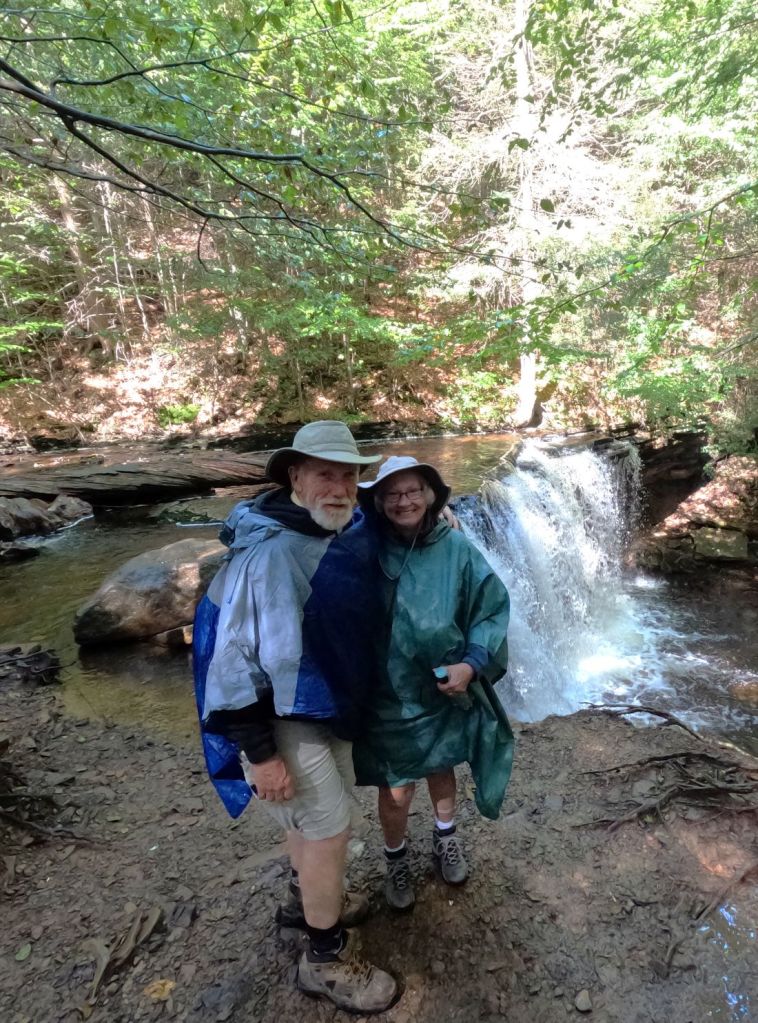
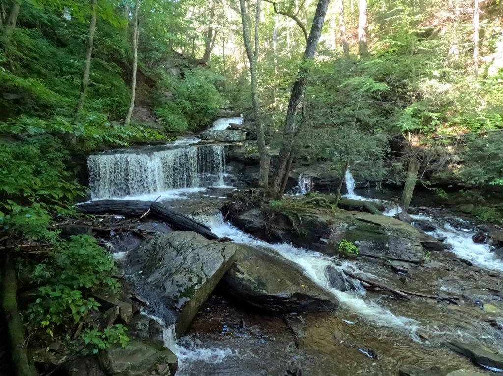
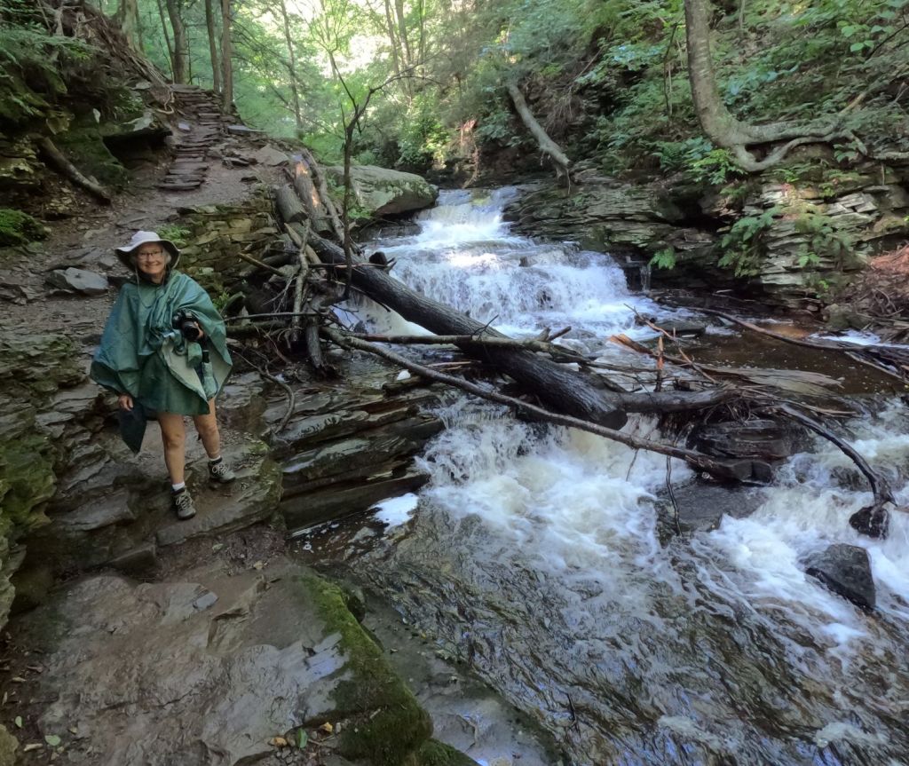
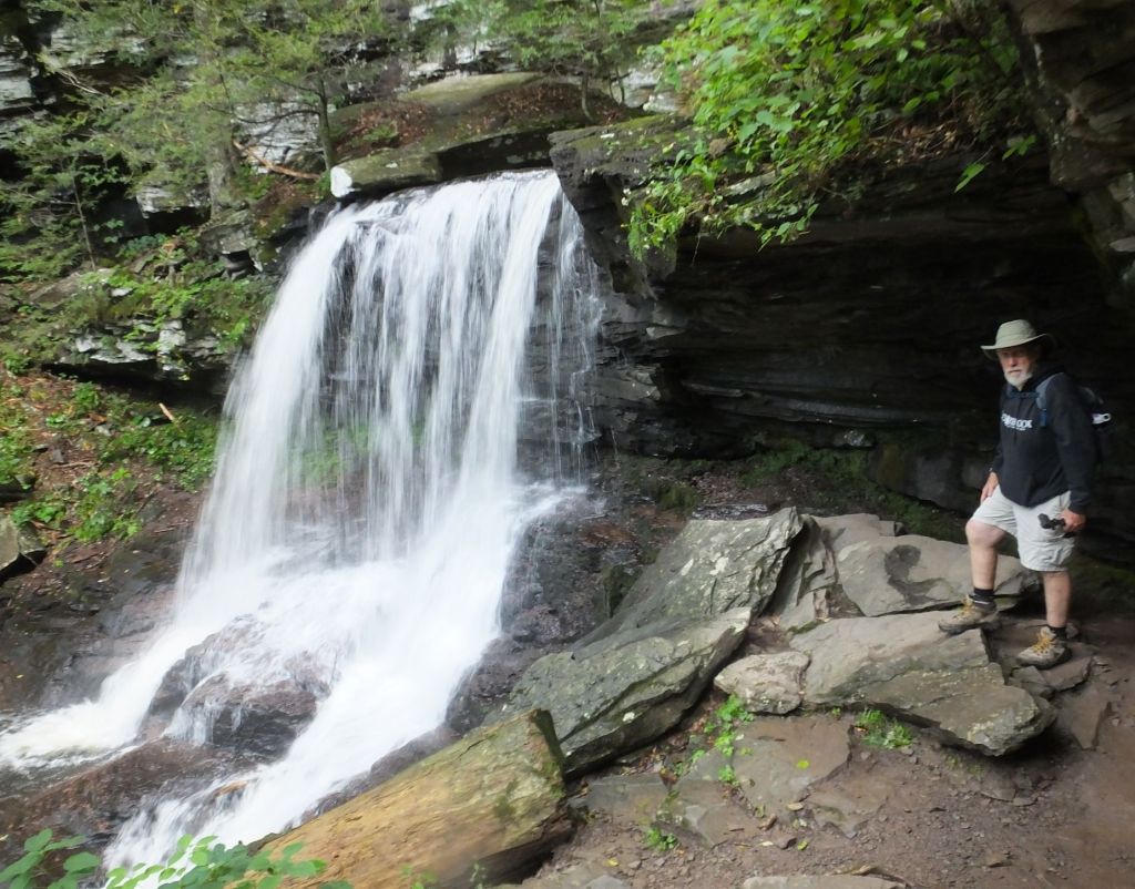
Our 3.5-mile waterfall hike went past 18 of the falls (the others are on a side trail that we didn’t take). It was raining when we started, so we carefully descended nearly 500 feet down steep slick stairs and across large boulders. The falls were various sizes, and we stopped at each to enjoy the peaceful tranquility.
Various photos of our hike to 18 waterfalls at Ricketts Glen SP
The rain had stopped by the time we reached the bottom of our descent. We paused for a snack and enjoyed talking with other hikers, comparing the falls and reviewing trail conditions.
Stopping to look at another beautiful waterfall
The return part of the trail was a little easier. Conditions were drier and, for us anyway, it always seems easier to climb a steep trail and stairs than the opposite.
The park has other trails and a nice lake. It is well worth a visit if you travel through central Pennsylvania.
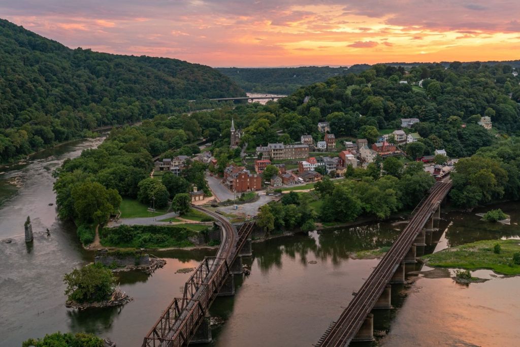
Harper’s Ferry
We drove southward from Pennsylvania into Maryland, then a tiny bit of Virginia and finally West Virginia.
Harpers Ferry, WV (image from Google)
We visited Harpers Ferry National Historic Park at Harpers Ferry, WV. The town is at the confluence of the Potomac and Shenandoah Rivers where Maryland, Virginia and West Virginia meet. It is interesting looking around the well-preserved historic area.
We learned the town was the northernmost point of the Confederacy during the Civil War. It is also where abolitionist John Brown led a raid on the federal armory in 1859, hoping to start a slave rebellion.
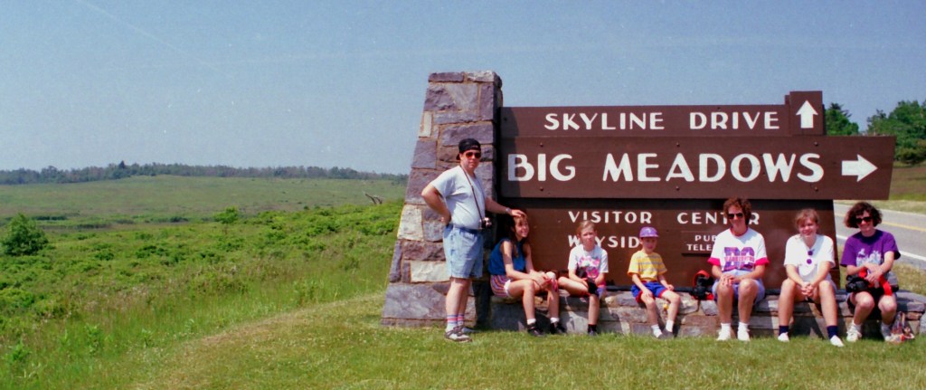
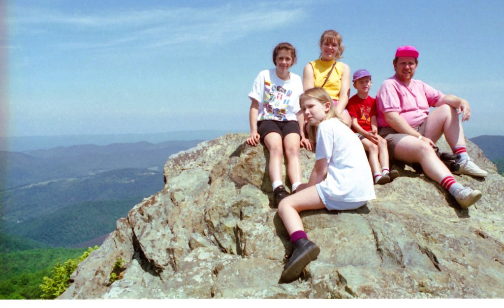
1993 Visit to Big Meadows with Pat’s sister and family
Driving the Shenandoah Skyline
Some of our favorite vacations over the years have been driving the Skyline Drive in Virginia’s Shenandoah National Park and the Blue Ridge Parkway in Virginia and North Carolina.
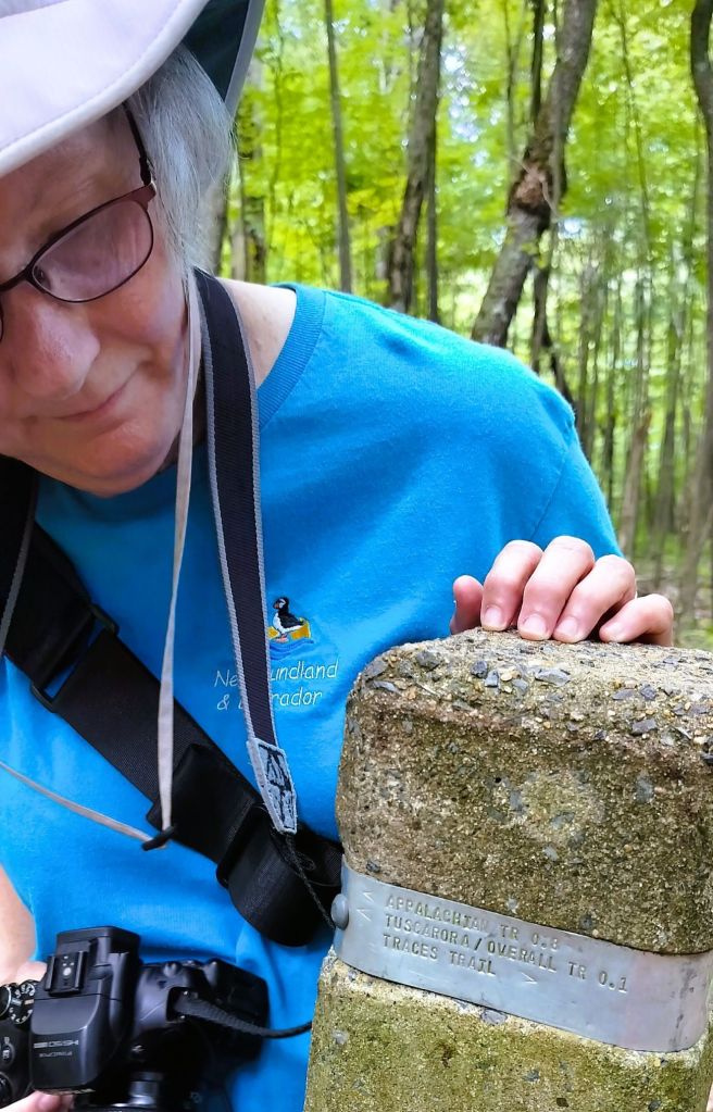
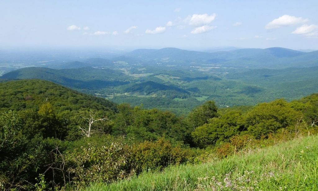
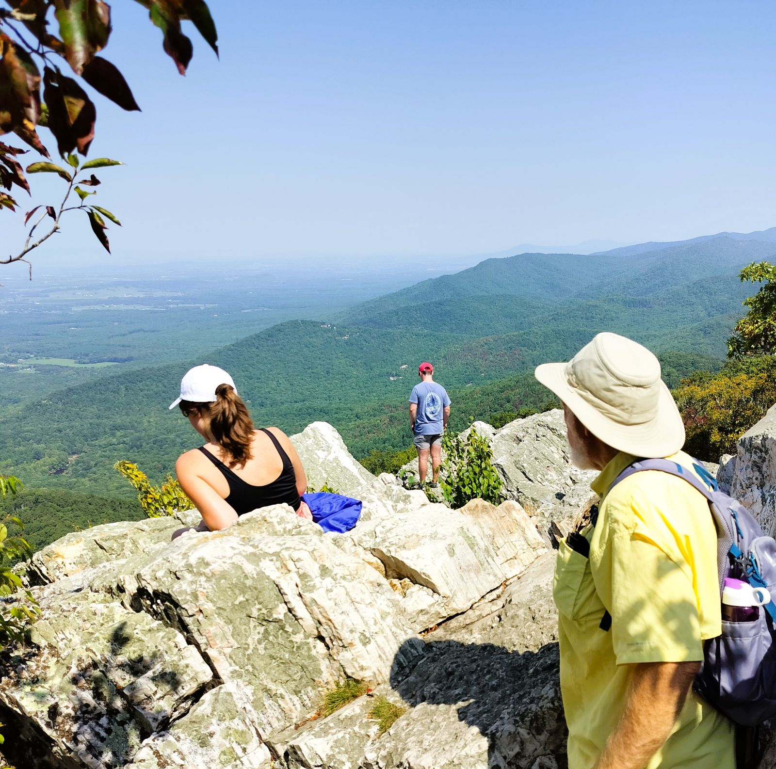
This trip we camped several nights at Matthew’s Arm campground at the northern end of the drive. We hiked several short trails that took us along the Appalachian Trail. The views of nearby valleys and distant mountains were nice, but not spectacular due to haze from fires in the far west.
Pat examines a band imprinted with trail information
This hazy view of the valley and distant mountains was still beautiful
We stopped for lunch at Big Meadows, midway on the drive, as we continued south. Maintained by periodic burning, the 136-acre meadow is the largest open area in the park. It is covered with a variety of flowering plants as well as blueberry and blackberry bushes.
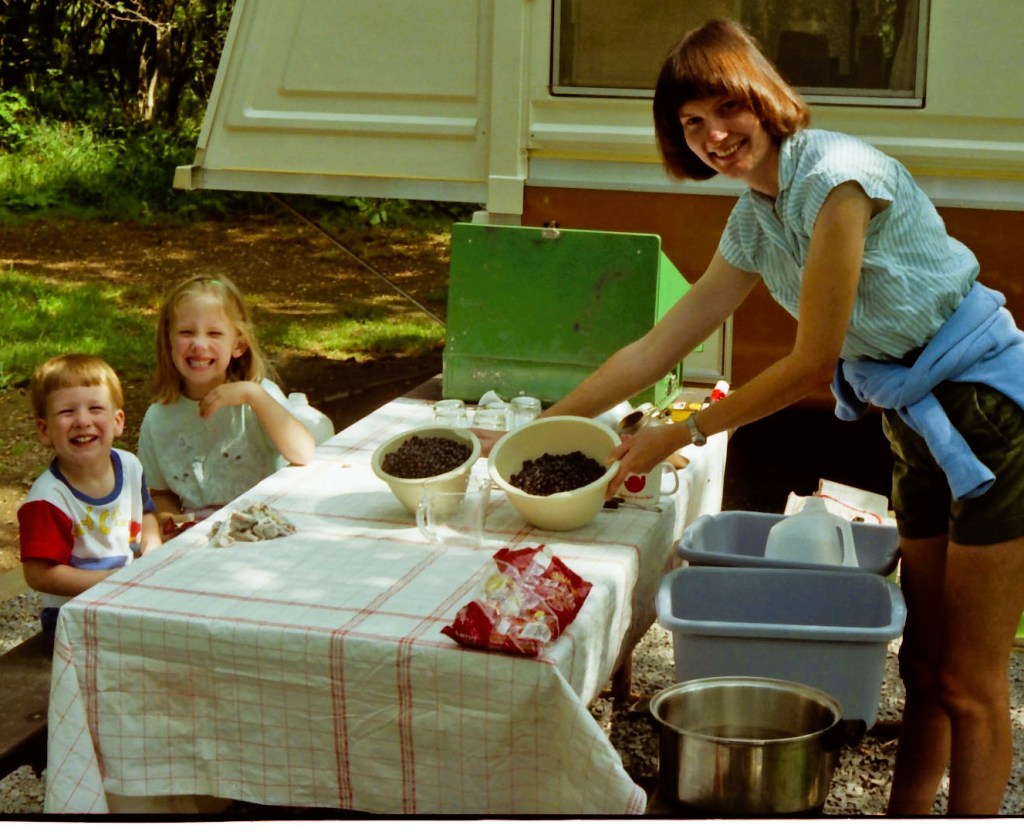
Making blueberry jam at Big Meadows in 1989
We recalled a trip with our children 35 (!) years ago when we picked blueberries and made jam at our campsite.
Bearfence rock scramblers, 1993
Further along we passed the trail to Bearfence. Over the years we scrambled over large, exposed boulders to a magnificent view of the distant mountains and Shenandoah Valley. One rock scaling adventure in 1993 is captured above with a photo of our children and nieces.
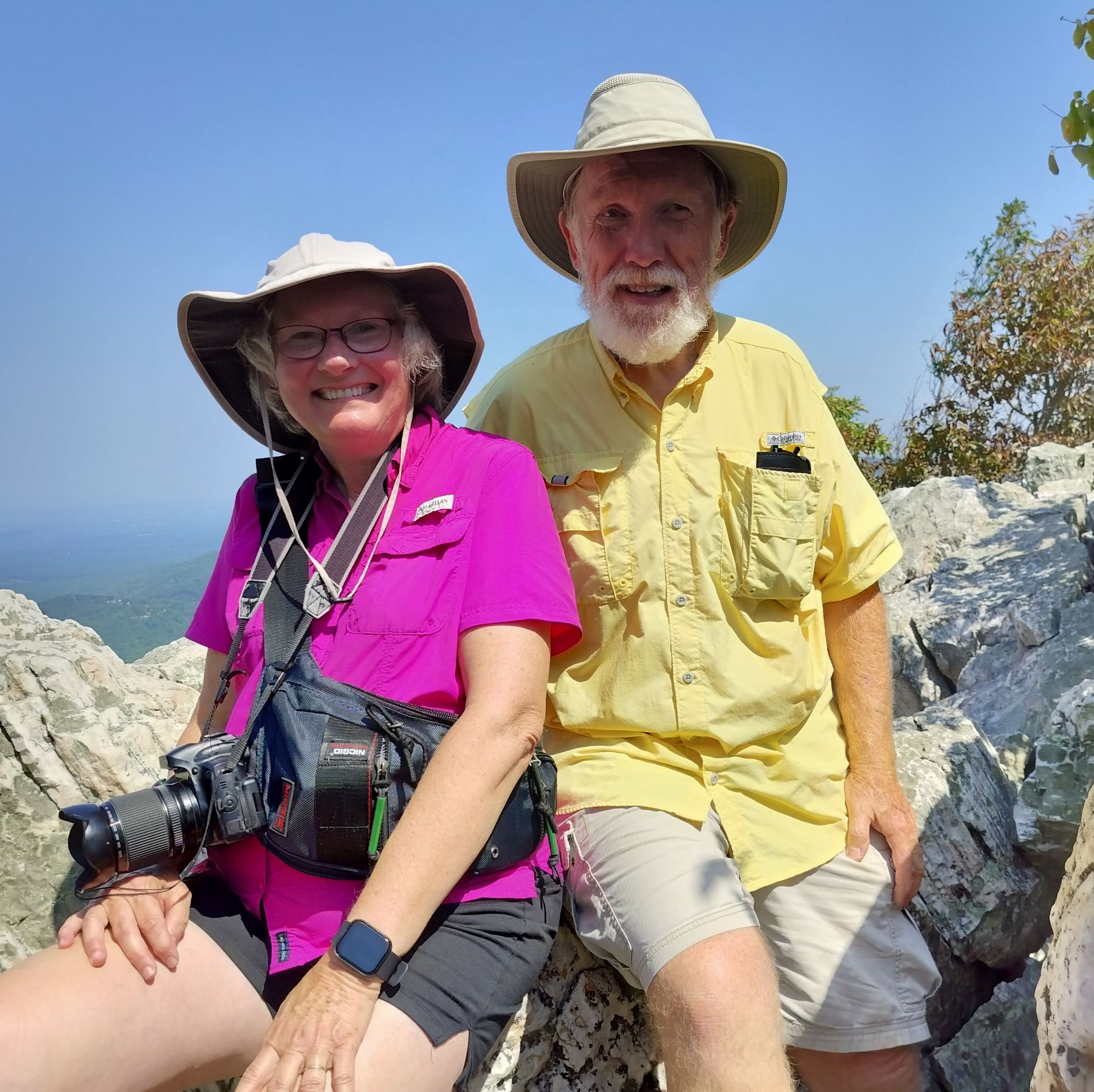
We spent a night at Lewis Mountain Campground, a new campground to us. The next day we ended our tour of the Skyline Drive with a hike to Turk Mountain. The 2.2-mile trail was steep with a 690-foot elevation gain. It ended with a short rock scramble to an outcropping with wonderful valley views. We caught up with a group of college students who passed us earlier and learned about their plans for the future. One of them took our picture to prove we made it all the way!
Photos taken at Turk Mountain viewpoint
Skylines to Blue Ridges
At the end of the 105-mile Skyline Drive the 469-mile Blue Ridge Parkway begins.
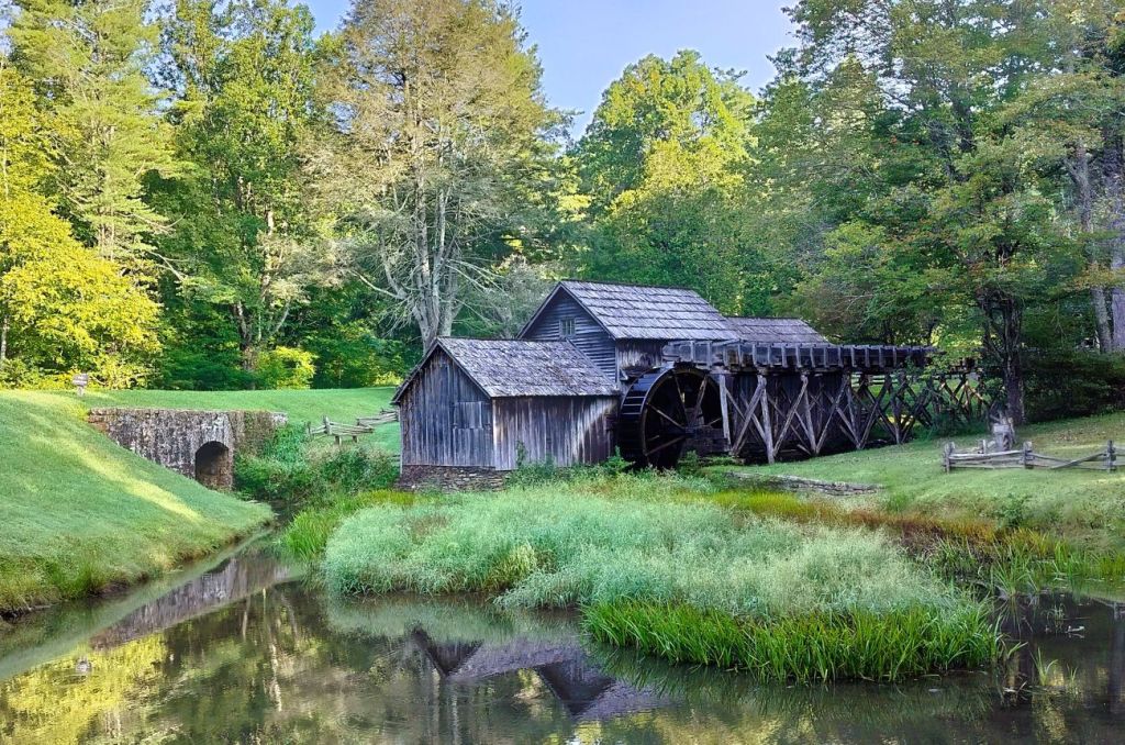
Iconic Mabry Mill at MP 176 on the Blue Ridge Parkway
We stopped at several favorite landmarks as we drove south on the parkway and made an early morning stop at picturesque Mabry Mill. The iconic landmark was built more than 100 years ago and was both a sawmill and grist mill. It is one of the most visited sites on the parkway.
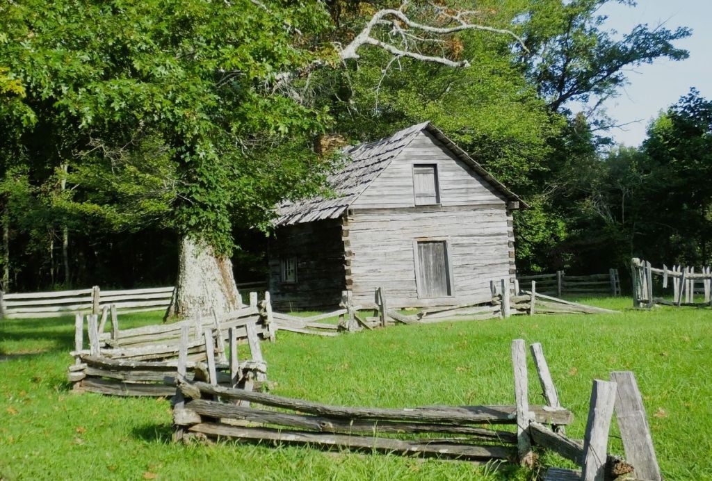
Our final stop on the parkway was at Puckett Cabin. We marveled at the story of “Aunt” Orelena Hawks Puckett, who lived in the cabin during the latter half of her 102-year life. She had a long career of midwifery, where she assisted at the births of more than 1000 babies. What an impact she had on the people in that area!
Puckett’s Cabin at MP 189 on the Blue Ridge Parkway
A few miles beyond the cabin, we left the parkway to begin the two-day trip home.
Our original plans were to spend more time in New England before returning home in late September or early October. Because of hazy conditions throughout the east, we moved more quickly than expected though.
Accustomed to longer trips, we wondered if we were going home early for some reason. We found out soon enough.
A few days after our return, intense weather struck our area.
After two evenings of considerable rainfall, the small creek in our back year rose above its banks. The creek flooded our backyard and continued to rise until it crossed the road next to our house. This has happened only one other time in nearly 40 years.
Although the rising creek never hit the house, rising groundwater began to seep into our semi-basement downstairs room. The sump pump we installed years ago (and tested right before our trip) had failed.
After an emergency late evening trip to Lowes to purchase a drill-powered pump, we drained the sump pit and began the timely process of drying out the room over the next week.
Had we not returned earlier than expected, water would have covered floor of the room. Carpet and furniture would have been damaged, and we would likely have had to deal with mold and mildew.
Giving Thanks
We are thankful!
God is our refuge and fortress in whom we trust for safety and protection – during our 2024 Heartland travels, trips in the past and journeys yet to come!
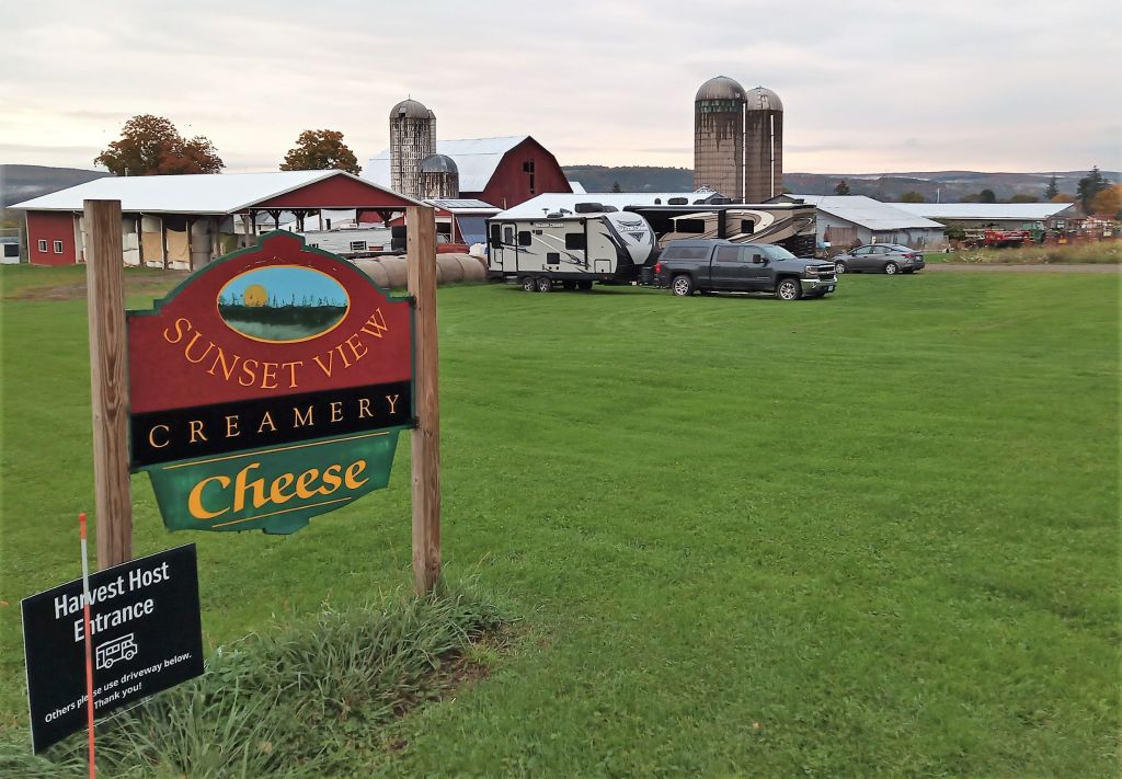
From the Utica area, we drove southwest through New York hill country past small towns, lush vineyards and fertile farms. Our destination was a Harvest Host location and state park in Watkins Glen, NY.
Camping at the Creamery
We camped for the night in a field at Sunset View Creamery. The creamery is a large dairy farm with a nice store where we sampled (and purchased) several types of cheese along with other local farm products.
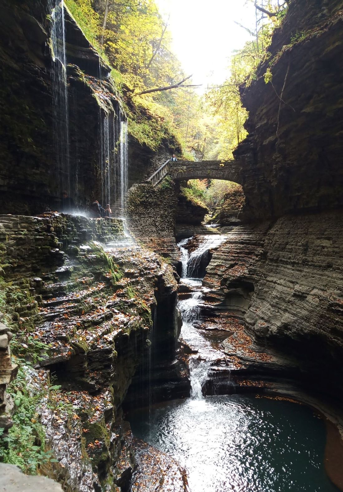
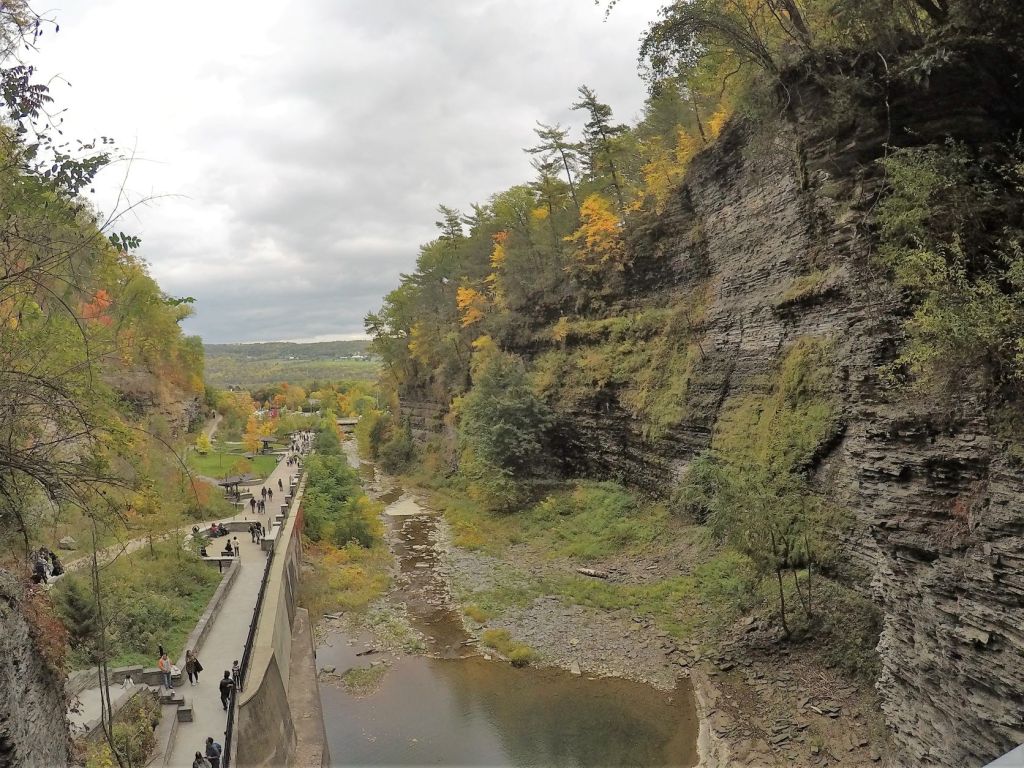
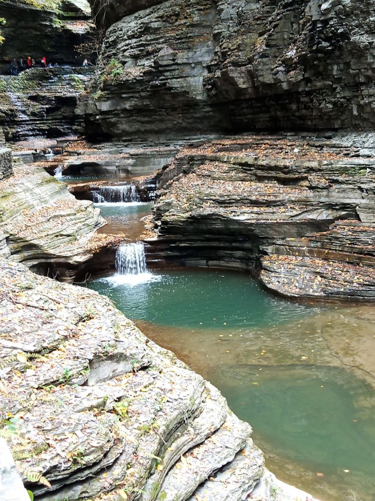
By then, it was mid-afternoon and we had to hurry to visit Watkins Glen. Although the town is noted for its role in auto racing, our visit was to see the gorge at Watkins Glen State Park
The large parking lot was crowded when we arrived. There is a charge to park but entrance to the state park and gorge is free. We crossed a busy street and the entrance to the gorge trail was ahead.
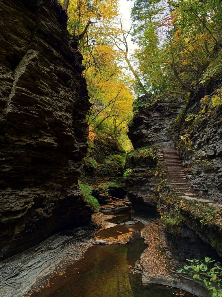
Entrance to the Gorge
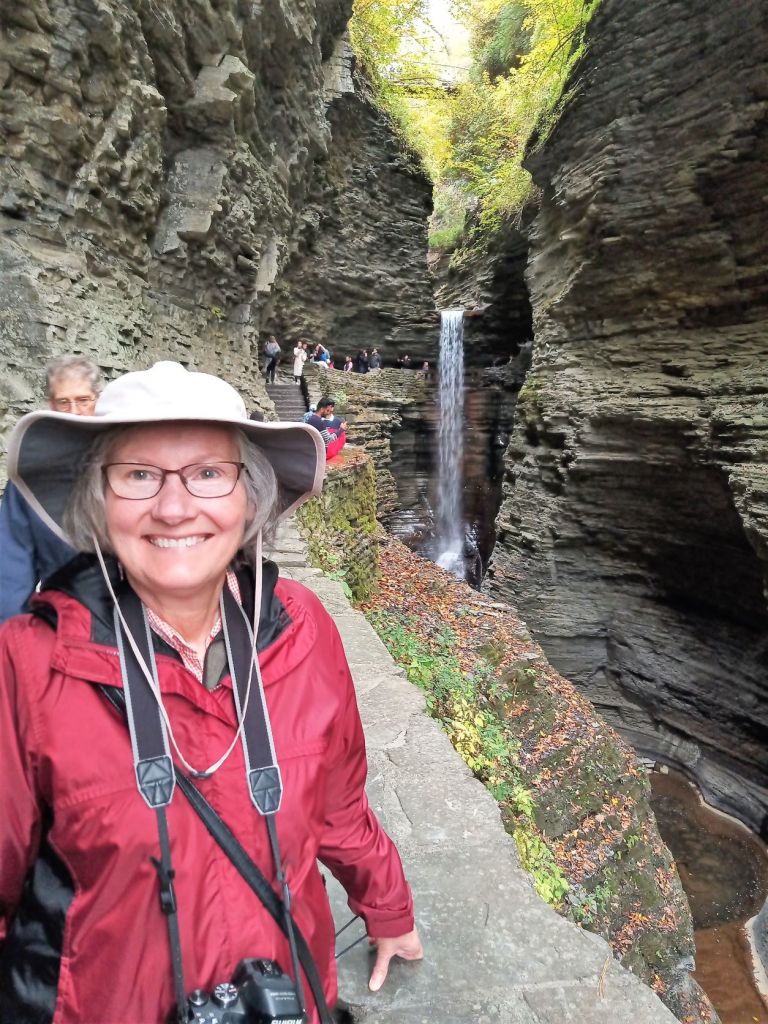
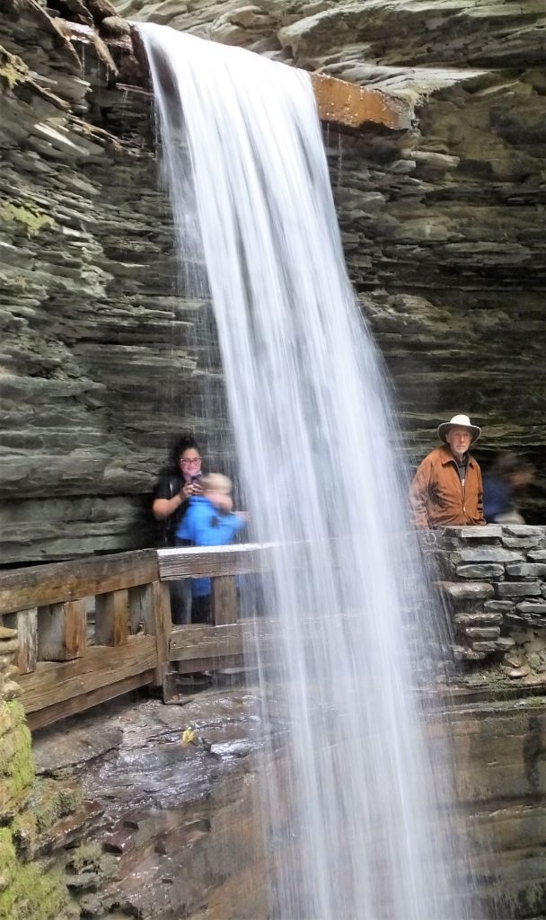
The trail starts at the bottom of the 400-foot deep gorge and continues for 1.5 miles as it follows a small stream up 832 steps. The paved trail goes over and under waterfalls, bridges and tunnels. The layered sides of the gorge were accented here and there with trees displaying colorful autumn leaves.
Gorgeous gorge views
The trail ends at the top of the gorge, where you can hike one of two trails along the top of the gorge or take an inexpensive shuttle back to the bottom of the gorge. Some visitors start with the shuttle and then take the steps down to the entrance. We think the views are better hiking up the gorge however.
The park has a lot to offer in addition to the gorge – a campground and cabins (both were closed for the season when we visited), biking and other hiking trails.
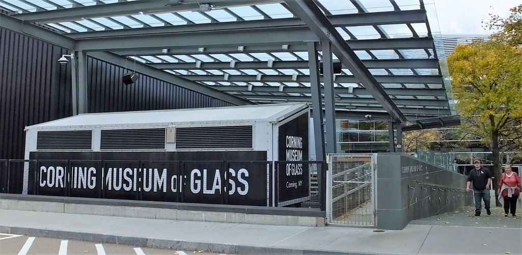
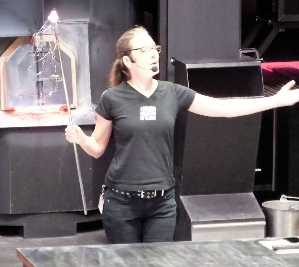
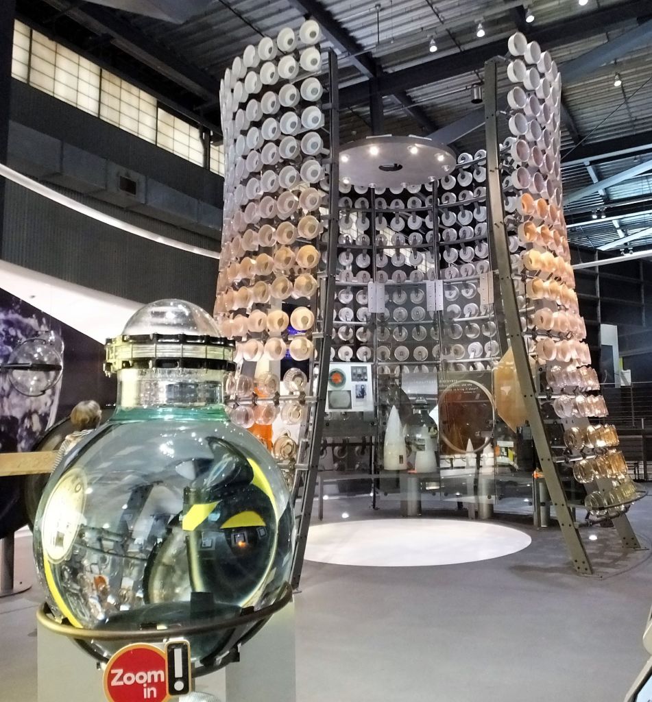
After a chilly no-hookups night at the Creamery, we arose early the next morning for a short drive to Corning NY to visit the Corning Museum of Glass.
The museum and town of Corning are worthy of a day or two visit, but we only had a few hours to explore the museum.
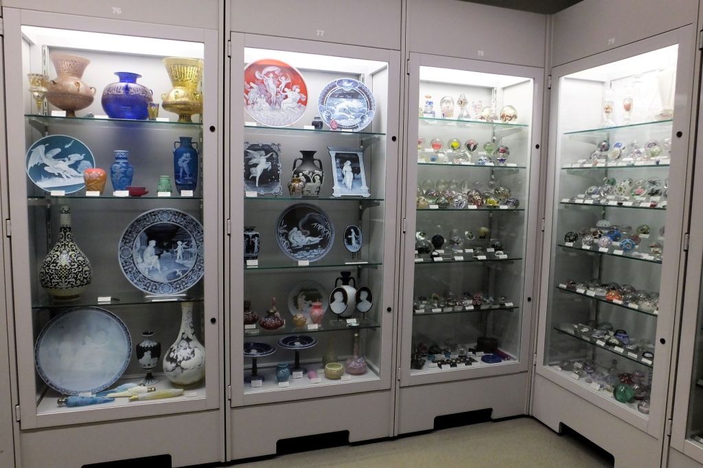
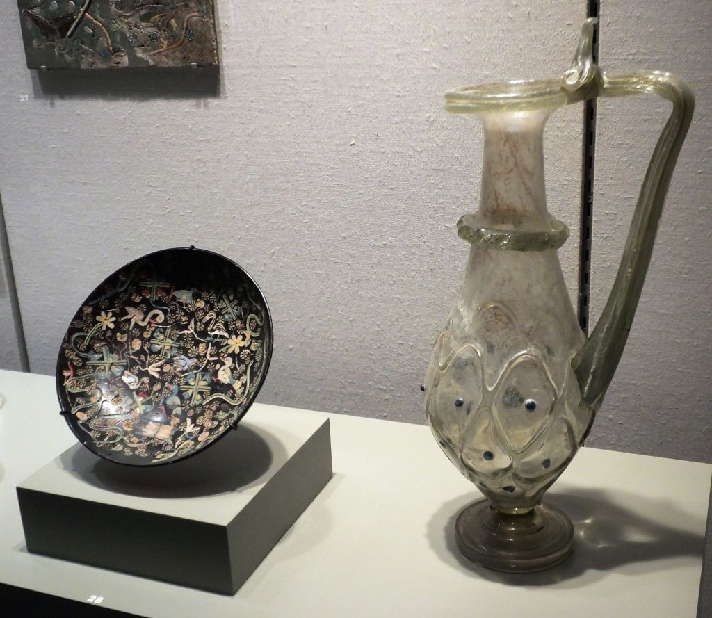
The museum has exhibits ranging from ancient glass artifacts more than 3500 years old to contemporary glass art, as well as various scientific and practical uses of glass in modern society. There were also several live glass-blowing demonstrations.
CMOG has glass antiquities and modern art displays, plus live glassblowing demonstrations
Who’d have thought there was so much to see at a glass museum!
After a quick lunch we were on the road again heading south to spend the night in Pennsylvania. We were on the way to Virginia and the Blue Ridge Parkway.
Next week: our plans take yet another unexpected turn.
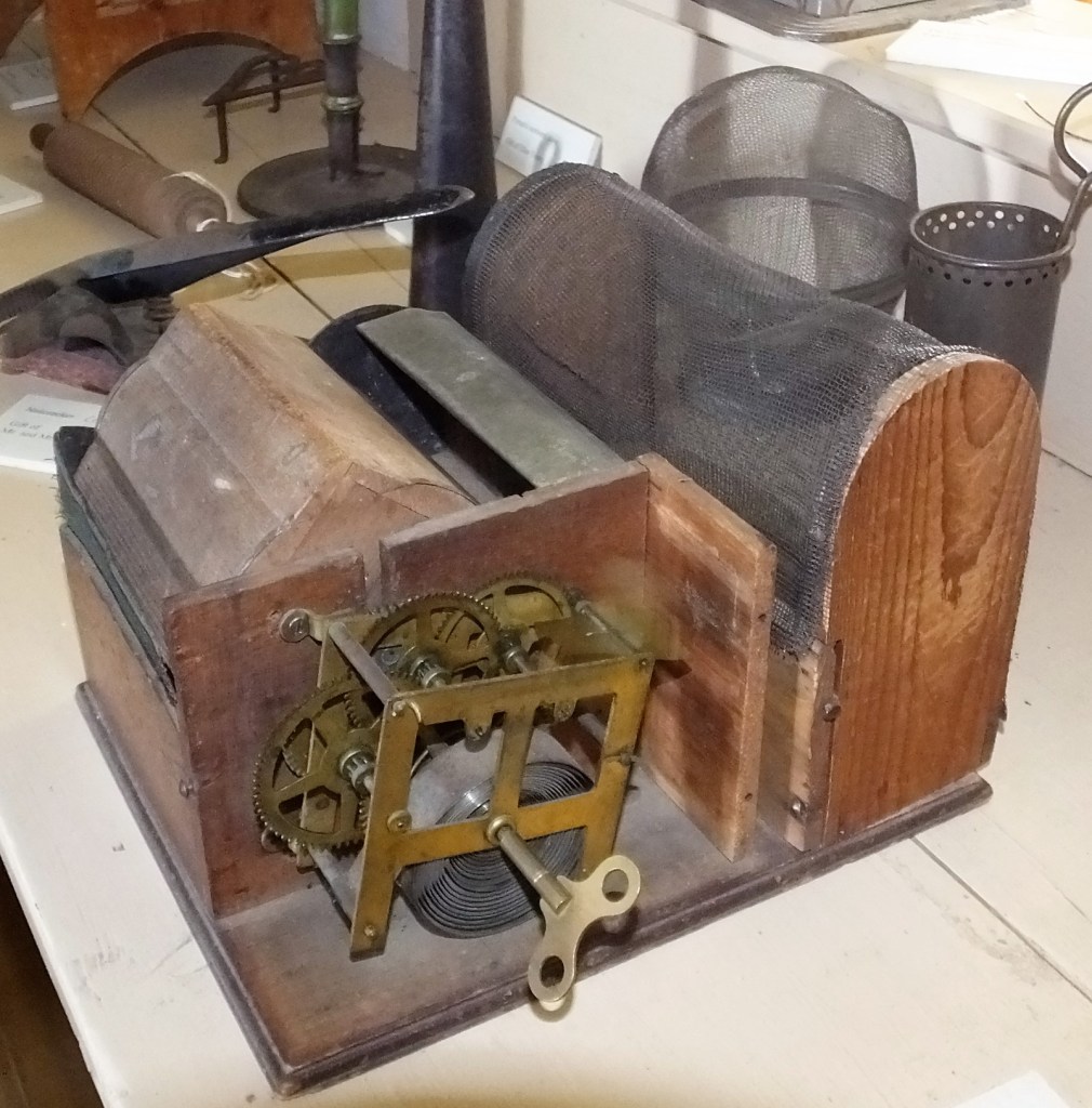
The device is a MOUSE TRAP! When triggered, a portion of the trap rotates and deposits the mouse in the adjacent screened box. This trap is more humane than a spring-loaded mouse crusher!
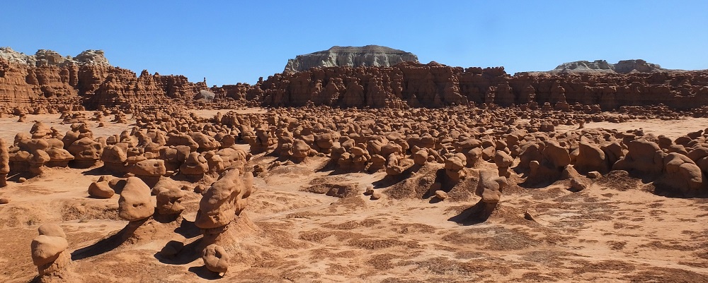
From Capitol Reef National Park we headed northeast towards Moab and Canyonlands/Arches national parks. About half way there were signs for Goblin Valley State Park and decided to sidetrack a few miles.
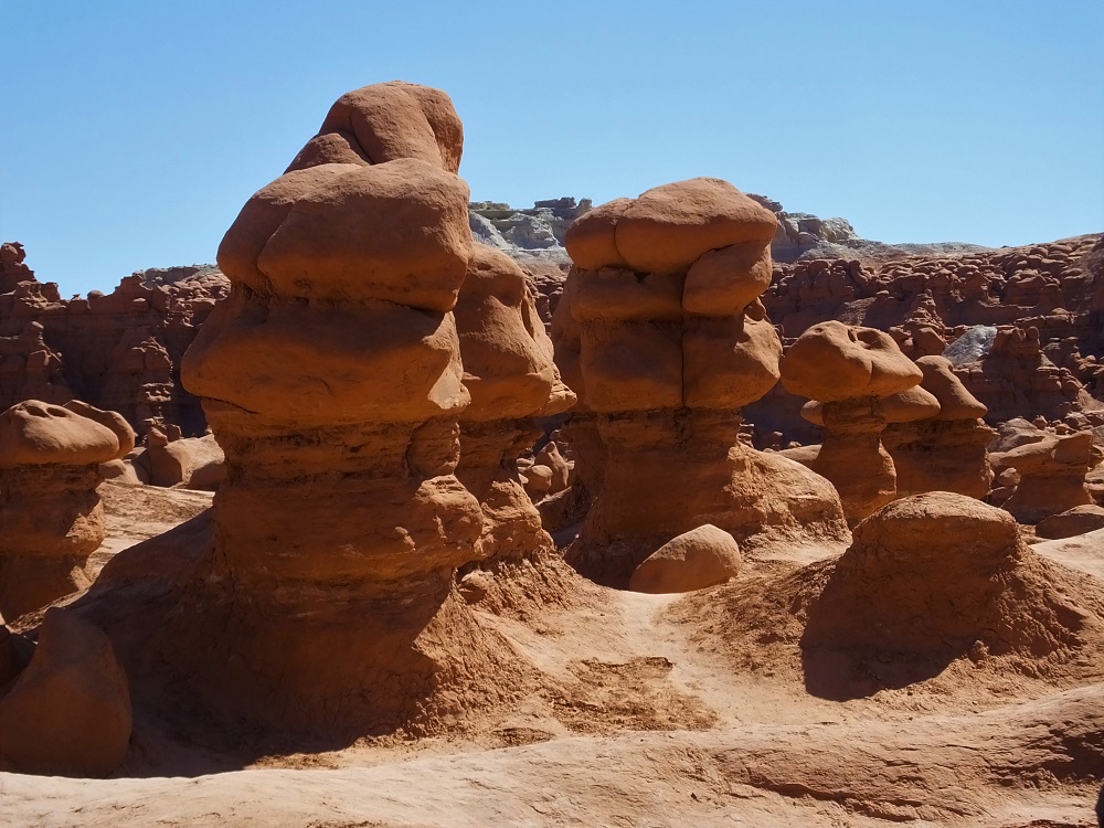
Located in a remote area about eight miles off the main highway, Goblin Valley State Park has thousands of hoodoos, referred to locally as goblins. The goblins are mushroom-shaped rock formations that are 10-20 foot in height.
Across several valleys, hundreds of these formations cast interesting shadows that look like goblins advancing on the visitor.
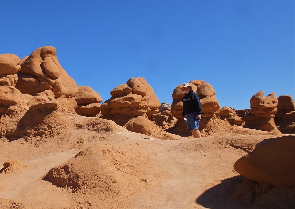
Goblin Valley
After lunch, we took a few moments to walk in one of the valleys, among the goblins/hoodoos.
Among the goblins/hoodoos
Here is a short video taken during our walk (please bear with us as we learn how to create and post Youtube videos).
After a safe escape from Goblin Valley, we continued to on Moab, where we found ourselves among many other visitors during one of the busiest times of the year.
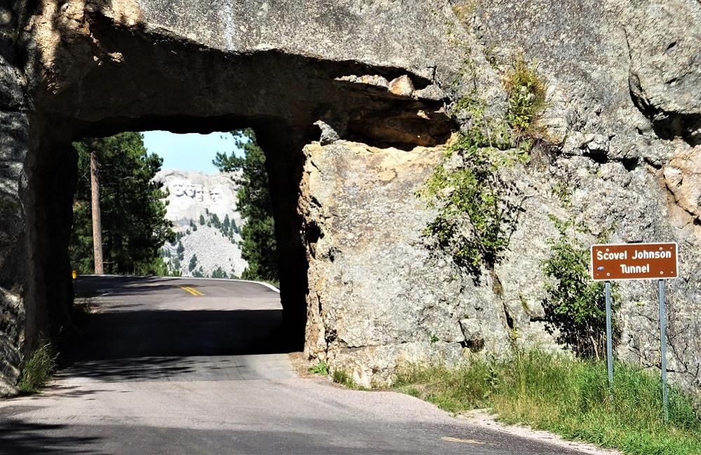
After enjoying the bison, burros, pronghorns and prairie dogs of Custer State Park, we decided to drive the Iron Mountain Road (US 16A) from Custer State Park to Mt. Rushmore National Monument the next morning. It took nearly an hour to drive the 20 mile road. Included were three single lane tunnels (e.g. very narrow and around 10 foot tall) and several pig tails, where the road makes a complete 360 degree loop under itself. Glad we weren’t towing our camper!
Mt. Rushmore is visible through tunnelDistant view of the memorial
When we drove through the first tunnel we realized Mt Rushmore was visible through the tunnel. We turned around and drove through it a second time to get the full impact and to take photos. The third tunnel has a similar view of Mt. Rushmore. Tip: it is better to drive the Iron Mountain Road from south to north for the Mt. Rushmore views.
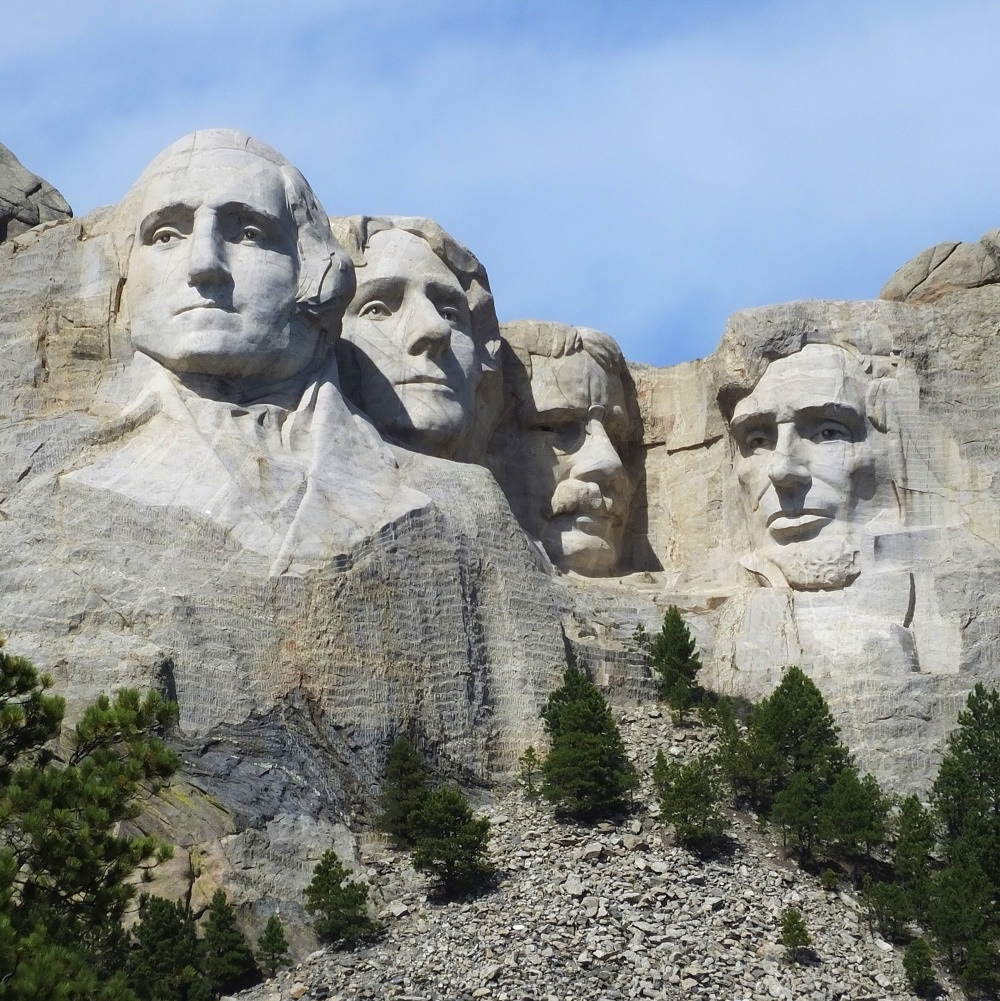
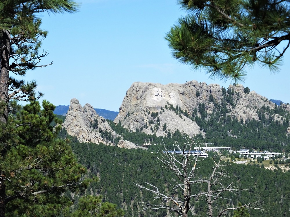
Mt. Rushmore
Although the previous day was overcast with occasional showers, we arrived at Mt Rushmore under crystal clear blue skies. The presidential views were awesome!
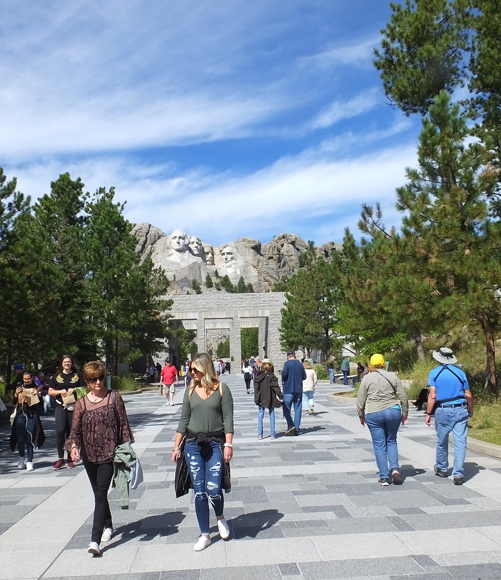
Courtyard in front of Mt. Rushmore
A large parking garage has been built just outside the entrance because lots of people visit the memorial, so finding a parking place was easy. From the entrance, a wide stone courtyard extends up to an amphitheater below the stone faces. There was construction on the front part of the courtyard so we were unable to walk only about halfway to the amphitheater. The views were fantastic nonetheless.
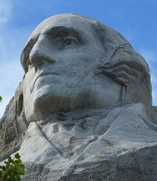
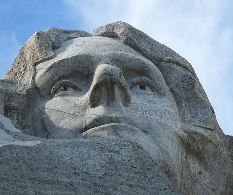
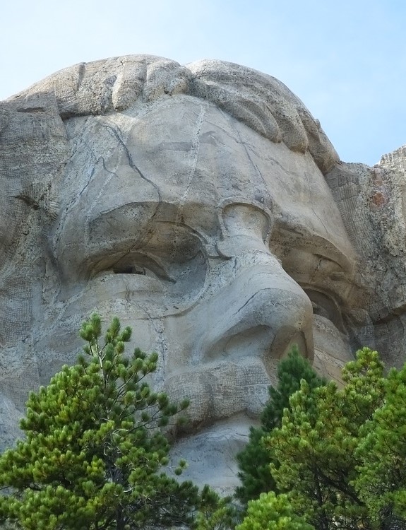
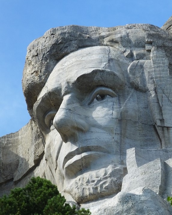
George WashingtonThomas JeffersonTeddy RooseveltAbraham Lincoln
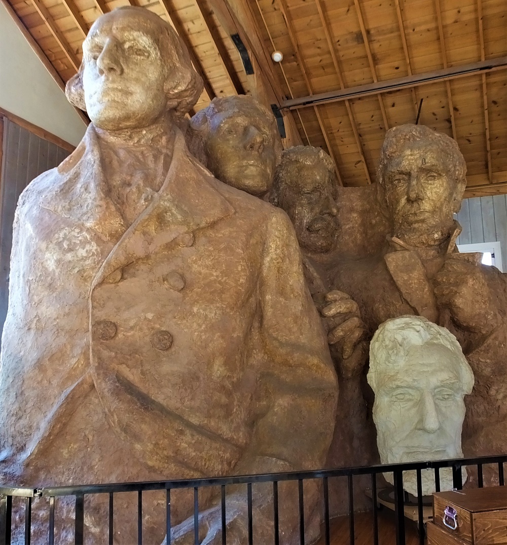
We also walked the trail that goes immediately under the sculptures. We climbed more than 200 stairs to get a special nosehair view of the presidents. As we returned we stopped by a studio that had the original sculpture from which Mt Rushmore was modeled.
Sculpture from which Mt. Rushmore was modeled
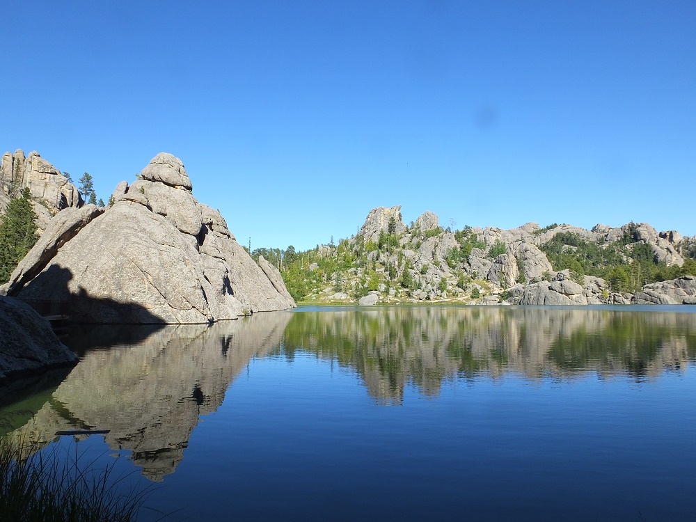
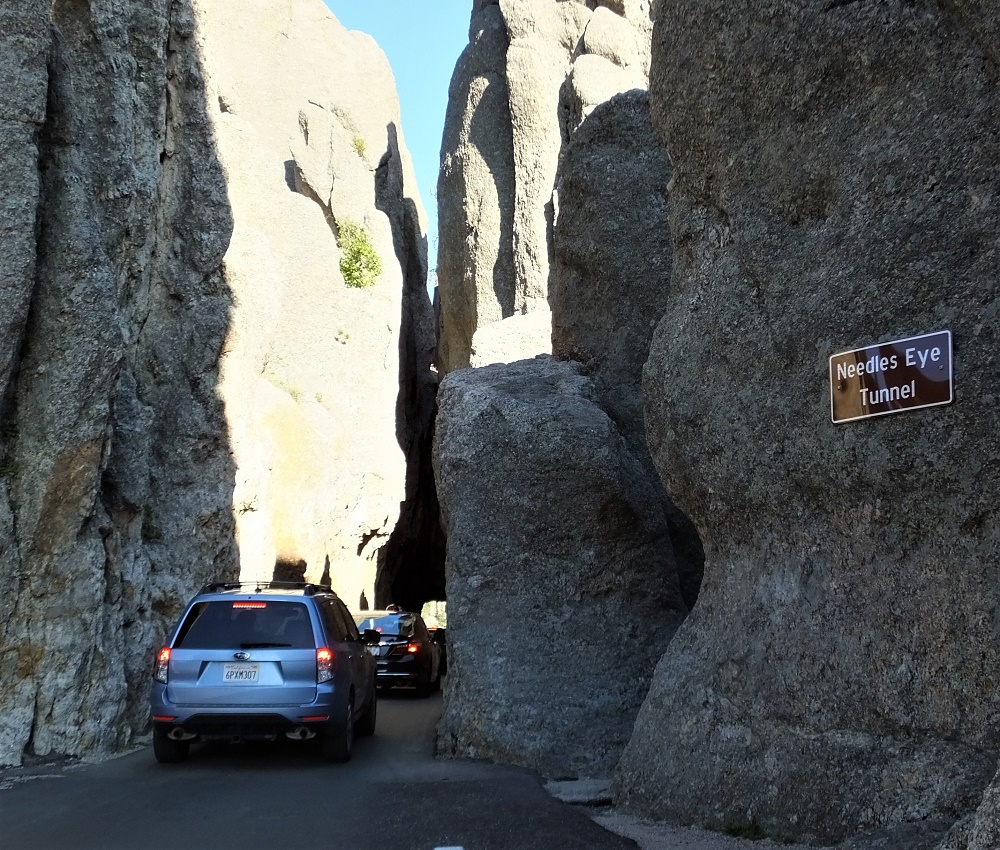
We left Mt Rushmore and reentered Custer State Park at the Sylvan Lake/Needles Highway Entrance. We hiked around Sylvan Lake, a tranquil lake at the top of the Black Hills, and then continued along the Needles Highway.
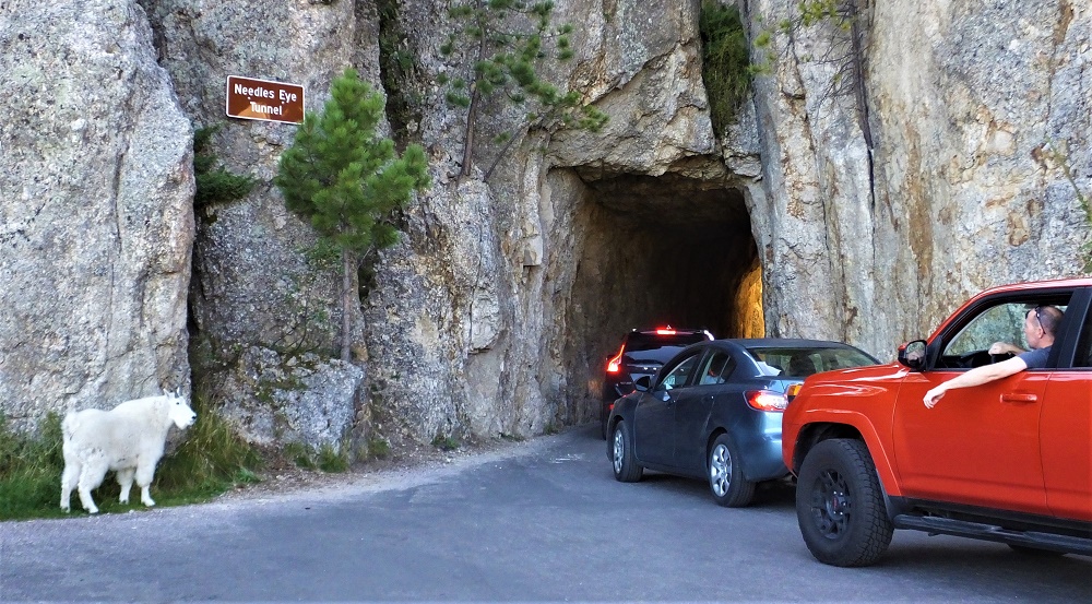
The highway makes its way through some stunning needle-like formations that culminate with a tricky drive through a very narrow (8.5 ft) tunnel. We had to fold in our truck side mirrors to avoid hitting the sides!
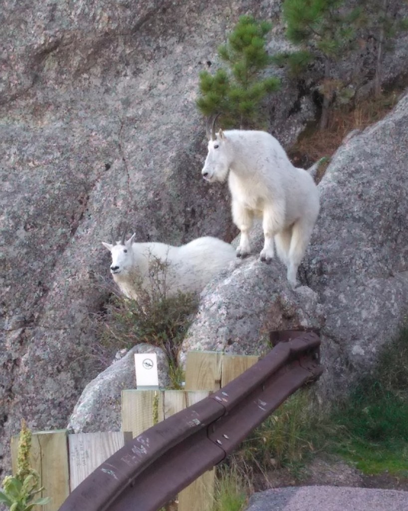
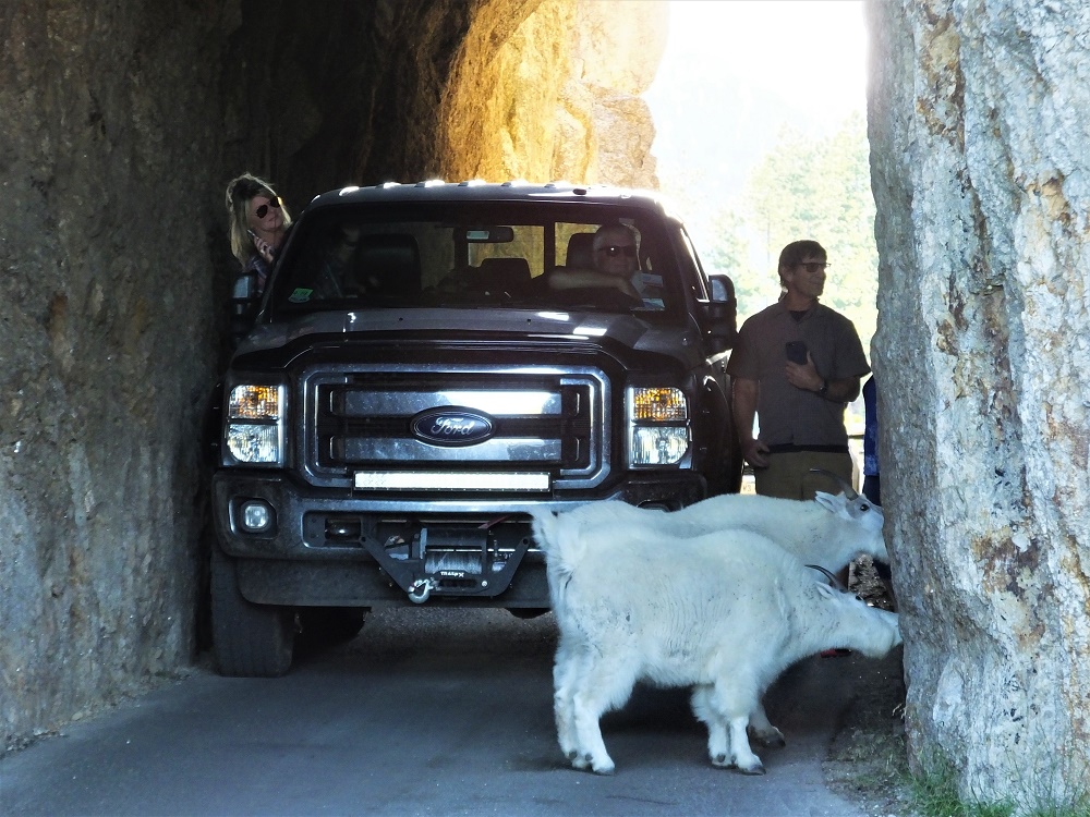
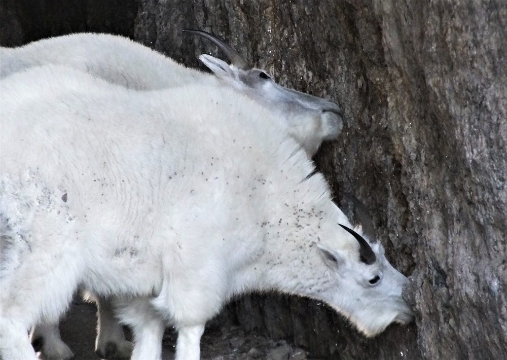
There were delays as cars drove through the tunnel – some more than 10 minutes. Our turn came and as we exited the other end of the tunnel we discovered the reason. There were two white mountain goats perched on a rock outside the end of the tunnel. During breaks in the traffic, the goats reentered the tunnel and began licking the minerals on the inside of the tunnel. Only after some assertive coaxing by drivers would they move and let cars pass!
Entering the narrow tunnelGoat sentries on the other sideWatching for a break in the trafficGoats blocking trafficCloseup – goats eating minerals from cave wall
We returned to our campsite and anticipated our drive the next day to the interesting formation made famous by the 1977 movie Close Encounters of the Third Kind.
Custer State Park is located In the heart of the South Dakota Black Hills. The park is more than 71,000 acres and has an amazing variety of wildlife and natural features. We spent two full days exploring the park.
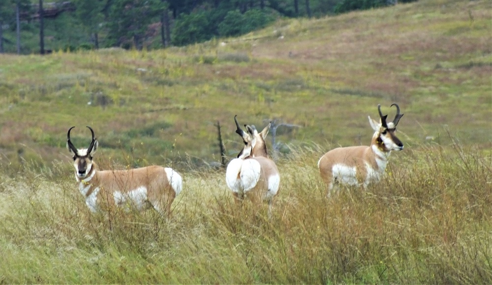
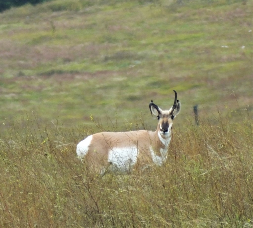
Three pronghorn antelopeProghorn antelopeTwo bison
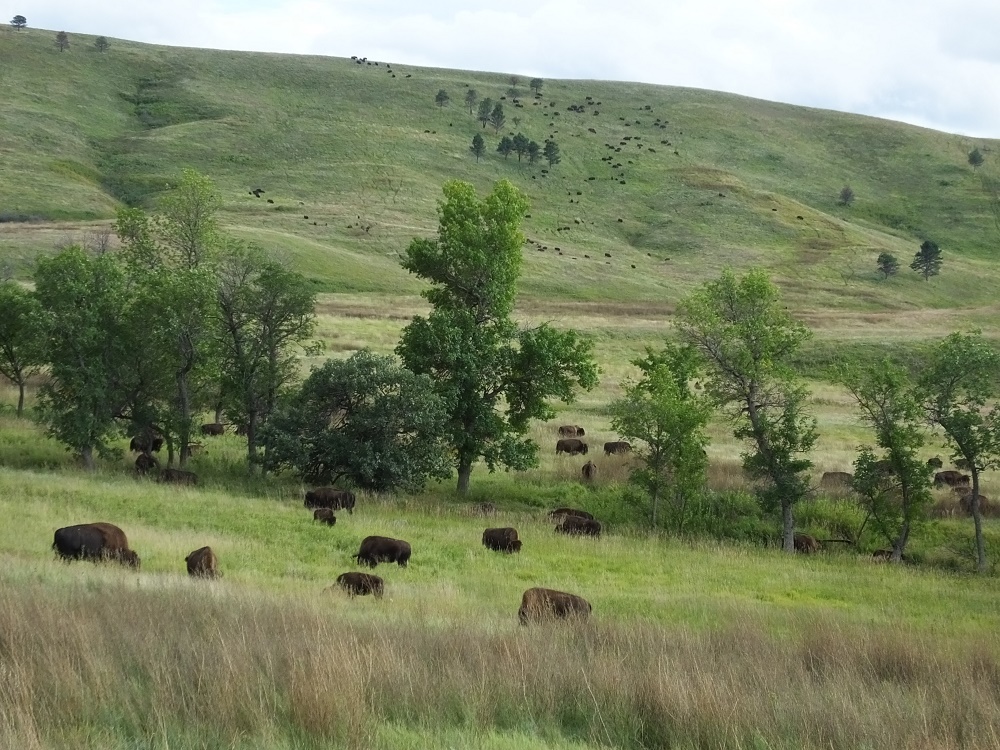
We started with the 18-mile wildlife loop. The loop traverses grass covered hills with tree covered taller hills in the distance. We saw dozens of pronghorn antelope and as we neared the southernmost part of the drive, we sighted a herd of about 50 bison slowly milling along as they dined on various grasses. At the Wildlife Visitor Center we learned the park can sustain 900-1100 bison during the winter. Each September, the herd is moved to the southern part of the park for a bison roundup. Several hundred bison in excess of the number above are sold and many become parts of bison herds elsewhere in the United States.
After viewing the bison for a while, we took a side trip on a dirt road that left Custer State Park and entered Wind Cave National Park. The views were amazing.
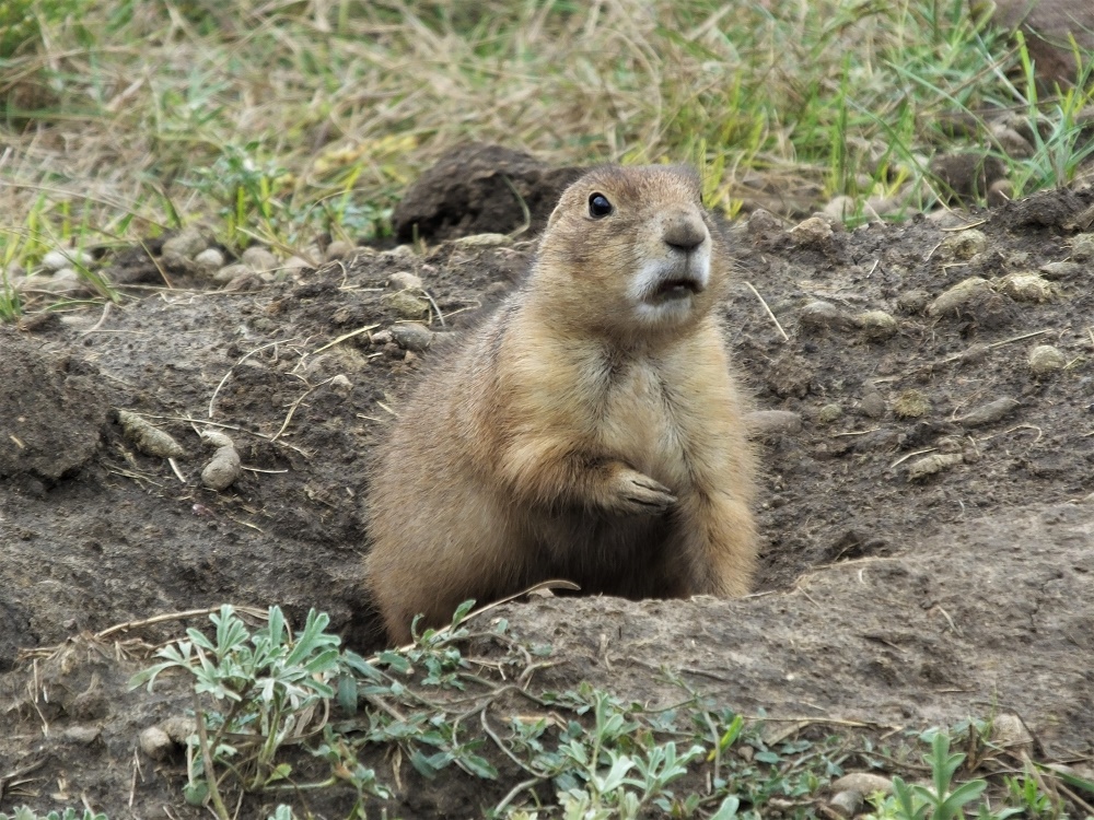
We noticed a number of small dirt mounds in some areas. On many of the mounds, one or more very active prairie dogs acted as sentries. The mounds mark the entrance to their underground burrows. There were lots of prairie dogs, and the noise they make really sounds like the bark of a small dog!
A prairie dog guards his burrow
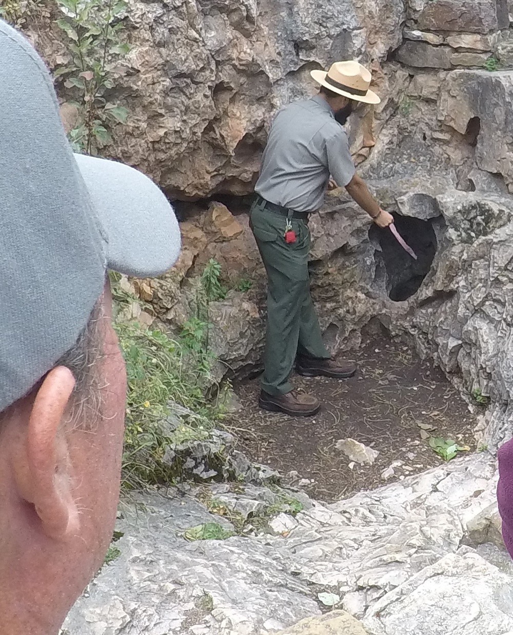
At the Wind Cave Visitor Center we learned cave tours were temporarily cancelled due to elevator problems. So we joined a ranger-led hike to the historic cave entrance to learn more about the cave.
A ranger demonstrates air being sucked into Wind Cave
The first documented discovery of the cave was in 1881, when the brothers Tom and Jesse Bingham heard wind rushing out from a hole in the ground. The ranger explained that during clear days with high pressure, air is sucked into the cave, and during stormy days with low pressure, air blows out of the cave. Using a small ribbon, he demonstrated a ribbon being sucked into the cave with a surprising amount of force. What a vacuum cleaner!
Although the historic opening is very small, about 10 inches by 14 inches, over 142 miles of cave passages have been mapped making Wind Cave is the third longest cave in the U.S. and the sixth longest cave in the world.
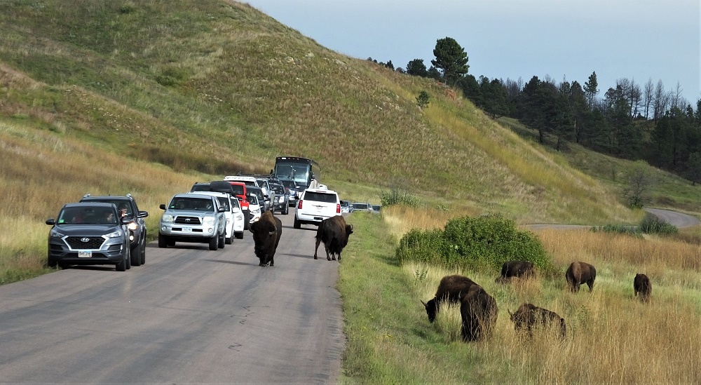
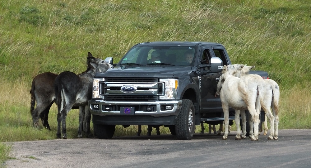
We returned to Custer State Park and the wildlife loop, and saw additional groups of antelope and bison. As we rounded a corner, we were stopped by a traffic jam in the middle of nowhere. Dozens of vehicles had stopped to see more than 500 bison – many on distant hills, others in a field close to the road and even a few walking down the middle of the road!
Bison on distant hills and fields belowBison jam!
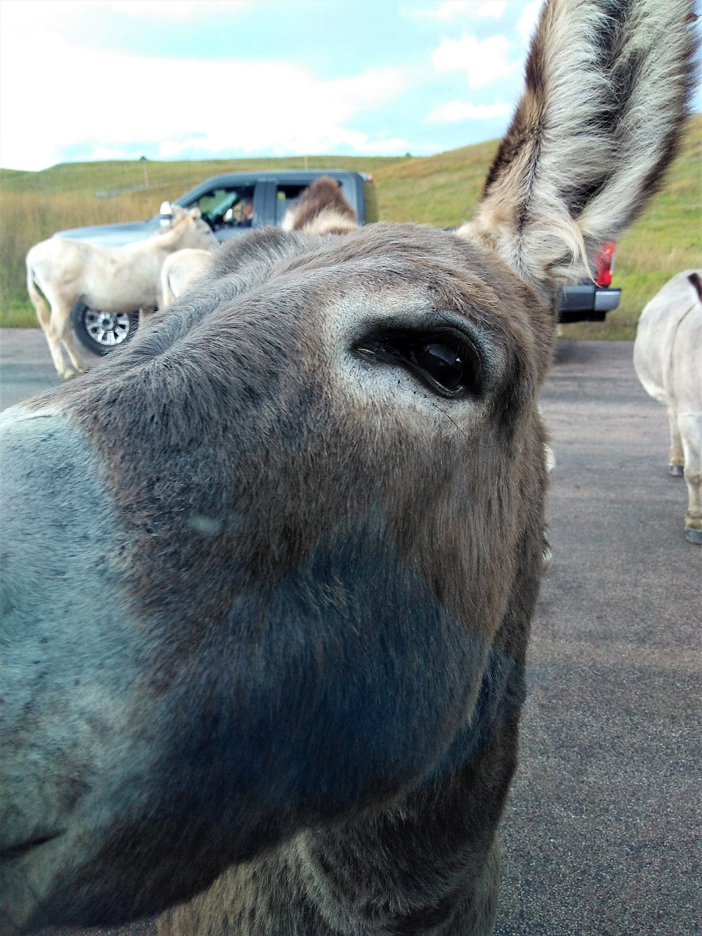
Not to be outdone for attention, there were about a dozen wild burros in the area as well, mooching carrots and such from passing vehicles. One burro approached our truck and tapped the side gently with its nose to see if we had anything.
Burros looking for a handoutOne persistent burro!
It was a great day to see wildlife and the big sky views of the park.
As we returned to our campsite, we looked forward to the next day to see the natural rock formations of the Needles Highway and the manmade massive stone carvings of Mt. Rushmore National Memorial.
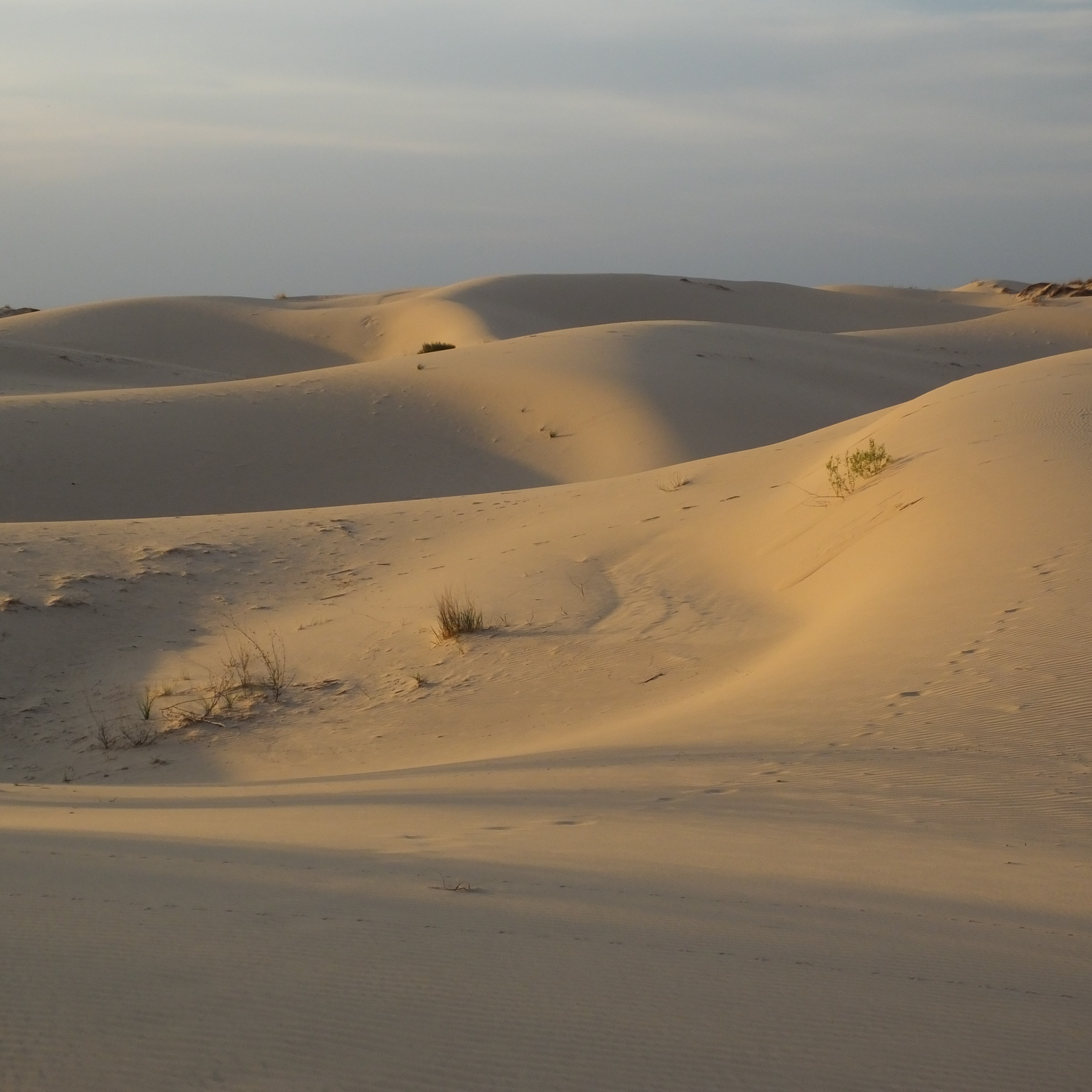
The drive was a bit too far for one day, so we spent the night at a west Texas state park known for its large sand dunes. They don’t call then dunes however – at Monahans State Park they are known as sandhillls.
One theory is the Monahans Sandhills were formed by remnants of the Rocky Mountains in New Mexico that eroded in the Pecos River. The sand was eventually blown by the wind into the area.
The sandhills are located atop the Permian Basin, one of the largest oil-producing areas in the world.
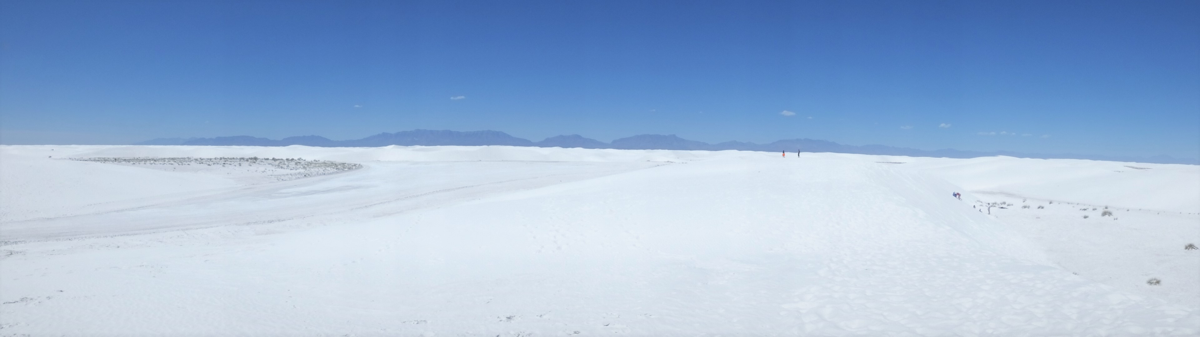
We visited some world class dunes in New Mexico also. Outside of Alamogordo is White Sands National Monument. The dunes are indeed brilliant white.
White Sands is the largest gypsum dunes on earth (275 square miles), the dunes are clearly visible from space and they are constantly moving – some as many as 32 feet year!
A couple interesting facts:
The White Sands dunes, created from eroding mountains to the west, are only about 10,000 years old.
In many areas, the water table is just a few feet below the dunes.
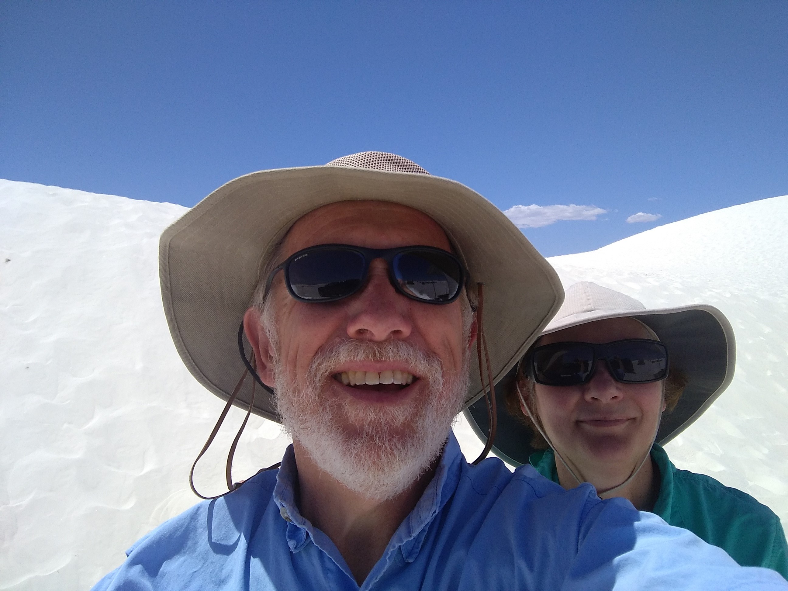
A dune selfie…hats and sunglasses are essential equipment at White Sands!
Camper repairs behind us (hopefully), we set up camp in Blanco State Park for a four-night stay. The campground is centrally located between Fredericksburg, Austin, San Antonio and my brother’s home in Boerne.
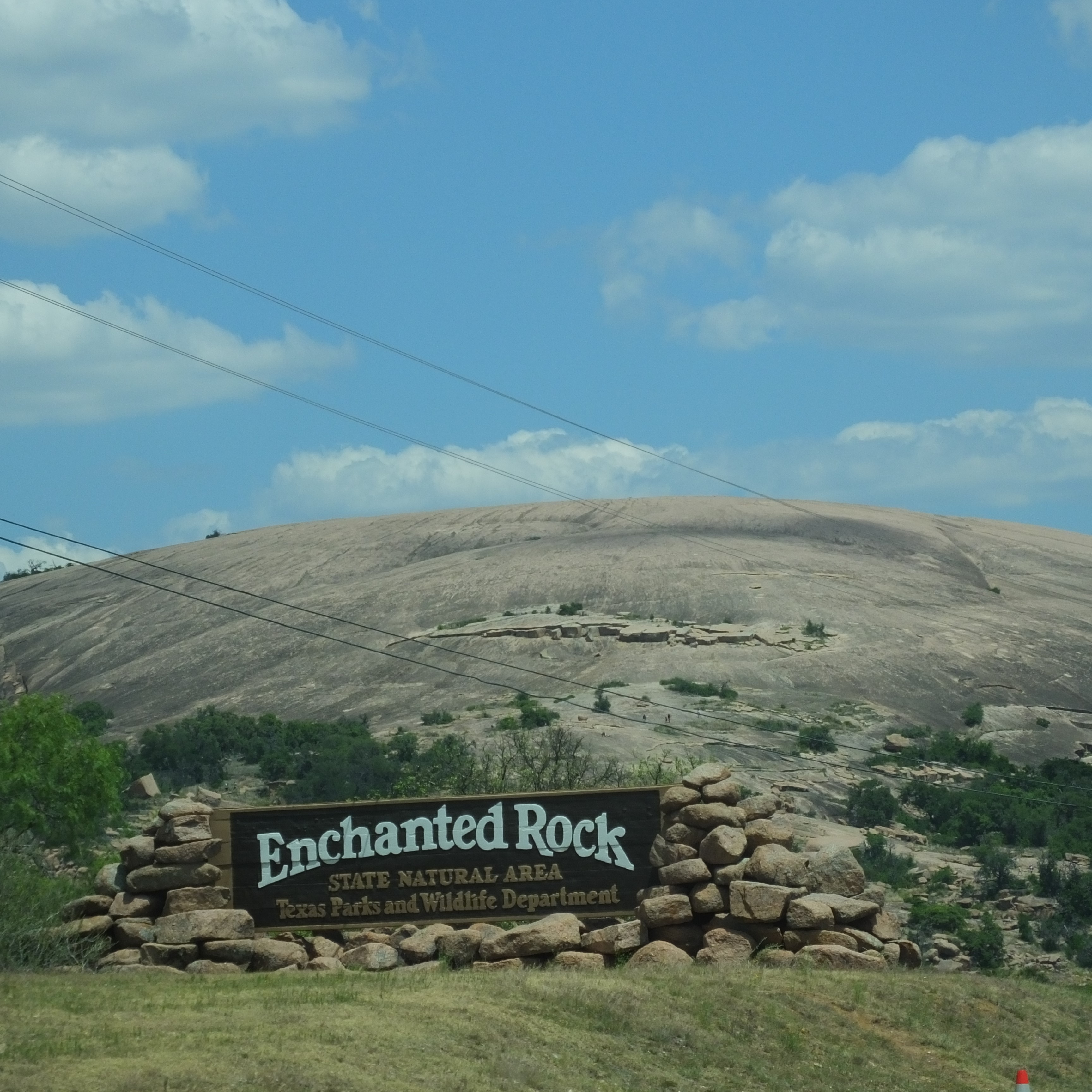
We were also close to Enchanted Rock and enchanted BBQ.
The Rock
Enchanted Rock is a pink granite mountain about 17 miles north of Fredericksburg. According to Trails.com, a hike to the summit of Enchanted Rock has been a right of passage for every teenaged Texan since the 1960s. Although we are neither Texans nor teenagers, we decided to tackle the short (.4 mile) and steep trail (332 ft elevation gain) to the top.
From a distance Enchanted Rock somewhat resembles Ayers Rock in Australia and Stone Mountain in Georgia. Up close, it is rather daunting – a steep hike up the side of the mountain looks challenging. From the top, what a view! Long vistas of the stunning Texas Hill Country.
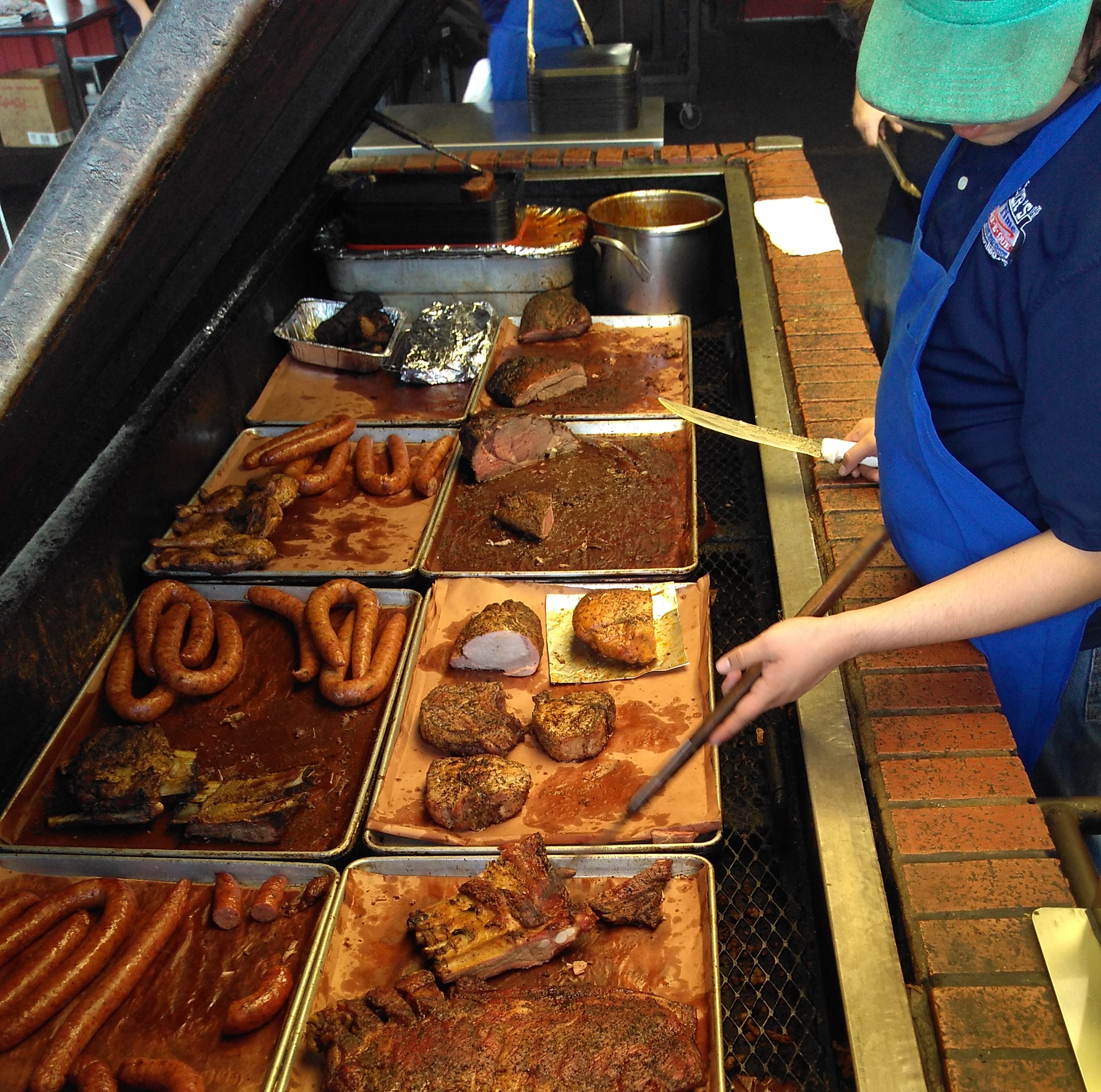
Having successfully ascended and descended the rock, it was lunchtime and we HAD to experience the enchanted BBQ of Cooper’s BBQ in Llano, about 15 miles north.
Smokey ribs, fork-tender brisket, cowboy pinto beans, white bread and MUCH more – there’s no better BBQ on the planet!
We saved a little room and finished our lunch with some pecan cobbler.
On the way back to Blanco we stopped at Fredericksburg, a town with many interesting shops along a wide main street through the center of town. Fredericksburg is surrounded by many bed and breakfasts and wineries. It’s a great place to visit for a special occasion or stop-off during a trip like ours.


 We noticed a number of small dirt mounds in some areas. On many of the mounds, one or more very active prairie dogs acted as sentries. The mounds mark the entrance to their underground burrows. There were lots of prairie dogs, and the noise they make really sounds like the bark of a small dog!