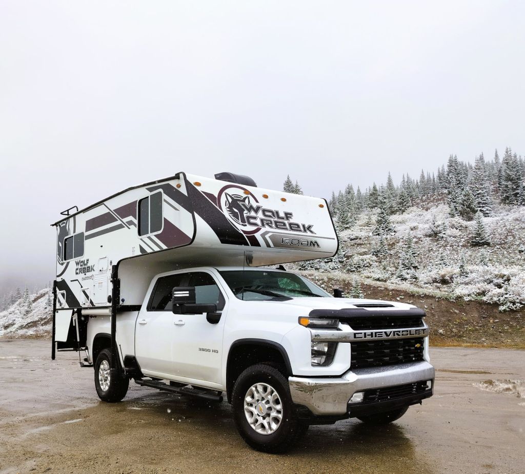
Join us as we travel to the 2025 Albuquerque International Balloon Fiesta. We expect to be awestruck by painted skies and endless wonder as more than 500 hot air balloons rise into the New Mexico skies!
RabbiTRAILS is now AD FREE – enjoy the less-cluttered format!
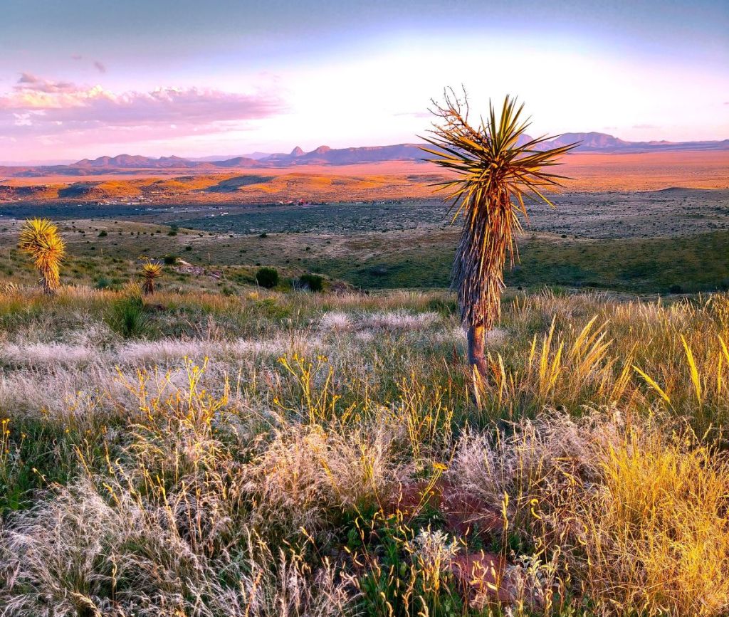
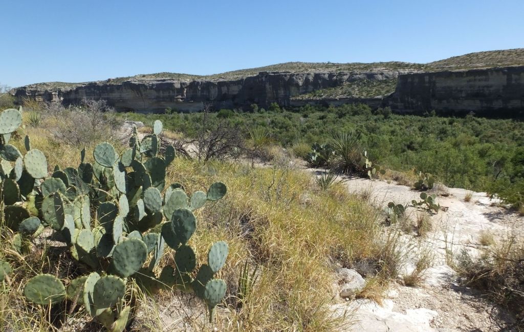
Our Palo Duro Canyon hiking travails ended and we continued southward through Texas for more than three hundred miles. We transited the oil fields near Ft. Stockton and Midland, and continued to Davis Mountains State Park.
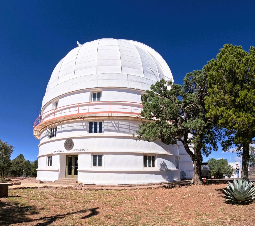
McDonald Observatory – Eyes on the Skies
We toured nearby McDonald Observatory, a noted astronomical observatory that sits atop 6790-foot Mount Locke. The observatory’s research telescopes are part of the University of Texas at Austin and used to research a wide variety of topics and projects.
This building houses the Otto Struve Telescope, once the world’s second largest
The Otto Struve Telescope, with its 82-inch mirror, was dedicated in 1939. At the time it was the world’s second largest telescope.
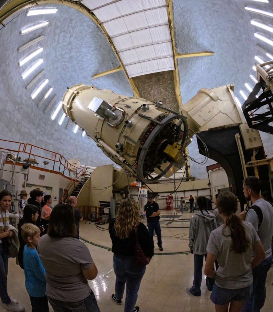
107-inch Harlan J. Smith telescope
The 107-inch Harlan J. Smith Telescope was completed in 1968. We toured the large observatory building that houses the Smith telescope. Our guide raised and lowered and rotated the telescope and explained how celestial objects are targeted and astronomical data is collected.
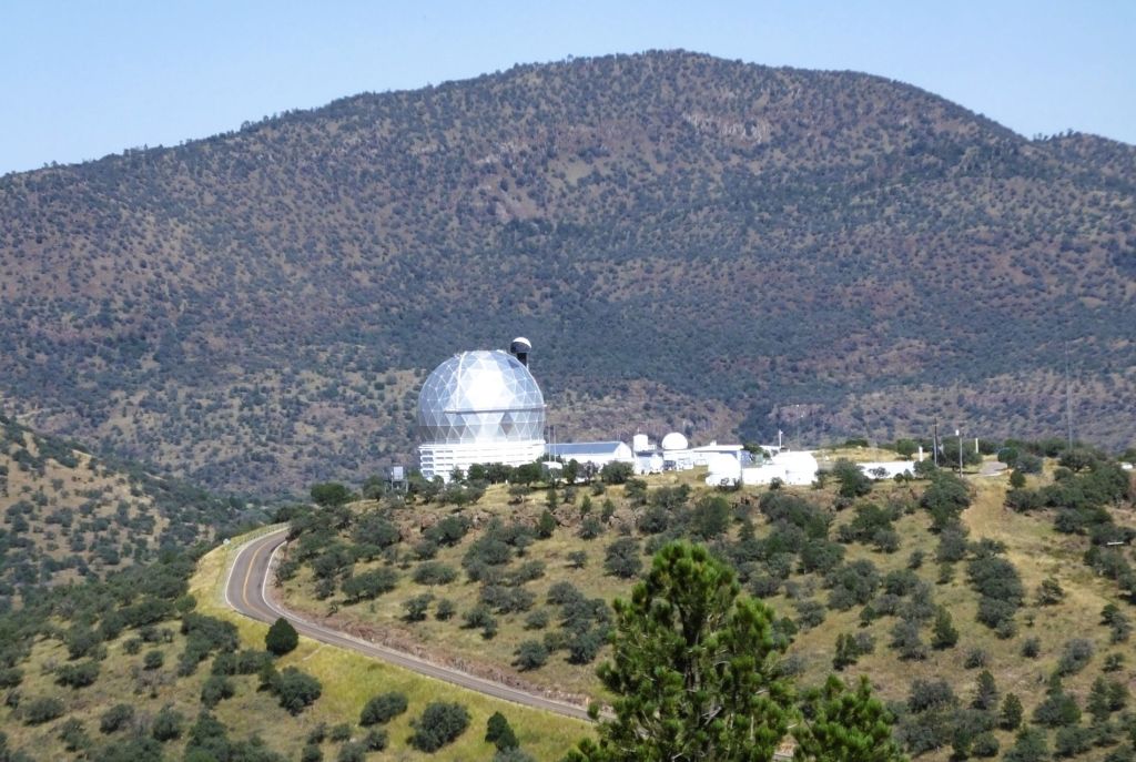
The 390-inch Holly-Eberly Telescope is one of the largest optical telescopes in the world
The 390-inch Holly-Eberly Telescope atop nearby Mount Fowlkes was completed in 1996 and is one of the largest optical telescopes in the world.
The telescopes at McDonald Observatory have been used to find planets orbiting around other stars, track the rotation of individual galaxies and conduct dark energy research.
Desert Views
Evening view of southwest Texas mountains
Davis Mountains State Park includes a short scenic drive that leads to amazing views of the rugged Texas mountains to the southwest. Beyond the mountains are Big Bend National Park, Rio Grande River and Mexico.
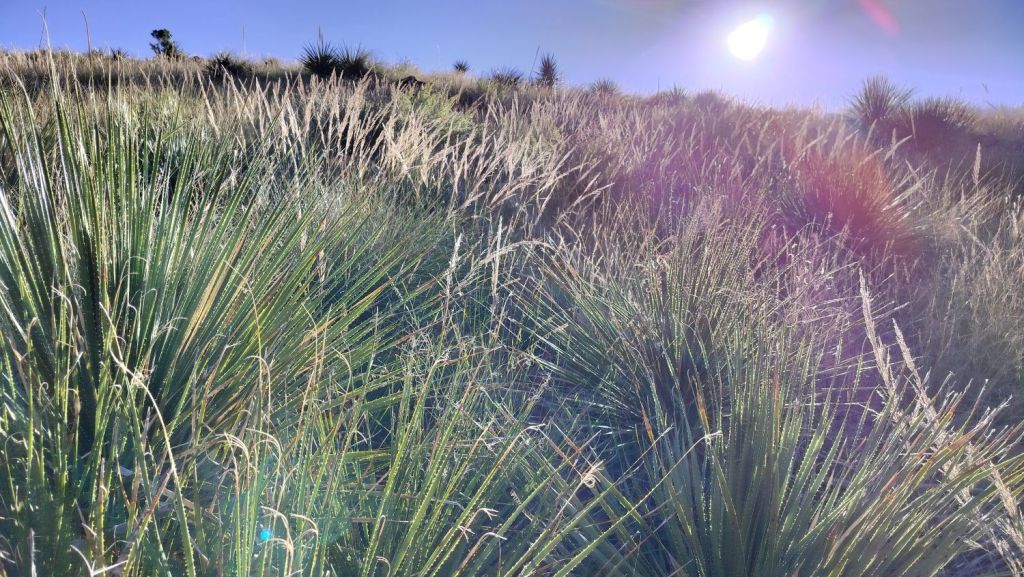
We hiked a steep trail for an early morning view of desert vegetation
We postponed our visit to the Big Bend area due to the US Government shutdown in October-November 2025 and hope to visit the area in our upcoming 2026 travels.
From the Davis Mountains, it was almost 1400 miles home – 600 miles across Texas and another 800 miles to Florida. We continued the long drive east on US 90, past tiny remote communities and across mountain ranges and dry canyons. We followed a lonely train track for miles where hundreds of empty rail cars were parked.
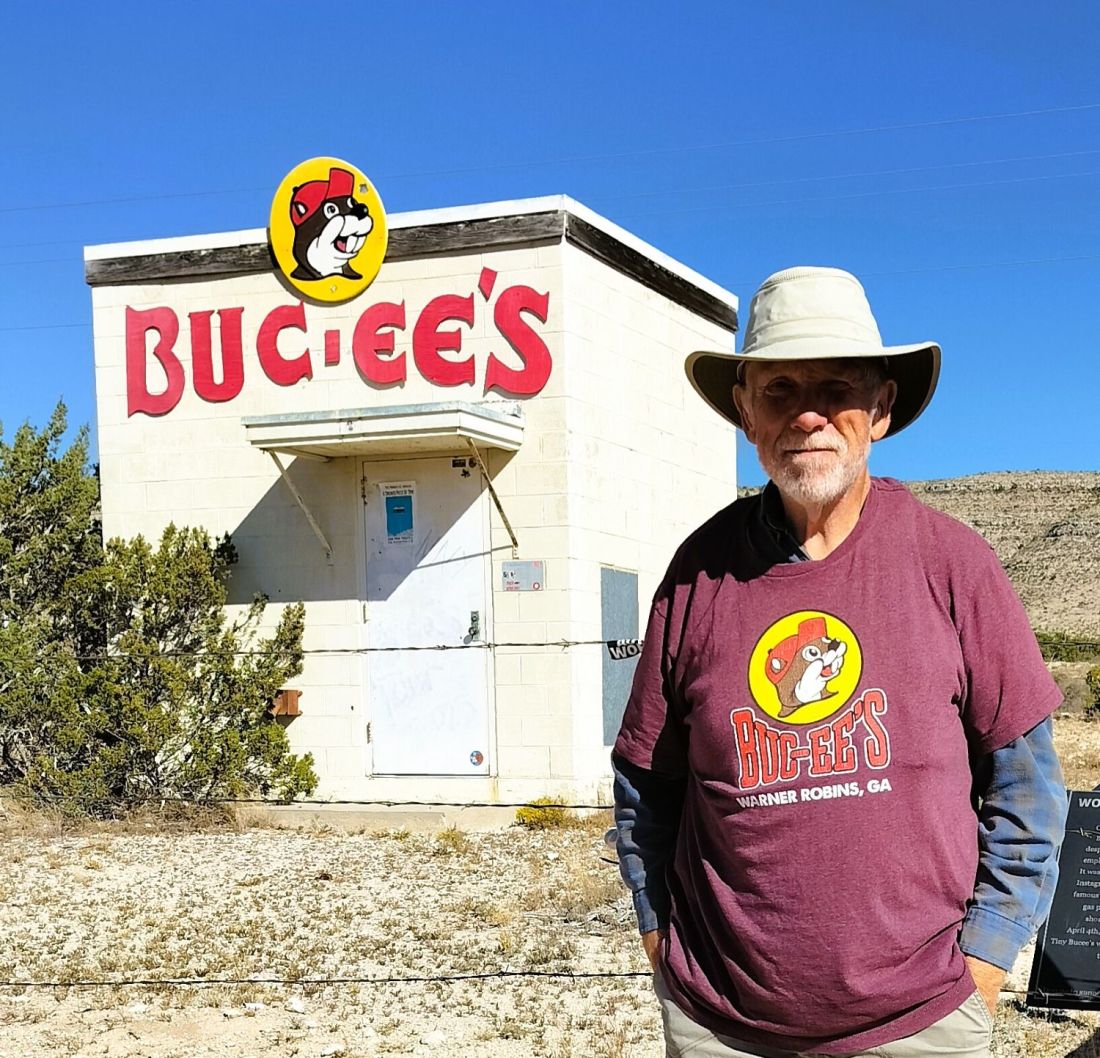
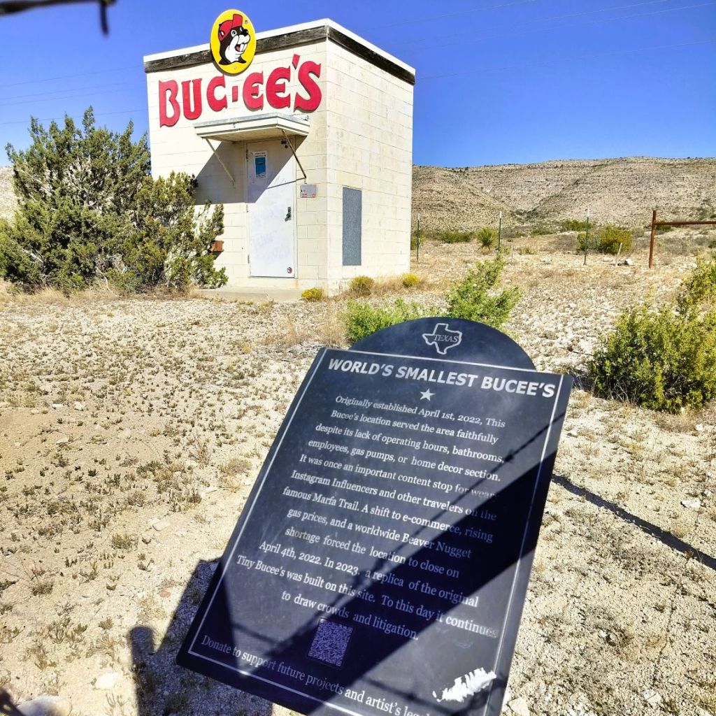
No Gas Pumps, No Brisket. What Kind of Buc-ees Is This?
In the middle of nowhere, we zipped past a small building where we spied a sign displaying the iconic Buc-ees Beaver logo!
We backtracked to see what it was all about.
Buc-ees – in the middle of nowhere
A sign indicated the tiny, single-door cinder block structure was the world’s smallest Buc-ees. It pokes fun at consumerism, similar to the faux, non-functional Prada store in Marfa, Texas, about 50 miles west on US 90.
It turns out that some things aren’t bigger in Texas. And we were disappointed this Buc-ees location offered no restrooms or beaver nuggets.
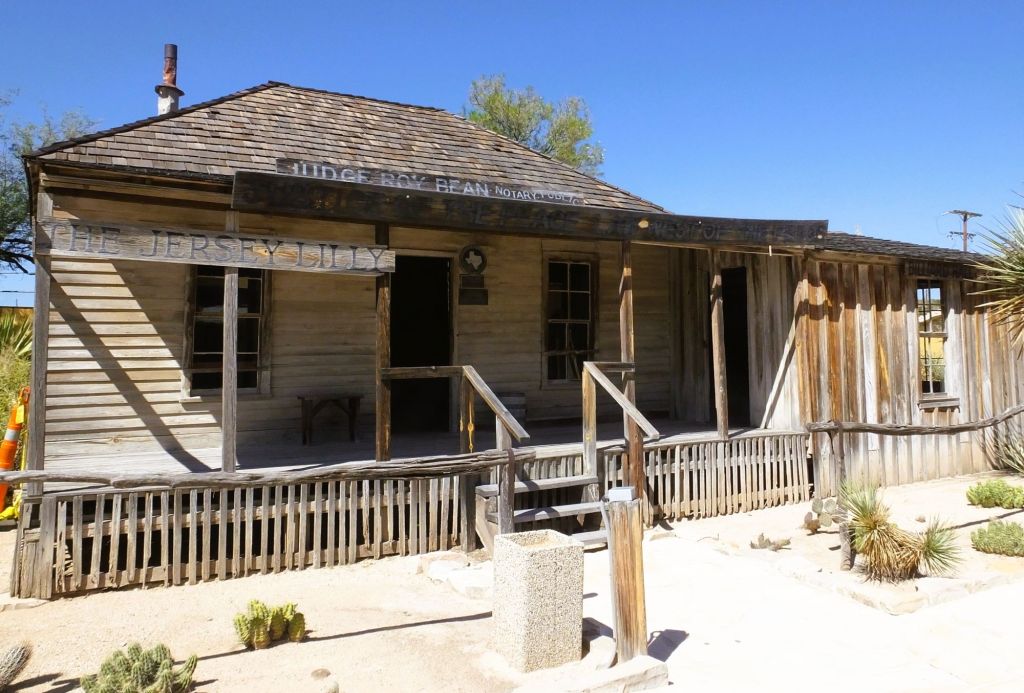
Law West of the Pecos
Judge Roy Bean administered justice in remote western Texas – Law West of the Pecos!
Around mid-day, we stopped at Langtry TX, a remote town near the Rio Grande River that was home of Judge Roy Bean, who enforced ‘Law West of the Pecos.’
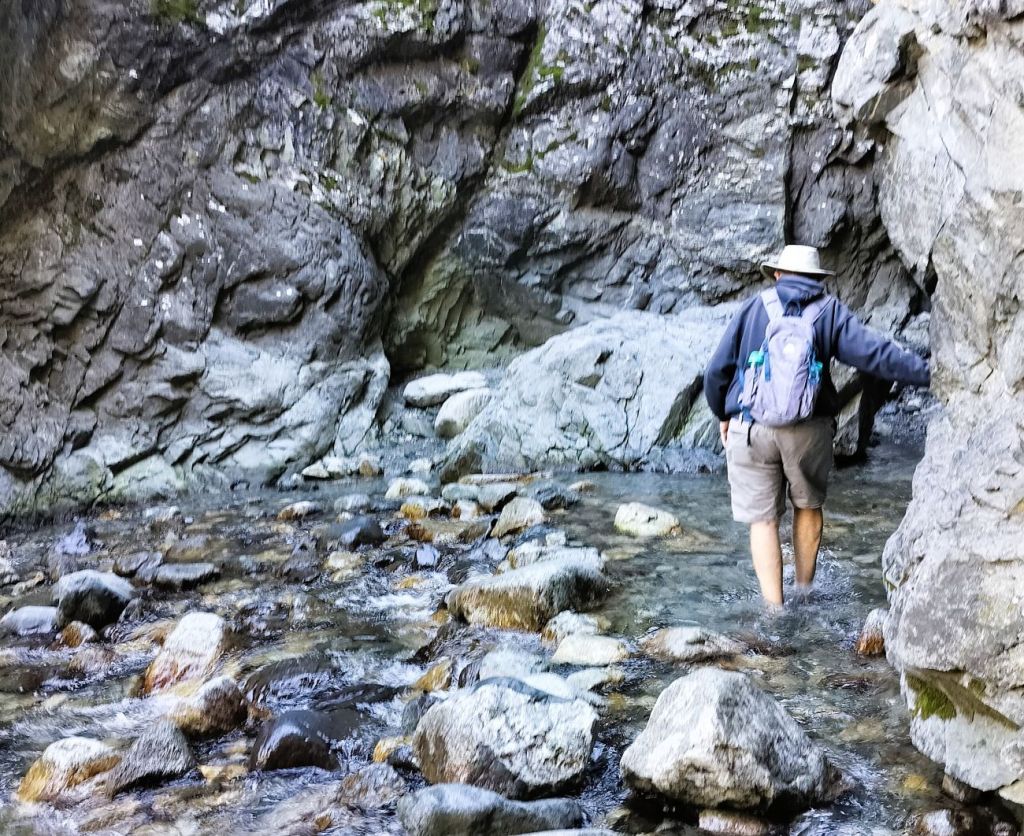
That evening we camped at Seminole Canyon State Park and Historic Site, known for ancient rock art drawn on canyon walls. We’ll share more about Seminole Canyon in our upcoming series.
Near Langtry, we ate lunch with a view of Mexico across the Rio Grande River
Continuing Home
We visited my brother Jim and his wife Mary near San Antonio
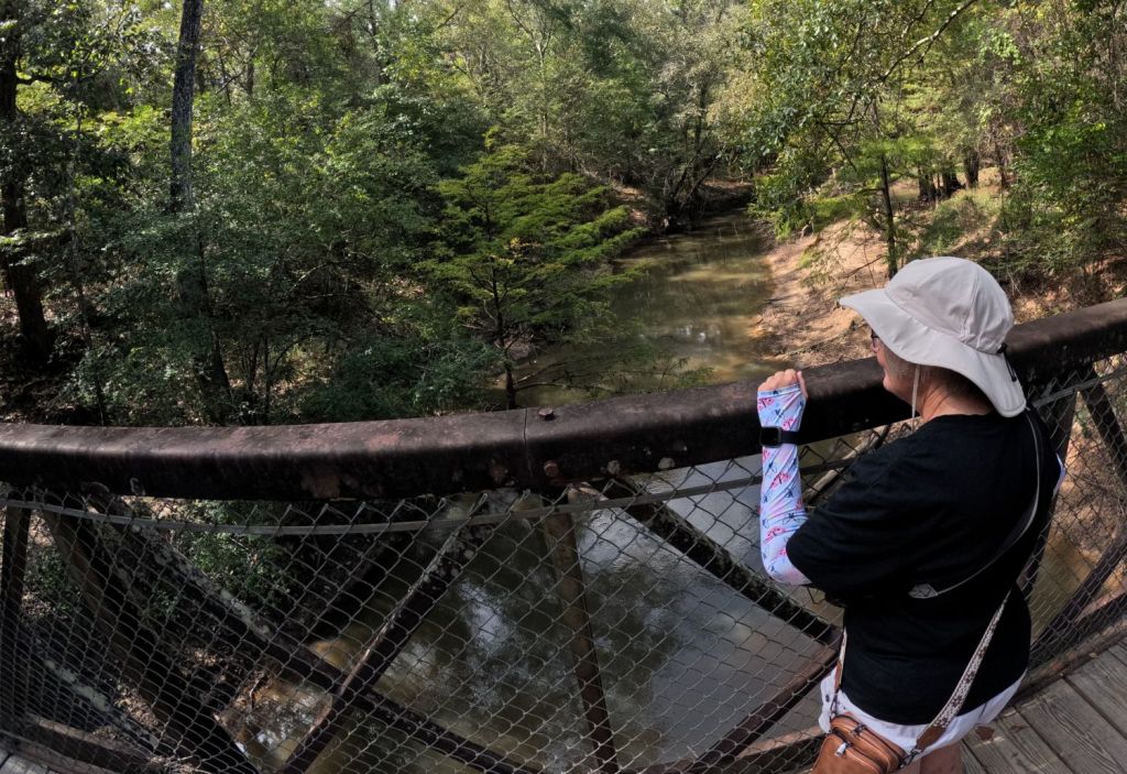
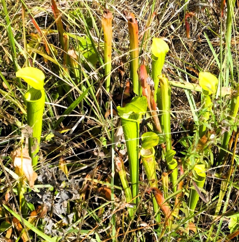
Continuing east, we had lunch with my brother and his wife near San Antonio, and then spent several days in east Texas near the Big Thicket Swamp. The contrast of arid west Texas around Palo Duro Canyon and David Mountains with the swampy Big Thicket bayous in east Texas is amazing.
Pat surveys a wet area in the Big Thicket Swamp in east TexasOn one Big Thicket trail we spotted pitcher plants in the wet areas
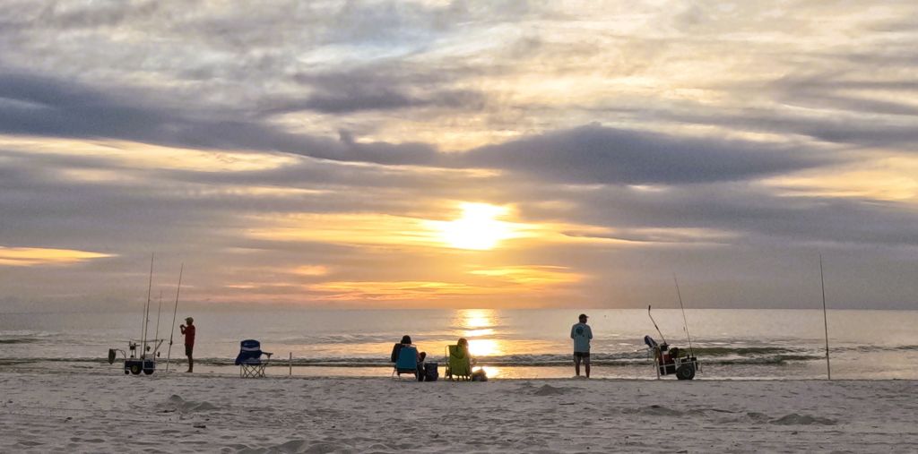
We arrived home after a final night on the beach at St. Joseph Peninsula State Park on the Florida Panhandle. It was a nice end to our Balloons and Beyond late summer adventure!
We enjoyed a beach sunset during our final night at St. Joseph Peninsula State Park on the Florida Panhandle
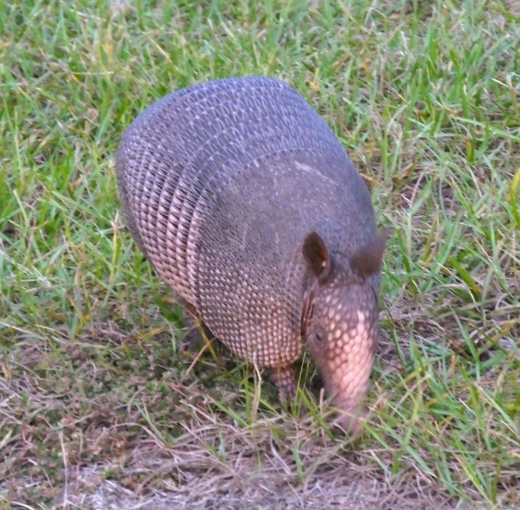
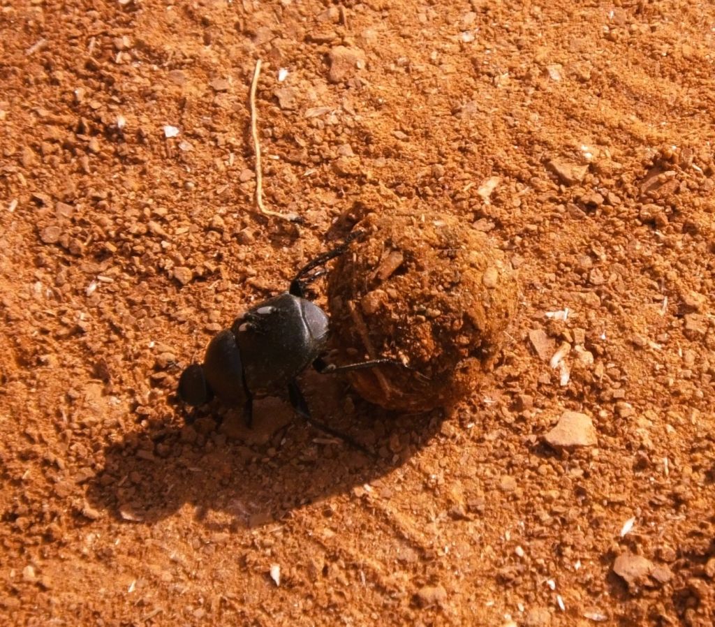
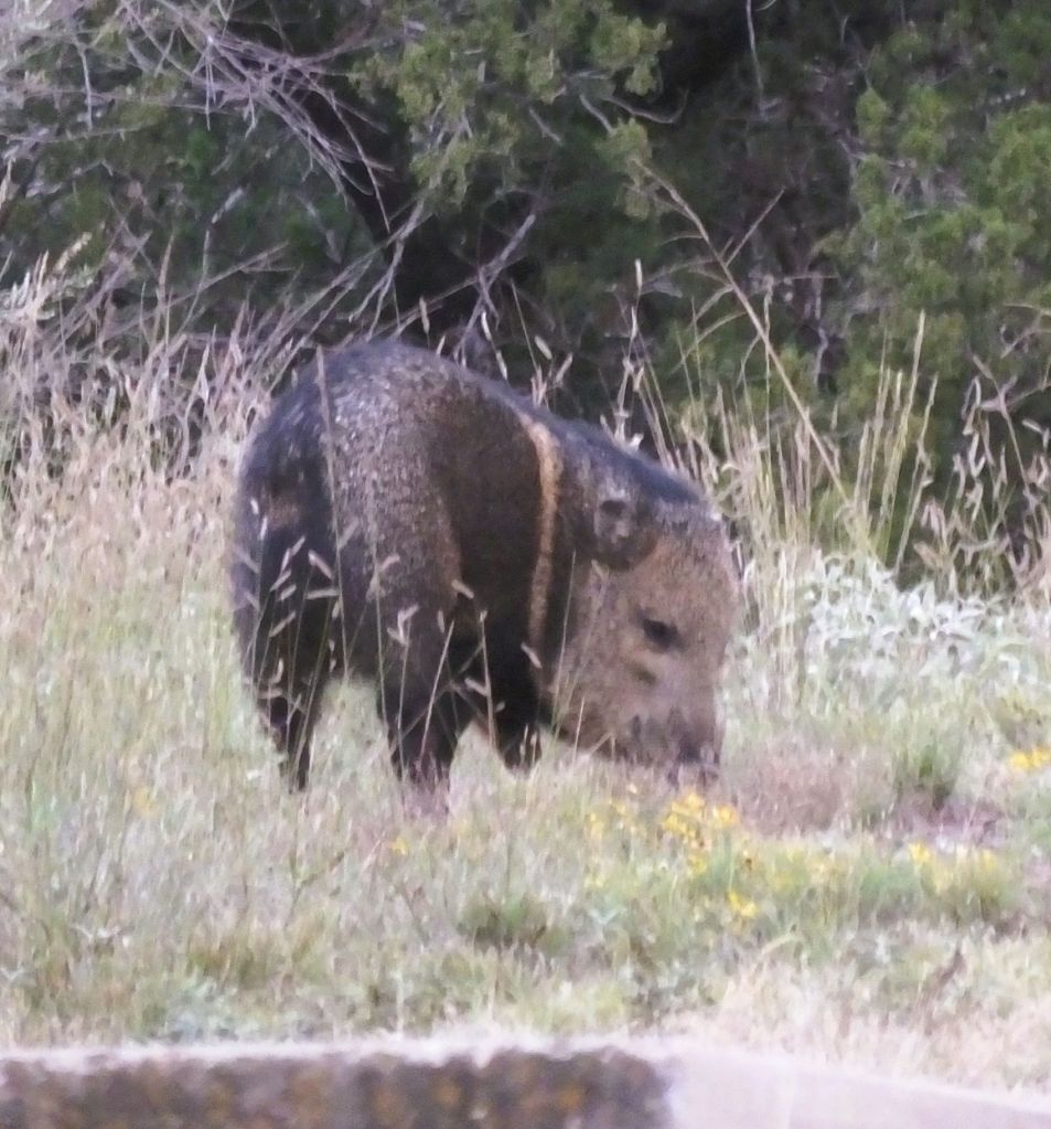
Texas Critters
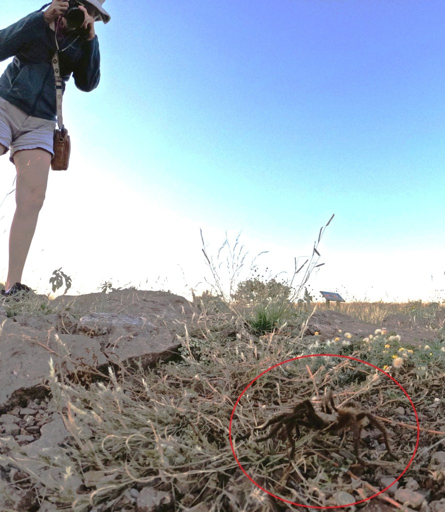
Something to ponder – what if Buc-ees chose an armadillo to be their mascot?This little beetle was rolling a dung ball as big as himselfA peccary (similar to wild pig) at Davis Mountains State Park. We kept our distance.Tarantulas come out at sunset we were told
Balloons and Beyond Recap
We camped 64 nights for an average of $18.97 per night and drove 7633 miles across 17 states.
Fuel was our biggest expense. Lowest paid was $2.09 (Flying J, Gulfport, MS), highest paid was $3.69 (Shell, Salida, CO).
Reminder to LIKE our blog posts and SUBSCRIBE for future updates
RabbiTRAILS is now AD FREE We hope you enjoy the less-cluttered format!
Balloons…
We spent three nights in the Albuquerque area during the Balloon Fiesta (2025 Balloons and Beyond Ep 6, Ep 7, Ep 8). Despite several balloon launches and glows cancelled due to rain, Friday was a perfect day with a spectacular morning ascension and wonderful evening glow-flicker, drone show and fireworks. It was the highlight of our trip!
And Beyond!
We left Albuquerque headed east on I-40 and spent the night in Tucumcari, NM.
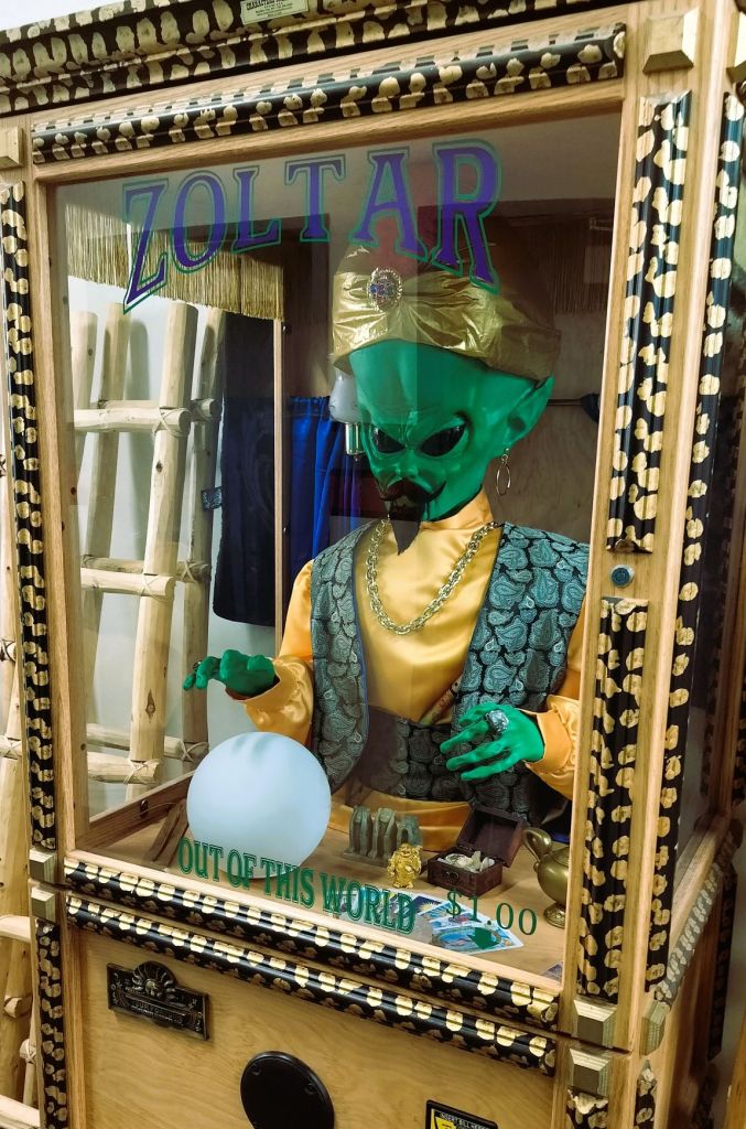
We ate lunch at Clines Corners, a gas station/kitschy tourist store a couple hours east of Albuquerque on I-40In addition to souvenir T-shirts, caramel nuts and toy slingshots, Clines Corners has several old-fashioned fortune-telling vending machines like Love Tester and Zoltar. Zoltar’s advice? Don’t drive truck campers through tunnels!
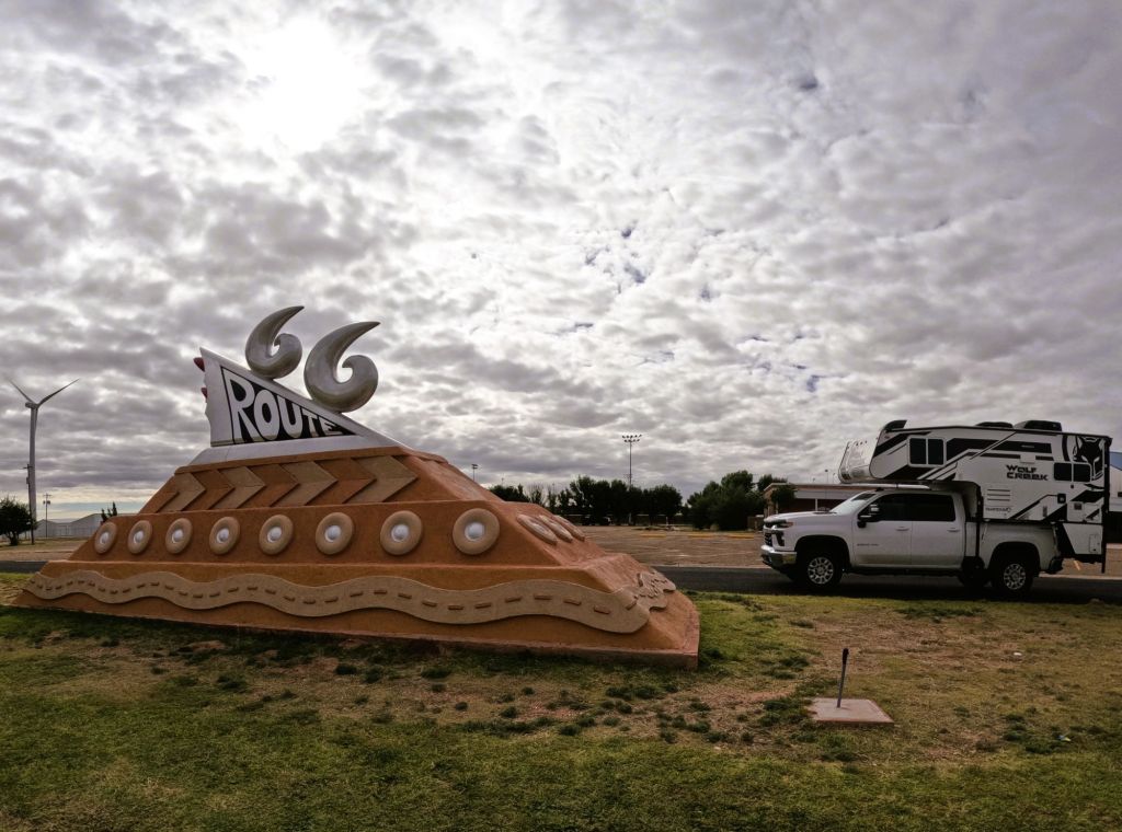
Tucumcari was once a major stop for travelers on Route 66, America’s Mother Road. On the edge of town there’s a whimsical Route 66 monument with a sloped sandstone base inscribed with tires and serpentine two-lane highway. It is topped with stylized sixes atop a 1950s tail fin and lights.
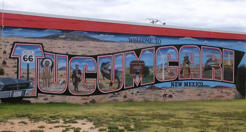
Tucumcari’s monument to Route 66, the Mother RoadMany towns have welcome murals like this one in Tucumcari
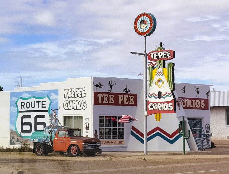
There are lots of small motels with names like Palomino Motel, Roadrunner Lodge, Relax Inn, Motel Safari, Pow Wow Inn and Buckaroo Motel that are closed or repurposed. A few remain open to offer lodging to nostalgic travelers.
Tucumcari also has a variety of curio shops
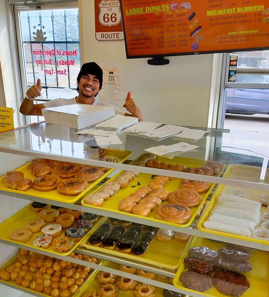
Cambodian Donut Cartel?
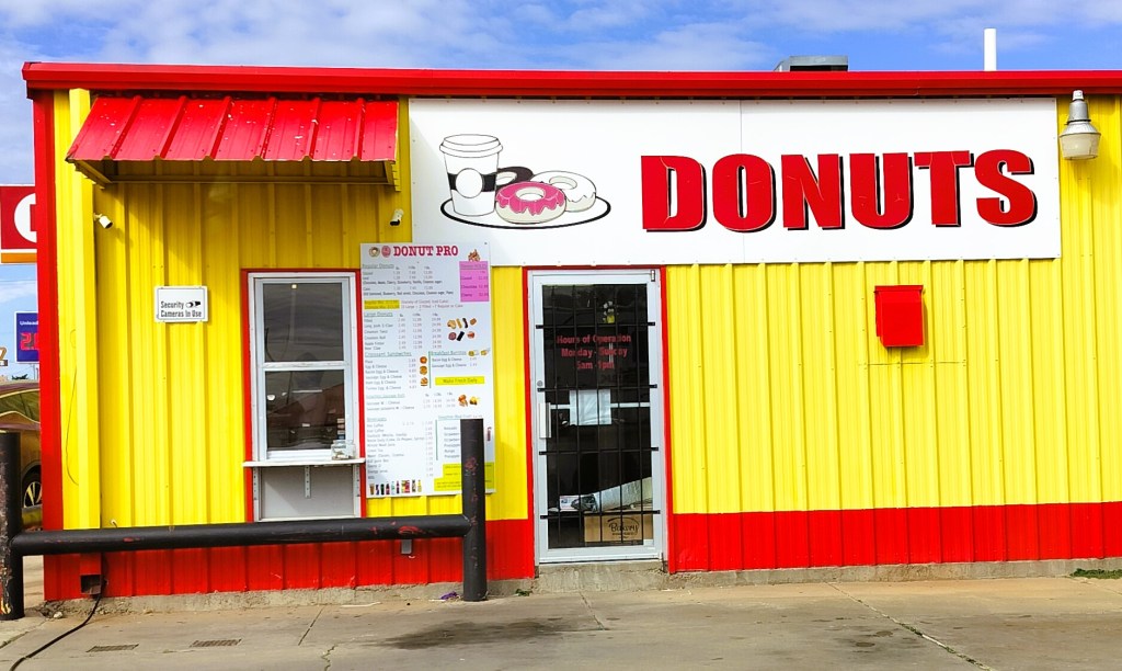
At Tucumcari Donuts we learned an interesting piece of the American story.
Tucumcari Donuts – part of the Cambodian Donut cartel?
A young Asian man served us donuts and coffee and told us his family was from Cambodia. At similar donut shops in Missouri, Colorado and east Texas we learned the employees were also of Cambodian descent.
This friendly fellow with Cambodian heritage poses with amazing donuts!
Cambodian-owned donut shops are a huge part of the American donut scene, many stemming from refugees finding opportunity in America in the 1980s. The shops were pioneered by Cambodian Ted Ngoy (the Doughnut King), who helped fellow refugees start their own businesses.
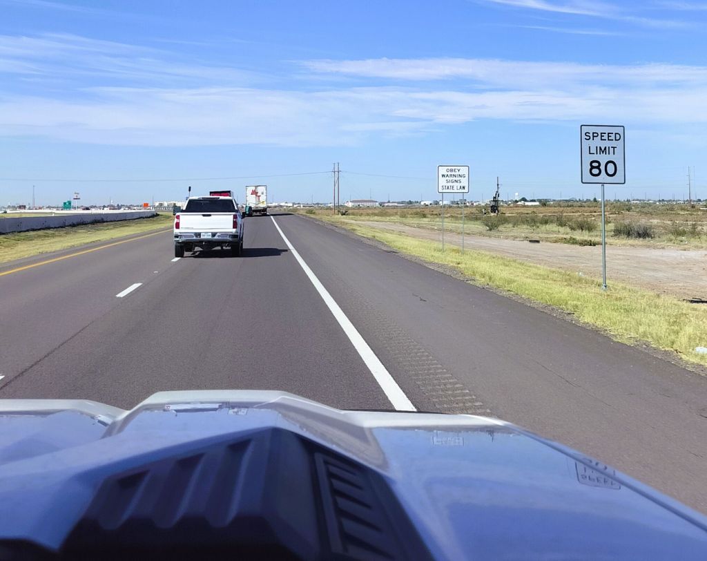
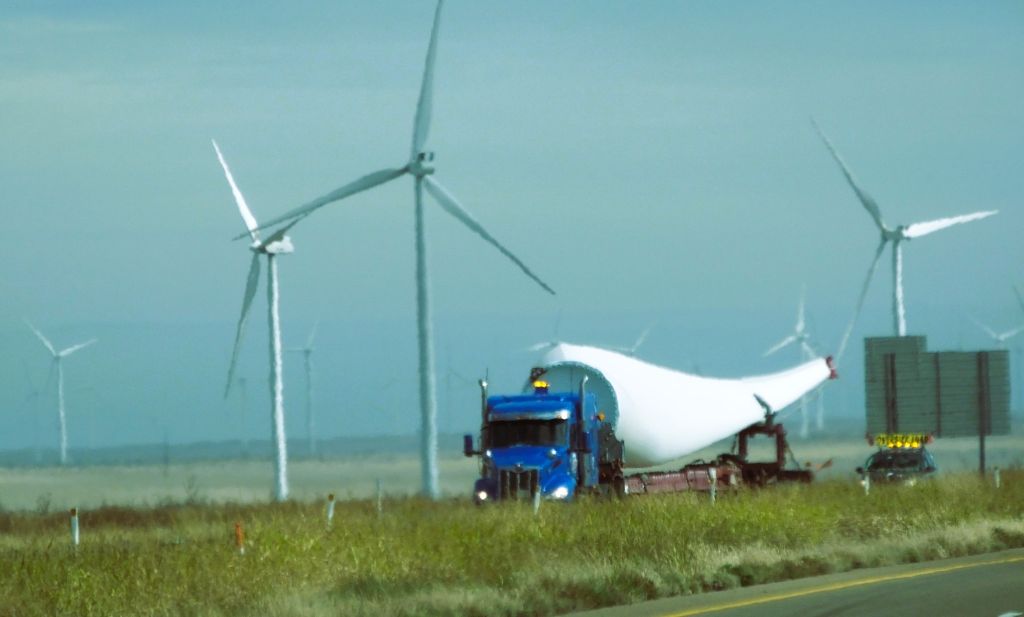
Not Up to the Challenge
Trucks and cars zipped by us on Texas I-40. We poked along at 60 mphA long windmill blade traveling along I-40 will be added to one of the thousands of already-installed windmills on the Texas panhandle
We continued east to the Texas panhandle. The flat terrain was punctuated with THOUSANDS of Texas-sized spinning windmills.
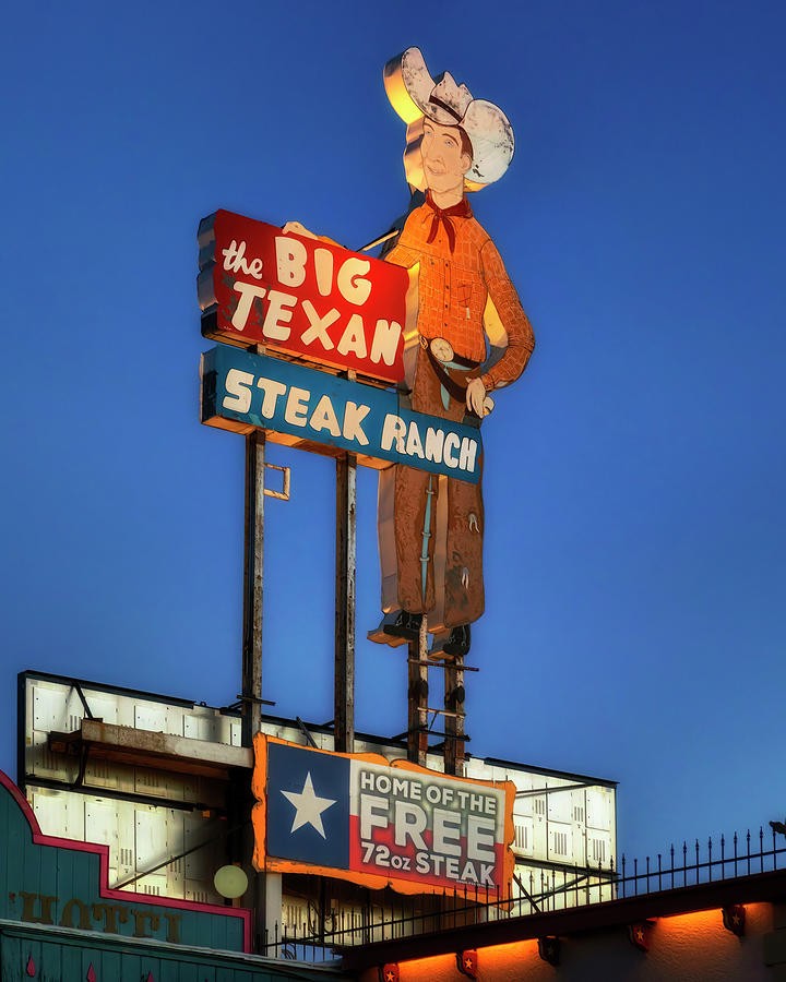
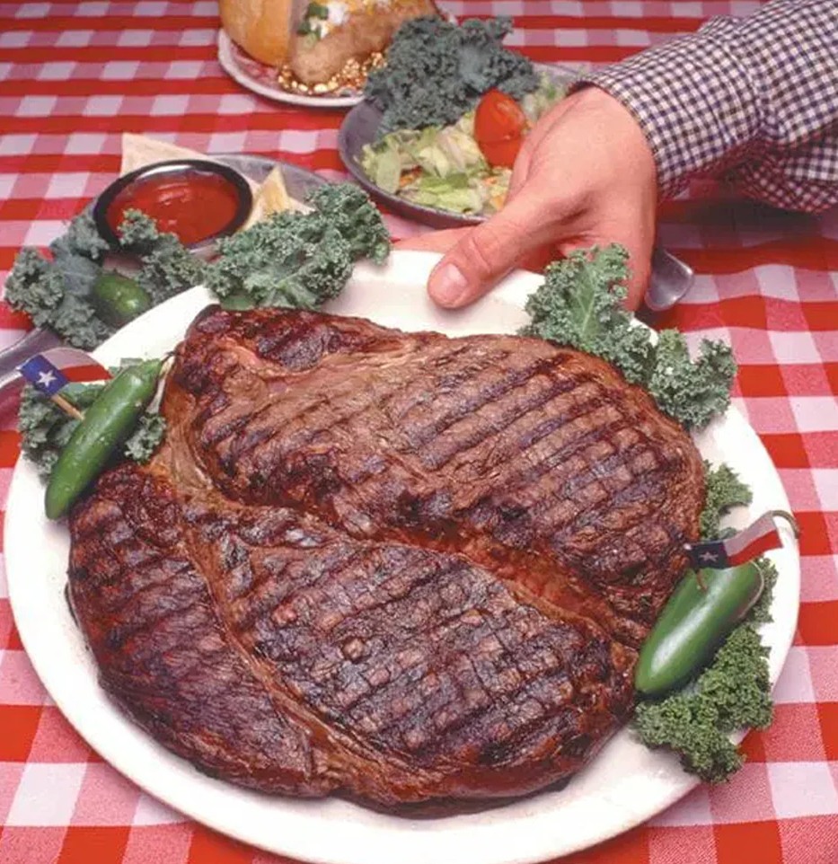
Like the omnipresent Buc-ee’s signs on interstate highways elsewhere, there were frequent signs encouraging a stop at The Big Texan Steak Ranch in Amarillo. The steakhouse is home of the world famous 72-ounce steak challenge: eat a 4½ pound steak and fixings in less than an hour and it’s free. Otherwise, the belly-busting meal will set you back $72!
Eat the 72-ounce steak at the Big Texan Steak Ranch in less than an hour and it’s free!
We weren’t up to the challenge. Full of our mid-morning donut snack, we passed by and turned south toward the second largest canyon in the United States.
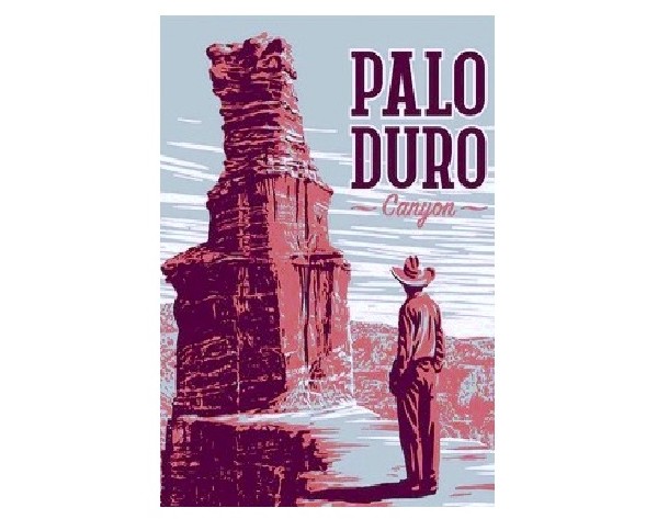
Palo Duro Canyon
Nicknamed “The Grand Canyon of Texas” both for its size and dramatic multicolored rock layers and steep mesa walls, Palo Duro is about 40 miles long, six miles wide (20 miles wide at places) and 800 feet deep.
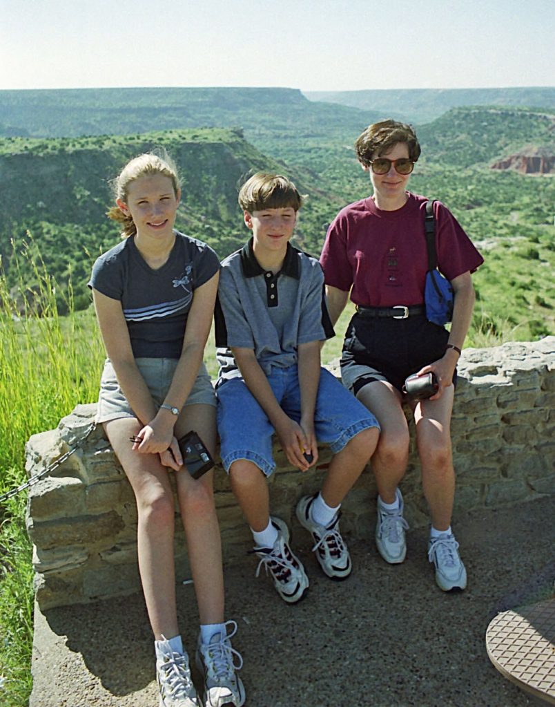
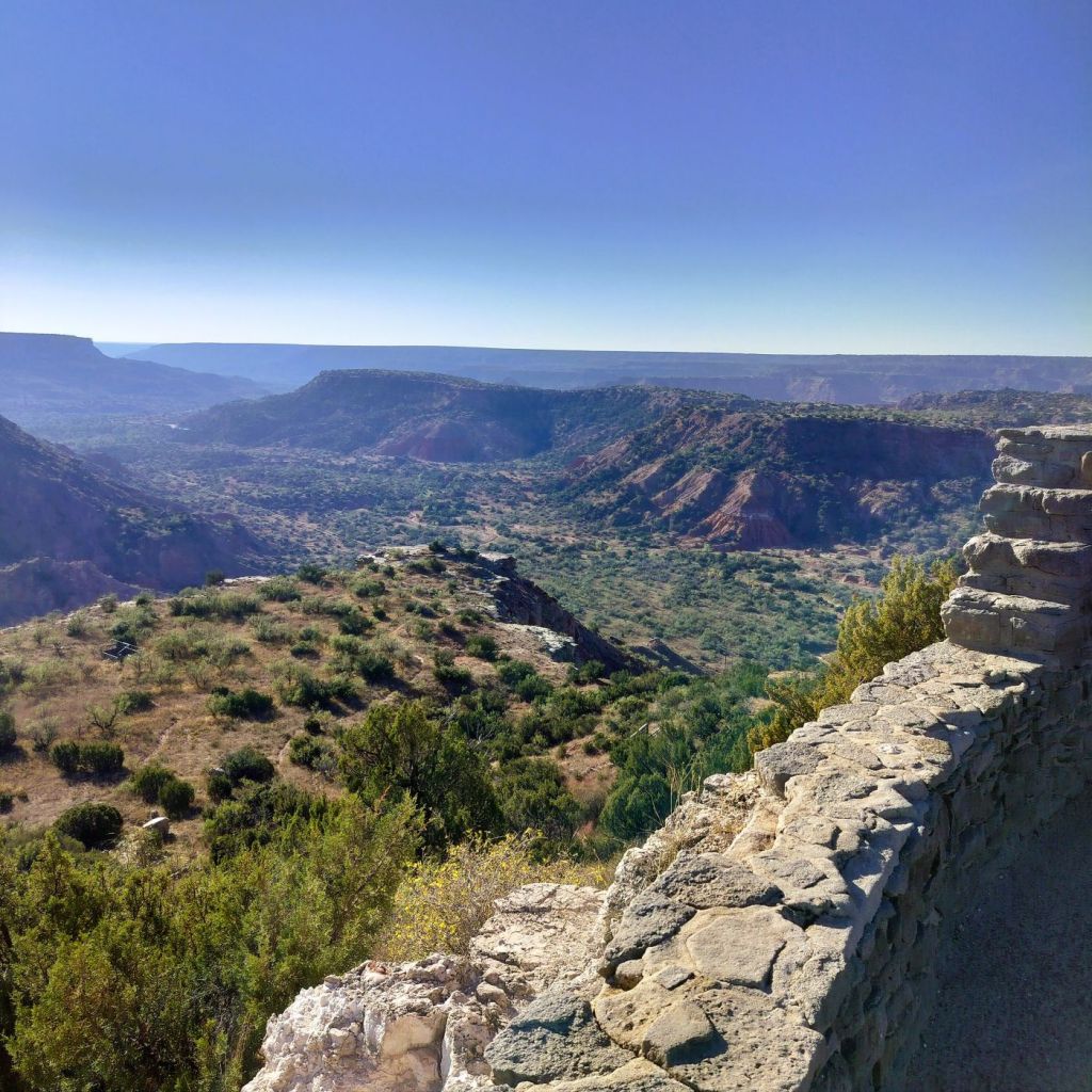
Liz, Phil and Pat during a 1999 visit to Palo Duro Canyon.2025 view of Palo Duro Canyon from same rock wall as 1999 family photo
Much of the canyon is contained within a Texas state park. The visitor center at the canyon’s rim has sweeping canyon views and in 1999 I took the family photo above as we enjoyed our first view of the canyon. How time flies!
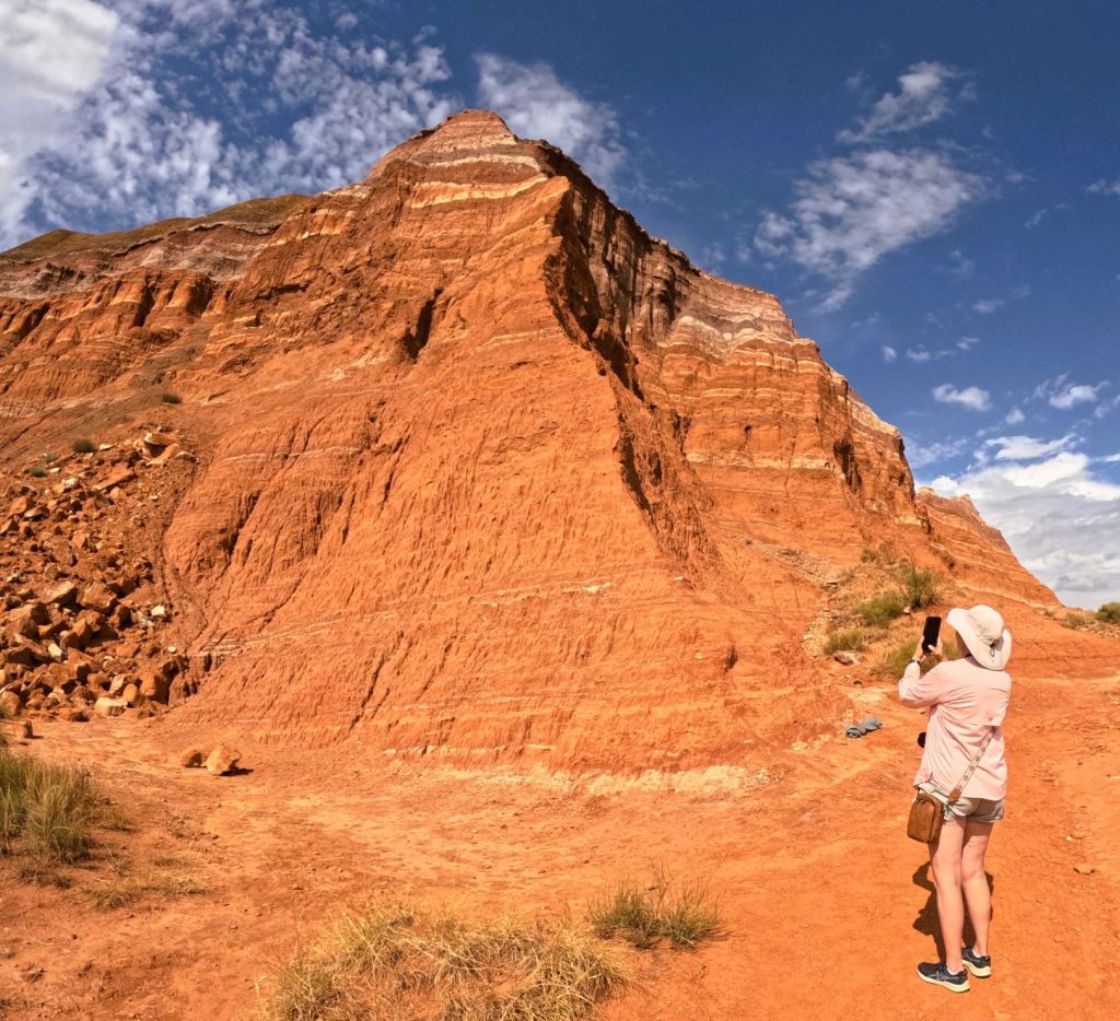
From the viewpoint, the road quickly descends to the bottom of the canyon. The layered and multicolored canyon framed the road as we drove to the campground where we would stay for the next two nights.
Photographing the colorful layered canyon wall at Palo Duro State Park
We were greeted by Bullet (his real name), a campground host originally from Amarillo. He was a rodeo cowboy in his teens and later owned an Amarillo copier service business. Now retired, he has been a fulltime volunteer at three different Texas state parks for more than a dozen years.
He helped us set up and provided useful details about the campground and things to do in the park.
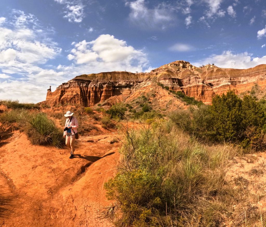
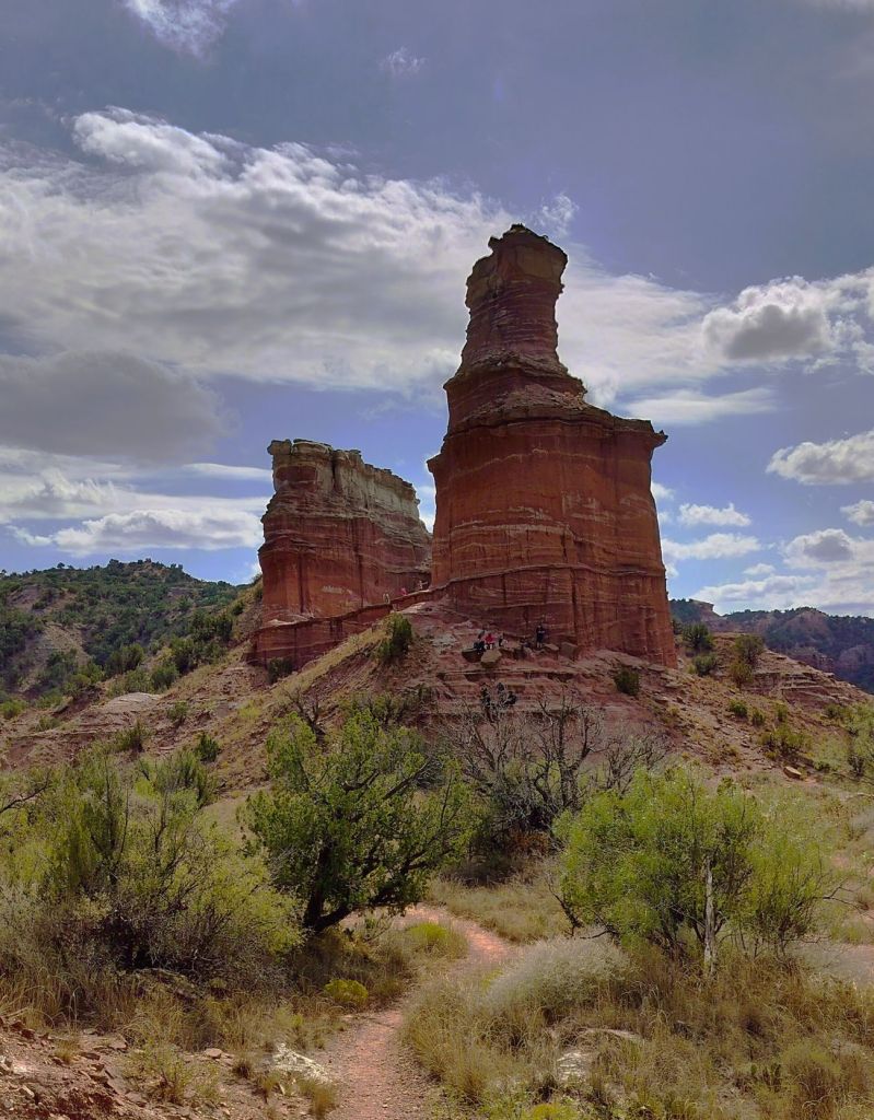
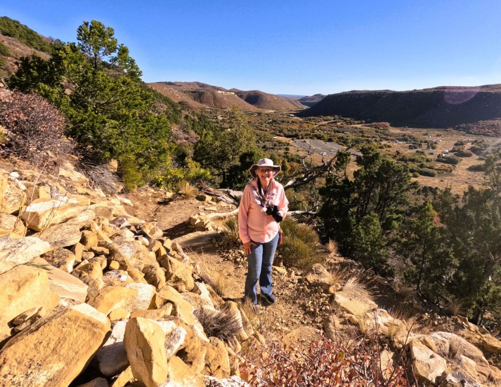
Pat carefully hikes into a low area along the Lighthouse TrailZoom this photo to see people on the ledge between the two formations – the Lighthouse is on the right
Six miles = Muscle Aches?
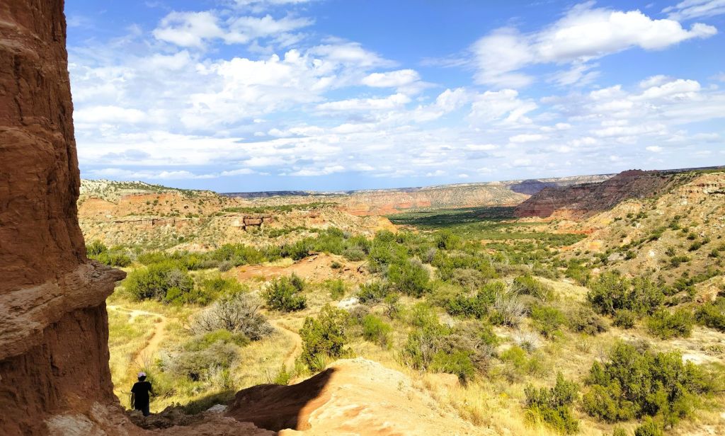
We decided to hike three miles to the iconic Lighthouse formation, prominently displayed in park promotional brochures. The mostly flat trail weaves through several canyons before the steep quarter-mile climb to the Lighthouse. After a precarious scramble to the base of the formation, we had great views of the broad canyon.
Sweeping view of Palo Duro Canyon from the Lighthouse
The hike was worth a few minor muscle aches!
Balloons and Beyond – Wrap-up
Palo Duro was our first Texas state park during our fall 2025 Balloons and Beyond travels. Next episode we wrap up the series with visits to five more Texas state parks as we cross the state on our way home.
Don’t forget to LIKE our blog posts and to SUBSCRIBE for future updates
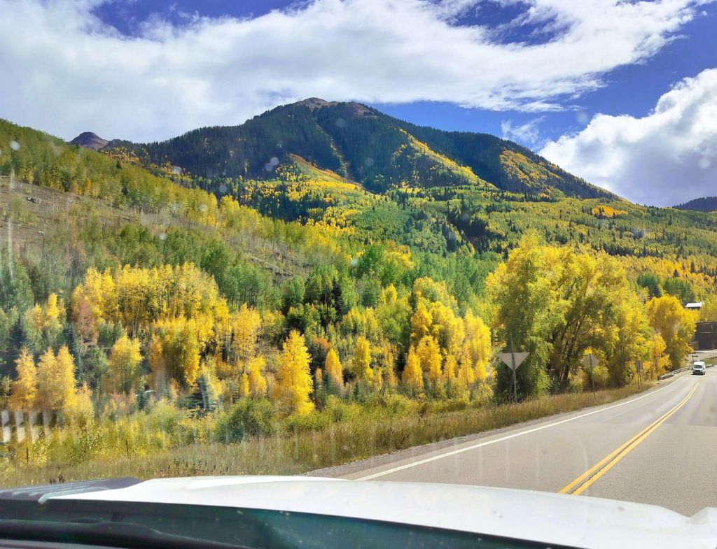
We left Black Canyon of the Gunnison bound for Mesa Verde, several hours away in southwest Colorado. Our route took us near Telluride, a former mining town that is now a popular tourist destination and ski resort, and across several mountain passes, where the Rocky Mountain fall colors were on full display.
Rocky Mountain fall colors
Brief Reunion
Pat’s brother, James, met us for the night near Cortez, CO. We enjoyed dinner outdoors and compared our travel experiences since parting ways in Wyoming several weeks prior. He was returning to Florida after traveling further west in Wyoming and Idaho.
The day ended with a beautiful fiery sunset over the San Juan Mountains.
Pat’s brother, James, met us as he returned to FloridaSunset near Cortez, CO
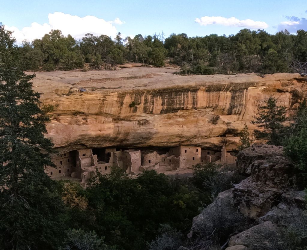
Green Table
At Mesa Verde National Park the next morning, we stopped at the visitor center to check on tours of the park’s ancient cliff dwellings. The park rangers were unsure how the US government shutdown would affect the three tours we booked during our stay. They said it was even possible we might have to leave the park.
The Mesa Verde entrance road zigzags up iconic Point Lookout on the way to the pueblos and cliff dwellings
While setting up at the national park campground, we took Pap off Percy. We often do this when staying two or more nights as it is easier to maneuver and park the truck without its piggyback friend. The gas mileage also is much better.
It takes fewer than 15 minutes to lower Pap’s four side legs so the camper is above the truck bed, drive the truck from beneath the camper and then lower it about halfway to the ground onto four screw jacks. In case you were wondering, putting Pap back onto Percy takes about 30 minutes.
That evening we drove the 15-mile narrow and winding road to the mesa top and cliff dwelling areas. From the park’s highest point, we could see how Mesa Verde got its name. Ahead of us was a relatively flat expanse covered with green pinyon pines and junipers. It looked like a green table – translated to Mesa Verde in Spanish.
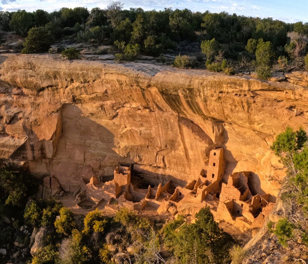
Spruce Tree House has about 130 roomsSquare Tower House, is a four story, 27-foot-tall structure surrounded by 24 rooms
We viewed the Spruce Tree House and Square Tower House cliff dwellings from the mesa top and wondered, like many visitors, about the ancient Puebloans that built and lived in the structures. How did they get from the mesa tops and canyon valleys to the dwellings? Where did they get water and food? Why was the area abandoned around 700 years ago?
We hoped to learn answers to these and other questions during the tours.
Mesa Nada
Unfortunately, the tours were not to be.
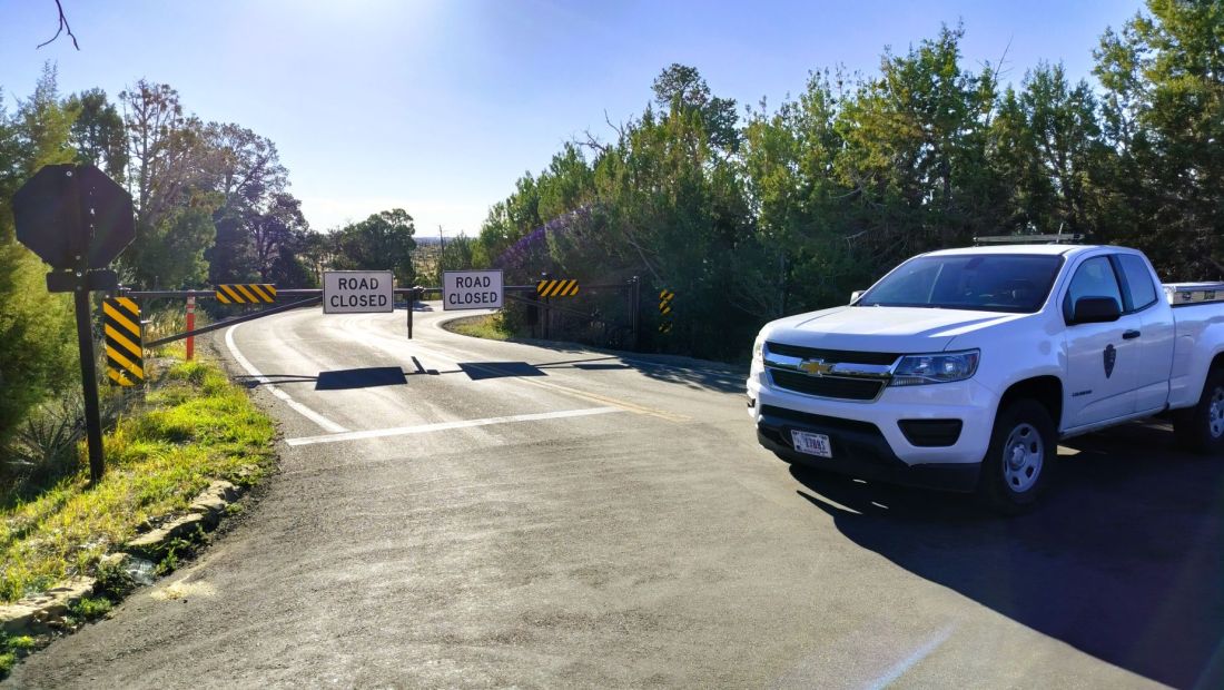
We rose the next morning before sunrise and drove to the meeting location of the Square Tower House tour. Almost there, we were stopped by a gate with road closed signs. We learned the US government had indeed shut down. All of the Mesa Verde’s historic sites were closed and our tours were cancelled.
From past travels we’ve learned that changed plans often yield unexpected surprises and blessings.
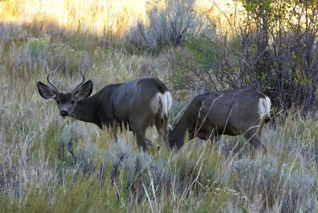
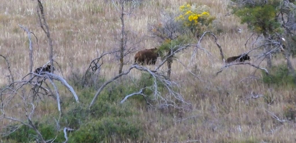
We were thrilled to see lots of mule deer and four black bears in the campground area.
A couple of the many mule deer near the campgroundA mama black bear and her two cubs seen on an early morning drive
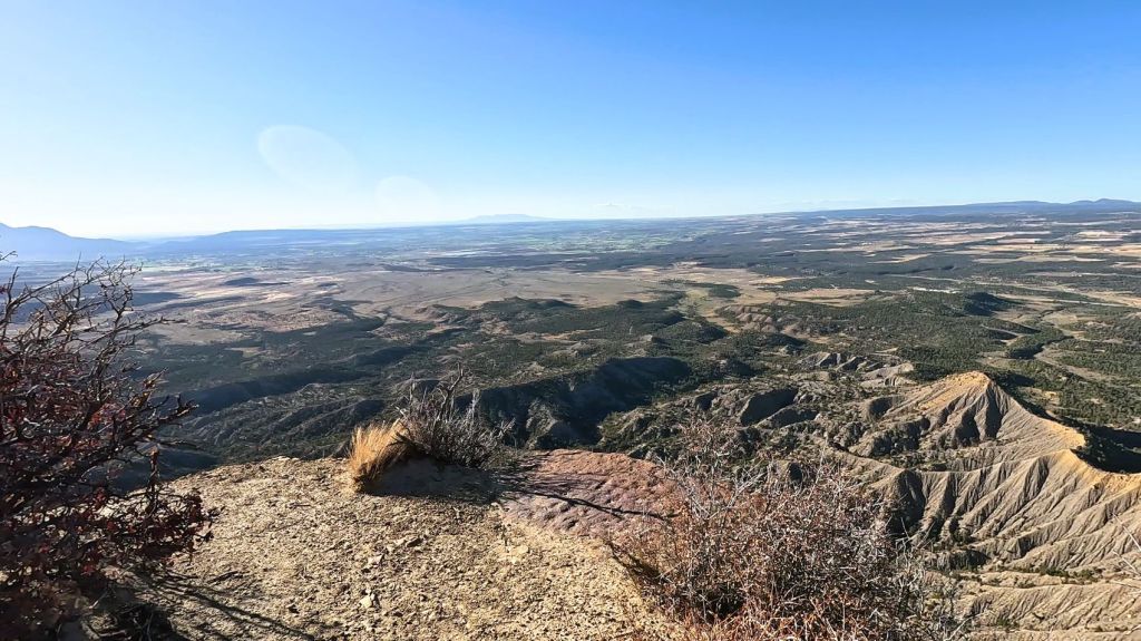
Later, we hiked to the top of Point Lookout, the iconic geological formation that towers above the park entrance. From the point, we were rewarded with views of the distant San Juan Mountains and valleys below.
Climbing the steep and rocky trail to Point LookoutView of valley and distant mountains from Point Lookout – we were right on the edge!
Answers to the questions above?
Most of the pueblos and cliff dwellings started around 600 AD were abandoned by 1300 AD following prolonged drought and social upheavals. The residents subsisted by growing maize on the mesa tops and by hunting. Narrow, steep trails connected the pueblos and cliff dwellings to the mesa top and sources of water.
Perhaps we’ll learn more complete details during a future visit to Mesa Verde. That is, of course, if the US government isn’t shut down!
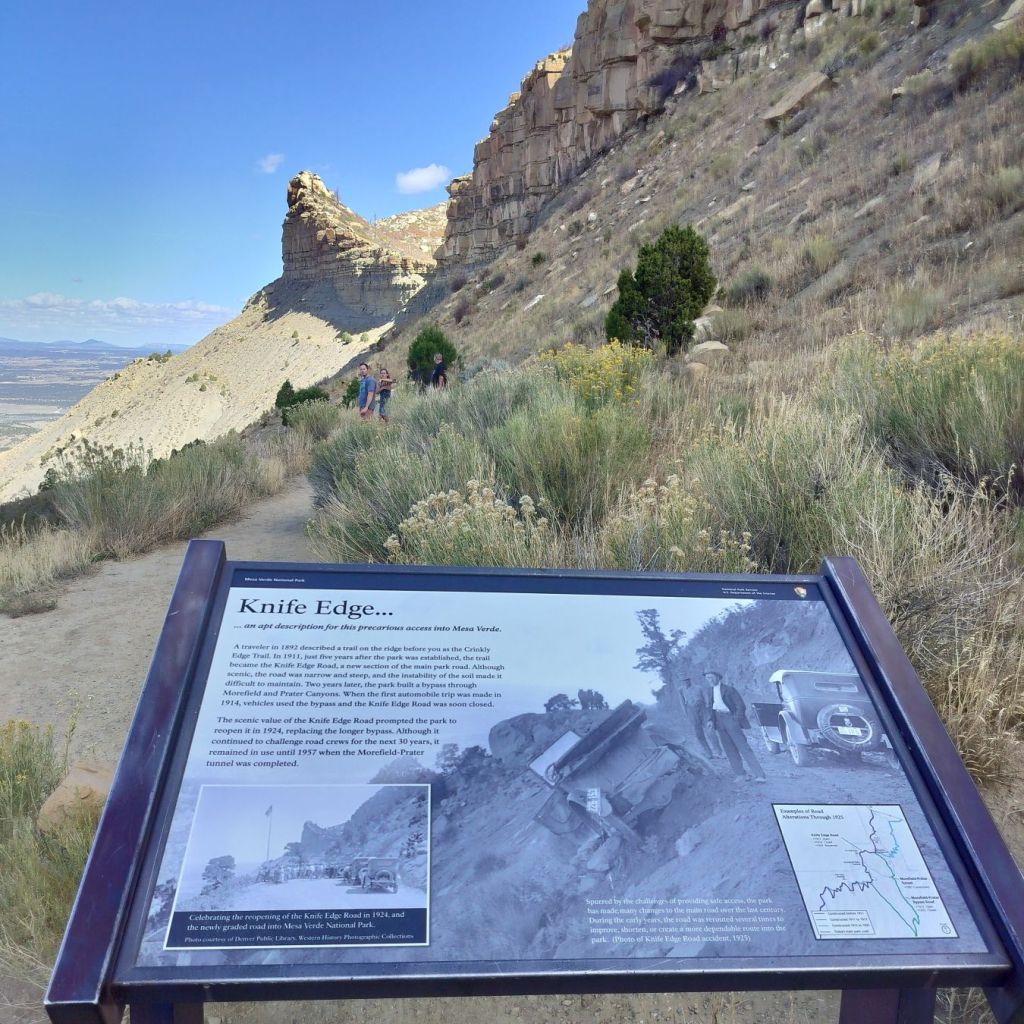
The original auto route to Mesa Verde’s mesa and cliff dwellings was described as a knife edge
Onward to the Balloon Fiesta
We left Mesa Verde a week before the Albuquerque Balloon Fiesta. We ate lunch in Farmington, a sizeable town in northern New Mexico with a HUGE Walmart, and continued southwest to a remote Harvest Host location.
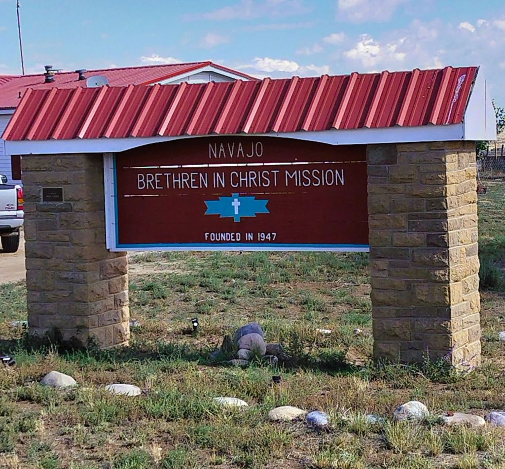
Navajo Mission
The Navajo Brethren in Christ Mission ministers to Navajo communitiesNumerous buildings and a small church are part of the Mission
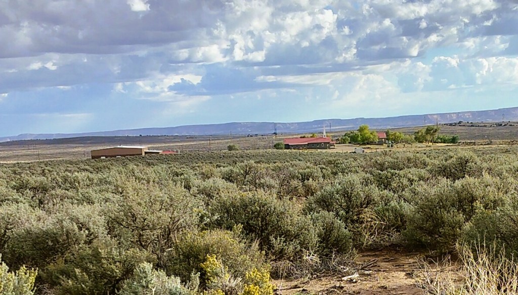
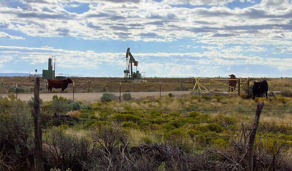
Our stay at the Navajo Brethren in Christ Mission revealed various ways the mission reaches out to Navajo residents in the area. The mission offers food, clothing, education assistance and the hope of Christ through their church ministry and fellowship programs. We camped a quarter mile from the Mission where the quiet sagebrush and cactus covered camping area was interrupted by passing water trucks, squeaking oil well grasshoppers and mooing cows.
Cows and oil wells from our remote campsite
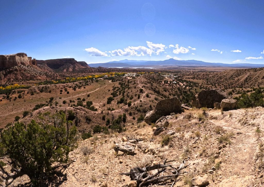
Abiquiu and the Georgia O’Keefe Connection
Our travels continued.
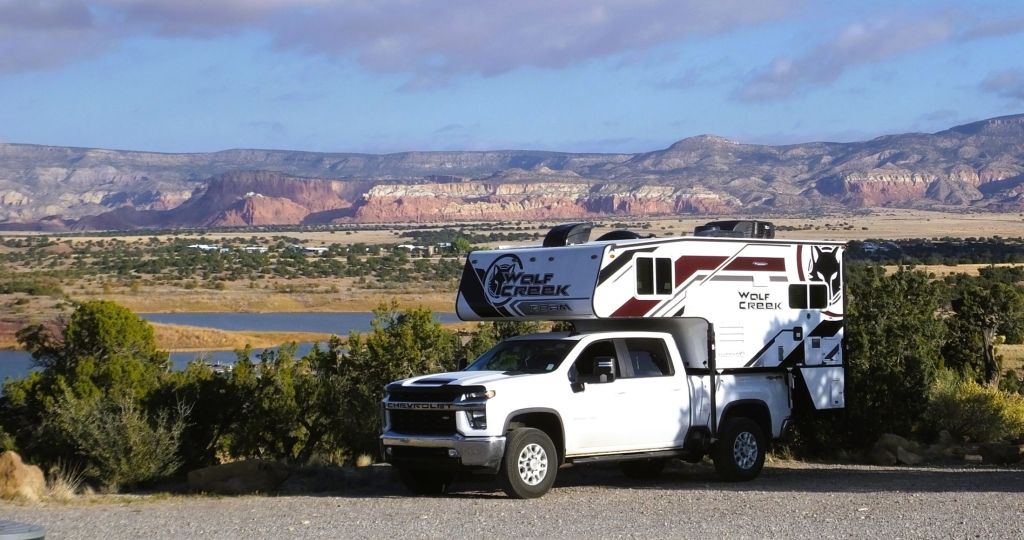
We camped several nights at a Corps of Engineers dam near Abiquiu, NM. Our campsite had a great view of the Abiquiu Reservoir and the red rock canyons and mountains in the distance.
Abiquiu Reservoir and distant red rock canyons and mountains
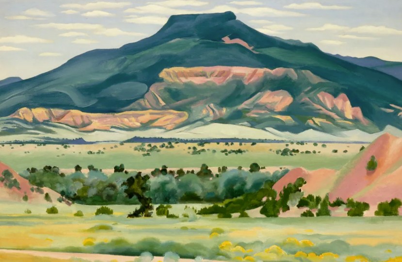
Abiquiu is best known for its connection with artist Georgia O’Keefe, where she had a home and studio. Her work was inspired by colorful and dramatic landscapes in the area that include the Abiquiu Reservoir and Ghost Ranch, a nearby education and retreat center.
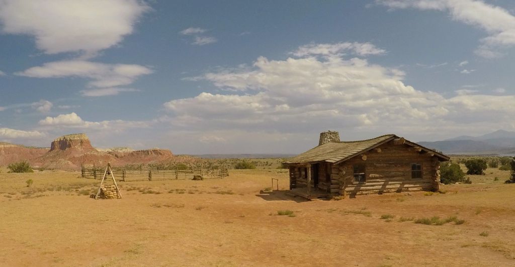
My Front Yard Summer by Georgia O’Keefe (1941) captures the beautiful landscapes near AbiquiuWe hiked to a beautiful lookout overlooking Ghost Ranch. The flat top mountain in the background is in the painting aboveA daunting reminder of the wilderness around Ghost RanchGhost Ranch locations have been used in many movies including City Slickers (1991), Cowboys vs Aliens (2011) and Oppenheimer (2024). This cabin was used in City Slickers.
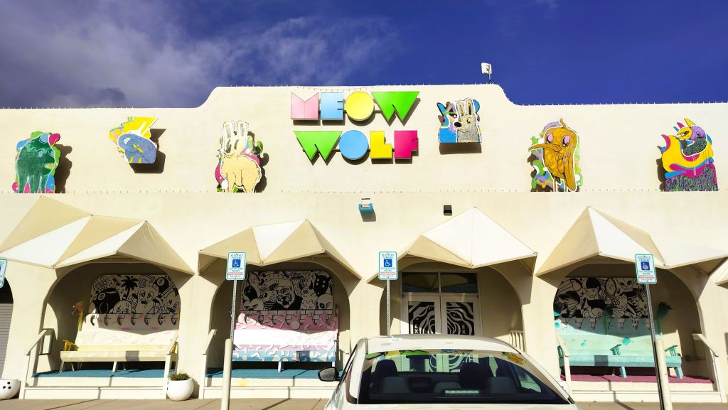
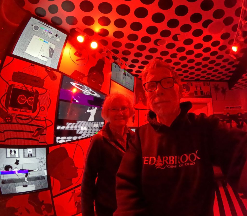
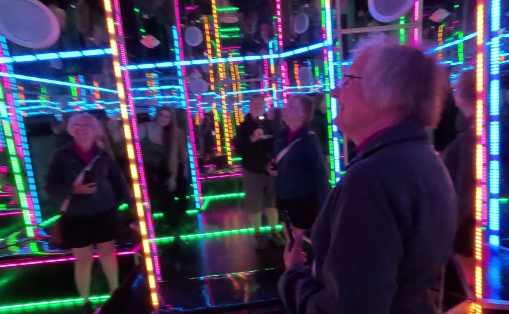
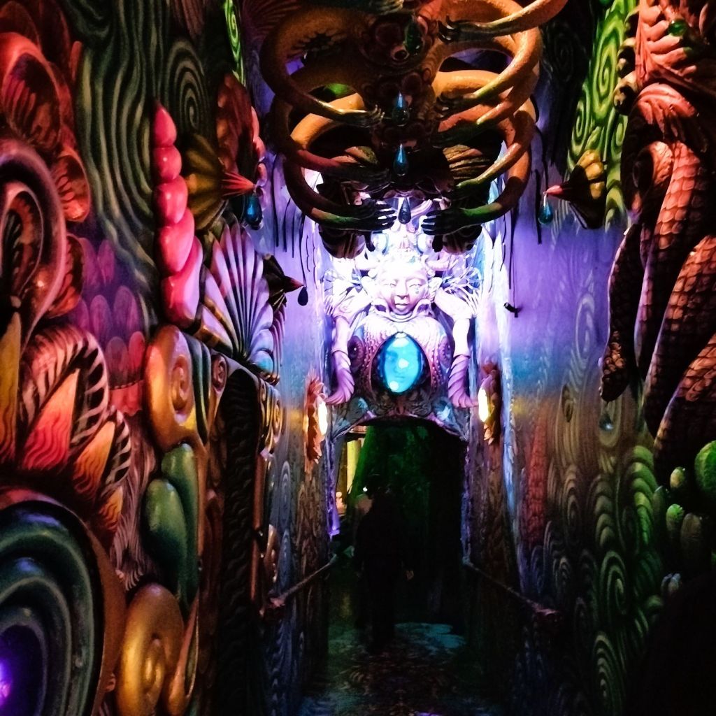
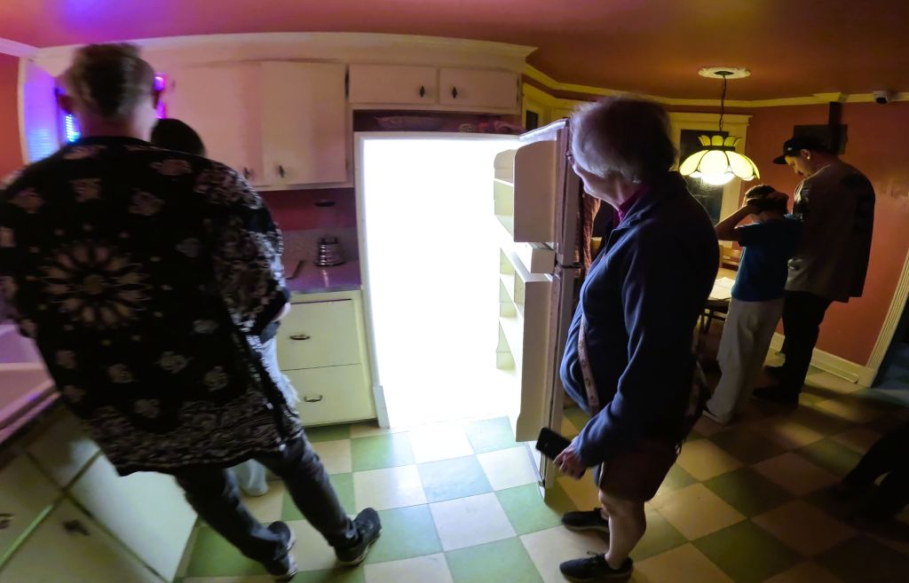
Santa Fe and Meow Wolf
Our final night before the Balloon Fiesta was in Santa Fe (click to see RabbiTRAILS Ep 6 / Ep 7 / Ep 8). During prior visits we walked around the historic downtown square and toured nearby Los Alamos and Bandolier National Monument. We’ll save those for future RabbiTRAILS blogs should we visit again.
Meow Wolf is an unusual attraction in Santa Fe
This time, however, we wanted to visit Meow Wolf, an unusual attraction formed in 2008 as part of an art collective of more than 135 local artists. The venue is a 20,000 square foot immersive art experience, where visitors wander through dozens of rooms and secret passages, attempting to unravel the mysterious disappearance of a family that experimented with interdimensional travel to bring back a deceased family member. (crazy, huh!)
Meow Wolf can be described as a combination of huge escape room and Disney Imagineering. It has been replicated in Las Vegas, Dallas, Houston and Denver. Each location has a distinct theme and narrative.
We visited many unique roomsLots of Pats in a mirror roomWe weren’t quite sure about the meaning of this and several other roomsPat prepares to go through the refrigerator portal to another room. There were also fireplace and dryer portals.
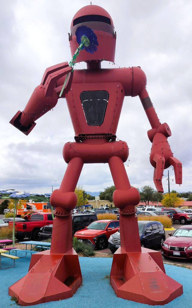
An interesting robot in the Meow Wolf parking lot
Next Week
From Santa Fe’s immersive Meow Wolf experience and Albuquerque’s colorful Balloon Fiesta, our route turns eastward to six state parks in Texas. As we cross the Lone Star State, the RabbiTRAILS vary from deep canyons to mountaintop telescopes to big thicket swamps. And one with a creepy tarantula that crossed our path just before sunset!
(Don’t forget to LIKE our blog posts and to SUBSCRIBE for future updates)
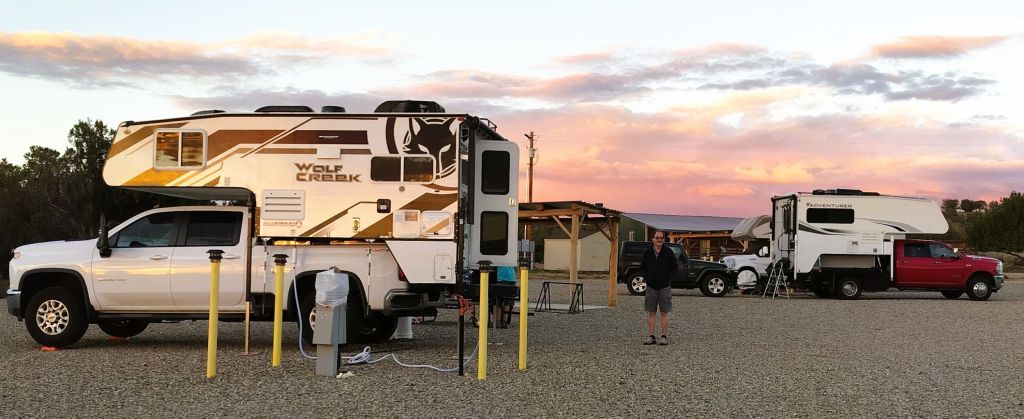
As September came to a close, we left Great Sand Dunes National Park and the Colorado alligators for Black Canyon of the Gunnison National Park, a lesser-known national park about a half day’s drive away.
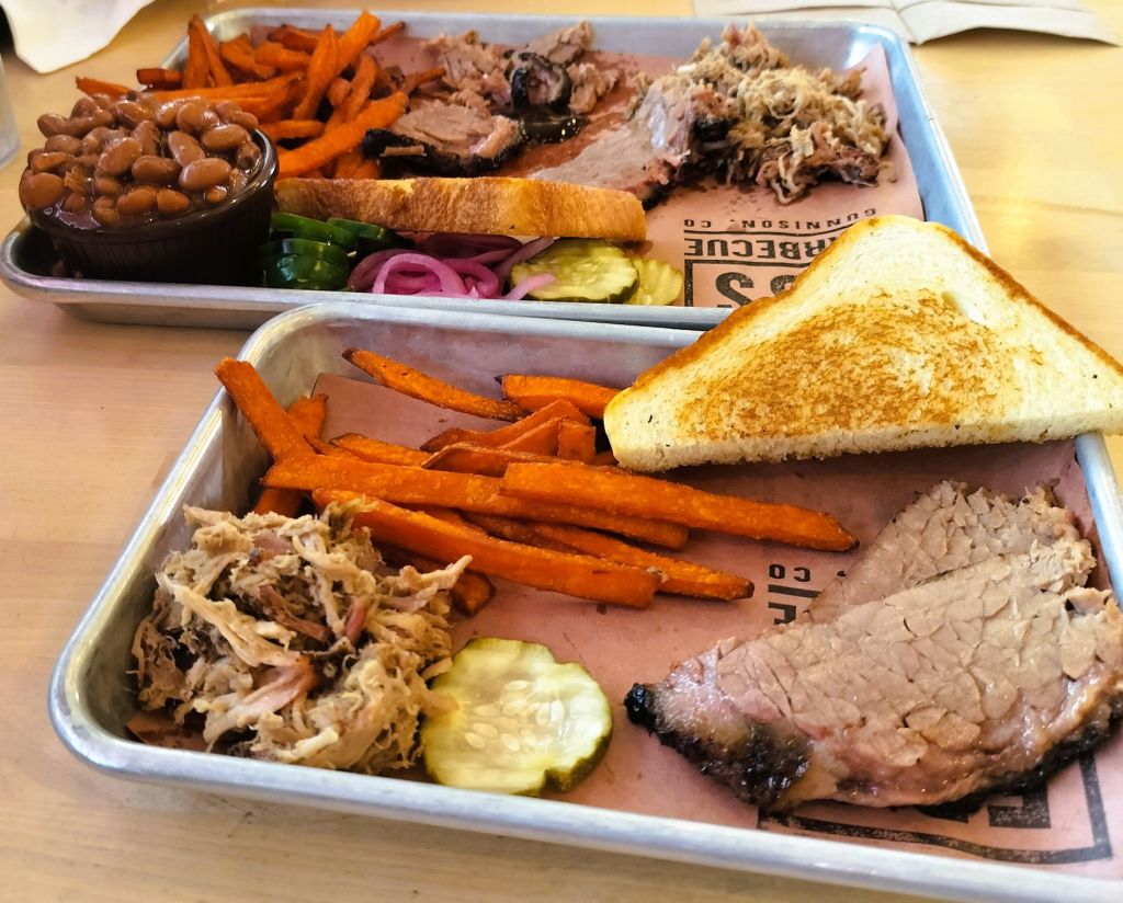
Lots of 5 Bs BBQ – we split a lunch special
We stopped in Gunnison, CO to resupply and to refuel Percy. Lunch was at 5 Bs BBQ, named for members of the Brown family who started a Gunnison catering business in 1991, expanded to a food trailer, moved into a gas station and settled into their current building in 2022. Their restaurant story is as great as the Q they serve!
Tummies, truck and pantry full, we discovered our route through town was blocked off for a high school homecoming parade. After a quick detour, we were back on the road.
Crawford Camping
We endured more than 30 miles of winding highway and finally arrived at Crawford State Park, our campsite for the next three nights while we explored Black Canyon of the Gunnison National Park.
Colorado’s Big Four
Colorado’s Big Four
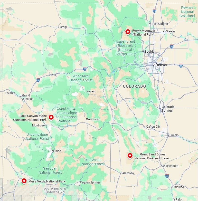
Utah’s big five national parks are on many travelers’ bucket lists. Zion, Bryce Canyon, Capitol Reef, Arches and Canyonlands are not to be missed!
Colorado has its own bucket list combination of four national parks that are more diverse than those in Utah: Rocky Mountain, with incredible views at the top of the Rocky Mountains, Great Sand Dunes, with the tallest dunes in North America, Mesa Verde, the location of antient Puebloan cliff dwellings, and Black Canyon of the Gunnison, where the Gunnison River has carved a deep and narrow slit in the earth.
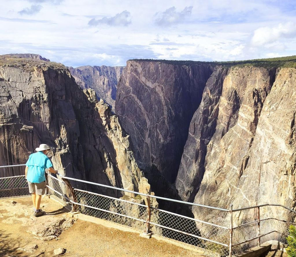
North Rim of the Black Canyon
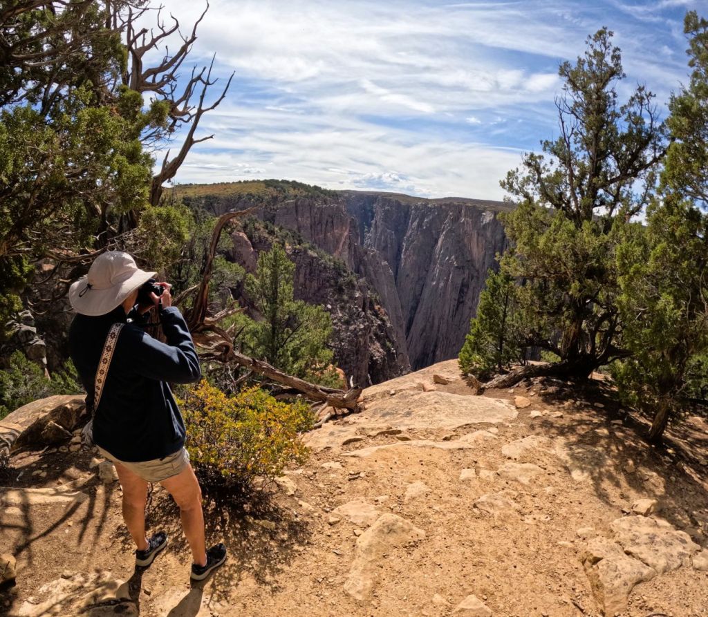
We visited the remote north rim of the canyon, a dozen miles from the campground. The clear and cool weather couldn’t have been any better as we undertook a 3.2-mile round trip hike to Exclamation Point.
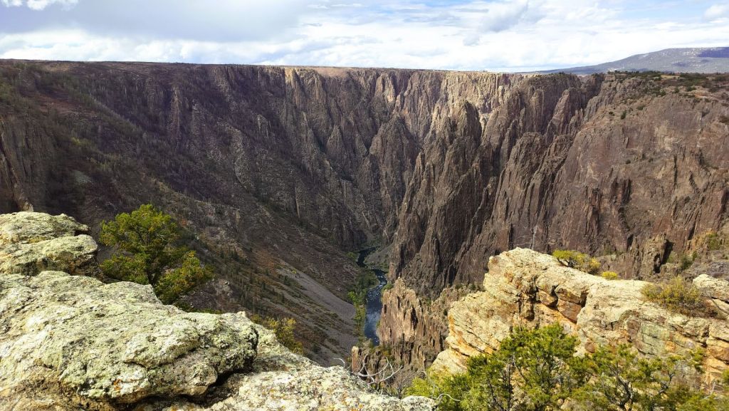
First view of the Black Canyon
Starting at the ranger station, our first view of the canyon came after hiking about a half mile along the mostly level trail. The trail continued along side arms of the main canyon. We finally reached a viewpoint where we could see the Gunnison River, a tiny ribbon nearly 2000 feet below!
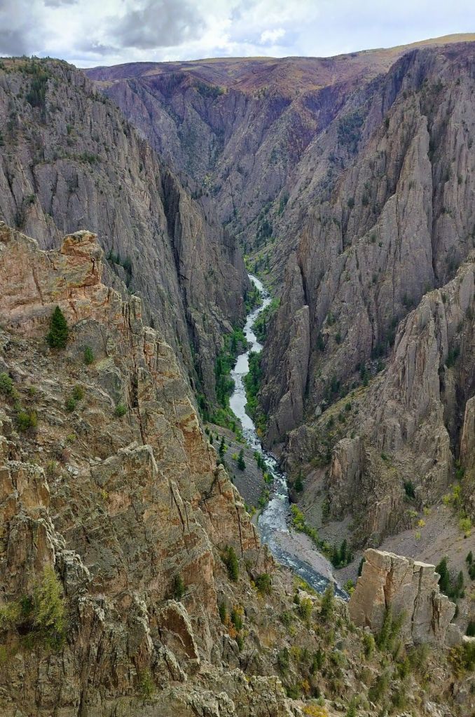
Full canyon view with the Gunnison River far below
Fourteen of the canyon’s 48 miles are located within the park. Varying from 1750 to 2700 feet in depth, the canyon has been carved by the Gunnison River as it falls an average of 95 feet per mile. No other canyon combines the depth, narrowness and sheerness of Black Canyon.
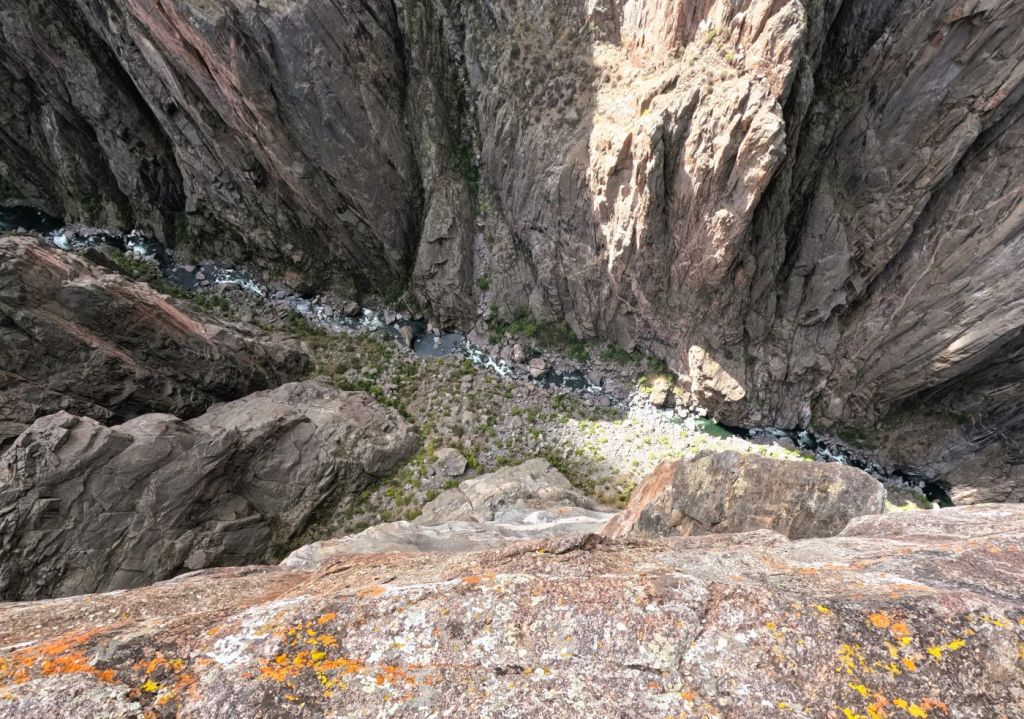
The Gunnison River was FAR below
Trails to the bottom of the canyon, called wilderness routes, are steep, unmarked and unmaintained scrambles. We wisely continued hiking the trail at the top of the canyon.
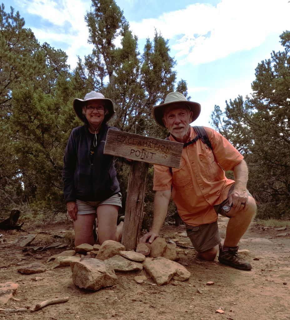
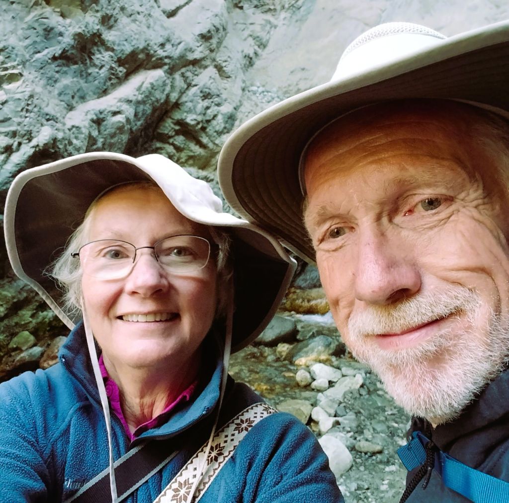
Selfie on the way to Exclamation Point
After posing for a selfie at a sign pointing us to Exclamation Point, we continued to a broad rock outcropping where the rugged canyon was visible from three sides. We found shade under a pinyon pine and enjoyed the view as we ate our backpack lunch.
Interesting rock layers on canyon wallsBlack Canyon with the Gunnison River far below
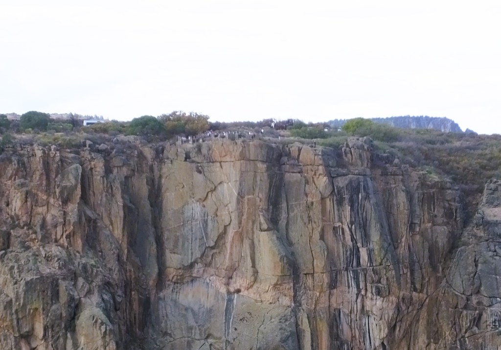
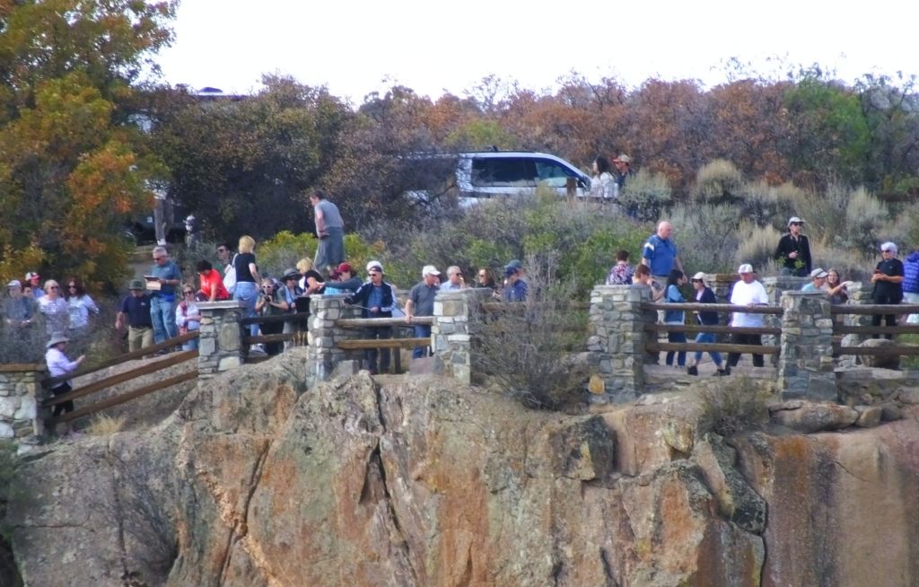
The next morning, we returned to the park’s North Rim Road where several short trails took us to breathtaking views of the canyon. At one overlook we could see people, buses and cars on the south rim of the canyon, just .2 miles away!
Visitors on the South Rim of the canyonCloseup of visitors
Next Week
We travel to our fourth national park in Colorado, Mesa Verde NP, anticipating ranger-led tours of several cliff dwellings. Unfortunately, our plans had to change due to the US government shut down.
(Don’t forget to LIKE our blog posts and to SUBSCRIBE for future updates)
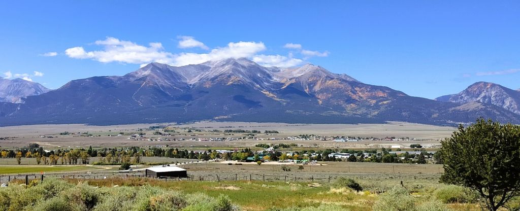
Bad weather and early snows behind us, we continued south through central Colorado. We spent the night and did laundry in the small town of Buena Vista, where we were awed by incredible views of the Collegiate Peaks. Princeton, Yale and Harvard are three of fifteen 14ers (mountains over 14,000 feet) in the range across the valley.
We had a true Buena Vista (good view).
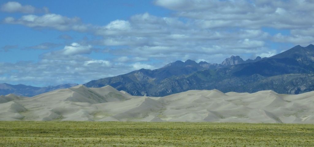
Great Sand Dunes from afar
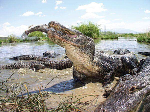
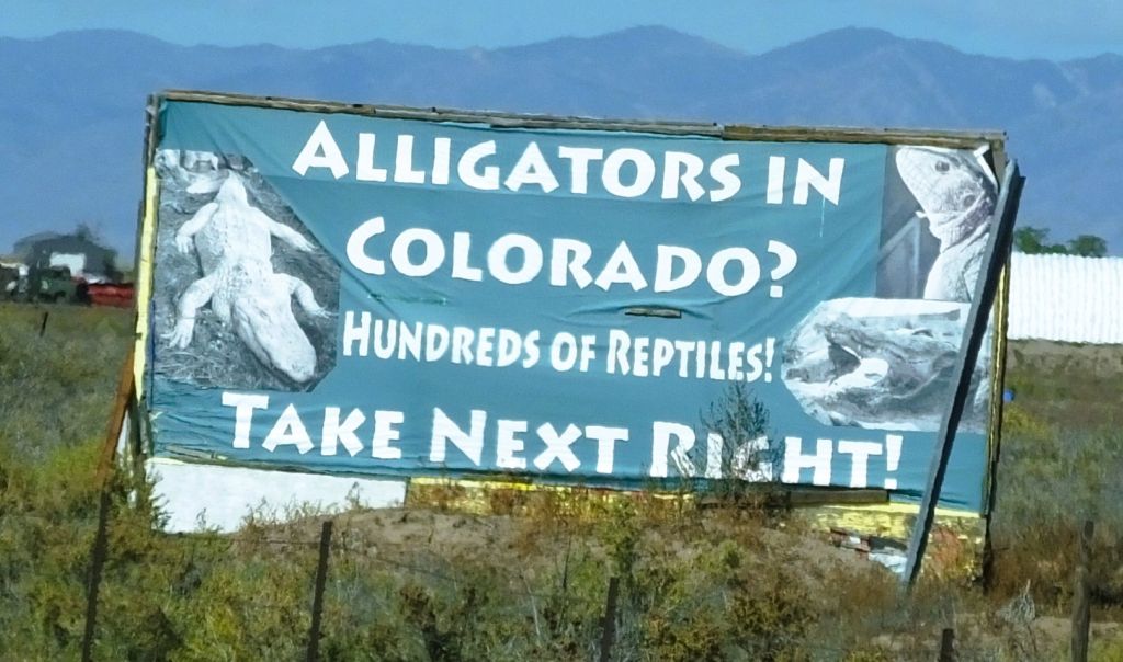
Alligators in Colorado?
The next morning, we drove Colorado route 17 southward toward the cutoff for Great Sand Dunes National Park and Preserve. To our left were the jagged peaks of the Sangre de Cristo mountains. We saw a brownish blur at the base of the mountains and realized it was the dunes – more than 30 miles away.
A road sign caught our attention, and we turned around for a closer look.
How could there be gators in Colorado? A tunnel from the Everglades? Holdovers from prehistoric times?
Nope.
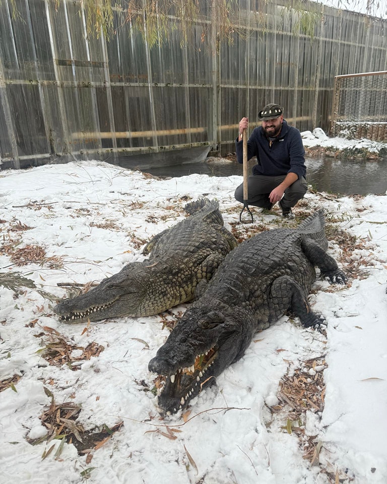
The gator haven, located north of Alamosa, CO, started as a tilapia farm in 1977. In 1987, 100 one-year old gators were purchased to dispose of fish-processing waste. The fish (and gators) flourished in the 87-degree water from a 2050 foot deep geothermal well, and as the gators grew, visitors wanted to see them.
Gators in the snow (from Reptile Park website)
The farm, now the Colorado Gators Reptile Park, was opened to the public in 1990 and has become a home of unwanted, abused and even dangerous gators and other reptiles.
Great Sand Dunes
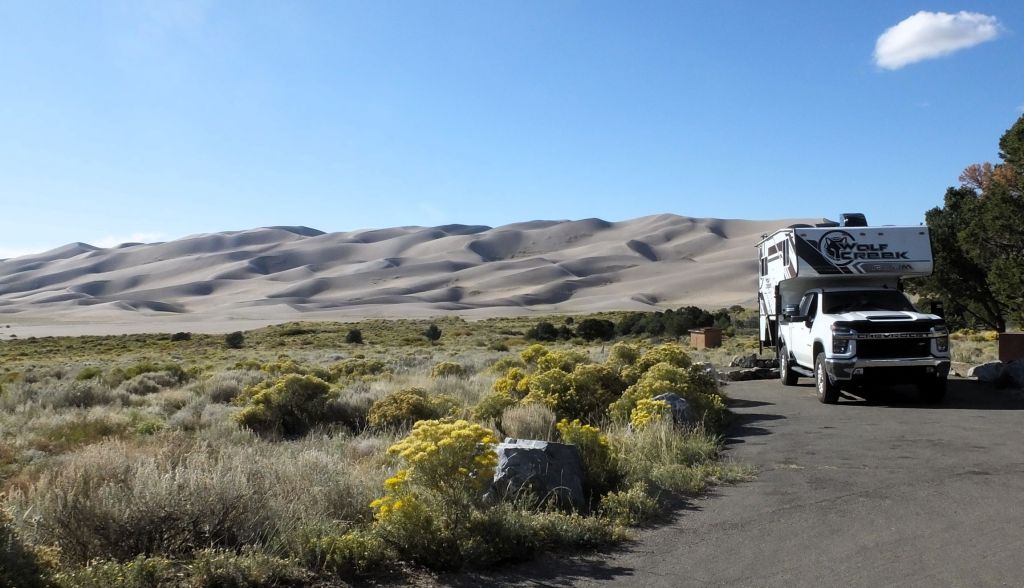
An hour or so later we arrived at Great Sand Dunes National Park and Preserve.
The dunes were just beyond our campsiteA beautiful sunset
From our campsite we could see the dunes, the tallest sand dunes in North America, some as high as 750 feet!
The dunes were formed from sediments from surrounding mountains blown by southwest winds toward the base of the Sangre de Cristo mountains. The dunefield is approximately 30 square miles in size!
We started our dune hike along the top of a ridge
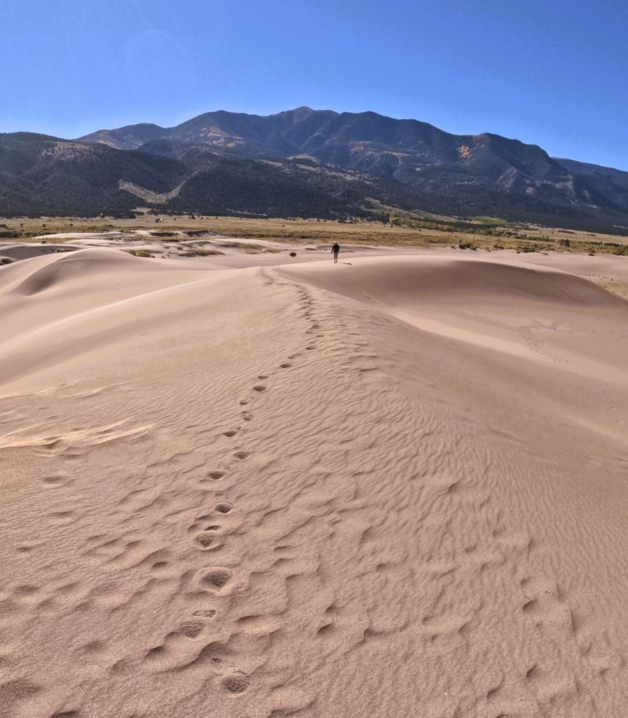
The next morning we hiked a half mile to the dunes. In the spring and early summer, the Medano Creek flows along the base of the dunes and visitors must wade across the shallow creek to reach the dunes. It was late September during our visit, and the sandy creek bed was dry as we began our hike.
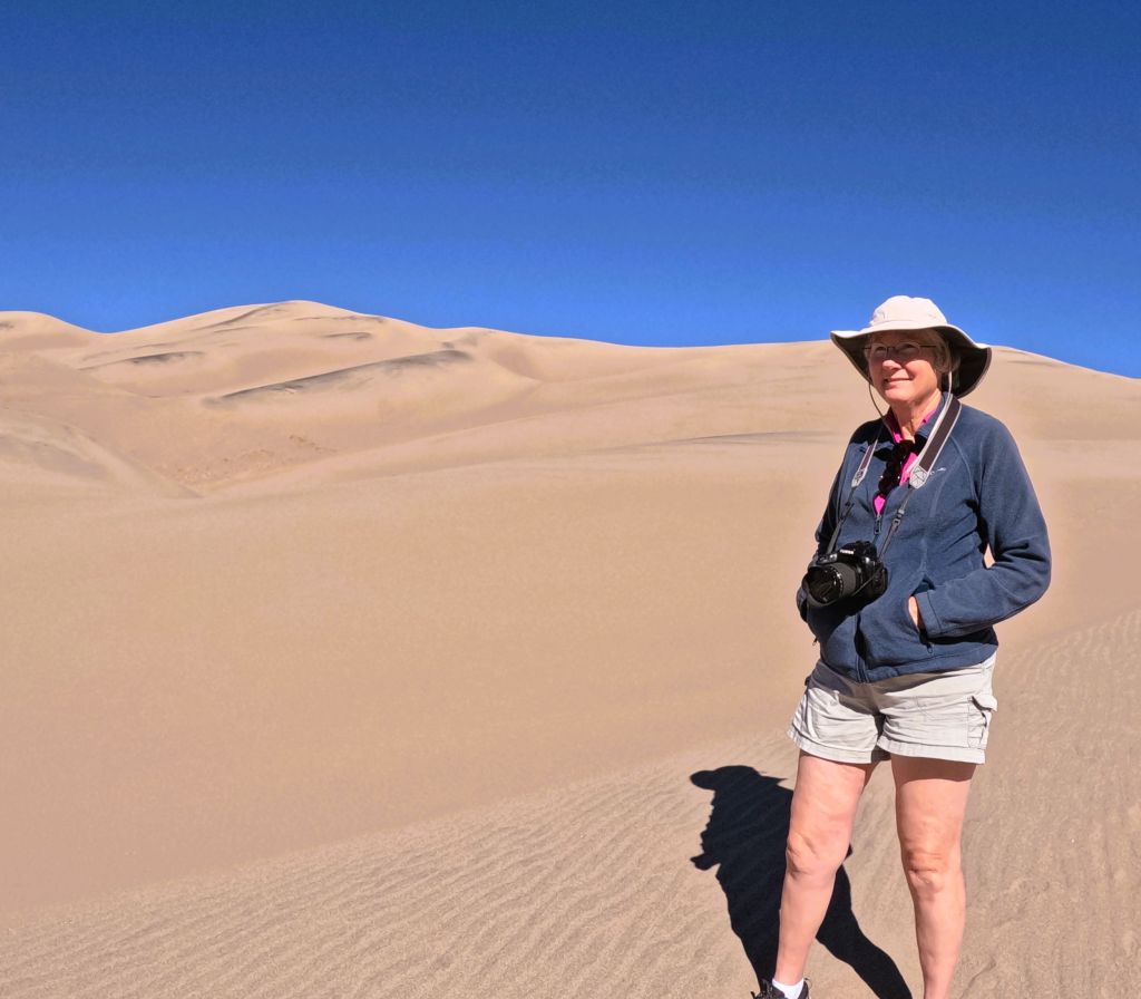
Pat surveys the dunes
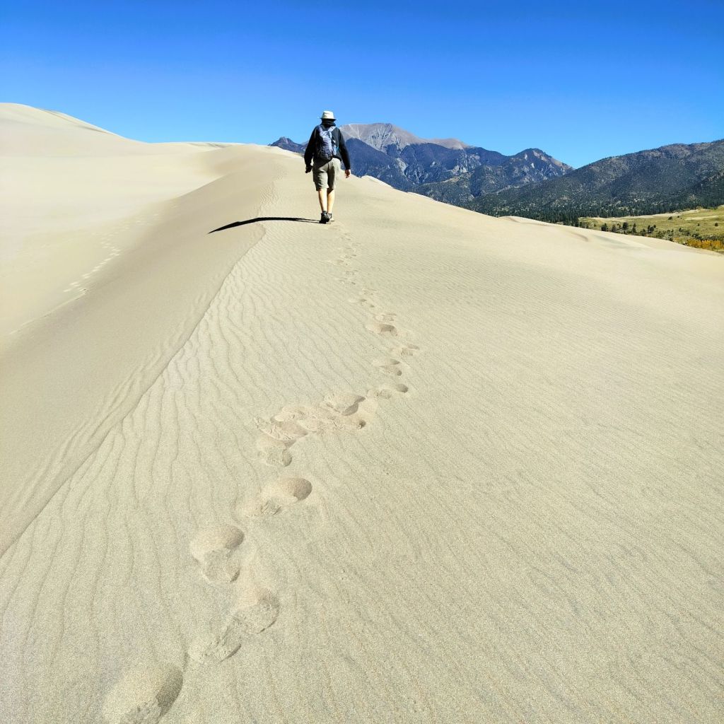
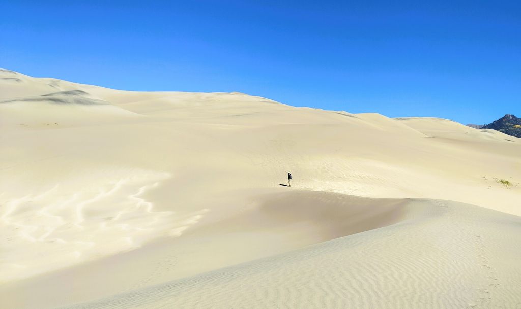
We hiked up several ridges and spotted tiny Pap and Percy far off in the campground. As we topped each dune, still higher dunes appeared. People above us were making their way to the top.
Continuing along a higher dune ridgeAlthough we had climbed nearly 300 feet, it was still a long way to the top
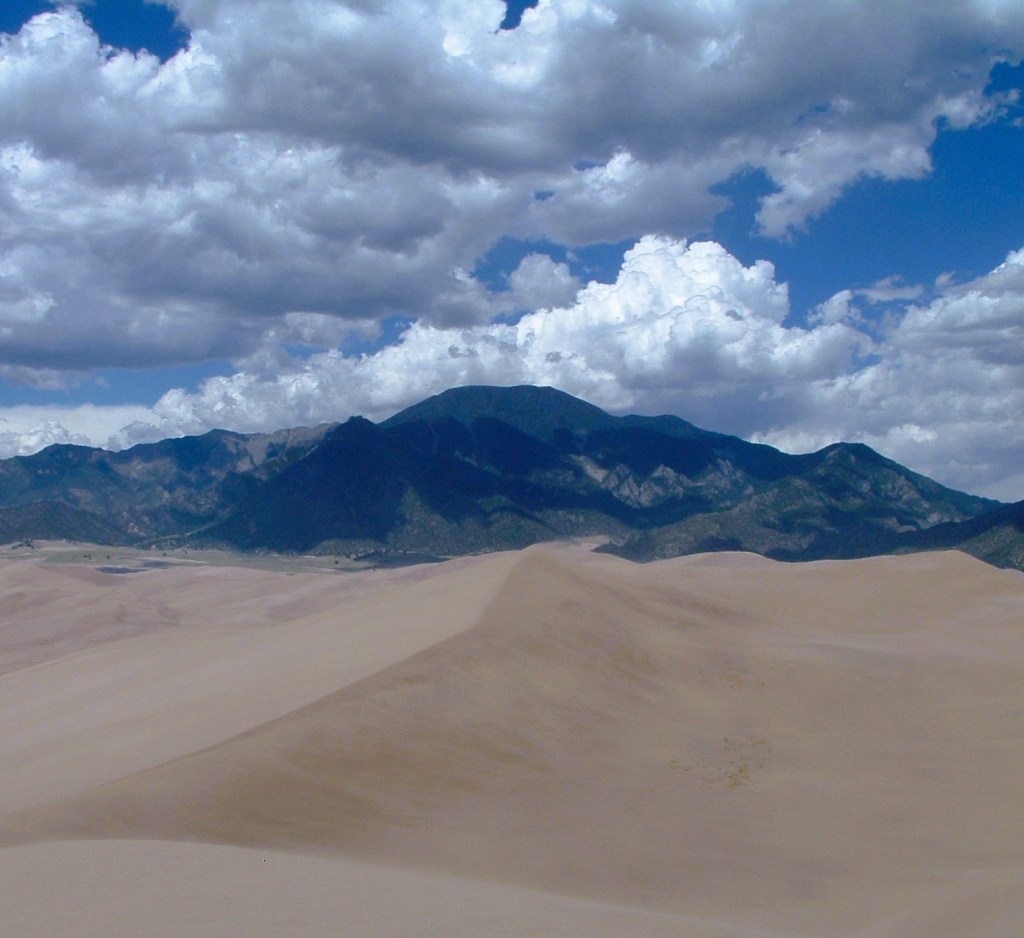
During a visit to the park in 2004, our son, Phil, took some beautiful pictures from the top of the dunes. The dunes are best photographed in the early morning and late afternoon when the shadows make the dunes stand out from the tall mountains beyond.
A photo from the top of the dunes taken by our son, Phil. in 2004
Viva Zapata!
A ranger at the visitor center recommended a nearby hike to Zapata Falls. The falls’ Spanish name refers to a settlement in the San Luis Valley started by Mexican families in 1864.
Wading the cold waters of South Zapata Creek
We hiked a half mile up a steep and rocky trail to South Zapata Creek. For the final 75 yards, we scrambled over rocks and waded through the VERY cold creek.
Taking a video of the rugged gorge and fallsZapata Falls
The marvelous 30-foot falls are hidden in a narrow, shaded gorge.
We thought about how refreshing the falls must be on a hot summer day and how stunningly beautiful they must be when frozen during winter.
Pat makes her way downstream
Our main concerns, however, were carefully hiking down the creek from the falls and thawing our feet when we changed from water shoes back to hiking boots.
Pat’s feet were pink from the VERY cold waterHappy to have warm feet as we returned to the parking lot
Next Week
We visit Black Canyon National Park, a deep and narrow gorge in central Colorado.
(Don’t forget to LIKE our blog posts and to SUBSCRIBE for future updates)
With the Fiesta balloons packed and ready for future hot air events, we return to the beyond portion of the RabbiTRAILS 2025 Balloons and Beyond series. We continue to Rocky Mountain National Park.
Rocky Mountain National Park
The park is about two hours northwest of Denver, CO in the Rocky Mountains. It is one of the most visited US National Parks, featuring rugged mountains often covered with snow, alpine lakes and abundant wildlife.
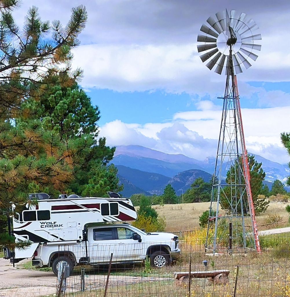
Our Harvest Host location on the east side of Rocky Mountain National Park
After a night at a Harvest Host location near Estes Park near the park entrance, we bypassed the popular east side of the park that we have visited before and drove the Trail Ridge Road toward the western side of the park instead.
There was little snow at higher elevations, but approaching rain clouds would change that
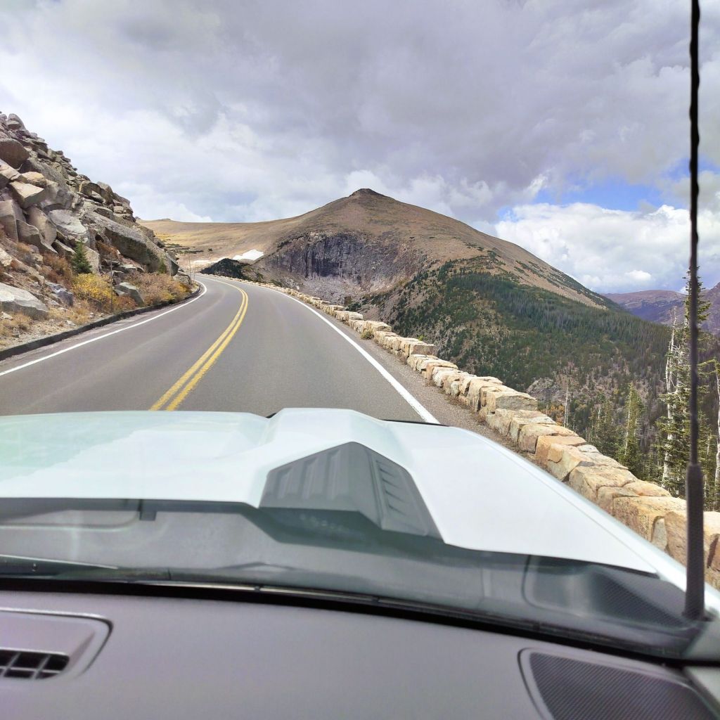
White Knuckles on the Trail ridge Road
Low walls along the Trail Ridge Road resulted in white-knuckled driving
The 48-mile Trail Ridge Road is the highest continuous paved road in North America, reaching an elevation of 12,183 feet. It is above the tree line in the upper elevations. I nervously gripped the steering wheel because the road is narrow, the guardrails are low or non-existent, the winds are strong, and it is a LONG way to the bottom! Despite this, the drive is wonderfully beautiful!
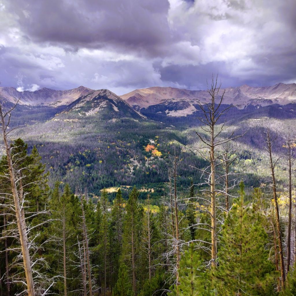
Elk herd in an alpine meadow at the top of the Rockies
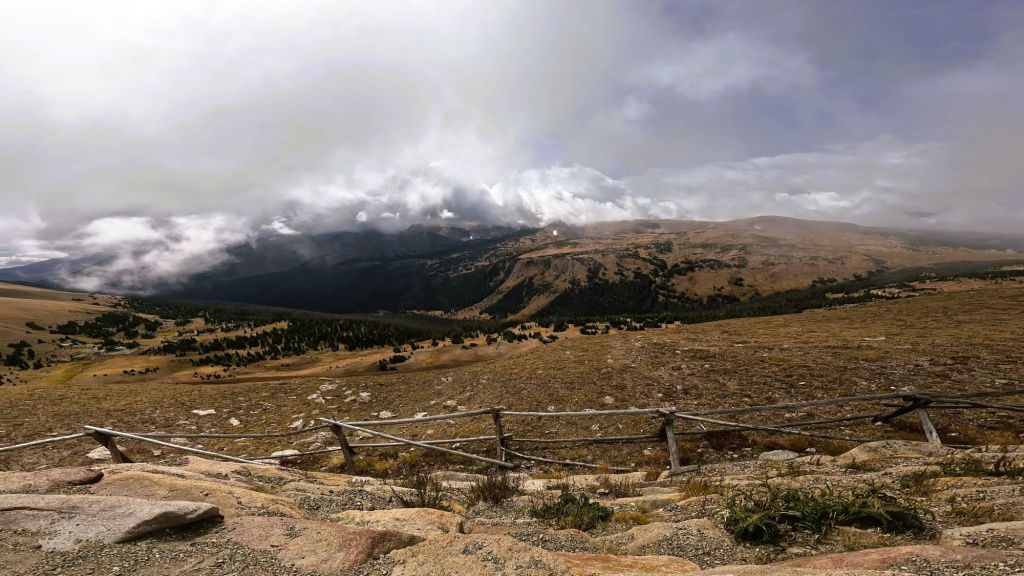
We stopped at the Alpine Visitor Center near the top of the drive to eat lunch and enjoy the mountain views. It was windy and cold, and storm clouds were approaching from the west.
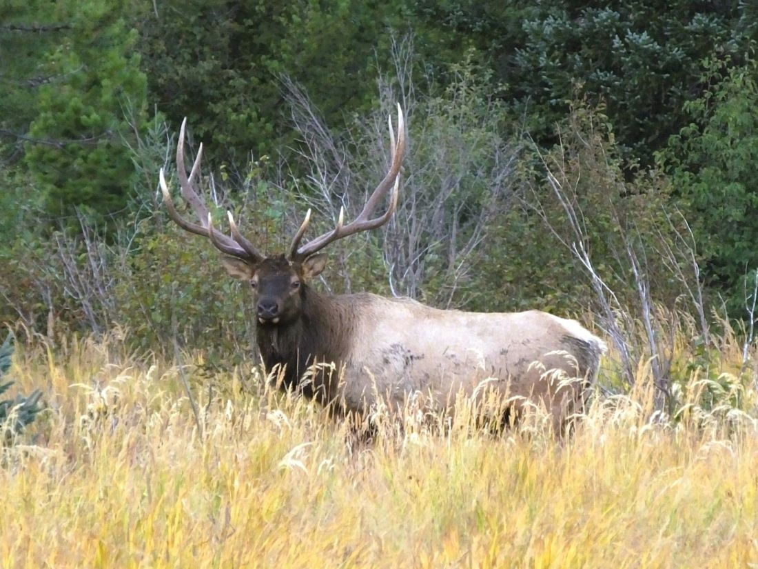
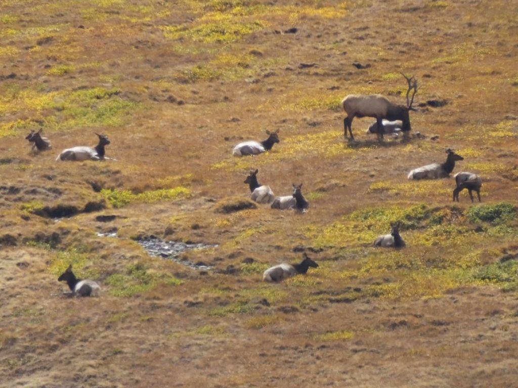
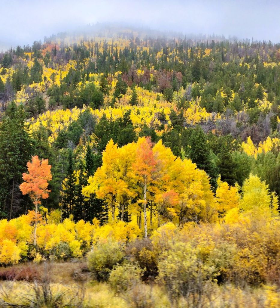
In an alpine valley we spotted a bull elk with massive antlers and his harem of nearly a dozen elk cows. The alpine ground cover had hues of yellow, orange and red, indicating fall had arrived and winter would soon follow.
Fall colors in the Rockies
On the west side of the park the road quickly descends. We soon arrived at Timber Creek Campground, our home for several nights.
Colorado River at its headwaters in western Rocky Mountain National Park
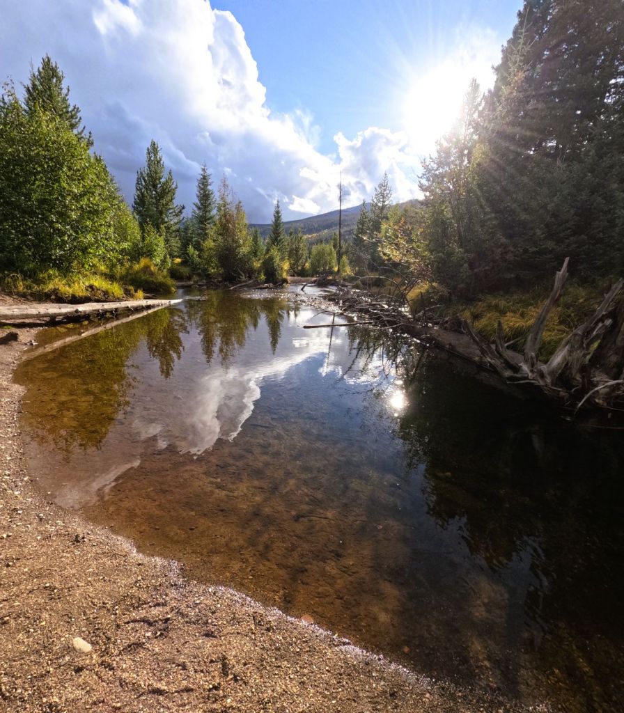
Bugle Calls Across the Colorado
After setting up, we followed a nearby trail to a small creek no more than 20 feet wide. Imagine our surprise to learn that we were at the headwaters of the mighty Colorado, the river that goes through the Grand Canyon and over Hoover Dam!
A woman whipped a flyfishing line back and forth, gently landing a small, feathered fly in the stream. She had no bites or strikes.
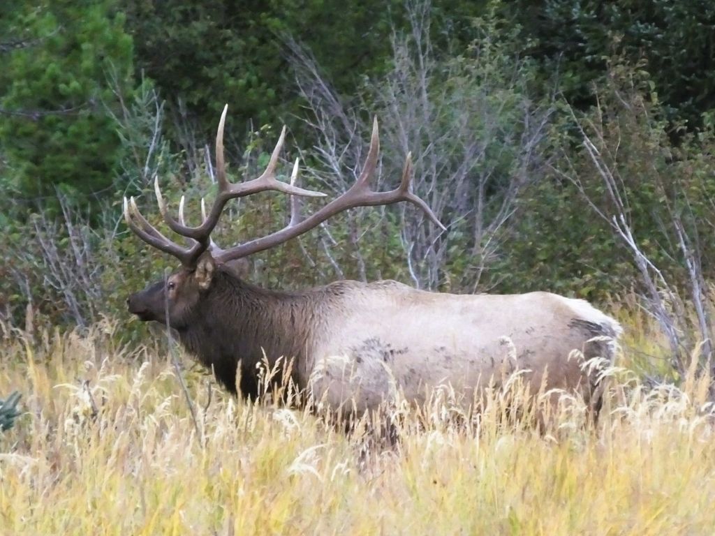
The fish were quiet but a nearby bull elk wasn’t. Although he was hidden in the undergrowth, we could hear him bugle hauntingly beautiful whistle sounds to call his elk lady friends. It was the elk rut.
Getting ready for a bugle call
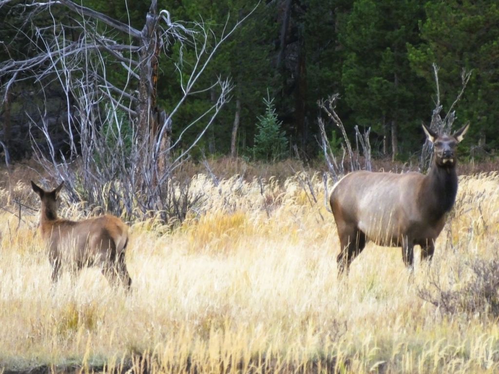
We quietly waited in waist high grass as the bull elk called again and again. The bushes on the far side of the Colorado began to shake and out stepped the magnificent elk. Behind him followed several elk cows.
Two of the bull elk’s harem
Rain and Snow on the Way
The weather changed. Passing clouds produced cold rain showers. Rain was forecast the next day with snow expected in the upper elevations. The park announced the Trail Ridge Road would be closed after 6 pm.
Snow caught up with us at Freemont Pass as we drove south
With that, we decided to leave a day early for Great Sand Dunes National Park to the south. One unexpected challenge was ahead – as we crossed Freemont Pass between Copper Mountain (a big ski resort on I-70) and Leadville, the rain turned to snow. Fortunately, the roads over the 11,316 foot pass were clear, but wet snow was accumulating on the trees, bushes and hillsides. It was a beautiful sight, but we were ready for warm, clear weather.
Next Week
Nestled up to the base of Colorado’s Sangre de Cristo mountains are massive dunes more than 700 feet tall. They can be seen from more than 30 miles away!
We explore the dunes and then hike to Zapata Falls nearby where we wade through frigid waters to view an unexpected double chasm.
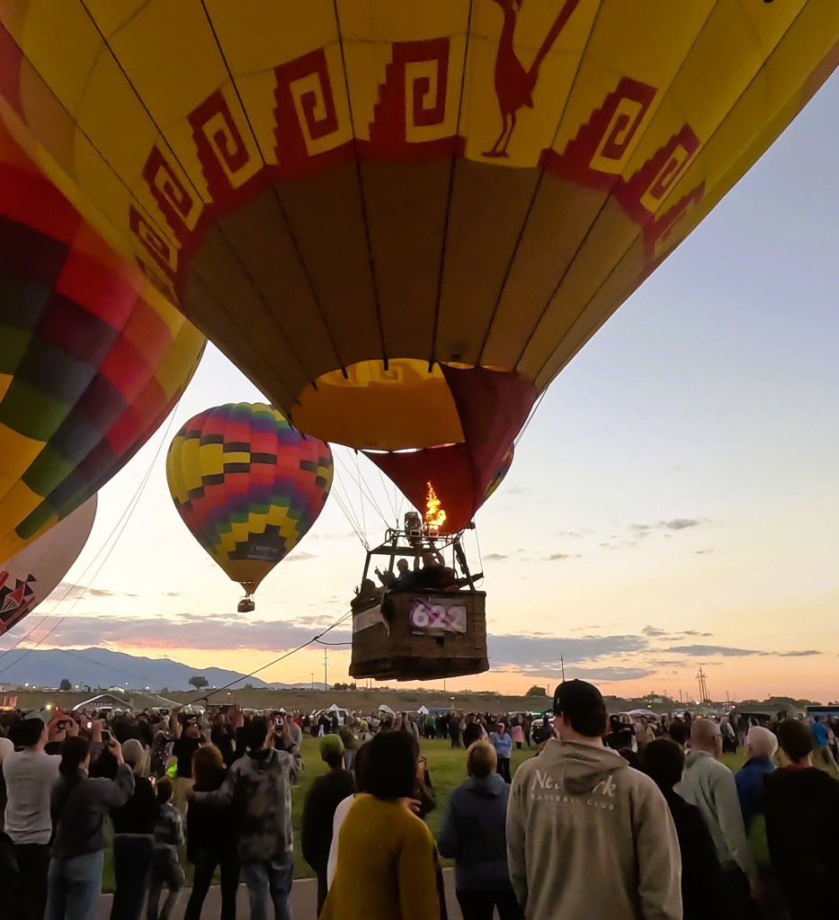
Today was the final day of the 2025 Albuquerque International Balloon Fiesta.
Friday’s mass ascension
From an elevated vantage point several miles east of the Fiesta grounds, we could see the cloud-covered Sandia Mountains to the east of Albuquerque and occasional shafts of sunlight peeking through to the ground.
A light rain was falling at the balloon launch area, so the final event of the Balloon Fiesta was a scrub.
A Perfect Friday
We are thankful to have enjoyed a perfect Balloon Fiesta day on Friday. We got up close and personal to the balloon crews as they inflated and launched their balloons, something that makes the Albuquerque Balloon Fiesta unique and special.
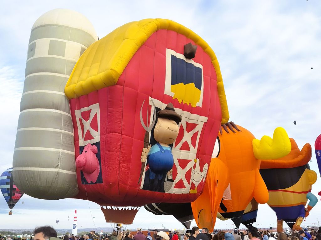
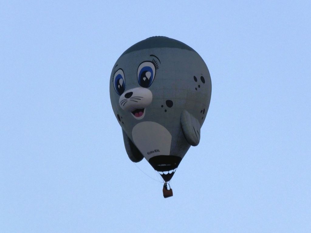
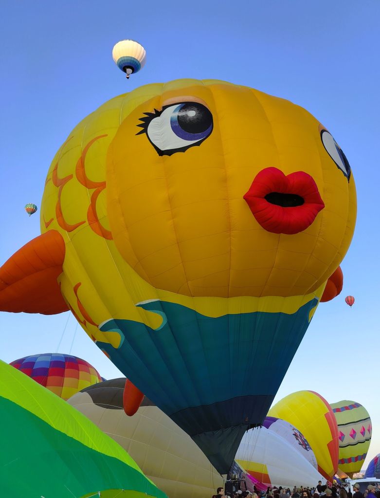
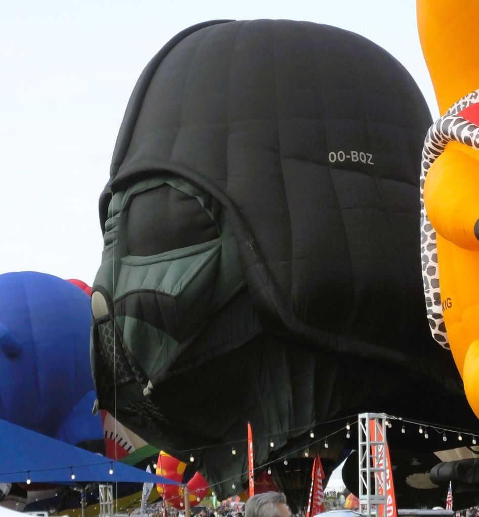
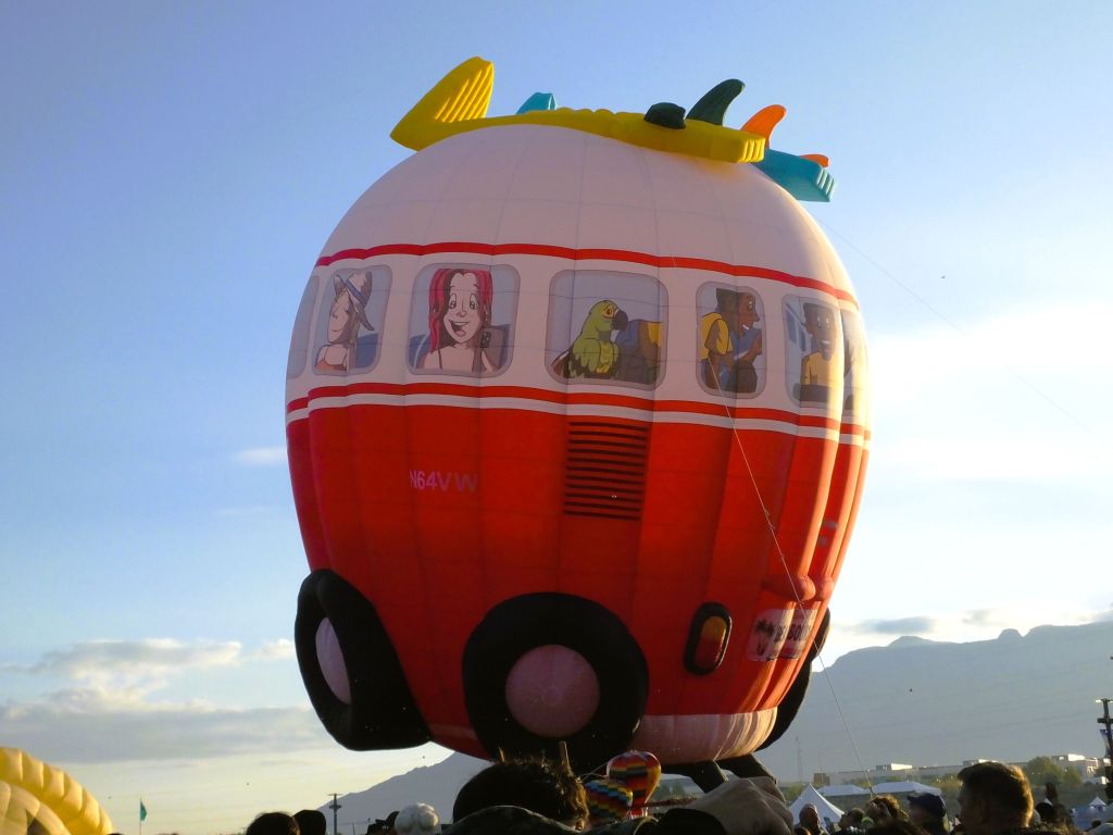
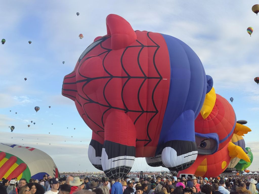
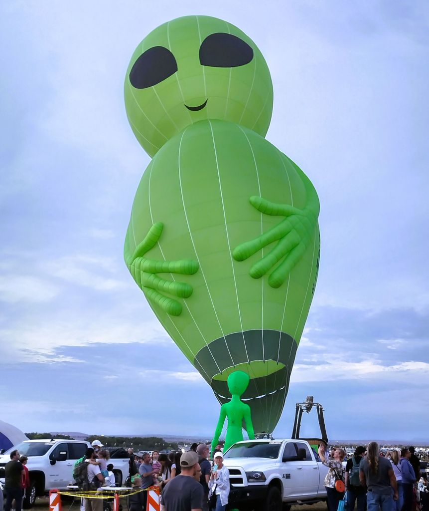
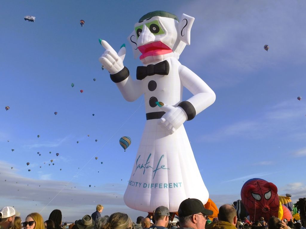
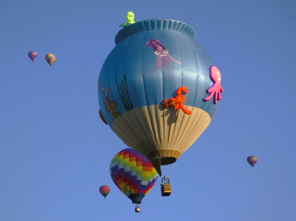
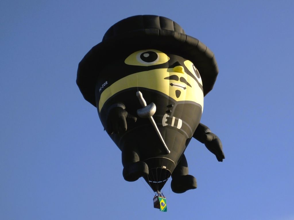
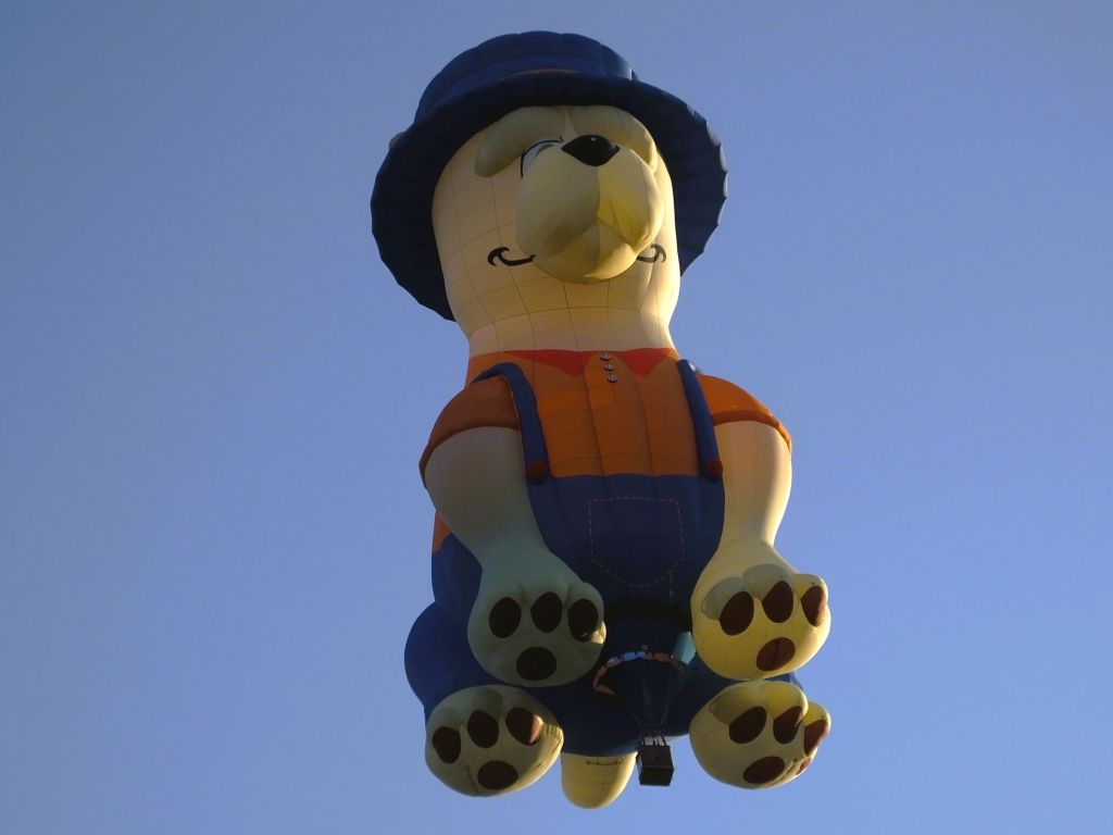
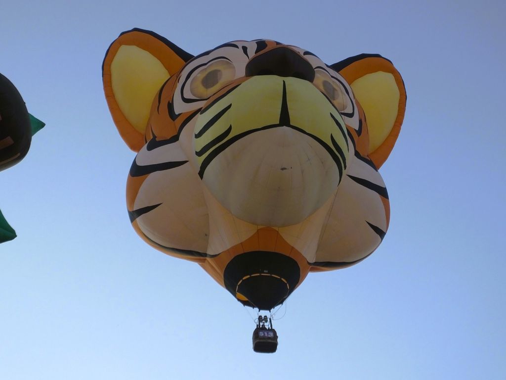
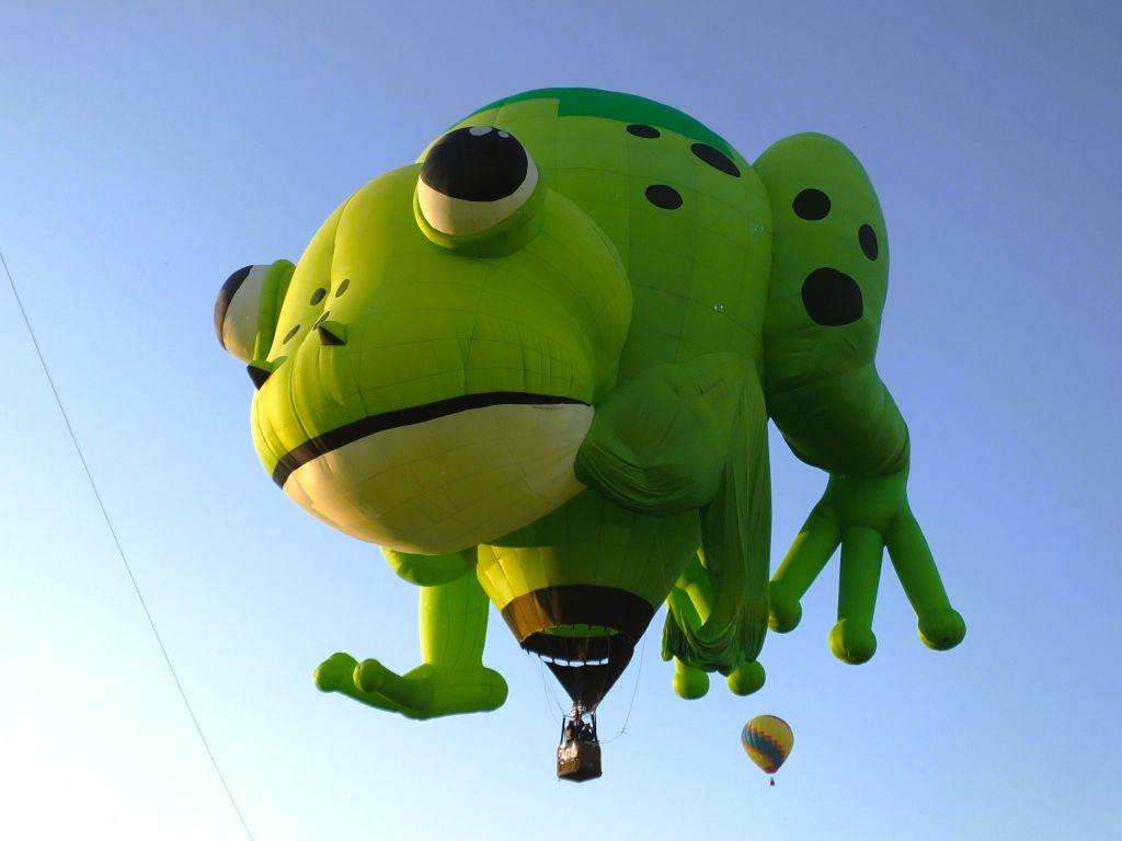
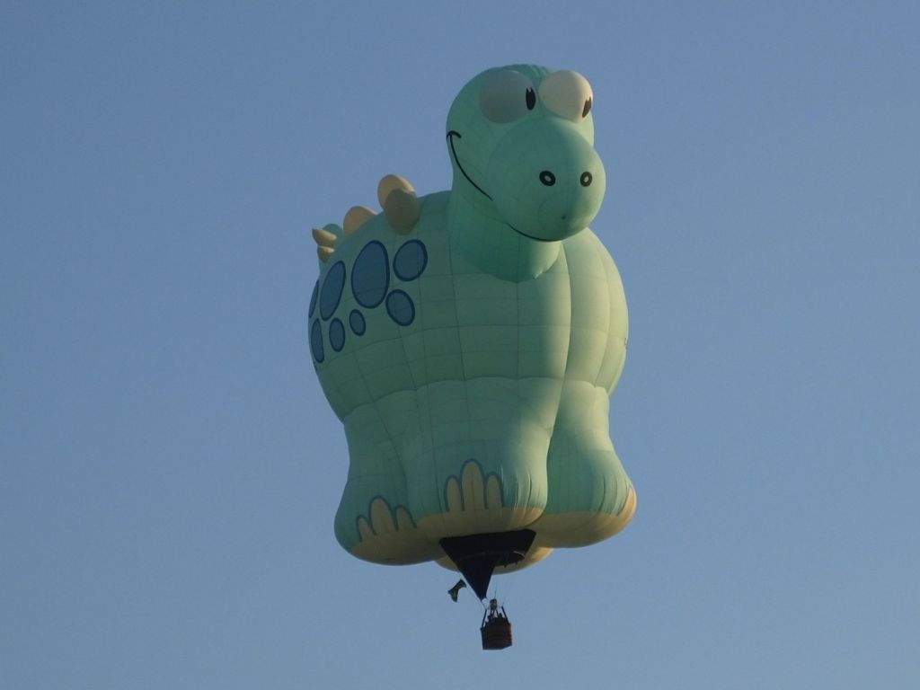
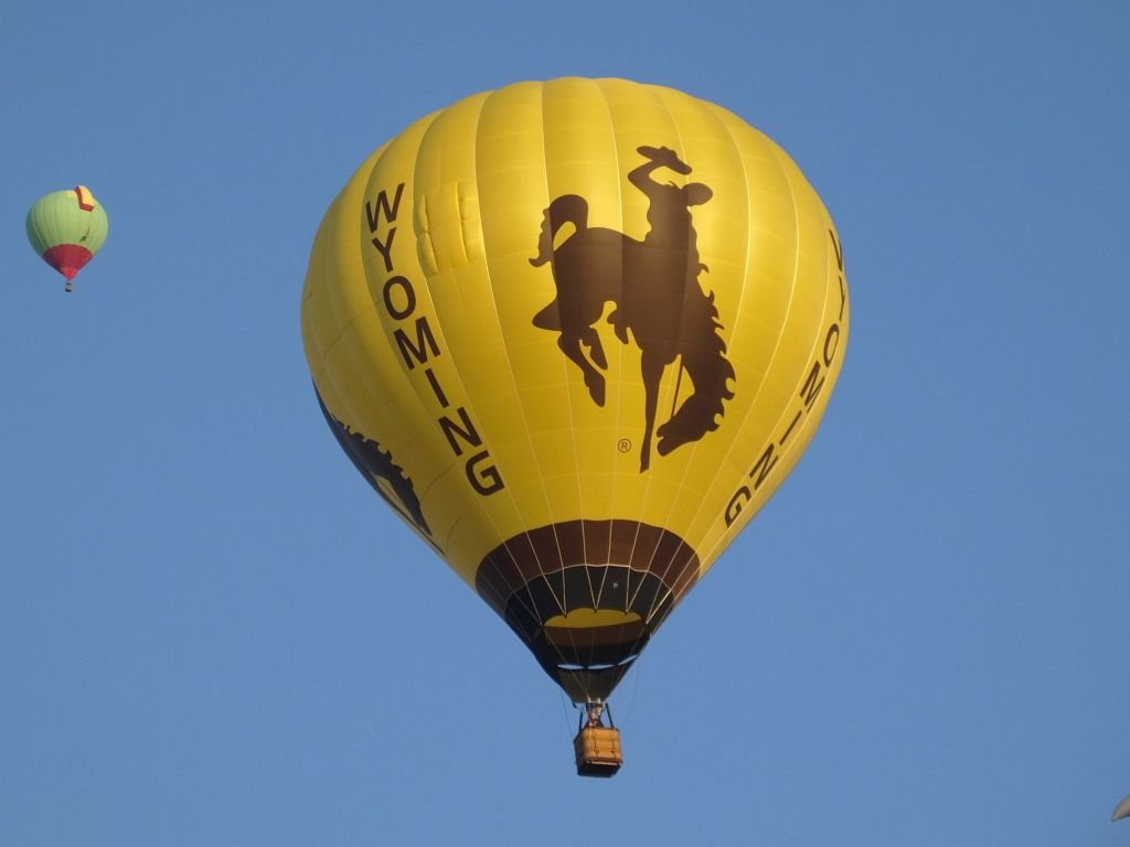
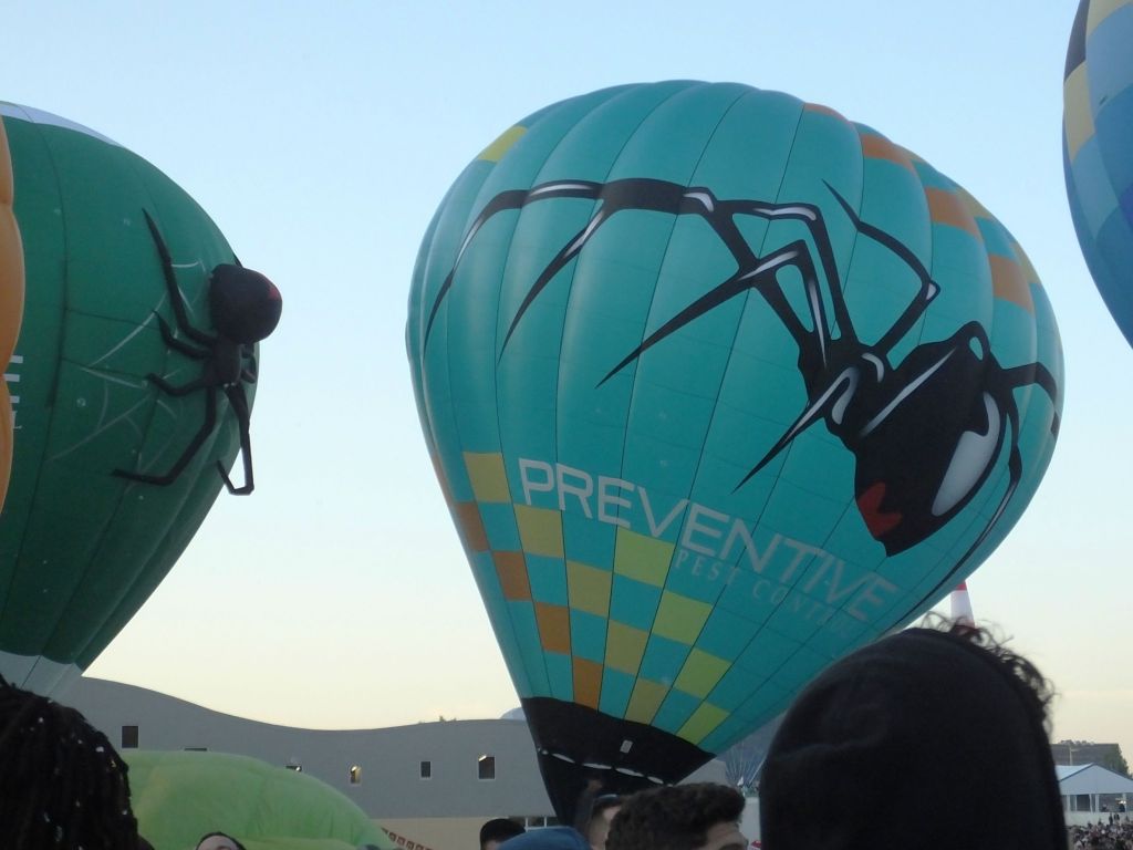
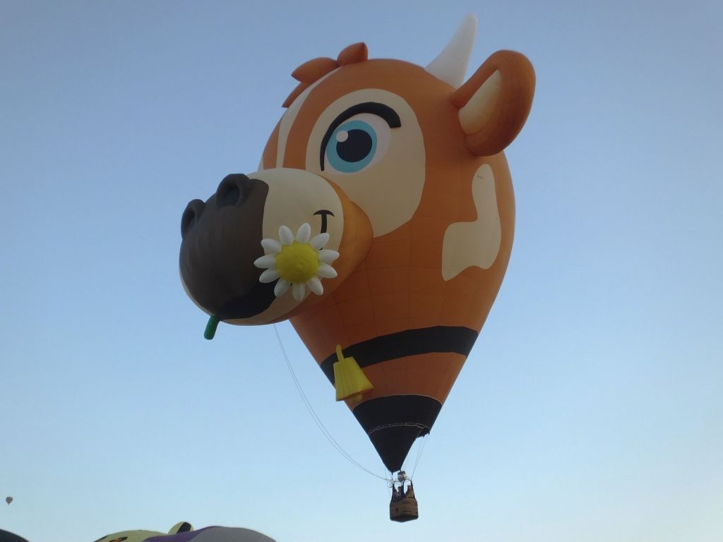
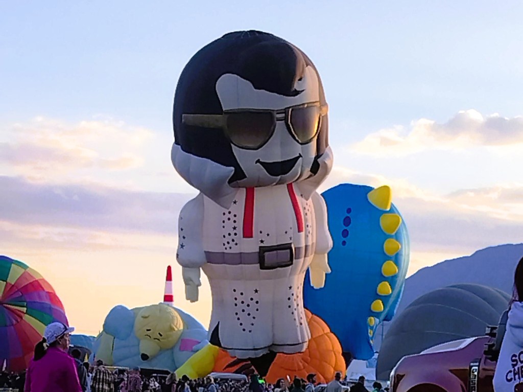
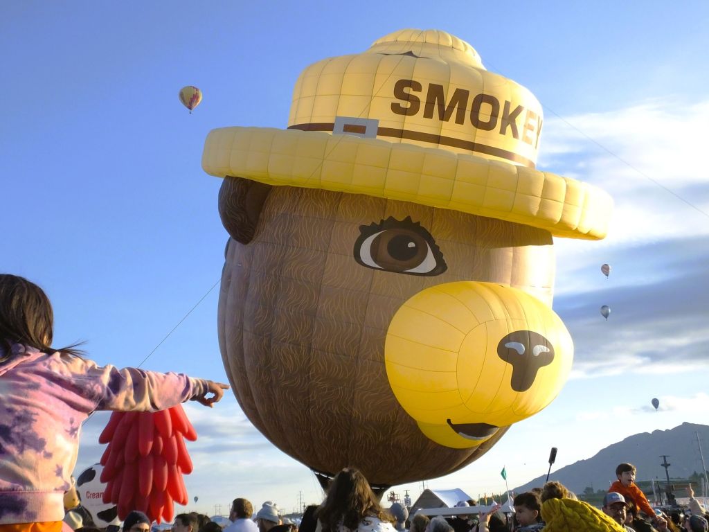
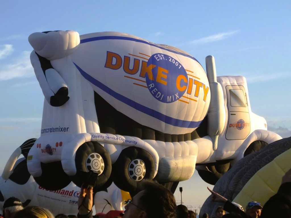
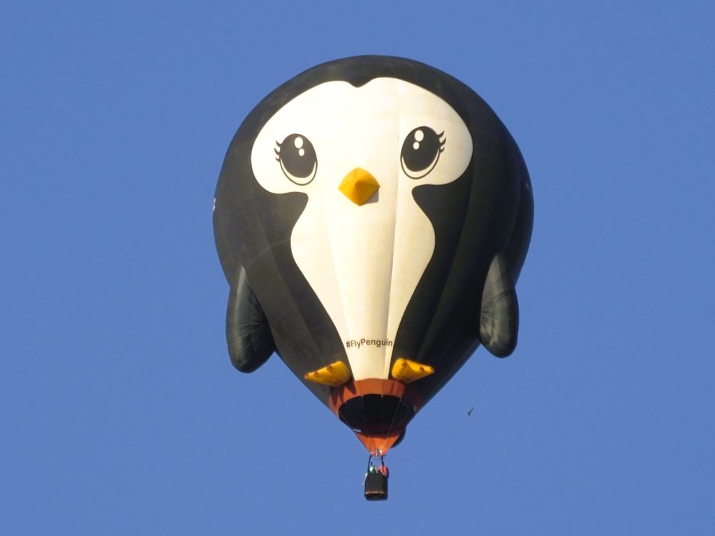
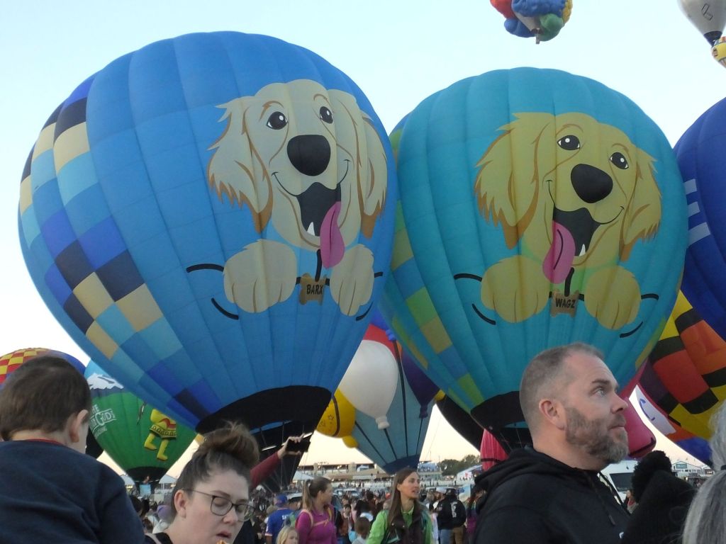
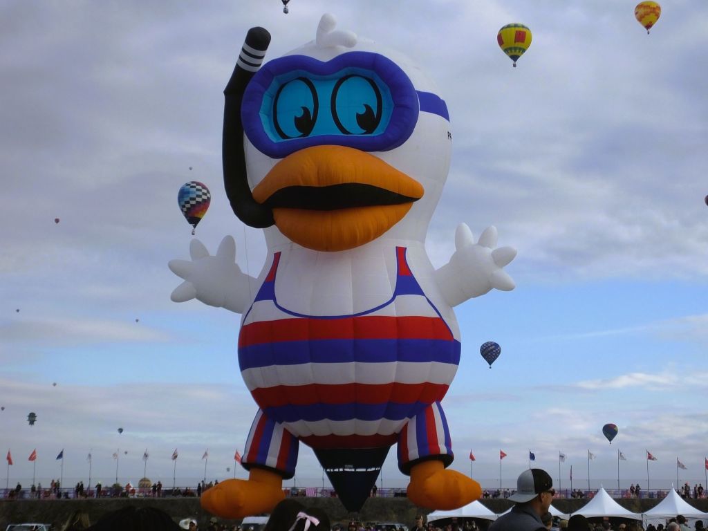
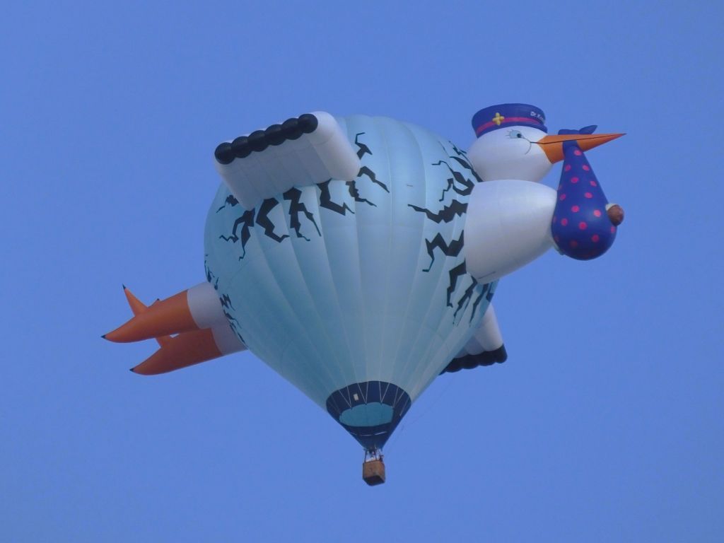
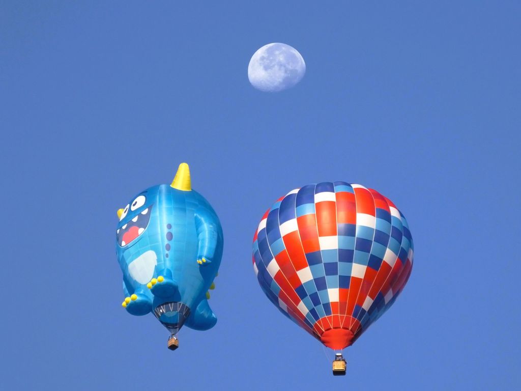
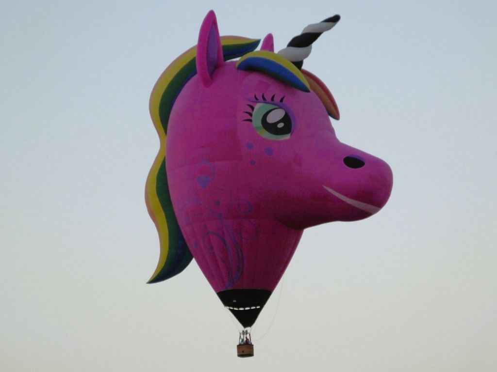
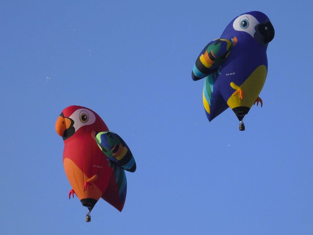
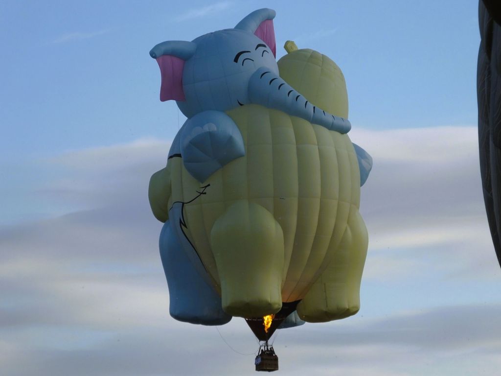
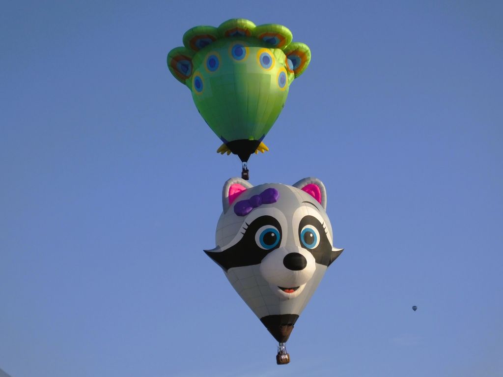
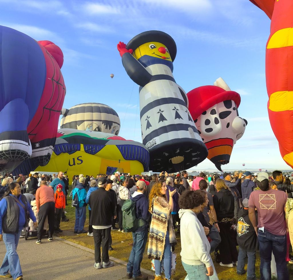
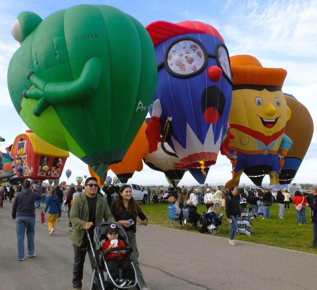
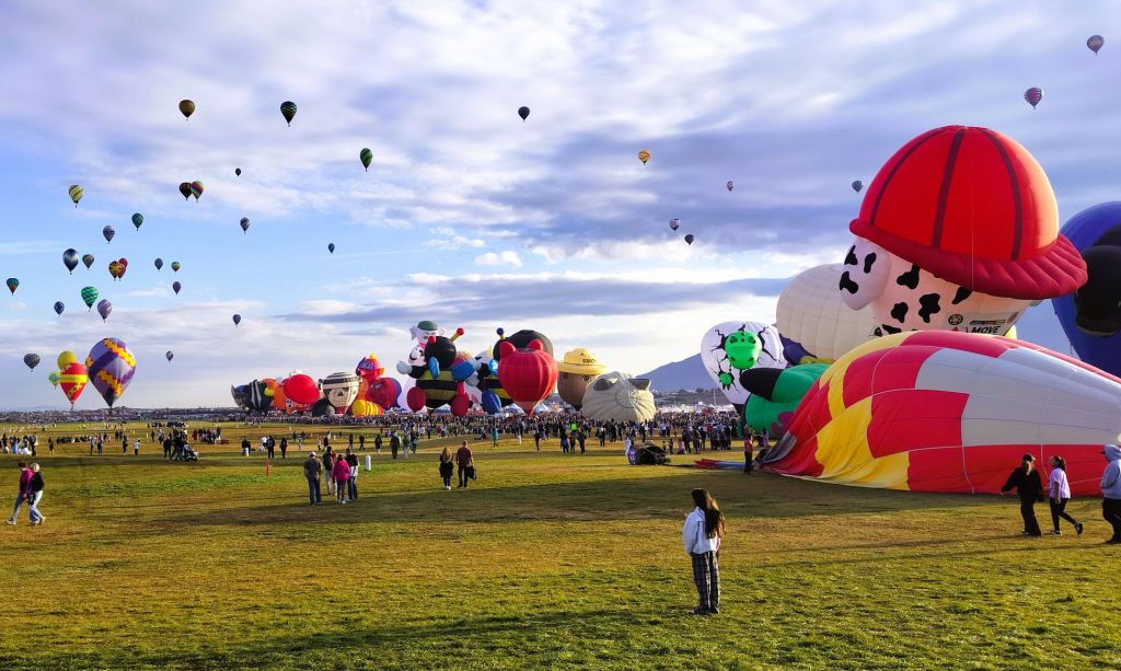
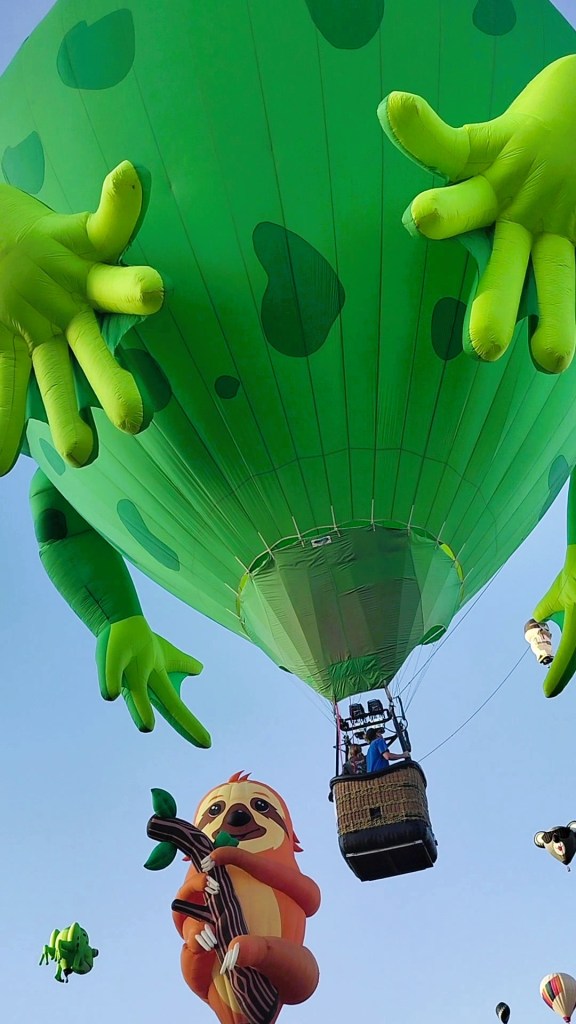
Here are photos of a few more of the specially shaped balloons. Let us know in the comments your favorites of the 30+ specially shaped balloons we posted.
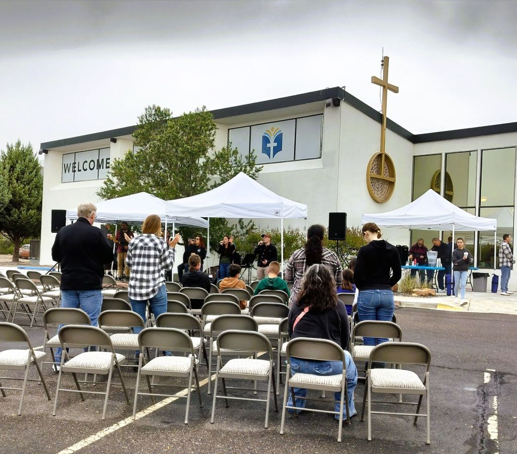
Guests for Breakfast and Church
We were invited to a special Balloon Fiesta breakfast and outdoor church service at Rio Rancho New Life Church near Albuquerque. By the time the service ended, the skies had cleared, and we enjoyed the beautiful day as we left for Texas.
We were welcomed to a Balloon Fiesta breakfast and outdoor service at New Life Church
A New Hobby?
Because we enjoyed the Balloon Fiesta so much, we’re considering a new hobby. What do you think?
Next Week
We pick up where we left off on the 2025 Balloons and Beyond blog timeline. Having overcome the flu, cold temperatures and high altitude in Wyoming, we continue south to Rocky Mountain National Park.
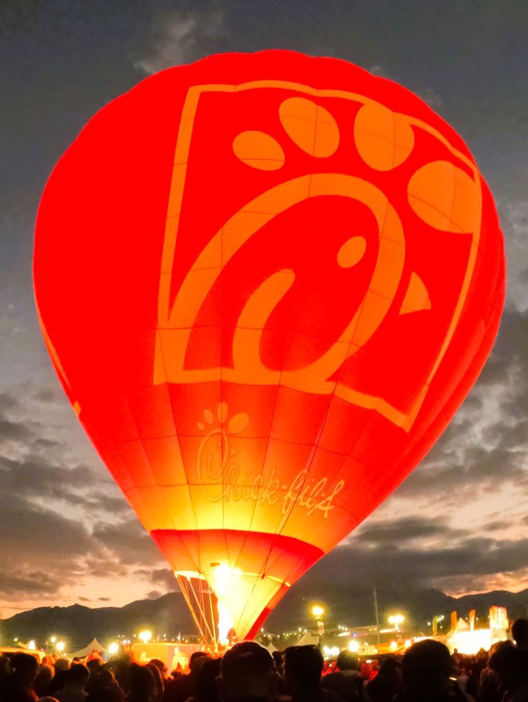
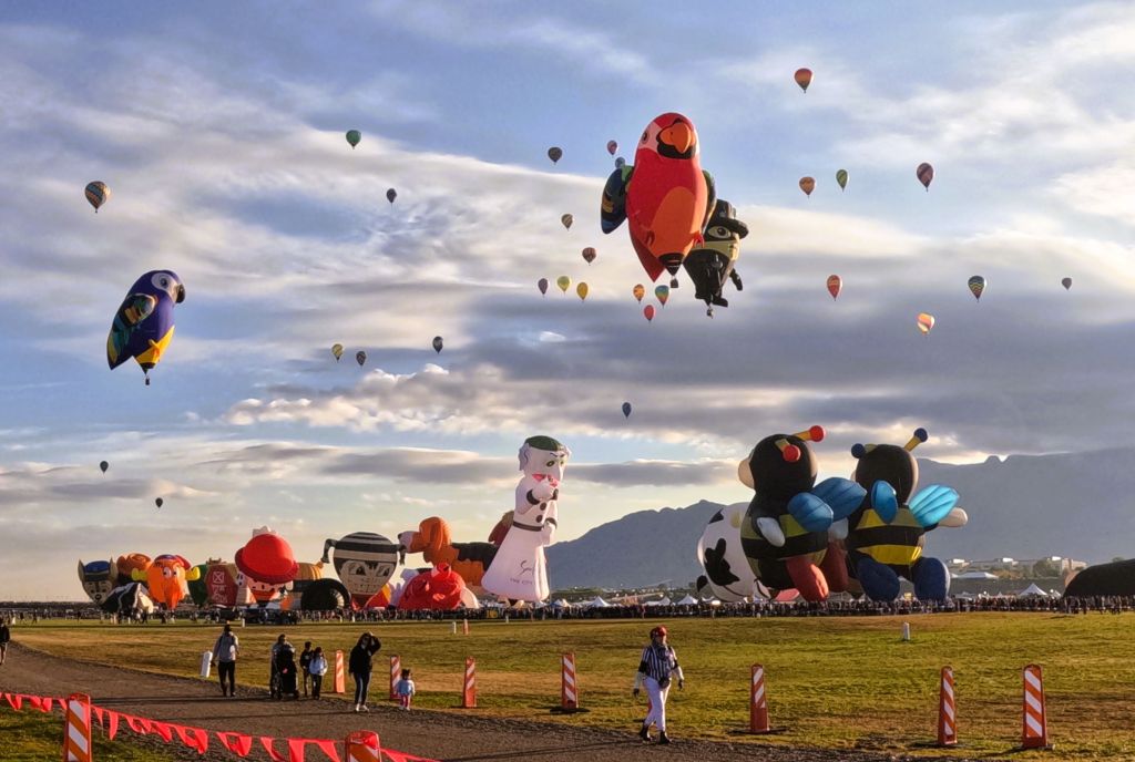
Specially shaped balloons are a favorite of Balloon Fiesta attendees. Balloons shaped like animals, cartoon characters and even a concrete truck capture spectators’ attention and bring smiles to their faces.
We hope some of the following balloons do the same for you!
Fantastic Fiesta Friday
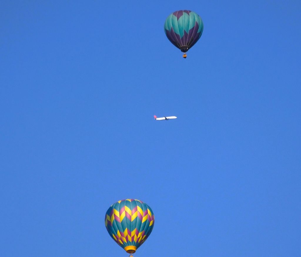
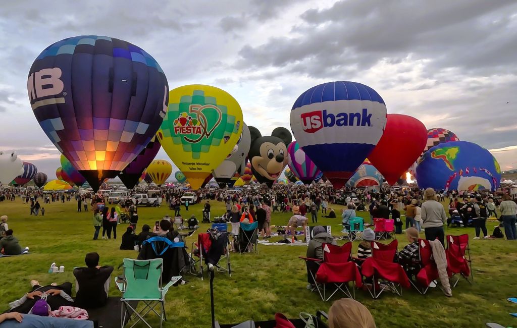
Yesterday (Friday) was a great day at the Fiesta. Weather conditions for the morning’s mass ascension were perfect, and we were awestruck as hundreds of balloons were launched in clear and calm skies.
The evening program included a balloon glow/flicker, drone show and fireworks. We were glad the weather was great considering Thursday’s evening program was rained out!
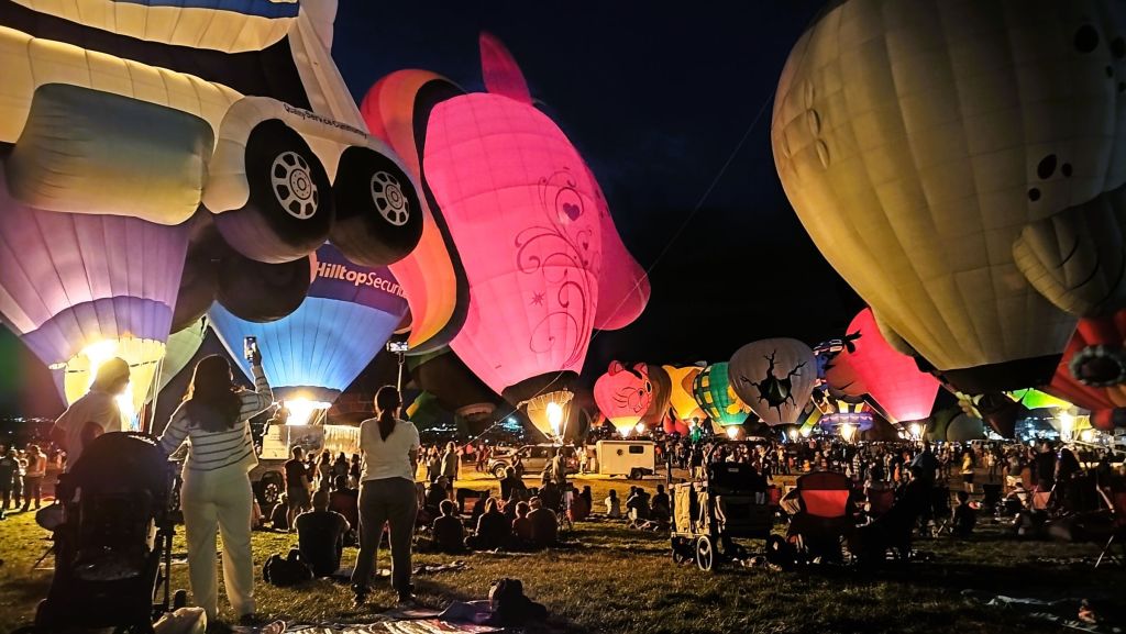
During the glow/flicker, hundreds of balloons were fully inflated but not launched. They stood tall across the Fiesta grounds.
Balloons glow and blink
As thousands of attendees counted down, the balloon pilots responded with coordinated bursts of flaming propane that made the balloons glow. Some countdowns were followed by short propane bursts that made the balloons flicker.
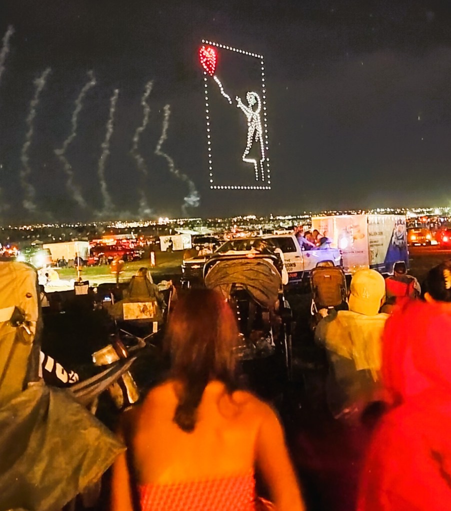
We were impressed with the images created during the drone show
The glow/flicker was followed by a drone show. We were impressed with how well the 500+ drones flew in formation to create various images – images that moved, changed color and told a story.
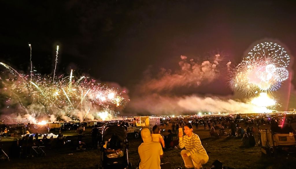
Friday’s fireworks finale from two sides of the Fiesta grounds
The drone show morphed into a spectacular firework finale for the evening – from the north and west sides of the Fiesta grounds.
Today (Saturday) Required Flexibility
This morning, we woke to raindrops tapping on our camper roof. Although the Dawn Patrol and mass ascension were cancelled, attendees were treated to a static balloon display instead. Balloons were fully inflated but not launched like a balloon glow/flicker. Seeing hundreds of balloons on the field during the daytime was interesting, much different than the normal mass ascension when balloons are inflated and launched in groups.
Saturday’s static display – balloons didn’t launch due to rainFiesta attendees enjoying Saturday’s static displayMore shapes seen during Saturday’s static display
Check Out – Pap and Percy on the Move
Our time at the Fiesta campground ended Saturday morning. We left to spend Saturday night at a church several miles away with an elevated view of the Fiesta grounds.
Saturday Evening Flexibility
This evening, we watched from afar as balloon pilots performed candlestick burns. Winds were too strong to set up and inflate the balloons for the glow/flicker, so pilots ignited their propane burners from their upright gondolas casting tall flaming flumes into the sky.
Tomorrow
We will be joining members of the church for breakfast as the final mass ascension of the 2025 Balloon Fiesta takes place. We’ll let you know tomorrow evening how things go as we wrap up the balloons portion of this RabbiTRAILs Balloons and Beyond series.
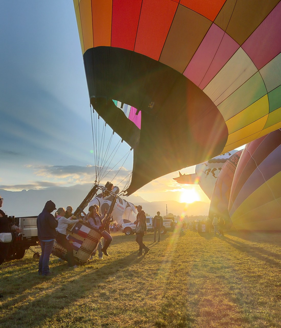
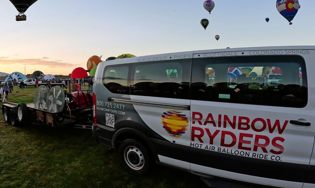
We interrupt this week’s RabbiTRAILS blog to take you live (almost) to the 53rd Albuquerque International Balloon Fiesta in New Mexico! It’s Balloon Fiesta time!
AIBF is the largest celebration of hot air ballooning in the world with more than 600 traditional and special shape balloons participating in this year’s fiesta that runs from Sat, Oct 4 – Sun, Oct 12.
This is our second balloon fiesta. It is a unique event – we and thousands of other spectators can get within a few feet of balloons as they are inflated and launched.
Fiesta Camping – Close to the Action
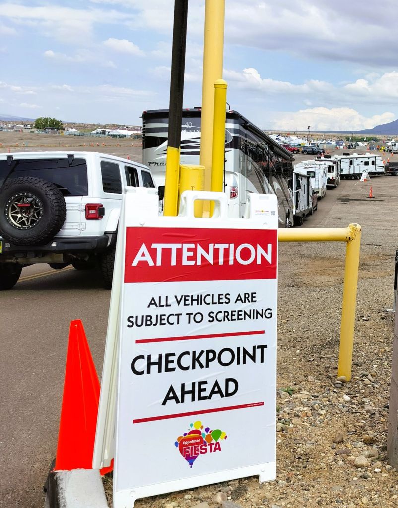
We arrived the afternoon of Thurs, Oct 9 and set up in the West VIP camping area that is on AIBF grounds, right next to the International Balloon Museum. After a short wait to check in, we were guided to our campsite – a small patch of asphalt normally part of the museum parking lot.
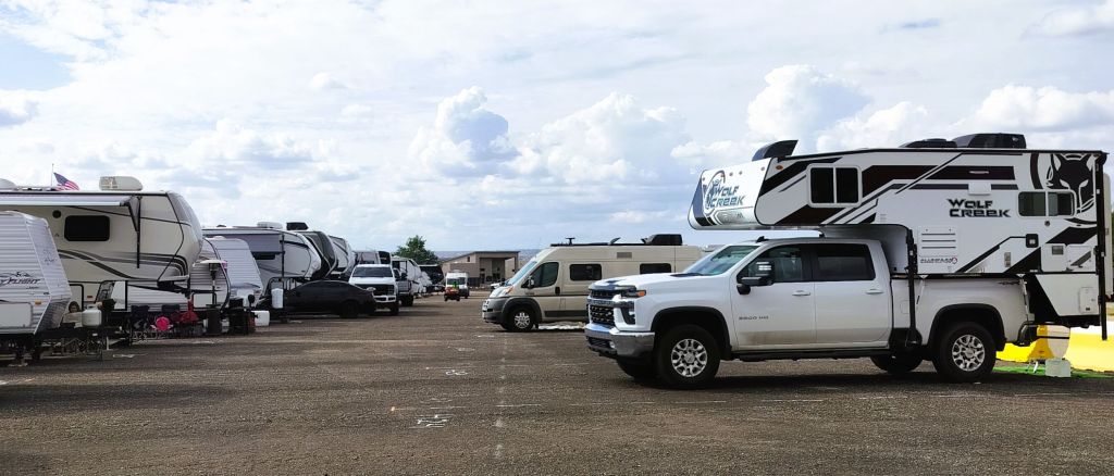
We’re camping rally style, a highfalutin way of saying no hookups (electricity, water or sewer) and parking so close to other RVs that the drone of their generators is soothing white noise. Generators must be turned off during quiet time (10 pm – 3:30 am) so there is a tiny bit of quiet relief!
Despite the noise and crowded conditions, we are a five-minute walk from where the balloon events take place.
RVs line up to check in at one of the AIBF campgroundsRally style camping – close together with no hookups
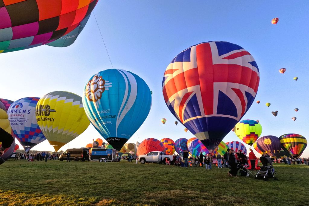
Mass Ascensions, Glows and Flickers
Events during the fiesta include daily mass ascensions during which hundreds of balloons launch just after sunrise, to evening balloon glows/flickers where balloons are inflated but not launched shortly after sunset. The balloons glow and blink as pilots ignite the propane jets that fill the balloons with hot air. It is quite a spectacle!
Seek Shelter – Rain Is Coming!
As we wandered the grounds after getting set up, we saw balloon chase crew help was needed. We signed up and were eagerly anticipating an interesting experience during the Thursday evening glow.
An ominous rain cloud approached the fiesta grounds as we waited for our balloon pilot to arrive. The evening events were cancelled, and our balloon crew experience was not to be. And we got soaked as we hastily made our way to a protected area.
Things are Looking Up!
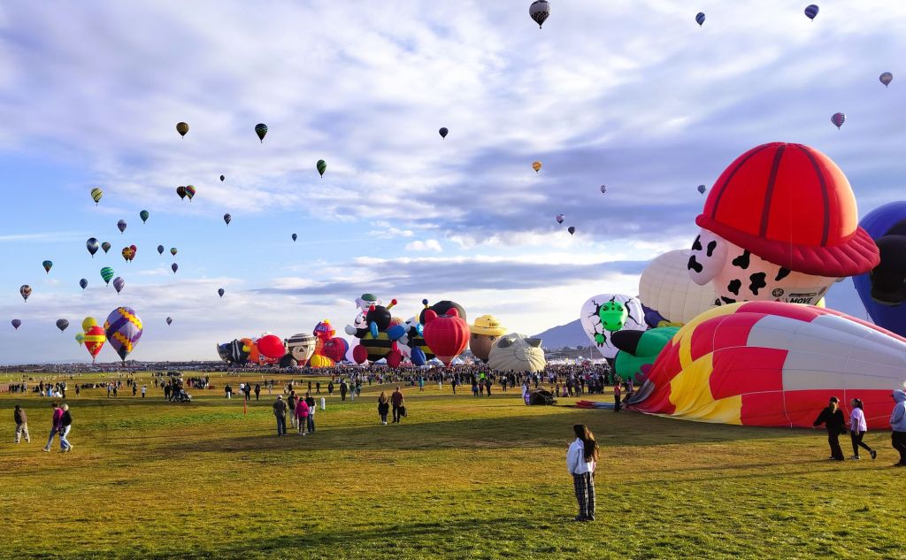
This (Friday) morning we were up at 5:15 for the mass ascension.
Dawn Patrol balloons check out wind currents before the mass ascension of hundreds of balloons
At 6 am, the Dawn Patrol was launched. Six balloons took off beneath a nearly full moon to check wind currents for the hundreds of balloons set to launch an hour later. The wind currents and morning weather were perfect!
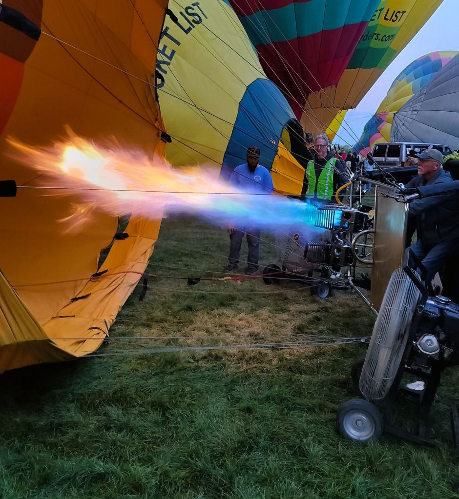
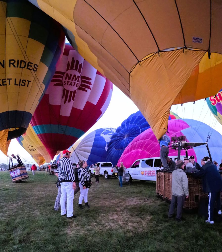
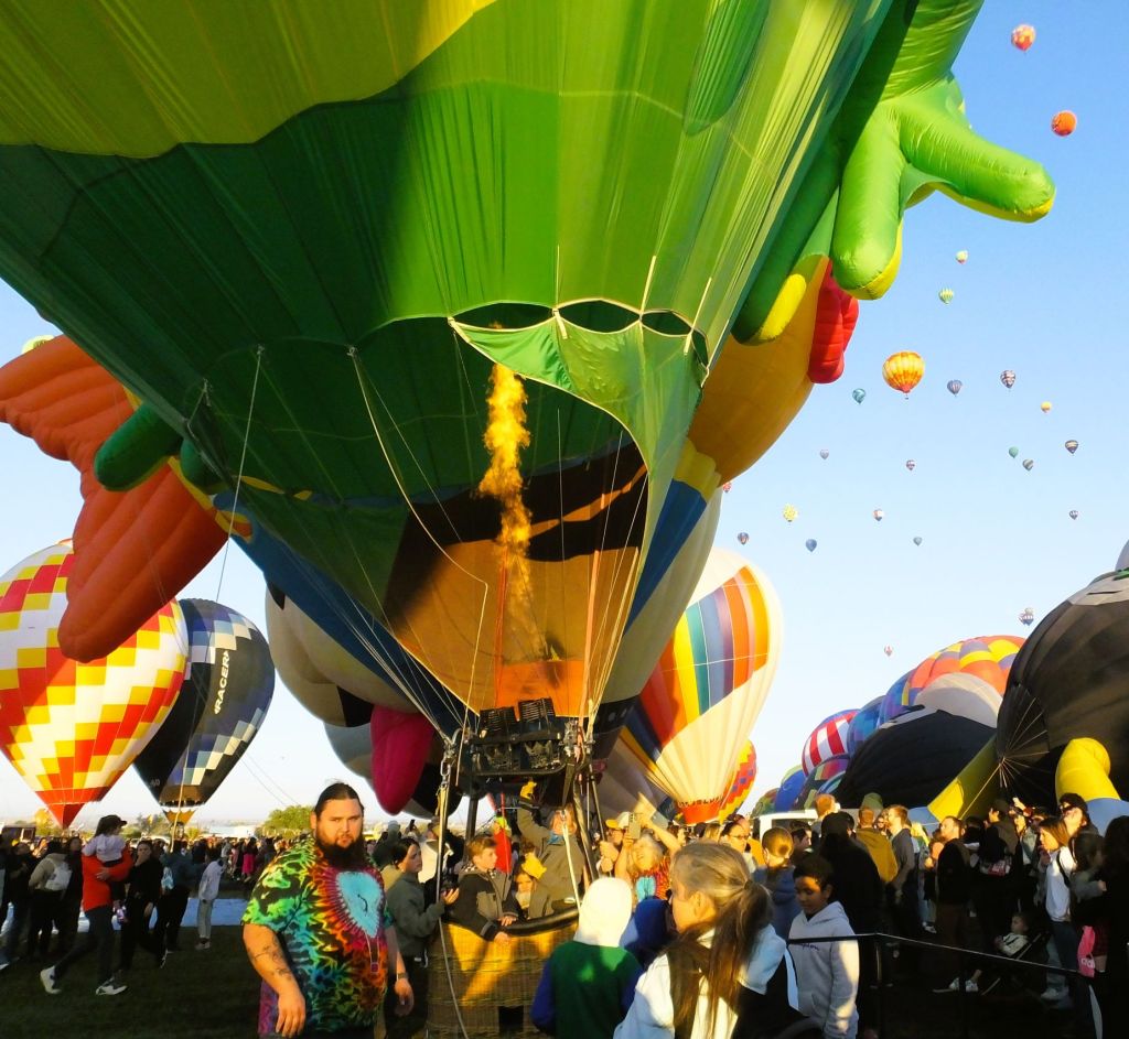
How to Launch 600 Hot Air Balloons
Balloon crews are assigned where to launch on the massive AIBF grounds. The grounds are laid out in a grid of 193 locations, each large enough to launch several balloons.
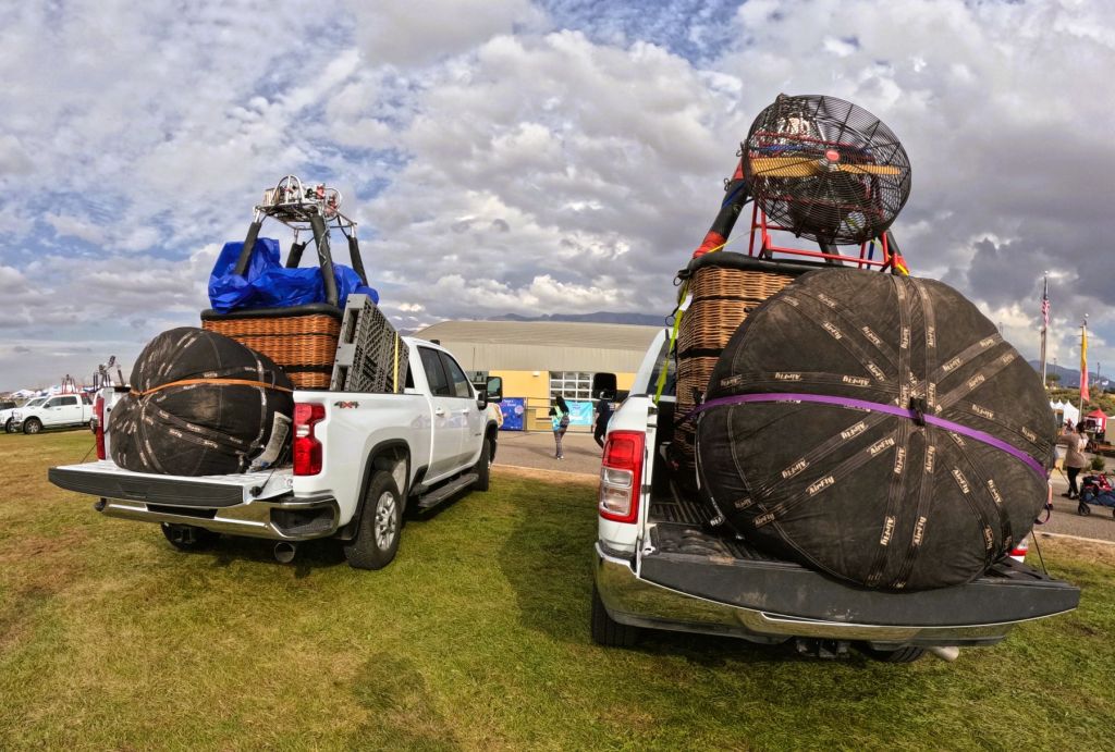
These trucks ready for balloon launch
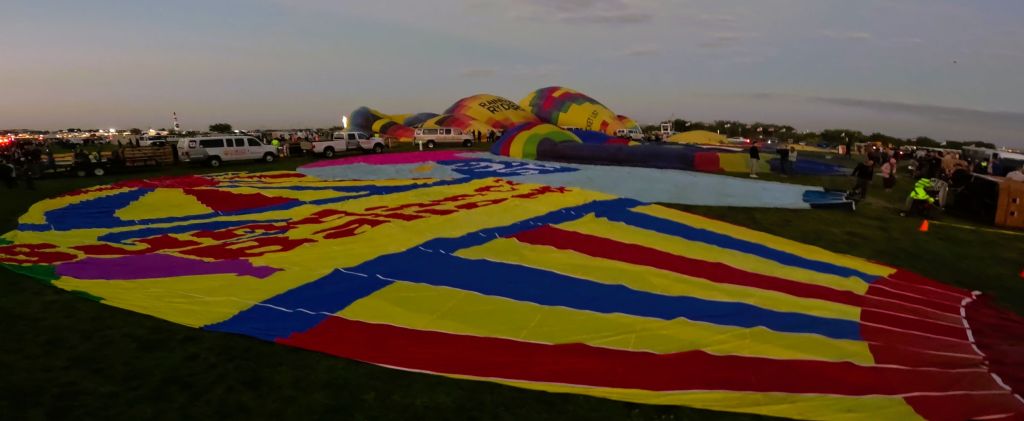
From balloon support vehicles/trailers, balloons, gondolas, fans and other items are unloaded. Large tarps are spread at each launch location and balloons are removed from bags more than four feet in diameter and spread out on the tarps.
Each balloon is carefully spread out over a large tarp
High powered fans connected to gasoline motors are started, and the balloons are inflated with cold air.
Large fans are used to fill the balloons with cold air
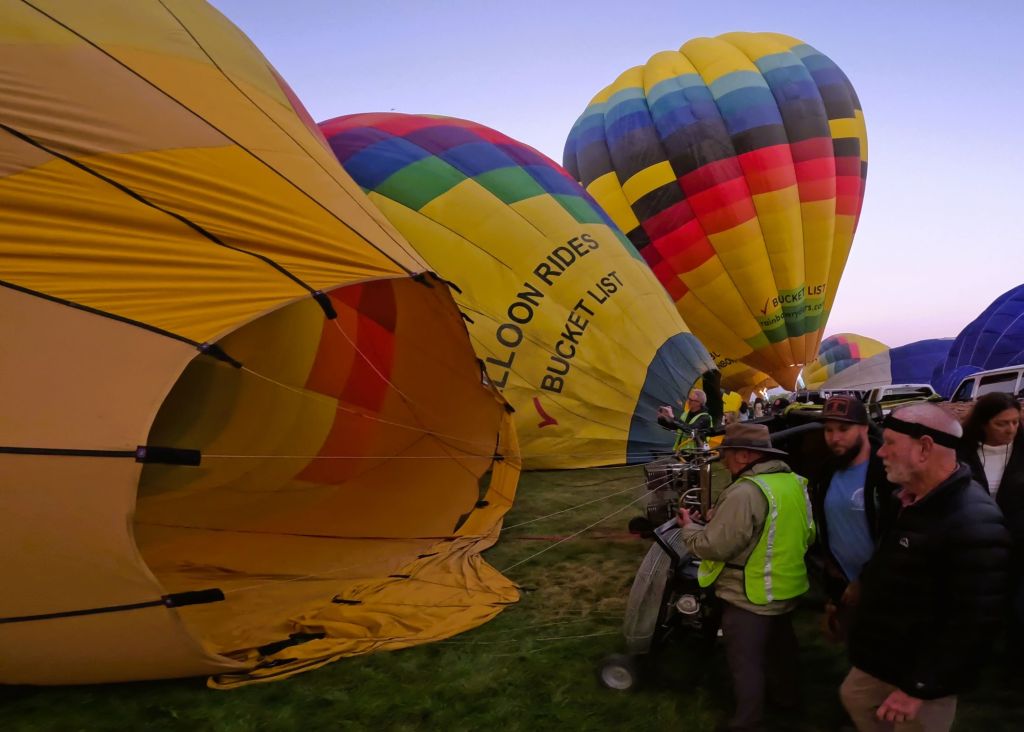
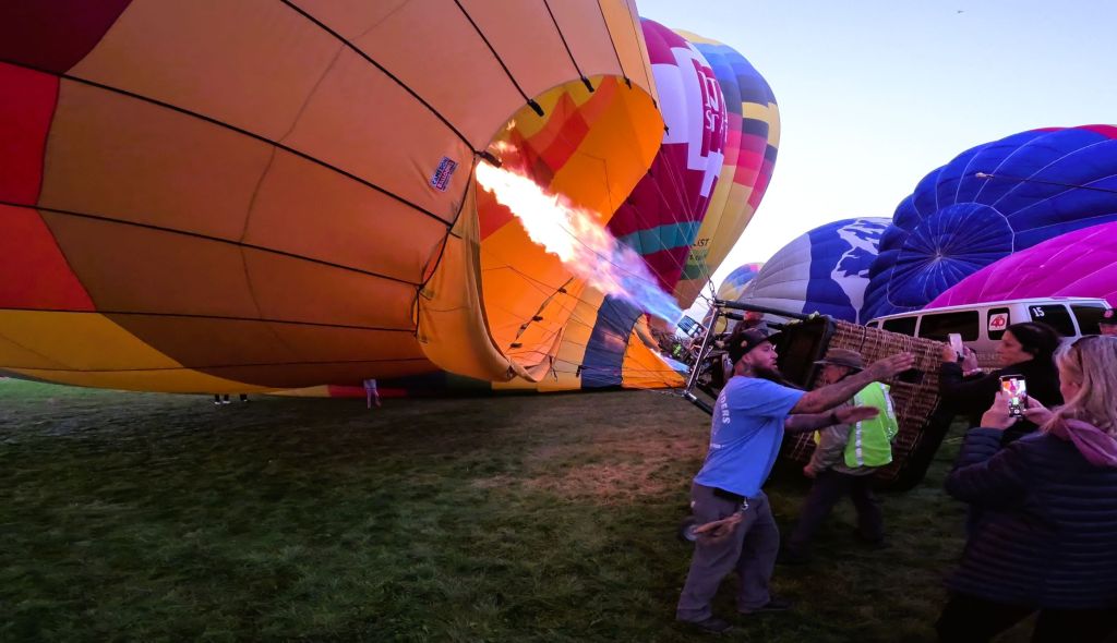
A gondola tipped on its side is attached to each balloon. When the balloon is fully inflated, the pilot ignites a propane jet at the top of the gondola to shoot VERY hot air into the balloon. The propane is ignited in three-to-four second bursts so as not to melt/burn the balloon fabric.
Once filled with cold air, propane jets fill balloons with hot air
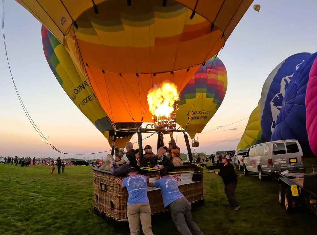
The balloon rises in a matter of minutes as it fills with hot air, and the gondola is eventually tipped upright to be ready for launch. The pilot and passengers climb on board.
Hot air causes a balloon to rise and the gondola is raised to an upright position
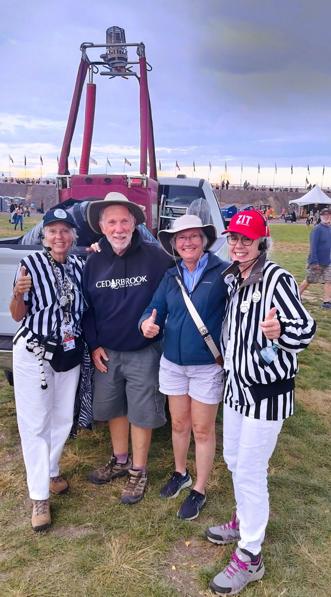
The launch sequence of each balloon is controlled by zebras, persons dressed in special striped clothing, who communicate with the launch controller and give each balloon pilot several whistle blasts to let them know when it is time to launch.
Zebras control the sequence of balloon launches
Each pilot continues with propane bursts until their gondola starts to lift. A tether line is then released and the balloon takes off!
This balloon is ready for launchThe balloon rises into the sky
A chase crew is then dispatched to follow and retrieve the balloon, pilot and passengers when the balloon lands.
An Unforgettable Spectacle
Watching hundreds of balloons launching and soaring into the sky is amazing. Below are some views of this morning’s (October 10) mass ascension.
Tomorrow
The RabbiTRAILS balloon fiesta blog continues with photos of the balloon glow/flicker event this evening, photos of the amazing special balloon shapes, and more.
Leaving the hills, mesas and pioneer landmarks of western Nebraska behind, we arrived in Wyoming. There were broad vistas and mountains to the southwest as we passed Cheyenne and Laramie.
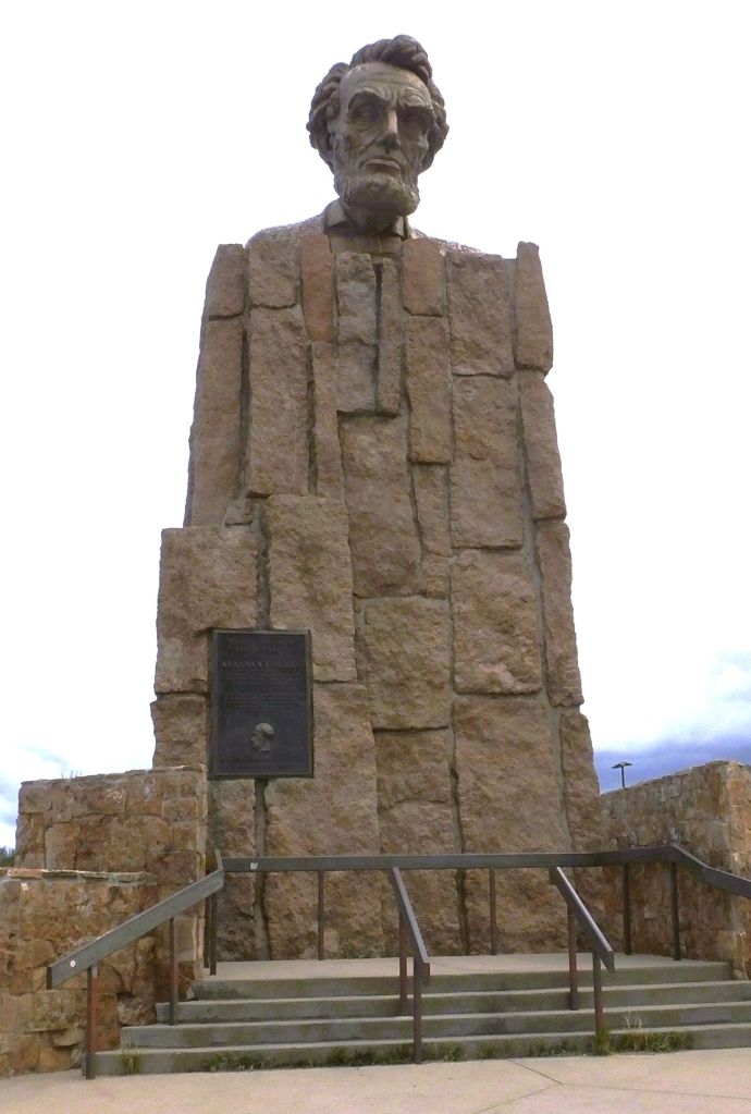
Lincoln Monument in Wyoming?
We continued west on I-80, stopping at the Summit Rest Area a few miles from Laramie.
Wyoming’s Lincoln Monument
There we found the Abraham Lincoln Memorial Monument, erected in 1959 to mark the president’s 150th birthday. The monument is a 13.5 ft bronze bust of Lincoln created by Wyoming artist Robert Russin. It sits atop a 35-foot granite pedestal.
The monument was originally located nearby on US 30. Better known as the Lincoln Highway, US 30 was the first transcontinental highway. It was completed in 1923 and ran 3389 miles coast to coast – from Times Square to the Golden Gate Bridge.
The monument was moved to its current location on I-80 in 1969 when the Interstate was completed.
Exploring Medicine Bow
West of Laramie, we camped in Saratoga, a small town near the Snowy Range Scenic Byway and Medicine Bow National Forest.
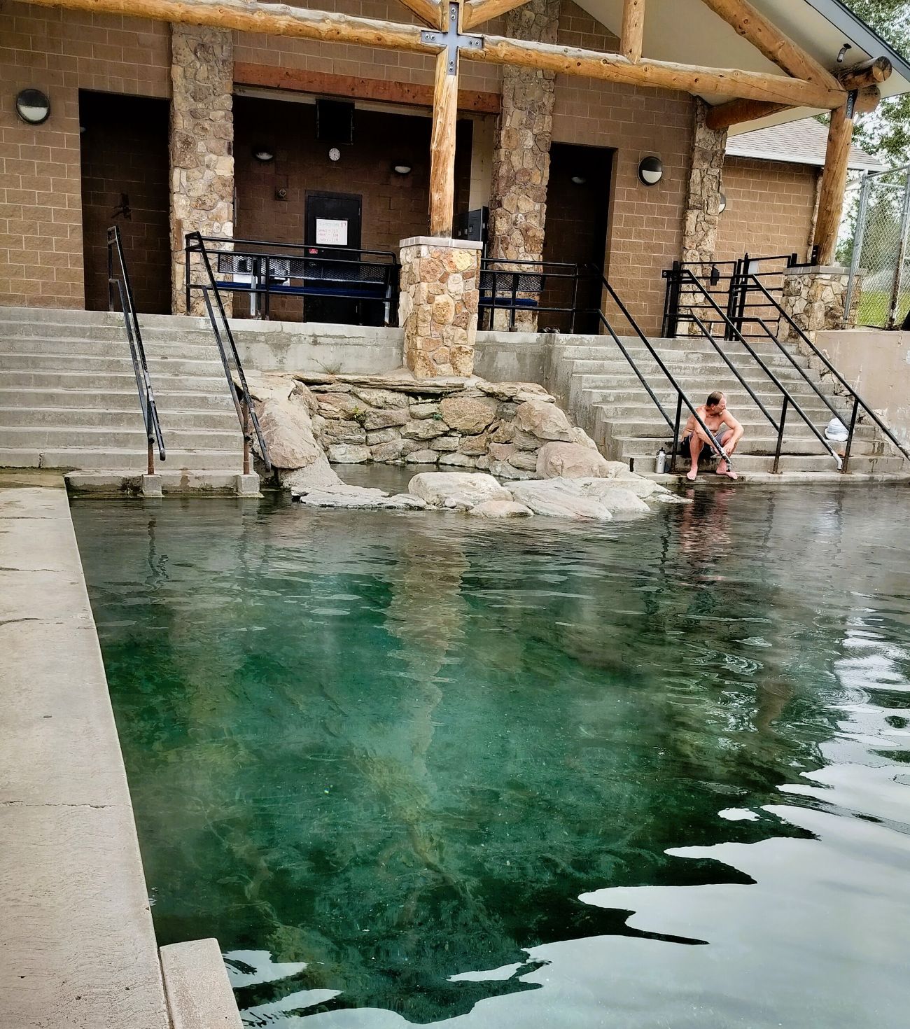
Saratoga is known for Hobo Hot Springs along the North Platte River. Unfortunately, we were unable to enjoy the springs.
Perhaps you remember Medicine Bow as the fictional town and setting of the Virginian, a 1960s television series that focused on the activities at the Shiloh Ranch in the late 19th century.
(The Medicine Bow area actually got its name from Native Americans who came to the area to cut mountain mahogany, water birch and juniper for making bows)
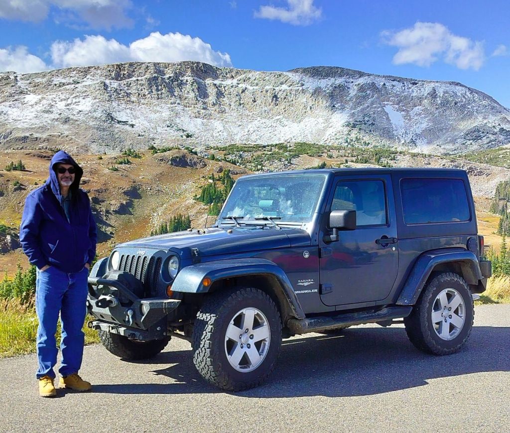
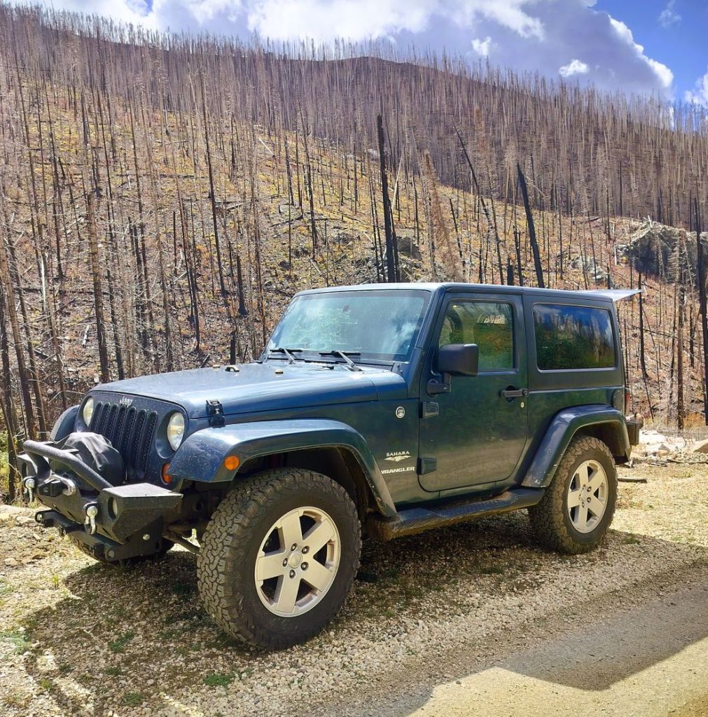
James poses with his Jeep and the Snowy Range
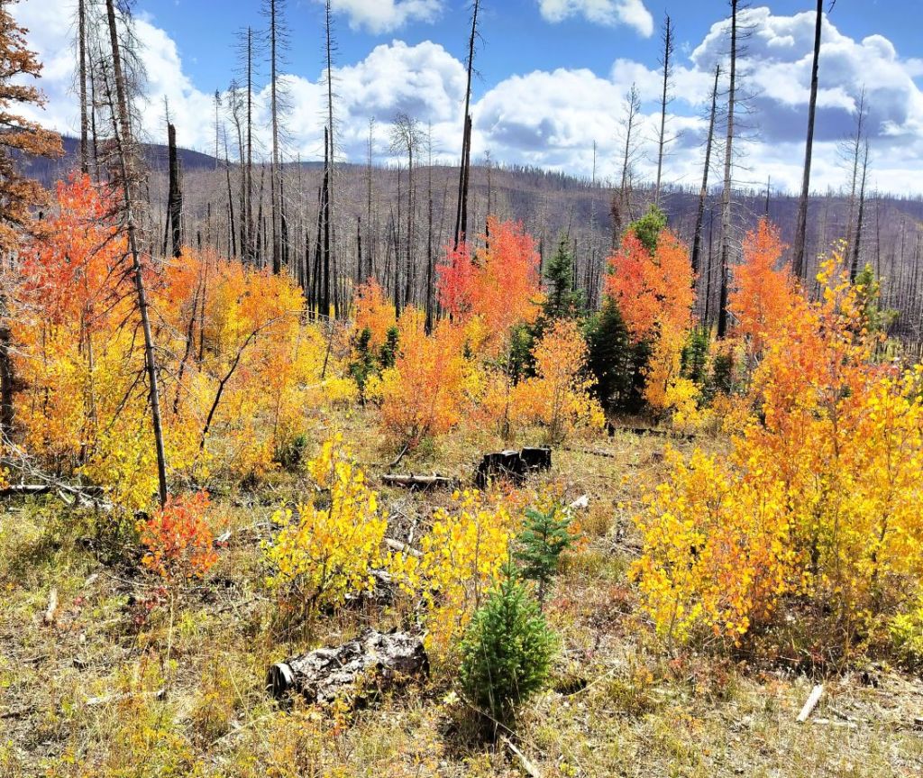
We decided to explore the area. James skillfully drove his Jeep up narrow gravel roads as we ascended into Medicine Bow National Forest. We drove through an area devastated by the East Troublesome Fire in October 2020. Amidst the charred stalks of once robust pine and fir trees were low bushes and small aspen trees. It will take many years for the forest to recreate itself.
Our route took us through an area devastated by a forest fire in 2020Aspens growing in the burned areas displayed amazing fall colors
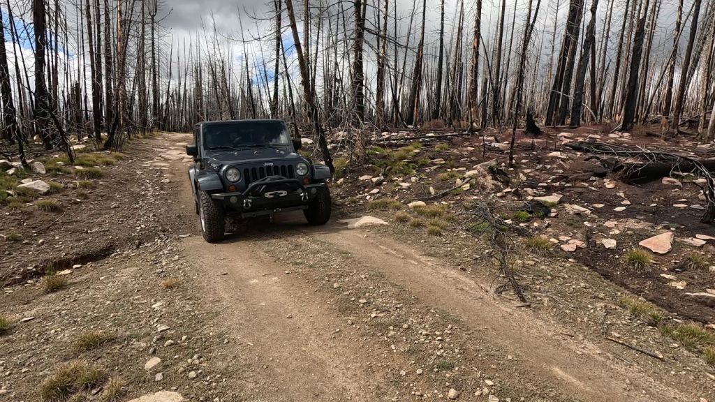
We followed a route suggested by Google and started up a steep, narrow road that became impassible. We backtracked and asked three camouflaged elk hunters for directions.
Backtracking along a narrow road as we made our way across the Medicine Bow National Forest
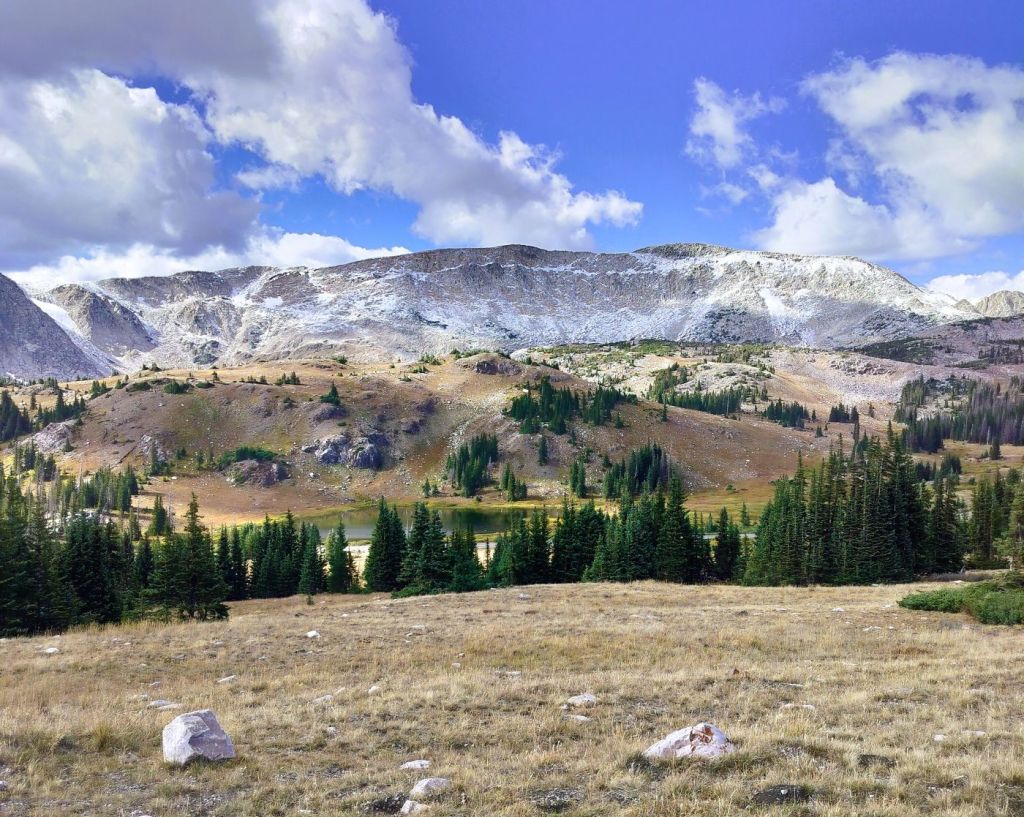
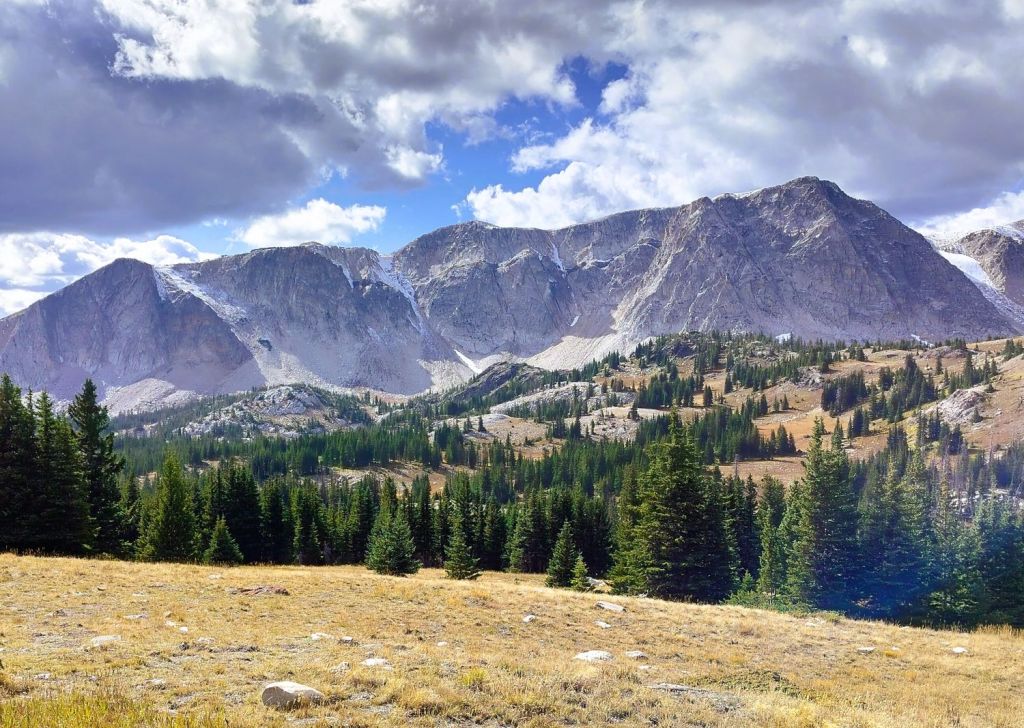
We eventually made it to Centennial WY where we turned back toward Saratoga on the Snowy Range Scenic Byway. We crossed the Snowy Range pass at 10847 ft and were breathless – from the elevation and from an amazing view of the Snowy Range. The tops of the mountains were covered with fresh snow from the prior evening.
Snowy Range view 1Snowy Range view 2. Medicine Bow Peak is the tallest mountain on the right
The tallest mountain in the range is Medicine Bow Peak. At 12018 ft, it is the highest point in southern Wyoming.
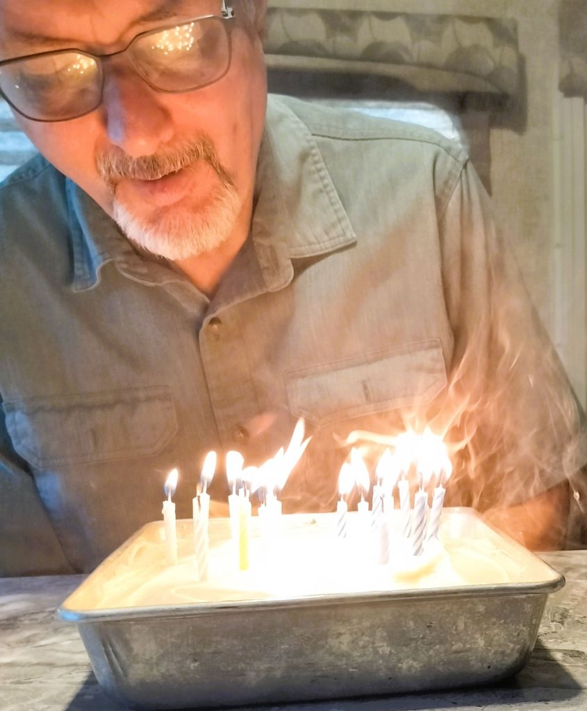
Happy Birthday, James!
That evening we celebrated James’ birthday!
Flu Pains
That night I (Ed) awoke with severe chills and fever. This repeated for two more evenings along with nearly a week of dry coughing spells. Although Pat was spared from flu symptoms, she felt the effects of a bad cold. We extended our stay in Saratoga to six days as we finally began to recover.
We said goodbye to James as he continued to Jackson WY and Grand Teton NP.
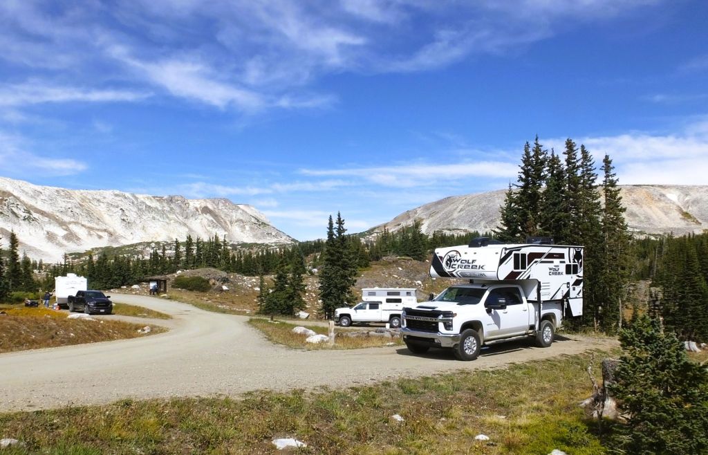
The next day we finally made our way up the Snowy Range Scenic Byway to spend a chilly night at Sugarloaf Campground. The campground is situated near three lakes at the base of the Snowy Range and Sugarloaf Mountain. At 10800 ft, the campground is one of the highest in the United States.
High altitude camping at Sugarloaf Campground with the Snowy Range in the background
We took it easy, limiting ourselves to several short hikes. The effects of the flu, cold temperatures and high elevations would linger with us for more than another week.
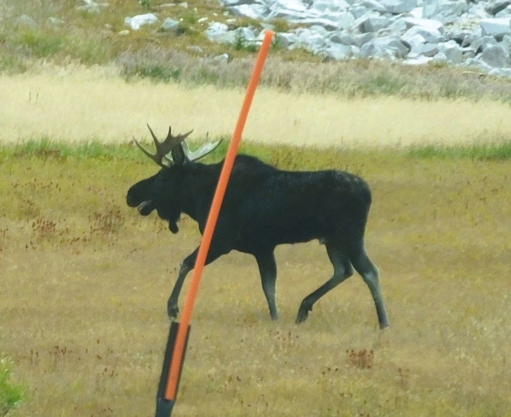
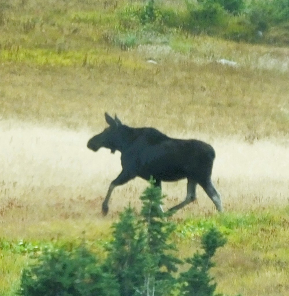
Critter Count
Our biggest critter surprise was along the Snowy Range Scenic Byway. As we neared a parking area for a short hike, a bull moose and cow were hastily crossing a field beyond the parking area. As we parked, another moose cow was making her way through the woods toward the other two moose. This was the first Bullwinkle (our name for a bull moose) we have seen in all our travels including Alaska and Newfoundland!