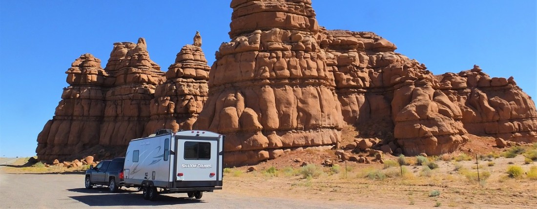
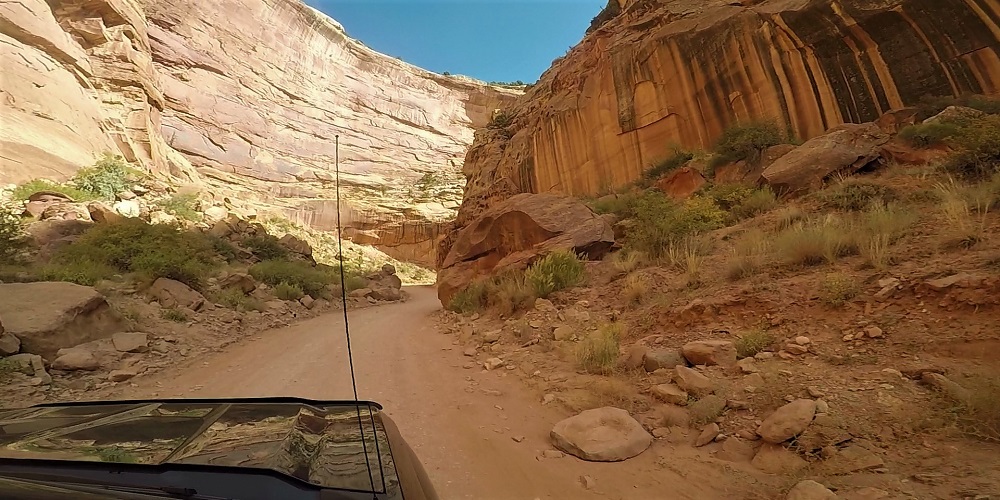
We left the goblins and traveled on toward Moab, Utah.
Moab is the gateway to Arches and Canyonlands national parks and is very popular for various types of outdoor adventure, including mountain biking, hiking and 4-wheel-drive driving.
We arrived in the early afternoon and learned all of the campgrounds in town were full. With cooler fall weather, there were lots of visitors in the area. Camping reservations are necessary during spring and fall months – something we will remember for our next time.
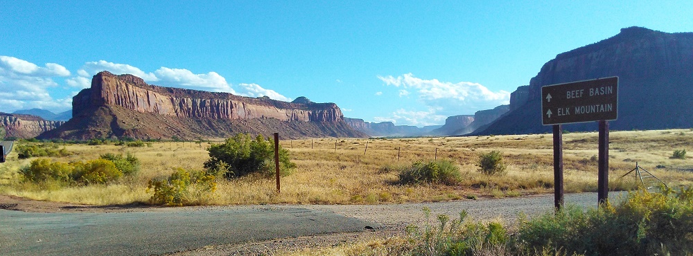
We continued 55 miles south to Monticello, Utah (map point 14). In 2013, we stayed at a bed and breakfast in Monticello and know what the area has to offer. With Monticello as a base, one can enjoy interesting day trips to the four corners area (where Arizona/New Mexico/Utah/Colorado touch), Monument Valley, Natural Bridges National Monument and the Canyonlands National Park Needles District. Longer day trips to Moab, Arches National Park and the Canyonlands National Park Islands in the Sky District are also possible.
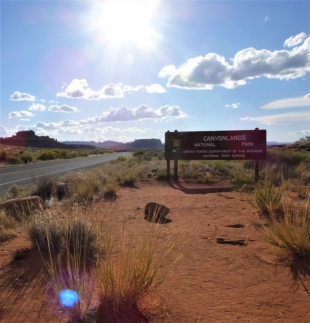
Canyonlands Park Entrance
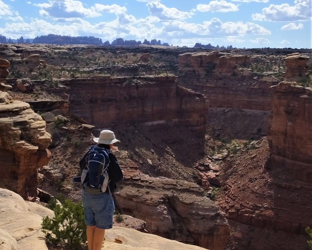
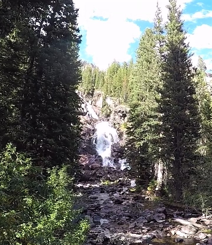
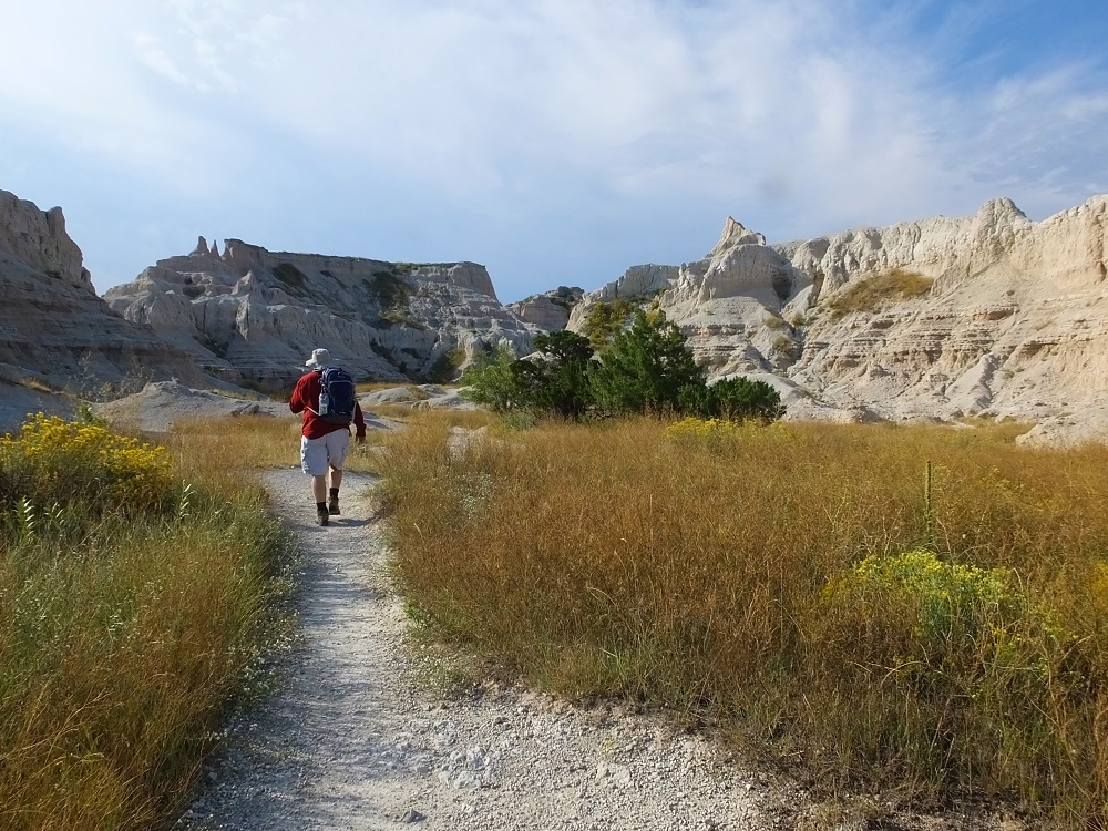
We camped in Monticello and decided to visit the Canyonlands Needles District during our one full day in the area.
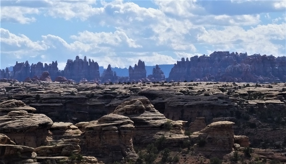
Canyonlands Needles in the distanceCanyonlands view: we drove a jeep to Beef Basin during our visit in 2013
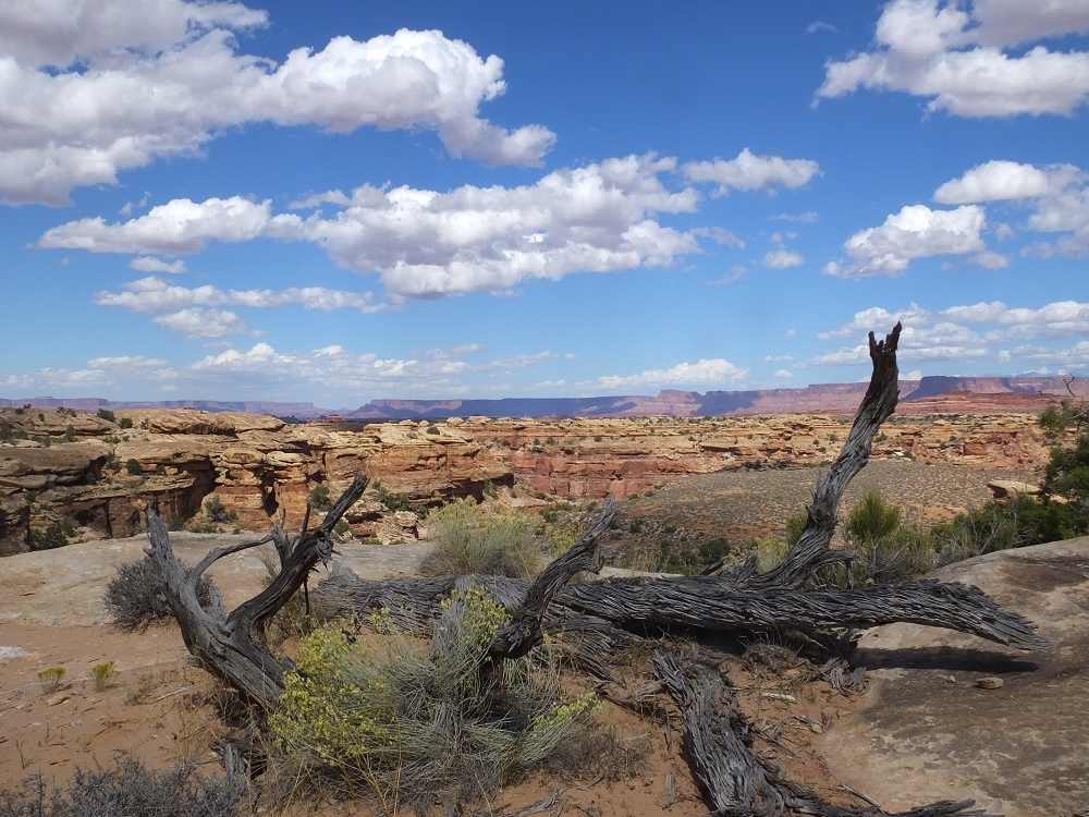
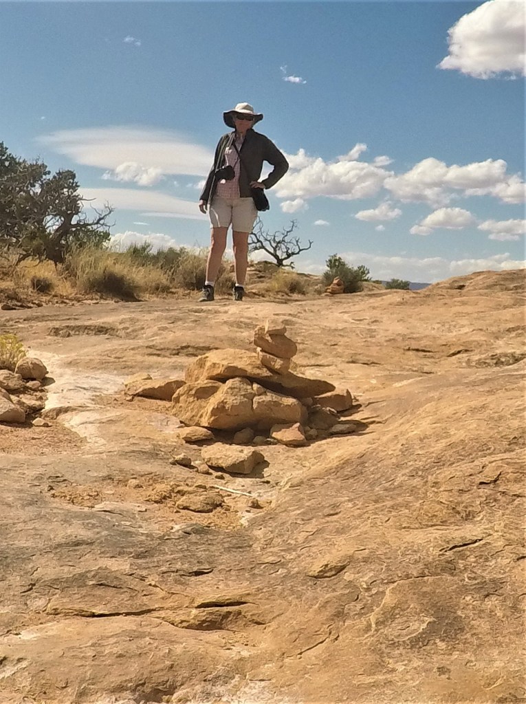
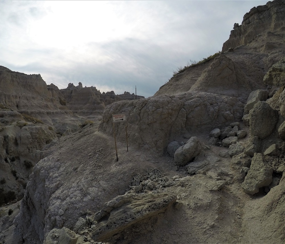
The temperatures were rather warm during our late September visit so we brought plenty of water and wore hats during two hikes in the park. We enjoyed four overlooks along the 2.4 mile Slickrock Foot Trail that had views of canyons, pinnacles and reddish peaks of the Needles area. We were unable to see where the Colorado and Green Rivers join at the bottom of the canyon however.
Canyonlands vistaLooking into the canyon from the Slick Rock TrailRockpiles (cairns) on the Slick Rock Trail guided our way
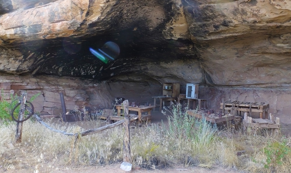
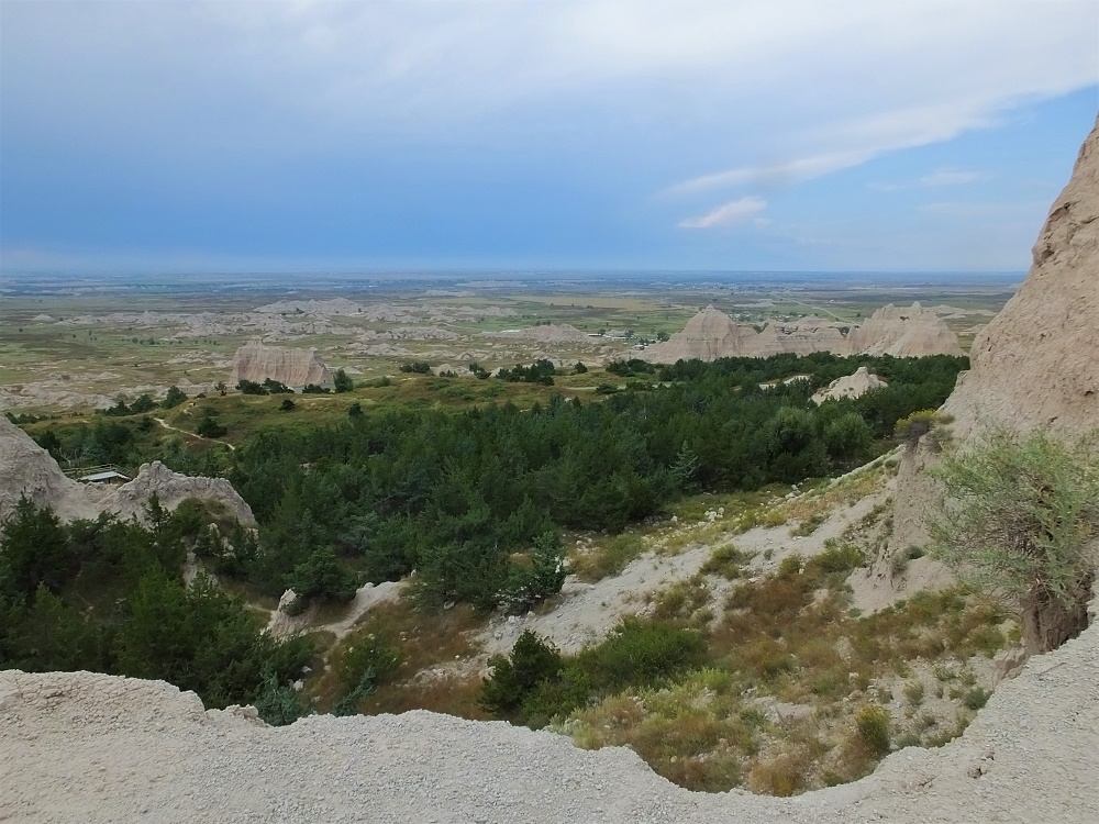
Later that afternoon we hiked the nearby Cave Spring Trail, a short trail that included relics from a 19th century cowboy camp tucked under cliffs of a low mesa, interesting petroglyphs and rock art, and a couple ladders that one must climb to reach the top of the mesa. From the top we had a panoramic view of the Needles area.
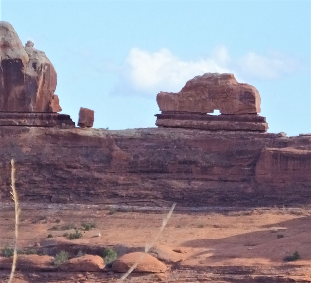
Cowboy camp on the Cave Spring TrailWooden shoe formation in the Canyonlands
As we drove back to Monticello, we passed by Newspaper Rock, a sandstone rockface that has hundreds of petroglyphs of human, animal and material forms. It is said to be one of the largest, best preserved and most accessible collections of petroglyphs in the Southwest. Perhaps this was the pre-Internet Internet…
We had reached the point in our journey to begin the long return to Florida. Our next planned stop would be at Cortez, Colorado, where I would have my dislocated finger checked out and where we would visit some amazing Indian cliff dwellings.
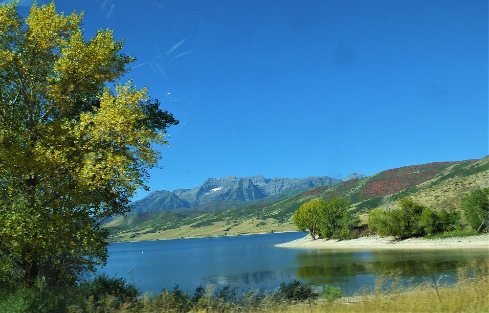
After visiting J.C. Penney, we continued south to Utah where we bypassed Salt Lake City and Provo, bound for Capitol Reef National Park. In some areas autumn was evident on the distant hills, with red and yellow tinged trees. Not the beauty of colors in the eastern U.S., but eye candy none-the-less.
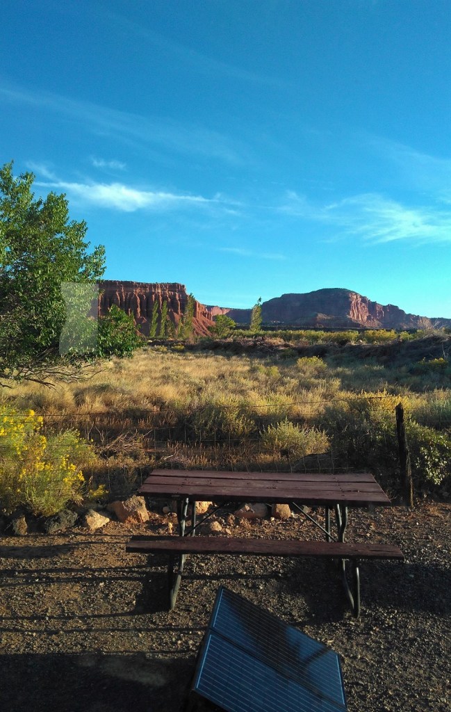
Changing leaves in UtahView from our campsite
We dry camped at Torrey, Utah, about seven miles from the park (map point 13). Our campsite had a nice view of sagebrush flats leading up to clay-colored, eroded mesas.
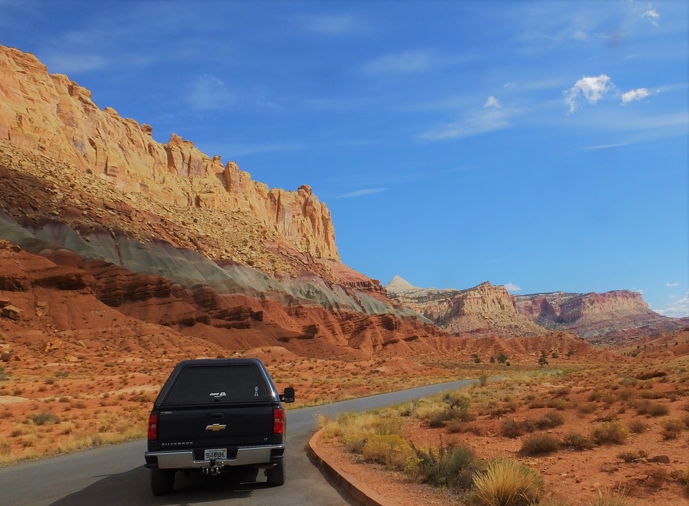
Capitol Reef National Park extends about 60 miles north to south and is less than five miles wide at most points. Although much of the park is remote, an eight-mile scenic drive provides amazing views.
The park is situated along a wrinkle in the earth known as the Waterman Fold. The dramatic lifts and folds of the fold are seen all along the drive. Two short side roads pass through narrow canyons to interesting hiking trails (time-lapse video).
Waterman Fold view along scenic driveDriving the canyon along the Capitol Gorge spur road
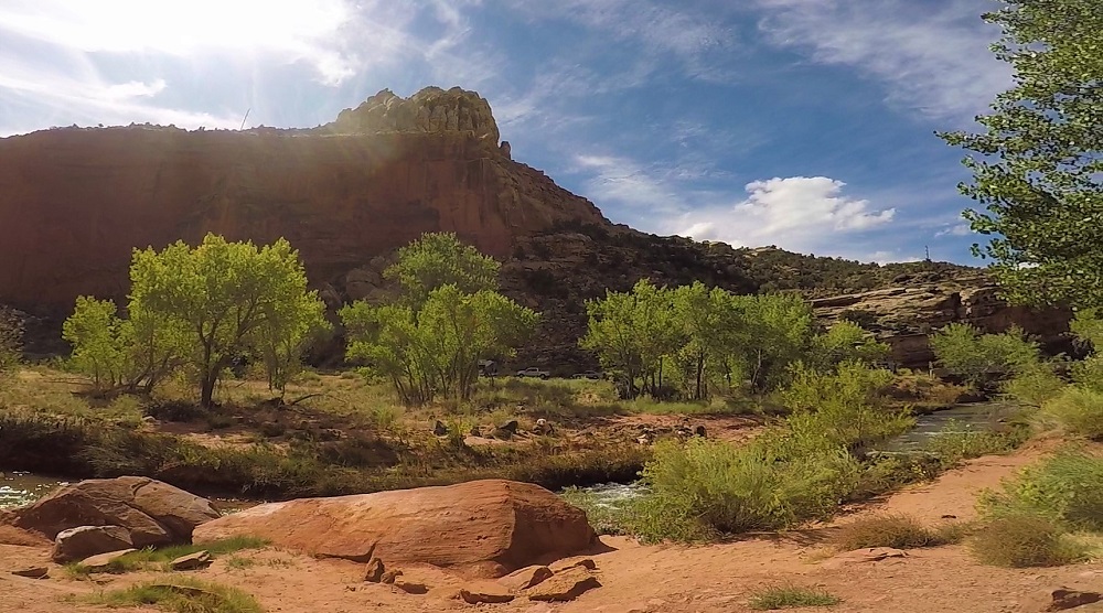
We ate lunch at a picnic area in the Fruita Historic District. The Fremont River flows through the district where Mormon pioneers built irrigation systems and planted apple, cherry, peach, pear and apricot trees. The apples were ripe so we picked several pounds for a small fee. Pat sliced the apples and baked them with cinnamon sugar and butter for a delicious dessert.
Fremont River along the Hickman Bridge TrailPicking apples
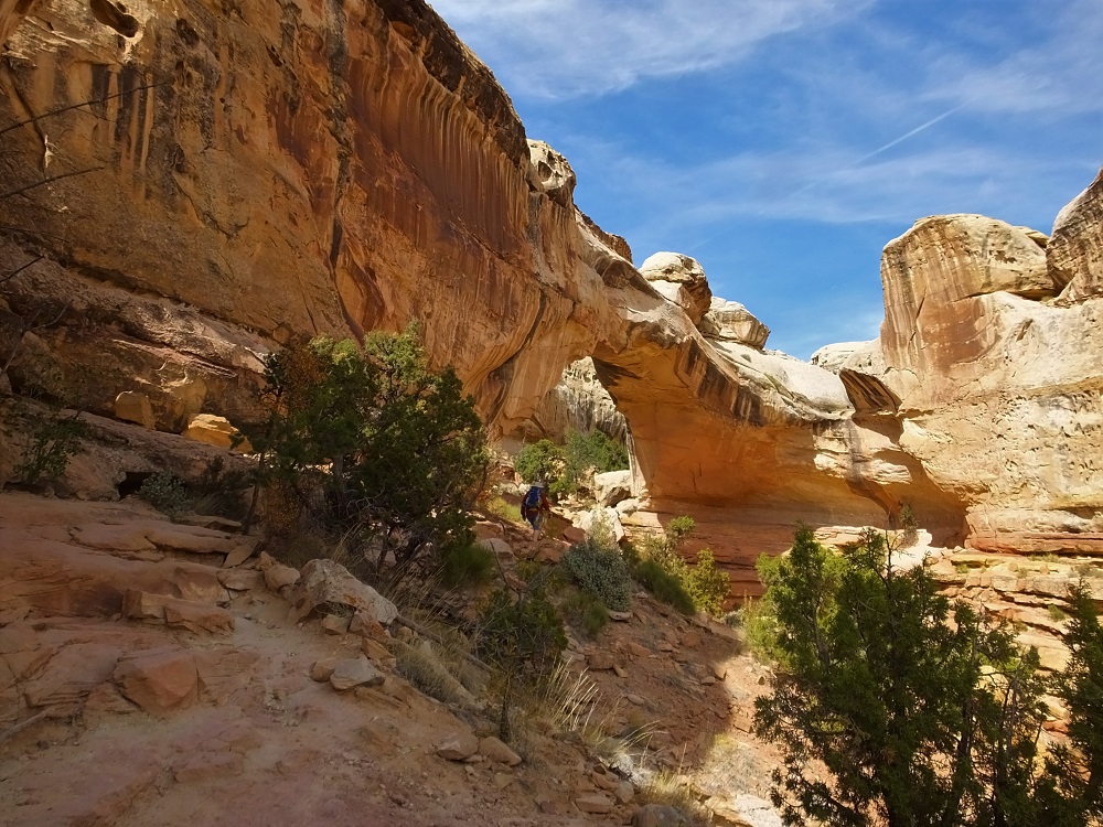
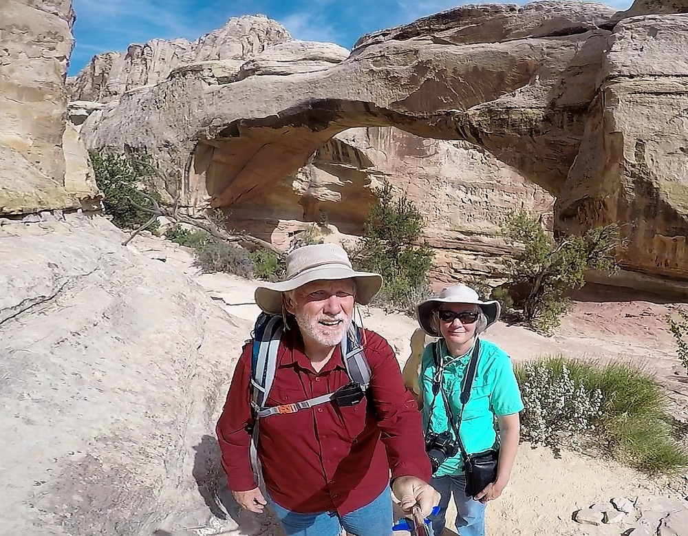
Not far away we ventured up a 1.2 mile rocky trail to Hickman Bridge, a 130-foot natural arch near the Fremont River. It was our first significant trail since hiking in the Tetons a week earlier where I fell and dislocated a finger. Thankfully there were no incidents this time – only great views of the arch and adjacent canyons.
Almost to the Hickman Bridge, a 130-foot long natural stone archHickman Bridge selfie
Tip: We learned an important lesson while in the area. Spring and fall months are high season – the parks are crowded and campgrounds are full. We were told summer (hot) and winter (cold) months are less busy. We’ll make reservations should we return one day.
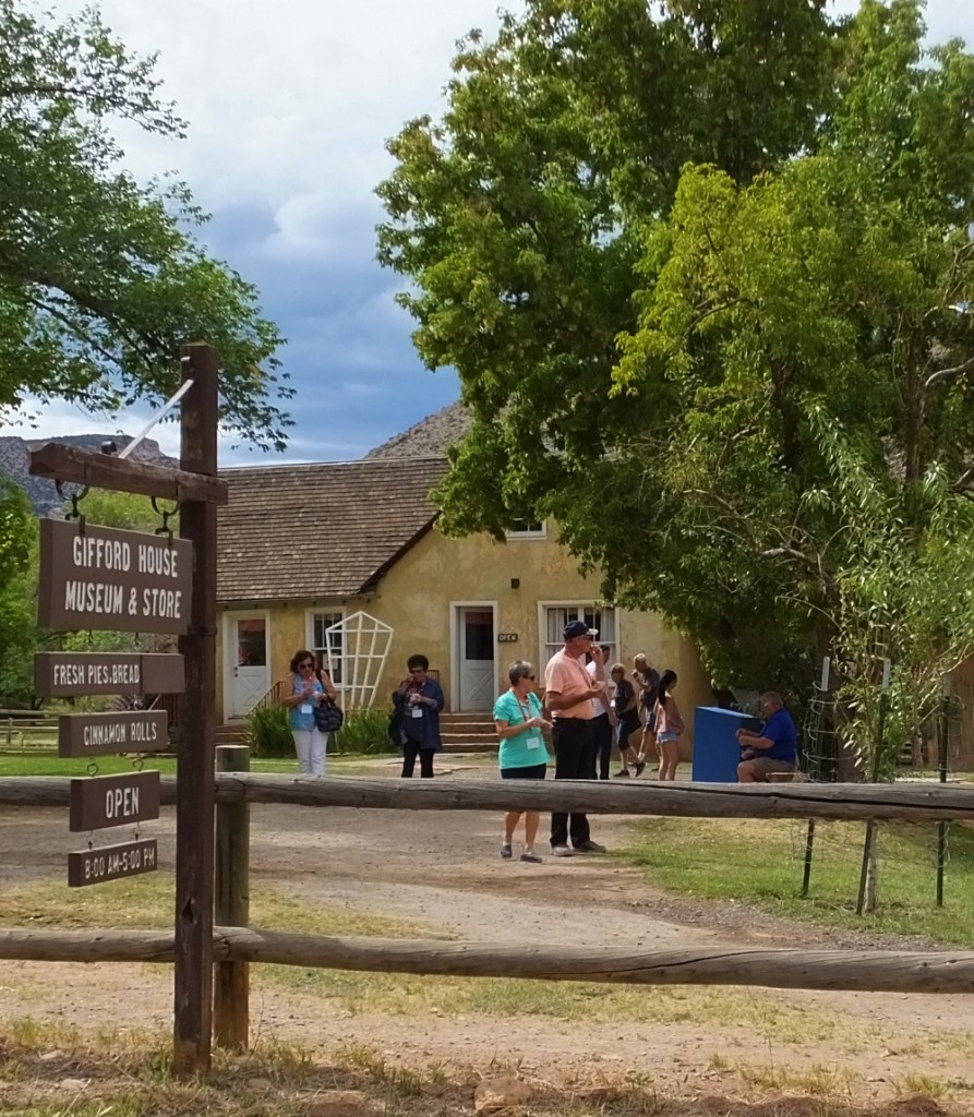
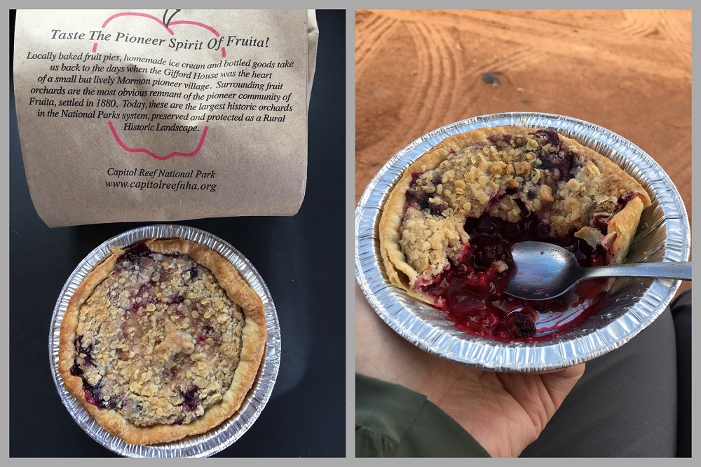
Bonus Tip: locally made fruit pies, various preserves and other items are sold in the park at the Gifford House. The fruit pies are VERY popular – 28 dozen were sold by 2 pm on the day we visited. All were gone when we went to the store :>(. Stop at the store EARLY if you want to enjoy a delicious local treat!
Gifford HouseFamous pies (Google image)
After a couple days in the area, we headed northeast to Moab and Canyonlands/Arches National Parks. Along the way we would have an interesting encounter with goblins.
Yellowstone National Park is north of the Tetons. Although we have visited Yellowstone a half dozen times in the past (including more than a week in 2018), we decided to visit again while we were in the neighborhood.
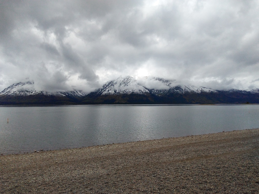
From Gros Ventre, we headed north a few miles to camp at Colter Bay (map point 10), still within Grand Teton National Park. Colter Bay is on the eastern shore of Jackson Lake. The Tetons rise majestically beyond the western shore of the lake. Unfortunately the weather turned cold and rainy, and we were unable to hike or take boat tours available in the area. Instead we did our laundry and toured the visitor center.
Snow-dusted Tetons across from Colter Bay
Two mornings later, we left for Flagg Ranch (map point 11) as the weather cleared. The tops of the mountains were dusted with fresh snow, a sign that winter was on its way.
Flagg Ranch is between Grand Teton and Yellowstone national parks, along the John D Rockefeller Jr Memorial Parkway. We decided we would camp at the ranch for three nights and take day trips into Yellowstone.
Map of the Teton-Yellowstone area
Our Yellowstone visit bypassed most of the places we visited in 2018 – Old Faithful, Mud Volcano, several other groups of geysers and many of the viewpoints of Yellowstone Falls. Instead we focused on areas we had not visited during recent trips or ever before.
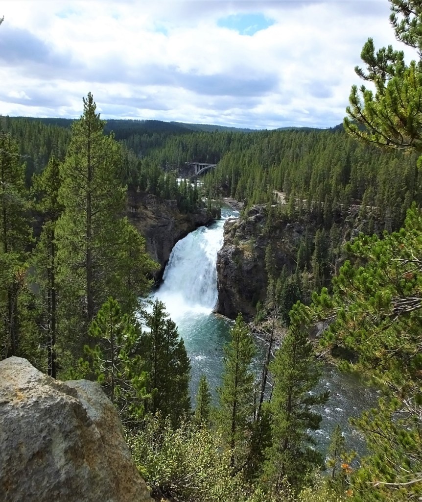
Upper FallsHayden ValleyTower FallYellowstone River Near Tower Fall
We decided to go to Tower Fall in the northeast corner of the park. En route we drove past Fishing Bridge, a Yellowstone River crossing just south of Yellowstone Lake. The bridge has been rebuilt since 2018 and is now MUCH smoother. Other road construction continues in the area and Fishing Bridge Campground will remain closed until sometime in 2021 (as an aside, Fishing Bridge is the only campground in the park with water and electric hookups).
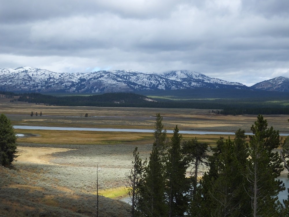
It was strange not see herds of bison as we drove through the Hayden Valley. They had migrated to other parks of the park. We took a short detour along the south rim drive to see the Upper Falls on the Yellowstone River from Uncle Tom’s Trail. The trail was closed for redevelopment during our 2018 visit.
About an hour later we arrived at Tower Fall, a 132-foot cascade along Tower Creek just before it merges with the Yellowstone River. We viewed the falls at the start of a one-third mile trail that winds down 225 feet to the river. At the bottom there is an interesting view of the multicolored canyon carved by the river.
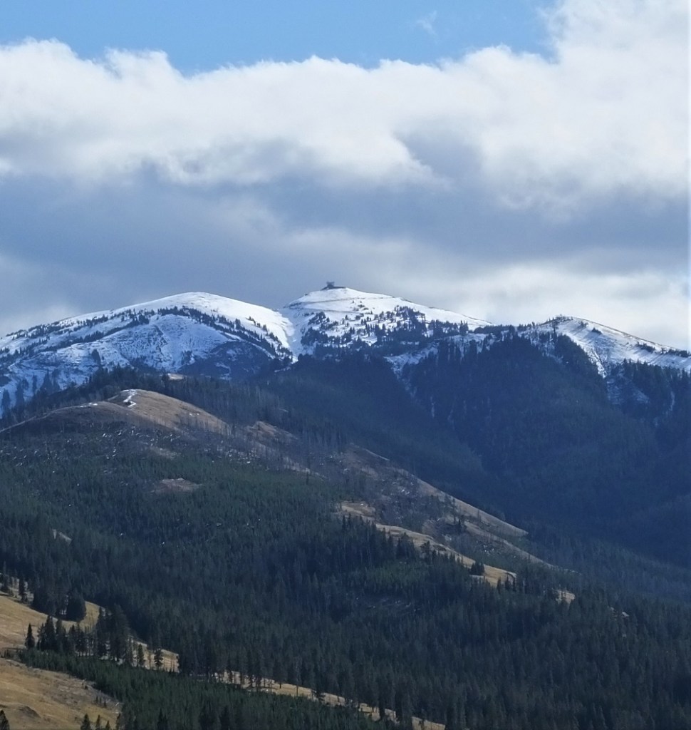
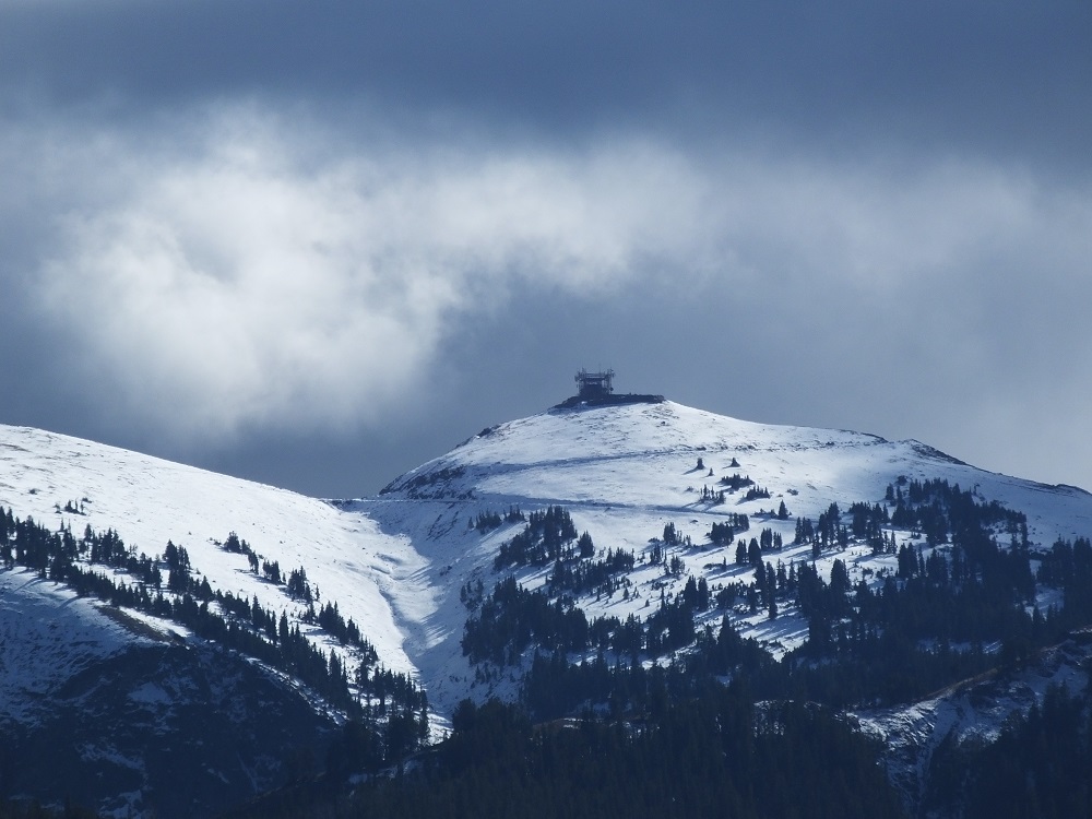
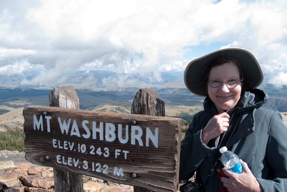
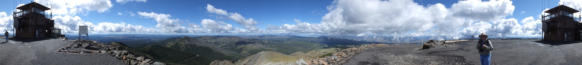
As we returned to Flagg Ranch, we stopped to photograph snow-covered Mt. Washburn. Pat and I (kind of) enjoyed a hike to the top of the mountain in September 2014 – breathless from the views and the 1400 foot climb to the peak!
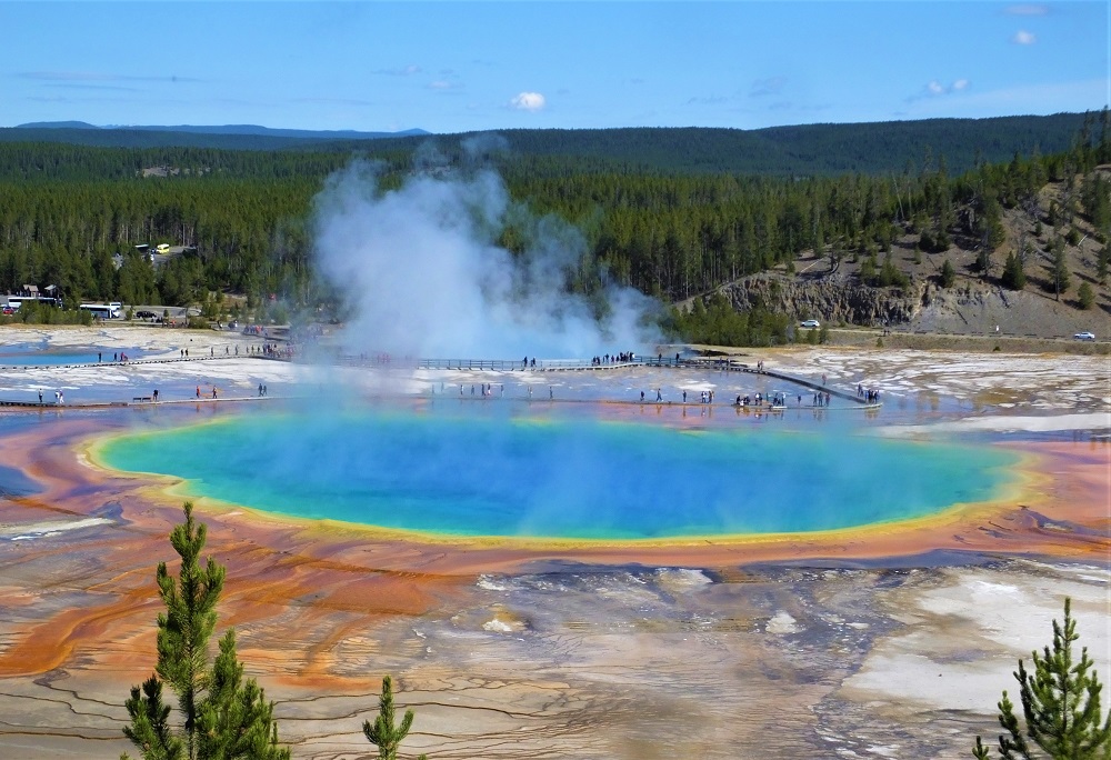
The next morning we drove to the west side of Yellowstone to hike the Grand Prismatic Overlook Trail. Parking at the trailhead was very crowded and we shared the trail with many others as we hiked one mile to the overlook. We took our turn enjoying the view of the colorful spring.
Grand Prismatic Spring from Overlook
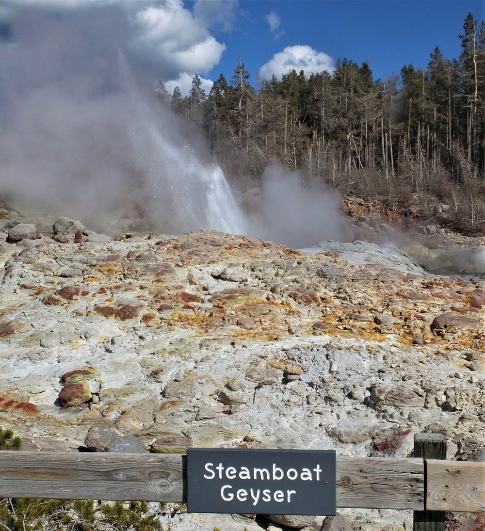
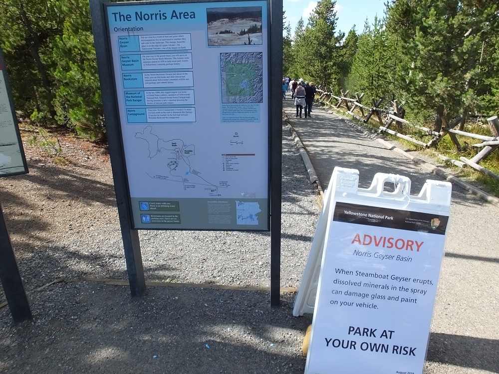
Later in the day we visited the Norris Geyser Basin to see Steamboat Geyser. Steamboat is the world’s tallest currently-active geyser and has been in an active phase since March 2018, with 71 eruptions through our visit in late September. The erupting geyser plume is more than 300 foot high and usually lasts between three and 40 minutes.
A worker at the adjacent National Park bookstore told us Steamboat eruptions were very load. “It roars like a locomotive,” he said.
Signs in the nearby parking lot warned vehicle paint could be damaged by fallout from the geyser. Some area workers even had covers on their cars.
The geyser did not erupt during our visit. We had to settle for spritzes of about 15-20 feet. Our truck was unaffected.
Little action at Steamboat GeyserWarning: Park at your Own Risk
After more than a week in the Teton/Yellowstone area, it was time to start heading home. We had a decision to make – head north to Montana and the Dakotas, or south to canyon country in Utah. We’ll let you know the outcome next week.
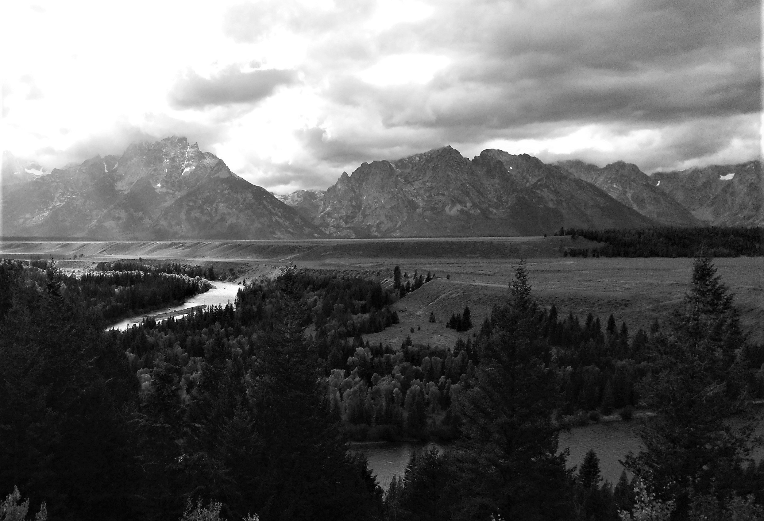
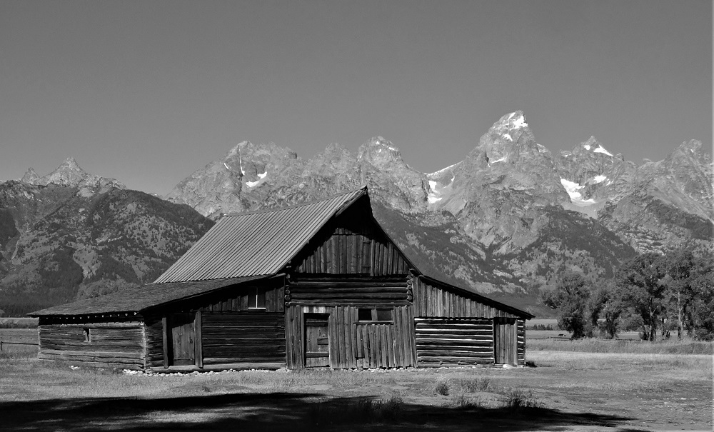
Tetons from Snake River OverlookT A Moulton Barn on Mormon Row
Some of the most stunning photographs of America’s national parks were taken by Ansel Adams. His most famous and remarkable photographs were taken in black and white, and include classic images of Half Dome in Yosemite and the Tetons from the Snake River Overlook.
Adams’ story is intriguing. He was not a successful student, suspected to be hyperactive and may have suffered from dyslexia. Early in his life piano was his intended profession, but a love of nature and association with the Sierra Club and several noted photographers led to a lifetime as a naturalist who captured wonderful and now iconic images.
His technical mastery of such creative photography was remarkable. He would spend eighteen or more hours per day for days and months on end mastering his craft. See Ansel Adams for more interesting details.
The beauty of the Tetons makes for excellent photographs. In the age of digital photography, one can do a reasonable job of capturing some of the same amazing elements made famous by Adams.
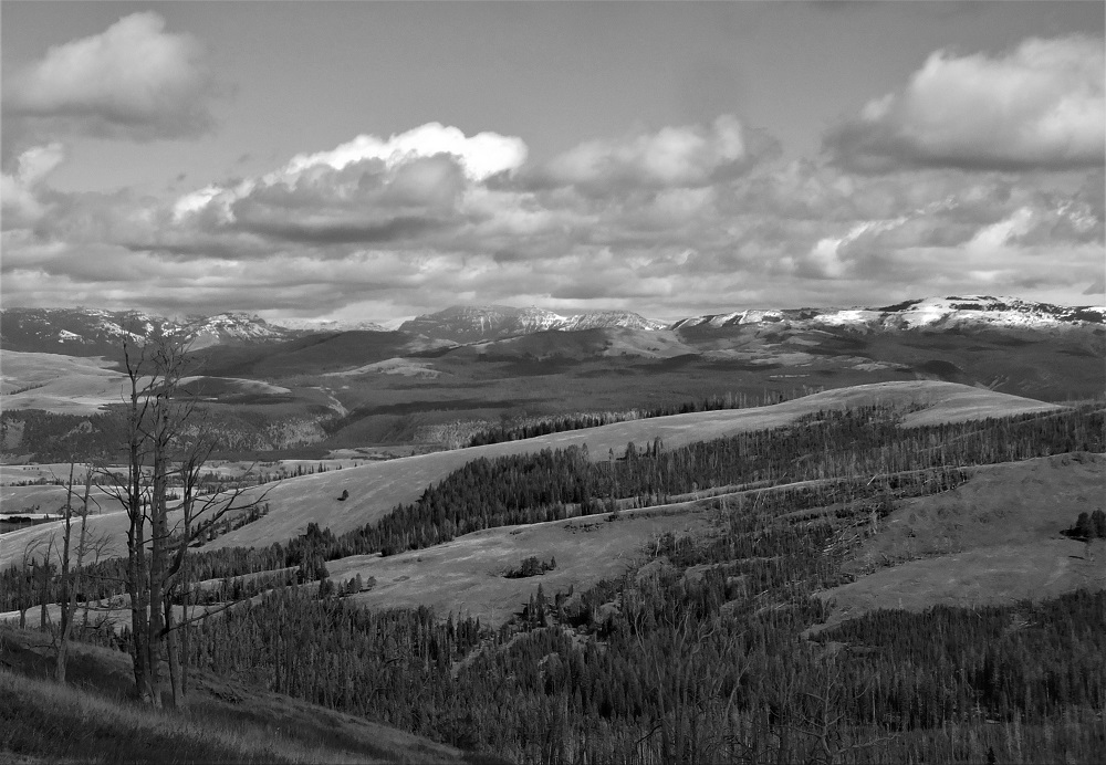
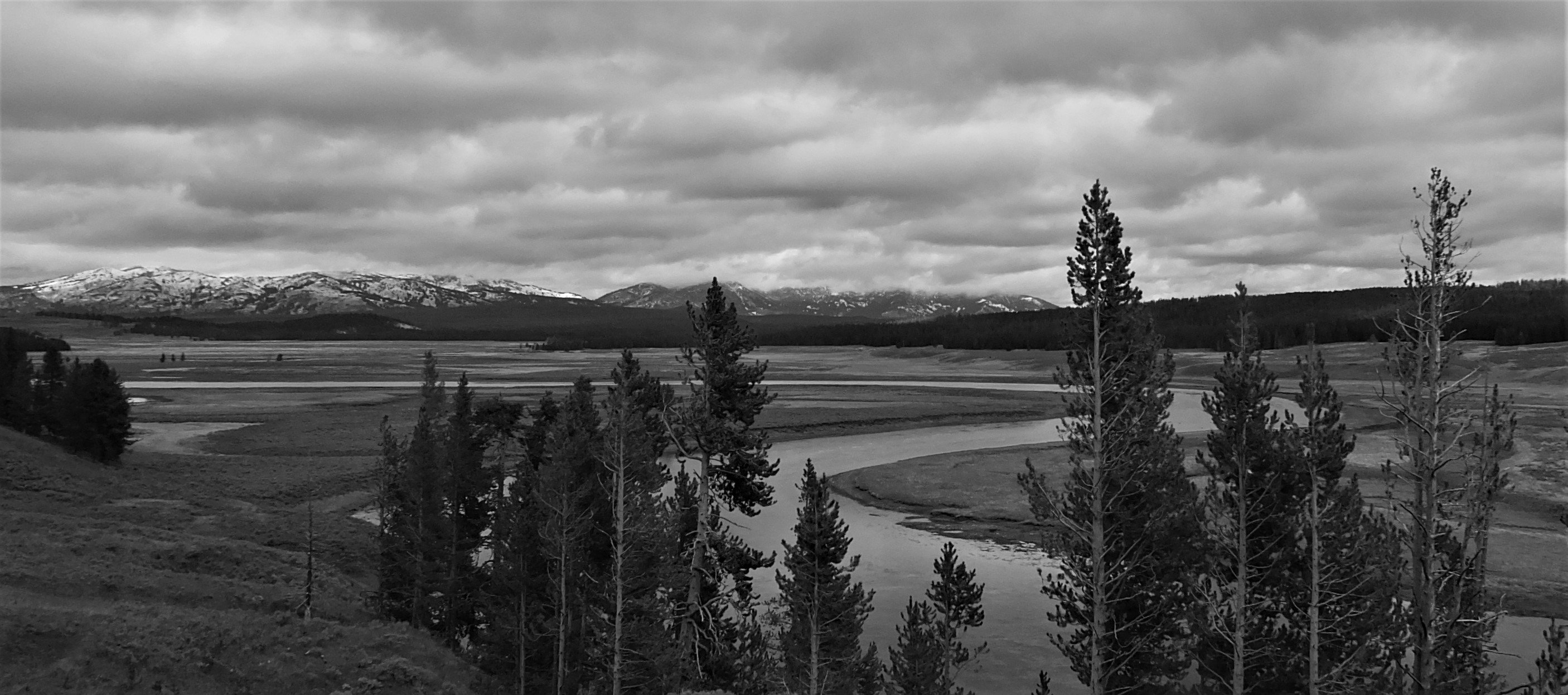
Gallatin Range from Dunraven Pass (Yellowstone NP)Yellowstone River in Hayden Valley (Yellowstone NP)
Next week – we head north from the Tetons to visit America’s and the world’s first national park – Yellowstone.
Despite our attempts to plan for and control everything, unexpected things happen. Familiar surroundings, familiar repair facilities and familiar hospitals and doctors at home help us deal with most unexpected events.
But when you are thousands of miles from home and the unexpected happens, it’s a different matter entirely.
Hidden FallsThe Rocky Trail
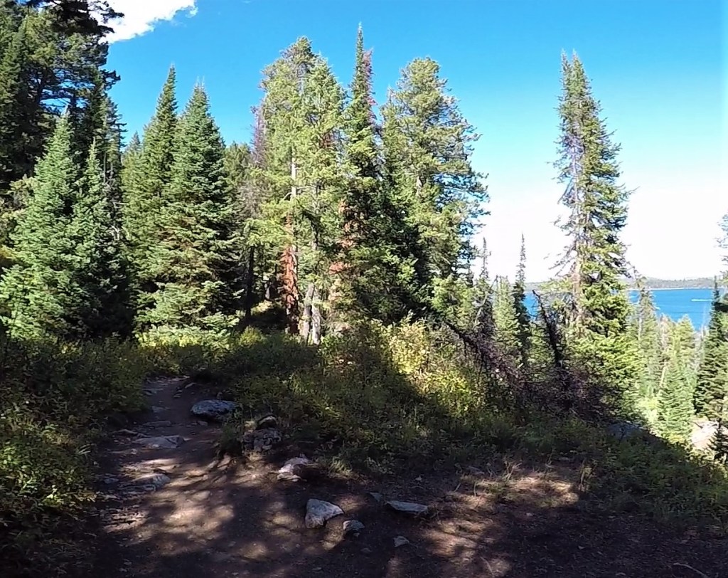
We were enjoying Grand Teton National Park after 11 days on the road. We hiked three miles above Jenny Lake to Hidden Falls and our plans were to take a boat back to where we started. But the last boat of the day was at 4 pm and we knew we could not make it time to catch the boat.
We viewed the falls for a few minutes and then started back up the trail, not looking forward to the 90-minute hike to the parking lot. The trail led up a steep slope for about a half mile, followed by a long descent to the parking lot.
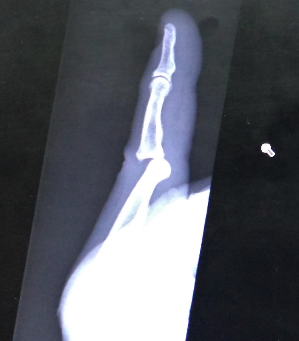
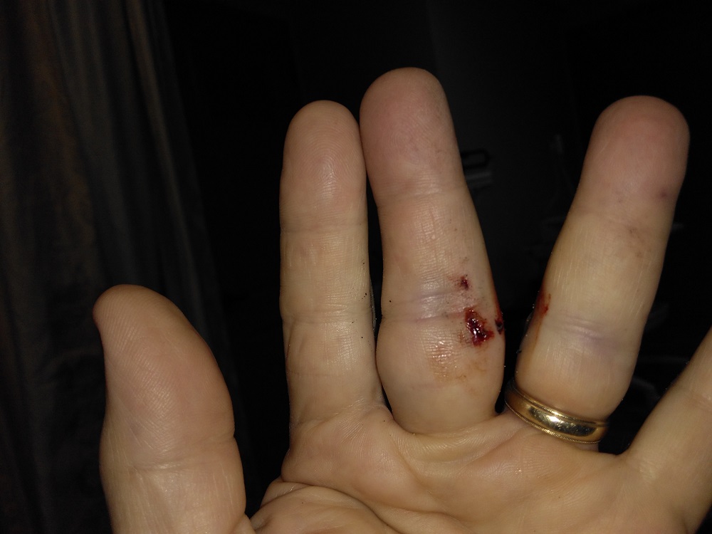
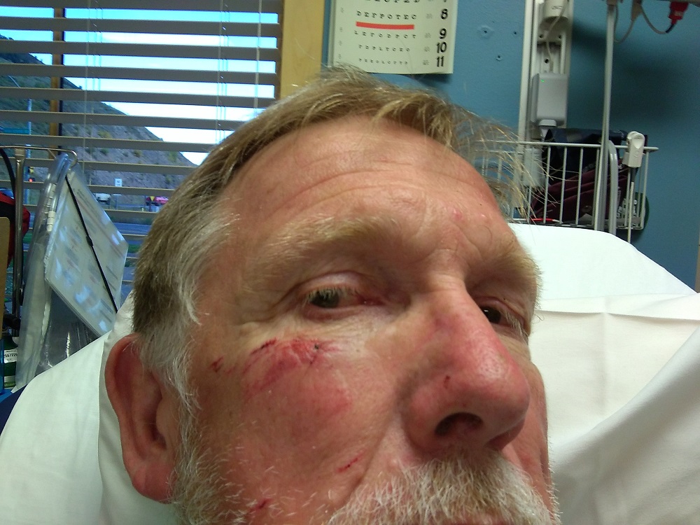
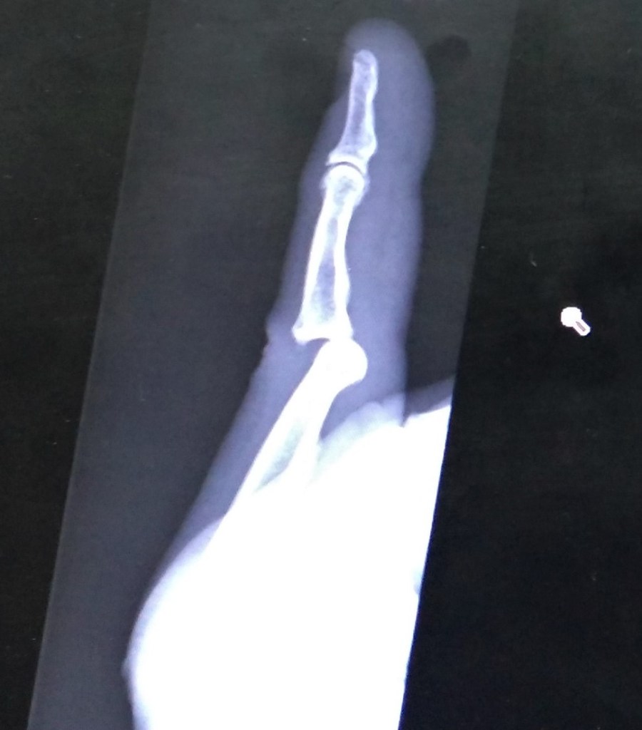
Then it happened. I caught my right foot on a rock and fell. Stumbling forward, I saw there was a drop off to the left side of the trail. With nothing to grab onto and not wanting to fall down the side, I tumbled to the ground trying to stop myself with my hands. My left hand jammed into a rock and my right cheek scraped along the ground.
Sprawled on the ground, I slowly tested various body parts to see if anything was hurt. Pat helped me up and I noticed the middle finger on my left hand was bulging at a peculiar angle. I touched my cheek and my fingers were covered with blood.
A hiker stopped and offered first aid tape to tape my throbbing fingers together. Pat dabbed the blood from my cheek with a wet handkerchief.
As we hiked the trail to the parking lot, Pat and I discussed my injuries. We decided I would have to visit a medical facility to have my finger and cheek looked at.
Ouch 1Ouch 2
Back at our truck, we learned the clinic in the park closed at 5 pm. So Pat began the 15 mile drive to Jackson, the nearest town. We called our insurance provider and found out there was an urgent care facility in town, but it also closed at 5 pm. So we headed to the emergency room at St Johns Medical Center.
We arrived a bit past 6:30 pm and anticipating high ER charges, I asked the receptionist if there were any other urgent care clinics in town. There was one across town affiliated with the hospital, but it closed at 7 pm.
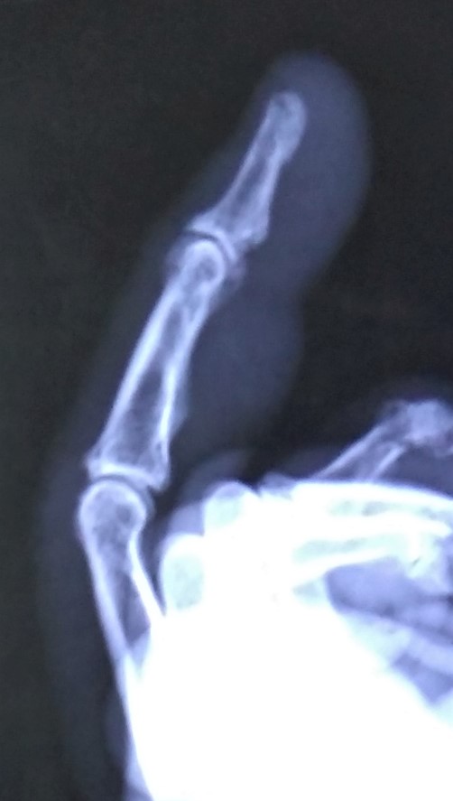
We made it to the clinic a little past 6:45 pm. An x-ray of my finger revealed it was dislocated. I was glad I did not need stitches for my cheek injury.
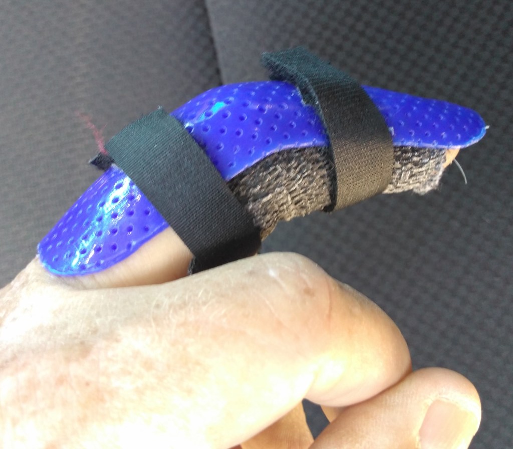
After trying twice to reset my finger, they splinted it, told me to keep it iced and made an appointment at Teton Orthopedic the next day for further treatment.
The next morning I was told the hand specialist at Teton Orthopedic had the day off. However, when she saw the x-ray, she made a special trip to the office. She was able to pop it in place to my immediate relief! I was then sent to get a more permanent splint. Shortly after noon we were finished!
BeforeAfterSplinted and ready to go
Since retiring, this was our first significant unexpected medical issue. We had several unexpected issues with our camper however during our 2018 Alaska trip – major repairs of the slide in Texas, a medicine cabinet falling off the wall along the Alaska Highway and bad wheel bearings just outside Haines, Alaska.
We realized things could have been MUCH worse in each situation – I could have been seriously injured in Grand Teton, the slide could have fallen out along the road in a remote area, or the camper could have required a long and expensive tow.
We have learned and re-learned several important lessons from the situations above:
We are under the watchful eye of loving God. To us, unexpected things happen. To Him, nothing is unexpected. Any situation can be used to glorify Him. We don’t always know why such things happen, but we know He is in control over everything. (Psalm 121:8 – The Lord will watch over your coming and going both now and forevermore)
There are many, many people who help in unexpected situations: a man with first aid tape along a trail, a worker at an auto parts store in Haines, Alaska who gave us the name of a repairman who fixed our camper bearings at the campsite for a reasonable price, a manager at Camping World near San Antonio who gave our camper repairs high priority. The list of helpful people goes on and on.
Being anxious about a situation (or anticipated situation) doesn’t help. Pat and I pray, discuss. seek advice from others and then trust as God guides us. (Philippians 4:6-7: Do not be anxious about anything, but in every situation, by prayer and petition, with thanksgiving, present your requests to God).
Unexpected things will continue to happen when we are at home and on the road. We are called to remember and often re-learn the lessons above. And, more often than not, we are taught new lessons as well.
Next week: so easy, even Ansel Adams could photograph it!
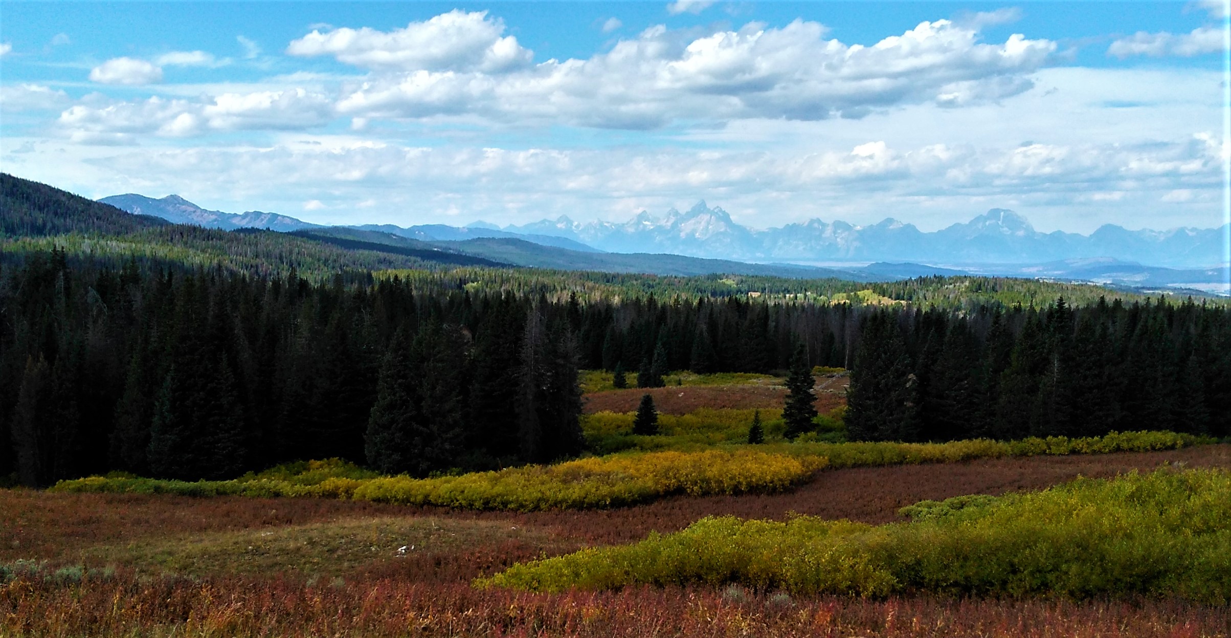
We headed west from Riverton (map point 8) anticipating our arrival at Grand Teton National Park. The road snaked upward between Absaroka mountain ranges and we approached Togwotee Pass at 9659 foot elevation. We crested the continental divide and pulled into a parking area.
Our first view of the Tetons.
It was our first view of the magnificent Tetons, some 30 miles to the west. Our travels had taken us more than 3000 miles over 11 days and the drive was worth it!
The Teton Range runs north-south for nearly 40 miles, with 10 peaks over 12000 feet. The tallest peak is Grand Teton at 13775 feet. What makes the range so spectacular is the view of the mountains from the relatively flat valley below – the range towers more than a mile above the valley in some areas!
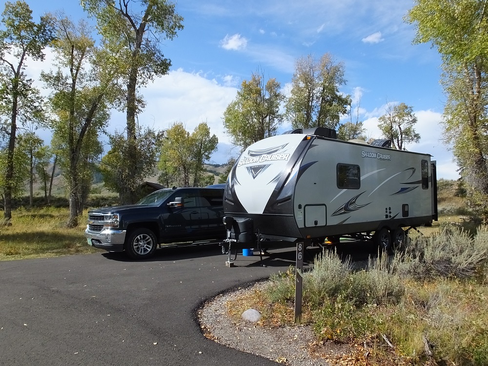
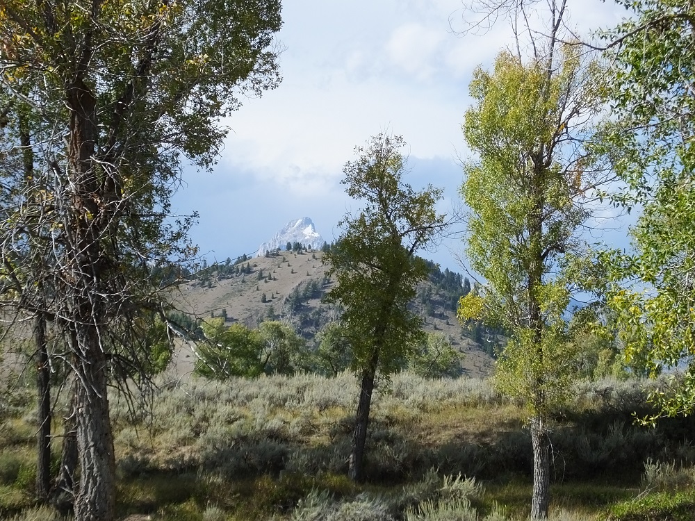
Our plans were to camp three nights at Gros Ventre Campground in Grand Teton National Park (map point 9). From our campsite, we could see the tips of some of the Tetons.
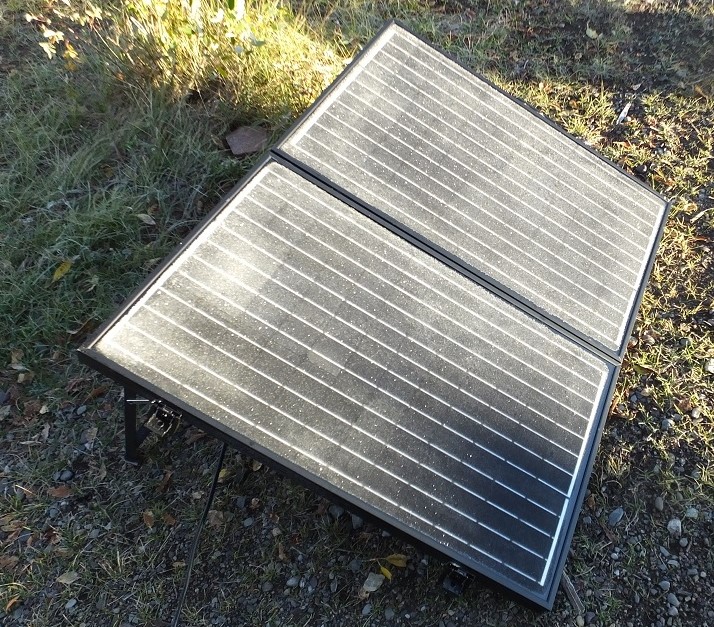
Gros Ventre camping, tips of Tetons behind our campsiteTeton view from campsiteFrosty solar panels
As in Alaska and Yellowstone, the weather can vary considerably each day – our first afternoon was cloudy and pleasant. It rained the next morning and began to clear in the afternoon. The third day started out nearly freezing and crystal clear. Because we were dry camping, we ran our generator the third morning to warm our camper and to charge the battery.
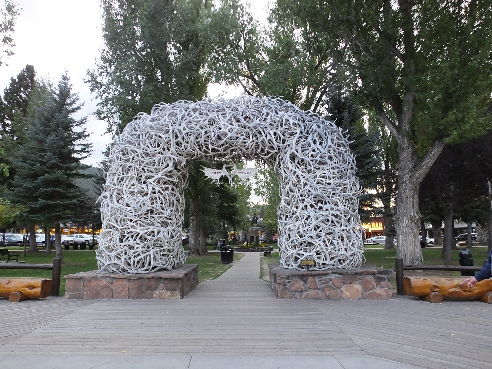
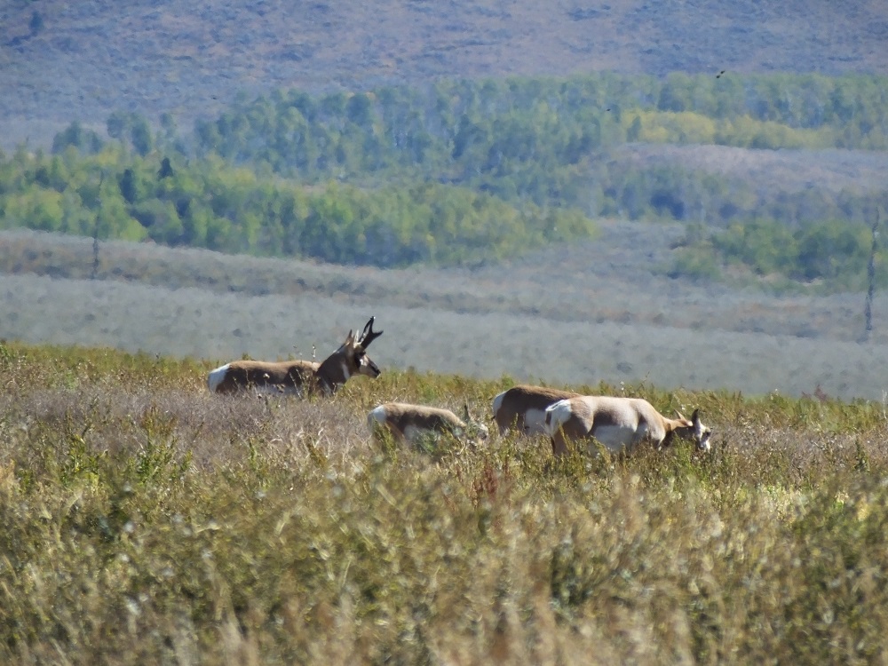
We made a trip into Jackson, a tourist town 15 miles to the south, to get gas and have dinner. In the center of town there is a large park with massive elkhorn arches at each corner entrance. We presume the antlers were collected at the National Elk Refuge not far out of town.
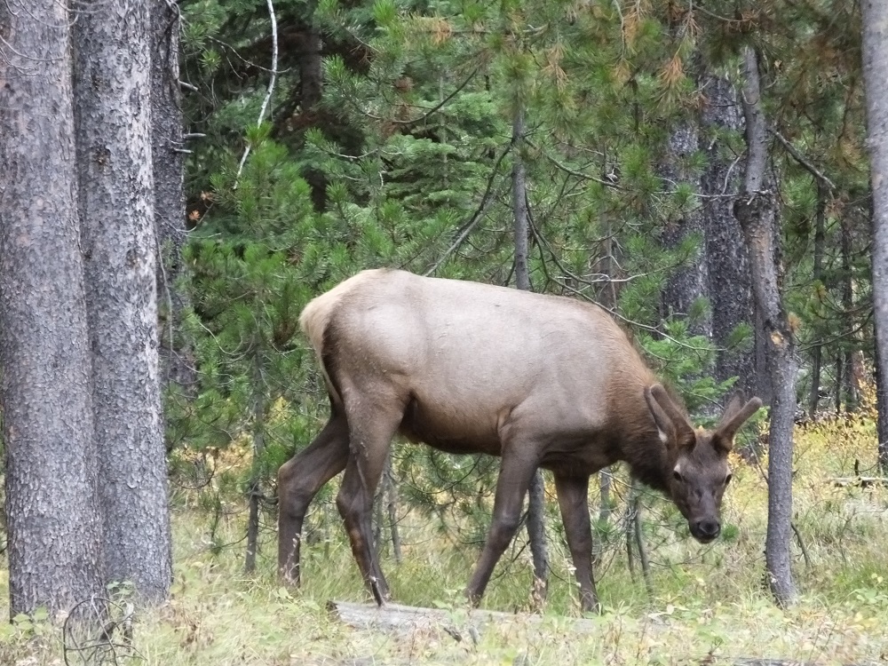
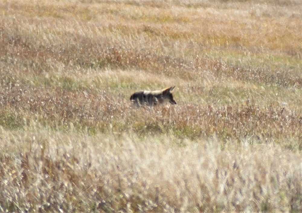
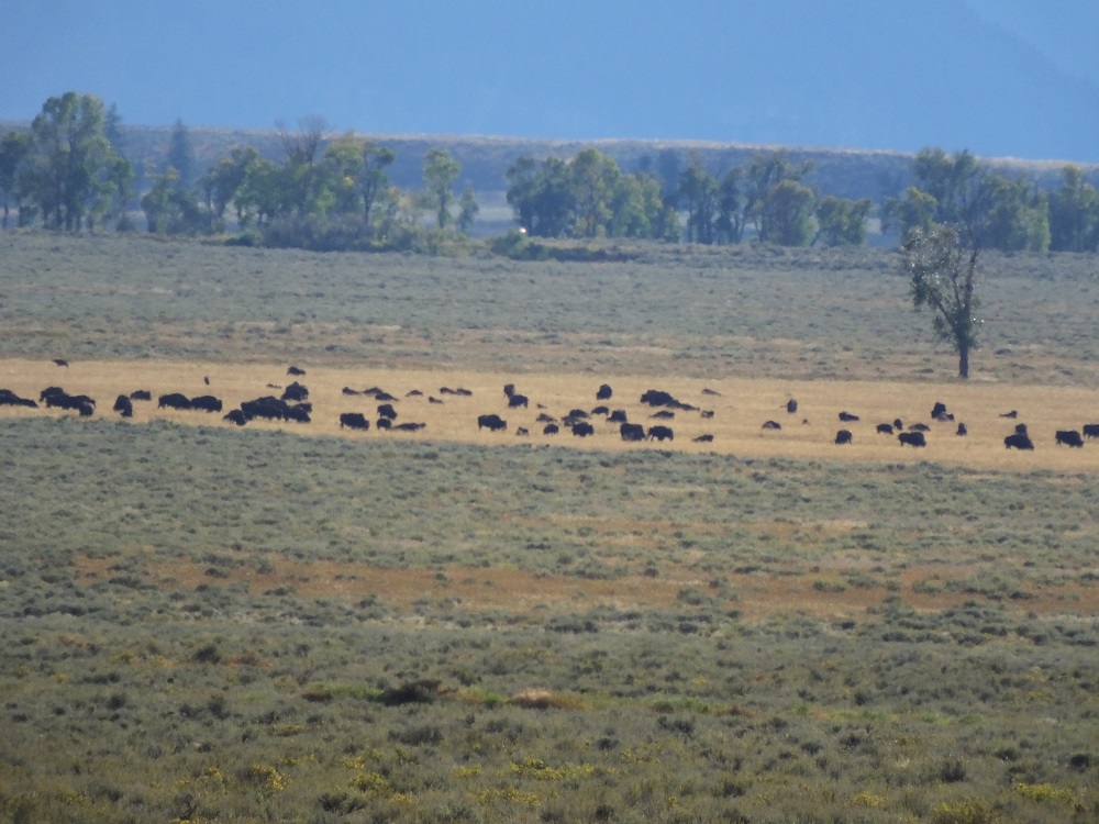
Elkhorn arches in JacksonElkCoyoteHerd of BuffaloPronghorn Altelope
We didn’t see elk herds in the refuge (wrong season), but did see various other animals in the park.
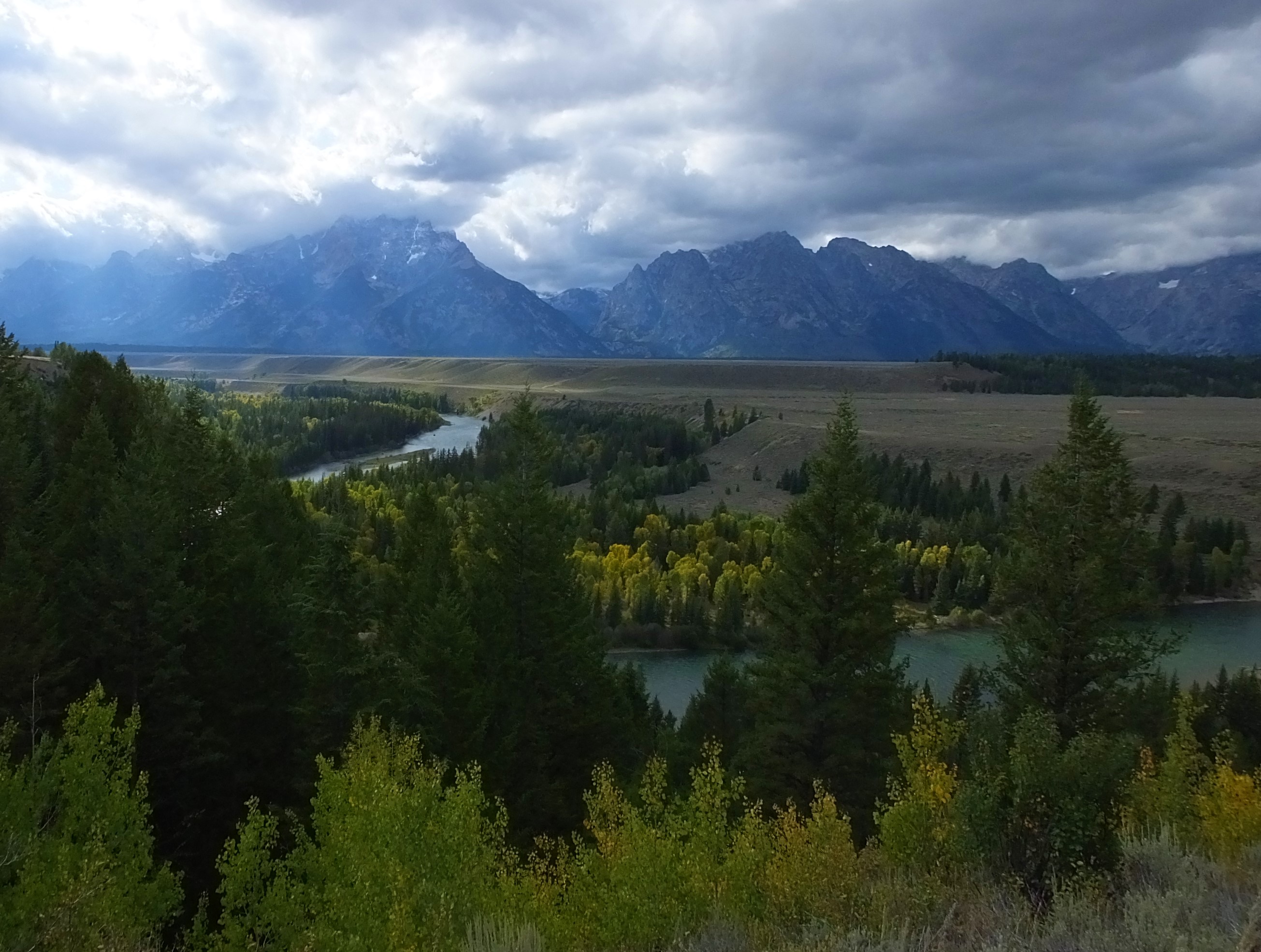
We dodged rain the next morning with stops at two visitor centers and a brief walk along the edge of Jenny Lake. After lunch in our truck as it drizzled, we drove a steep road to the top of Signal Mountain as the weather began to clear. We enjoyed the views of the Jackson Hole Valley, the Tetons and the large lakes at the foot of the Teton mountain range.
Snake River Overlook on a cloudy day
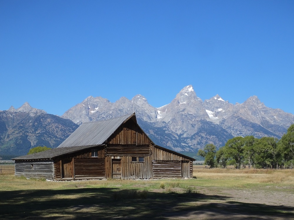
The next morning was clear. We took photos of the Tetons from the Snake River Overlook and from Mormon Row with several iconic barns in the foreground.
Snake River Overlook on a clear dayT A Moulton Barn on Mormon Row
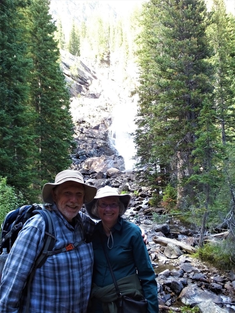
Later we hiked to Hidden Falls, following a three mile trail above Jenny Lake to a nice 200 foot waterfall. Little did we know something unexpected would change our plans as we hiked back to our starting point. More on that in the next blog update.
View of Jenny Lake and distant mountains from trailPhoto at Hidden Falls
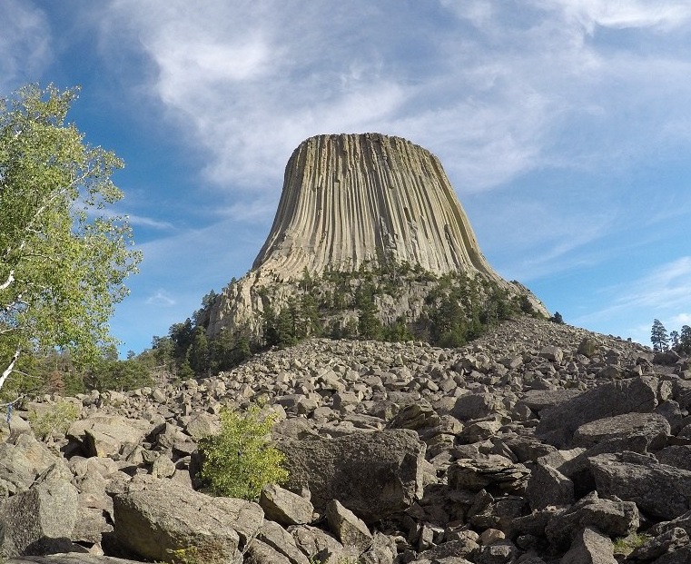
In northeastern Wyoming, an 867-foot stone formation rises up against the sky. Originally called Bear Lodge in a Kiowan Indian tribe legend, the formation became known as Devils Tower after an incorrect translation in 1875. The name stuck and Devils Tower was sensationalized by Hollywood in the 1977 movie Close Encounters of the Third Kind.
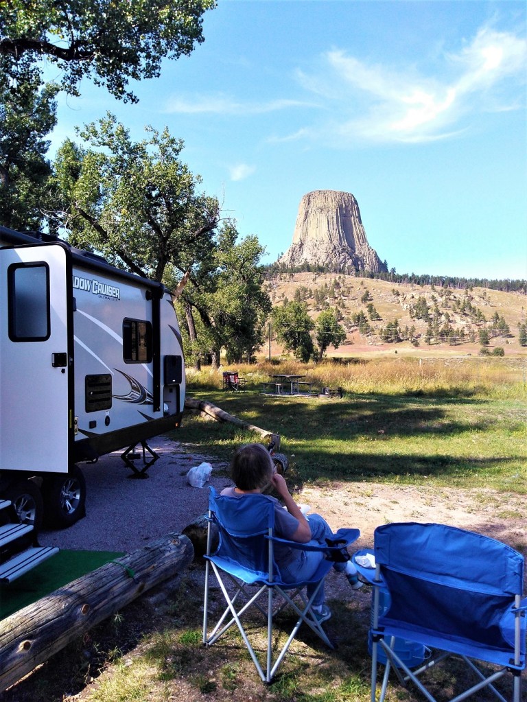
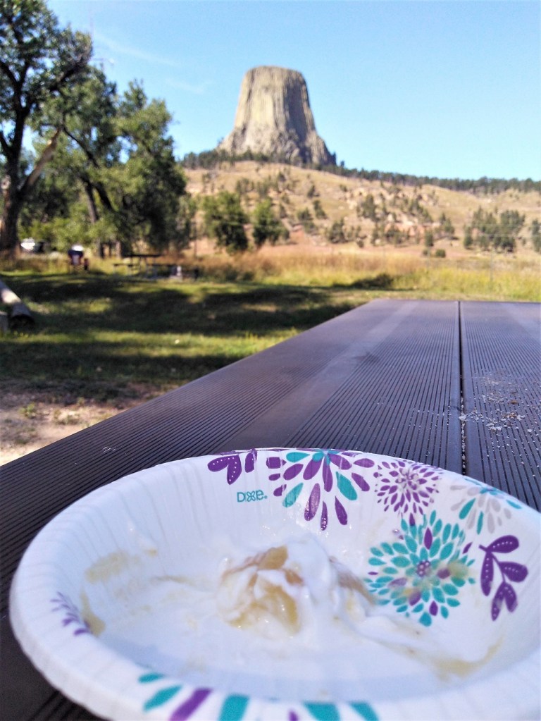
From our campsiteDidn’t have mashed potatoes – used yogurt and applesauce instead.
We camped close to the base of Devils Tower and after lunch, set out to encounter the tower via a 1.3 mile trail around the base.
Devils Tower
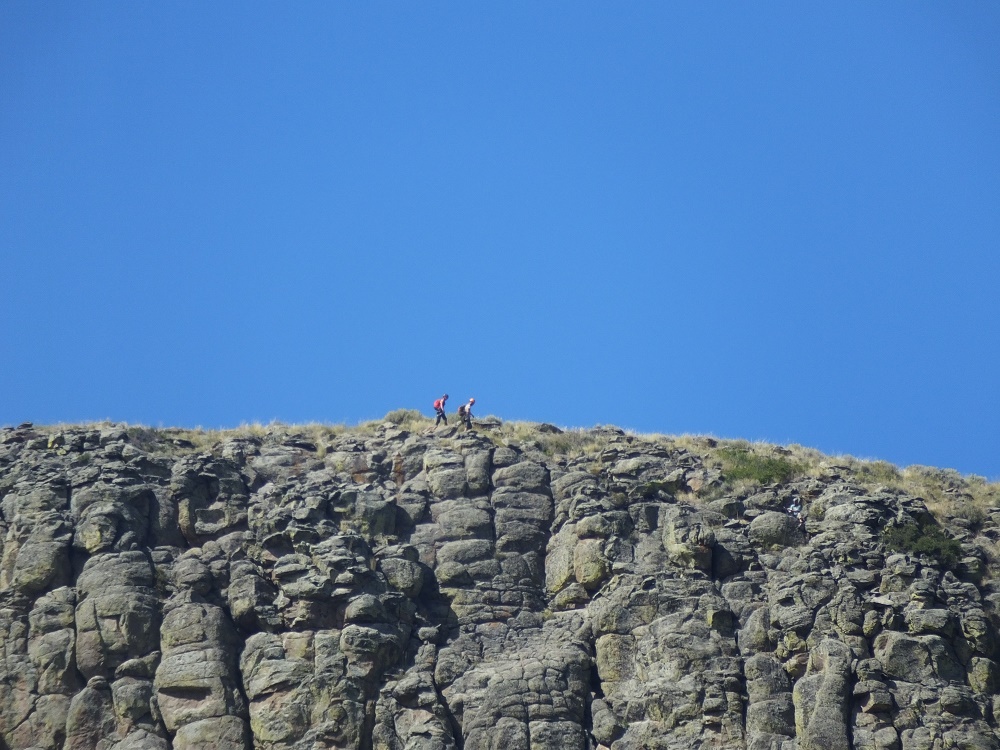
We saw the tower from every angle except the top. That is reserved for hearty climbers who brave their way up (and back down). Every year around 5000 climbers from all over the world climb one of over 220 routes to the top. We were quite content to enjoy Devils Tower from below.
Climbers on the topClimbing Devils Tower
Soon we would be enjoying views of much taller mountains above a broad Wyoming river valley in Grand Teton National Park.
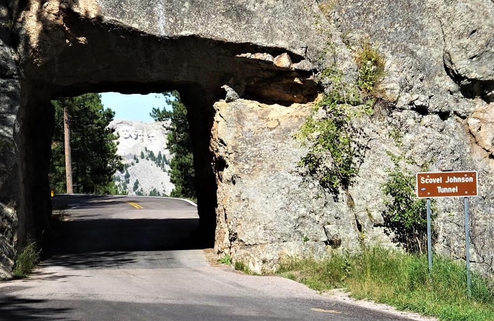
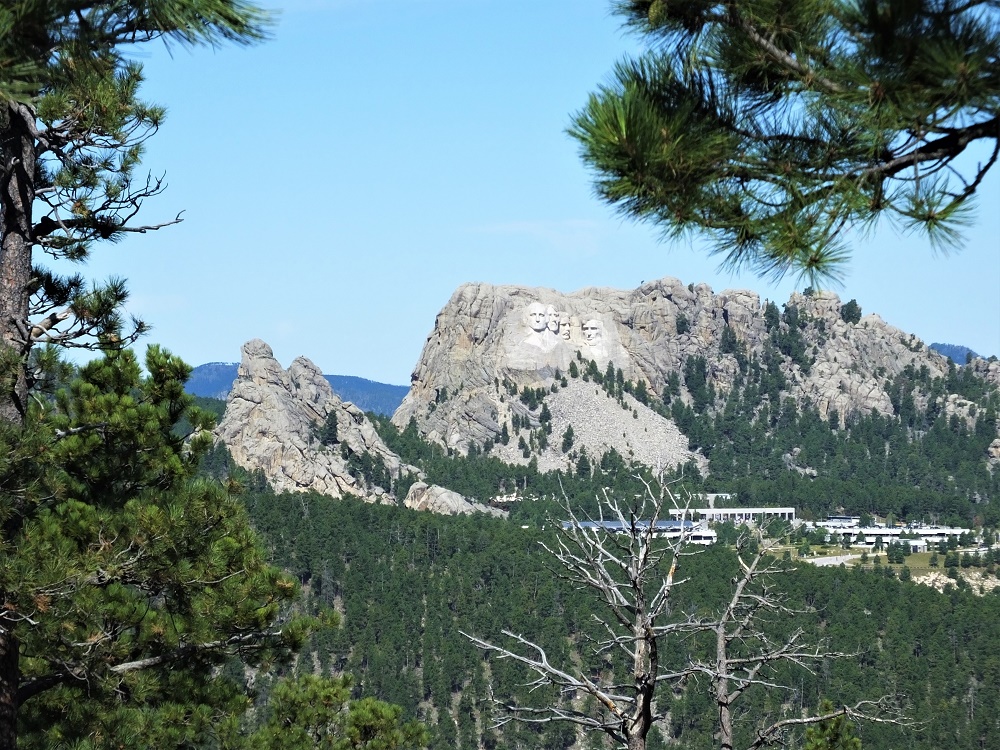
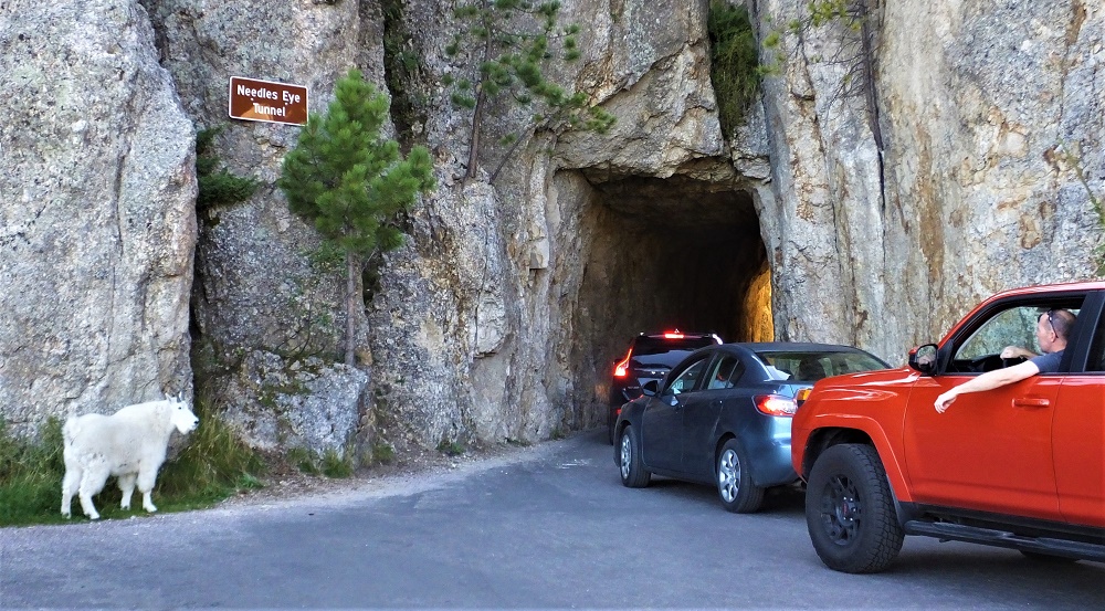
After enjoying the bison, burros, pronghorns and prairie dogs of Custer State Park, we decided to drive the Iron Mountain Road (US 16A) from Custer State Park to Mt. Rushmore National Monument the next morning. It took nearly an hour to drive the 20 mile road. Included were three single lane tunnels (e.g. very narrow and around 10 foot tall) and several pig tails, where the road makes a complete 360 degree loop under itself. Glad we weren’t towing our camper!
Mt. Rushmore is visible through tunnelDistant view of the memorial
When we drove through the first tunnel we realized Mt Rushmore was visible through the tunnel. We turned around and drove through it a second time to get the full impact and to take photos. The third tunnel has a similar view of Mt. Rushmore. Tip: it is better to drive the Iron Mountain Road from south to north for the Mt. Rushmore views.
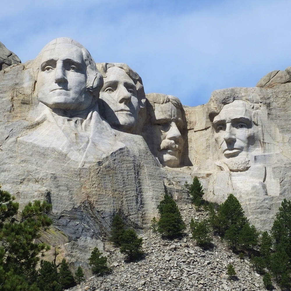
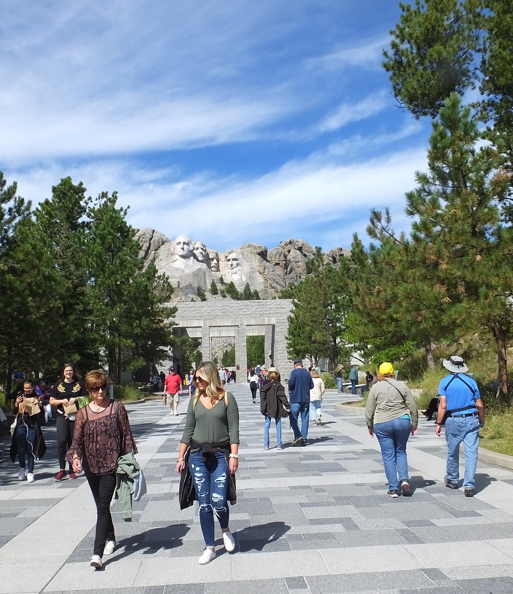
Mt. Rushmore
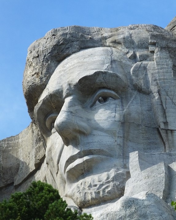
Although the previous day was overcast with occasional showers, we arrived at Mt Rushmore under crystal clear blue skies. The presidential views were awesome!
Courtyard in front of Mt. Rushmore
A large parking garage has been built just outside the entrance because lots of people visit the memorial, so finding a parking place was easy. From the entrance, a wide stone courtyard extends up to an amphitheater below the stone faces. There was construction on the front part of the courtyard so we were unable to walk only about halfway to the amphitheater. The views were fantastic nonetheless.
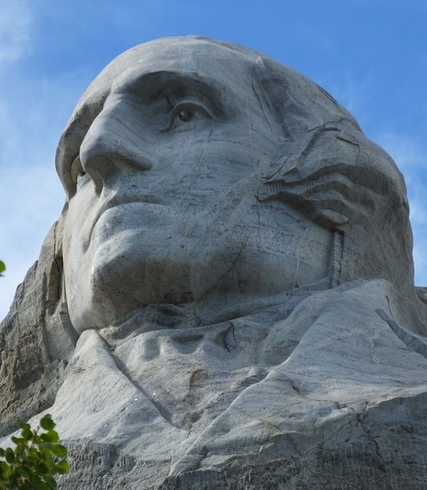
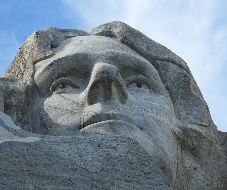
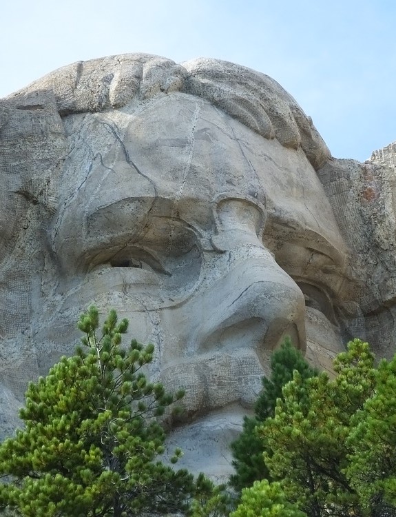
George WashingtonThomas JeffersonTeddy RooseveltAbraham Lincoln
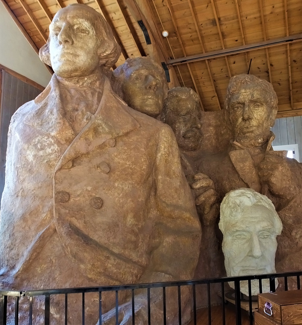
We also walked the trail that goes immediately under the sculptures. We climbed more than 200 stairs to get a special nosehair view of the presidents. As we returned we stopped by a studio that had the original sculpture from which Mt Rushmore was modeled.
Sculpture from which Mt. Rushmore was modeled
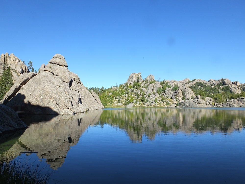
We left Mt Rushmore and reentered Custer State Park at the Sylvan Lake/Needles Highway Entrance. We hiked around Sylvan Lake, a tranquil lake at the top of the Black Hills, and then continued along the Needles Highway.
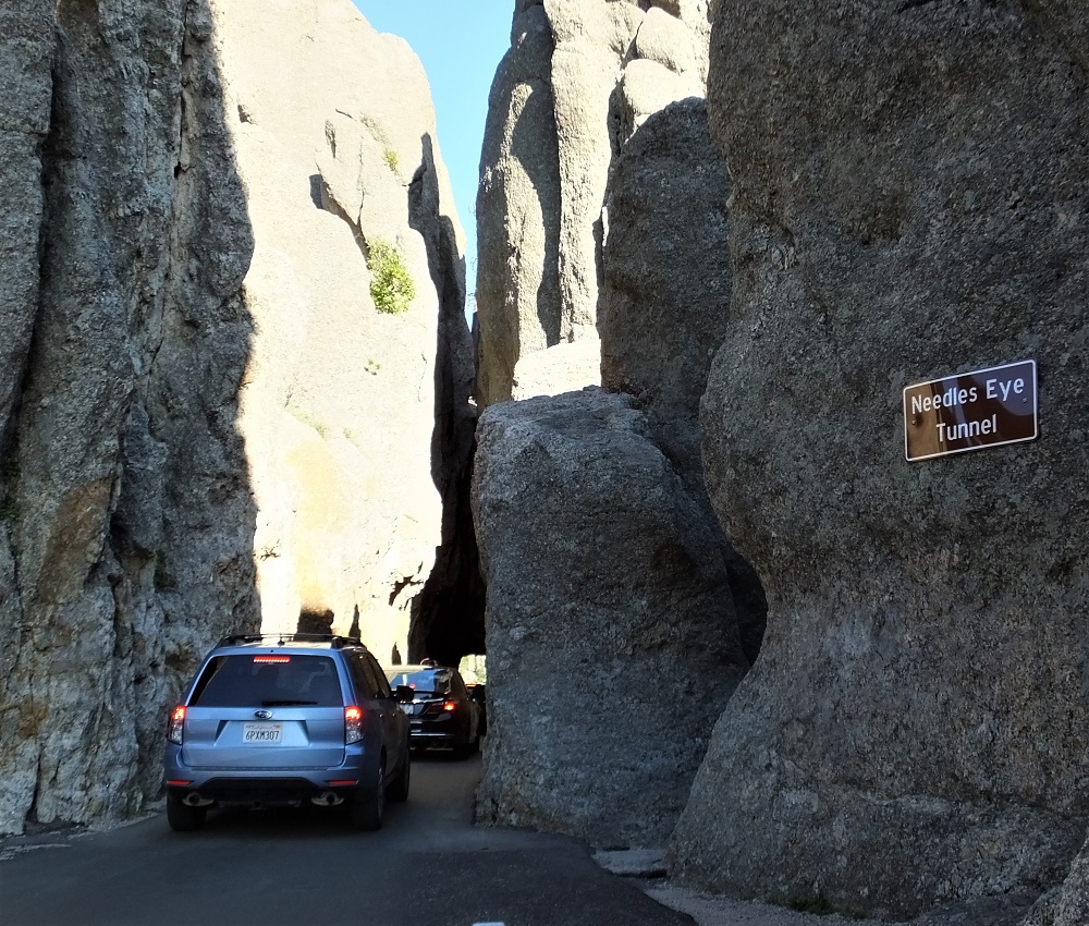
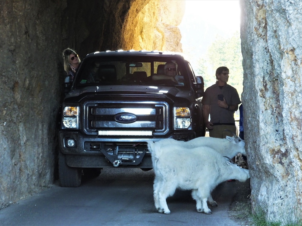
The highway makes its way through some stunning needle-like formations that culminate with a tricky drive through a very narrow (8.5 ft) tunnel. We had to fold in our truck side mirrors to avoid hitting the sides!
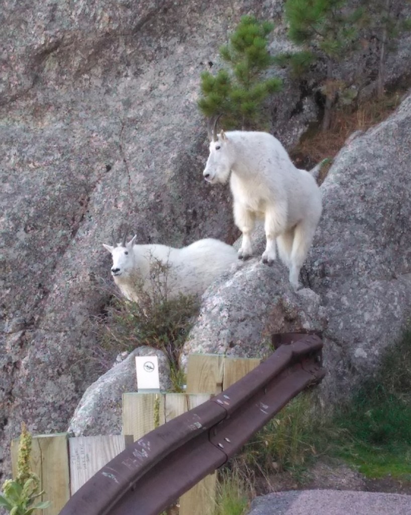
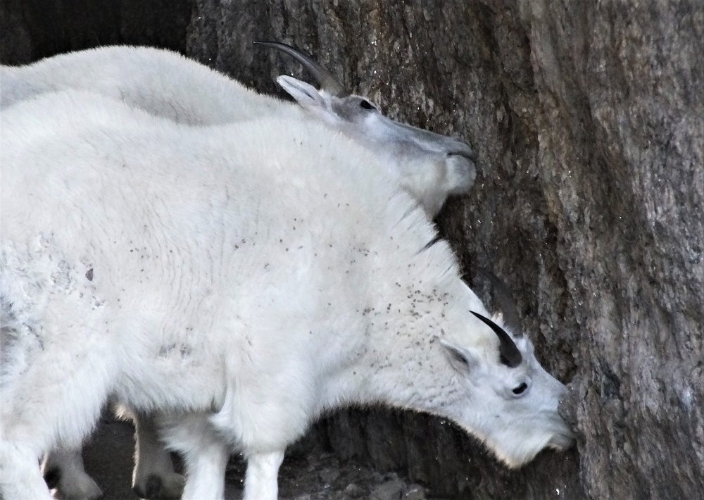
There were delays as cars drove through the tunnel – some more than 10 minutes. Our turn came and as we exited the other end of the tunnel we discovered the reason. There were two white mountain goats perched on a rock outside the end of the tunnel. During breaks in the traffic, the goats reentered the tunnel and began licking the minerals on the inside of the tunnel. Only after some assertive coaxing by drivers would they move and let cars pass!
Entering the narrow tunnelGoat sentries on the other sideWatching for a break in the trafficGoats blocking trafficCloseup – goats eating minerals from cave wall
We returned to our campsite and anticipated our drive the next day to the interesting formation made famous by the 1977 movie Close Encounters of the Third Kind.
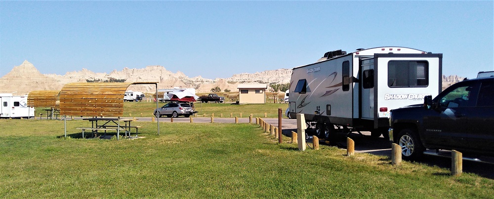
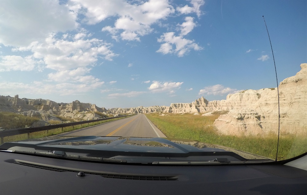
We left Omaha on Sunday, Sept. 8, and after a night on the road, arrived in Badlands National Park in South Dakota. The Badlands are known for unusual rock formations, fossils and wildlife.
We camped in Cedar Pass Campground, a very short distance from the base of the rugged Badlands rock formations. After a short drive we hiked the Window and Door trails. Each trail provided up close and personal views of the Badlands. The formations are kind of a cross between the Grand Canyon and the beach, although on a much smaller scale.
Camping on the edge of the formationsBadlands driveBadlands viewBadlands view
On the way back to camp, we hiked the Cliff Shelf Nature Trail. The trail was steep with several sets of stairs. We enjoyed early evening views of the formations and valley below.
We set out to drive the 60-mile Badlands Loop the next morning. The loop travels through the eastern part of the park, along I-90 to the town of Wall and then back through the park to our starting point.
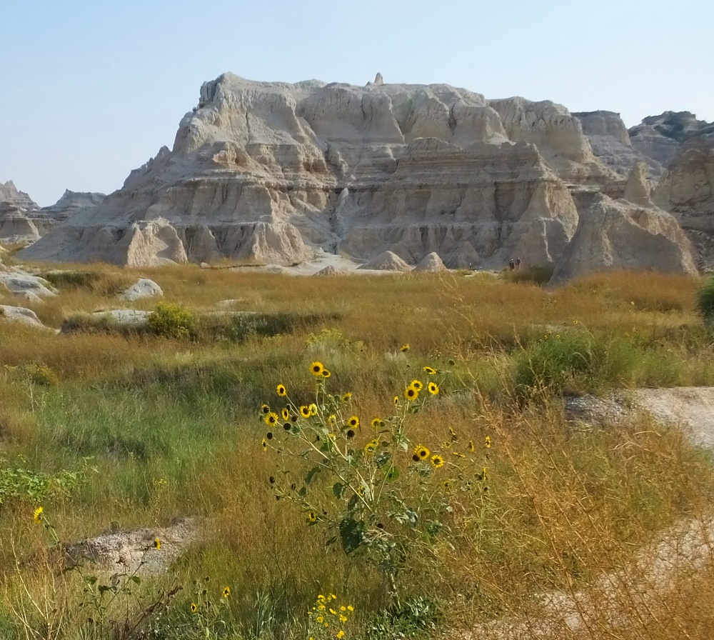
Notch trailClimbing the ladderTrail along the narrow ledgeNotch viewFossil
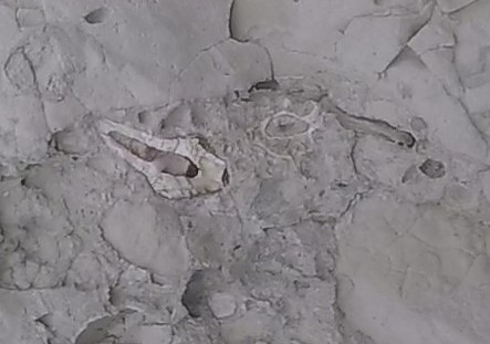
We stopped to hike the Notch trail. After a short distance, the trail continued up a 100-foot ladder and then along a narrow ledge trail to the ‘Notch.’ From the Notch, we saw a phenomenal view of the formations extending into the valley below. It was like a scene out of the move Dances with Wolves.
As we returned to the start of the trail, we discovered a large boulder containing a bird skull fossil. We finished the trail with a nervous climb back down the 100-foot ladder!
We continued the loop out of the park and upon reaching I-90, we toured the Minuteman Missile National Historic Site. During the Cold War, Minuteman nuclear bomb-tipped missiles were spread in remote locations across South Dakota and other western states. Many of the sites were decommissioned in the 1990s based on arms reduction treaties between US and Russia.
The museum provides a sobering reminder of the potential destructive power of such weapons. It is worth a visit if you are traveling in the area.
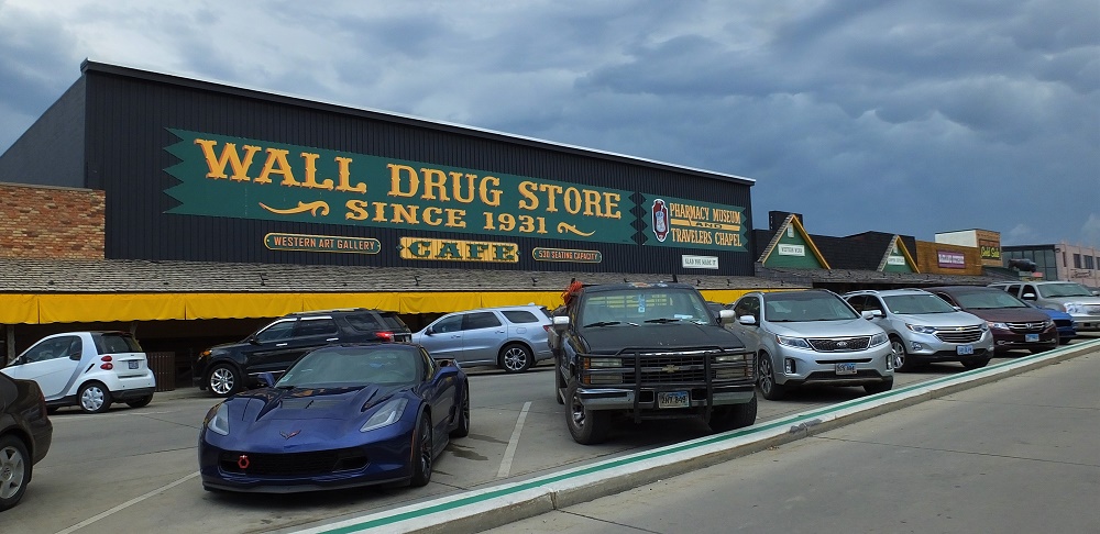
We then headed to Wall. Wall is made famous by hundreds of signs along I-90 telling about the many things available in the town. Wall Drug, the most well known place in town, has about every tourist souvenir imaginable, plus a large café offering 5 cent coffee and free ice water.
Wall is a South Dakota icon and an interesting stop on the way going east or west.
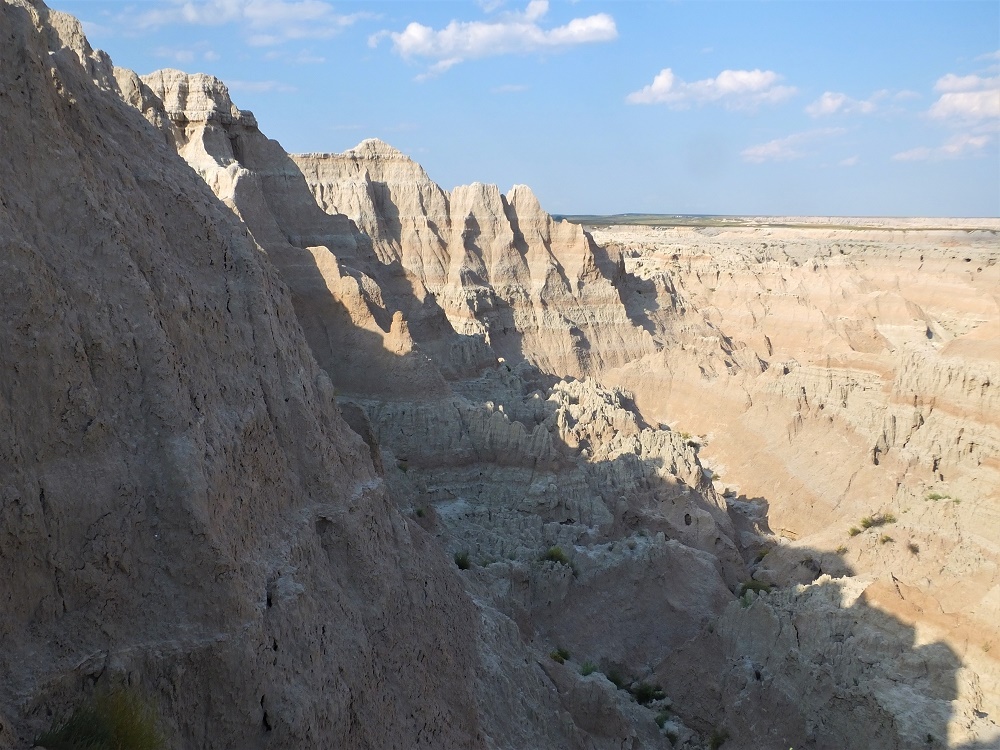
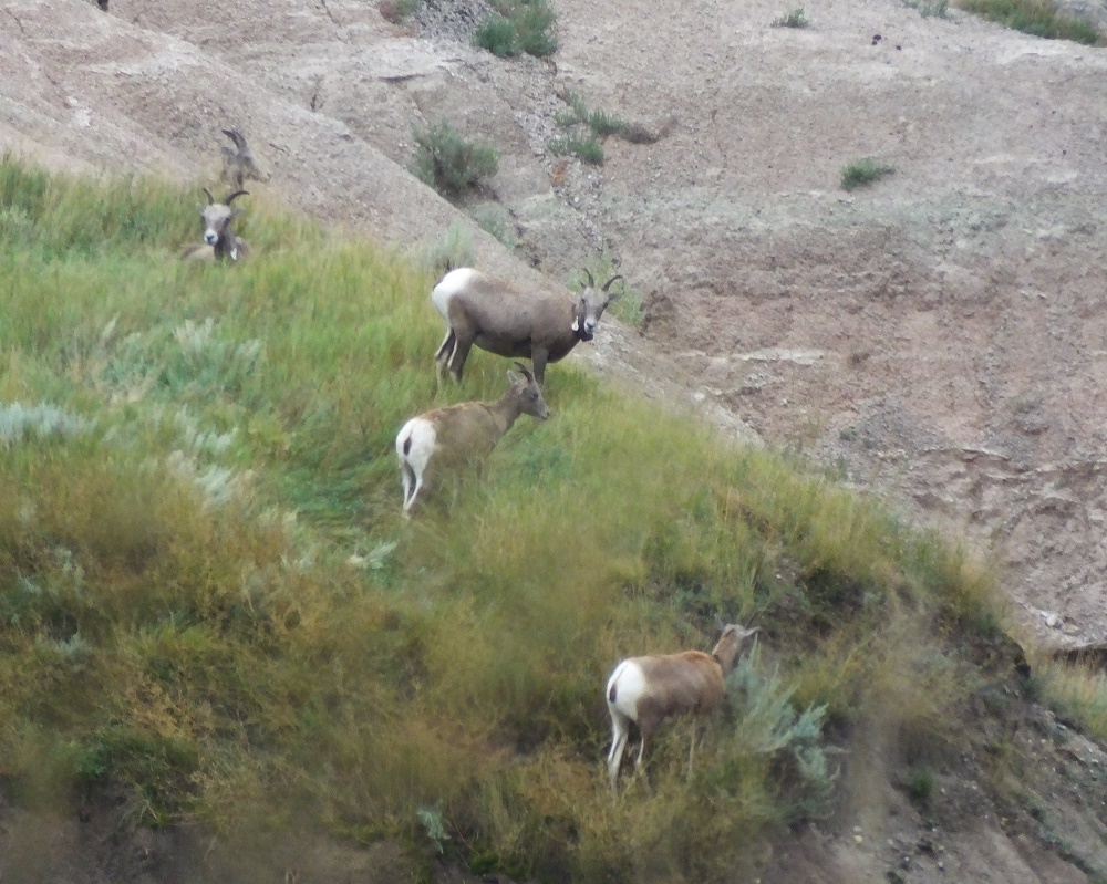
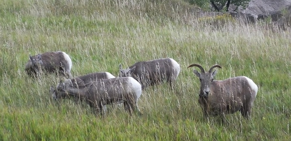
We reentered the west side of park and again saw views of the Badlands. Among the formations was a herd of Big Horn sheep and numerous bison.
Bighorn sheepBighorn sheep
The Badlands wildlife was a preview of our next destination, Custer State Park.
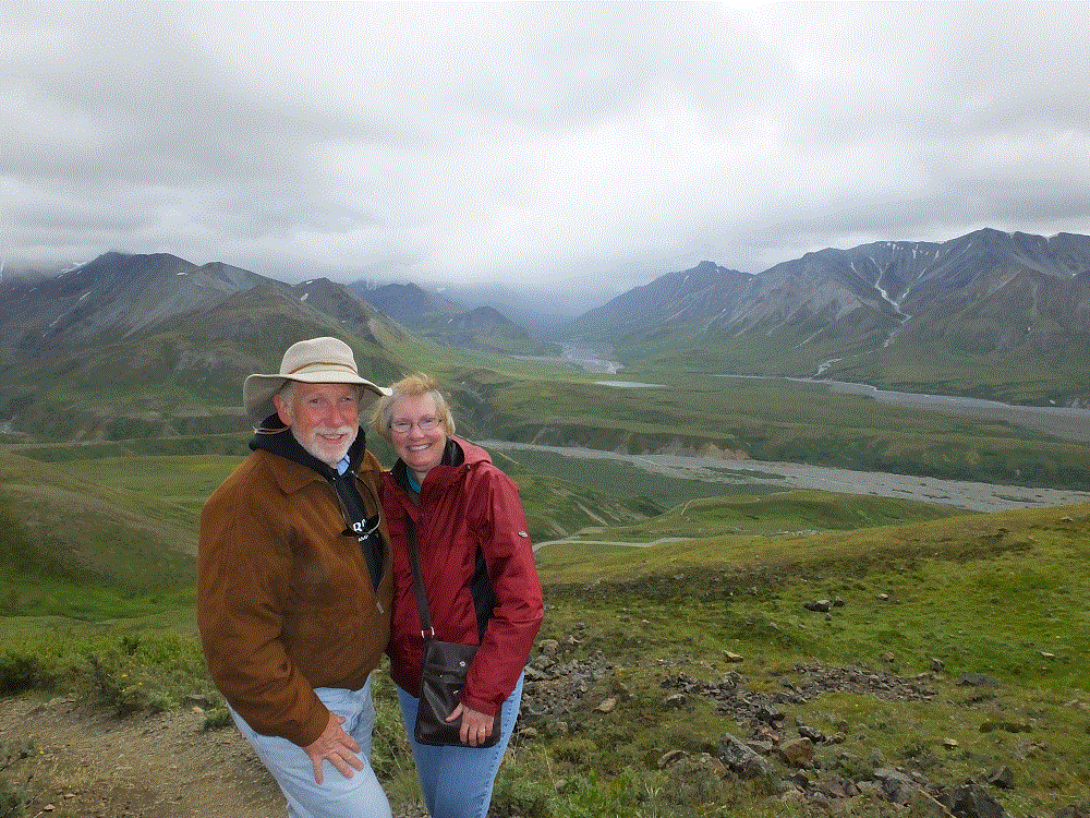
After the Glacier-Wildlife Cruise on Friday, August 10, Phil flew home late Saturday and Pat and I left Anchorage on Sunday morning. Our plans were to revisit Denali if the weather was good. We wanted to see some of the sights and hike several trails that we couldn’t during our first visit rainout.
We camped at Willow and Talkeetna on the way (RabbiTRAILS Alaska Map, pts #46 and #47) and arrived at Denali (map pt #45) on Wednesday, August 15. Campsites weren’t available in the park so we set up camp at a private campground six miles south of the park.
We checked the weather forecast for the next two days and decided to ride the park transit bus to the Eielson Visitor Center on Thursday. Eielson is about two-thirds of the way to Kantishna, at mile 66 of the 92-mile-long Denali Park road.
We were amazed at the mountain and valley vistas that were shrouded by rain and fog during our first visit. The unspoiled wilderness and immenseness of Denali is awesome. And to think, we only saw about 2% of the park!
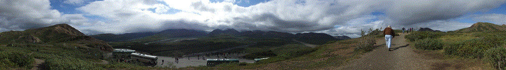
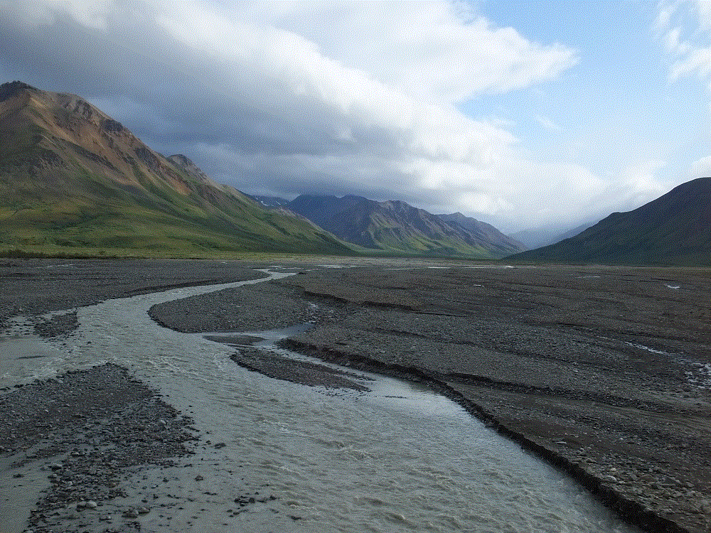
Panorama view from Polychrome PassToklat River flowing from distant mountains
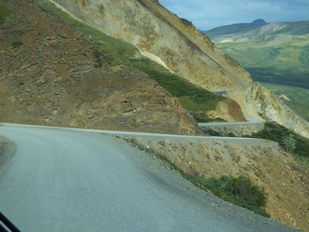
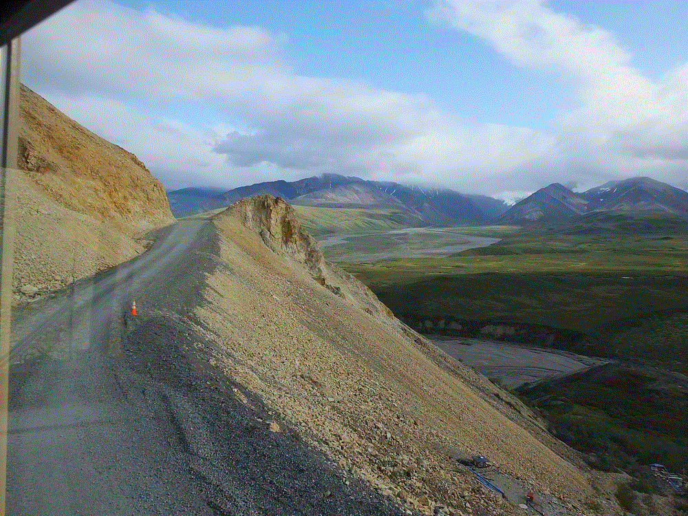
The park road crosses wide rivers and climbs steep mountains. Steep drop-offs along the narrow road that were hidden from us during our first bus trip were now clearly visible and a bit scary!
Zig-zag roadSteep dropoffs along the narrow road
At Eielson we hiked a short (.8 mile one way) but very steep (1000 ft elevation gain) trail to an alpine ridge overlooking the visitor center. The day was partly cloudy and the views were wonderful. Had the day been clear, we would have seen Denali.
Pausing for a photo on the Eielson Alpine Trail – great views but no Denali
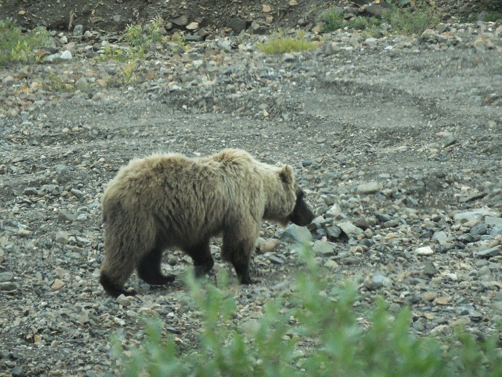
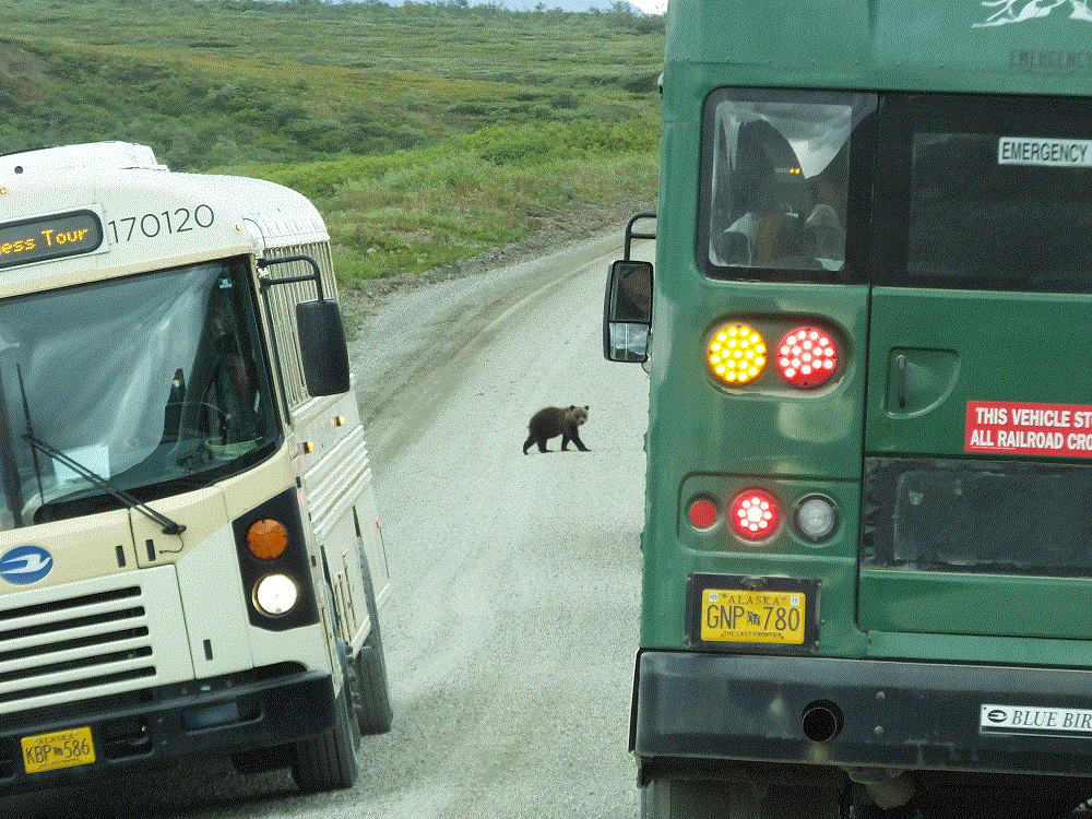
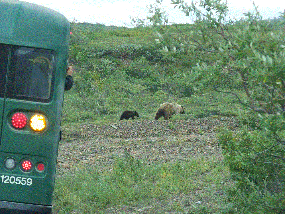
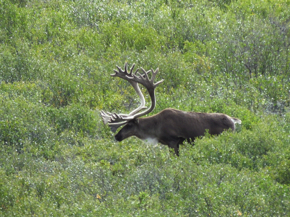
Like our previous trip we saw lots of animals, including a mother grizzly and cub that crossed the road right in front of several buses.
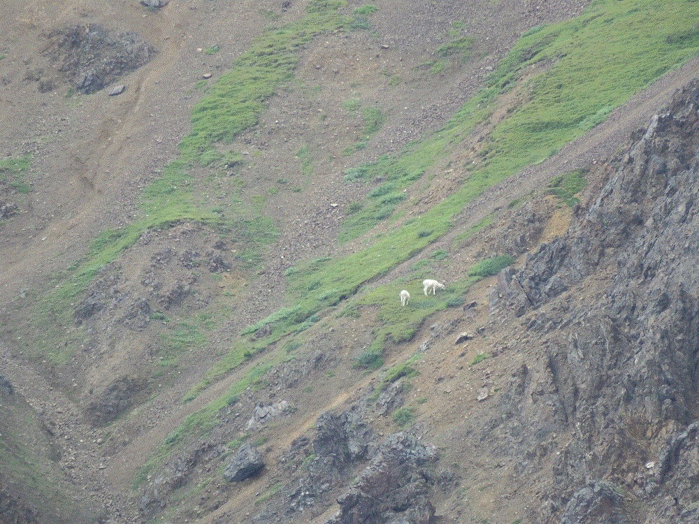
Momma griz getting ready to cross roadBaby griz crossing ahead of busesMomma and baby together againCaribou with amazing antlersDall Sheep on a distant mountainside
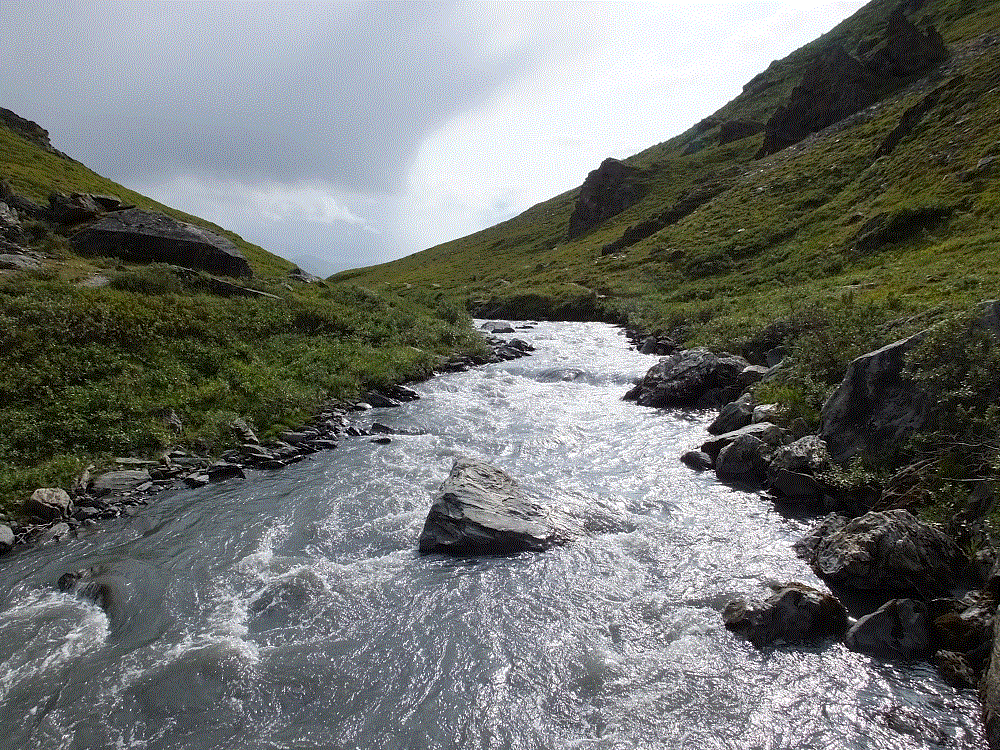
On Friday, we hiked a loop trail along the Savage River. It is one of the most beautiful hikes we have ever taken.
Savage River
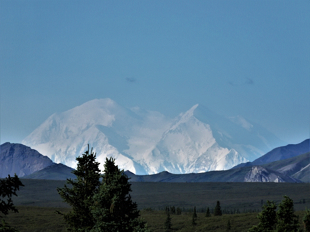
We broke camp on Saturday and prepared to leave for Fairbanks. The day was clear. Before we left the Denali area, we caught a spectacular glimpse of The Great One!