Mesa Nada

Featured
(2025 Balloons and Beyond Ep 12)

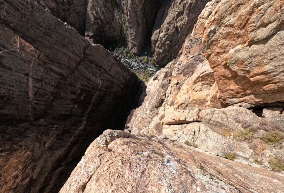
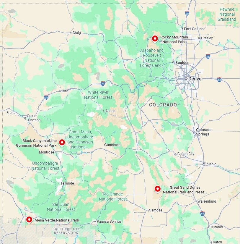
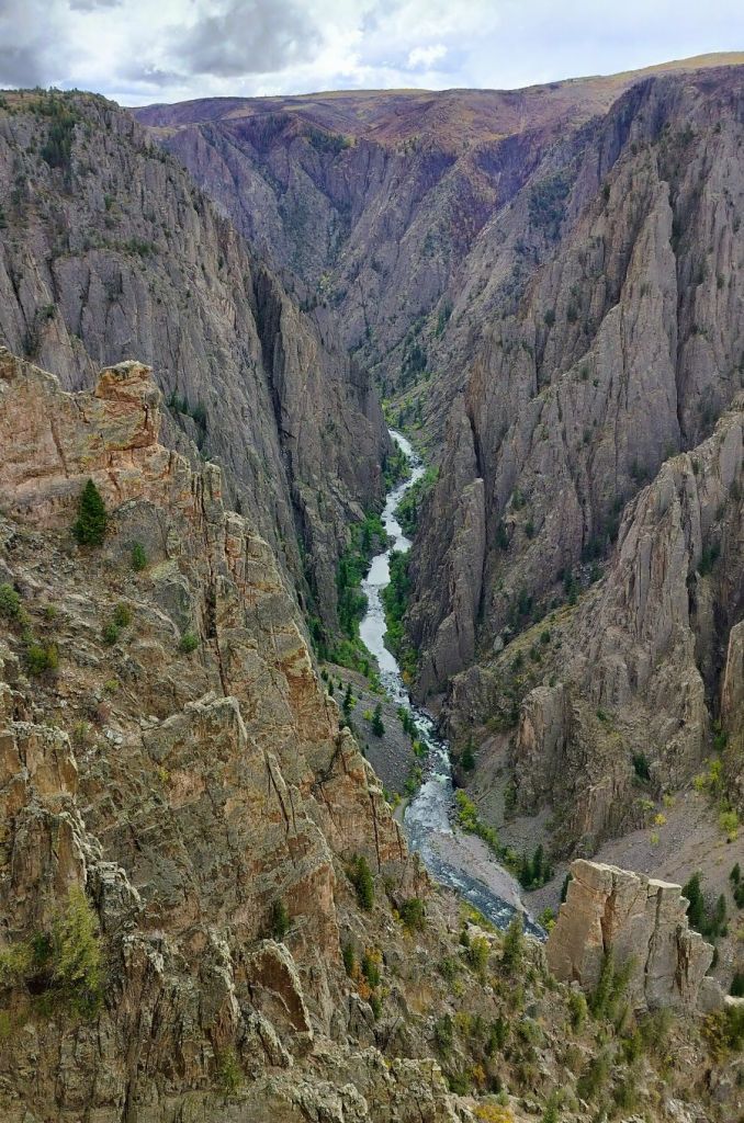
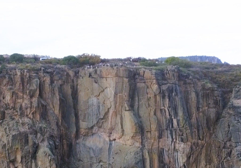
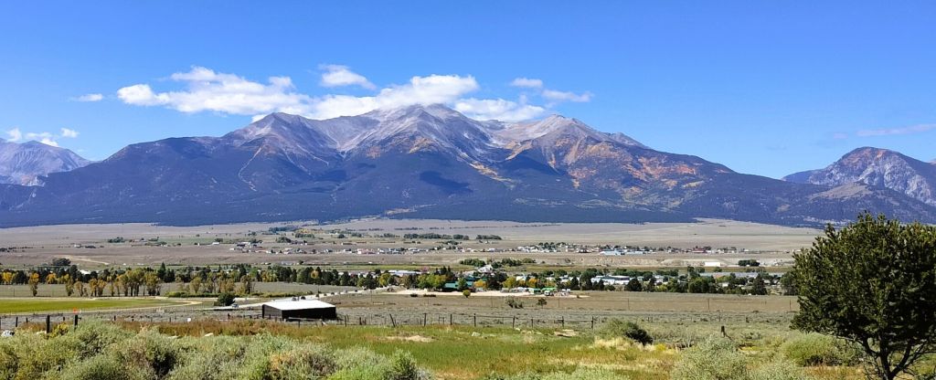
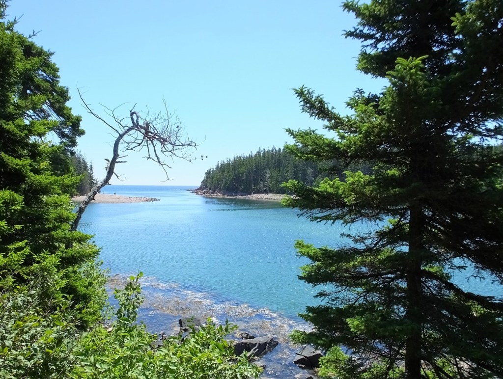
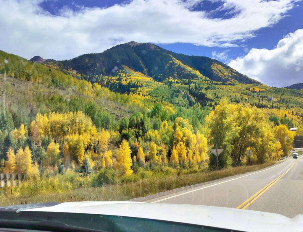
We left Black Canyon of the Gunnison bound for Mesa Verde, several hours away in southwest Colorado.  Our route took us near Telluride, a former mining town that is now a popular tourist destination and ski resort, and across several mountain passes, where the Rocky Mountain fall colors were on full display.

Rocky Mountain fall colors

Brief Reunion

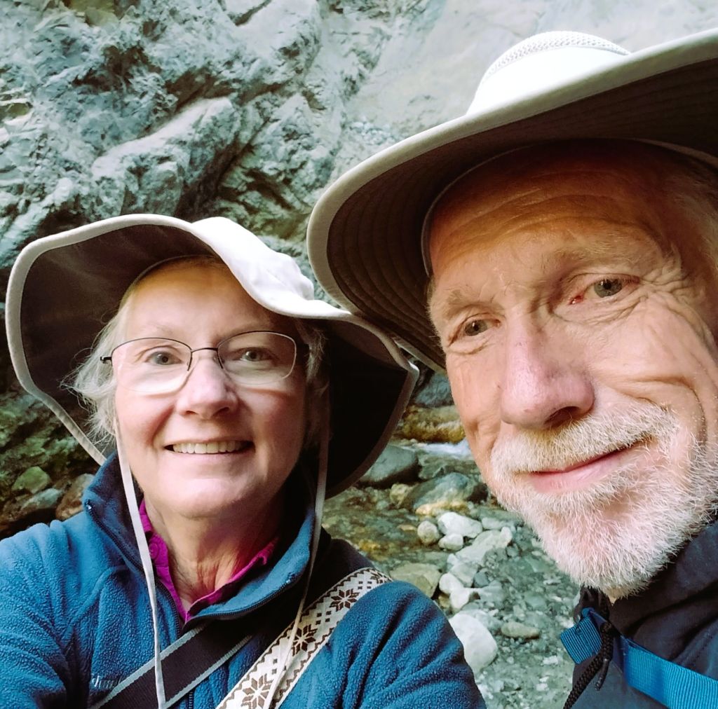
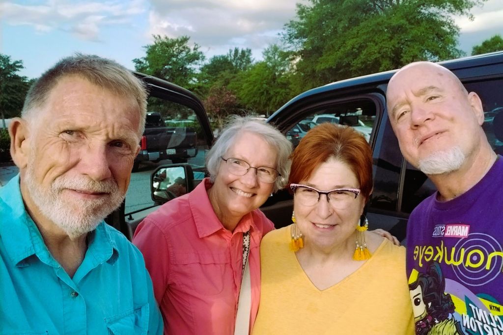
Pat’s brother, James, met us for the night near Cortez, CO.  We enjoyed dinner outdoors and compared our travel experiences since parting ways in Wyoming several weeks prior.  He was returning to Florida after traveling further west in Wyoming and Idaho.

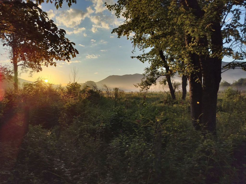
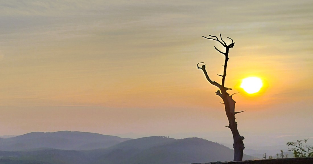
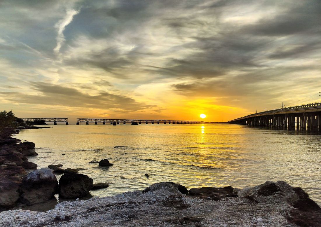
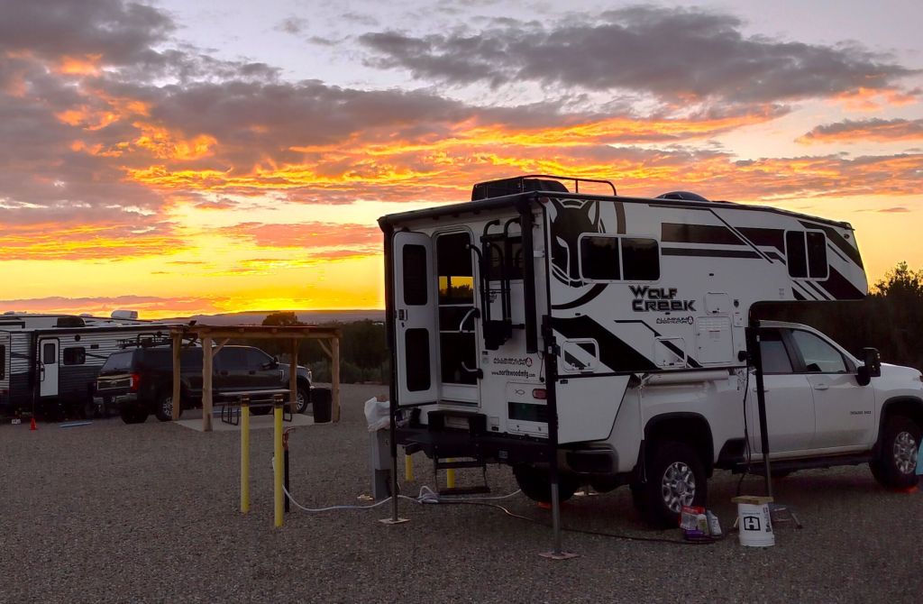
The day ended with a beautiful fiery sunset over the San Juan Mountains.
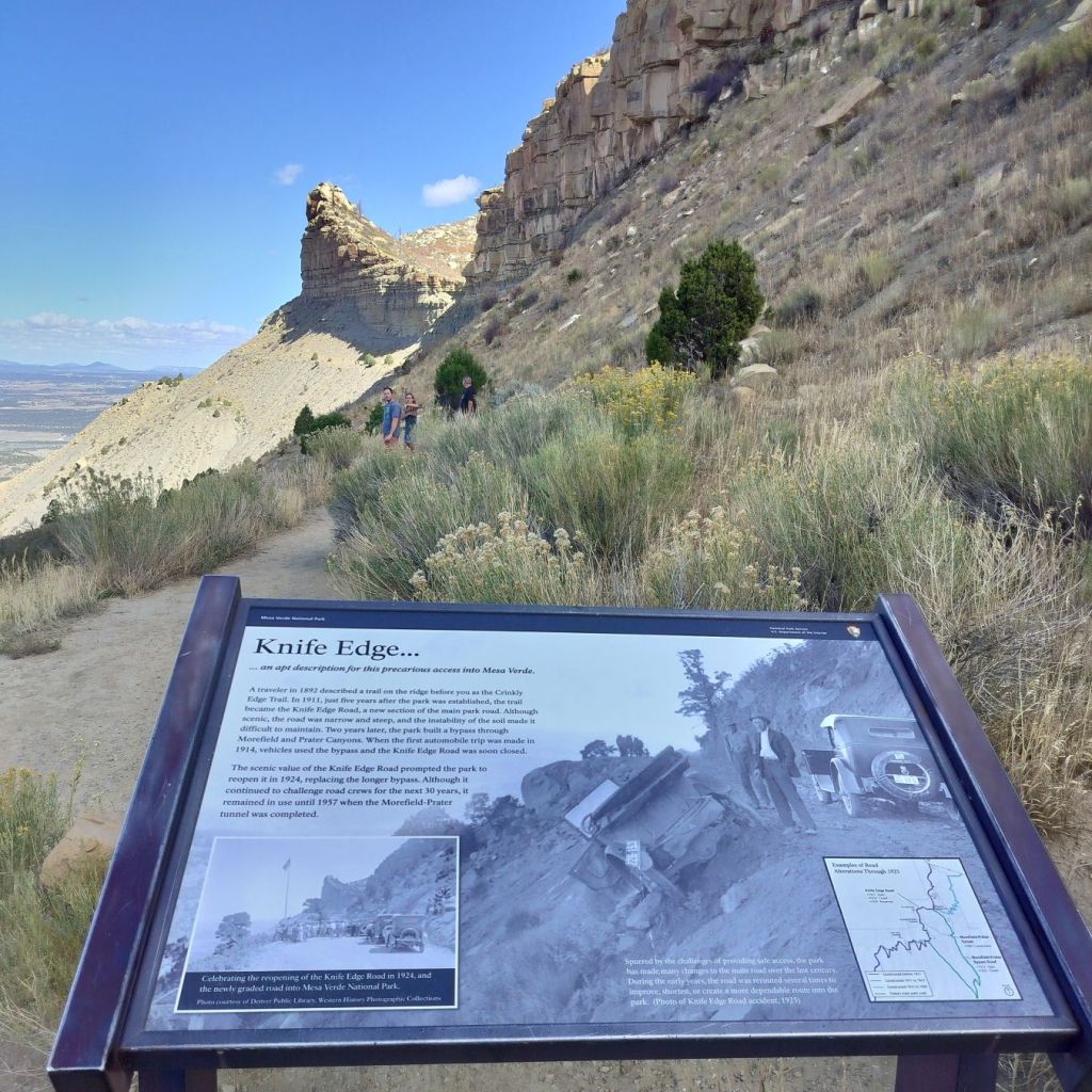
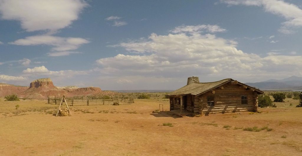
Pat’s brother, James, met us as he returned to Florida
Sunset near Cortez, CO

Green Table

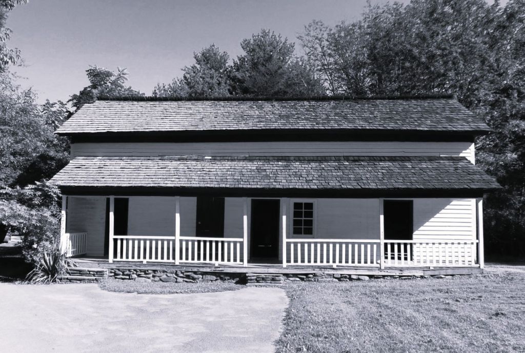
At Mesa Verde National Park the next morning, we stopped at the visitor center to check on tours of the park’s ancient cliff dwellings.  The park rangers were unsure how the US government shutdown would affect the three tours we booked during our stay.  They said it was even possible we might have to leave the park.

The Mesa Verde entrance road zigzags up iconic Point Lookout on the way to the pueblos and cliff dwellings

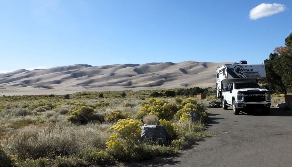
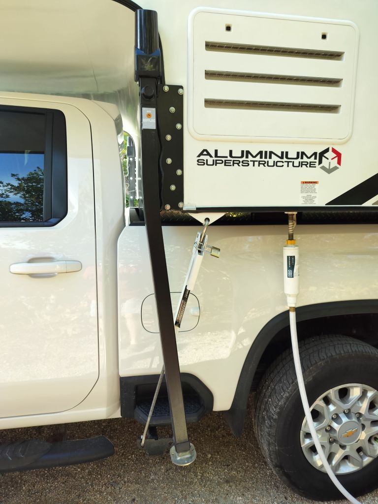
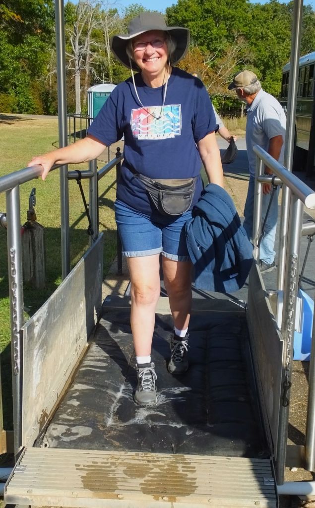
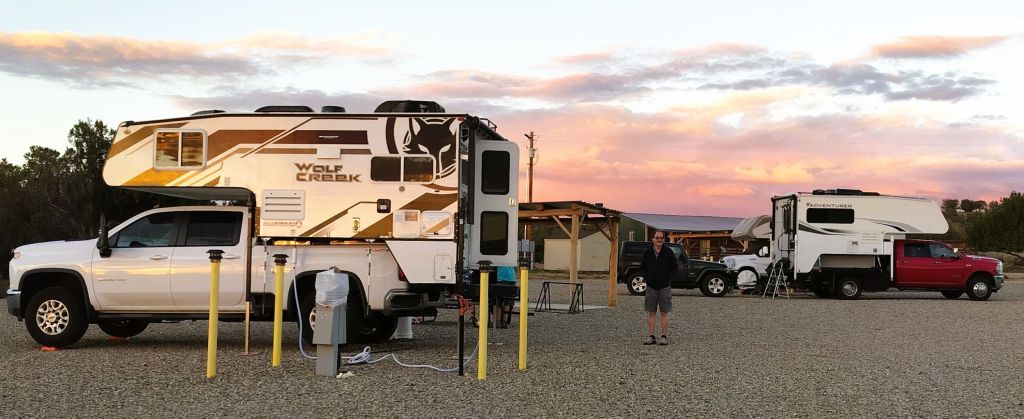
While setting up at the national park campground, we took Pap off Percy. We often do this when staying two or more nights as it is easier to maneuver and park the truck without its piggyback friend. The gas mileage also is much better.

It takes fewer than 15 minutes to lower Pap’s four side legs so the camper is above the truck bed, drive the truck from beneath the camper and then lower it about halfway to the ground onto four screw jacks.  In case you were wondering, putting Pap back onto Percy takes about 30 minutes.

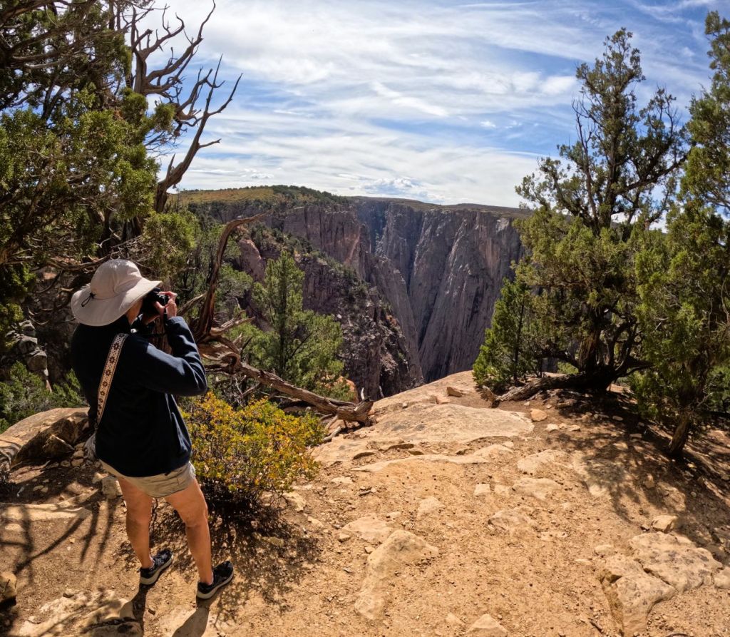
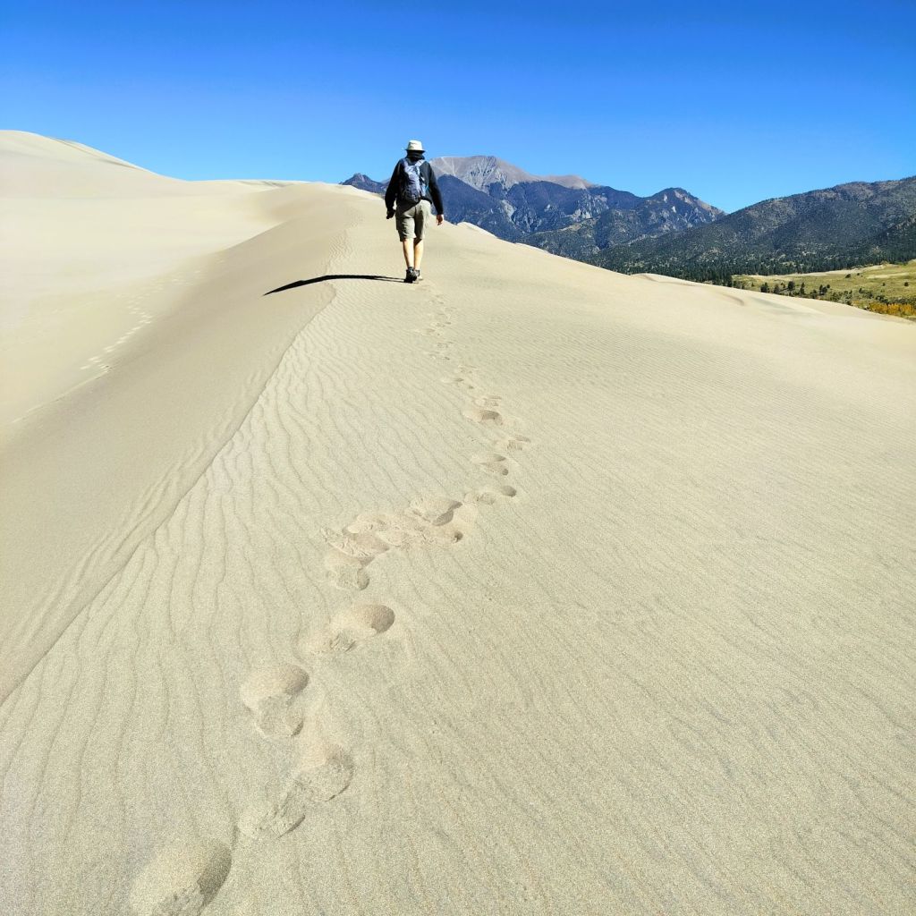
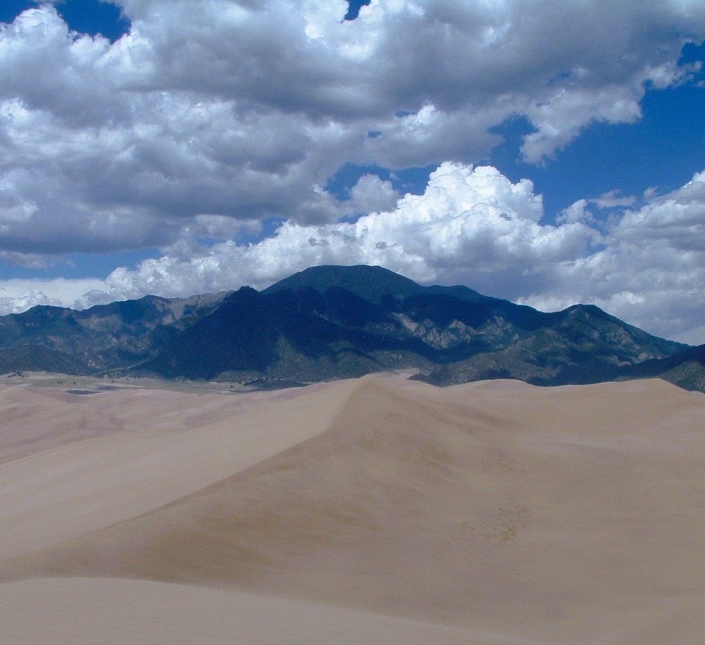
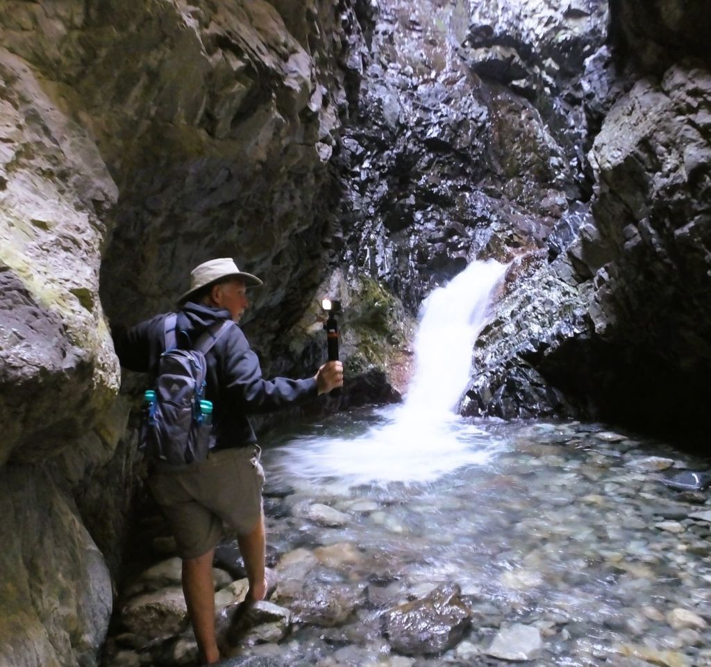
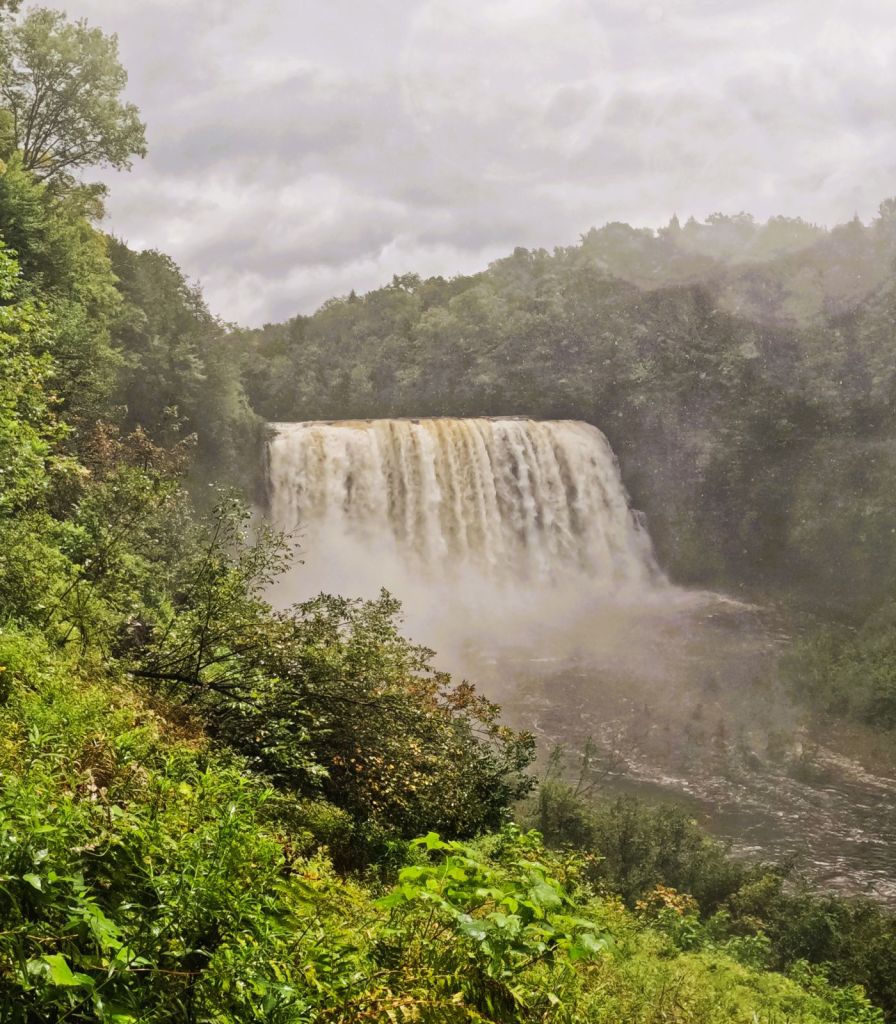
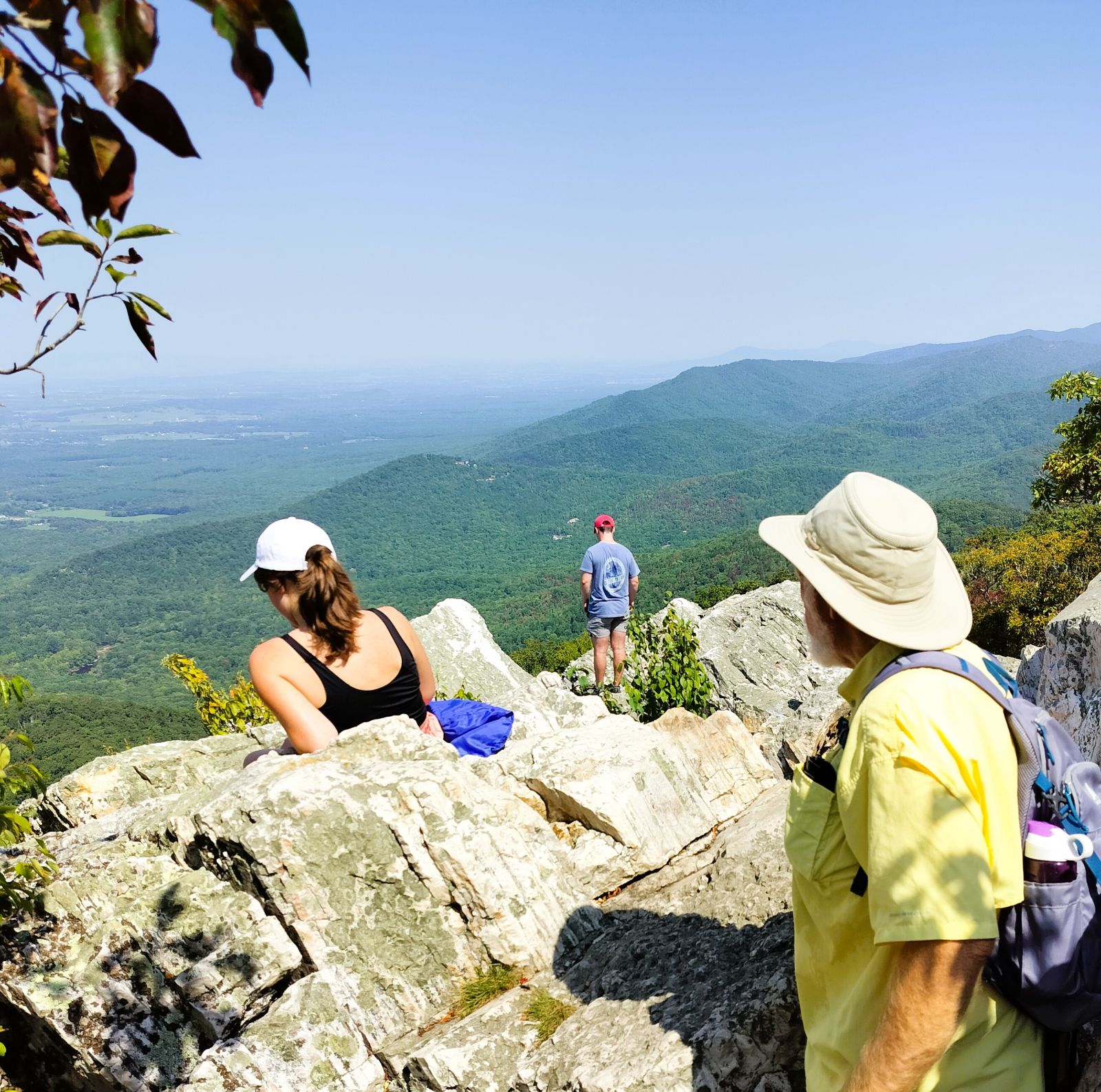
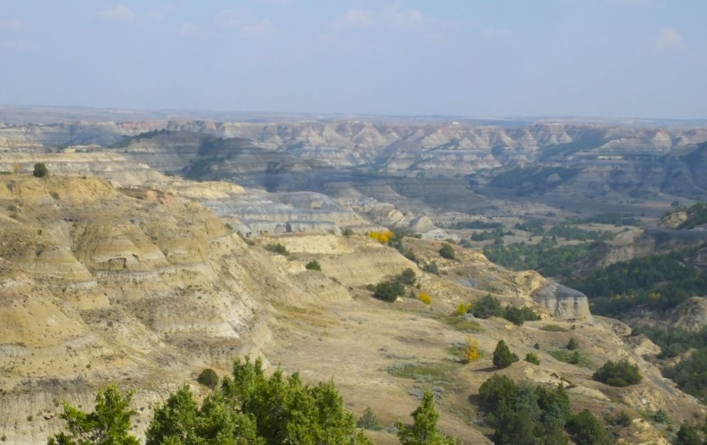
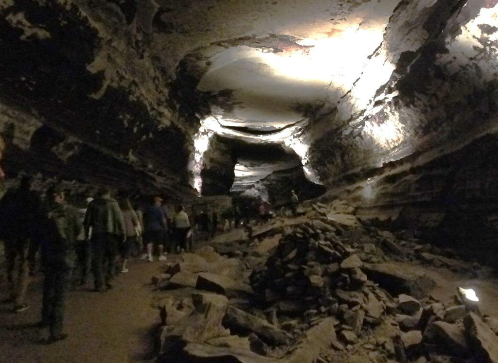
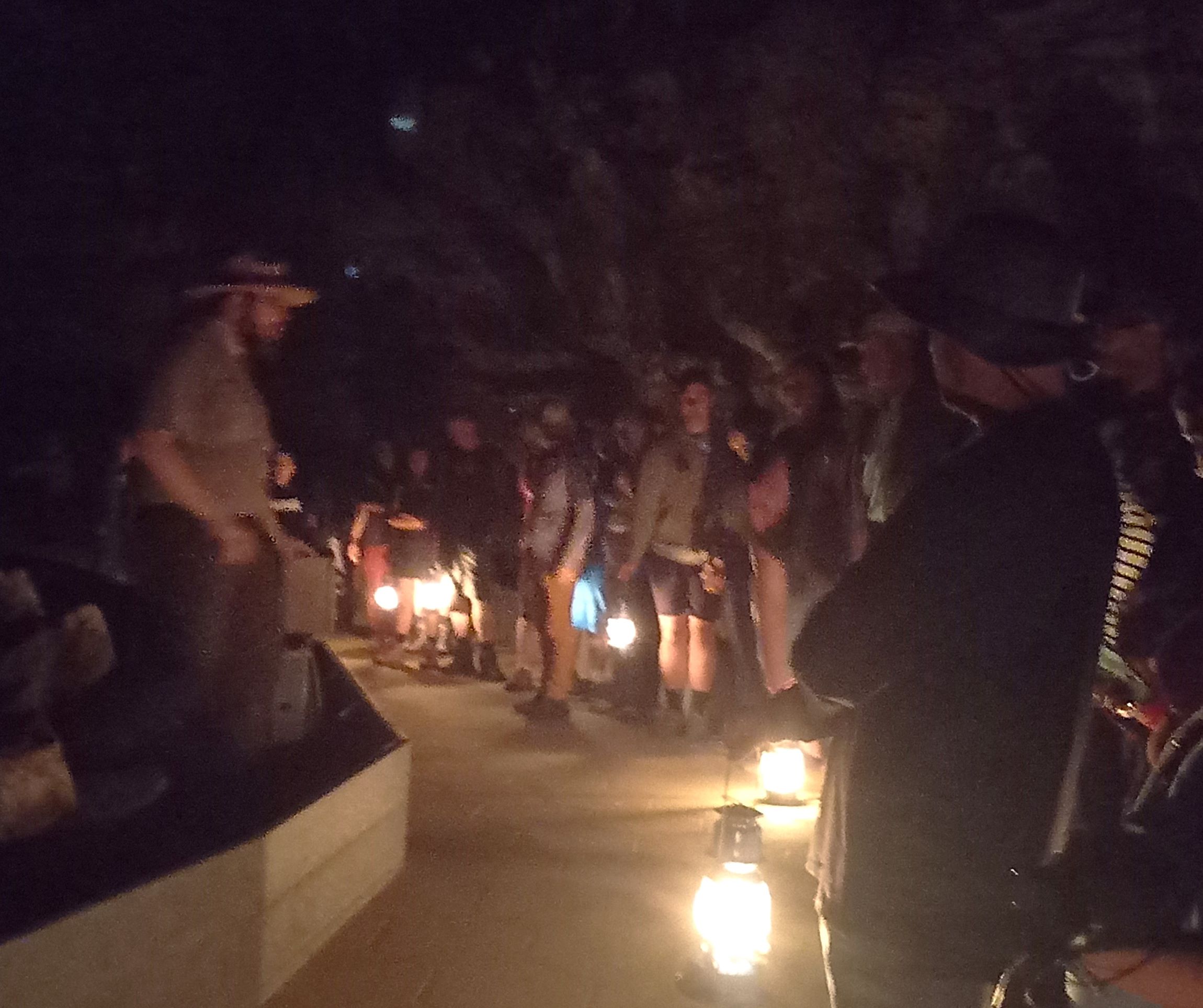
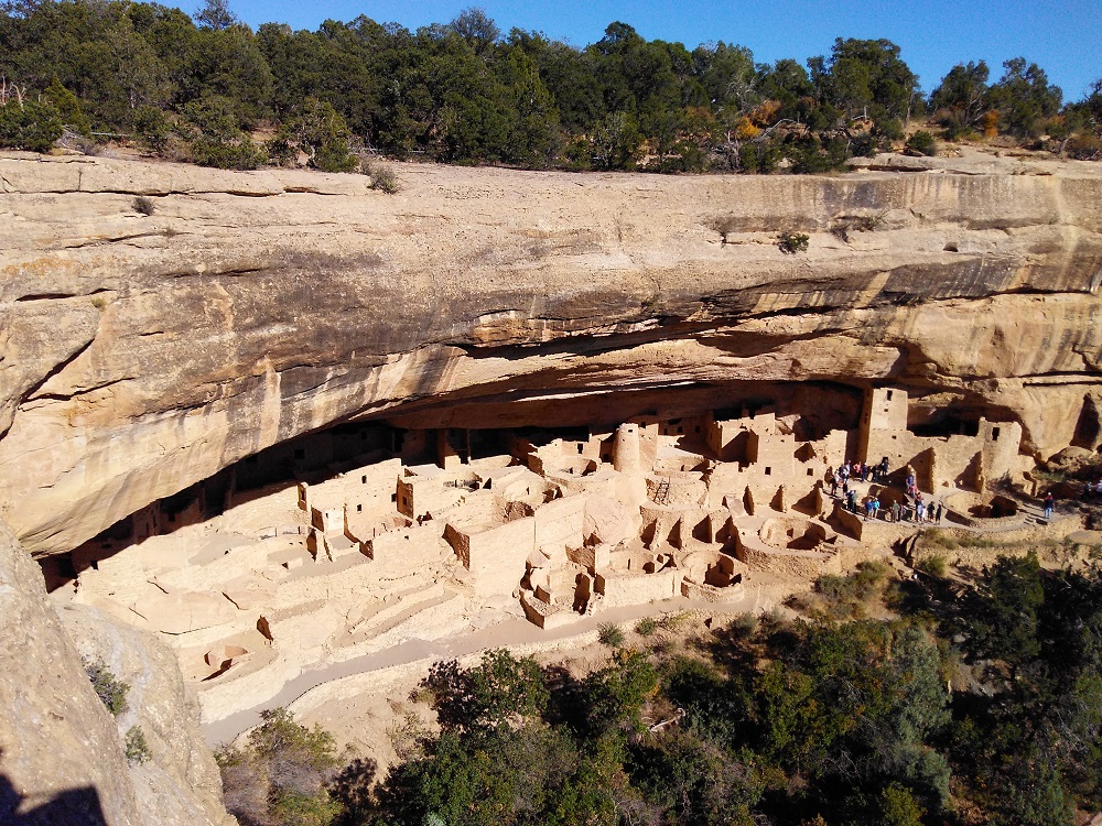
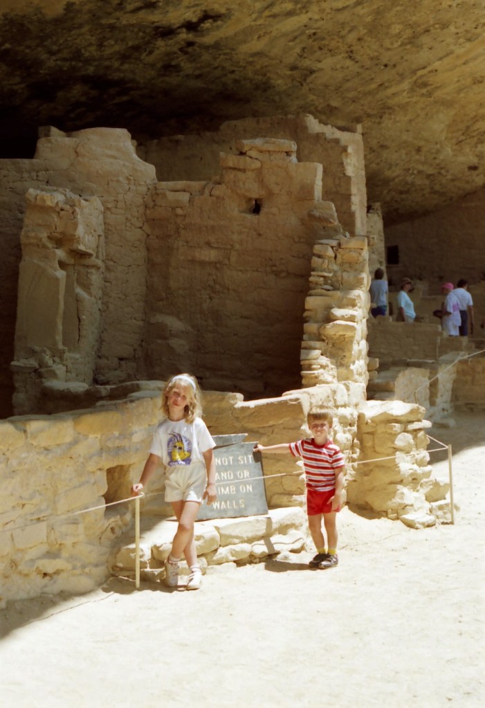
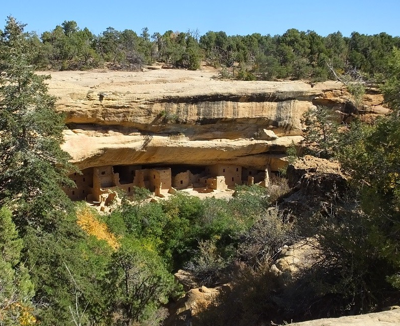
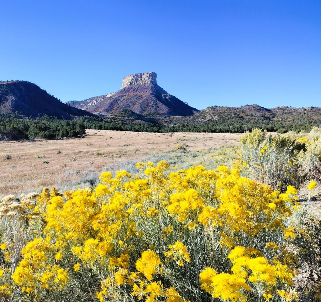
That evening we drove the 15-mile narrow and winding road to the mesa top and cliff dwelling areas.  From the park’s highest point, we could see how Mesa Verde got its name.  Ahead of us was a relatively flat expanse covered with green pinyon pines and junipers.  It looked like a green table – translated to Mesa Verde in Spanish.

Spruce Tree House has about 130 rooms
Square Tower House, is a four story, 27-foot-tall structure surrounded by 24 rooms

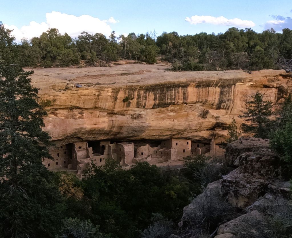
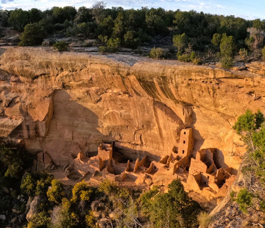
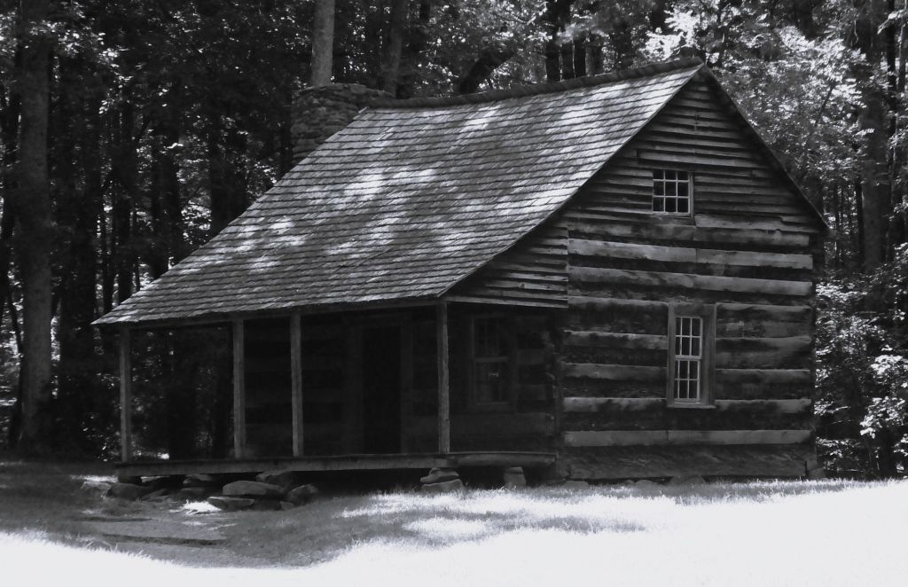
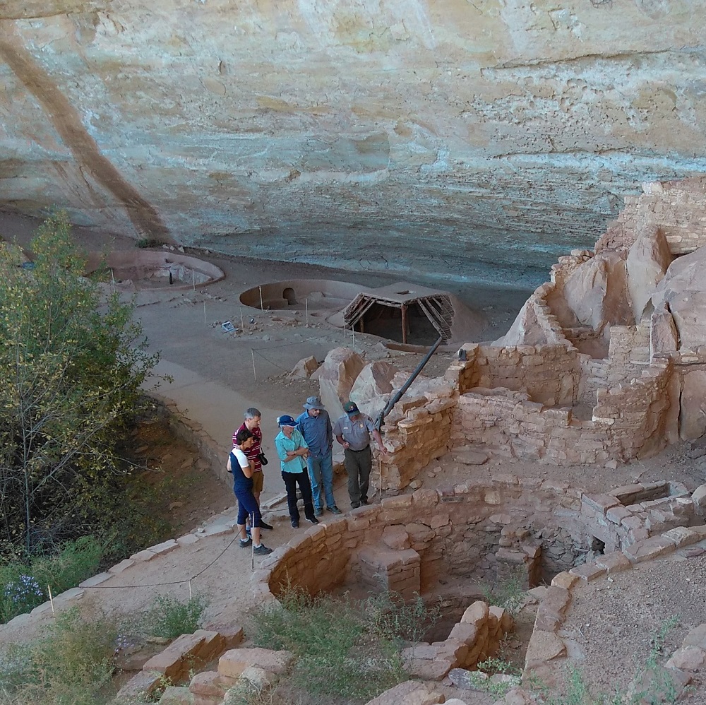
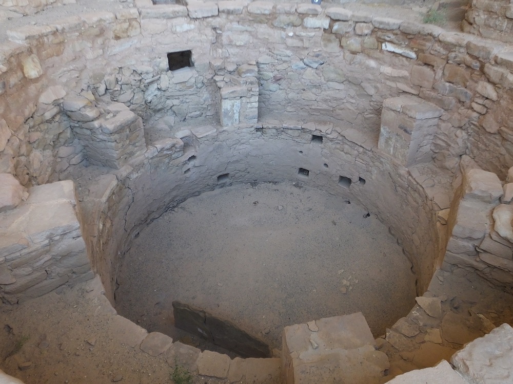
We viewed the Spruce Tree House and Square Tower House cliff dwellings from the mesa top and wondered, like many visitors, about the ancient Puebloans that built and lived in the structures.  How did they get from the mesa tops and canyon valleys to the dwellings? Where did they get water and food? Why was the area abandoned around 700 years ago?

We hoped to learn answers to these and other questions during the tours.

Mesa Nada

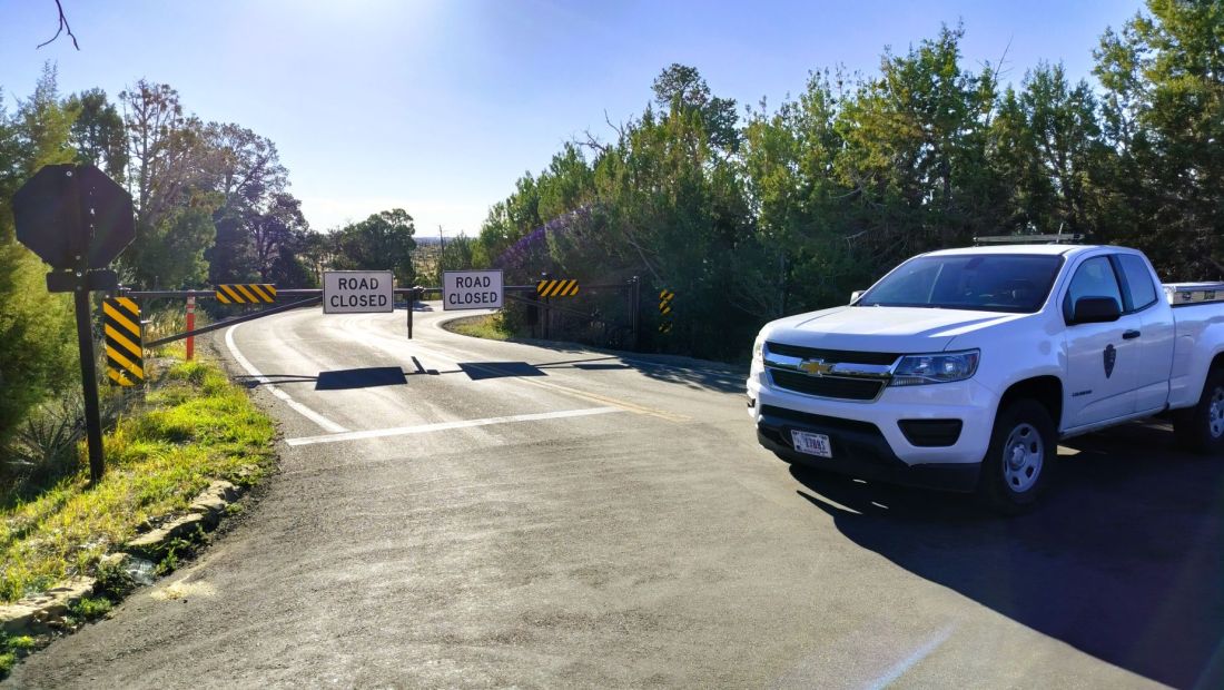
Unfortunately, the tours were not to be. 

We rose the next morning before sunrise and drove to the meeting location of the Square Tower House tour.  Almost there, we were stopped by a gate with road closed signs.  We learned the US government had indeed shut down. All of the Mesa Verde’s historic sites were closed and our tours were cancelled.

From past travels we’ve learned that changed plans often yield unexpected surprises and blessings. 

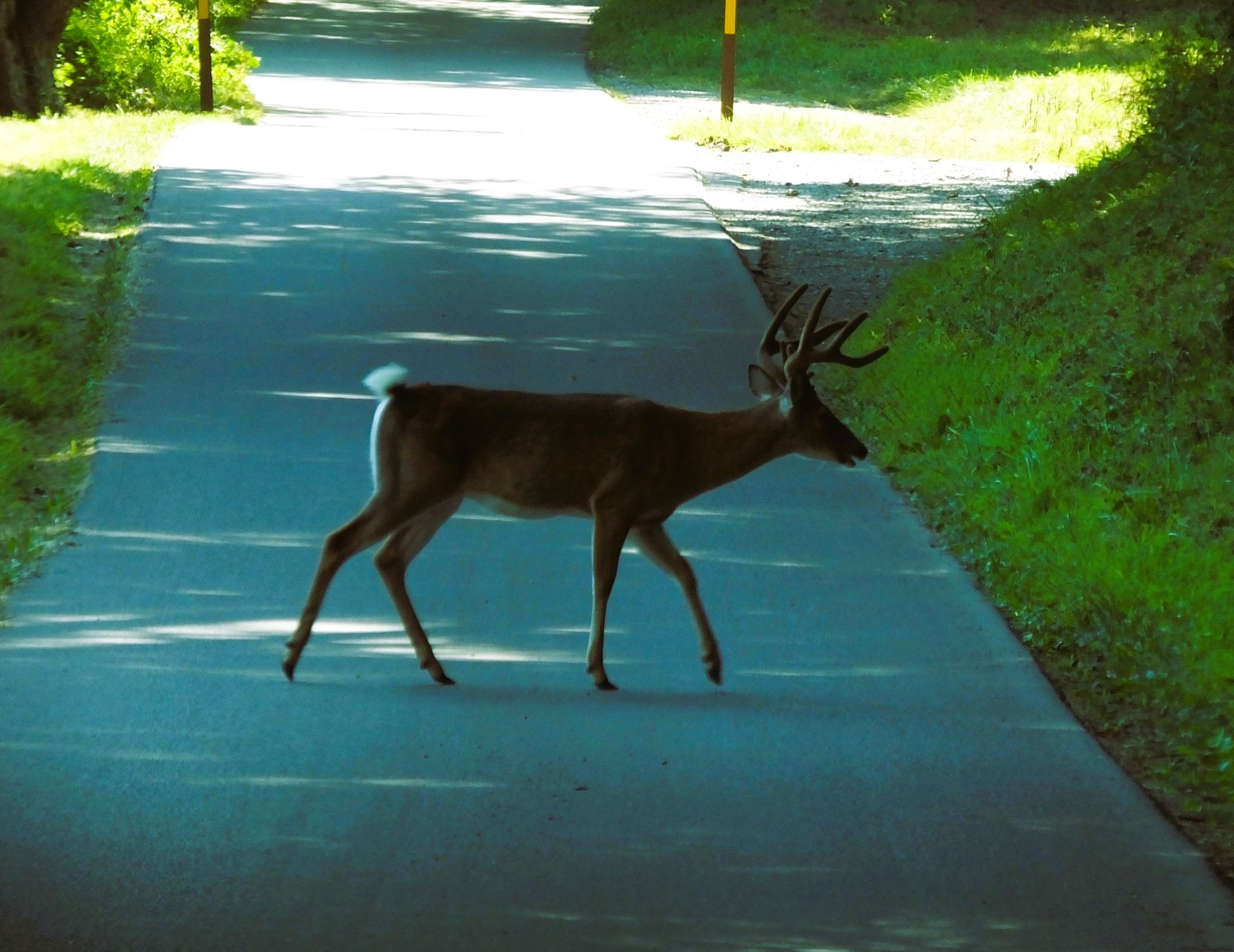
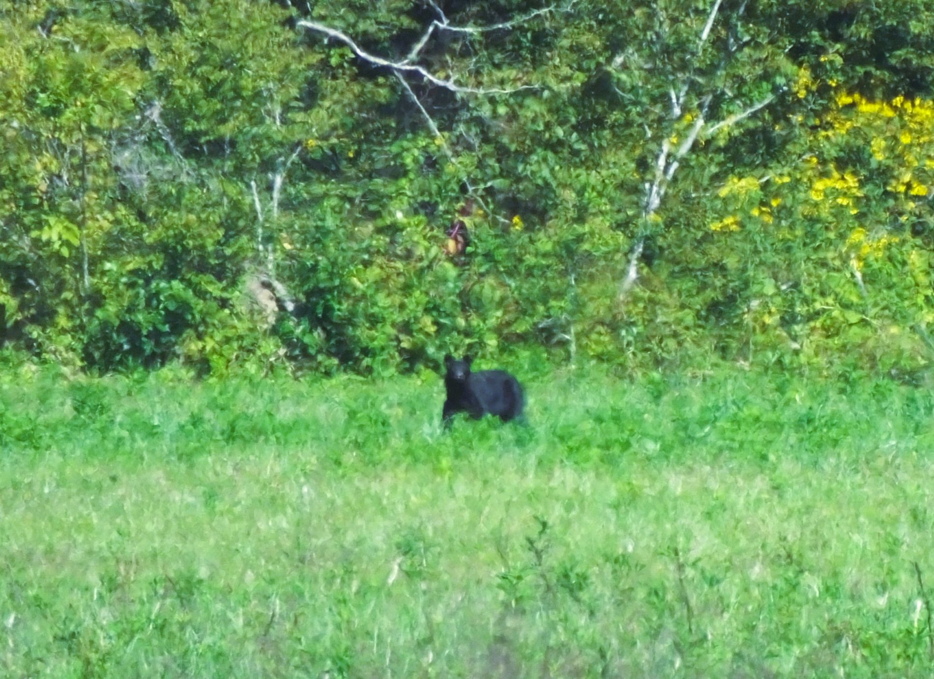
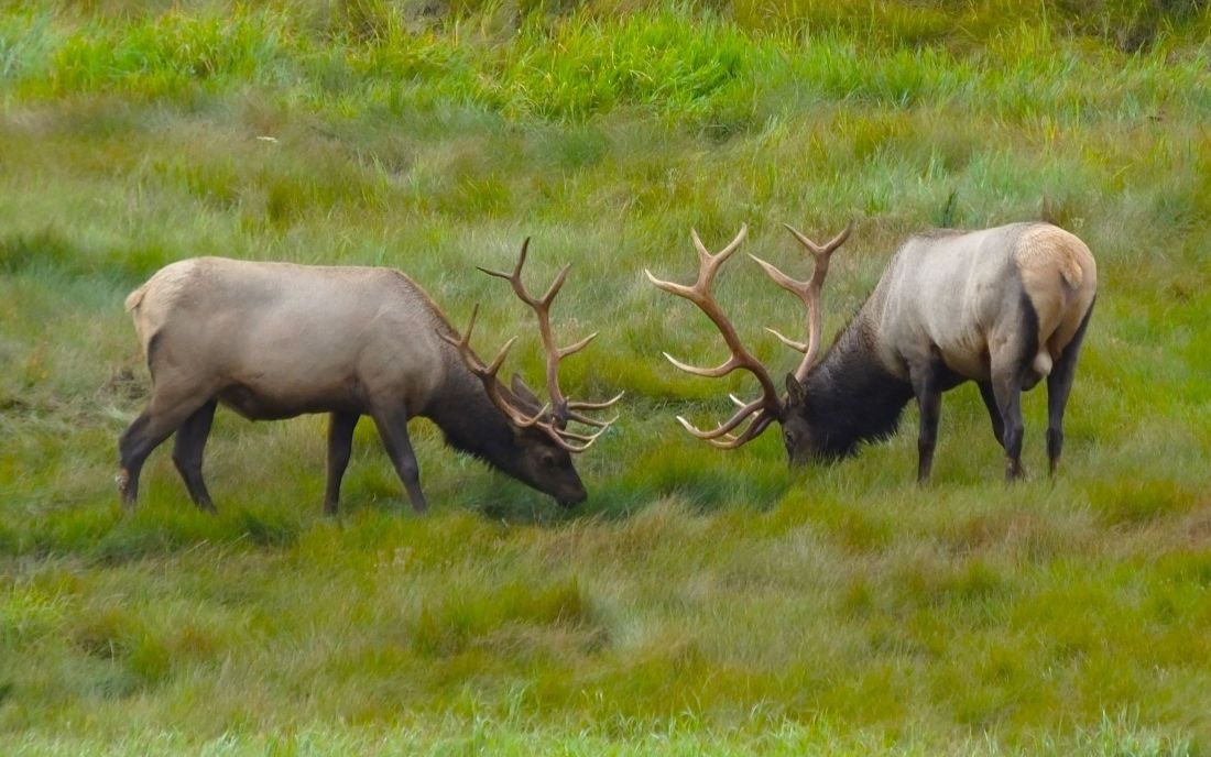
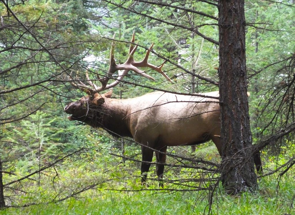
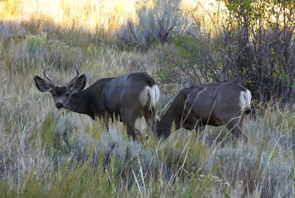
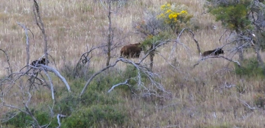
We were thrilled to see lots of mule deer and four black bears in the campground area. 

A couple of the many mule deer near the campground
A mama black bear and her two cubs seen on an early morning drive

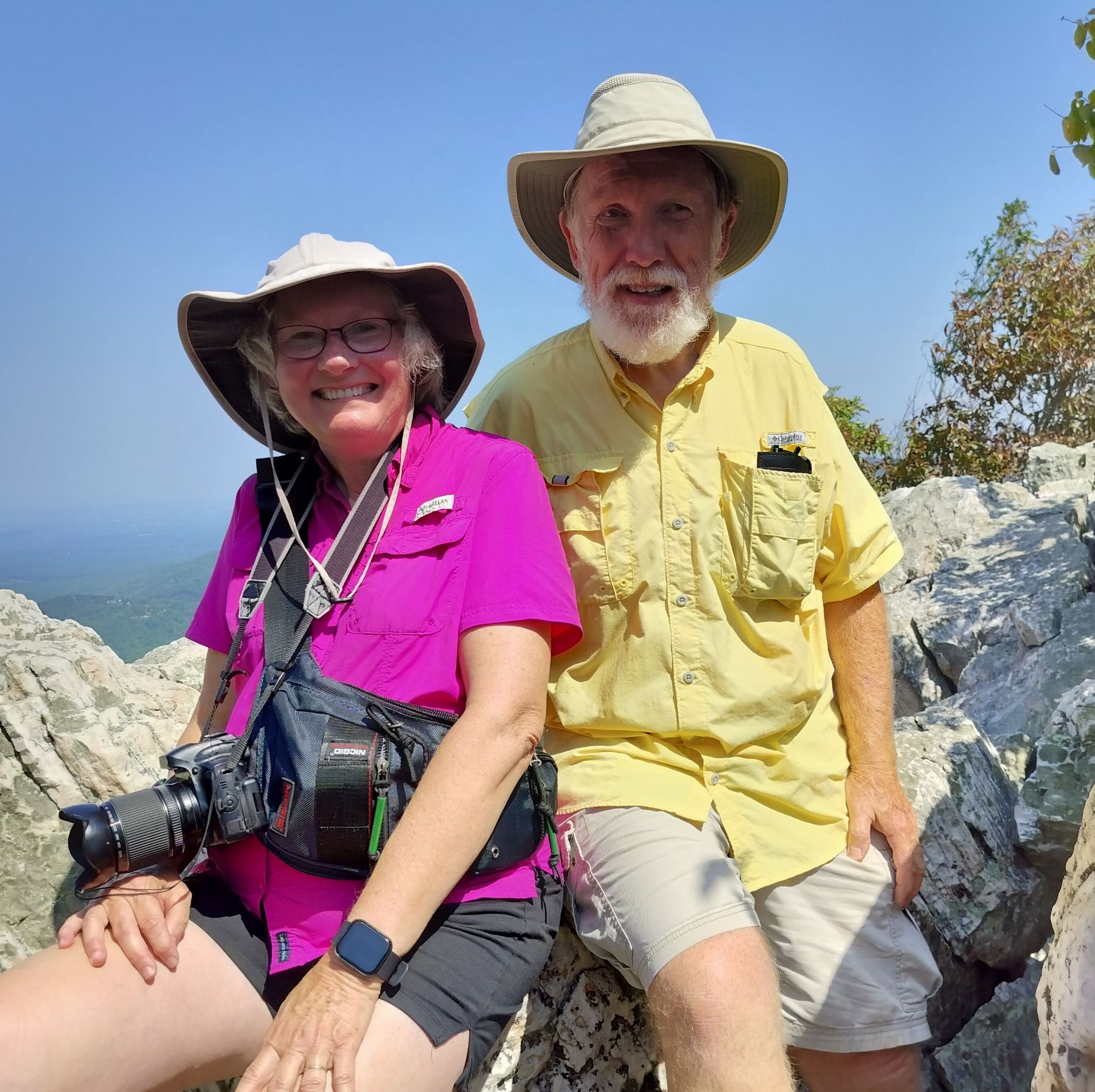
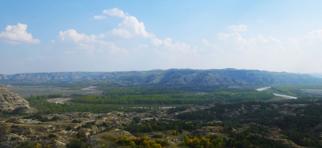
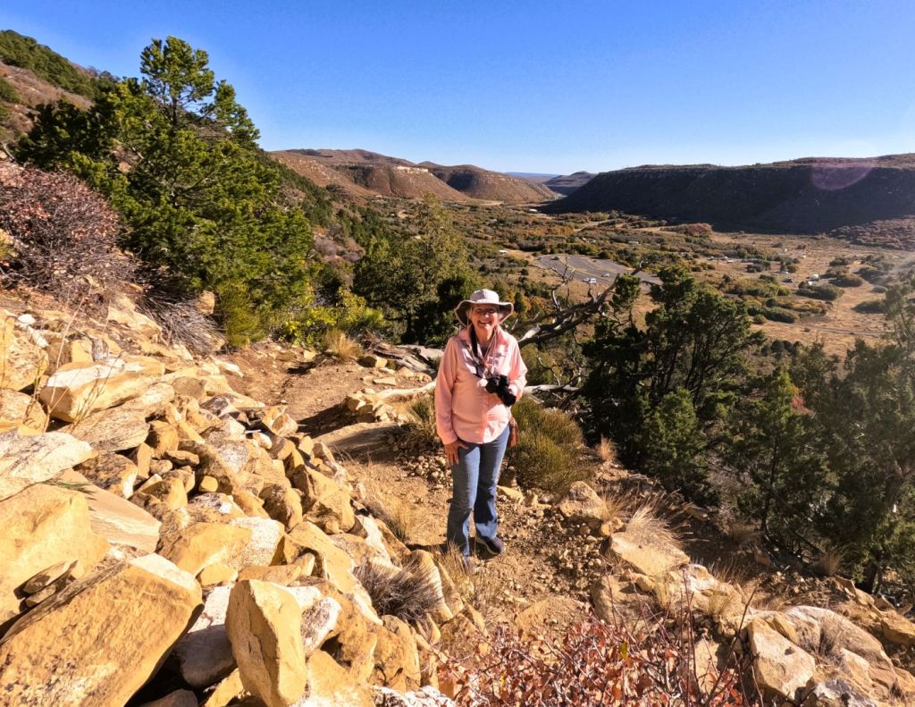
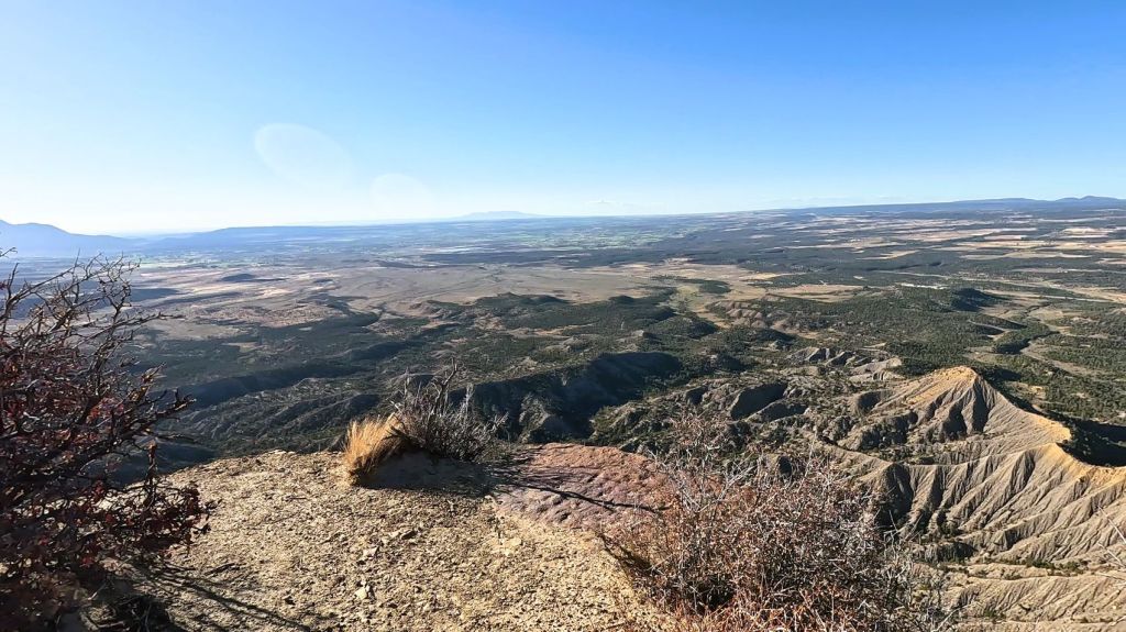
Later, we hiked to the top of Point Lookout, the iconic geological formation that towers above the park entrance. From the point, we were rewarded with views of the distant San Juan Mountains and valleys below.

Climbing the steep and rocky trail to Point Lookout
View of valley and distant mountains from Point Lookout – we were right on the edge!

Answers to the questions above?

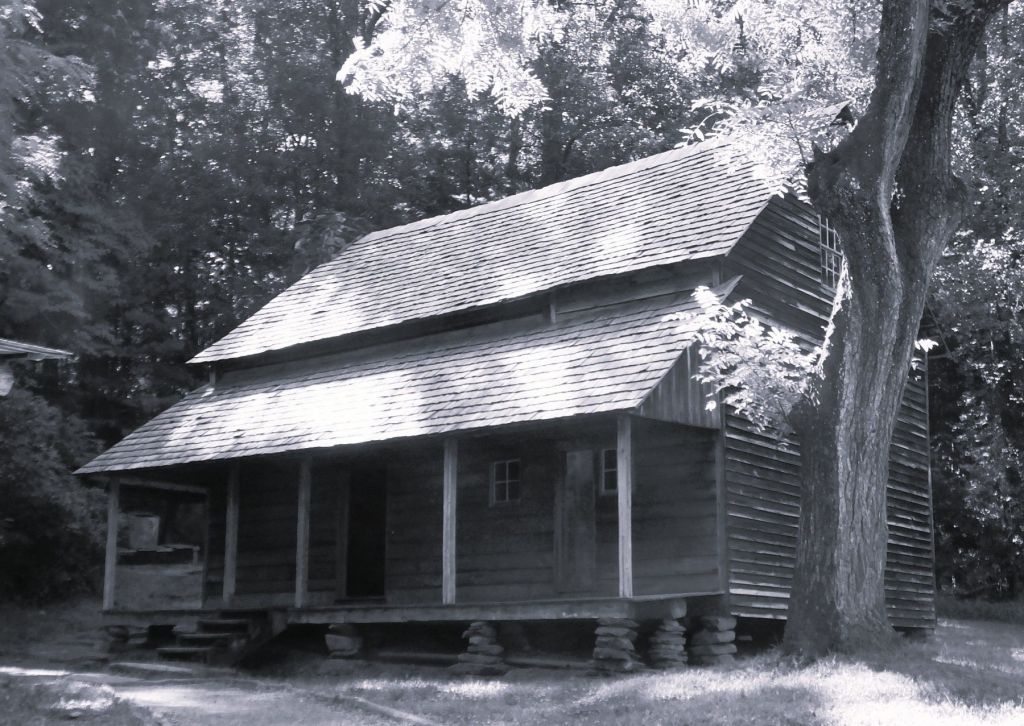
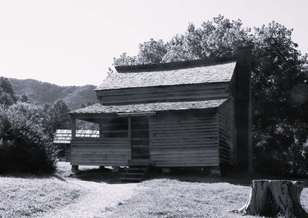
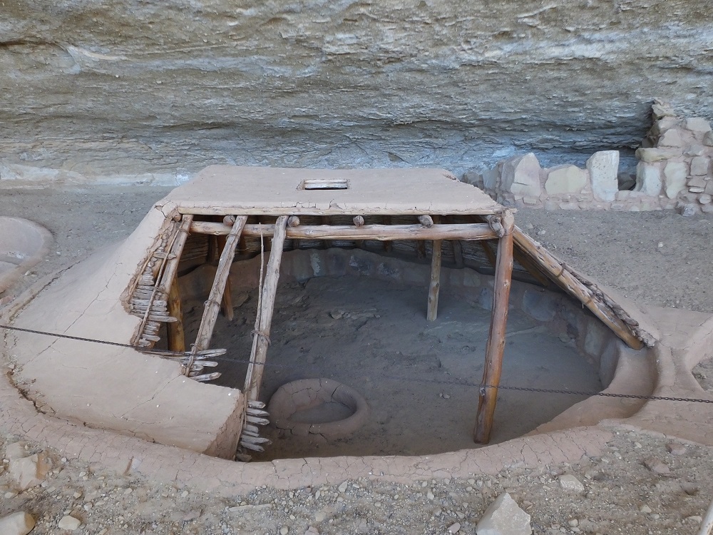
Most of the pueblos and cliff dwellings started around 600 AD were abandoned by 1300 AD following prolonged drought and social upheavals.  The residents subsisted by growing maize on the mesa tops and by hunting. Narrow, steep trails connected the pueblos and cliff dwellings to the mesa top and sources of water.  

Perhaps we’ll learn more complete details during a future visit to Mesa Verde.  That is, of course, if the US government isn’t shut down!

The original auto route to Mesa Verde’s mesa and cliff dwellings was described as a knife edge

Onward to the Balloon Fiesta

We left Mesa Verde a week before the Albuquerque Balloon Fiesta.  We ate lunch in Farmington, a sizeable town in northern New Mexico with a HUGE Walmart, and continued southwest to a remote Harvest Host location.

Navajo Mission

The Navajo Brethren in Christ Mission ministers to Navajo communities
Numerous buildings and a small church are part of the Mission

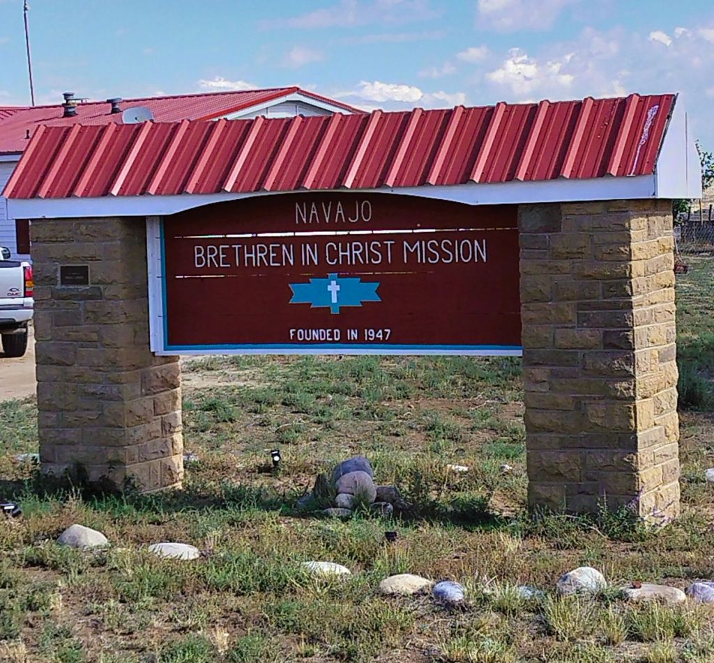
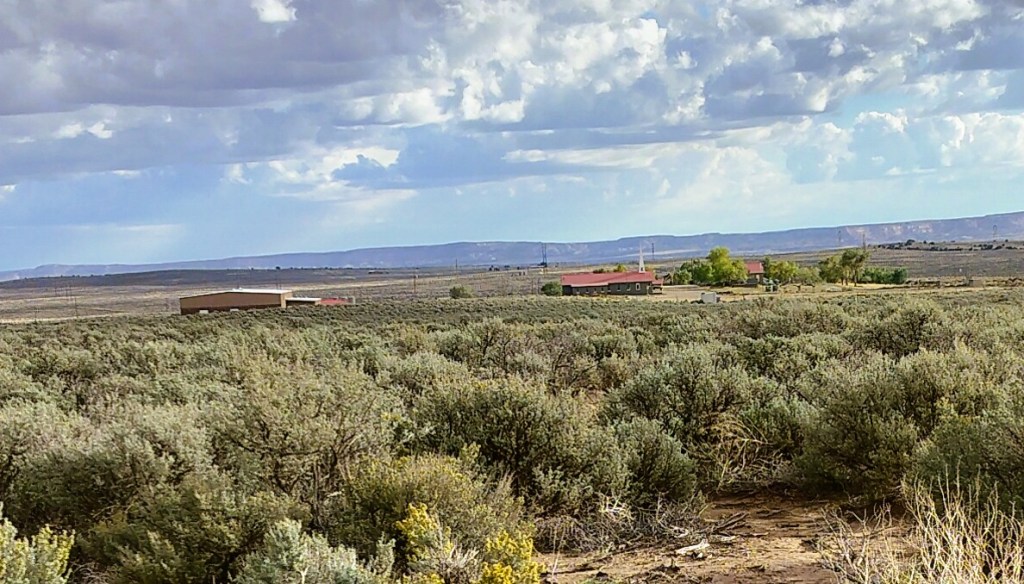
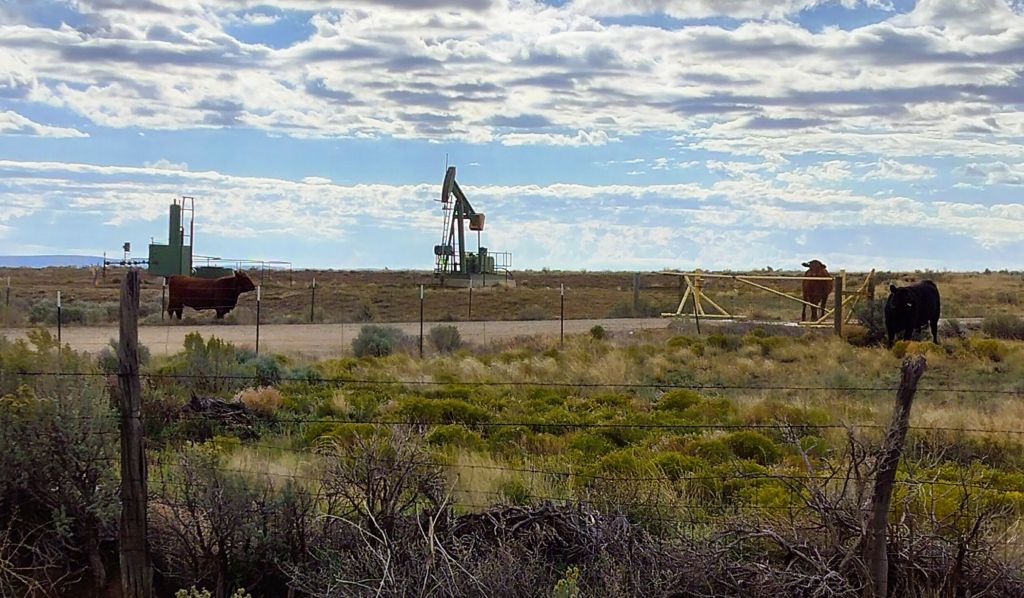
Our stay at the Navajo Brethren in Christ Mission revealed various ways the mission reaches out to Navajo residents in the area.  The mission offers food, clothing, education assistance and the hope of Christ through their church ministry and fellowship programs.  We camped a quarter mile from the Mission where the quiet sagebrush and cactus covered camping area was interrupted by passing water trucks, squeaking oil well grasshoppers and mooing cows.

Cows and oil wells from our remote campsite

Abiquiu and the Georgia O’Keefe Connection

Our travels continued.

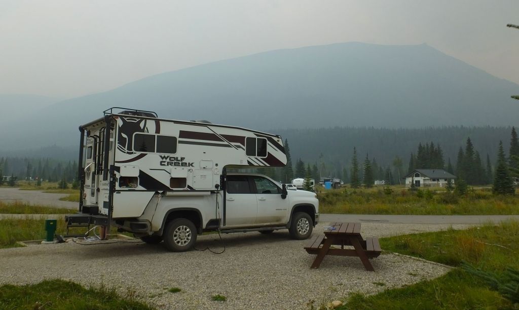
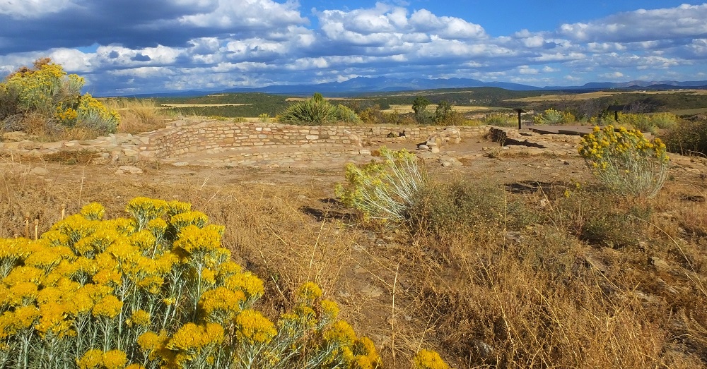
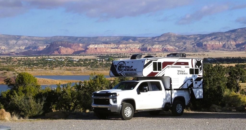
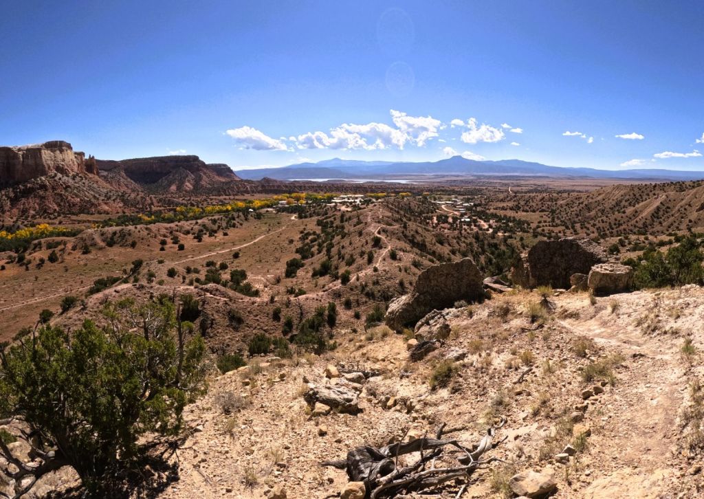
We camped several nights at a Corps of Engineers dam near Abiquiu, NM. Our campsite had a great view of the Abiquiu Reservoir and the red rock canyons and mountains in the distance. 

Abiquiu Reservoir and distant red rock canyons and mountains

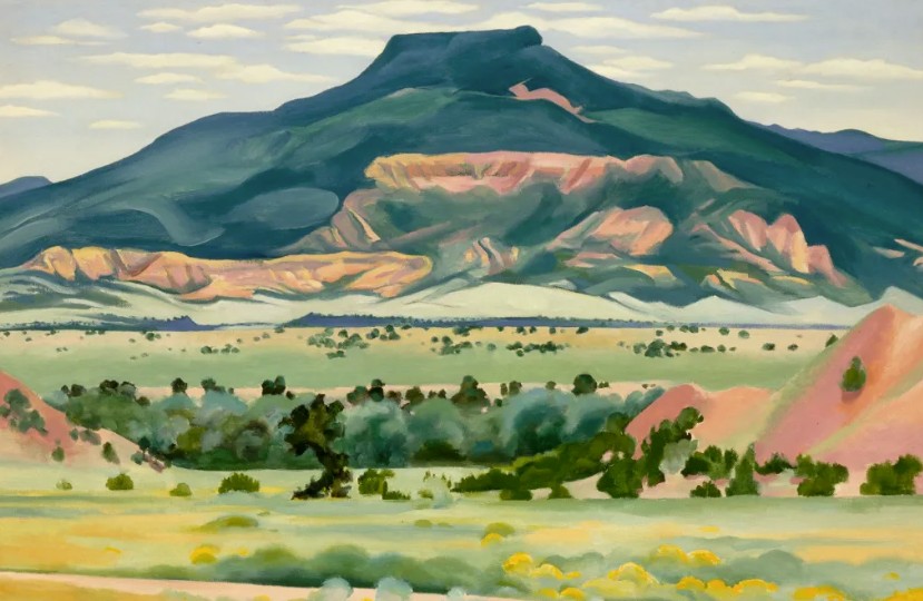
Abiquiu is best known for its connection with artist Georgia O’Keefe, where she had a home and studio.  Her work was inspired by colorful and dramatic landscapes in the area that include the Abiquiu Reservoir and Ghost Ranch, a nearby education and retreat center.

My Front Yard Summer by Georgia O’Keefe (1941) captures the beautiful landscapes near Abiquiu
We hiked to a beautiful lookout overlooking Ghost Ranch. The flat top mountain in the background is in the painting above
A daunting reminder of the wilderness around Ghost Ranch
Ghost Ranch locations have been used in many movies including City Slickers (1991), Cowboys vs Aliens (2011) and Oppenheimer (2024). This cabin was used in City Slickers.

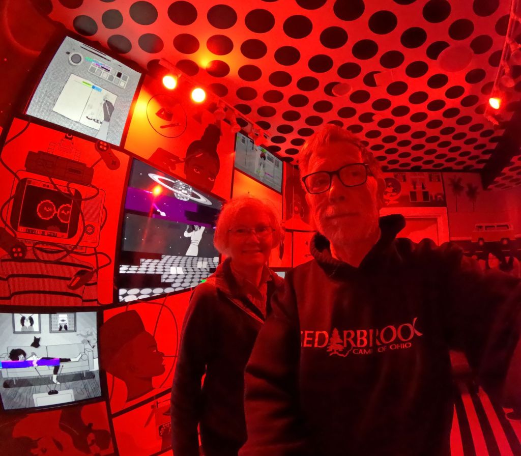
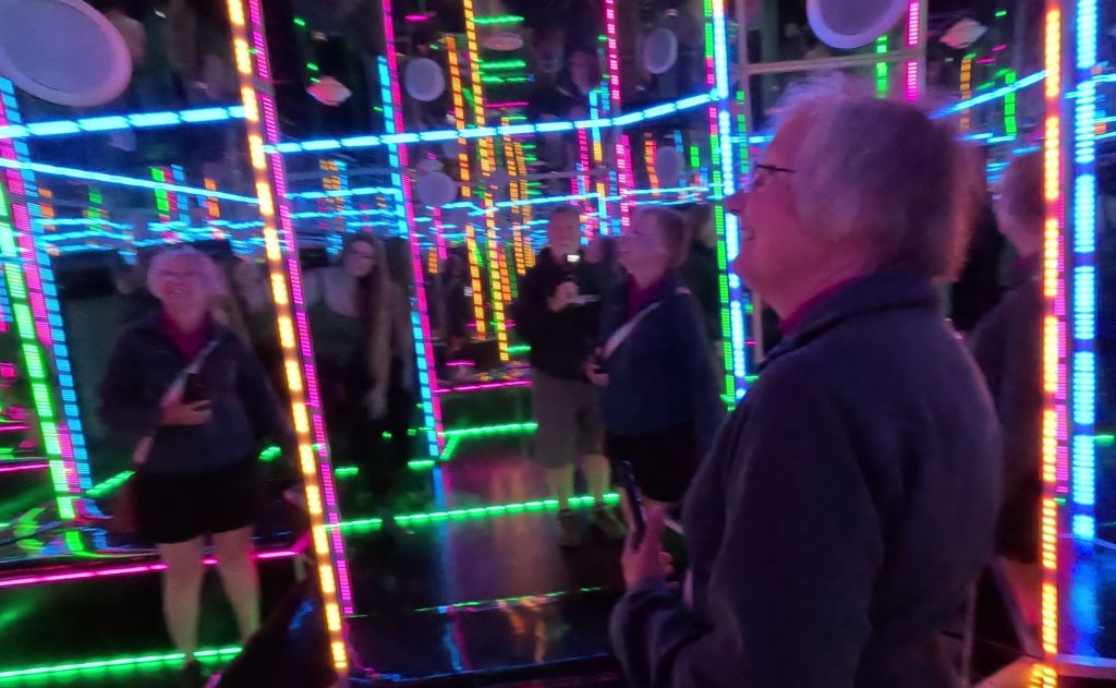
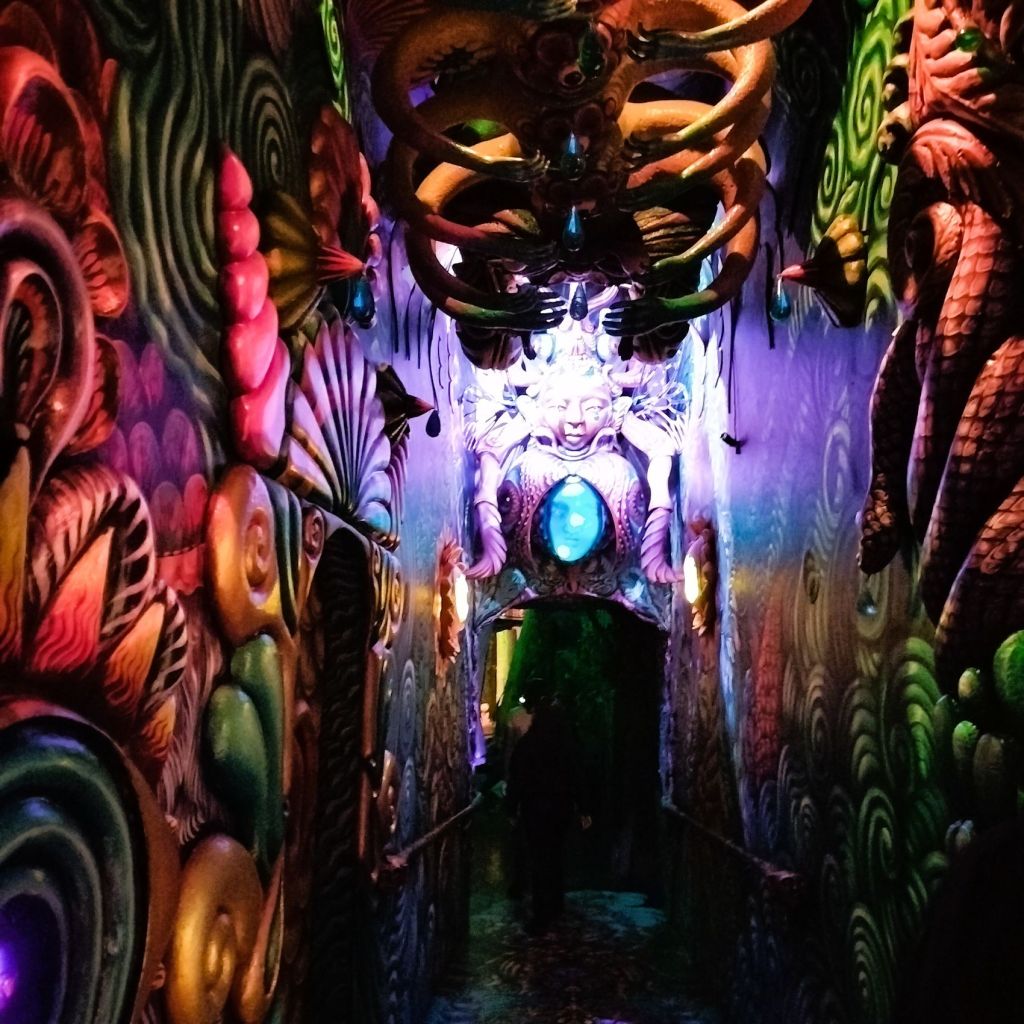
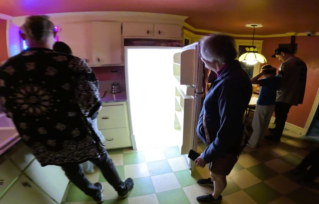
Santa Fe and Meow Wolf

Our final night before the Balloon Fiesta was in Santa Fe (click to see RabbiTRAILS Ep 6 / Ep 7 / Ep 8).  During prior visits we walked around the historic downtown square and toured nearby Los Alamos and Bandolier National Monument.  We’ll save those for future RabbiTRAILS blogs should we visit again.

Meow Wolf is an unusual attraction in Santa Fe

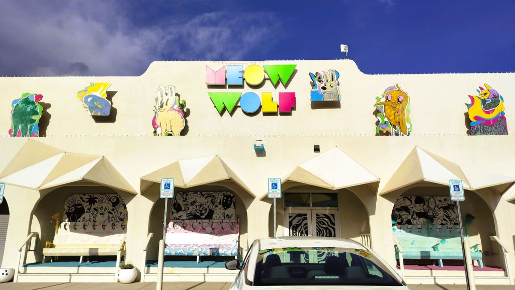
This time, however, we wanted to visit Meow Wolf, an unusual attraction formed in 2008 as part of an art collective of more than 135 local artists.  The venue is a 20,000 square foot immersive art experience, where visitors wander through dozens of rooms and secret passages, attempting to unravel the mysterious disappearance of a family that experimented with interdimensional travel to bring back a deceased family member. (crazy, huh!)    

Meow Wolf can be described as a combination of huge escape room and Disney Imagineering. It has been replicated in Las Vegas, Dallas, Houston and Denver. Each location has a distinct theme and narrative.

We visited many unique rooms
Lots of Pats in a mirror room
We weren’t quite sure about the meaning of this and several other rooms
Pat prepares to go through the refrigerator portal to another room. There were also fireplace and dryer portals.
An interesting robot in the Meow Wolf parking lot

Next Week

From Santa Fe’s immersive Meow Wolf experience and Albuquerque’s colorful Balloon Fiesta, our route turns eastward to six state parks in Texas.   As we cross the Lone Star State, the RabbiTRAILS vary from deep canyons to mountaintop telescopes to big thicket swamps.  And one with a creepy tarantula that crossed our path just before sunset!

Deep, Dark and Stark

Featured
(2025 Balloons and Beyond Ep 11)

As September came to a close, we left Great Sand Dunes National Park and the Colorado alligators for Black Canyon of the Gunnison National Park, a lesser-known national park about a half day’s drive away.

Lots of 5 Bs BBQ – we split a lunch special

We stopped in Gunnison, CO to resupply and to refuel Percy. Lunch was at 5 Bs BBQ, named for members of the Brown family who started a Gunnison catering business in 1991, expanded to a food trailer, moved into a gas station and settled into their current building in 2022.  Their restaurant story is as great as the Q they serve!

Tummies, truck and pantry full, we discovered our route through town was blocked off for a high school homecoming parade. After a quick detour, we were back on the road.

Crawford Camping

We endured more than 30 miles of winding highway and finally arrived at Crawford State Park, our campsite for the next three nights while we explored Black Canyon of the Gunnison National Park.

Colorado’s Big Four

Colorado’s Big Four

Utah’s big five national parks are on many travelers’ bucket lists.  Zion, Bryce Canyon, Capitol Reef, Arches and Canyonlands are not to be missed!

Colorado has its own bucket list combination of four national parks that are more diverse than those in Utah:  Rocky Mountain, with incredible views at the top of the Rocky Mountains, Great Sand Dunes, with the tallest dunes in North America, Mesa Verde, the location of antient Puebloan cliff dwellings, and Black Canyon of the Gunnison, where the Gunnison River has carved a deep and narrow slit in the earth.

North Rim of the Black Canyon

We visited the remote north rim of the canyon, a dozen miles from the campground.  The clear and cool weather couldn’t have been any better as we undertook a 3.2-mile round trip hike to Exclamation Point.

First view of the Black Canyon

Starting at the ranger station, our first view of the canyon came after hiking about a half mile along the mostly level trail.  The trail continued along side arms of the main canyon.  We finally reached a viewpoint where we could see the Gunnison River, a tiny ribbon nearly 2000 feet below!

Full canyon view with the Gunnison River far below

Fourteen of the canyon’s 48 miles are located within the park.  Varying from 1750 to 2700 feet in depth, the canyon has been carved by the Gunnison River as it falls an average of 95 feet per mile.  No other canyon combines the depth, narrowness and sheerness of Black Canyon.

The Gunnison River was FAR below

Trails to the bottom of the canyon, called wilderness routes, are steep, unmarked and unmaintained scrambles.  We wisely continued hiking the trail at the top of the canyon.   

Selfie on the way to Exclamation Point

After posing for a selfie at a sign pointing us to Exclamation Point, we continued to a broad rock outcropping where the rugged canyon was visible from three sides.  We found shade under a pinyon pine and enjoyed the view as we ate our backpack lunch.

Interesting rock layers on canyon walls
Black Canyon with the Gunnison River far below

The next morning, we returned to the park’s North Rim Road where several short trails took us to breathtaking views of the canyon.  At one overlook we could see people, buses and cars on the south rim of the canyon, just .2 miles away!

Visitors on the South Rim of the canyon
Closeup of visitors
Next Week

We travel to our fourth national park in Colorado, Mesa Verde NP, anticipating ranger-led tours of several cliff dwellings.  Unfortunately, our plans had to change due to the US government shut down.

Gators in Colorado?

Featured
(2025 Balloons and Beyond Ep 10)
View of the Collegiate Peaks from Buena Vista

Buena Vista

Bad weather and early snows behind us, we continued south through central Colorado.  We spent the night and did laundry in the small town of Buena Vista, where we were awed by incredible views of the Collegiate Peaks.  Princeton, Yale and Harvard are three of fifteen 14ers (mountains over 14,000 feet) in the range across the valley. 

We had a true Buena Vista (good view).

Great Sand Dunes from afar

Alligators in Colorado?

The next morning, we drove Colorado route 17 southward toward the cutoff for Great Sand Dunes National Park and Preserve.  To our left were the jagged peaks of the Sangre de Cristo mountains.  We saw a brownish blur at the base of the mountains and realized it was the dunes – more than 30 miles away. 

A road sign caught our attention, and we turned around for a closer look. 

How could there be gators in Colorado?  A tunnel from the Everglades?  Holdovers from prehistoric times?

Nope. 

The gator haven, located north of Alamosa, CO, started as a tilapia farm in 1977.  In 1987, 100 one-year old gators were purchased to dispose of fish-processing waste.  The fish (and gators) flourished in the 87-degree water from a 2050 foot deep geothermal well, and as the gators grew, visitors wanted to see them. 

Gators in the snow (from Reptile Park website)

The farm, now the Colorado Gators Reptile Park, was opened to the public in 1990 and has become a home of unwanted, abused and even dangerous gators and other reptiles.

Great Sand Dunes 

An hour or so later we arrived at Great Sand Dunes National Park and Preserve.

The dunes were just beyond our campsite
A beautiful sunset

From our campsite we could see the dunes, the tallest sand dunes in North America, some as high as 750 feet! 

The dunes were formed from sediments from surrounding mountains blown by southwest winds toward the base of the Sangre de Cristo mountains.  The dunefield is approximately 30 square miles in size!

We started our dune hike along the top of a ridge

The next morning we hiked a half mile to the dunes.  In the spring and early summer, the Medano Creek flows along the base of the dunes and visitors must wade across the shallow creek to reach the dunes.  It was late September during our visit, and the sandy creek bed was dry as we began our hike. 

Pat surveys the dunes

We hiked up several ridges and spotted tiny Pap and Percy far off in the campground.  As we topped each dune, still higher dunes appeared.  People above us were making their way to the top.

Continuing along a higher dune ridge
Although we had climbed nearly 300 feet, it was still a long way to the top

During a visit to the park in 2004, our son, Phil, took some beautiful pictures from the top of the dunes.  The dunes are best photographed in the early morning and late afternoon when the shadows make the dunes stand out from the tall mountains beyond.

A photo from the top of the dunes taken by our son, Phil. in 2004

Viva Zapata!

A ranger at the visitor center recommended a nearby hike to Zapata Falls.  The falls’ Spanish name refers to a settlement in the San Luis Valley started by Mexican families in 1864.

Wading the cold waters of South Zapata Creek

We hiked a half mile up a steep and rocky trail to South Zapata Creek.  For the final 75 yards, we scrambled over rocks and waded through the VERY cold creek.

Taking a video of the rugged gorge and falls
Zapata Falls

The marvelous 30-foot falls are hidden in a narrow, shaded gorge.   

We thought about how refreshing the falls must be on a hot summer day and how stunningly beautiful they must be when frozen during winter.    

Pat makes her way downstream

Our main concerns, however, were carefully hiking down the creek from the falls and thawing our feet when we changed from water shoes back to hiking boots.

Pat’s feet were pink from the VERY cold water
Happy to have warm feet as we returned to the parking lot

Next Week

We visit Black Canyon National Park, a deep and narrow gorge in central Colorado.

October in August!

Featured
(2025 Balloons and Beyond Ep 1)

After enduring brutal summer heat in Florida, we left home on a rainy Saturday to visit family in Georgia. We often do this when we travel.

We enjoyed visits with Henry, Josh, Emilia and Liz, and with my sister, Kitty, and her husband, Mike.

Christmas in July.  Breakfast for dinner.  October in August?

Family visits behind us, we were surprised the next morning with brisk temps (50 degrees) as we camped in Cherokee National Forest near Knoxville, TN.   We fired up Pap’s furnace, arose and cooked breakfast to begin the day. Out came our jackets!

From our remote campsite on the North River we moved to Indian Boundary Campground, just 16 miles away, for the next three nights.    On the way, we stopped to enjoy Baby Falls and Bald River Falls, and later rode our bicycles around Indian Boundary Lake.  We continued to wear jackets in the cool October in August weather!     

Bald River Falls in Cherokee National Forest

Pick a Parkway

Perhaps you have driven the Blue Ridge Parkway, a 469-mile scenic highway that winds through the Appalachian Mountains in North Carolina and Virginia, or perhaps the Skyline Drive as it continues another 105 miles from the end of the Parkway through Shenandoah National Park, just 70 miles west of Washington DC.  

How about the Cherohala Skyway?  It connects Tellico Plains, TN and Robbinsville, NC through Cherokee NF in Tennessee and Nantahala NF in North Carolina.  The 43-mile scenic road rises to more than a mile high with mountain vistas, numerous overlooks and sweeping curves popular with motorcycle riders! (it’s very close to the well-known Tail of the Dragon motorcycle route) 

Pat views the small waterfall after our steep downhill descent

At one overlook, we hiked three miles to a small waterfall. Nearing the falls, we tightly held onto tree branches, roots and rocks as we descended the final quarter mile.  We ate lunch to the sounds of rushing water and gave thanks for God’s wonderful creation!

Cades Cove

The Cable mill and homestead area in Cades Cove includes a blacksmith demonstration

The next day we left for a two-day visit to Cades Cove in Great Smoky Mountains National Park.  The Cove is known for its 11-mile loop road with historic homesites and churches, and diverse wildlife (see Critter Count below). 

A misty early morning sunrise along the Cades Cove Loop Road

We have visited and camped at the Cove several times in the past, and although the loop road and campground were busy this time with Labor Day visitors, we enjoyed our two drives around the loop road.

A number of historic cabins and houses (above) and barns (below) can be toured in Cades Cove

Critter Count

Deer – 8
Black bear – 2 (plus a couple other we just missed as evidenced by two bear jams)
Turkeys – 10
Glow worms (bioluminescent larvae of fungus gnats) – lots
(faintly glowing on the ground at North River Campground)

Deer and black bear were among the critters we saw in Cades Cove

Next Week

Our travels continue to a deep and very ancient gorge, and we watch dinosaurs and sharks under the moonlight.

Waterfall Views and Mountain Hues

Featured
(2024 Heartland Ep 13)

We left New England enjoying the warm, hazy days and cool nights of mid-August. 

We endured several days of heavy rainfall as we crossed Vermont and New York. While camping on the St. Lawrence River, we watched big ships and wondered if any would be traveling nearly 2500 miles across the Great Lakes to Duluth, MN, a stop we made earlier this summer.

Camping on the St Lawrence River. The far shore is Ontario, Canada.

The next night we camped close to where the St Lawrence flows out of Lake Ontario.  Our campground was covered with large puddles and the ground was squishy everywhere.  We left our shoes on the back step of Pap to avoid tracking mud into the camper!

Fishes and Falls

The next morning, we visited a fish hatchery nearby on the Salmon River.  The hatchery was opened in 1981 to raise king and silver salmon and trout. 

Salmon River Fish hatchery: stream where fish are directed to fish ladder, room where eggs and milt are harvested, developing fish are raised in indoor tanks and then transferred to outdoor tanks before being released

Millions of eggs are collected from adult fish, hatched, raised and released throughout New York’s Great Lakes and the rest of the state.  Egg harvesting takes place in the spring and fall, so it was quiet during our visit (mid-August).  We were reminded of hatcheries visited on past trips to Alaska and Oregon.

The Salmon River Falls were nearby, and we decided to check them out. 

Salmon River Falls, swollen by the recent heavy rains

The falls were amazing!  Swollen from the recent rains, we could hear the falls nearly a mile away.  We carefully walked down a steep trail towards the base of the 110-foot falls but had to turn back to avoid being soaked by the falls’ mist cloud!

Salmon River Falls at normal water levels

More Waterfalls

Our travels continued south into Pennsylvania, enroute to Ricketts Glen State Park.

Percy and Pap posing at Tunkhannock Creek Viaduct
Aerial view of the viaduct (image from Google)

Passing through Nicholson, PA, we stopped at the Tunkhannock Creek Viaduct.  Completed in 1915, the half-mile long viaduct was the largest concrete bridge in the world at the time and regarded by some as the ninth wonder of the world.  The impressive structure is nearly 300 feet tall and still in use by Norfolk Southern freight trains. 

22 Falls at Ricketts Glen

If you have a wish to see waterfalls, Ricketts Glen SP is the place for you.  In just over five miles of rocky, steep trails you can view 22 named waterfalls.  At 94 feet, the park’s tallest waterfall isn’t the size of Niagara (or Salmon River) Falls, but it and the other falls are beautiful.

Waterfall hiking at Ricketts Glen

Our 3.5-mile waterfall hike went past 18 of the falls (the others are on a side trail that we didn’t take).  It was raining when we started, so we carefully descended nearly 500 feet down steep slick stairs and across large boulders. The falls were various sizes, and we stopped at each to enjoy the peaceful tranquility. 

Various photos of our hike to 18 waterfalls at Ricketts Glen SP

The rain had stopped by the time we reached the bottom of our descent. We paused for a snack and enjoyed talking with other hikers, comparing the falls and reviewing trail conditions.

Stopping to look at another beautiful waterfall

The return part of the trail was a little easier.  Conditions were drier and, for us anyway, it always seems easier to climb a steep trail and stairs than the opposite.

The park has other trails and a nice lake. It is well worth a visit if you travel through central Pennsylvania.

Harper’s Ferry

We drove southward from Pennsylvania into Maryland, then a tiny bit of Virginia and finally West Virginia. 

Harpers Ferry, WV (image from Google)

We visited Harpers Ferry National Historic Park at Harpers Ferry, WV.  The town is at the confluence of the Potomac and Shenandoah Rivers where Maryland, Virginia and West Virginia meet.  It is interesting looking around the well-preserved historic area. 

We learned the town was the northernmost point of the Confederacy during the Civil War.  It is also where abolitionist John Brown led a raid on the federal armory in 1859, hoping to start a slave rebellion.       

1993 Visit to Big Meadows with Pat’s sister and family

Driving the Shenandoah Skyline

Some of our favorite vacations over the years have been driving the Skyline Drive in Virginia’s Shenandoah National Park and the Blue Ridge Parkway in Virginia and North Carolina.

This trip we camped several nights at Matthew’s Arm campground at the northern end of the drive.  We hiked several short trails that took us along the Appalachian Trail.  The views of nearby valleys and distant mountains were nice, but not spectacular due to haze from fires in the far west.

Pat examines a band imprinted with trail information
This hazy view of the valley and distant mountains was still beautiful

We stopped for lunch at Big Meadows, midway on the drive, as we continued south.  Maintained by periodic burning, the 136-acre meadow is the largest open area in the park.  It is covered with a variety of flowering plants as well as blueberry and blackberry bushes.

Making blueberry jam at Big Meadows in 1989

We recalled a trip with our children 35 (!) years ago when we picked blueberries and made jam at our campsite. 

Bearfence rock scramblers, 1993

Further along we passed the trail to Bearfence. Over the years we scrambled over large, exposed boulders to a magnificent view of the distant mountains and Shenandoah Valley.   One rock scaling adventure in 1993 is captured above with a photo of our children and nieces.

We spent a night at Lewis Mountain Campground, a new campground to us. The next day we ended our tour of the Skyline Drive with a hike to Turk Mountain.  The 2.2-mile trail was steep with a 690-foot elevation gain. It ended with a short rock scramble to an outcropping with wonderful valley views.  We caught up with a group of college students who passed us earlier and learned about their plans for the future. One of them took our picture to prove we made it all the way!

Photos taken at Turk Mountain viewpoint

Skylines to Blue Ridges

At the end of the 105-mile Skyline Drive the 469-mile Blue Ridge Parkway begins. 

Iconic Mabry Mill at MP 176 on the Blue Ridge Parkway

We stopped at several favorite landmarks as we drove south on the parkway and made an early morning stop at picturesque Mabry Mill.  The iconic landmark was built more than 100 years ago and was both a sawmill and grist mill. It is one of the most visited sites on the parkway.

Our final stop on the parkway was at Puckett Cabin.  We marveled at the story of “Aunt” Orelena Hawks Puckett, who lived in the cabin during the latter half of her 102-year life.  She had a long career of midwifery, where she assisted at the births of more than 1000 babies.  What an impact she had on the people in that area!

Puckett’s Cabin at MP 189 on the Blue Ridge Parkway

A few miles beyond the cabin, we left the parkway to begin the two-day trip home. 

Our original plans were to spend more time in New England before returning home in late September or early October. Because of hazy conditions throughout the east, we moved more quickly than expected though.

Accustomed to longer trips, we wondered if we were going home early for some reason.  We found out soon enough.

A few days after our return, intense weather struck our area.

After two evenings of considerable rainfall, the small creek in our back year rose above its banks. The creek flooded our backyard and continued to rise until it crossed the road next to our house. This has happened only one other time in nearly 40 years.

Although the rising creek never hit the house, rising groundwater began to seep into our semi-basement downstairs room. The sump pump we installed years ago (and tested right before our trip) had failed.

After an emergency late evening trip to Lowes to purchase a drill-powered pump, we drained the sump pit and began the timely process of drying out the room over the next week.

Had we not returned earlier than expected, water would have covered floor of the room. Carpet and furniture would have been damaged, and we would likely have had to deal with mold and mildew.

Giving Thanks

We are thankful!

God is our refuge and fortress in whom we trust for safety and protection – during our 2024 Heartland travels, trips in the past and journeys yet to come!

Bent Leg Blues and Catching Up (part 2)

Featured
(2024 Heartland Ep 2)

In recent years we have made several late-winter/early-spring camping trips to the Florida Keys. This year’s trip has some interesting surprises.

Robert is Here has an amazing selection of local and exotic fruits and vegetables

Robert is Here!

Fist-sized green Emu eggs would make a rather pricey omelet!

Our Florida Keys journey began with a stop at Robert is Here, an amazing fruit stand near Homestead at the start of the Keys. Dozens of local and exotic fruits and vegetables, and amazing fresh fruit-flavored milkshakes, can be purchased.  

The attraction was named for a sign Robert’s dad made to get the attention of people passing by his six-year-old son’s small fruit stand in 1959.  That day all of his produce was sold by noon and Robert’s lifelong fruit stand business was born!   

On to the Keys and John Pennekamp State Park 

From Florida City on the Florida mainland to its end in Key West, the Overseas Highway counts down 126 miles.  There’s lots to see and do all along the drive!

Our first stop was at mile marker 102.5 near Key Largo to spend a week at John Pennekamp Coral Reef State Park.  The park is known for coral reefs located several miles off the ocean side of the island.  Excursion boats carry snorkelers who view the coral and various sea life, and scuba divers who swim to a well-known underwater statue of Christ. 

Underwater statue of Christ at John Pennekamp SP (from Fla State Park website)

Due to choppy sea conditions, we opted for a glass bottom boat tour.  Unfortunately, the reefs were seriously damaged by high water temperatures last summer (as high as 101.1 F) and the reef views were disappointing.  One can only hope the reefs will recover with more normal ocean temperatures.

We did enjoy bicycling and hiking several short trails in the park and nearby.  A highlight of our visit was kayaking some very interesting ‘water trails’ in the park mangroves.

Pat kayaking in the mangrove canals at John Pennekamp SP

Crocs, Gators and More in the Everglades

We took two day trips to Everglades National Park.  At the northern boundary of the park, we bicycled the 15-mile Shark Valley loop road, passing herons, egrets and numerous alligators. The highlight of the ride was a viewing tower from which we could see expansive grasslands and hammocks.  The tower reminded us of a similar structure at Clingman’s Dome in Great Smoky Mountains National Park.

Viewing tower at Shark Valley in Everglades NP

Shark valley views – biking, birds and trailside gators

The next day we drove to Flamingo, a developed area deep in the heart of the national park.  They have an excellent visitor center, campground, other accommodations and marina. 

Snarly-toothed crocodile at Flamingo

At the marina boat landing, a park ranger kept curious visitors at a safe distance from two large snarly-toothed crocodiles that were sunning themselves.  We learned the Everglades has crocodiles AND alligators – both are rather ominous!  Meanwhile, several manatees swam at boat docks not too far away.

We hiked along an overgrown canal to Florida Bay; the tall white feathered fellow blocked the path

Later, we hiked along an overgrown canal trail to a viewpoint of the Florida Bay.  We saw many birds, including one rather tall white egret that blocked the trail for a bit, and a number of stealthy alligators trying to hide nearby.

Elevation 3 feet – the Everglades are flat!

As we exited the park that afternoon, we stopped at Rock Reef Pass, elevation 3 foot.  The Everglades are remarkably flat, indeed!

We tried a cinnamon bun at Doc’s Diner in Key Largo – it was 4+ (out of 5) sweet goodness

On to Bahia Honda State Park

Bahia Honda sunset seen from the campground

From Pennekamp SP we continued on the Overseas Highway past the busy towns of Islamorada and Marathon, and across the seven-mile bridge to Bahia Honda State Park, mile marker 37.8.  The park is one of our favorite places to camp.

We bicycled to see the remains of a railroad bridge built by Henry Flagler.  The railroad to Key West was an amazing engineering feat for its time.  Completed in 1912, trains made the trip for 23 years before the bridges and rail lines were seriously damaged by the Labor Day Hurricane of 1935.   The railway was turned over to the state and converted to an automobile highway in the following years.

There are beaches on both sides of the island – an oceanside beach faces the Strait of Florida and Cuba, and a gulf-side beach faces Florida Bay and distant Everglades.  There are places to camp on both sides of the island.

Construction workers and supplies were staged on Pigeon Key during construction of the 7 Mile railroad bridge

Pigeon Key – A Tiny Island with a Big Story

One day we visited Pigeon Key, a small island visible from the seven-mile bridge.  We took a tram nearly three miles on the original Bahia Honda bridge to the island that was used as a work camp when the original railroad bridge was built.  Photos and relics in Pigeon Key buildings give an interesting history about the railroad.

Ouch! Pap has a bent leg

Pap Gets A Bent Leg

We have been blessed with relatively few issues with our vehicles and campers as we have traveled over the years. 

We had an unfortunate accident when arriving at Bahia Honda.  As we entered the campground, the front camper jack hit a post that protected the campground entry keypad. The jack, used to raise the camper, was significantly bent.   Pap had to stay on Percy until we got home and the jack was replaced.  It was an unfortunate and expensive lesson.          

Next Week 

Our heartland journey begins as we travel to Huntsville, TX for a week at Camp Cedarbrook Texas.

Badland Raves and Mammoth Cave

Featured
(2023 Alaska Revisited Ep 29)

Our trip home included visits to two national parks.

Theodore Roosevelt National Park

After the death of his wife and mother on Valentine’s Day 1884, Teddy Roosevelt sought solitude and healing in the North Dakota Badlands.    The rugged landscape and strenuous life that he experienced there helped shape the conservation policy we benefit from today.

The rugged badlands at Theodore Roosevelt National Park in North Dakota

His ranch and two nearby areas are now part of Theodore Roosevelt National Park. 

The Little Missouri River winds through the park

We spent three days in the park and marveled at the weathered landscape and the Little Missouri River that winds through the park.  Two scenic drives provided plenty of viewing opportunities of deep, layered canyons that cut into the grassed prairie and a wide variety of Great Plains wildlife, including bison, pronghorn antelope, elk, bighorn sheep and wild horses. 

God owns bison on a thousand hills… (Psalm 50:10 paraphrase)
This brute eyed us from atop a drop-off. We kept our distance!

We hiked two miles along a small canyon to hard packed bottom land.  The trail passed small dirt piles with a few prairie dogs scurrying about.  We were at the prairie dog suburbs. 

Ahead, we came to many, many more dirt piles and hundreds of the yapping terrier-sized critters that announced our arrival.  Some scurried in and out of holes, and others sat or sprawled lazily, watching us closely.  This was TRNP’s prairie dog city!

Citizens of TRNP prairie dog city

Later we saw a number of unusual cannonball-shaped rocks along the base of an eroded canyon wall.  These were spherical concretions formed by mineral deposits dripping through gaps in the sediment.

Unusual cannonballs jut out of the eroded hillsides, some more than four foot in diameter

A Close Encounter of the Bison Kind

We saw telltale evidence of bison throughout the park.  Individuals and small groups wandered up and down the hills and valleys, including one group of nearly a dozen bison that walked in the middle of one of the scenic drives. Several passed within feet of our truck!

Several bison walked on the road right by our truck

Our mid-September visit to TRNP was enjoyable: the scenic drives and trails weren’t crowded, campsites were available in the park and the weather was pleasant.  If you pass through North Dakota on Interstate 94, the park is a great stop.

We visited the monument of the Lakota Indian holy man and leader Sitting Bull. It is located on a remote bluff above the Missouri River near Mobridge, South Dakota.

From TRNP, we continued south, visiting many of the roadside attractions mentioned recently in RabbiTRAILS episode 27 and episode 28.

Mammoth Cave National Park

Closer to home, we visited Mammoth Cave National Park in south-central Kentucky.  Explorers have surveyed and mapped 426 miles of the cave, making it the world’s longest known cave system.

Our last visit to the cave was in 1991, when we took several ranger-guided cave tours with Liz and Phil, our (now) adult children.  32 years later, our tours included the Extended Historic Modified Tour and Violet City Lantern Tour.

Percy and Pap would easily fit in some Mammoth Cave passages
Something to ponder: when does graffiti become a historic artifact?
Mammoth Cave’s bottomless pit is actually 105 feet deep

We hiked a steep trail down to the cave entrance where we entered the cool cave and walked nearly two underground miles on the two-hour Extended Historic Modified Tour.  The tour included many of the historic areas that originally made the cave famous – visits to huge rooms that gave Mammoth Cave its name and much tighter places deep inside the cave. We endured the narrow passage through fat man’s misery and welcomed the underground restrooms in great relief hall that followed.  The tour also included a side trip to the site of the 1840s Mammoth Cave experiment to treat consumption.

Getting ready for the big squeeze on the way to great relief hall

The next morning’s Violet City Lantern Tour was exclusively by lantern light.  For nearly three hours, we followed the dimly lit three-mile trail as it wound through huge, broad tunnels. We climbed and descended several steep hills on our way to the cave exit. The exit was several miles from the original cave entrance and a bus took us back to the visitor center

The three-hour tour was illuminated with kerosene lanterns

Mammoth Cave has few flowstone formations typically seen in caves. The formations above are at Wondering Woods Cave, a separate cave a few miles from the main cave
Pat walks the mat to save a bat. At the end of each cave tour, we walked across a bio-security mat that kills fungus spores that cause white-nose syndrome fatal to cave bats

Mammoth Cave tours are moderately strenuous. Some of the trails include series of stairs and a few steep climbs.  The rangers do a great job providing interesting historical and geologic details.  Before visiting, we recommend researching the cave tours and buying tickets in advance, as many tours sell out during the busier late-spring and summer months.

Critter Count

bison – many
pronghorn antelope – 36
wild turkey – 11
deer – 16
wild horses – 20
sandhill cranes – 2
prairie dogs – many
snakes – 3
skunk – at least 1 (by the smell)

Next week

We wrap up our 2023 Alaska Revisited trip with a by-the-numbers recap. Pat and I will compare our answers to several questions that include best trip experiences, favorite places camped and most amazing views. 

And we will reveal our pick of the best cinnamon bun of the trip!

Elk Calls and Waterfalls (and more) in the Canadian Rockies

Featured
(2023 Alaska Revisited Ep 26)

Canada’s Banff and Jasper National Parks are a common stopover for those driving to or from Alaska.  After nearly two months in Alaska and several weeks in Yukon and Northwest Territories, we decided to check out these parks as we headed home.

The parks encompass the Canadian Rockies, with Jasper NP (and the town of Jasper) to the north and Banff NP (and town of Banff) to the south.   The 143-mile Icefields Parkway, one of the world’s most scenic highways, connects the two parks.

Getting There

From Dawson Creek and the end of the Alaska Highway, we drove southeast past large wheat and hay fields at first, then across rolling hills with dense forests, and finally through low mountains.  We expected to see rugged and tall mountains along the route, but thick forest fire smoke kept them mostly hidden.

The mountains were shrouded in rain and smoke when we arrived at Jasper NP
Jasper National Park

It was drizzling when we arrived at Jasper NP and set up camp.  Near freezing nighttime temps with snow flurries were forecast, so we splurged on a campsite with electricity and water.  That night, we were thankful for the tiny electric heater that kept us warm.

We were awakened by the eerie bugle calls of nearby elk the next morning.  We couldn’t see them but knew they were there!  We opened Pap’s window shades and were elated to see sunshine and the tall mountains surrounding the campground.

A magnificent elk bugles during our trail encounter
An Elk Encounter of the Jasper Kind

After breakfast, we hiked a short trail around Annette Lake. We stopped to watch an elk rubbing its huge antlers against a small tree.  The tree shook back and forth, no match for the big animal.  The elk eyed us warily, so we made plans to take cover in a thick stand of trees nearby should the elk came toward us.  Fortunately, he walked away from us toward the lake and emitted a shrill bugle call, as if to warn us not to follow! 

Narrow Maligne Canyon with a small creek nearly 100 foot below
The Maligne Canyon widens as side creeks join the main flow

Later that day we took a longer and muddier hike along the Maligne Canyon, where a small creek flows through a deep fissure in the rocks.  We crossed several bridges as the trail followed the creek downstream. Other creeks joined the flow and we were soon following a swiftly flowing river.

We had dinner in Jasper, a town similar to Gatlinburg, TN and Estes Park, CO.  The streets and businesses weren’t busy. We were told the busy summer tourist season had ended a few days earlier.

Icefields Parkway     

The next day we started south on the Icefields Parkway.  

Turbulent Athabasca Falls

Our first stop was at Athabasca Falls, a beautiful and powerful waterfall that cascades 75 feet through narrow rock outcroppings on the Athabasca River.  The river starts at the toe of the Athabasca Glacier and eventually to the Arctic Ocean via the Mackenzie River.

Athabasca Glacier
Snow coaches and visitors on the Athabasca Glacier

A few miles south we stopped at the Columbia Icefield Discovery Centre.  To the west we could see the Athabasca Glacier extending downward from the Columbia Icefield.   The icefield is the largest in North America’s Rocky Mountains.  Big-wheeled snow coaches were taking visitors up a steep road for a short walk on the glacier (a neat experience we enjoyed in September 2014).  

Banff National Park

The next day, we continued along the parkway and stopped mid-morning to hike up a steep 1.5-mile trail to Peyto Lake Viewpoint.  At the end of the trail, we stepped onto a crowded platform for a magnificent view of turquoise Peyto Lake far below framed by the rugged mountains.

A view of Peyto Lake and the Canadian Rockies

Our drive ended in the town of Banff, where we enjoyed touring the town during our two-night stay in the area.  Parking in the area is very crowded and expensive, so we purchased day passes for public buses that go to most of the local points of interest.  It was nice not to drive for a couple of days!    

Suspended walkway in Johnston Canyon and Lower Johnston Falls

We hiked along narrow suspended walkways to Johnston Lower Falls and later visited a nice waterfall on the Bow River very close to the town of Banff.  The Bow River flows from the Columbia Icefield/Athabasca Glacier as it makes its way to the Columbia River and Pacific Ocean.

Banff is a very walkable town, with much of the downtown area closed to auto traffic

(You may find it interesting that rivers originating from the Columbia Icefield flow into the Atlantic, Pacific and Arctic oceans! Besides the two rivers mentioned above, a third, the Saskatchewan River, eventually reaches the Atlantic Ocean via Lake Winnipeg and Hudson Bay)

Banff is Canada’s first national park.  Combined with Jasper and other national parks in the Canadian Rockies, they offer amazing opportunities to see beautiful mountains and rivers, and abundant wildlife.

Like Yellowstone NP in the US, many persons visit the parks and roads/parking lots/trails/viewpoints are often crowded, even during the mid-September ‘shoulder’ season when we visited.   We recommend advance planning and making reservations for the best experience!

Our four-day visit was not sufficient to see all Banff and Jasper parks have to offer.  We hope to visit the area again in the future.

Critter Count

Deer – 5
Elk – 23
Canadian Geese – lots, especially in Jasper Campground
Grouse – 1
Bighorn Sheep – 6

Big horn sheep near entrance to Jasper NP; Canadian geese left unsavory calling cards in the campground

Bow Lake

Cinnamon Bun Review

We stopped at Bow Lake to view the towering mountains beyond the lake. Our walk took us past Hanging Glacier Cafe where a sign indicated they had fresh baked sticky buns.

We had to give one a try.

Although not technically a ‘cinnamon bun,’ the sticky bun had nice flavor with a very slight cinnamon taste. The pastry was topped with salt crystals that gave each bite a salty, sweet crunch. Outside, we shared the bun and enjoyed the magnificent view.

Sticky bun and coffee at Hanging Glacier Cafe

Bun score – 4+ out of 5

Next week:

From Banff NP, it was still nearly 2800 miles home. We came up with a plan to make the long trip a little more interesting.

Acadia NP: Coves, Carriage Roads and Cadillac

(2022 Newfoundland Ep 4)

After saying goodbye to our friend Norm, we pointed Max and Oscar northeast for our next stop at Acadia National Park on the Maine coast.

We arrived at Ellsworth, Maine that afternoon, a few miles north of the park.  We saw lots of signs for Maine lobster – lobster dinners, lobster rolls, lobster chowder, fresh and steamed lobsters from roadside stands with large steaming pots.  Despite these temptations, we decided to wait for Newfoundland lobster.

Hanging out at Sand Beach

The next morning we visited the park visitor center to get our bearings and to get our National Park book stamped.  We decided to take a free shuttle bus around the 27-mile park loop road.  The first stop was at Sand Beach, a beautiful beach where we ate a picnic lunch and watched visitors enjoying the sand, waves and summer sun.  Honestly, it was hard to get excited about the beach, considering the frigid temperature of the water and fantastic beaches we have in Florida.

Waiting for thunder…

From Sand Beach we walked about a mile to Thunder Hole.  Thunder Hole is a natural formation that thunders loudly when sea water races up a narrow inlet to a small cavern.  The thunder is loudest just before high tide. We were there a little early and had to settle for fainter, distant thunder.

Lunch on the Jordan Pond House Lawn

We reboarded the shuttle and rode to Jordan Pond House.  Many were enjoying dining on the lawn, an appealing grassy area dotted with chairs, tables and green umbrellas.   Having already eaten lunch, we opted for a 2-mile trail along the east side of the pond and then another trail back to the loop road and a shuttle bus stop.  Little did we know that the shuttle no longer stopped at that location.  As we considered whether to go back to Jordan Pond House or to continue along the road to the next shuttle stop, a volunteer park ranger and his wife from Tennessee kindly offered us a ride back to the visitor center.  We enjoyed visiting with them and learned we had much in common – RVing and past travels to Alaska and the US west.  

Deciding which way to go on an Acadia Carriage Road

We packed a lunch the next morning and set out to ride our bikes on Acadia’s carriage roads.  Forty-five miles of gravel lanes, gifted by philanthropist John D. Rockefeller, run throughout the park and are used by hikers, horseback and carriage riders, and cyclists.

From the visitor center we circled Eagle Lake and returned for a total of 12 miles.

Although the roads are designed so they are not too steep for horse drawn carriages, there were some rather substantial and long hills that required us to walk our bikes.  Of course, the rides back down were lots of fun!

Serene Eagle Lake view

A drive to Cadillac Mountain is not to be missed when visiting Acadia.  At 1530 feet, it is the highest point in the park and offers great views of Bar Harbor town and the Maine coastline.   Many get up early to see America’s earliest sunrise from the mountain. Sunrise the next day was at 4:37 am and that would have meant we leave our campsite at 2 am.

We decided to see the sunset instead.  We brought our dinner and were rewarded with a beautiful close to the day.       

Sunset on Cadillac Mountain

During our final day at Acadia we explored the lesser visited western side of the park.  We visited the picturesque and much photographed Bass Harbor Lighthouse and hiked to Ship Harbor, a beautiful, secluded cove. 

Next week:  we cross the border into Canada, travel through New Brunswick and Nova Scotia, and arrive in Newfoundland.

Mesa Verde NP: Where Did The Cliff Dwellers Go?

(2019 Grand Teton Ep 21)

A few miles east of the Canyonlands there are archaeological sites containing dwellings and relics of ancestral pueblo people that lived in the area until around 800 years ago.  Many of these sites are preserved at Canyons of the Ancients and Hovenweep National Monuments, Escalante Pueblo (at the Anasazi Heritage Center) and Mesa Verde National Park.

We could only spend a couple days in the area (map point 15) before continuing home, so our visits had to be short.

Escalante Pueblo and Distant Mountains
Escalante Pueblo Ruin

After seeing a hand therapist in Cortez, Colorado for my dislocated finger, we toured the Anasazi Heritage Center, a short distance from town.  The center has interactive exhibits on archaeology, local history and Native America cultures, and includes a full-scale mock-up of an Anasazi pit house from around 1000 AD.  We then walked a half mile trail up to Escalante Pueblo, a partially excavated surface ruin that has at least 20 rooms and a kiva. From the hilltop, we enjoyed views of the Delores River and McPhee Reservoir, and several distant mountain ranges.

The next morning we drove to Mesa Verde National Park about 30 minutes from Cortez.  I first visited the park with my family when I was teenager.  Pat, our children and I have visited the park a half dozen times over the years.

Although Mesa Verde is Spanish for Green Table, the park actually slopes to the south.  From the visitor center at the park entrance, added since our last visit, a steep winding road scales the face of the mesa and continues nearly 25 miles to the ruins.  The park is the largest archaeological preserve in the US, with over 5000 sites and 600 cliff dwellings.

Tickets are required for ranger-led tours of three of the most well-known and visited cliff dwellings (see below).  Unfortunately tickets were sold out the day of our visit, so we settled for two self-guided tours.

We visited Step House after hiking 3/4 mile via a steep and winding trail that descends 100 ft.  The dwelling has more than a dozen rooms and several kivas.  We enjoyed cool shadows during an otherwise warm late September afternoon.

Step House
Step House

Several miles away, Spruce Tree House has 130 rooms and 8 kivas.  It the easiest cliff dwelling to access via a 1/2 mile round trip trail that descends only 100 ft with no steps or ladders.  Unfortunately we could only view the ruin from the mesa above – the trail and cliff dwelling were closed due to rock fall from the cliff above the ruin.  The view was amazing none-the-less.

Spruce Tree House
Spruce Tree House

Here is some information about ranger-led tours – we have visited these dwellings several times previously.

Cliff Palace, the largest cliff dwelling in North America, has 150 rooms and 23 kivas, and supported around 125 people.  You must follow a steep trail with four ladders to descend to the ruin and ascend back to the parking lot.

Cliff Palace

Not far away, Balcony House has 40 rooms.  You descend a LONG (and scary!) ladder to reach the ruin, crawl through a short tunnel, and then ascend a steep cliff face back to the parking lot.  This tour was one of our favorites!

Long House is located several miles away on the Wetherill Mesa.  After hiking more than two miles to reach the ruin, you must climb two ladders and a steep staircase to the 150 room cliff dwelling.

There is much more to see at Mesa Verde, and at least two days are needed to take it all in.  The park is a fascinating place to visit.


Our homeward drive to the east continued the next day.  Near Taos, New Mexico, we encountered a different type of fascinating and rather unique dwellings.

More on our visit next week.