Grand Teton Wrap Up

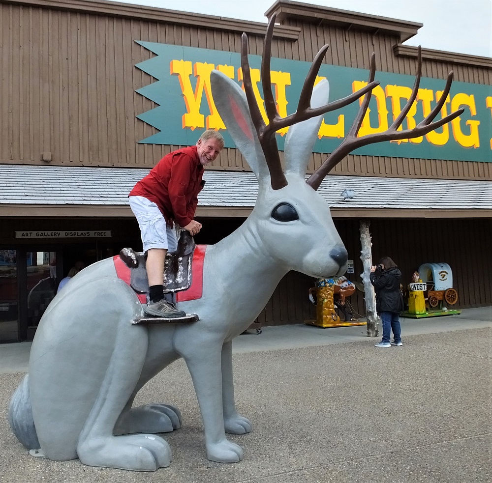
(2019 Grand Teton Ep 23)

Oil and Wind
Old and new on the Oklahoma Panhandle: oil wells and windmills

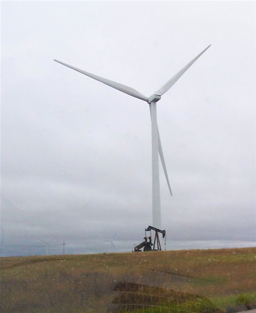
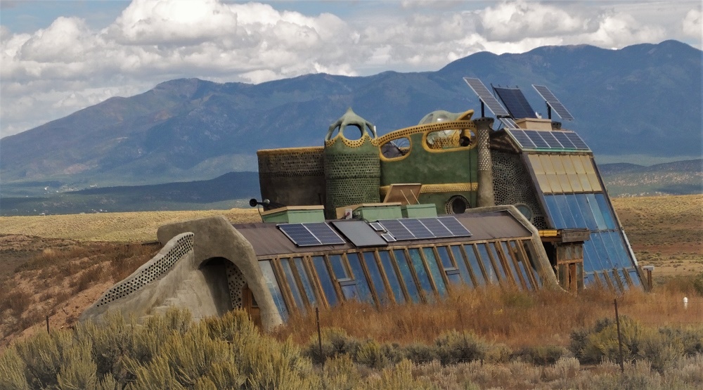
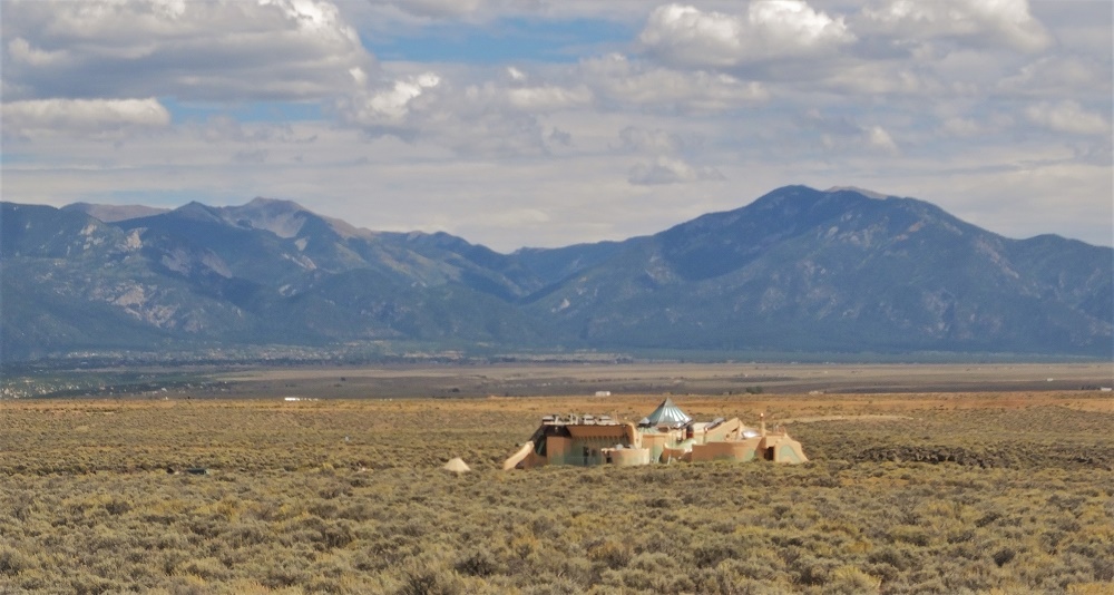
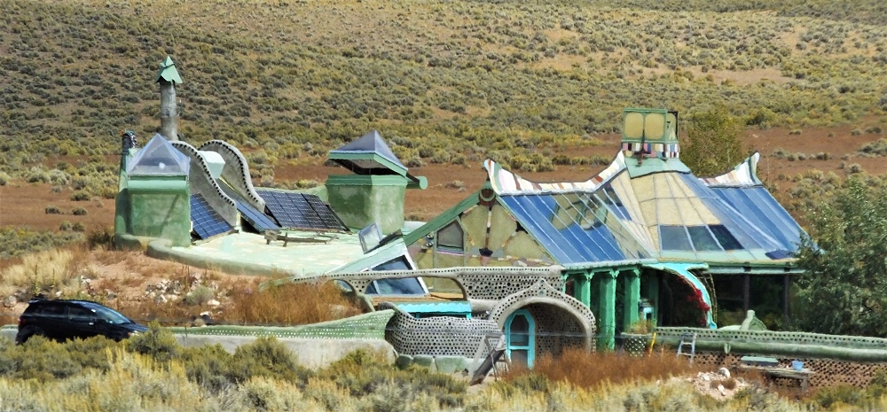
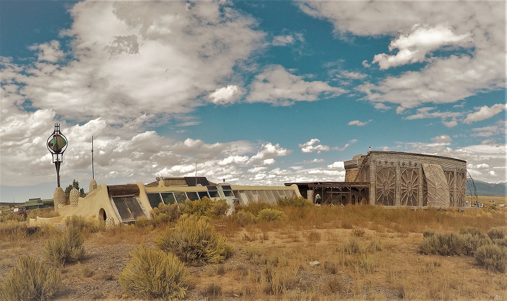
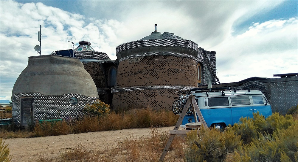
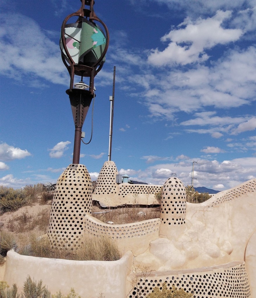
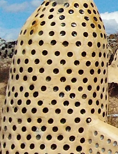
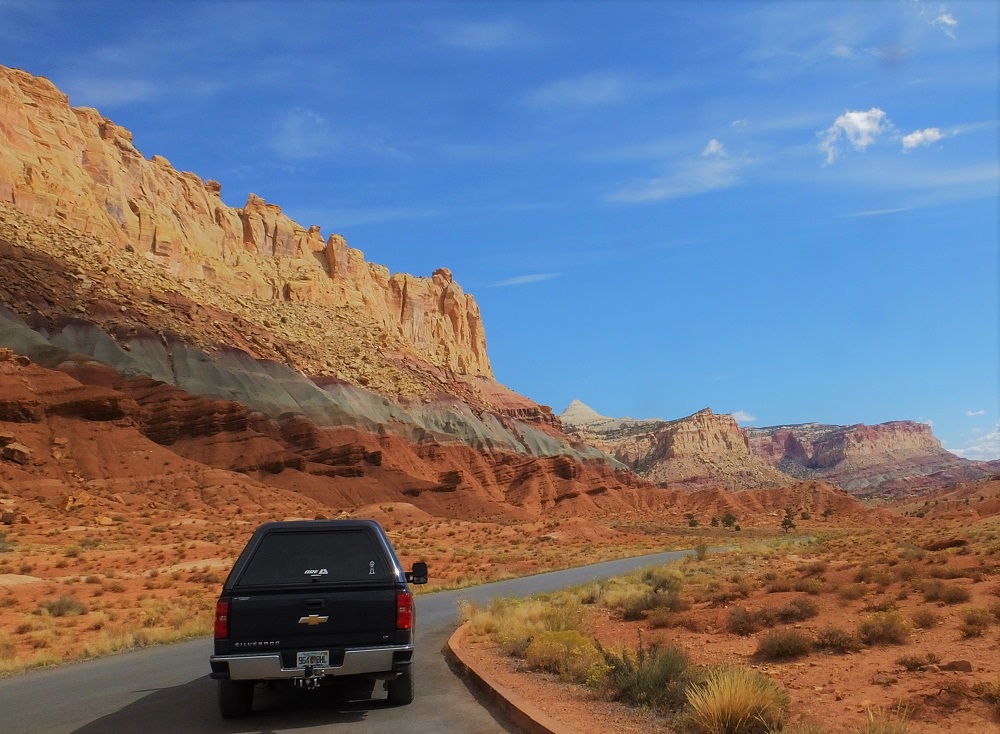
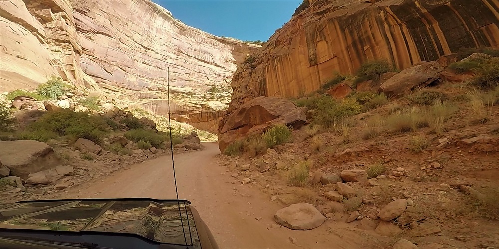
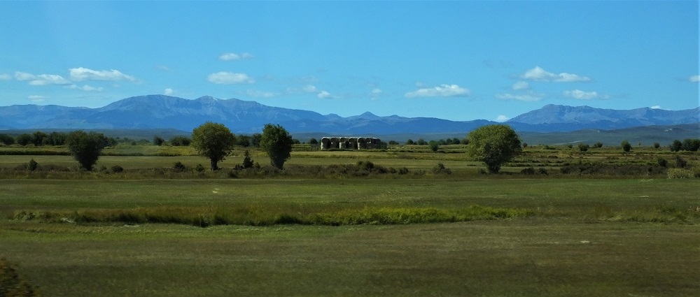
After an other-worldly visit to Earthship Biotecture near Taos, NM, our next eight days were spent returning home to Florida.   Some days were longer than others as we crossed the Oklahoma panhandle, southern Missouri, Mississippi, Alabama and Georgia (map points 16-20).

(Quick aside: we recently learned about the 230 Rule from a fellow RVer.   According to the rule, one should drive no more than 230 miles or stop by 2:30 pm on travel days.  Sounds like a good thing – we will have to remember this on our next trip!)

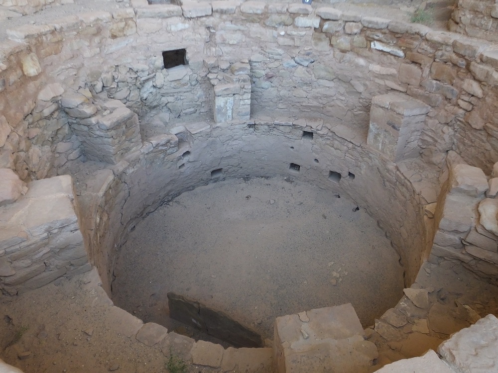
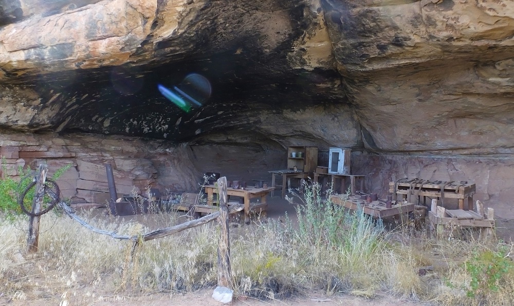
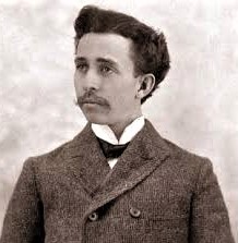
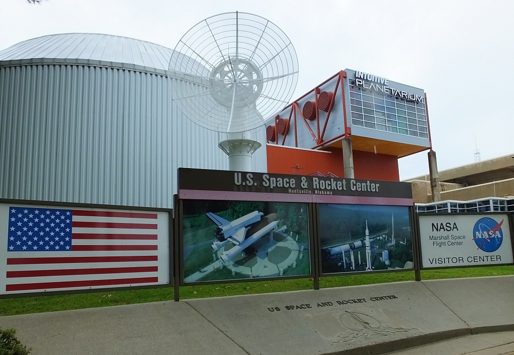
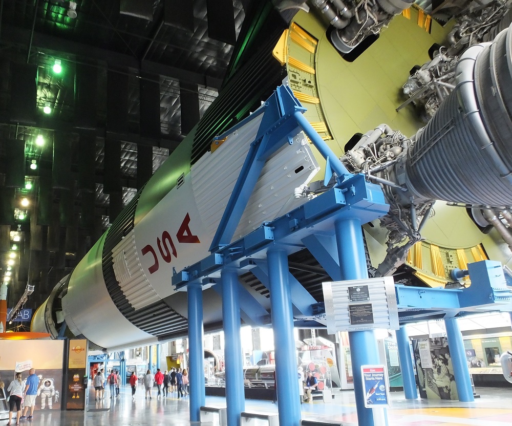
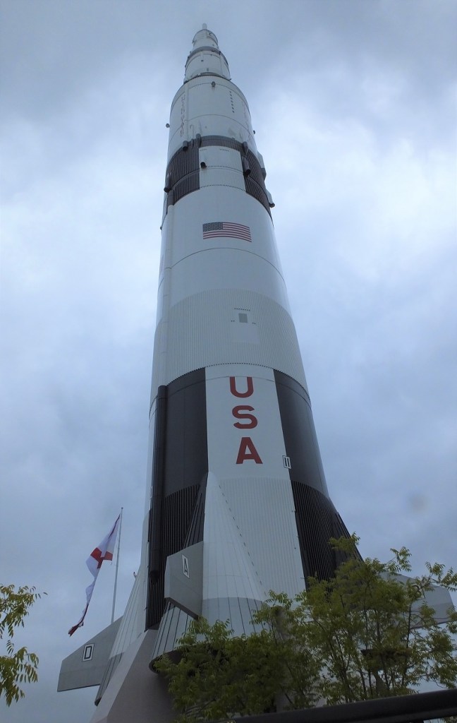
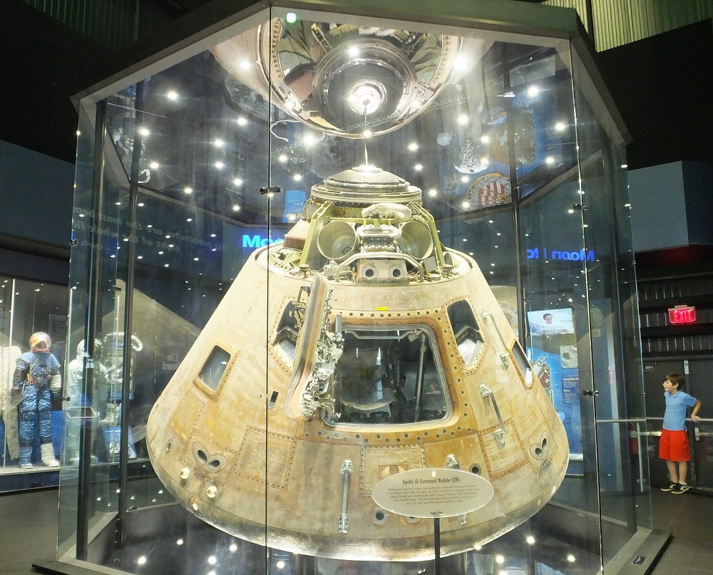
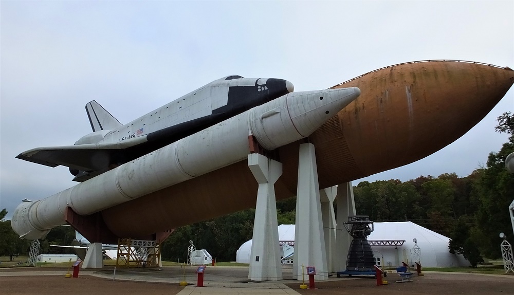
After driving east for several days, we enjoyed two days at Monte Sano State Park (map point 21), atop a tall mountain near Huntsville, Alabama. We visited the US Space and Rocket Center in Huntsville where we learned the importance of German rocket scientist Wernher von Baun to the US space program following WWII.  The museum has lots of interesting displays including a full-scale Saturn V rocket/Apollo capsule and space shuttle mockup.  The museum is well worth visiting if you are in the area.

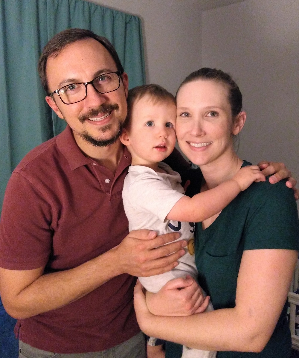
We visited Liz, Josh and Henry in Georgia on our last night before returning home. What fun it was to see them all and enjoy our grandson now that he is walking and beginning to talk.  We are eagerly anticipating the arrival of Henry’s baby sister in April!

Josh-Henry-Liz
Josh, Henry and Liz

Grand Teton Journey:  by the Numbers

  • 6960 / $1647.17 – total miles driven/total fuel costs (23.7 cents/mile)
  • 1380 – photos of trip (actually there were a lot more but we deleted duplicate and unflattering photos)
  • $1155.54 – campsite fees ($33 night average)
  • 35 and 22 – days of trip and different places camped
  • 23 – Grand Teton Journey blog posts
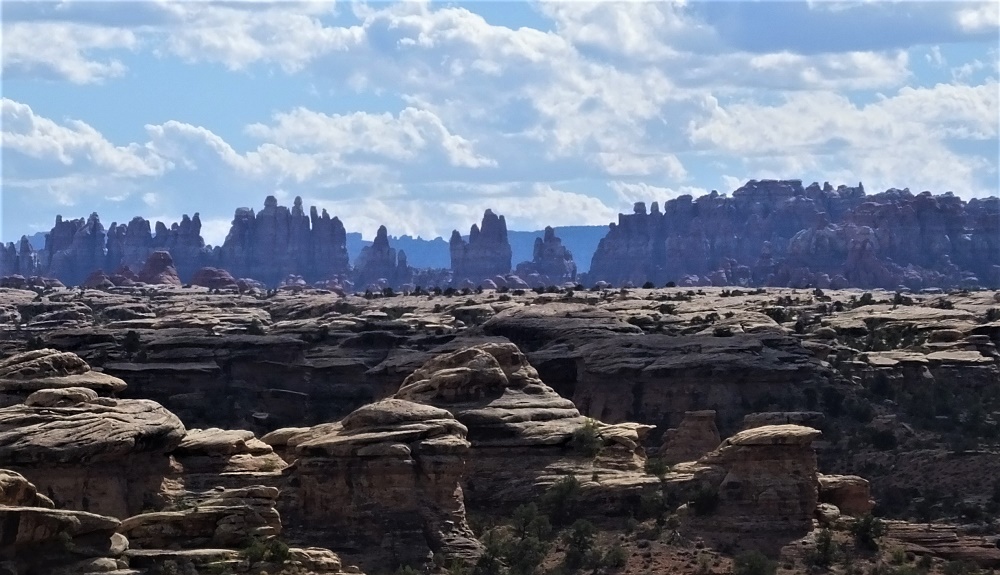
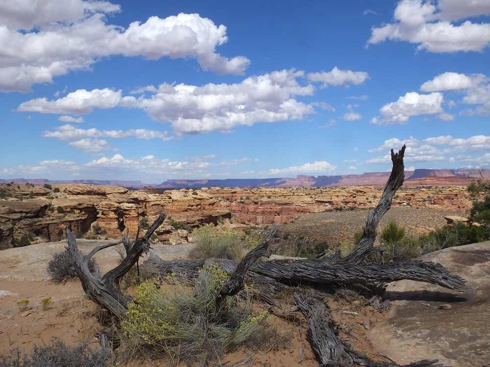
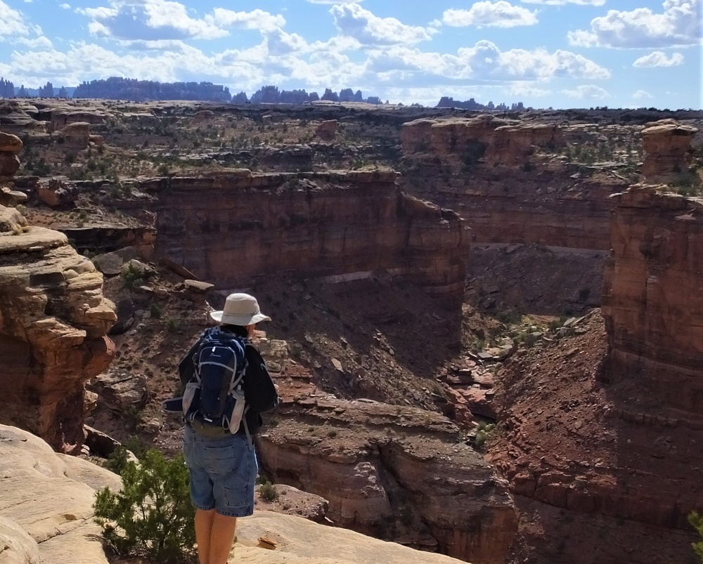
  • 18 – states visited (including our #50 Nebraska)
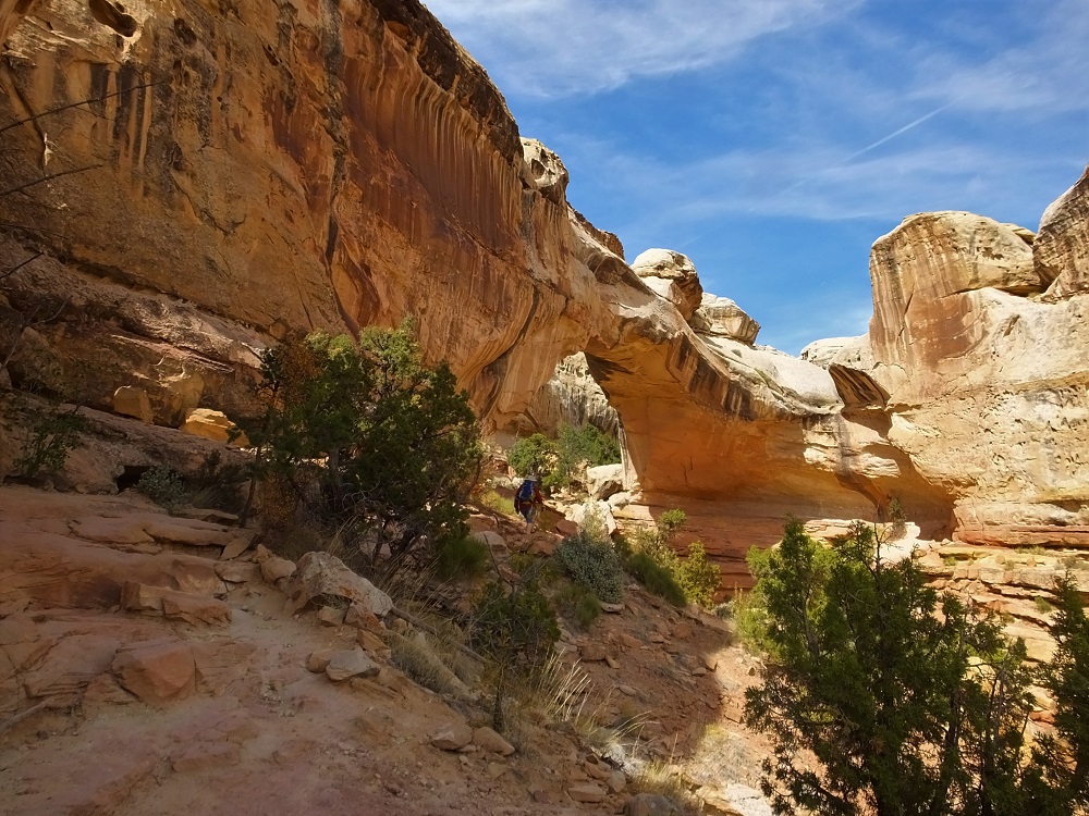
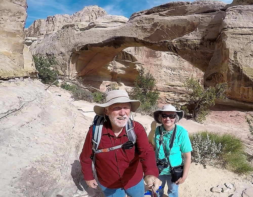
  • 10 – national parks visited (camped at 4)
  • 9 – state parks visited (camped at all 9)
  • 1 – dislocated finger (ouch)

Grand Teton Journey Faves

Favorite Place Camped

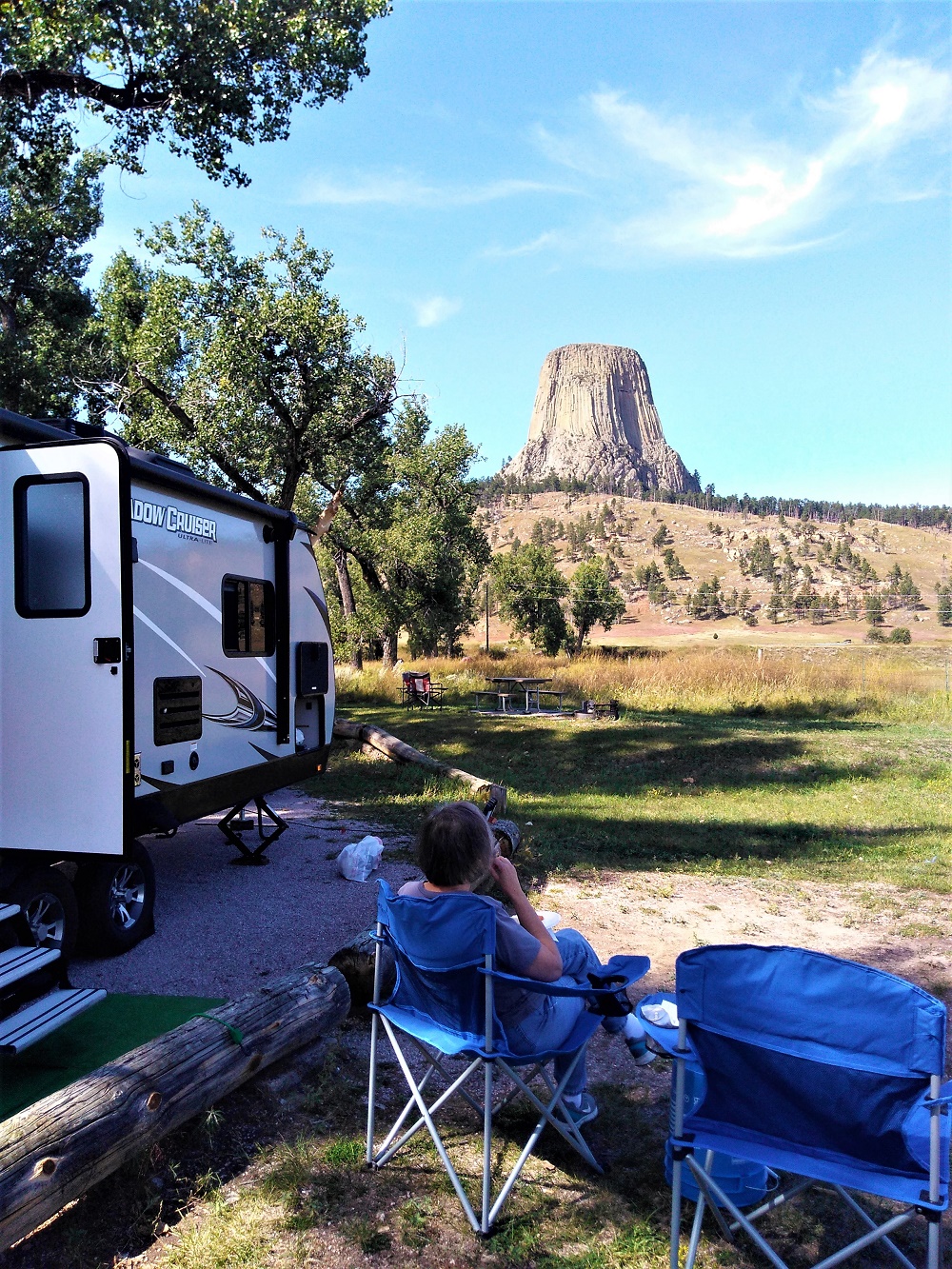
Both – Devils Tower National Monument.  Perfect weather and unparalleled views.

Devils Tower 2
From our campsite

Favorite View From The Road

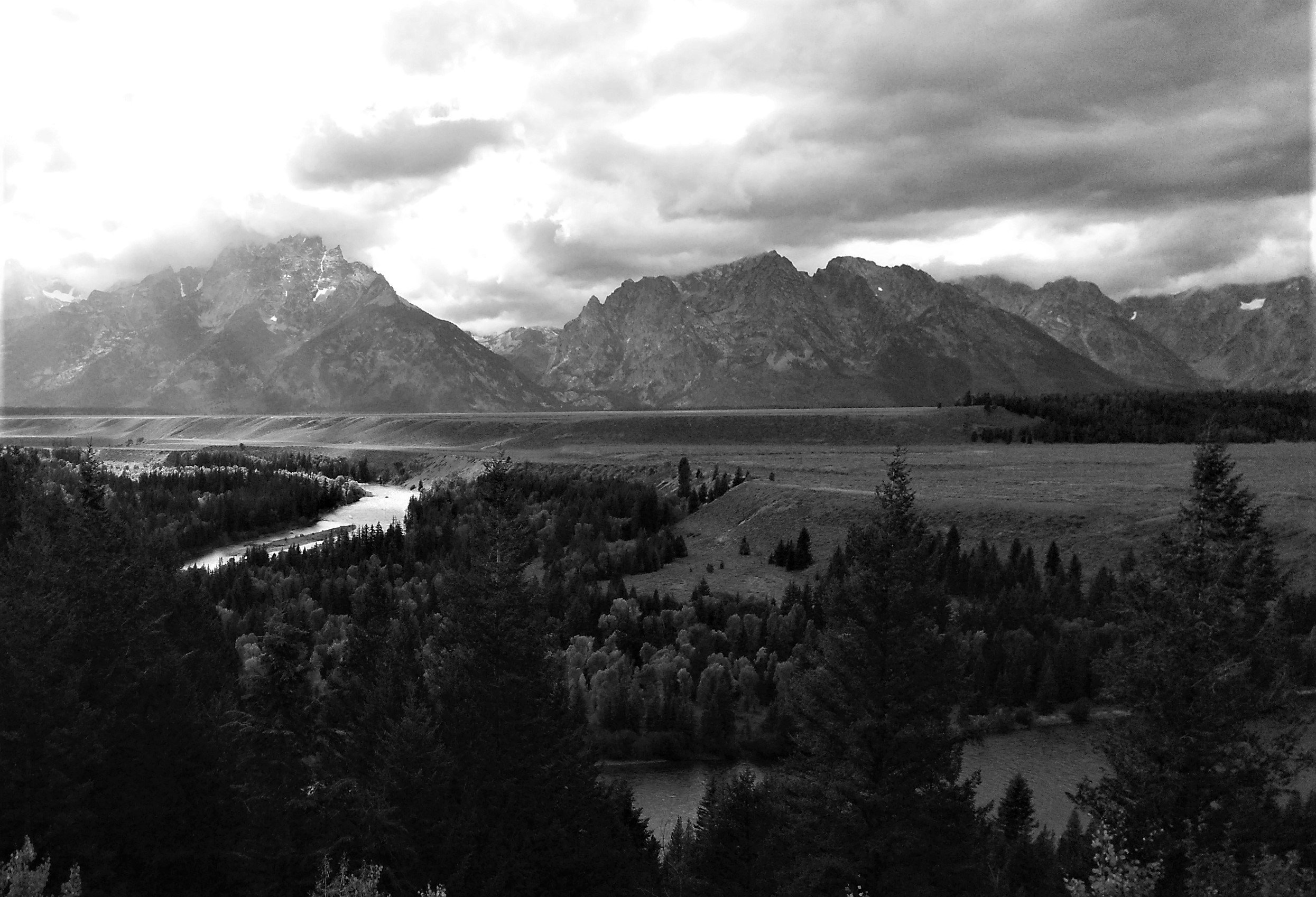
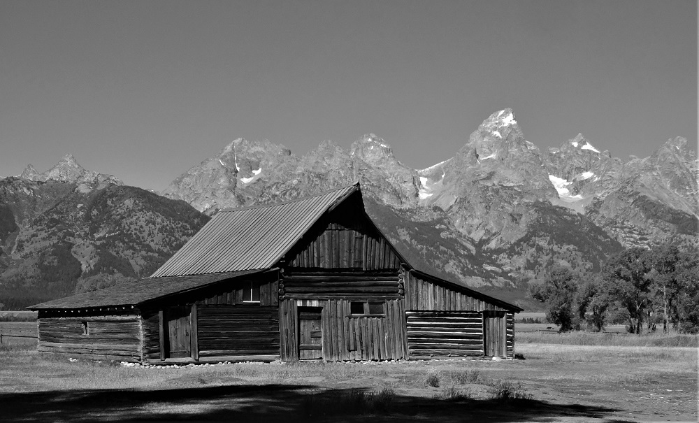
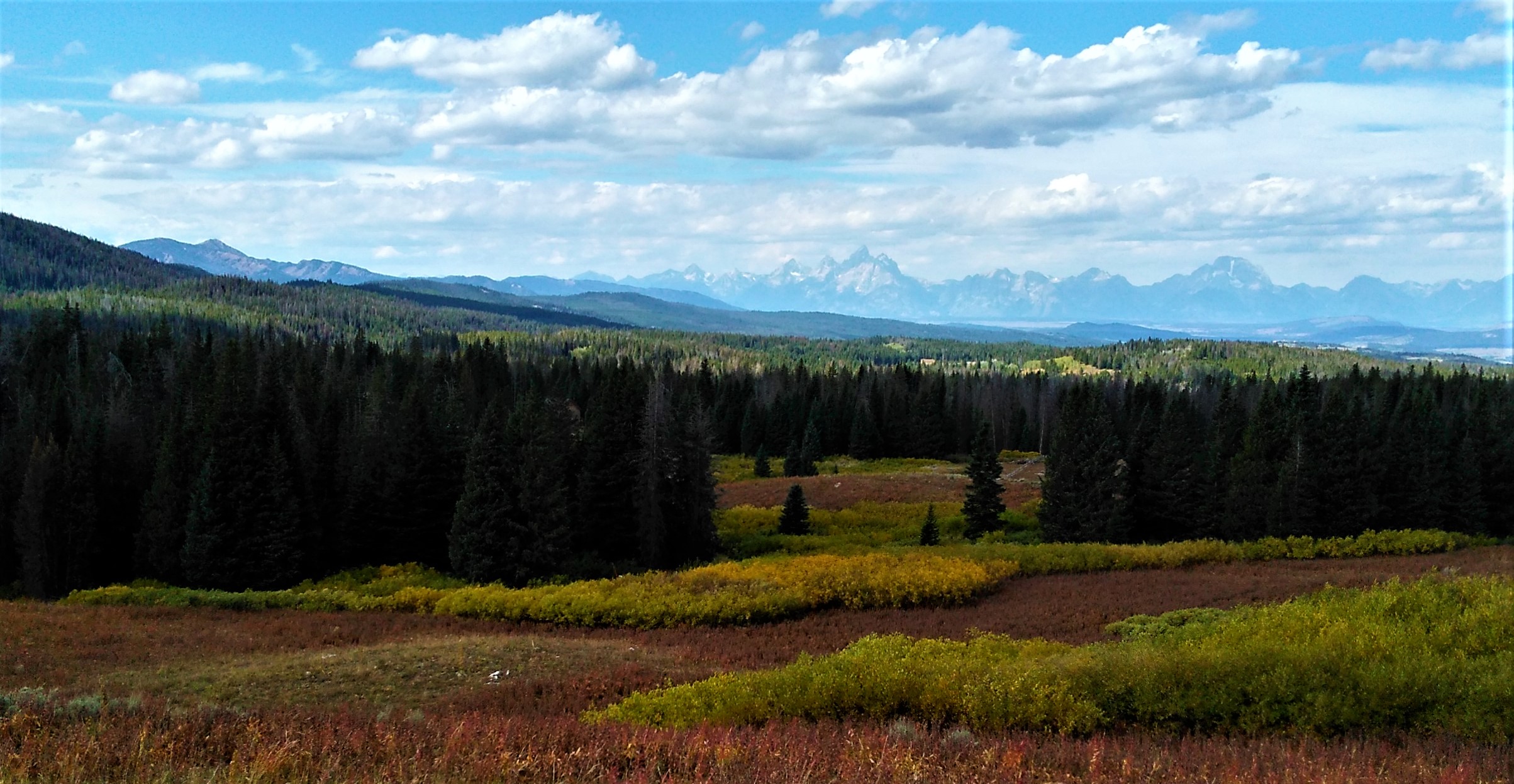
Ed – first view of Grand Tetons to the west as we crossed the Togwotee Pass

Tetons - First View
Our first view of the Tetons.

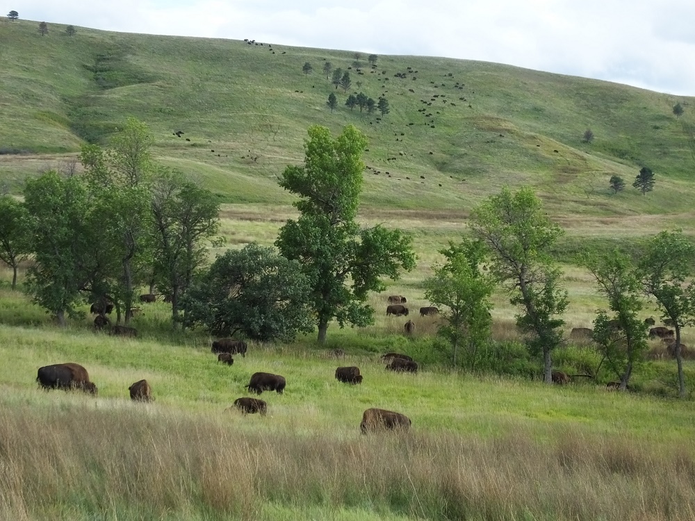
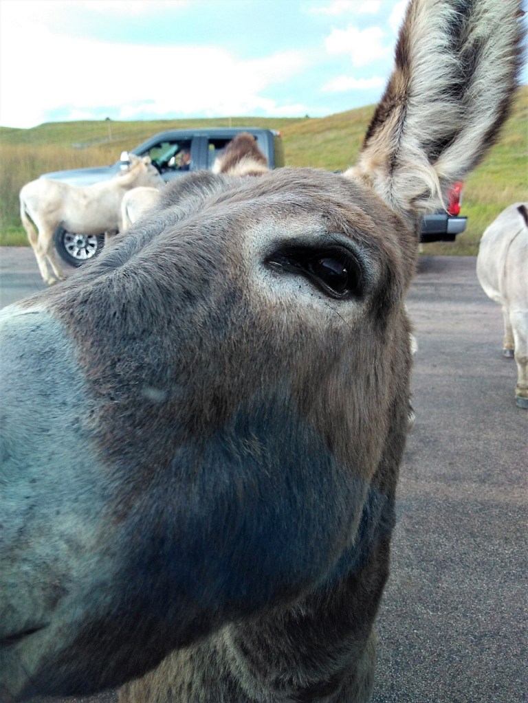
Pat – bison herds and donkeys at Custer State Park

Favorite Hike

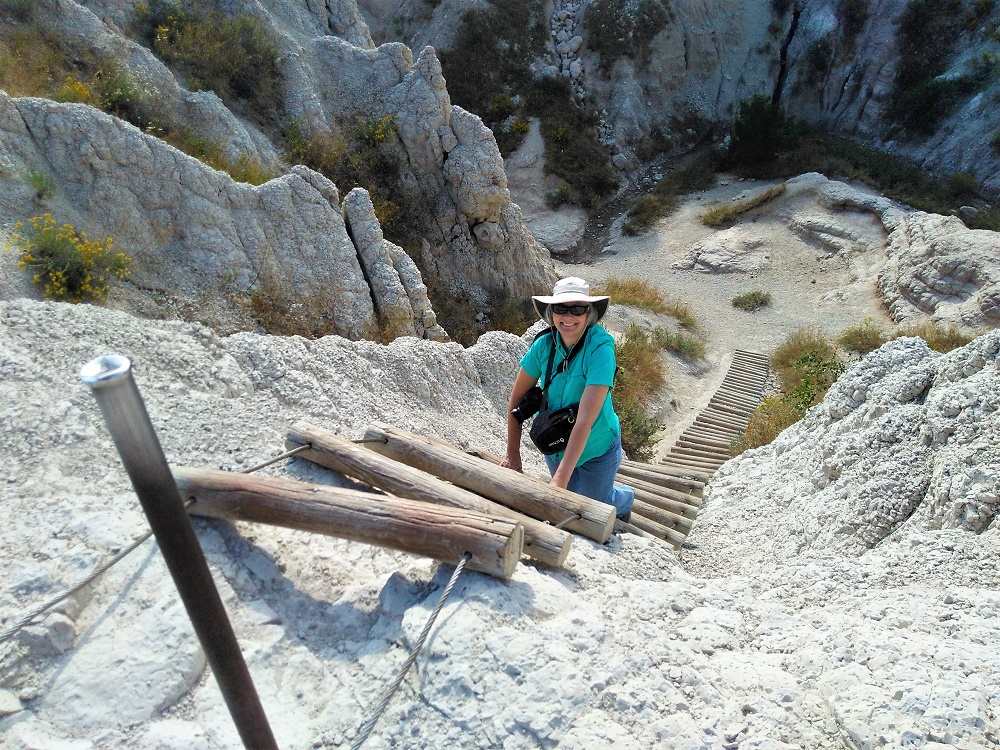
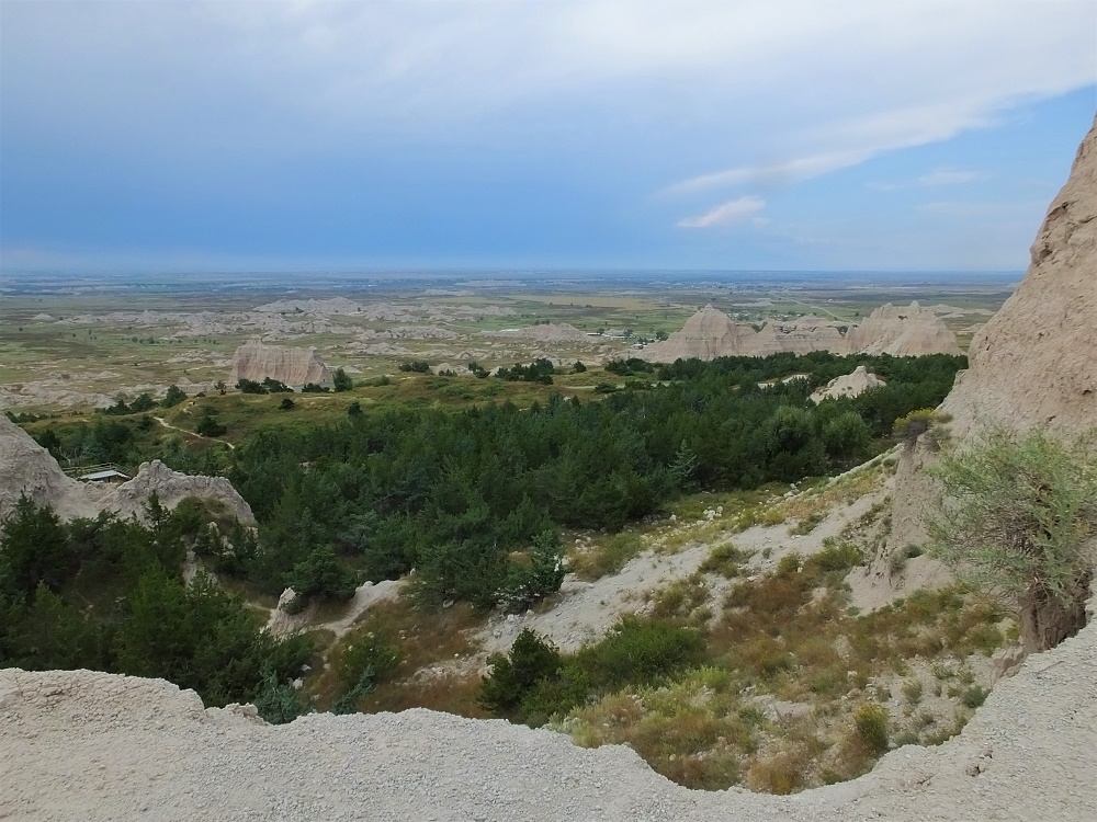
Ed – Notch Trail in Badlands National Park

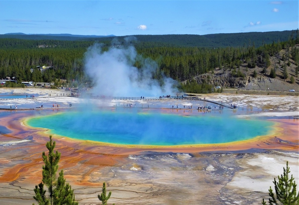
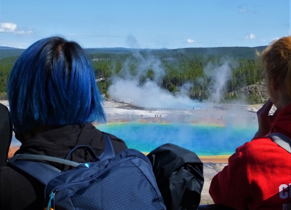
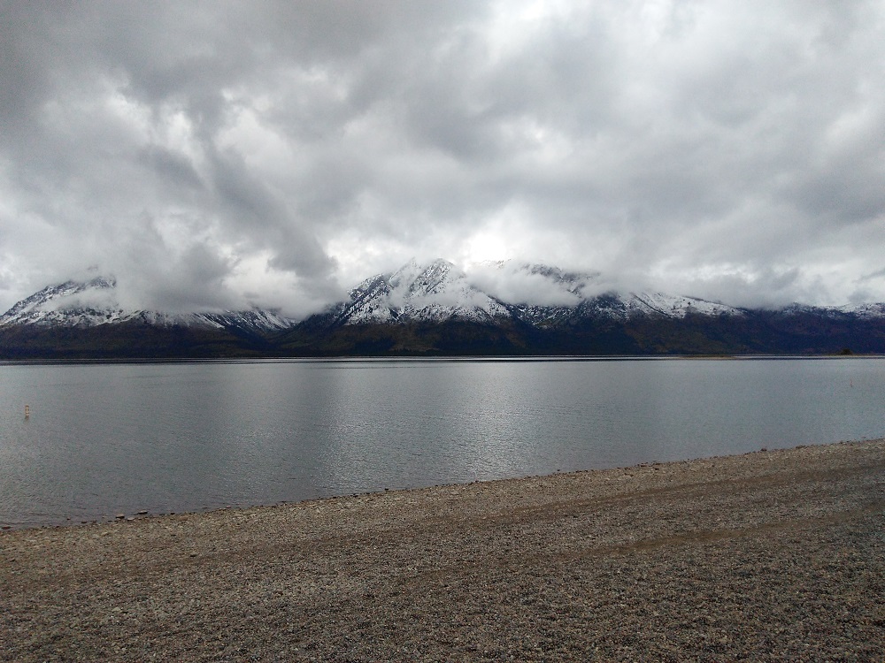
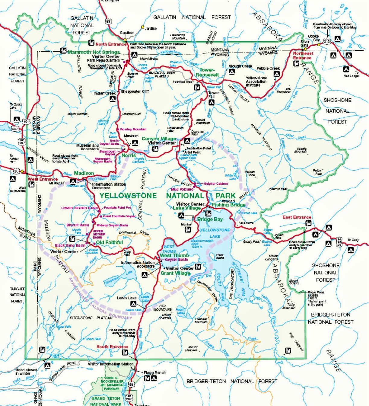
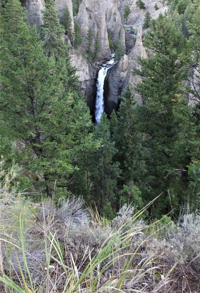
Pat – Grand Prismatic Spring Overlook Trail in Yellowstone National Park

Grand Prismatic Spring

Otherworldly Sightings in NM: Earthship Biotecture

(2019 Grand Teton Ep 22)

We headed east across northern New Mexico (between map points 15 and 16).  From sagebrush covered mesas we enjoyed panoramic views of distant mountain ranges.

Near Taos we encountered a bizarre looking community spread across the arid valley floor.

There were dozens of houses that looked like a cross between Captain Nemo and Lost in Space.  Or perhaps Star Wars Tatooine come to Earth.  We stopped to take a look.

The houses are part of a community that is the home of Earthship Biotecture.

Earthships are passive solar houses made of natural and upcycled materials such as earth-packed tires, bottles and more.  Pioneered by architect Michael Reynolds, the houses offer unique solutions to (what they say) are six needs for harmonious living on earth: food, energy, clean water, shelter, garbage management and sewage treatment.

At the visitor center we learned about eco-construction and self-sufficient living. There are examples of interesting construction methods and implementations of systems for food production, solar energy collection and storage, and waste-water management.

Earthships have landed in dozens of locations around the globe.  Sustainable living concepts and how to build the structures are taught at Earthship Academies at the headquarters near Taos, in distant locations like Haiti and Puerto Rico, and online.

Want to experience life in an Earthship?  You can rent one for a night or a week!

Max and Earthship Oscar
Max and Our Earthship Oscar

Oscar is our more conventional version of an Earthship.   As we left, we programmed in our GPS coordinates, engaged Max’ propulsion systems and headed on to the next rabbit trail.


Next week – we take a blog break.  RabbiTRAILs will resume on January 29 with a wrap up of our 2019 Grand Teton journey.  Until then…keep taking the LONG ROAD!

Mesa Verde NP: Where Did The Cliff Dwellers Go?

(2019 Grand Teton Ep 21)

A few miles east of the Canyonlands there are archaeological sites containing dwellings and relics of ancestral pueblo people that lived in the area until around 800 years ago.  Many of these sites are preserved at Canyons of the Ancients and Hovenweep National Monuments, Escalante Pueblo (at the Anasazi Heritage Center) and Mesa Verde National Park.

We could only spend a couple days in the area (map point 15) before continuing home, so our visits had to be short.

Escalante Pueblo and Distant Mountains
Escalante Pueblo Ruin

After seeing a hand therapist in Cortez, Colorado for my dislocated finger, we toured the Anasazi Heritage Center, a short distance from town.  The center has interactive exhibits on archaeology, local history and Native America cultures, and includes a full-scale mock-up of an Anasazi pit house from around 1000 AD.  We then walked a half mile trail up to Escalante Pueblo, a partially excavated surface ruin that has at least 20 rooms and a kiva. From the hilltop, we enjoyed views of the Delores River and McPhee Reservoir, and several distant mountain ranges.

The next morning we drove to Mesa Verde National Park about 30 minutes from Cortez.  I first visited the park with my family when I was teenager.  Pat, our children and I have visited the park a half dozen times over the years.

Although Mesa Verde is Spanish for Green Table, the park actually slopes to the south.  From the visitor center at the park entrance, added since our last visit, a steep winding road scales the face of the mesa and continues nearly 25 miles to the ruins.  The park is the largest archaeological preserve in the US, with over 5000 sites and 600 cliff dwellings.

Tickets are required for ranger-led tours of three of the most well-known and visited cliff dwellings (see below).  Unfortunately tickets were sold out the day of our visit, so we settled for two self-guided tours.

We visited Step House after hiking 3/4 mile via a steep and winding trail that descends 100 ft.  The dwelling has more than a dozen rooms and several kivas.  We enjoyed cool shadows during an otherwise warm late September afternoon.

Step House
Step House

Several miles away, Spruce Tree House has 130 rooms and 8 kivas.  It the easiest cliff dwelling to access via a 1/2 mile round trip trail that descends only 100 ft with no steps or ladders.  Unfortunately we could only view the ruin from the mesa above – the trail and cliff dwelling were closed due to rock fall from the cliff above the ruin.  The view was amazing none-the-less.

Spruce Tree House
Spruce Tree House

Here is some information about ranger-led tours – we have visited these dwellings several times previously.

Cliff Palace, the largest cliff dwelling in North America, has 150 rooms and 23 kivas, and supported around 125 people.  You must follow a steep trail with four ladders to descend to the ruin and ascend back to the parking lot.

Cliff Palace

Not far away, Balcony House has 40 rooms.  You descend a LONG (and scary!) ladder to reach the ruin, crawl through a short tunnel, and then ascend a steep cliff face back to the parking lot.  This tour was one of our favorites!

Long House is located several miles away on the Wetherill Mesa.  After hiking more than two miles to reach the ruin, you must climb two ladders and a steep staircase to the 150 room cliff dwelling.

There is much more to see at Mesa Verde, and at least two days are needed to take it all in.  The park is a fascinating place to visit.


Our homeward drive to the east continued the next day.  Near Taos, New Mexico, we encountered a different type of fascinating and rather unique dwellings.

More on our visit next week.

Canyonlands NP: Dry, Desolate and Deep!

(2019 Grand Teton Ep 20)

We left the goblins and traveled on toward Moab, Utah.

Moab is the gateway to Arches and Canyonlands national parks and is very popular for various types of outdoor adventure, including mountain biking, hiking and 4-wheel-drive driving.

We arrived in the early afternoon and learned all of the campgrounds in town were full.  With cooler fall weather, there were lots of visitors in the area.  Camping reservations are necessary during spring and fall months – something we will remember for our next time.

We continued 55 miles south to Monticello, Utah (map point 14).  In 2013, we stayed at a bed and breakfast in Monticello and know what the area has to offer.  With Monticello as a base, one can enjoy interesting day trips to the four corners area (where Arizona/New Mexico/Utah/Colorado touch), Monument Valley, Natural Bridges National Monument and the Canyonlands National Park Needles District.  Longer day trips to Moab, Arches National Park and the Canyonlands National Park Islands in the Sky District are also possible.

Canyonlands NP
Canyonlands Park Entrance

We camped in Monticello and decided to visit the Canyonlands Needles District during our one full day in the area.

The temperatures were rather warm during our late September visit so we brought plenty of water and wore hats during two hikes in the park.  We enjoyed four overlooks along the 2.4 mile Slickrock Foot Trail that had views of canyons, pinnacles and reddish peaks of the Needles area.  We were unable to see where the Colorado and Green Rivers join at the bottom of the canyon however.

Later that afternoon we hiked the nearby Cave Spring Trail, a short trail that included relics from a 19th century cowboy camp tucked under cliffs of a low mesa, interesting petroglyphs and rock art, and a couple ladders that one must climb to reach the top of the mesa.  From the top we had a panoramic view of the Needles area.

As we drove back to Monticello, we passed by Newspaper Rock, a sandstone rockface that has hundreds of petroglyphs of human, animal and material forms.  It is said to be one of the largest, best preserved and most accessible collections of petroglyphs in the Southwest.  Perhaps this was the pre-Internet Internet

We had reached the point in our journey to begin the long return to Florida.  Our next planned stop would be at Cortez, Colorado, where I would have my dislocated finger checked out and where we would visit some amazing Indian cliff dwellings.

Beware – A Valley of Goblins!

green goblin
Fortunately we didn’t see any of these

(2019 Grand Teton Ep 19)

From Capitol Reef National Park we headed northeast towards Moab and Canyonlands/Arches national parks.  About half way there were signs for Goblin Valley State Park and decided to sidetrack a few miles.

Located in a remote area about eight miles off the main highway, Goblin Valley State Park has thousands of hoodoos, referred to locally as goblins.  The goblins are mushroom-shaped rock formations that are 10-20 foot in height.

Across several valleys, hundreds of these formations cast interesting shadows that look like goblins advancing on the visitor.

2019-09 Grand Teton 1026 - 1909271227
Goblin Valley

After lunch, we took a few moments to walk in one of the valleys, among the goblins/hoodoos.

Here is a short video taken during our walk (please bear with us as we learn how to create and post Youtube videos).


After a safe escape from Goblin Valley, we continued to on Moab, where we found ourselves among many other visitors during one of the busiest times of the year.

Capitol Reef NP: Ripe Fruit Trees and Views that Please

(2019 Grand Teton Ep 18)

After visiting J.C. Penney, we continued south to Utah where we bypassed Salt Lake City and Provo, bound for Capitol Reef National Park.  In some areas autumn was evident on the distant hills, with red and yellow tinged trees.  Not the beauty of colors in the eastern U.S., but eye candy none-the-less.

We dry camped at Torrey, Utah, about seven miles from the park (map point 13).   Our campsite had a nice view of sagebrush flats leading up to clay-colored, eroded mesas.

Capitol Reef National Park extends about 60 miles north to south and is less than five miles wide at most points.  Although much of the park is remote, an eight-mile scenic drive provides amazing views.

The park is situated along a wrinkle in the earth known as the Waterman Fold.  The dramatic lifts and folds of the fold are seen all along the drive.  Two short side roads pass through narrow canyons to interesting hiking trails (time-lapse video).

Scenic Drive
Waterman Fold view along scenic drive
Canyon Drive
Driving the canyon along the Capitol Gorge spur road

We ate lunch at a picnic area in the Fruita Historic District.   The Fremont River flows through the district where Mormon pioneers built irrigation systems and planted apple, cherry, peach, pear and apricot trees.  The apples were ripe so we picked several pounds for a small fee.  Pat sliced the apples and baked them with cinnamon sugar and butter for a delicious dessert.

Freemont River
Fremont River along the Hickman Bridge Trail
Apples
Picking apples

Not far away we ventured up a 1.2 mile rocky trail to Hickman Bridge, a 130-foot natural arch near the Fremont River.  It was our first significant trail since hiking in the Tetons a week earlier where I fell and dislocated a finger.  Thankfully there were no incidents this time – only great views of the arch and adjacent canyons.

Hickman
Almost to the Hickman Bridge, a 130-foot long natural stone arch
Hickman Bridge Selfie
Hickman Bridge selfie

Tip:  We learned an important lesson while in the area.  Spring and fall months are high season – the parks are crowded and campgrounds are full.  We were told summer (hot) and winter (cold) months are less busy.  We’ll make reservations should we return one day.

Bonus Tip:  locally made fruit pies, various preserves and other items are sold in the park at the Gifford House.  The fruit pies are VERY popular – 28 dozen were sold by 2 pm on the day we visited.  All were gone when we went to the store :>(.   Stop at the store EARLY if you want to enjoy a delicious local treat!


After a couple days in the area, we headed northeast to Moab and Canyonlands/Arches National Parks.  Along the way we would have an interesting encounter with goblins.

Along the LONG ROAD

(2019 Grand Teton Ep 17)

During the weeks and miles of our trip to the Tetons, we saw some interesting sights that we would like to share with you.

Bison, Goats, Prairie Dogs, Sheep…Brontosaurus?

We were driving along the rolling hills of southwest South Dakota enjoying amazing wildlife.  Then we saw it – a turquoise brontosaurus.  We wondered how it got there…

Bronto

Riding A Jackalope

The jackalope is part of western folklore – said to be a cross between a now extinct pygmy-deer and a species of killer-rabbit.  Occasional sightings of this rare creature are rumored to still occur, with small pockets of jackalope populations persisting in the America West.

Jackalope Rider

Expedition RV Inspiration

The typical RVs one sees while traveling include trailers, fifth wheels, pop-ups and slide-ins.

Some rugged, probably affluent and definitely eccentric travelers camp in military-style prepper expedition RVs.  We saw the massive rig below in Grand Teton National Park.

Truck 2

A few minutes later we discovered the vehicle that must have provided the inspiration for this rugged RV.

Truck 1

What Hair Color is That?

We hiked to an overlook with a phenomenal view of the Grand Prismatic Spring in Yellowstone.  A young lady with blue hair was also enjoying the view.  If you would like to dye your hair her color, request Grand Prismatic Blue.

Grand Prismatic Blue

Caution:  Bison Formation Ahead

As we returned to the parking lot from the Grand Prismatic Spring, we saw the interesting formation below alongside the trail.  The cone resembled several of the geysers elsewhere in the park.

A reminder to stay alert and watch where you walk.

Bison Formation

Ava the Avocado

Before we left for the Tetons, Pat placed an avocado seed in a cup filled with water to get it to sprout.  We didn’t want the resulting baby avocado plant to shrivel up while we were away, so we brought Ava with us – for more for than 6000 miles and 17 states.  Now that she’s home, Ava is putting down roots in a pot on our deck!

Ava

No Double D for Pat and Me

The photo below is of a ranch entrance near Taos, New Mexico.  We had no desire to trespass or camp in the area.

No Trespass

Next week – Capital Reef National Park and the missing pies…

A Visit with J.C. Penney

(2019 Grand Teton Ep 16)

Having toured the Tetons and Yellowstone we faced a decision:

Head north to the Dakotas and Theodore Roosevelt National Park, then to International Falls and Voyageurs National Park in Minnesota, continue across the north shore of Lake Superior to Pukaskwa National Park in Canada and finally to Sault Ste. Marie in Michigan on the way home.

Or head south to Capitol Reef, Arches and Canyonlands National Parks in Utah, followed by Mesa Verde National Park in Colorado.

We chose the southern route.  I had to find a place for treatment of my dislocated finger and the weather forecast for a major first storm of the winter was expected to hit Montana and the Dakotas .  The northern route would have to wait for a future trip.

Our choice was good!  To the north it was cold and snowy (see news), definitely not suitable for camping and outdoor activities – not for thin-blooded Floridians and most other people.  In addition, we found a hand therapist in Cortez, Colorado (near Mesa Verde) to look at my finger.

Rangelands
Wyoming rangelands and distant mountains

We made plans to spend the night in Evanston, a town in southwestern Wyoming (map point 12).  Crossing rolling rangelands with mountains in the distance, we came to the town of Kemmerer, Wyoming.  In the center of town, we noticed a sign on a building:

Storefront
The first JC Penney store in Kemmerer, Wyoming

The first JC Penney store was in a small town in remote southwest Wyoming!  We stopped to learn how the massive department store chain started in Kemmerer.

JC Penney photo
JC Penney

James Cash Penney was born in 1875 on a small farm in Missouri.  After high school, he held several jobs, including that of clerk at a dry goods store where he began his training as a merchant.   He moved to Colorado where he owned a butcher shop, and at age 23 he went to work for Golden Rule Stores based in Colorado and Wyoming.

The store owners offered him an opportunity to join them as a partner and to open a new store in Kemmerer, Wyoming.  The store opened on April 14, 1902 and was an instant success, based on two then revolutionary ideas – cash only transactions and the golden rule: do unto others as you would have them do unto you.

Additional stores were opened, and when the owners gave Penney an opportunity to buy their interest in the Wyoming stores, he jumped at the chance.  By 1912, there were 34 Golden Rule Stores headquartered in Salt Lake City.

In 1913 the chain was incorporated in Utah as the JC Penney Company.  The company headquarters was moved to New York City a year later to be closer to their major suppliers of merchandise.

The JC Penney Company was remarkably successful – by the beginning of the 1920s, there were 197 stores from coast to coast with sales of nearly $43 million.

See JC Penney for more fascinating information about this man and the department store chain that help shape America.  For example, in 1940 he helped train a young Sam Walton at a JC Penney store in Des Moines, Iowa.

Penney lived the tenets of the company’s mission statement “Honor, Confidence, Service and Cooperation” and underlying Christian principles throughout his 95-year-life.


Before continuing to Capitol Reef National Park, we will pause next week to share several interesting sights encountered thus far during our Grand Teton travels.

Yellowstone NP: While in the Neighborhood…

(2019 Grand Teton Ep 15)

Yellowstone National Park is north of the Tetons.  Although we have visited Yellowstone a half dozen times in the past (including more than a week in 2018), we decided to visit again while we were in the neighborhood.

From Gros Ventre, we headed north a few miles to camp at Colter Bay (map point 10), still within Grand Teton National Park.  Colter Bay is on the eastern shore of Jackson Lake.  The Tetons rise majestically beyond the western shore of the lake.  Unfortunately the weather turned cold and rainy, and we were unable to hike or take boat tours available in the area.  Instead we did our laundry and toured the visitor center.

Colter Bay
Snow-dusted Tetons across from Colter Bay

Two mornings later, we left for Flagg Ranch (map point 11) as the weather cleared.   The tops of the mountains were dusted with fresh snow, a sign that winter was on its way.

Flagg Ranch is between Grand Teton and Yellowstone national parks, along the John D Rockefeller Jr Memorial Parkway.  We decided we would camp at the ranch for three nights and take day trips into Yellowstone.

Yellowstone National Park Map
Map of the Teton-Yellowstone area

Our Yellowstone visit bypassed most of the places we visited in 2018 – Old Faithful, Mud Volcano, several other groups of geysers and many of the viewpoints of Yellowstone Falls.   Instead we focused on areas we had not visited during recent trips or ever before.

We decided to go to Tower Fall in the northeast corner of the park.  En route we drove past Fishing Bridge, a Yellowstone River crossing just south of Yellowstone Lake.   The bridge has been rebuilt since 2018 and is now MUCH smoother.  Other road construction continues in the area and Fishing Bridge Campground will remain closed until sometime in 2021 (as an aside, Fishing Bridge is the only campground in the park with water and electric hookups).

It was strange not see herds of bison as we drove through the Hayden Valley.  They had migrated to other parks of the park.  We took a short detour along the south rim drive to see the Upper Falls on the Yellowstone River from Uncle Tom’s Trail.  The trail was closed for redevelopment during our 2018 visit.

About an hour later we arrived at Tower Fall, a 132-foot cascade along Tower Creek just before it merges with the Yellowstone River.  We viewed the falls at the start of a one-third mile trail that winds down 225 feet to the river.  At the bottom there is an interesting view of the multicolored canyon carved by the river.

As we returned to Flagg Ranch, we stopped to photograph snow-covered Mt. Washburn.  Pat and I (kind of) enjoyed a hike to the top of the mountain in September 2014 – breathless from the views and the 1400 foot climb to the peak!

Washburn Panorama
Mt Washburn Panorama 2014

The next morning we drove to the west side of Yellowstone to hike the Grand Prismatic Overlook Trail.  Parking at the trailhead was very crowded and we shared the trail with many others as we hiked one mile to the overlook.  We took our turn enjoying the view of the colorful spring.

Grand Prismatic Spring
Grand Prismatic Spring from Overlook

Later in the day we visited the Norris Geyser Basin to see Steamboat Geyser.  Steamboat is the world’s tallest currently-active geyser and has been in an active phase since March 2018, with 71 eruptions through our visit in late September.  The erupting geyser plume is more than 300 foot high and usually lasts between three and 40 minutes.

A worker at the adjacent National Park bookstore told us Steamboat eruptions were very load.  “It roars like a locomotive,”  he said.

Signs in the nearby parking lot warned vehicle paint could be damaged by fallout from the geyser.  Some area workers even had covers on their cars.

The geyser did not erupt during our visit.  We had to settle for spritzes of about 15-20 feet.  Our truck was unaffected.

Steamboat Geyser
Little action at Steamboat Geyser
Steamboat Warning
Warning: Park at your Own Risk

After more than a week in the Teton/Yellowstone area, it was time to start heading home.  We had a decision to make – head north to Montana and the Dakotas, or south to canyon country in Utah.  We’ll let you know the outcome next week.

Ansel Adams Wannabe?

(2019 Grand Teton Ep 14)

Snake River
Tetons from Snake River Overlook
Barn
T A Moulton Barn on Mormon Row

Some of the most stunning photographs of America’s national parks were taken by Ansel Adams.  His most famous and remarkable photographs were taken in black and white, and include classic images of Half Dome in Yosemite and the Tetons from the Snake River Overlook.

Adams’ story is intriguing.  He was not a successful student, suspected to be hyperactive and may have suffered from dyslexia.  Early in his life piano was his intended profession, but a love of nature and association with the Sierra Club and several noted photographers led to a lifetime as a naturalist who captured wonderful and now iconic images.

His technical mastery of such creative photography was remarkable. He would spend eighteen or more hours per day for days and months on end mastering his craft.  See Ansel Adams for more interesting details.

The beauty of the Tetons makes for excellent photographs.  In the age of digital photography, one can do a reasonable job of capturing some of the same amazing elements made famous by Adams.

Dunraven Pass
Gallatin Range from Dunraven Pass (Yellowstone NP)
Yellowstone River
Yellowstone River in Hayden Valley (Yellowstone NP)

Next week – we head north from the Tetons to visit America’s and the world’s first national park – Yellowstone.