

(2026 Wild West Wander Ep 6)
At more than 3.3 million acres, Death Valley is the largest national park in the contiguous US, larger than Yellowstone, Big Bend and Everglades national parks. Our three-day visit to the park gave us ample time to see various historic and geologic exhibits, visit better known areas like Furnace Creek and Stovepipe Wells, and hike several trails.
How Death Valley Got Its Name
In 1849-1850, a group bound for the California gold fields became lost as they crossed the valley. They feared they would perish in the harsh, unforgiving environment When they finally left the valley crossing mountains to the west, one of the pioneers said ‘goodbye, Death Valley.’ The name stuck!
Death Valley is an area of remarkable extremes.
Lowest
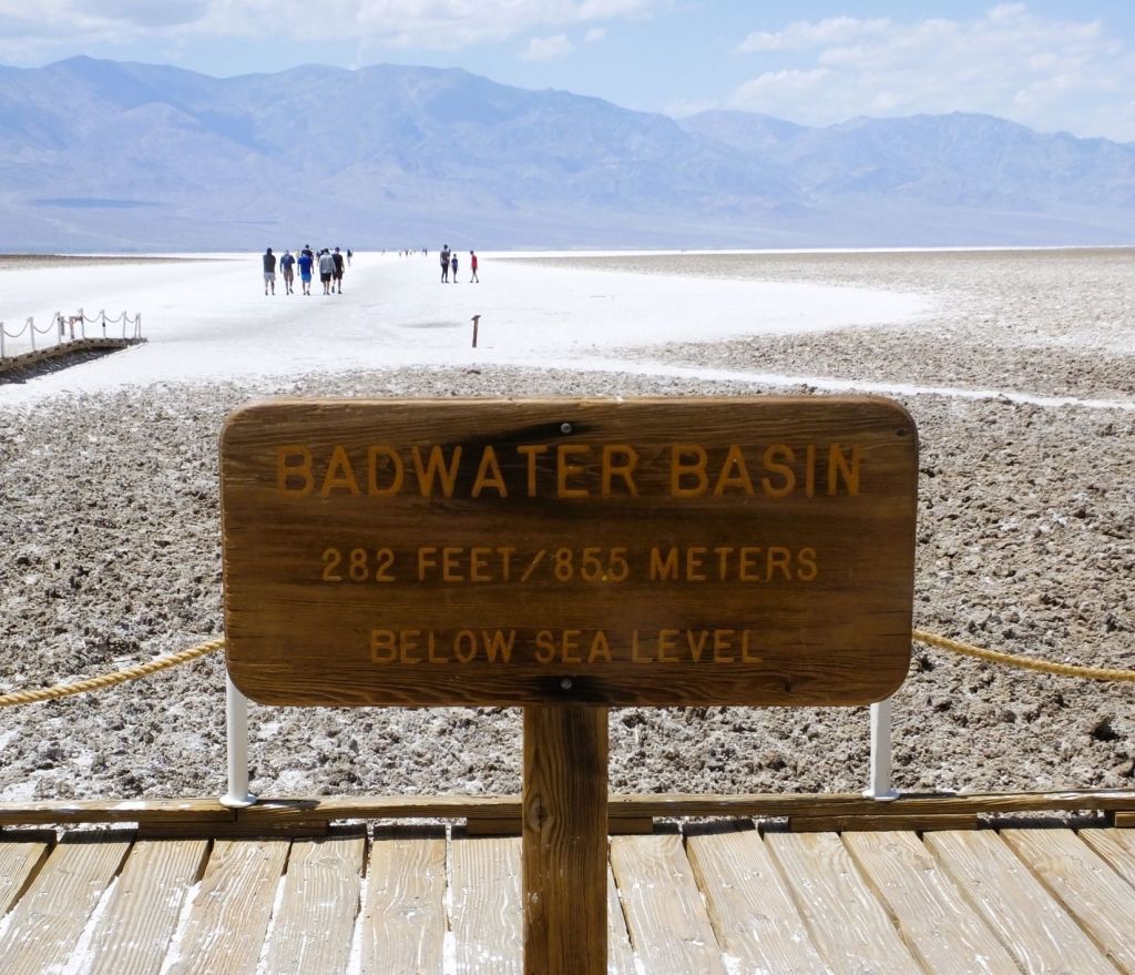
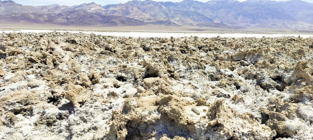
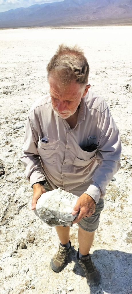
At 282 feet BELOW sea level, Death Valley’s Badwater Basin is North America’s lowest point.

We walked on the eye-numbing white salt flat that extends several miles to the Panamint Mountains to the west. Death Valley salt flats cover nearly 200 square miles.
Hottest
Death Valley is known for its extreme temperatures.
In 1913, temperatures reached a staggering 134°F – the hottest on earth and still the record.
In 2024, temperatures were over 120°F on 37 days and there were nine consecutive days where they did not get below 100°F.
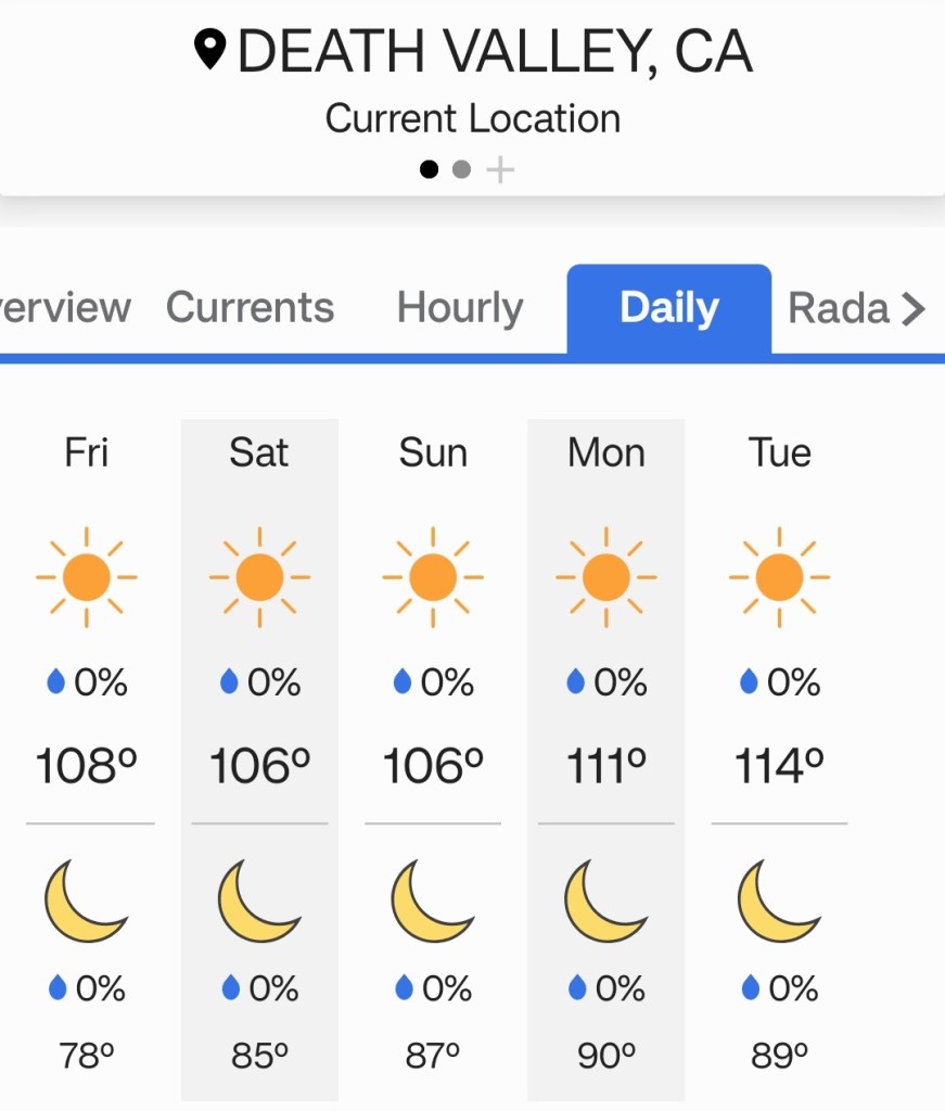
We were fortunate – the highs approached 100°F on two days of our visit and 85°F during our last day. Highs for the week after our visit were forecast to be between 106°F and 114°F!
Driest
Death Valley is also very dry, with an annual average rainfall of 2.15 inches.
When it does rain, the results can be devastating. In 2023, parts of the valley had 2.2 inches of rain IN ONE DAY causing flooding and road damage throughout the park.
The effects of water were very evident during a couple of our early morning hikes.
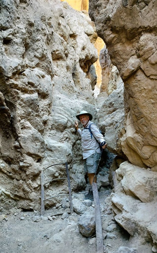
Mosaic Canyon
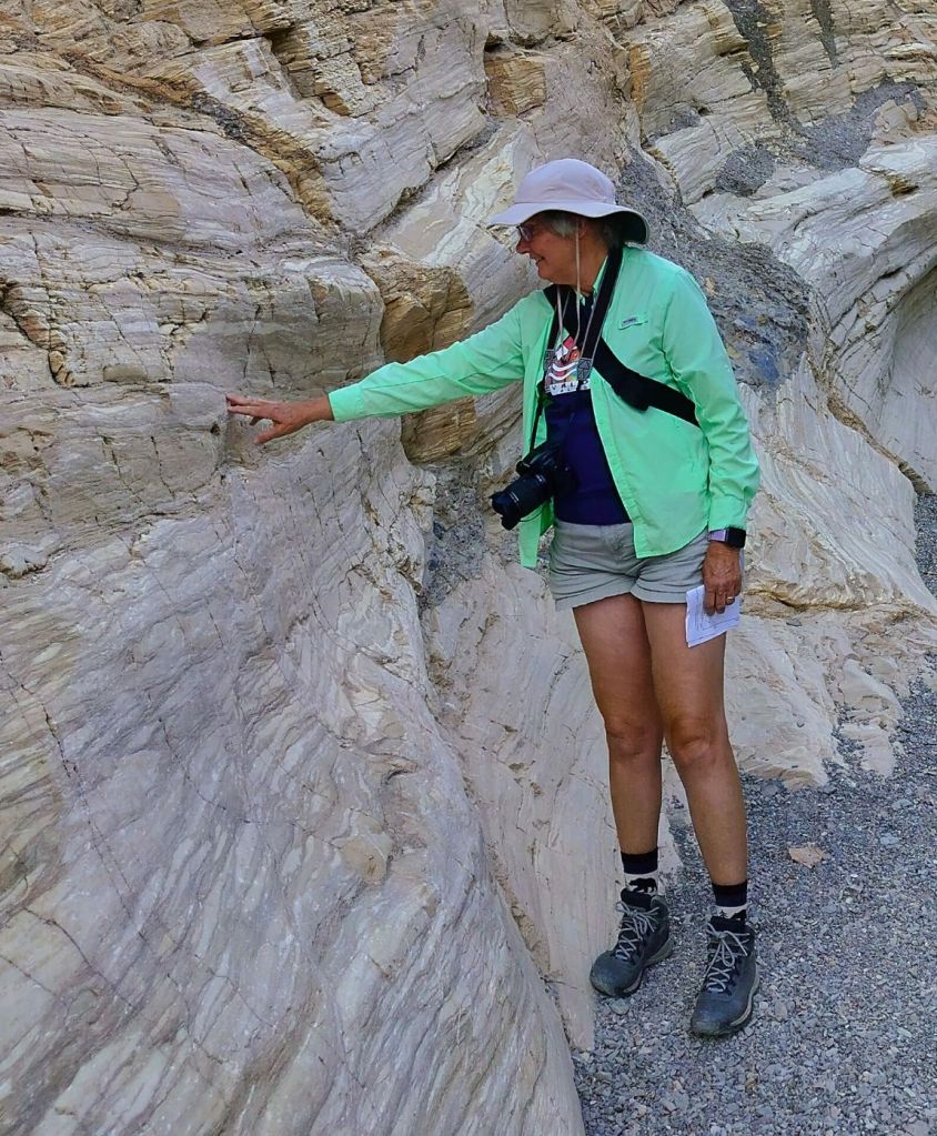
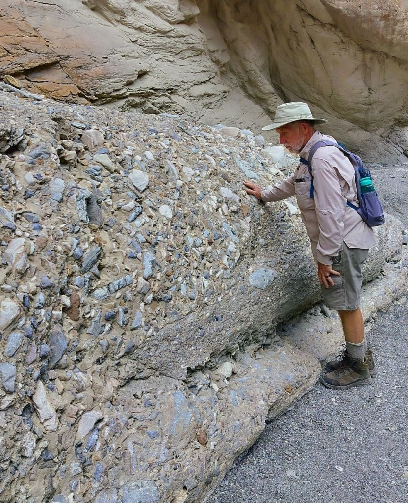
We hiked two miles up Mosaic Canyon passing through eroded canyon narrows with polished marble walls and colorful mosaics of conglomerated rocks,
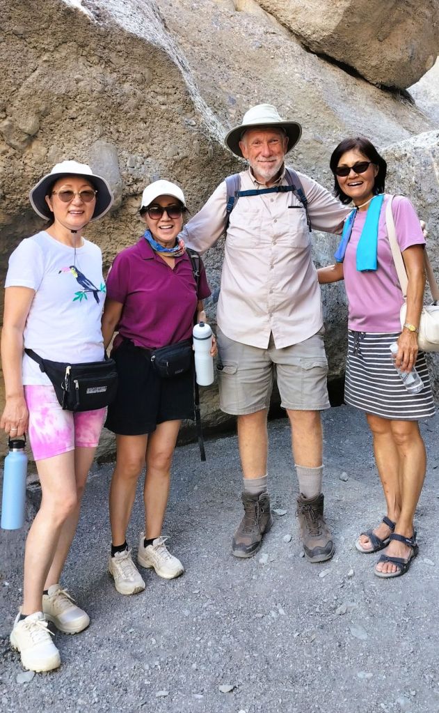
We met three women from California and when we told them about our travels and RabbiTRAILS blog, they asked to take a photo with us. We felt like celebrities.
We left the ladies as they discussed whether they would scramble up a 15-foot rockfall to continue the trail, and began our return to the start of the trail.
Mosaic Canyon is a mostly easy four-out-of-five boot trail. Start early in the day and bring lots of water.
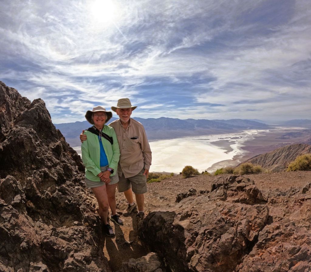
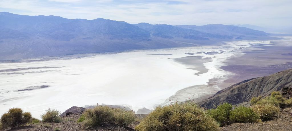
Dante’s View
As the day got hotter, we drove to Dante’s View, where Badwater Basin was visible 5700 feet below. The view was amazing and it was nearly 20 degrees cooler!
Red Cathedral Scramble
We started early the next morning to hike up Golden Canyon to the Red Cathedral. To reach the base of famous red colored amphitheater, we had to squeeze between, crawl over and duck under a number of large boulders.
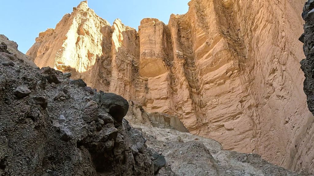
The 3.3-mile trail was beautiful, challenging and fun – a Death Valley must-do hike that we would rate five-out-of-five boots!
Harmony Borax Works
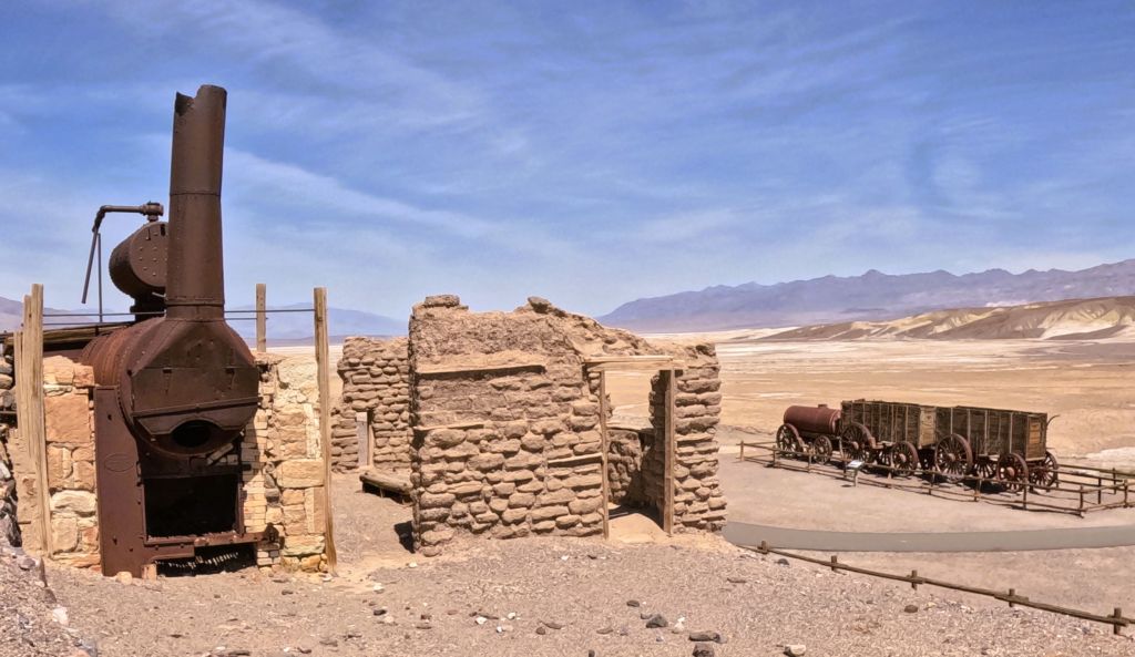
Death Valley is associated with images of 20-mule-teams transporting massive wagons of borax across the valley, primarily due to long running radio and television series that featured true stories of the American old west.
At the historic site of Harmony Borax Works, processing equipment and a double borax wagon are displayed. When in full operation, 40 men produced three tons of borax daily. More than 20 million pounds of ore were transported 165 miles to a railhead in Mojave, CA, a ten-day trip across the barren and hostile wilderness. Processing at the location ended in 1888, after only five years.
Borax is a multi-purpose cleaner used in laundry detergent and a number of industrial processes.
Salt Creek
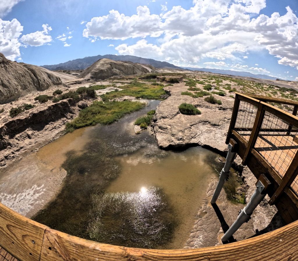
Salt Creek bubbles up and flows across the valley floor not far from the Harmony location. A half mile boardwalk follows the stream where the saline water starts its flow and eventually disappears as it soaks into the desert floor.
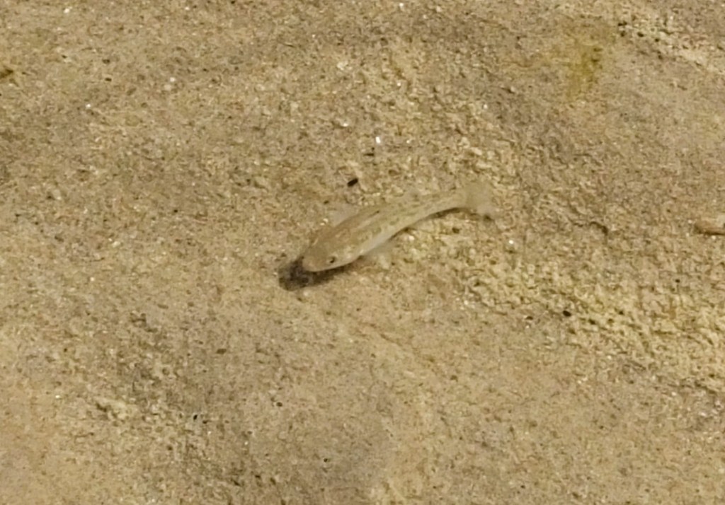
The stars of the walk are pupfish. Thousands of the one-to-two-inch-long fish dart in and out of underwater vegetation. The endangered fish have adapted to live in the creek, which has a salt concentration several times that of sea water.
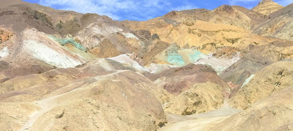
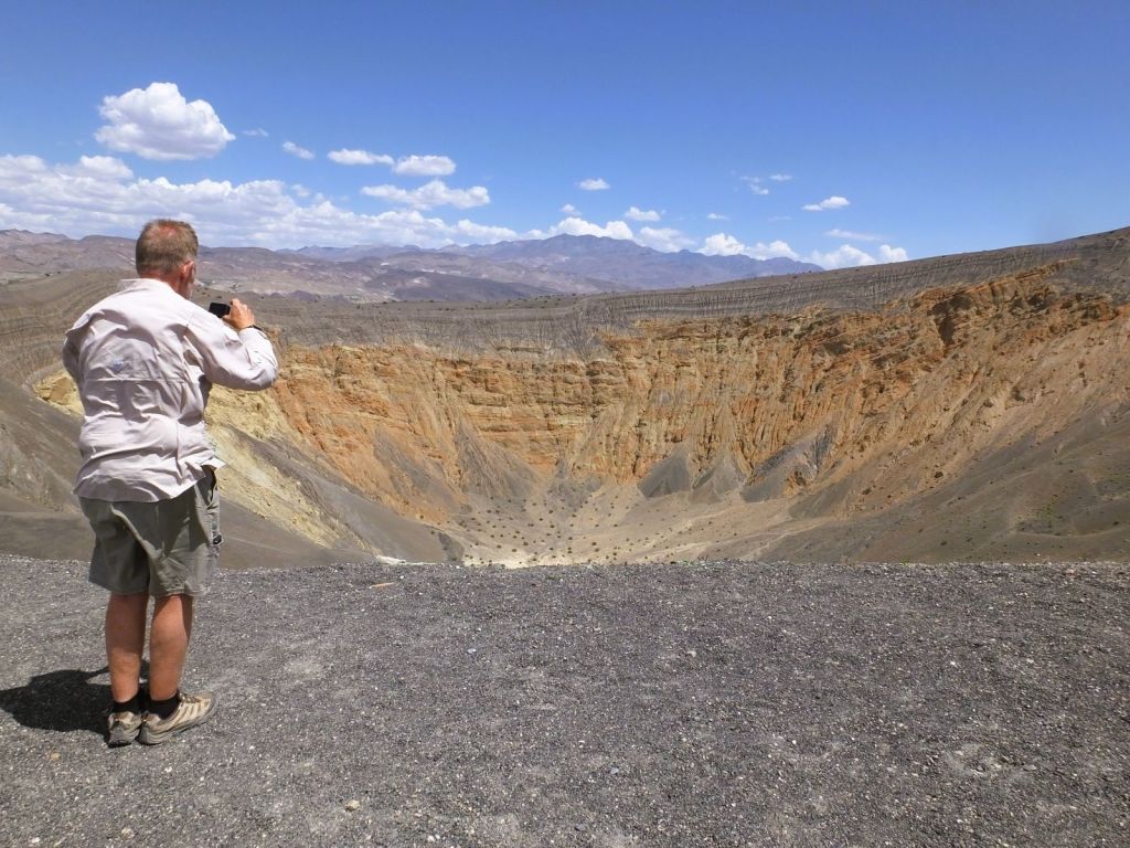
Other Death Valley Views
Next Week
We boondock in a rugged location where more than 400 movies have been made.

Thanks… you celebrities. Lol. Will have to add this to our must see locations. Russ
LikeLike
Hi – DV was great but I would avoid it later in the summer! We were glad to have hookups when we camped at Stovepipe Wells.
We are in Yosemite the next few days – our blog lags real time about two weeks.
Love and blessings to you and your wife!
E & P
LikeLike
20 mule team borax ghost wagons. Did you visit the Bristlecone forest with the Earths oldest living tree-it was alive when Moses lived. I presume next is Lone Pine and the Alabama Foothills.
LikeLike
Hi, next episode of RabbiTRAILS will be about Alabama Hills – we spent three nights there. We passed by the cutoff to the bristlecone pines, but did not have enough time to see them. Next trip perhaps…
LikeLike