Bison, Antelope and Prairie Dogs, Oh My

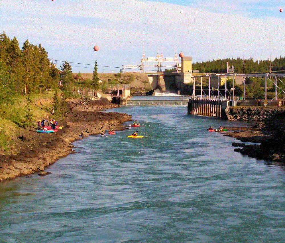
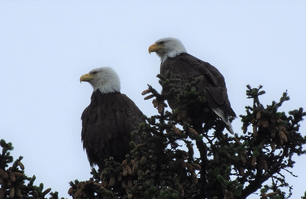
(2019 Grand Teton Ep 8)

Custer State Park is located In the heart of the South Dakota Black Hills.   The park is more than 71,000 acres and has an amazing variety of wildlife and natural features. We spent two full days exploring the park.

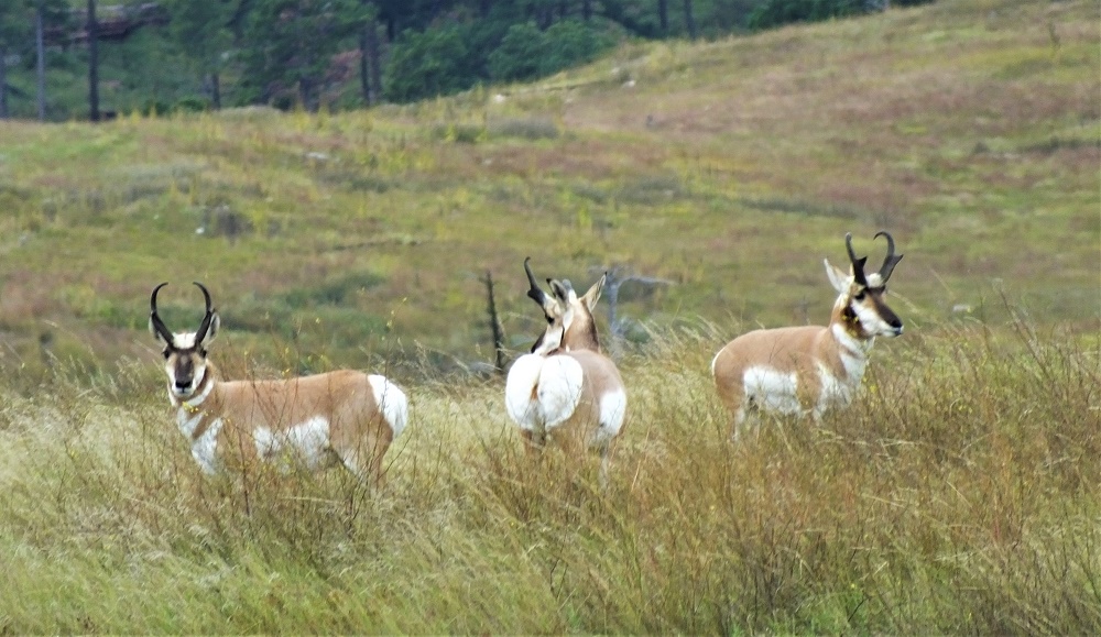
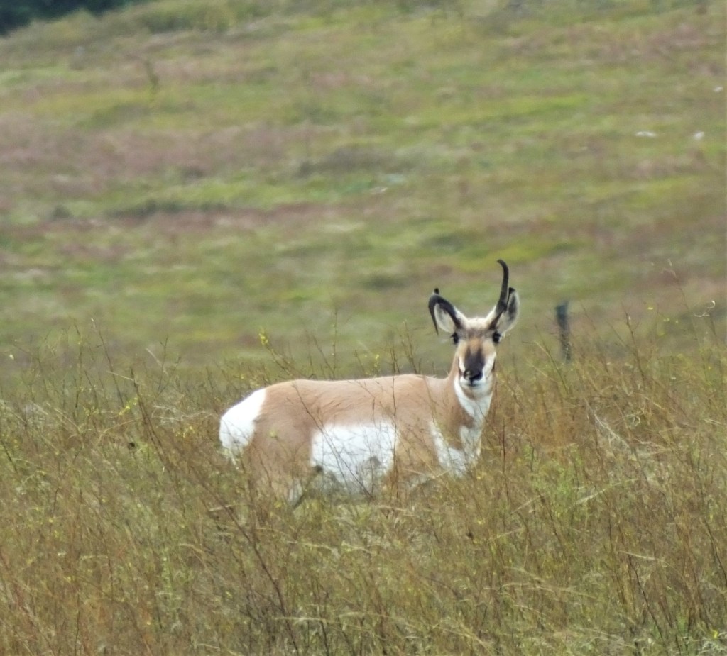
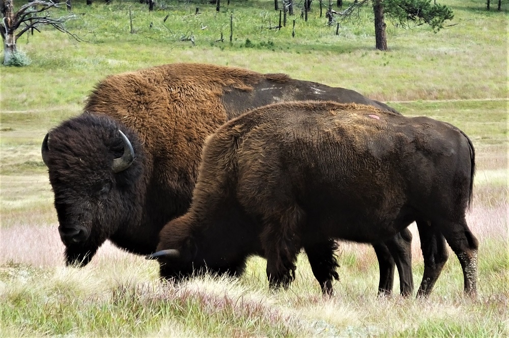
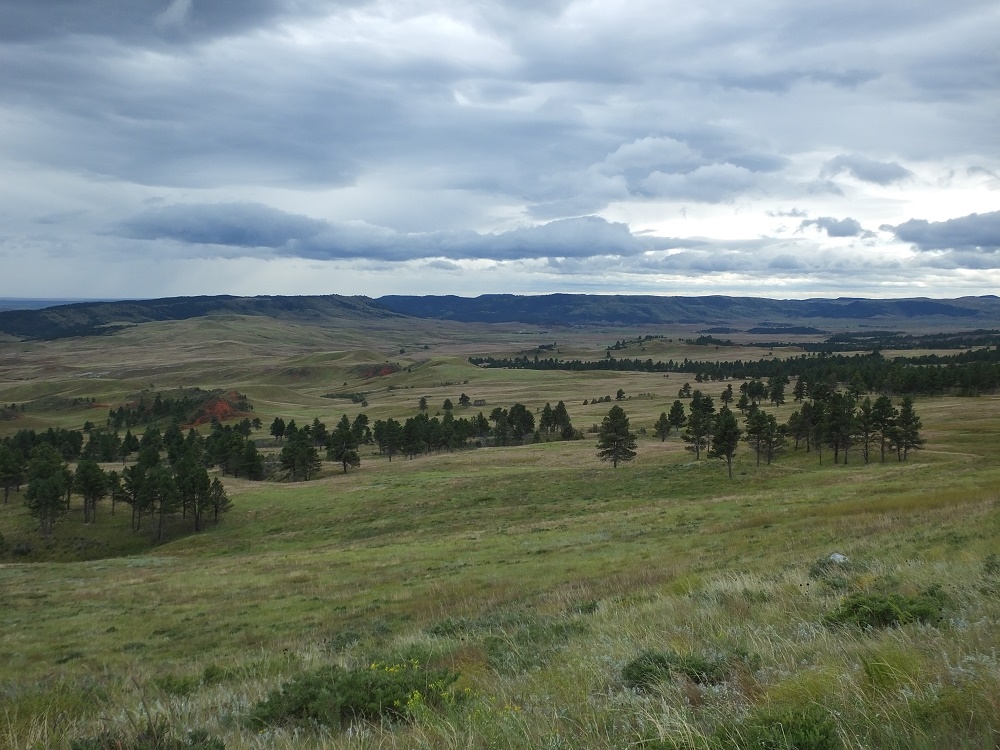
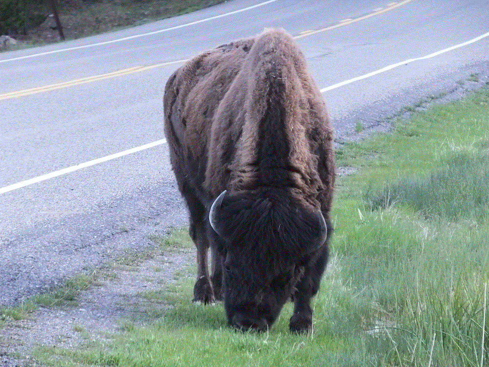
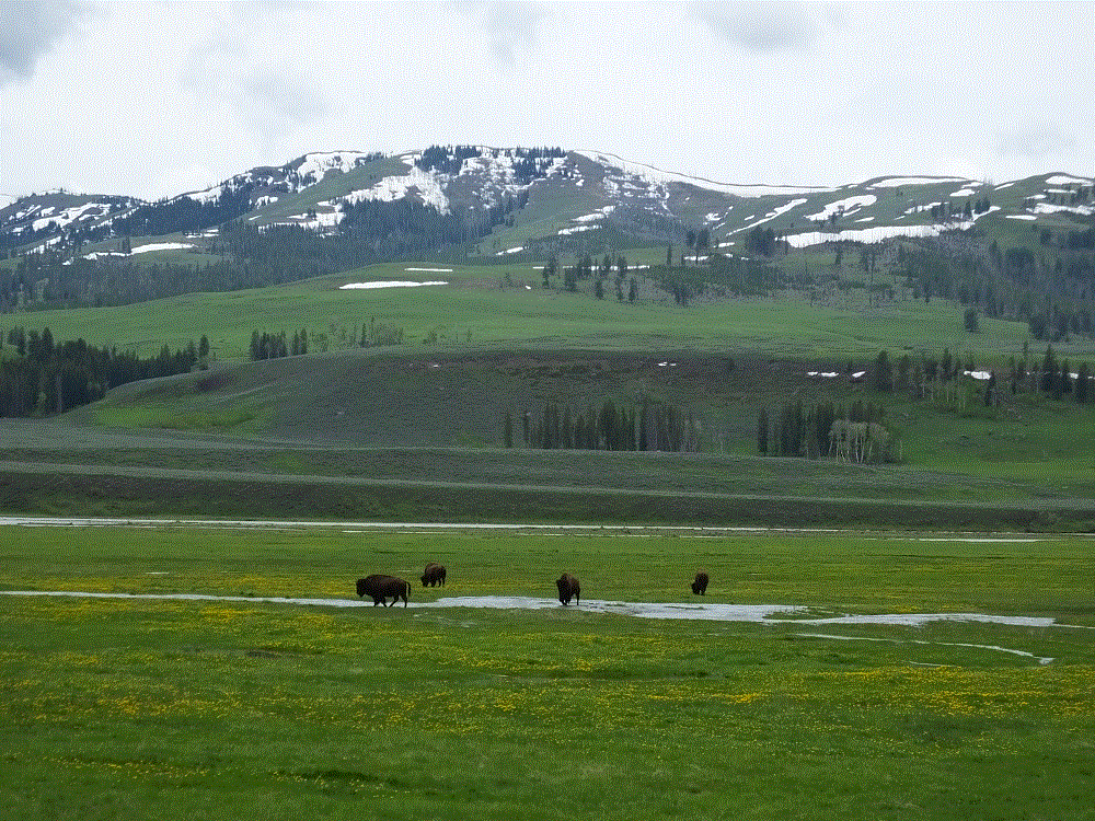
We started with the 18-mile wildlife loop. The loop traverses grass covered hills with tree covered taller hills in the distance. We saw dozens of pronghorn antelope and as we neared the southernmost part of the drive, we sighted a herd of about 50 bison slowly milling along as they dined on various grasses. At the Wildlife Visitor Center we learned the park can sustain 900-1100 bison during the winter. Each September, the herd is moved to the southern part of the park for a bison roundup. Several hundred bison in excess of the number above are sold and many become parts of bison herds elsewhere in the United States.

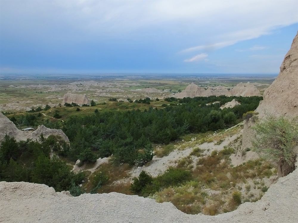
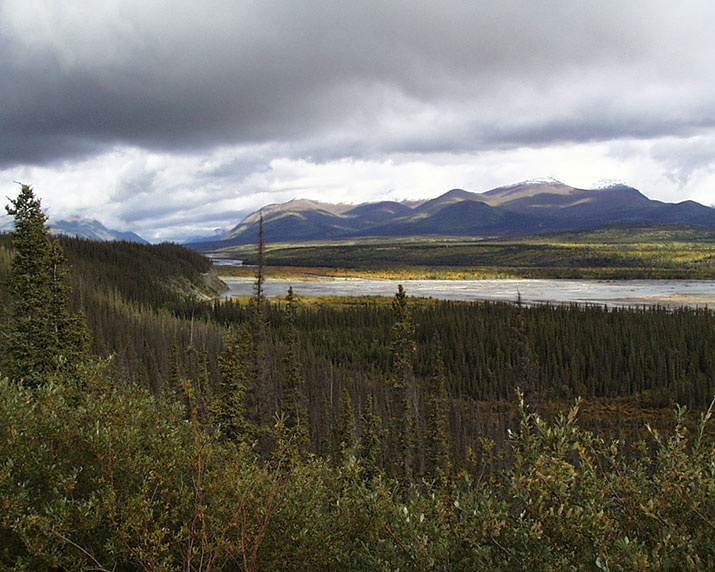
After viewing the bison for a while, we took a side trip on a dirt road that left Custer State Park and entered Wind Cave National Park. The views were amazing.

Custer State Park 1
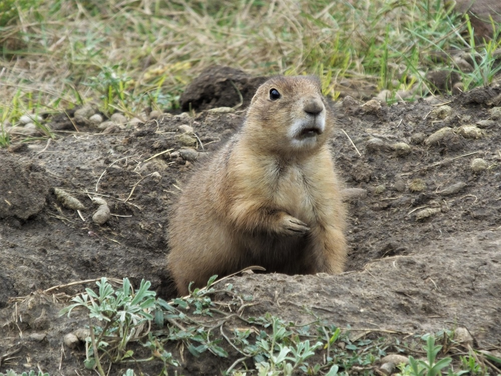
We noticed a number of small dirt mounds in some areas. On many of the mounds, one or more very active prairie dogs acted as sentries. The mounds mark the entrance to their underground burrows. There were lots of prairie dogs, and the noise they make really sounds like the bark of a small dog!

Custer Groundhog
A prairie dog guards his burrow

At the Wind Cave Visitor Center we learned cave tours were temporarily cancelled due to elevator problems. So we joined a ranger-led hike to the historic cave entrance to learn more about the cave.

DCIM100GOPROGOPR0089.JPG
A ranger demonstrates air being sucked into Wind Cave

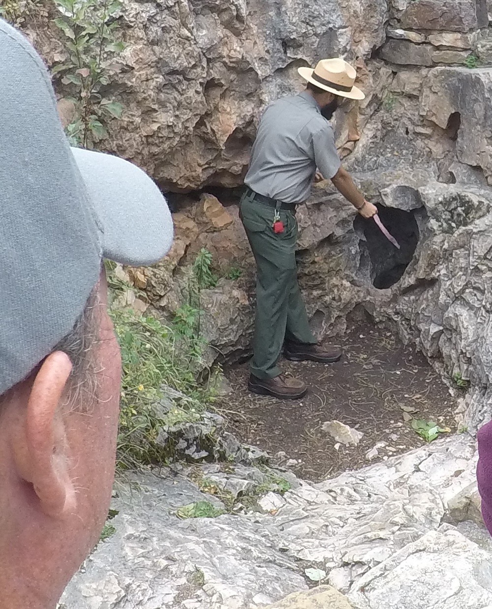
The first documented discovery of the cave was in 1881, when the brothers Tom and Jesse Bingham heard wind rushing out from a hole in the ground. The ranger explained that during clear days with high pressure, air is sucked into the cave, and during stormy days with low pressure, air blows out of the cave. Using a small ribbon, he demonstrated a ribbon being sucked into the cave with a surprising amount of force. What a vacuum cleaner!

Although the historic opening is very small, about 10 inches by 14 inches, over 142 miles of cave passages have been mapped making Wind Cave is the third longest cave in the U.S. and the sixth longest cave in the world.

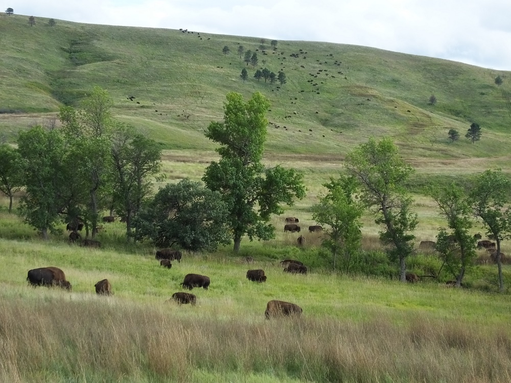
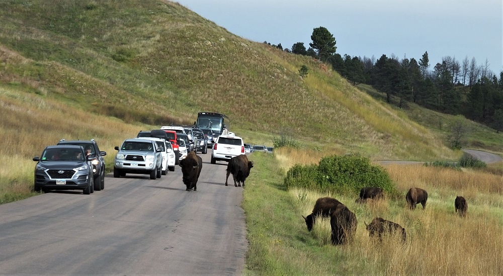
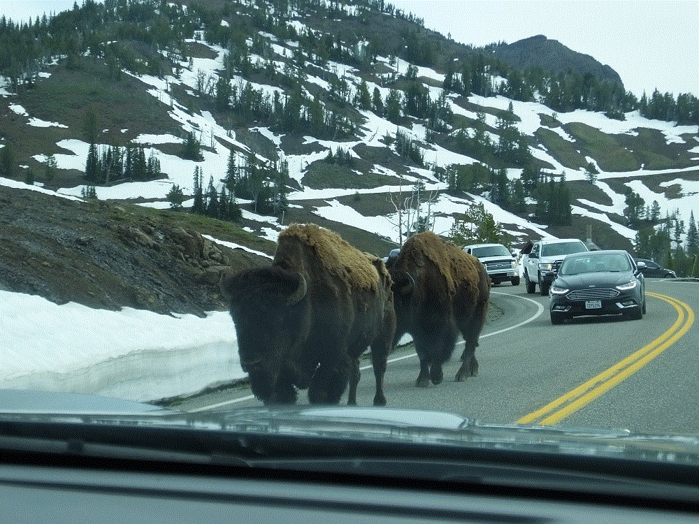
We returned to Custer State Park and the wildlife loop, and saw additional groups of antelope and bison. As we rounded a corner, we were stopped by a traffic jam in the middle of nowhere. Dozens of vehicles had stopped to see more than 500 bison – many on distant hills, others in a field close to the road and even a few walking down the middle of the road!

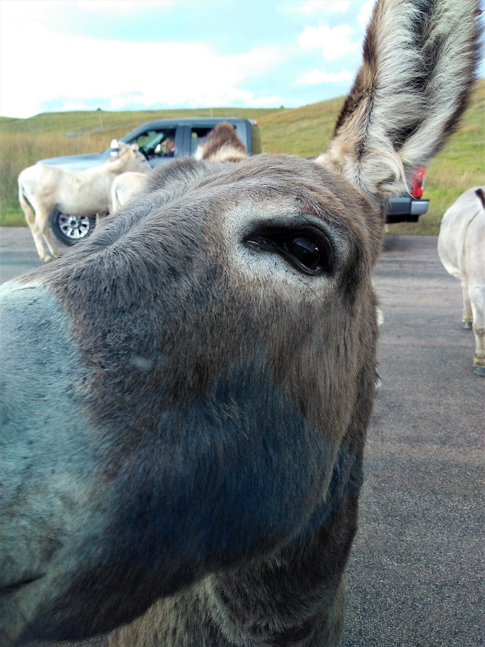
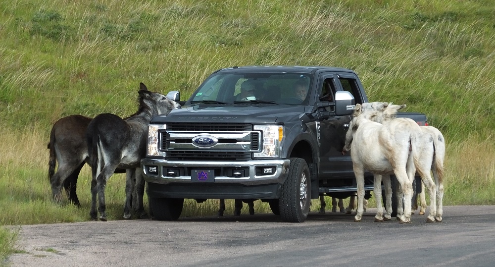
Not to be outdone for attention, there were about a dozen wild burros in the area as well, mooching carrots and such from passing vehicles. One burro approached our truck and tapped the side gently with its nose to see if we had anything.

It was a great day to see wildlife and the big sky views of the park.

As we returned to our campsite, we looked forward to the next day to see the natural rock formations of the Needles Highway and the manmade massive stone carvings of Mt. Rushmore National Memorial.

Badlands NP, Missiles and a Tourist Trap

(2019 Grand Teton Ep 7)

We left Omaha on Sunday, Sept. 8, and after a night on the road, arrived in Badlands National Park in South Dakota.  The Badlands are known for unusual rock formations, fossils and wildlife.

We camped in Cedar Pass Campground, a very short distance from the base of the rugged Badlands rock formations.  After a short drive we hiked the Window and Door trails.  Each trail provided up close and personal views of the Badlands.  The formations are kind of a cross between the Grand Canyon and the beach, although on a much smaller scale.

On the way back to camp, we hiked the Cliff Shelf Nature Trail.  The trail was steep with several sets of stairs.  We enjoyed early evening views of the formations and valley below.

We set out to drive the 60-mile Badlands Loop the next morning.  The loop travels through the eastern part of the park, along I-90 to the town of Wall and then back through the park to our starting point.

We stopped to hike the Notch trail.  After a short distance, the trail continued up a 100-foot ladder and then along a narrow ledge trail to the ‘Notch.’   From the Notch, we saw a phenomenal view of the formations extending into the valley below.  It was like a scene out of the move Dances with Wolves.

As we returned to the start of the trail, we discovered a large boulder containing a bird skull fossil.  We finished the trail with a nervous climb back down the 100-foot ladder!

DCIM100GOPROGOPR0042.JPG

We continued the loop out of the park and upon reaching I-90, we toured the Minuteman Missile National Historic Site.  During the Cold War, Minuteman nuclear bomb-tipped missiles were spread in remote locations across South Dakota and other western states.  Many of the sites were decommissioned in the 1990s based on arms reduction treaties between US and Russia.

The museum provides a sobering reminder of the potential destructive power of such weapons.  It is worth a visit if you are traveling in the area.

We then headed to Wall.  Wall is made famous by hundreds of signs along I-90 telling about the many things available in the town.  Wall Drug, the most well known place in town, has about every tourist souvenir imaginable, plus a large café offering 5 cent coffee and free ice water.

Wall is a South Dakota icon and an interesting stop on the way going east or west.

Wall Drug 1

We reentered the west side of park and again saw views of the Badlands.  Among the formations was a herd of Big Horn sheep and numerous bison.

The Badlands wildlife was a preview of our next destination, Custer State Park.

Alaska Highway – Segment 5

(2018 Alaska Ep 30)

Restocked and medicine cabinet remounted with four additional screws, we pressed on to Tok, Alaska (RabbiTRAILS Alaska Map, pt #35), with a night at a Yukon Provincial Park (map pt #34) along the way.

Before leaving Whitehorse we visited the world’s largest weathervane at the airport.  A full-sized Douglas DC3, manufactured in 1942 and retired in 1970, is mounted so that it actually turns in the wind!

2018 Alaska Trip 1907 - 1806201046

Later, we skirted snowcapped mountains to the west, part of Kluane National Park and Preserve.

2018 Alaska Trip 1978 - 1806211156

At one point, we noticed the distant mountains were shrouded by haze.  We assumed a forest fire, but discovered the haze was an immense dust cloud raised by winds blowing along a dried portion of Kluane Lake.

That afternoon we watched a mother grizzly bear and her two cubs near Destruction Bay.

2018 Alaska Trip 1992 - 1806211437

We thought the name Destruction Bay referred to poor roads in the area and their effect on RVs.  The name was actually given following a storm that destroyed buildings and such when the Alaska Highway was being built.

Our stop for the night was at Lake Creek Yukon Provincial Park.  We enjoyed the quiet campground.  The hungry Yukon mosquitoes enjoyed us….

Critter Count Day 5 (Whitehorse to Lake Creek)

  • grizzly bears – 3

Alaska Highway – Whitehorse

(2018 Alaska Ep 29)

We arrived in Whitehorse (RabbiTRAILS Alaska Map, pt #33) on June 18 and stayed for three days.

We biked and hiked along the Yukon River, and enjoyed the excellent trails that extend throughout the town.  We rode past the SS Klondike, a sternwheeler that ran freight between Whitehorse and Dawson City from 1929 to 1950.  The ship is now a national historic site.

2018 Alaska Trip 1899 - 1806191954

The Yukon is dammed upriver from Whitehorse.  Besides hydro power and the trails mentioned above, there are various other recreational opportunities, such as kayaking (downriver) and boating (upriver).

We visited the Yukon Wildlife Preserve where a number of animals native to the north can be seen in their natural habitat.   The animals include mule deer, wood bison, elk, musk ox, thin horn sheep, caribou (also known as reindeer), mountain goats, arctic and red fox, lynx and moose.

We also restocked our groceries at a smaller-than-normal Wal-Mart, the first we’d seen since Dawson Creek more than 900 miles back.  We counted more than 50 RVs in the parking lot, who were enjoying a free night stay and convenient shopping.

Finally, we celebrated Pat’s birthday with dinner at the Klondike Rib and Salmon BBQ.  We ended a great meal with birthday-sized bread pudding!

2018 Alaska Trip 1896 - 1806191911

Alaska Highway – Segment 4

(2018 Alaska Ep 28)

We continued from Watson Lake (RabbiTRAILS Alaska Map, pt #32) to Whitehorse (map pt #33) on June 18 – past boreal forests, catching glimpses of snowy mountains in the distance.

kluane-roadside

Alaska Highway and Yukon guides, and numerous information displays along the road reference the term boreal – we wondered about the meaning of the word.

A boreal climate is characterized by long winters and short, cool to mild summers, and is just south of the Arctic.  We have been fortunate that our Alaska Highway trip has been very pleasant with little or no rain.

A boreal forest is characterized by coniferous trees – we have driven by miles and miles of spruce and pine trees.  Sizes vary, with shorter trees in areas of past forest fires or flat areas where permafrost keep tree roots very shallow stunting tree growth.

There are also stands of aspen and other broadleaf trees.  Perhaps we will see leaves changing when we begin the trip home in early September.

Our fears of the condition of the Alaska Highway have generally been unfounded.  The road is in good shape, with few rough areas and occasional road construction.  Road construction is extremely dusty – the dust gets onto and into everything.

Alaska Highway road construction is a short video that shows typical road construction on the Alaska Highway.  Note the dust clouds created by the vehicles ahead!  (this is an experiment – it may take a moment to load.  Please let us know in the comments if the video works for you)

The long road has taken its toll.  When we stopped for lunch we discovered the bathroom medicine cabinet fell off the wall!  There was no damage other than four gaping holes in the wall where the screws that held the cabinet pulled out and various items strewn all over the floor.

At the end of the day we arrived in Whitehorse, the capital and largest city in Yukon with about 25,000 residents.

Critter Count Day 4 (Watson Lake to Whitehorse)

  • black bear – 4
  • grizzly bear – 1
  • bald eagles – 2

2018 Alaska Trip 2071 - 1806261357

Yellowstone NP: Animals, Oh My!

(2018 Alaska Ep 18)

Yellowstone never disappoints with an amazing diversity of wildlife.  And the reaction of visitors to the wildlife is sometimes more interesting than the wildlife itself.

More than our previous visits to Yellowstone, buffalo could be seen throughout the park – singles on hillsides,  groups of a few walking down the road, larger groups grazing in the meadows and so on.  In fact, unless there was a danger to traffic or walkers/hikers, it seemed the reaction of most persons to the buffalo was pretty much ho-hum.

2018 Alaska Trip 1226 - 1805281156
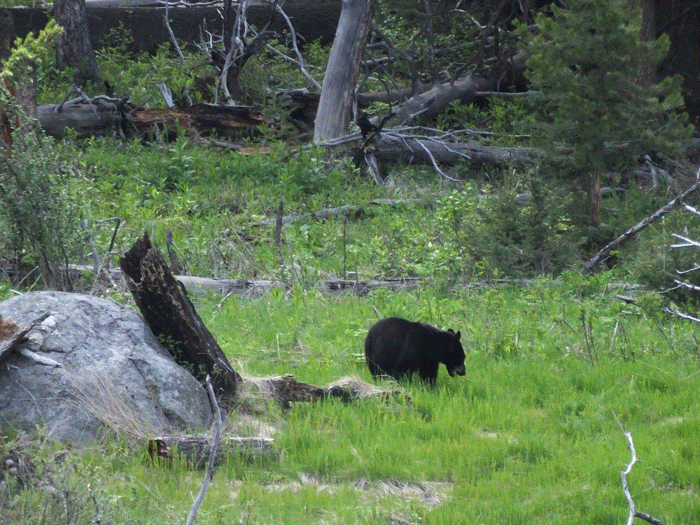
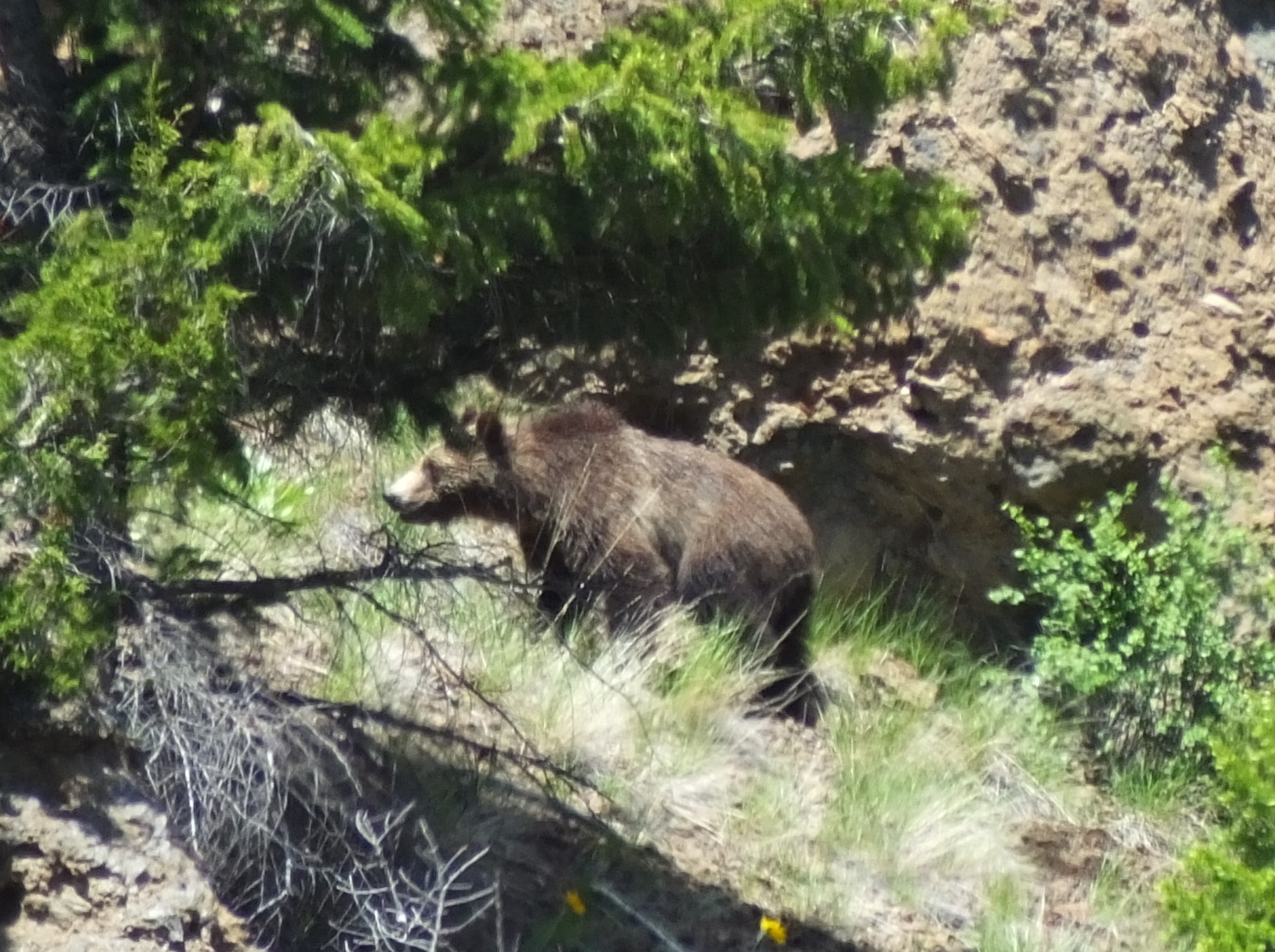
The buffalo were everywhere, or at least the telltale signs of buffalo were everywhere.  One buffalo below seems to be viewing a hot spring near Mud Volcano (below).  When we were camping at Madison,  a fellow camper stopped by to remark the biggest buffalo he had seen spent the day in our campsite.  Wish I had a picture of that to share.

2018 Alaska Trip 1194 - 1805271642 
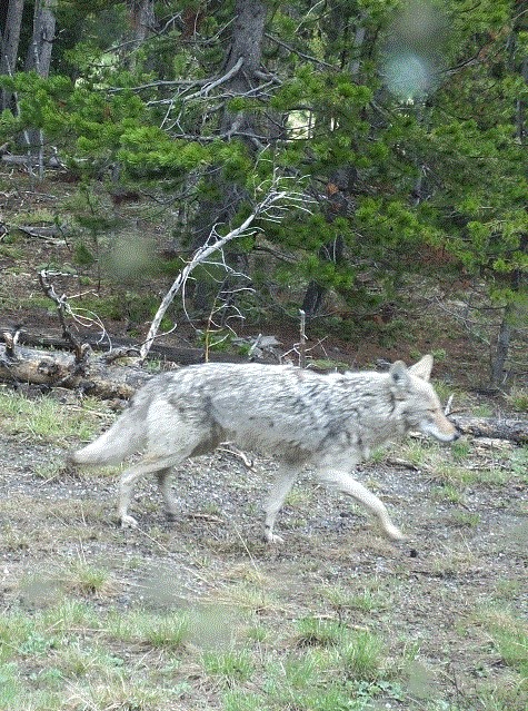
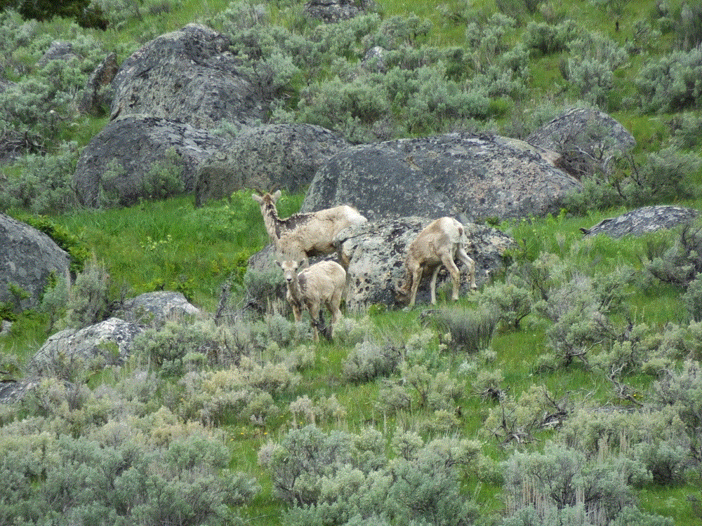
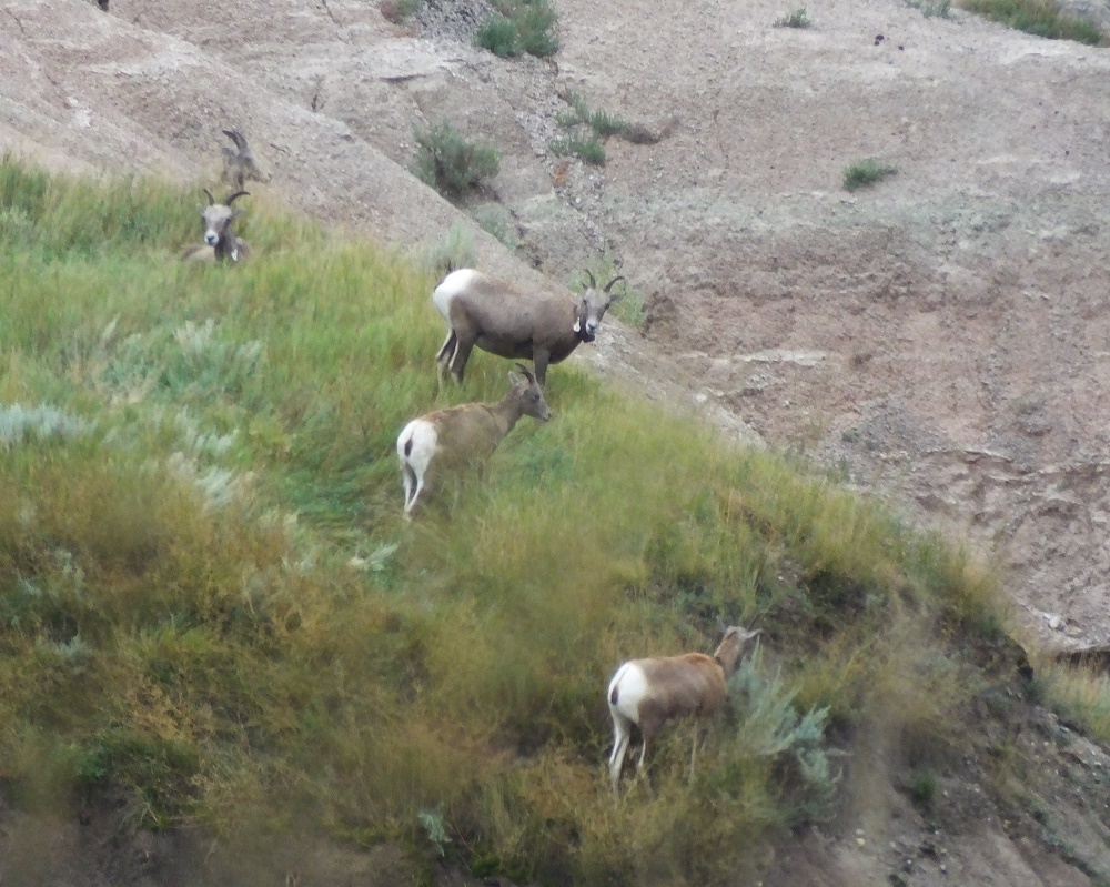
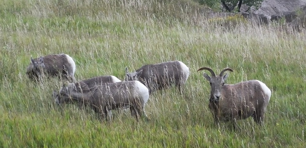
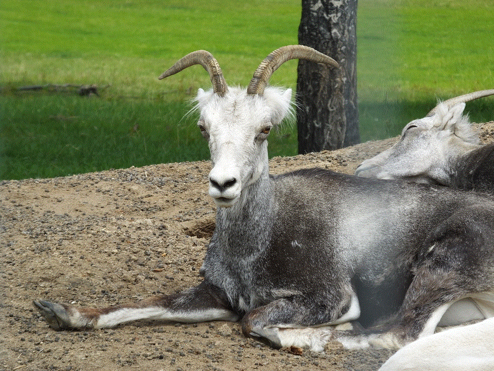
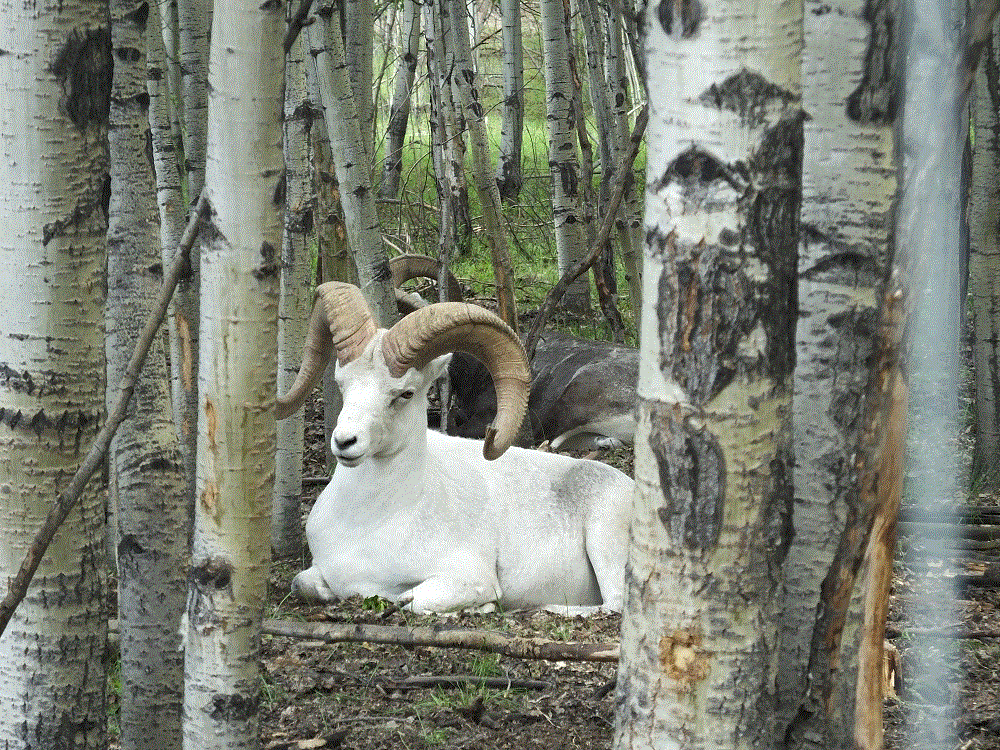
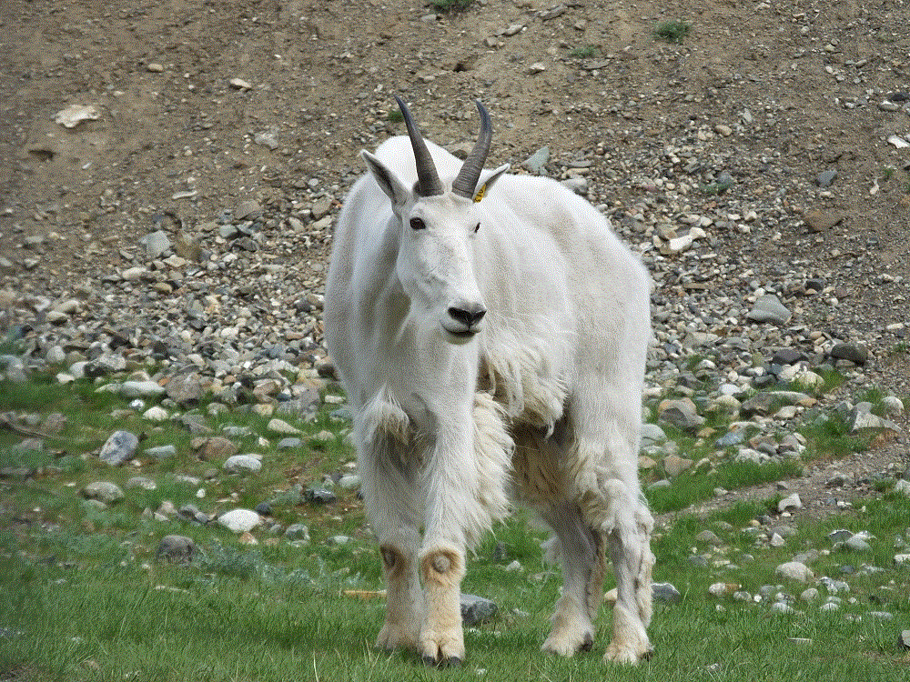
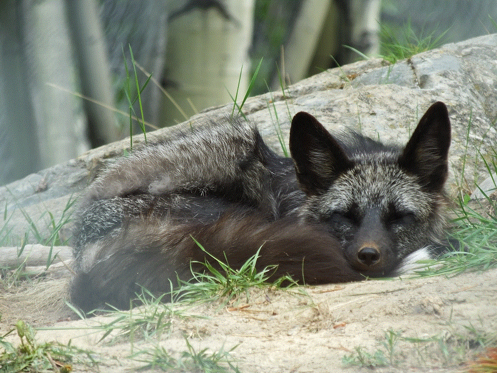
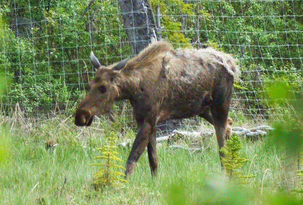
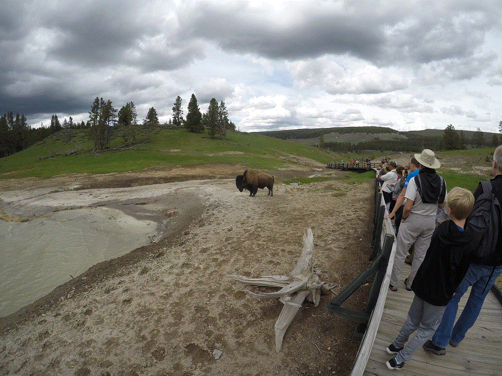
We didn’t see moose or wolves during our visit,  but we did see a coyote and several big horn sheep.

What created the most excitement were bears.  

Anytime cars were stopped in the middle of the road, people were crossing with cameras and binoculars with no heed to oncoming traffic and waving at their family members to do the same, a bear had been sighted.

Fortunately, both bears we saw were a long distance away and no danger to anyone.  We only had to worry about the crazy drivers…

2018 Alaska Trip 1260 - 1805281812
DSCF0392 edit