Flying Saucers and NFL Pigskins

Featured
(2024 Heartland Ep 9)

As our travels across the north shore of Lake Superior came to a close, we made a brief overnight trip across the US-Canada border to Sault Ste. Marie, Michigan.   There, we purchased gas and groceries because they were much less expensive than in Canada.

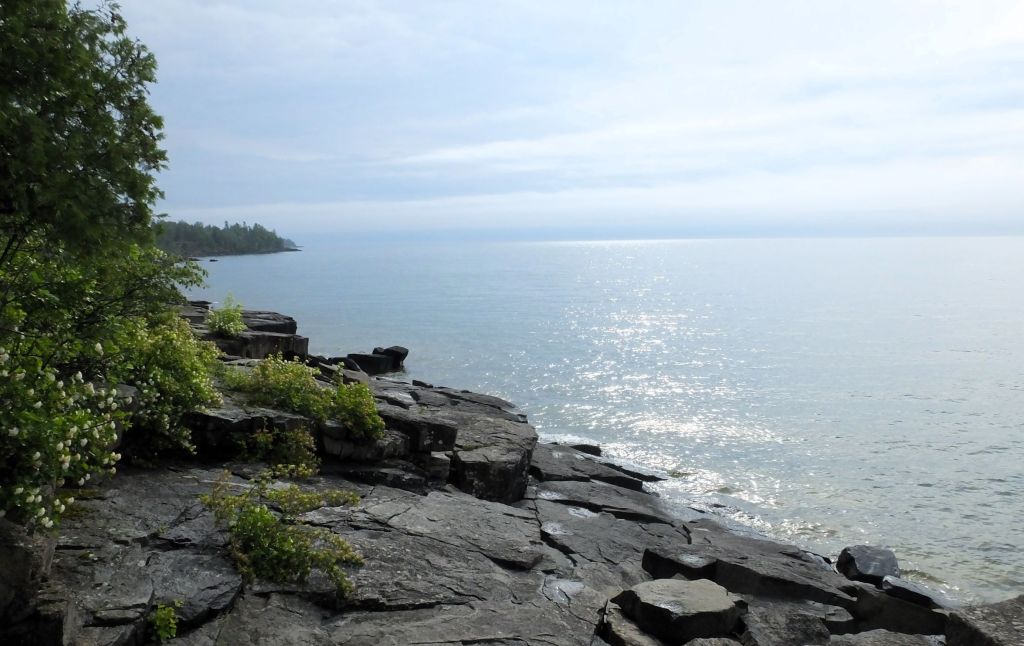
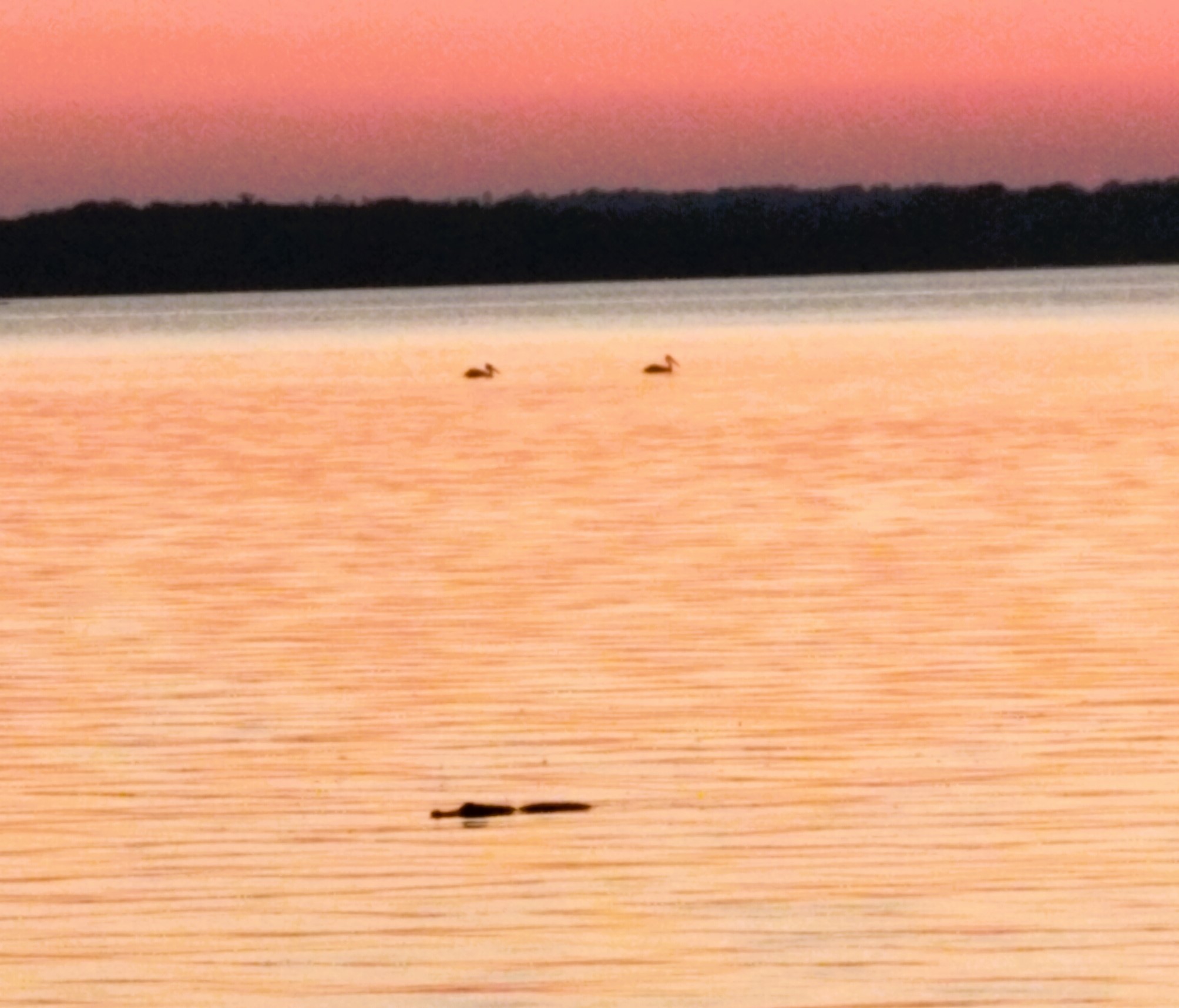
We returned to Canada and continued across the top of Lake Huron, the second largest of the great lakes. 

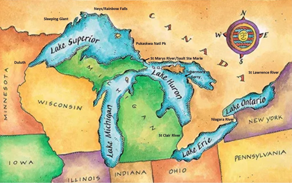
Some Great Lakes geography (see map): 

Lake Superior, at 21 feet higher elevation, flows into Lake Huron via the St Mary’s River at Sault Ste. Marie.   Lake Huron and Lake Michigan are the same level connected by the five-mile-wide Straits of Mackinac.  Some consider the two lakes to be a single lake. 

Lake Huron flows south into Lake Erie via the St. Clair River near Detroit.  Lake Erie empties into Lake Ontario via the Niagara River, and Lake Ontario continues on to the Atlantic Ocean via the St Lawrence River.

Back to the USA!

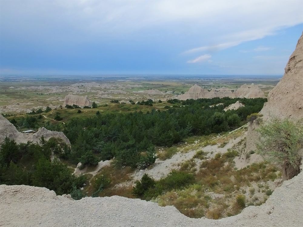
We cut our Lake Huron tour in half by taking a ferry across Lake Huron to Tobermory, Ontario.  At nearby Wiarton, we hiked to Bruce’s Cave burrowed underneath the Niagara Escarpment. The escarpment runs from Wisconsin to New York and is the same formation associated with Niagara Falls.

Bruce’s Cave, near Wiarton, Ontario
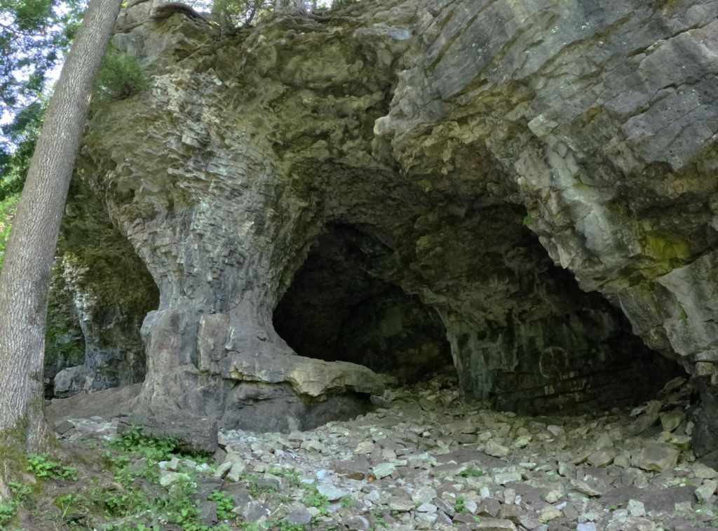
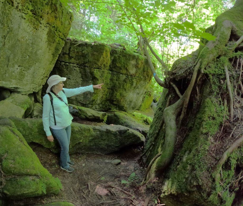
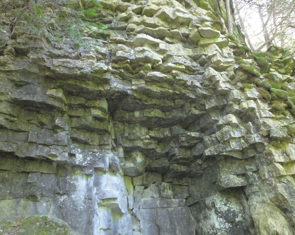
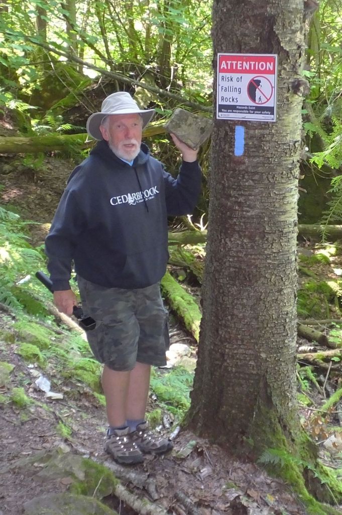
Our escarpment hike included hiking through narrow passages and rock scrambling amidst interesting rock layers

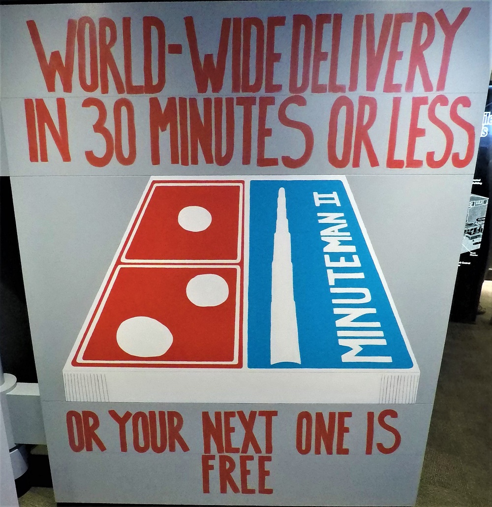
We drove south to Port Huron, Michigan and Ohio. It was about a week before our second planned week on staff at Cedarbrook Camp of Ohio, so we decided to visit the Air Force Museum near Dayton, Ohio. 

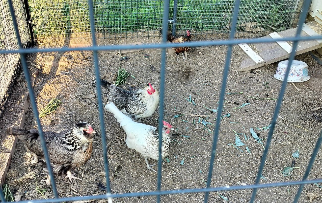
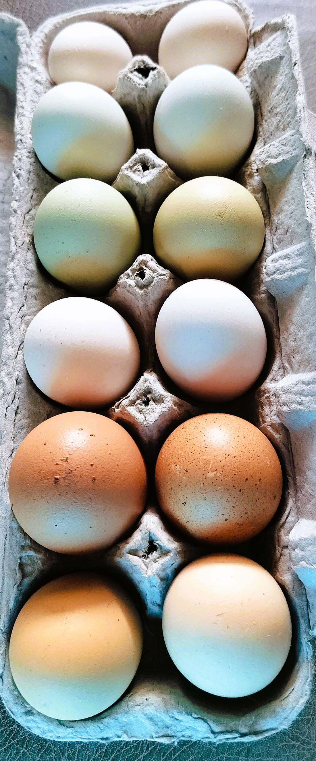
Our Ada, Ohio chicken ambassadors laid multicolored eggs
Eggs and Footballs in Ada

Halfway to Dayton, we spent the night at a Harvest Host location in Ada, Ohio.  Our host’s home was located a mile out of town, surrounded by soybean and corn fields.   The owner had several laying hens, and we purchased a dozen multicolored farm fresh eggs that we enjoyed for breakfast over the next several mornings. 

The colorful eggs tasted the same to us.

Touring the football production facilities in Ada

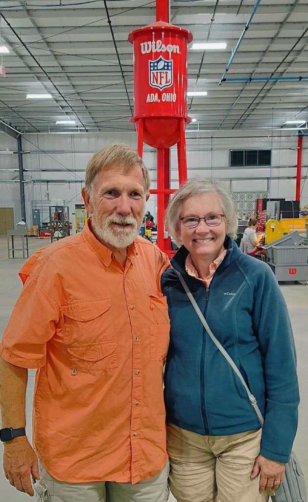
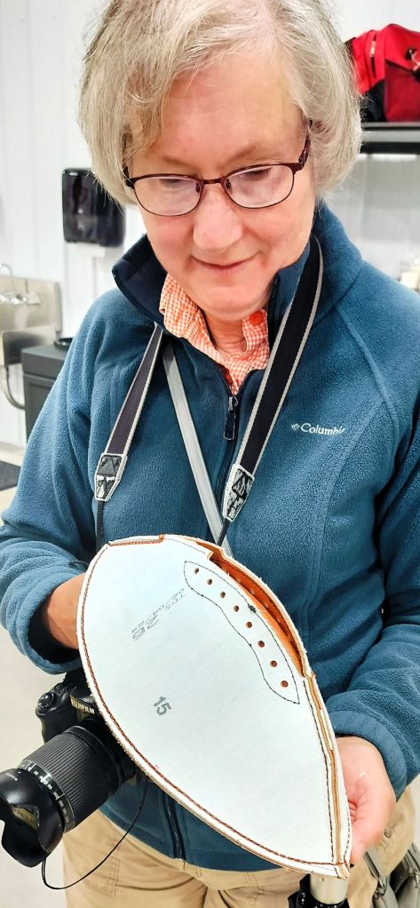
Eggs aside, Ada has the interesting distinction of having a Wilson Sporting Goods factory where every leather official-size NFL football has been handcrafted since 1955.

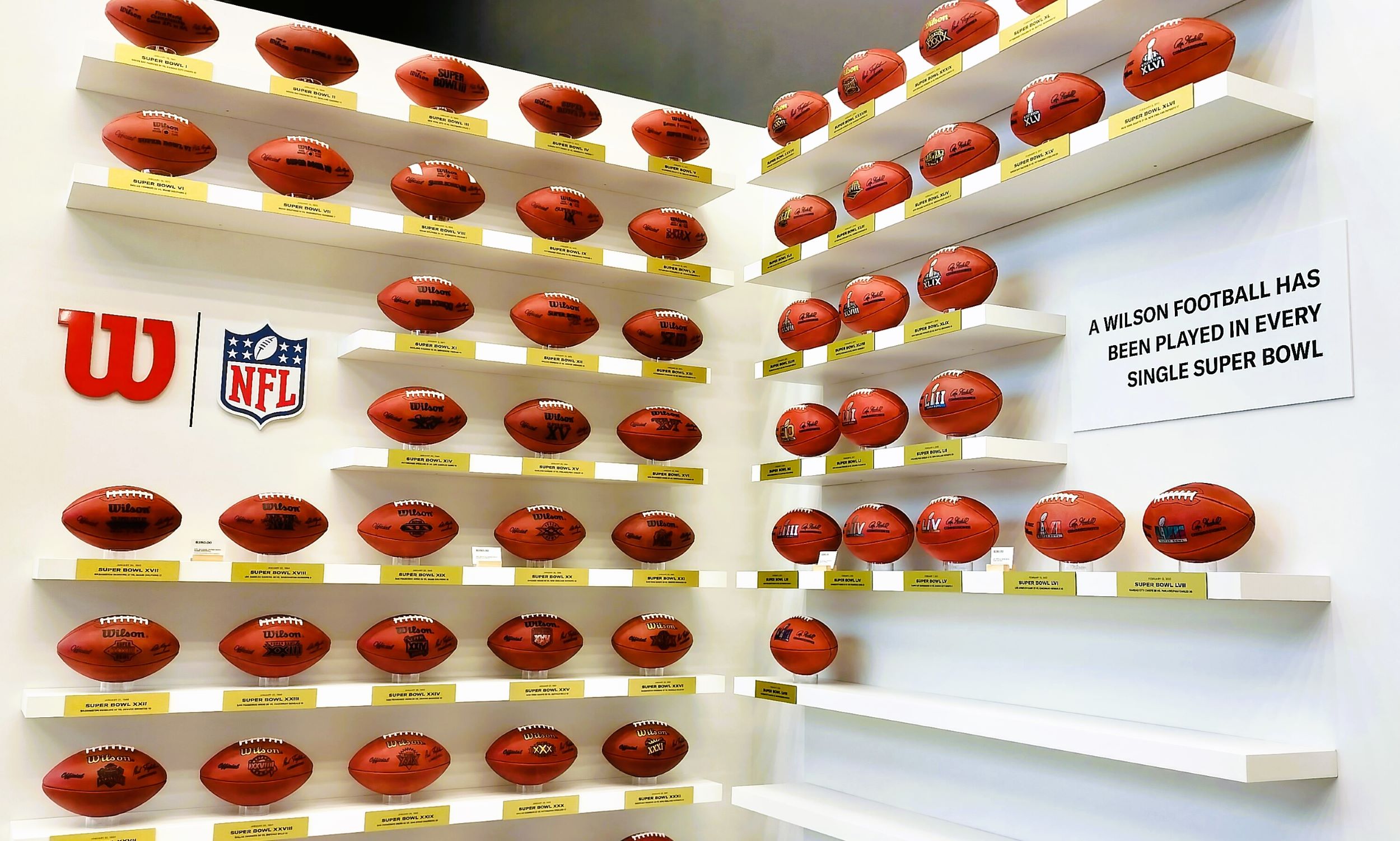
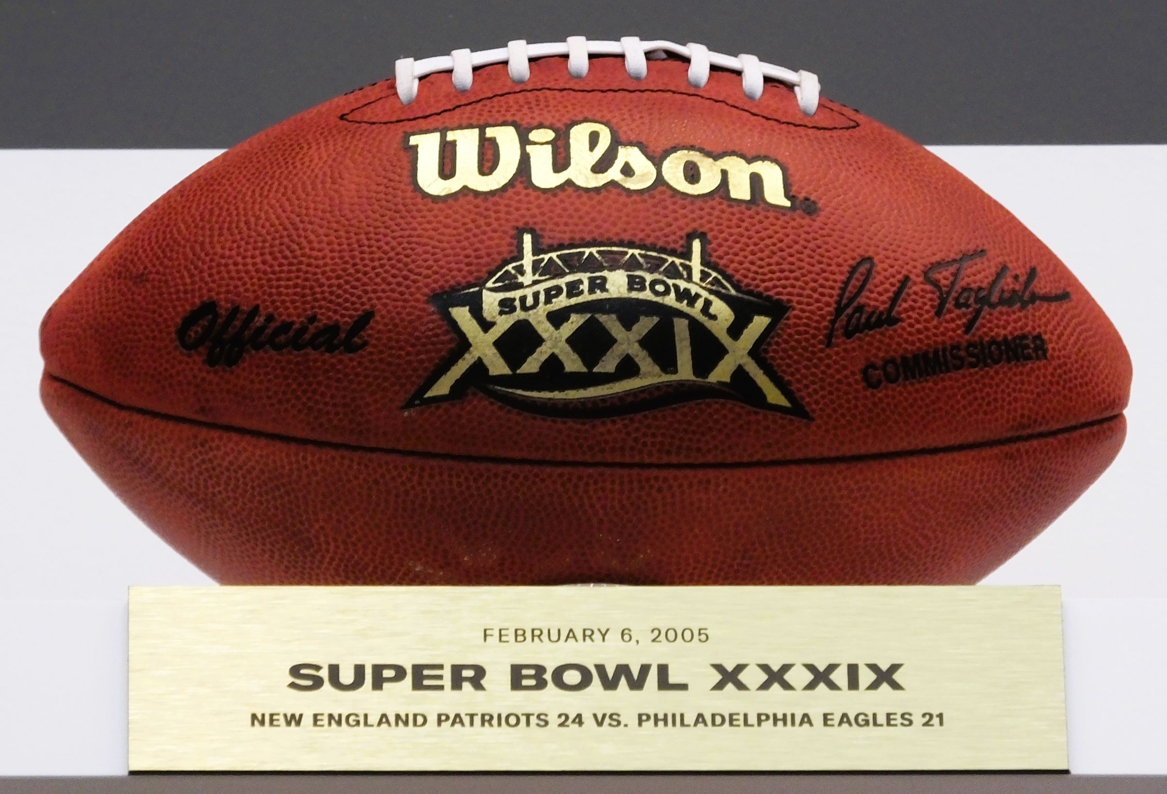
Super Bowl footballs on display, including one from Super Bowl XXXIX

We toured the busy football manufacturing plant, watching large pieces of leather being cut into four-piece football-shaped stacks.  The stacks are sewn together with a special liner. An inflatable bladder is then inserted into each ball before it is stitched, and various lettering and logos are applied.  Each football includes an RFID chip used to track the ball’s location during NFL games.   

Pat examines an inside-out football; as each ball is turned right-side out, an inflatable bladder is inserted and the ball is stitched
National Museum of the US Air Force

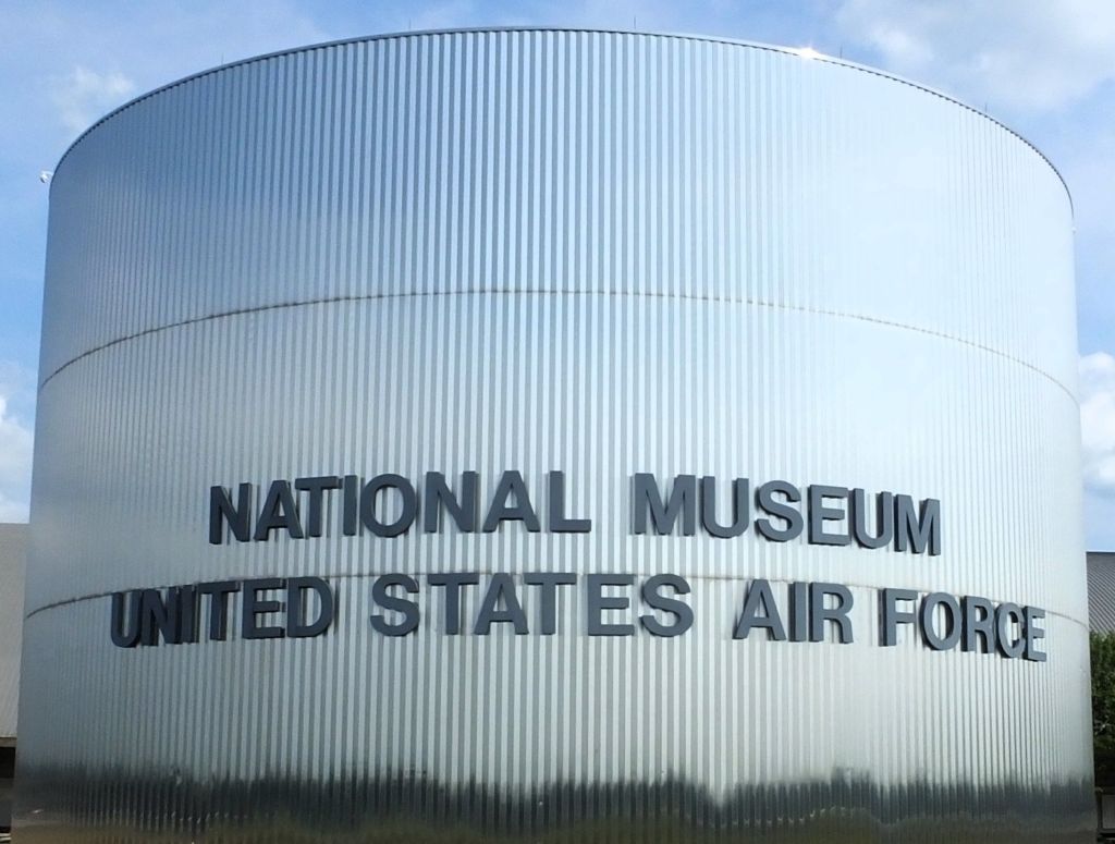
From Ada, we traveled to Dayton, Ohio where we spent two days touring the amazing National Museum of the US Air Force.

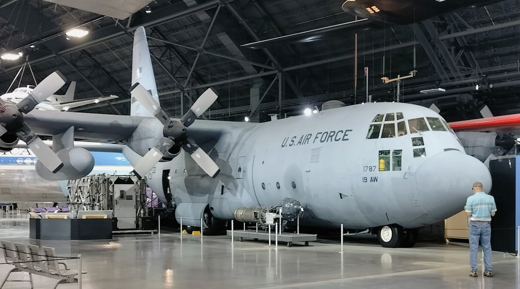
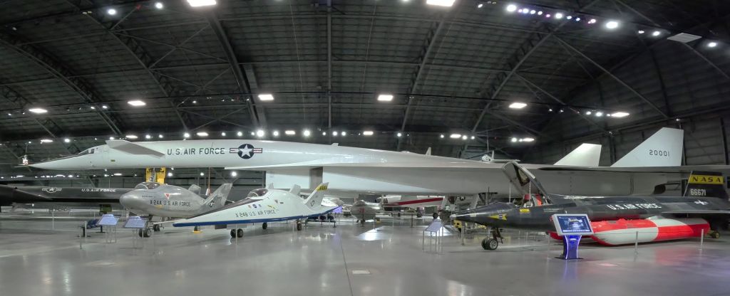
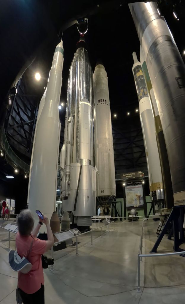
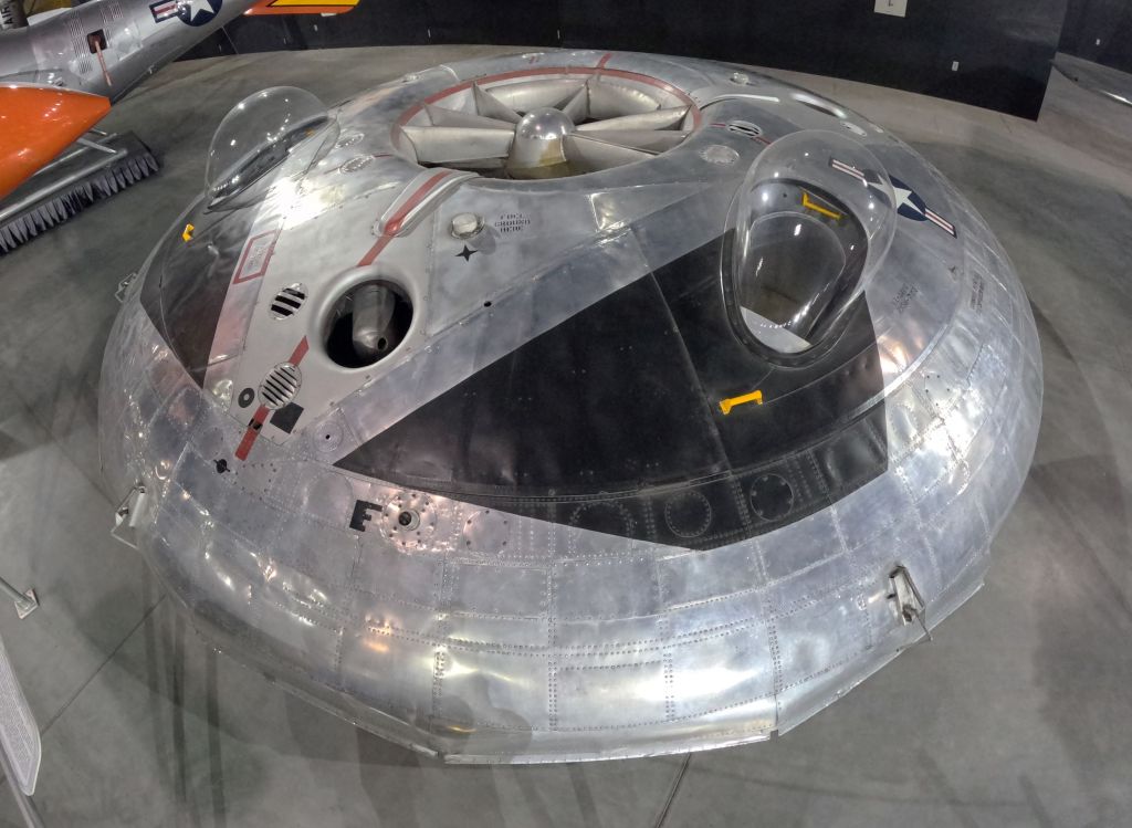
Two days are hardly enough to walk through the museum that is housed in four large hangars on Wright-Patterson Air Force Base.  Hundreds of planes, helicopters, drones, missiles, a space shuttle mockup and more are displayed.

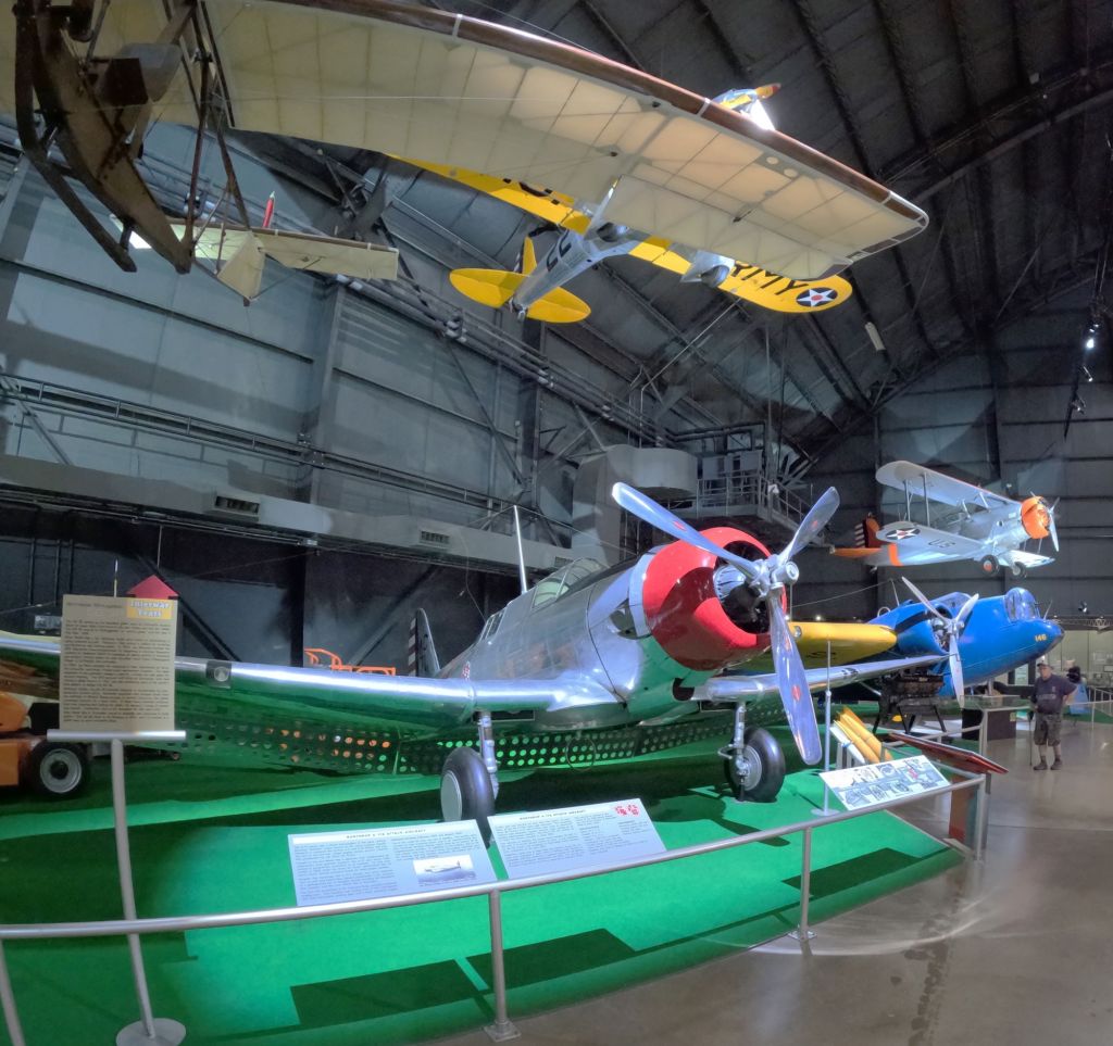
One hangar is dedicated to the history of air flight from the Wright Brothers to WWII

The museum is divided into four main sections – history of flight from the Wright Brothers to WWII, Korea and Vietnam, the Cold War era and the modern Air Force. 

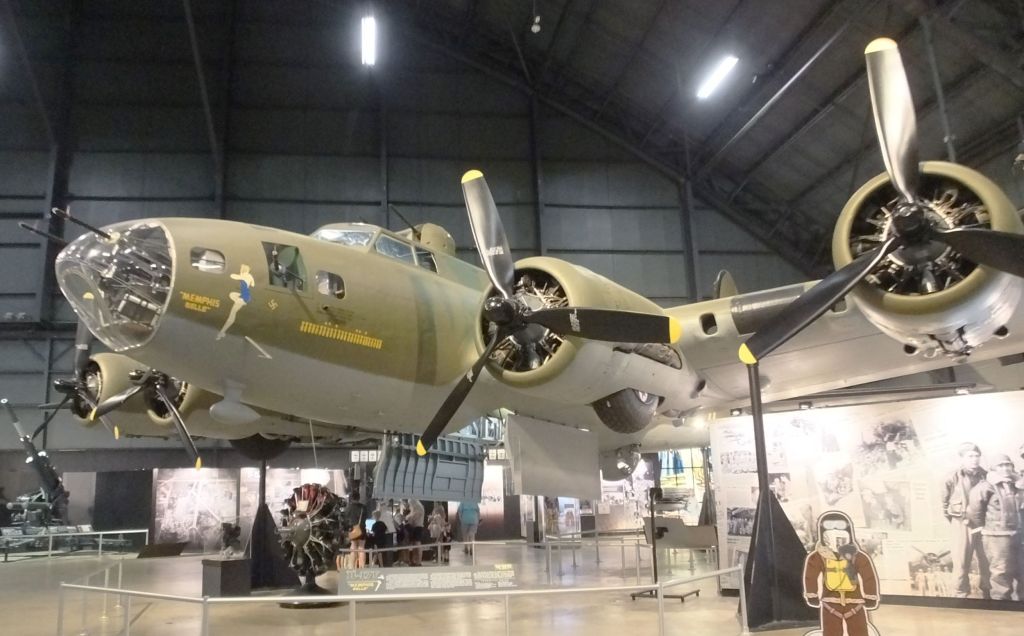
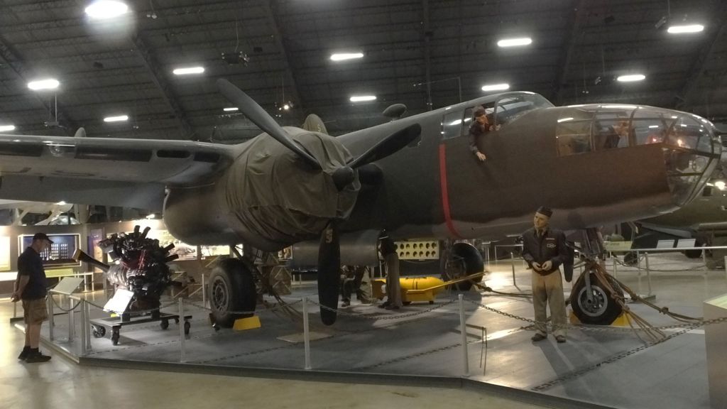
WWII bombers including the B-17 Memphis Belle and a B-25 Mitchell
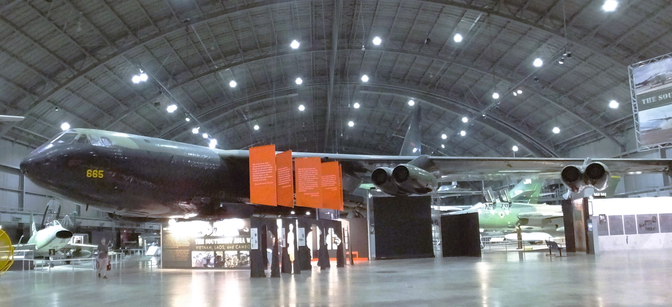
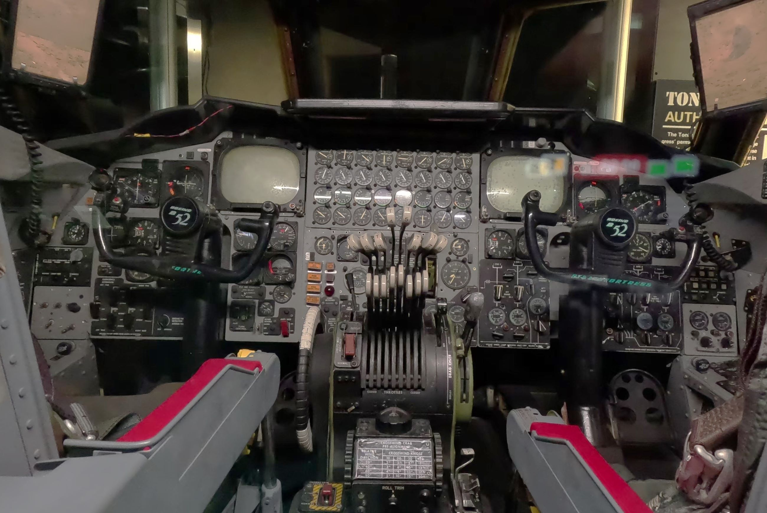
For more than 60 years, the B-52 Stratofortress has been the backbone of the US strategic bomber force; a B-52 cockpit is filled with levers and instruments
The C-130 Hercules is a medium-sized multi-role transport aircraft that supports military operations world-wide; Josh, our son-in-law, and James, Pat’s brother, worked on these aircraft at Warner-Robins AFB in Georgia
A 1960s prototype of the supersonic XB-70 Valkyrie; B1 and B2 stealth aircraft are also on display
The museum includes displays of an assortment of Air Force missiles and rockets
The museum included a 1950s prototype VZ-9AV Avrocar; it resembled ‘flying saucers’ from movies of that time period

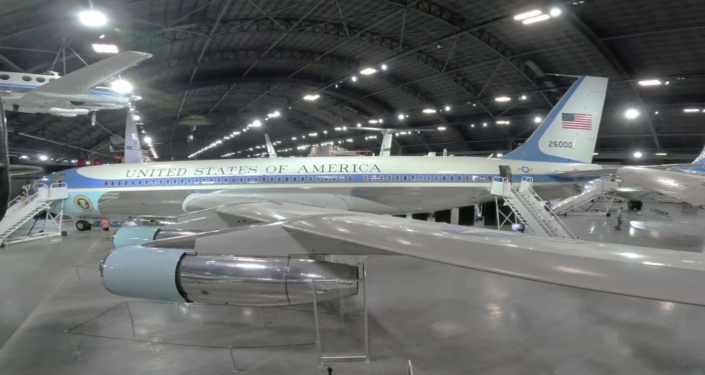
Several airplanes used by US presidents were on display, including the customized Boeing 707 that was in service when Lyndon Johnson was sworn into office following the assassination of President John F. Kennedy on November 22, 1963.

SAM26000, the customized Boeing 707 used by several US Presidents, was in service thru 1990
Next Week

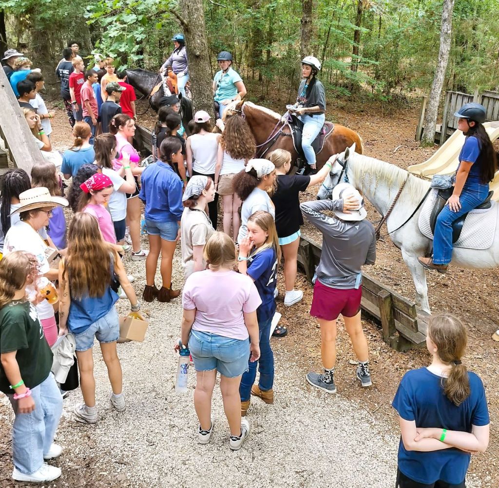
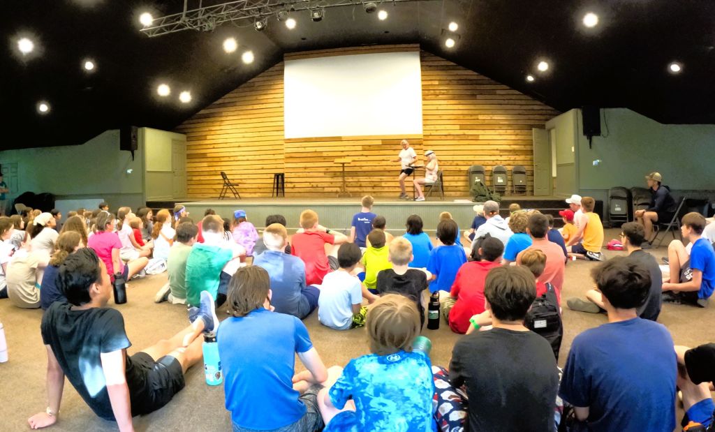
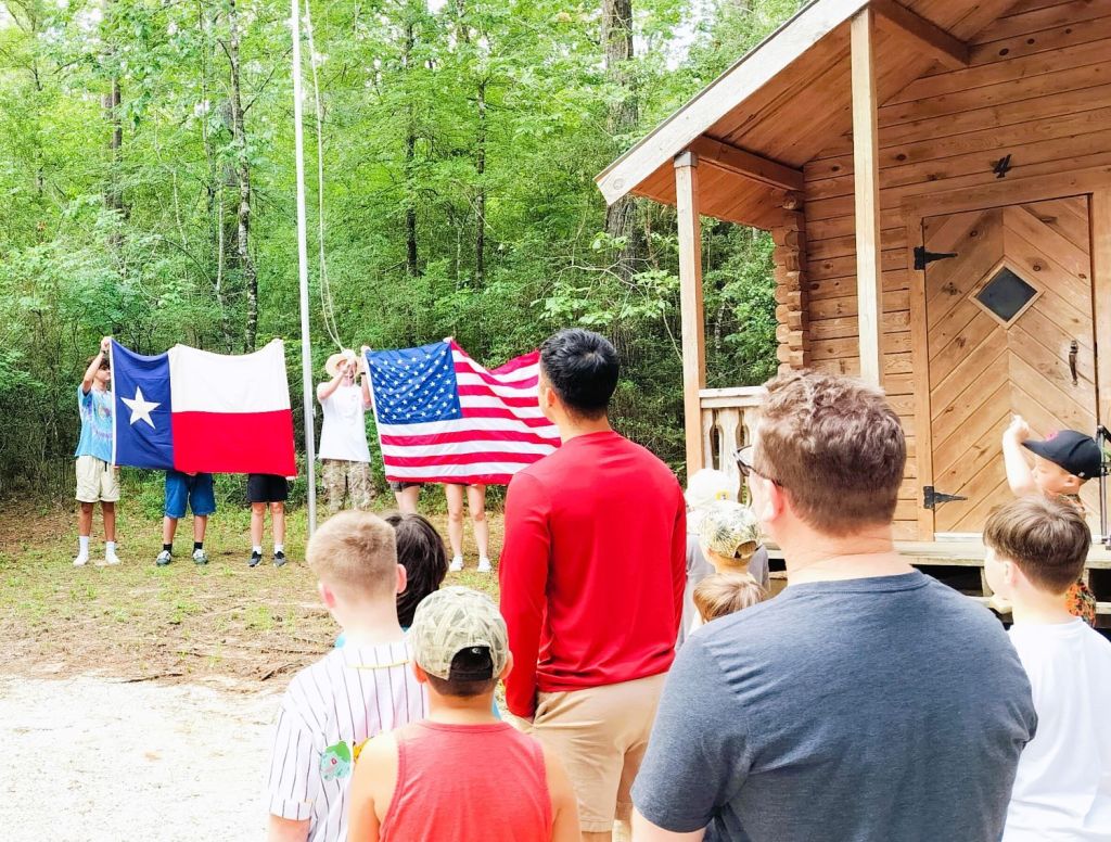
We spend our second week on staff at Cedarbrook Camp of Ohio, about an hour east of Cleveland.

Gichi-gami Voyageurs and Donut Connoisseurs

Featured
(2024 Heartland Ep 6)

We left Duluth on a crisp Sunday morning bound for Canada and the north shore of Lake Superior.  Our route was Minnesota Highway 61 and the North Shore Scenic Drive with its 154 miles of lake views, waterfalls, historic sites, a donut shop that makes lofty claims and much more.

Shoreline view of Lake Superior

We stood on the rocky shore a few miles from Duluth and were awed by the size of Lake Superior.  As Floridians, a body of water that large should be salty, with seashells, sharks, jellyfish and other such things. 

Lake Superior IS Superior

Consider these amazing stats:

Lake Superior is 350 miles long and 160 miles wide and borders two countries and three states. It covers 31,700 square miles, about the size of South Carolina.

The lake contains 10% of the world’s fresh water – 440 trillion cubic feet. That’s enough to fill more than one BILLION Olympic swimming pools.  Superior has enough water to fill the other four Great Lakes combined!

The average depth is 439 feet (deepest is 1333 feet) with an average temperature of 40F.  The lake rarely freezes over completely – only twice in the last 100 years, 1973 and 1996 did this occur.

The lake has seen waves over 40 feet and through the years about 550 shipwrecks have occurred with over 1000 lives lost.

The Ojibwe name for the lake is gichi-gami meaning ‘great sea.’  Longfellow used this name as ‘gitche gumee’ in the poem ‘The Song of Hiawatha,’ as did Gordon Lightfoot in his ballad ‘The Wreck of the Edmund Fitzgerald.’

Falling Waters

The rivers that flow into Lake Superior have beautiful waterfalls.  There are at least ten spectacular falls worth seeing on the drive.          

Two of the five waterfalls at Gooseberry Falls State Park

We stopped at Gooseberry Falls State Park about an hour from Duluth and hiked to four of the five falls in the park.  The water, muddy from recent rains, cascaded over several large drops and down steep inclines.  We moved quickly, trying to avoid being breakfast for hungry mosquitoes and blackflies.  This was a hint of what was to come in Canada.

Rugged High Falls at Grand Portage State Park

That afternoon, we hiked to magnificent High Falls in Grand Portage State Park.  At 120 feet, they are Minnesota’s tallest waterfall.  Located on the Pigeon River on the US-Canada Border, they can be seen from several great viewpoints along the trail.

The Great Carrying Place – Grand Portage

A few miles from the US-Canada border, we stopped to learn about the fascinating history of Grand Portage at the Grand Portage National Monument.

The Heritage Center at Grand Portage NM has live demonstrations of the North West Company operations and the Voyageurs and Montrealers who exchanged goods at the annual Rendezvous. The wall that surrounded the company buildings was for protection from the traders, NOT the native peoples nearby!

In the closing years of the 18th century, fur-trading companies labored to meet European demand for beaver skins. Fur covered hats were all the rage.

Late each spring French-Canadian Voyageurs traded for furs from native peoples living west of the Great Lakes. Using large birchbark canoes, they paddled eastward to the North West Company headquarters on Lake Superior.  Trade goods and supplies were paddled westward across the Great Lakes by men from Montreal. 

To construct a birchbark canoe, strips of birchbark are attached to a wooden frame and made watertight with pitch

At an annual mid-summer Rendezvous in Grand Portage, furs and goods were exchanged, with the furs bound for Montreal and the goods and supplies for the native peoples. 

The routes of the Voyageurs totaled nearly 3000 miles and included around 100 portages.  None were more than 13 miles in length.  The final or ‘Grand Portage’ to the Rendezvous was 8.5 miles, requiring the Voyageurs to make several trips carrying 90-pound packs. The portage was necessary due to waterfalls like High Falls and other rapids on the Pigeon River.

Samples of various animal furs exchanged in the compound

With the depletion of beavers and introduction of silk covered hats in Europe, the North West Company ceased operations in 1803.

What could be better than a maple bacon long john?

World’s Best Donuts?

At Grand Marais, midway along scenic drive, we waited in line to see if this was true.

The verdict? The donuts are good but not the world’s best. 

You must admit, however, they have a great marketing scheme!

Name a place ‘Joe’s Donuts’ and you’ll get the usual traffic of people seeking something sweet to have with coffee.  But name it ‘World’s Best Donuts’ and people (like us and dozens of others) will come from afar and wait in line to see if the claim is true.  

Next Week

Lake Superior’s north shore – black flies, sore feet and the world’s richest silver mine.

Des Moines and Duluth, Two Heartland Cities

Featured
(2024 Heartland Ep 5)

Our route took us across the American heartland from south to north, through Kansas, Missouri, Iowa and Minnesota.  The rolling landscape was covered with corn, beans and hay fields.  There weren’t many farmers and mechanical implements to be seen, however, as it was between planting and harvest.

Des Moines

We came to Des Moines, Iowa, a small (population 225,000) city somewhat in the center of the heartland and the capitol of Iowa.  Friends of ours, Steve and Audra, chronicled their visit to Des Moines in 2023 on their YouTube channel.  Based on their positive review, we decided to spend a couple days looking around.

The Des Moines River bisects the city and was near flood stage during our visit due to heavy rains to the north.  We saw numerous signs about road closures due to flooding in low areas.

Gold in the Sky
Iowa’s gold-domed state capitol is covered with 100 ounces of 23-karat gold leaf and is replaced about every 30 years

The Iowa capitol building has a magnificent gold covered dome.  Inside, the view upward into the dome is equally as impressive.

A view inside the dome. It rises more than 275 feet above us!

We joined a group touring the building and learned essential facts about Iowa state government and the building itself.  Completed in 1886, the capitol has two ornate main chambers – one for Iowa’s 50 senators and the other for their 100 representatives.  Another chamber for the state supreme court is no longer in use with completion of a nearby judicial branch building in 2003.

All was quiet in the ornate senate chamber – the Iowa state legislature is in session January-April.

Our tour took us to various other parts of the building, including the Iowa state law library with its intricate ‘Victorian’-style architecture and spiral staircases at each end of the library. 

One of two spiral staircases in the Iowa state law library.

We also ascended a steep circular staircase to the whisper chamber high up in the dome. There, we could clearly hear our guide’s whispered comments all the way across the dome.

Botanical Gardens
Pat surveys Des Moines’ tropical garden

From the capitol building we drove several minutes to the Des Moines Botanical Garden.  Inside a large dome structure was an assortment of tropical plants that included various types of palms, orchids, ferns and many other tropical plants.  We have some of the same plants in our yard at home!

The garden includes outdoor sculptures and sitting areas amidst native plants, shade trees and several water features

There are various nicely landscaped garden areas and water features outside as well, with plenty of shaded benches to enjoy the setting.  The Des Moines River is adjacent to the gardens.

Better Sculptures, Better Art…Pappajohn!
Two of the sculptures with Des Moines city buildings in the background

Our Des Moines visit ended with a walk through the Pappajohn Sculpture Park.  Opened in 2009, the 4.4-acre park has more than 30 sculptures by world-celebrated artists and was made possible by the generosity of John and Mary Pappajohn and other donors. 

Some of the sculptures were inspiring.  Others were difficult to understand and appreciate!

Riding the Trestle Bridge
High trestle bridge across the Des Moines River

We left Des Moines the next morning and detoured a few miles to ride a portion of the High Trestle Rail Trail. 

The highlight of the trail is a nearly half-mile long converted trestle railroad bridge 13 stories above the Des Moines River.  The bridge, originally built in the 1970s and retired in the early 2000s, has a series of decorative rotating rectangle structures.

Pat takes a sunny ride above the Des Moines River
Trouble on the Horizon

During our drive north toward Minneapolis, the sky darkened. We drove through heavy rain showers and Pat spotted a small funnel cloud. We were thankful the funnel quickly disappeared.

Duluth
We rode along Lake Superior and were rewarded with a great view of Duluth

Before continuing north to Canada and the north side of Lake Superior, we stopped at Duluth, Minnesota for a couple nights.  Percy was due for an oil change and tire rotation – road trips are not always sunshine and rainbows!

Duluth’s iconic aerial lift bridge was partially lifted so a small sailboat could pass

From downtown Duluth, we rode several miles along the shore of Lake Superior and returned to Canal Park, home of the Aerial Lift Bridge, which raises for ships entering the harbor area from Lake Superior.  A schedule with information about daily arrivals and departures of the nearly 1000 vessels that use the canal each year is posted at the Lake Superior Maritime Visitor Center.

We didn’t see any large ships during our visit but were told a 1000-ft ship passing through the canal is quite a spectacle.                        

Next Week

The world’s best donuts and spectacular waterfalls along the Lake Superior North Shore Highway.  Is Lake Superior really all that superior?

1100 Miles and Heartfelt Camp Smiles

Featured
(2024 Heartland Ep 3)

Our 2024 Heartland Journey Begins

A last minute photo before leaving

Our travels got underway the second Sunday in June.  We visited Liz and Josh and our two grands, Henry and Emilia, near Warner Robins, GA, where we moochdocked in their driveway.  Like most grandparents, we marveled at how quickly they are growing up.  

A peaceful view after a thunderstorm at Blackwater River SP

We left Georgia and continued to the western part of the Florida panhandle, where we spent the night at Blackwater River SP.   A thundershower grumbled in the distance, so we quickly set up camp.   

Once we were confident the storm was not getting closer, we followed a path to view the tea-colored river.  It twisted and turned with numerous sandbars on both sides of the flow.  The water in one backflow area was mirror-smooth, reflecting the sun and clouds.

We continued across Alabama, Mississippi and Louisiana, where we camped two nights in the bayou state.   We drove Louisiana Route 8 westward and neared the Sabine River, the border between Louisiana and Texas.  Ahead, a yellow sign warned the clearance of the bridge was 12 foot 3 inches.  Images of the tops of campers and trucks smashing into low bridges came to mind, so we quickly flipped down our passenger side windshield visor. 

Checking our height before a low bridge crossing between Louisiana and Texas

When riding on Percy, Pap is 12 foot 0 inches high.  To be safe, we slowed considerably as we crossed the bridge and passed into Texas with three inches to spare! Whew!

Views from our campsite on Steinhagen Reservoir in eastern Texas – a sunset and passing gator

Our two final nights before camp were spent at a Corps of Engineers campground on Steinhagen Reservoir near Jasper, TX.  Our campsite was right on the lake, and we enjoyed two beautiful sunsets.

Anchored in Truth

For the next week Pat and I were on staff with Camp Cedarbrook Texas, a Christ-centered, Bible-based camp near Huntsville, TX.   More than 100 campers arrived on Sunday, and for the next six days and nights we modeled and taught about God’s truths of grace, forgiveness and new life for those who believe in Jesus. 

CCT offers campers a broad outdoor program that includes horsemanship and riding, archery, riflery, canoeing and kayaking, swimming, survival skills and lots more.  Pat and I led ‘Fire and Food’ activity, where we taught campers how to build and cook over a fire.  Pat worked with younger girls, and I taught younger boys.

We joined our cabin groups at a cookout one evening

Whoo (CCT staff) shows third/fourth grades campers a model rocket he built as they work on their own model rockets
Campers receive mail from the CCT ‘Pony Express’ (horsemanship activity)
Evening worship included skits, and fun and worship songs

We enjoyed dining hall meals, evening worship times and nightly outdoor programs. 

50 and 1 Stars

Following devotions and breakfast each morning, all campers and staff attended a flag raising ceremony.  When presenting the colors, it was interesting that the Texas state flag, with its single white star, was proudly displayed.  

Flag raising ceremony

These were Texans after all!

Next Week

We say goodbye to CCT campers and staff friends, and continue west toward San Antonio for a visit with my brother and his family.     

Heartland Bound and Catching Up (part 1)

Featured
(2024 Heartland Ep 1)

Welcome to RabbiTRAILS as we get underway with our summer 2024 travels. 

After an epic 2023 journey to Alaska, we are staying (much) closer to home this year.

Why 2024 Heartland? 

Much of our trip this year will be traveling through the central United States heartland from Texas to Minnesota.  We’re bound to see oilwells, windmills, cattle herds, cicadas and miles of cornfields. Hopefully we won’t encounter tornadoes and hailstorms!

Other affairs of the heart will be at play as we travel:  catching up with family in Texas, Oklahoma, Kansas and possibly Connecticut, and a visit with a close friend in New Hampshire.

We top it all off with something near and dear to our hearts:  two weeks serving at Camp Cedarbrook camps in Texas and Ohio.  As we connect all of this together, we’ll be on the lookout for interesting RabbiTRAILS to follow and share with you.

Before things get underway, there’s some catching up needed since our last blog post in December: 2023 Alaska Revisited Recap.

Catching Up, Part 1

Earlier this year Percy, Pap and a new addition carried us on a couple trips.

When we travel closer to home, Pat and I enjoy kayaking in addition to biking.  There’s no easy way to take kayaks with our current setup, so we purchased a small utility trailer and configured it to haul two kayaks, our bikes and assorted other camping gear.  Introducing Junior, Percy and Pap’s first cousin!    

Junior, our little utility trailer, joins Percy and Pap
Our travels included Tomoka and Manatee Springs State Parks in Florida

Tomoka State Park

In January, we camped with longtime friends, John and Carol, at Tomoka State Park a few miles north of Daytona Beach.  Located on the Tomoka River, the park includes the site of an ancient Timucuan Indian village and a large statue of Timucuan Chief Tomokie.  The monument is a reminder that the area was populated by Native Americans for centuries before Europeans arrived.

Chief Tomokie statue in Tomoka State Park

For several days we kayaked, biked and took several local side trips.  We toured nearby Bulow Plantation Ruins Historic State Park.  Developed in 1821, the plantation was once the largest plantation in East Florida where indigo, cotton, rice and sugarcane were cultivated.  The plantation was destroyed in the Seminole War of 1836, and, although many of the original plantation structures no longer exist, sizeable remnants of a large sugar mill can still be seen.  The plantation is an interesting part of Florida history.

Ruins of the sugar mill at Bulow Ruins Historic State Park

Aunt Catfish’s Cinnamon Bun

We stopped for lunch at Aunt Catfish’s on the River restaurant in Port Orange.  The menu offerings were what one would expect at a southern-style seafood restaurant. We learned they served homemade cinnamon buns and it was game on!  Although the buns were smaller than the ginormous buns we sampled on our 2023 Alaska Revisited journey, they were wonderfully sweet and cinnamony.  We had to have more than one to satisfy our bun craving!

Manatee Springs State Park

We left Tomoka and crossed the state, where we camped at Manatee Springs State Park. 

Manatee Springs is a first magnitude (e.g. large) spring that flows into the Suwannee River.  A boardwalk extends nearly a quarter mile from the spring through a swampy area with tall Spanish moss-covered cypress trees.  The boardwalk ends at a small pier on the Suwannee River. 

A quarter mile boardwalk runs from Manatee Springs to the Suwannee River

One morning we kayaked the run and along the Suwannee for several miles, where we enjoyed the sunny, cool and quiet surroundings.

Pat and Carol kayaking near Manatee Springs

When we returned to the spring, we were delighted to find several manatees swimming near the boat launch area.  We paused for several minutes to watch the large potato-shaped animals swim about and surface from time to time.  I used my GoPro camera to capture some underwater photos of the spectacle.      

Manatee and reflection at Manatee Springs SP

As we walked along the boardwalk one evening, we noticed the cypress trees surrounding the spring run were filled with hundreds of large, American black vultures. It was a rather Gothic spectacle in the evening twilight.

Hundreds of vultures watched us from cypress trees near the springs

Our Manatee Springs stay included visits to Cedar Key, where we rode our bicycles around the small Gulf Coast community, and Fanning Springs, where we admired a remnant of an old bridge that crossed the Suwannee River inscribed with the title of Stephen Foster’s memorable song, “Way Down Upon the Suwannee River!”

One of four spans from the bridge that crossed the Suwannee River at Fanning Springs has been preserved. The bridge was built in 1934.

Henry Turns 6

Our trip ended near Macon, GA with a sixth birthday celebration for our grandson, Henry.

Son-in-law Josh, daughter Liz, and grandkids, Emilia and Henry; Henry celebrates his birthday

Next Week

Catching Up (part 2): Florida Keys and Everglades National Park

Road Ramblings and a Dead Horse

(2023 Alaska Revisited Ep 5)

After a couple of hot days and chilly nights in Valley of Fire SP, our travels continued toward Arizona.  We had an unfollowed RabbiTRAIL from a previous trip to take care of.

Twilight Time Zone

In less than 100 miles, our route took us from Nevada to Arizona, then to Utah and back to Arizona.  Our various timepieces couldn’t keep up with the time zone changes.  Our truck had one time, phones had different times and wrist watches yet another time.  We gave up trying to figure out what time it was and decided to temporarily endure our twilight time zone experience.

By the next day we were well inside Arizona and our various clocks finally synched to the correct time!

Colorado Horseshoe

Two years ago we camped at Lee’s Ferry on the Colorado River, a few miles down river from the Glen Canyon Dam.  We highly recommend the campground and several great hiking trails nearby. 

One afternoon we drove to Page, AZ for supplies and gas.  Page is near the Glen Canyon Dam and Lake Powell.  Down river from the dam the Colorado River has a horseshoe bend that can be seen at the end of an easy half mile trail.  We didn’t stop in 2021 but did so this time and were awestruck with an iconic view of the river. 

Colorado River Horseshoe Bend selfie
Morning view of snowy San Francisco Mountains near Flagstaff

That evening we spent a subfreezing night in a Coconino National Forest dispersed camping area near Flagstaff.  The mountain tops were dusted with snow that night and we had to use our RV furnace to stay warm.

The next morning, we drove south of Flagstaff, driving highway 89A to Cottonwood AZ.  The highway descends narrow Oak Creek Canyon before reaching Sedona.  The Google map of the route shows what can best be described as a plate of spaghetti!

Sedona

Many of our friends have recommended visiting Sedona, AZ, a charming town in a stunning red rock canyon between Phoenix and Flagstaff.  Sedona has an attractive downtown district with shops and restaurants that remind us of Fredericksburg TX or Gatlinburg TN.  It also has MANY dizzying traffic circles coming in and going out of town!

Red Rock formations near Sedona
No Dead Horses

We camped the next three nights at Dead Horse Ranch State Park south of Sedona, enjoying warm, sunny days and chilly, almost cold, nights.  We unpacked our bicycles and rode throughout the park, along the swift flowing 50-foot-wide Verde River and around the three lakes in the park.

Serene lake at Dead Horse Ranch State Park

There was evidence of a substantial recent flood along the Verde River – tangles of brush in trees, piles of dirt and piles of rocks were everywhere.  We spoke with a ranger digging a small ditch to drain an area of backed up water.  He said a flood had occurred several weeks earlier from rapid snowmelt and a storm that dumped more than an inch of rain upriver.  During the flood the river was as much as a half mile wide!

Swift flowing Verde River

We wondered about the park name – there were no dead horses from what we could see. 

It seems a family from Minnesota came to Arizona in the 1940s looking to buy a ranch.  At one property a dead horse was lying by the road.  After looking at several properties, the father asked his children which ranch they liked best.  They said, “the one with the dead horse.”  So the family named it “Dead Horse Ranch” and when Arizona State Parks acquired the park in 1973, retaining the name was a condition of the sale.

A Detour and An Unexpected Blessing

From Dead Horse Ranch SP, we were bound for Lost Dutchman SP near Phoenix.  We decided to skip the more direct interstate highway route for the longer route through the Coconino National Forest.   The hills were covered with magnificent yellow and orange flowers, accented with skinny ocotillo and stately saguaro cactus.

We drove along a long reservoir created by the Roosevelt Dam.  Google routed us on AZ 88 through the canyon below the dam – the most direct route to Lost Dutchman SP.  Unfortunately, the road was closed due to a rock fall. and we had to detour more than 40 extra miles to reach our destination.

Tonto National Monument was along the detour, and we decided to stop to check things out.  We hiked a steep half mile trail to a small cliff dwelling overlooking the rugged valley.  Yellow, orange and purple desert flowers were at their peak.

Tonto NM cliff dwelling and more desert blooms

The detour was yet another reminder that changed plans often result in unexpected blessings from our Amazing God! 

NEXT WEEK:

We cross the Arizona desert bound for California and are joined in our travels.

Badlands NP, Missiles and a Tourist Trap

(2019 Grand Teton Ep 7)

We left Omaha on Sunday, Sept. 8, and after a night on the road, arrived in Badlands National Park in South Dakota.  The Badlands are known for unusual rock formations, fossils and wildlife.

We camped in Cedar Pass Campground, a very short distance from the base of the rugged Badlands rock formations.  After a short drive we hiked the Window and Door trails.  Each trail provided up close and personal views of the Badlands.  The formations are kind of a cross between the Grand Canyon and the beach, although on a much smaller scale.

On the way back to camp, we hiked the Cliff Shelf Nature Trail.  The trail was steep with several sets of stairs.  We enjoyed early evening views of the formations and valley below.

We set out to drive the 60-mile Badlands Loop the next morning.  The loop travels through the eastern part of the park, along I-90 to the town of Wall and then back through the park to our starting point.

We stopped to hike the Notch trail.  After a short distance, the trail continued up a 100-foot ladder and then along a narrow ledge trail to the ‘Notch.’   From the Notch, we saw a phenomenal view of the formations extending into the valley below.  It was like a scene out of the move Dances with Wolves.

As we returned to the start of the trail, we discovered a large boulder containing a bird skull fossil.  We finished the trail with a nervous climb back down the 100-foot ladder!

DCIM100GOPROGOPR0042.JPG

We continued the loop out of the park and upon reaching I-90, we toured the Minuteman Missile National Historic Site.  During the Cold War, Minuteman nuclear bomb-tipped missiles were spread in remote locations across South Dakota and other western states.  Many of the sites were decommissioned in the 1990s based on arms reduction treaties between US and Russia.

The museum provides a sobering reminder of the potential destructive power of such weapons.  It is worth a visit if you are traveling in the area.

We then headed to Wall.  Wall is made famous by hundreds of signs along I-90 telling about the many things available in the town.  Wall Drug, the most well known place in town, has about every tourist souvenir imaginable, plus a large café offering 5 cent coffee and free ice water.

Wall is a South Dakota icon and an interesting stop on the way going east or west.

Wall Drug 1

We reentered the west side of park and again saw views of the Badlands.  Among the formations was a herd of Big Horn sheep and numerous bison.

The Badlands wildlife was a preview of our next destination, Custer State Park.

Denali NP: Revisited

After the Glacier-Wildlife Cruise on Friday, August 10, Phil flew home late Saturday and Pat and I left Anchorage on Sunday morning.  Our plans were to revisit Denali if the weather was good.  We wanted to see some of the sights and hike several trails that we couldn’t during our first visit rainout.

We camped at Willow and Talkeetna on the way (RabbiTRAILS Alaska Map, pts #46 and #47) and arrived at Denali (map pt #45) on Wednesday, August 15.  Campsites weren’t available in the park so we set up camp at a private campground six miles south of the park.

We checked the weather forecast for the next two days  and decided to ride the park transit bus to the Eielson Visitor Center on Thursday.  Eielson is about two-thirds of the way to Kantishna, at mile 66 of the 92-mile-long Denali Park road.

We were amazed at the mountain and valley vistas that were shrouded by rain and fog during our first visit.  The unspoiled wilderness and immenseness of Denali is awesome.  And to think, we only saw about 2% of the park!

2018 Alaska Trip 3784 - 1808161401
Panorama view from Polychrome Pass
2018 Alaska Trip 3852 - 1808161736
Toklat River flowing from distant mountains

The park road crosses wide rivers and climbs steep mountains.  Steep drop-offs along the narrow road that were hidden from us during our first bus trip were now clearly visible and a bit scary!

At Eielson we hiked a short (.8 mile one way) but very steep (1000 ft elevation gain) trail to an alpine ridge overlooking the visitor center.  The day was partly cloudy and the views were wonderful.  Had the day been clear, we would have seen Denali.

2018 Alaska Trip 3837 - 1808161716
Pausing for a photo on the Eielson Alpine Trail – great views but no Denali

Like our previous trip we saw lots of animals, including a mother grizzly and cub that crossed the road right in front of several buses.

On Friday, we hiked a loop trail along the Savage River.  It is one of the most beautiful hikes we have ever taken.

2018 Alaska Trip 3901 - 1808171548
Savage River

We broke camp on Saturday and prepared to leave for Fairbanks.  The day was clear. Before we left the Denali area, we caught a spectacular glimpse of The Great One!

Denali – the Great One