RV Show Tips/Tampa RV Show Report

Show Logo

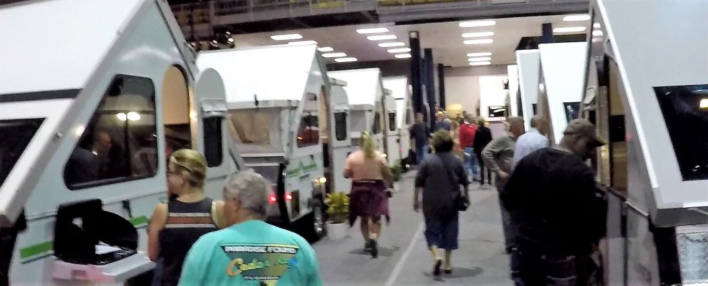
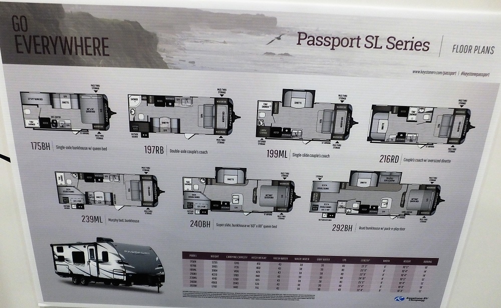
We attended the Florida RV Super Show in Tampa, FL on January 16-17.  Said to be the greatest RV show in the country,  it was the greatest RV show we’ve been to by a LONG shot.  The promos said there were 450 vendor booths and more than 1550 RVs in a mere 26 acres.  But we weren’t counting…

Show-Entry
An early morning start at the show – already overwhelmed!

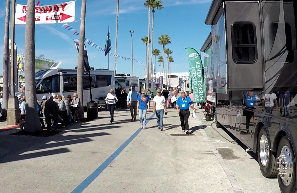
Much has been said and written about the incredible diversity of RVs available today – many could be seen at the show.  Included were Class As, Class Bs, Class Cs, fifth wheels, travel trailers, toy haulers, truck campers, popups, teardrops, hybrids, park models and probably others I am not remembering at the moment.  Each fits one’s lifestyle, budget and style of camping.  The show was a great way to see all things RV in a relatively small area and short period of time.

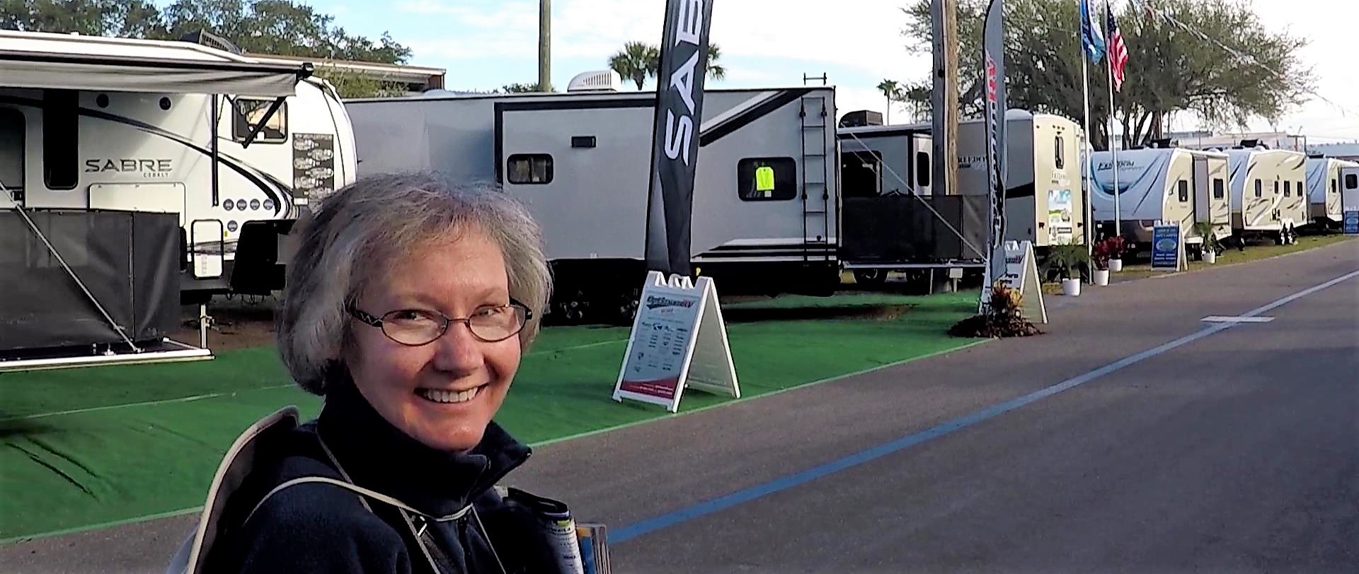
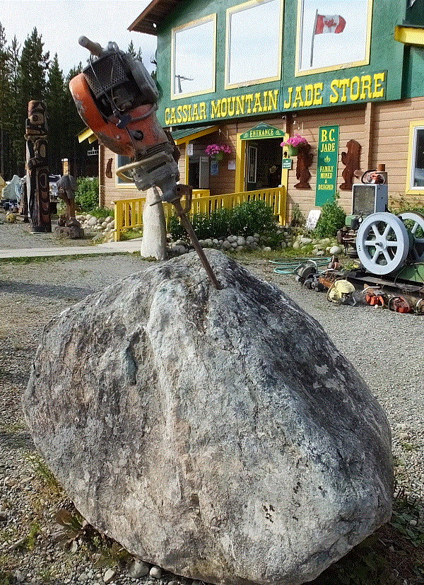
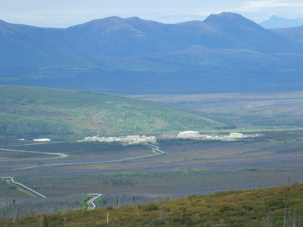
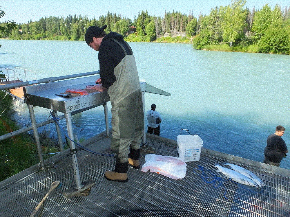
Check out a few of the show views below:

YouTube has lots of videos posted by seasoned reviewers that offer great comments on what is new and different.  This was our first BIG show so it was all new and different to us!

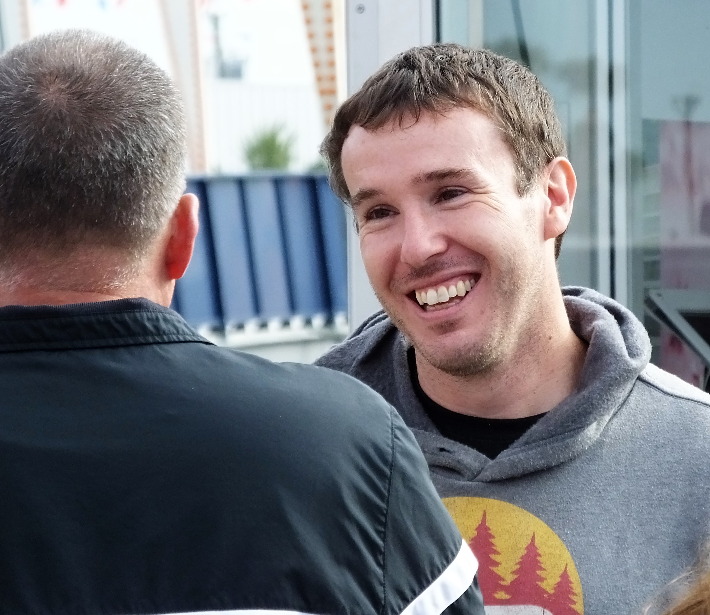
There were even Youtube RV celebrities  at the show.  We had a chance to meet up with Nathan and Marissa from Less Junk, More Journey.  They spoke with their online followers for more than an hour!

Diversion 2-LJMJ
Nathan from the Less Junk, More Journey Youtube Channel

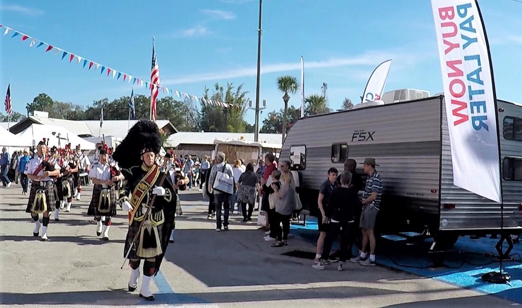
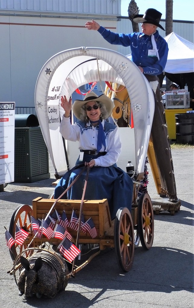
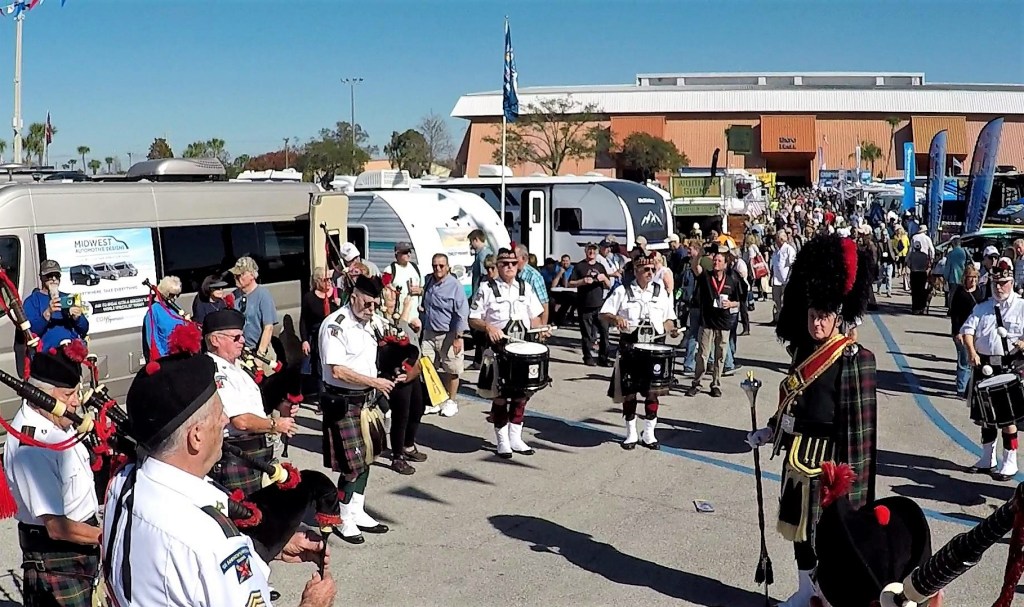
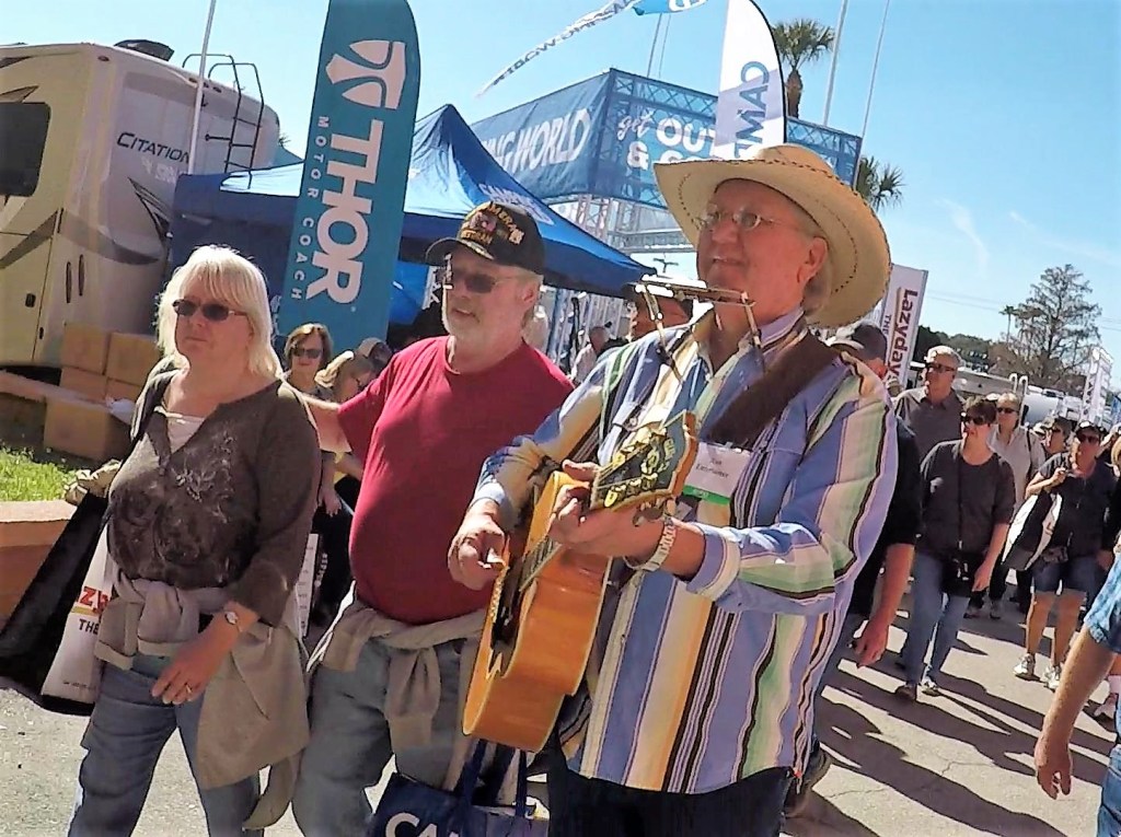
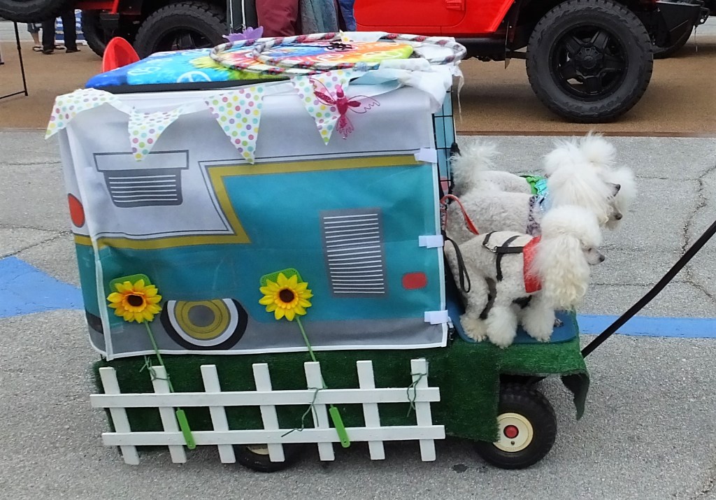
Besides the mind-numbing array of camping rigs and vendor booths, the show included roving entertainment – a bagpipe band, cowboys on stilts, guitar and trumpet players, and much more.

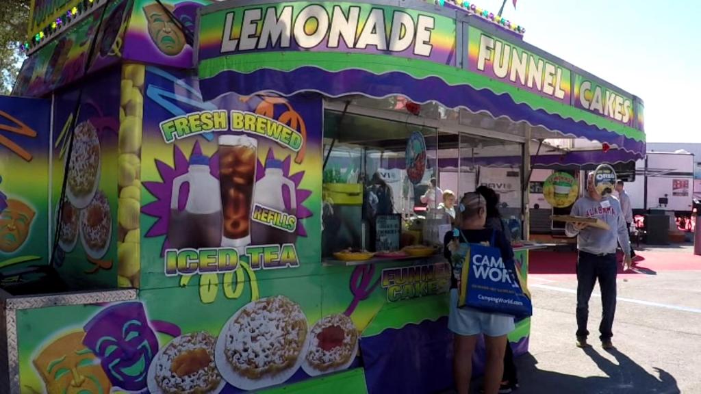
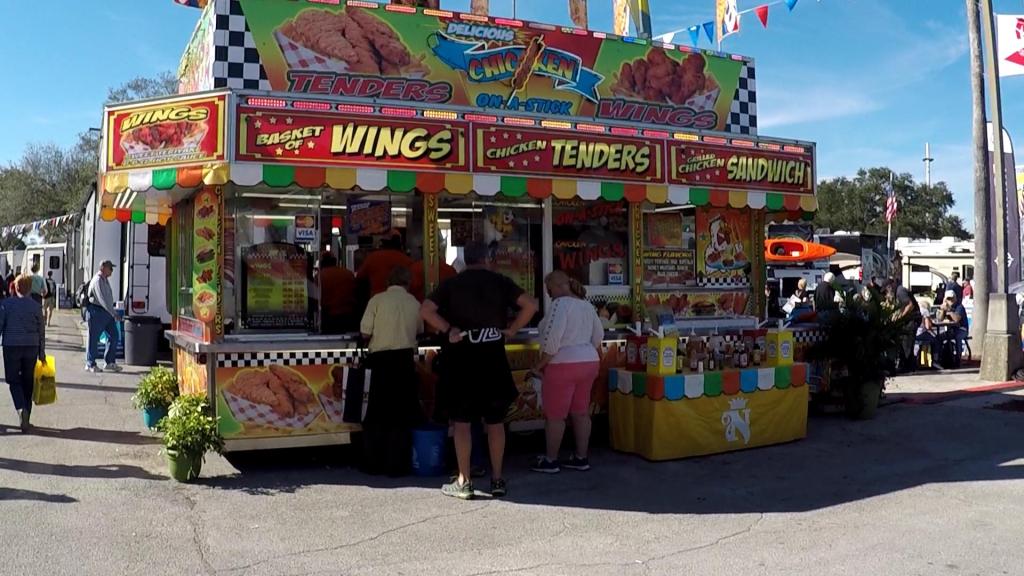
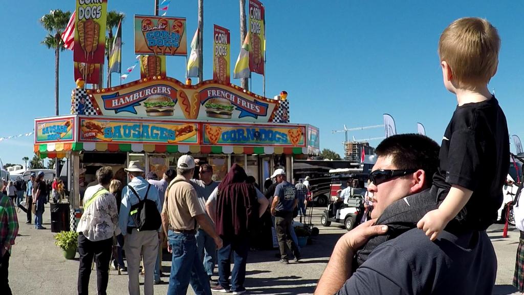
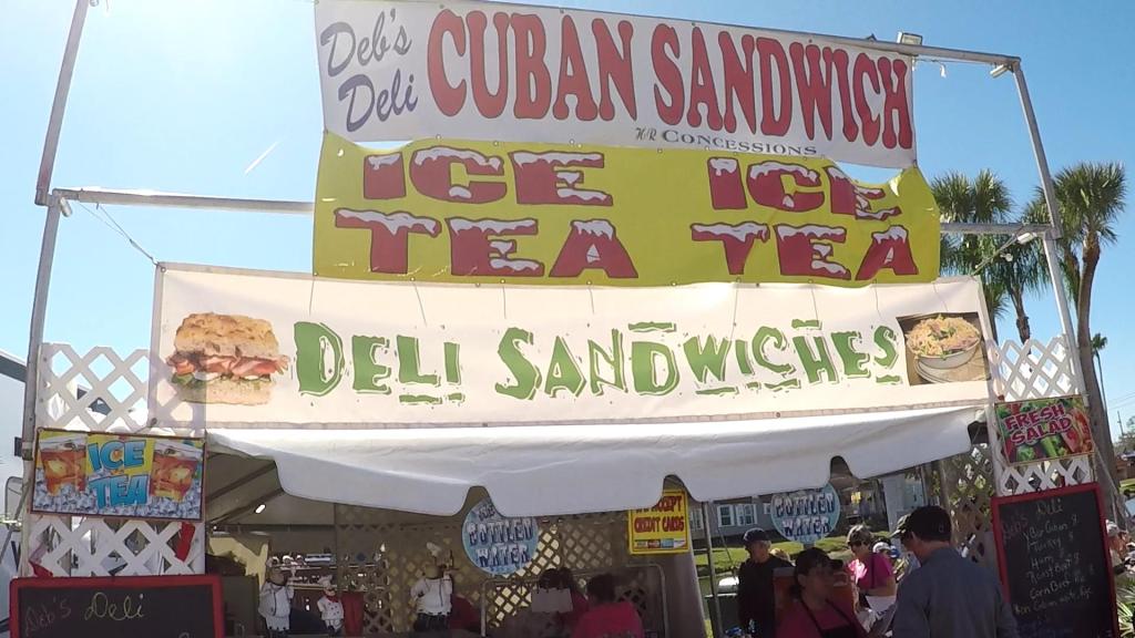
Hungry or thirsty?  There was a variety of fair-type food and drink – pizza, funnel cakes, barbecue, lemonade, burgers and hot dogs and so on.

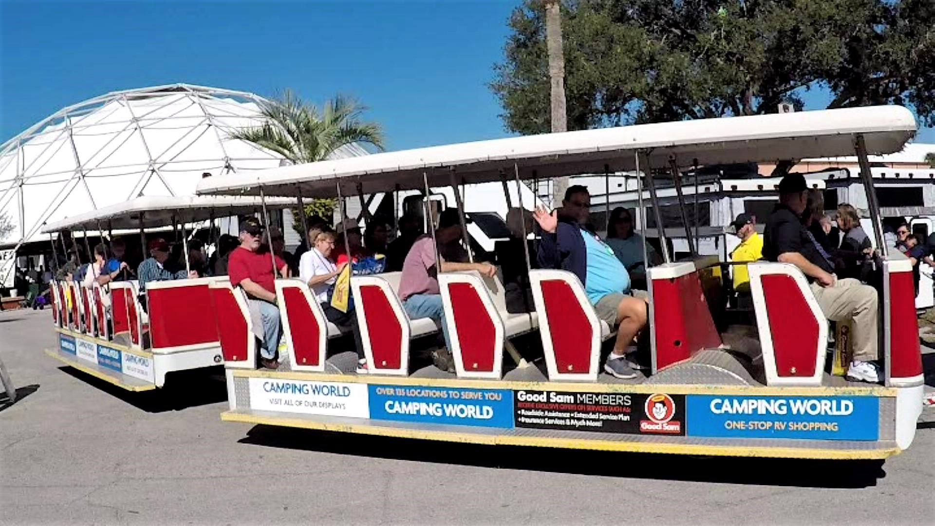
Tired?  Don’t want to walk?  There were trams that continually circled the show.

Shuttle

Here are some suggestions to help you get the most out of RV shows you might attend in the future:

Save on tickets.  We purchased show tickets in advance for a small savings.  Then, as we entered the show, we got free tickets for a second day.  Sometimes Groupon or websites have specials as well.

Save on parking.  Cash was needed for parking – no credit cards!  Carpool with friends to save even more.

Avoid crowds and arrive early to park near the gate.  We attended Wednesday and Thursday to avoid the larger Friday and weekend crowds.  The show opened at 9 am and we arrived around 9:15.  This allowed us to park very close to the entrance.  We bypassed the lines at the entrance ticket booths that got rather long by 10 am.  We also bypassed kiosks where one could sign up for prizes (signup when leaving).

Decide what you want to see and stay focused.  We determined the types of campers we wanted to see and decided on the RV manufacturers to visit.  We found them on the show map and visited those at the back of the show first.  We then worked forward.

On our second day we looked through campers that caught our eye in addition to those we were focusing on.  We also used the second day to look over RV-related products and services in the exhibitor areas.

Show-Dreamy Rig
The $2 million RV of Pat’s dreams!

Dress wisely, take breaks.  Wear comfortable shoes and clothing, with removable layers if it is chilly.  Include a hat if sunny.  We took regular breaks and stayed hydrated.

Checklist
Our RV Show Checklist

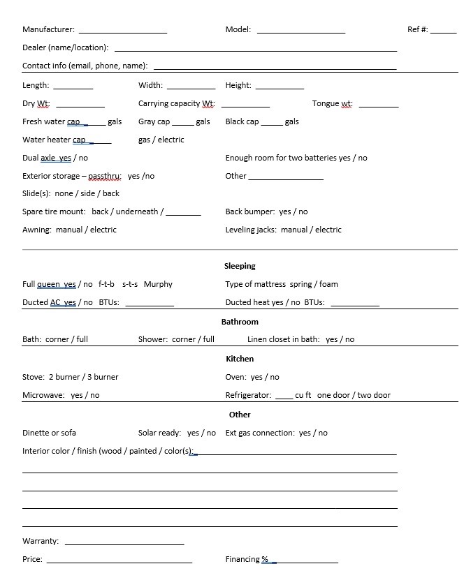
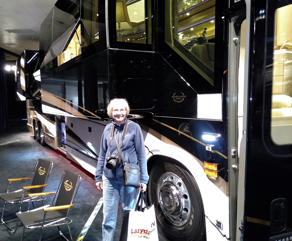
Take notes and photos.  Details of the rigs visited run together after a very short while.  We created a checklist of the key features of we were looking for in advance and took pictures to help us remember each rig.

Ask questions.  There were lots of salesmen and manufacturer reps at the show. They were happy to answer detailed questions as we looked things over.  We noticed they were much more attentive before lunch.  As the crowds grew in the afternoon, everyone grew tired!

Enjoy the diversions.  The fun and useful diversions were enjoyable – bagpipes, walking entertainers, seminars and the multitude of vendor displays.

Full Camper Line
Not all models of a camper series were at the show.

Wait – there’s more!  Not all models of a particular camper could be seen at the show.  Review manufacturer brochures and tell sales people/manufacturer reps what you are looking for.  What you are looking for may be found at a dealer nearby.  Also, carry a backpack to stow brochures, completed checklists and any purchases you make.

Additional ideas?  If you have other RV show tips, please add to the comments below.

Our Alaska Journey Ends – Glad to be Home!

(2018 Alaska Ep 48)

We arrived home on Monday, October 8 – after 177 days and 22819 miles.  We are getting things put away, cleaning a LOT of Alaska dirt and bugs off the truck and camper, and catching up on house maintenance chores.

Michael

Our welcome home was not quite what we expected – Hurricane Michael hit Florida Wednesday afternoon.  Thankfully, the impact to us was minimal.  Our prayers go to the many people affected by this serious storm.


Since our previous blog post, it took about a month to make our way from Bellingham, Washington to Florida.  Our pace was slow and steady as we enjoyed various sights along the way.

  • while in Bellingham (RabbiTRAILS Alaska Map, pt # 58), we visited camp friends on Vancouver Island and Lynden, WA.  We also visited Pat’s cousin – whom she had not seen in more than 30 years!
  • we also toured Boeing aircraft facilities north of Seattle.  The place is HUGE.
2018 Alaska Trip 4833 - 1809101259
Airliner takeoff over the Boeing facilities. We could not take photos inside.
  • we headed south along the Washington, Oregon and California coasts, and visited a couple interesting lighthouses (map, pts #59-63).
  • in California we were awestruck by the huge redwoods at Redwood National Park  (map, pt # 63).  A giant Paul Bunyan and his blue ox Babe kept watch at the nearby Trees of Mystery tourist attraction.
Minneapolis Friends
A visit with church friends Ray and Kathy near Minneapolis
  • continuing east and south, we spent a night in Illinois and then visited the Ark Encounter and Creation Museum just south of Cincinnati (map, pt # 72).
  • after another night on the road near Chattanooga, we spent three nights near Warner Robins, GA and caught up with our daughter, son-in-law and nearly nine-month-old grandson, Henry (map, pt # 74).
Liz-Josh-Henry
Josh, Henry and Liz. Henry has grown a lot since we saw him in April!

Many thanks for following us on this journey, and for your prayers and comments along the way.

Watch for new topics on the RabbiTRAILS blog, including National Parks, bike trips, trip planning, interesting things seen along the way and more.  Eventually we will include links to videos of our experiences.

Until then, many blessings and interesting RabbiTRAILS to you. Remember to take the LONG ROAD!

cropped-rabbitrails1-e15191822266541.jpg

Interesting Collections, Missing Bears and a Gorgeous Glacier

(2018 Alaska Ep 47)

After leaving Skagway, we camped at Six Mile River Resort in Tagish, Yukon on August 31 (RabbiTRAILS Alaska Map, pt #53). The campground has some interesting collections on display.

The most memorable sight during our stay was of boats on the serene Six Mile River – this was taken early the next morning just before we left.

2018 Alaska Trip 4588 - 1809010814

We continued along the Alaska Highway, and because our destination was the Vancouver/Washington area, we turned south on the Cassiar Highway.   Although the entire Cassiar is paved, the first two hundred miles are very narrow with no center line or shoulders.  It has several one lane, wooden decked bridges.

The highway is more remote than the Alaska Highway – it has only five gas stations in 450 miles. We had to plan gas stops carefully.

The Discovery Channel series Jade Fever takes place in Jade City, a small town on the Cassiar Highway.

2018 Alaska Trip 4635 - 1809031018

We took another side trip to Alaska while driving the Cassiar. We spent September 2-3 in Stewart, British Columbia, and crossed the border into the very small town of Hyder, Alaska (map pt 55).

Just outside of Hyder, the US Forest Service manages the Fish Creek Wildlife Observation Site. A wooden platform extends more than 1000 feet along Fish Creek, and when salmon swim up the creek to spawn between July and September, visitors can see black and grizzly bears that frequent the area for an easy meal.

The fish were there – the creek was active with lots of salmon splashing their way upstream to spawn.

The bears weren’t there. We didn’t see bears during three visits to Fish Creek. Perhaps the bears were full from their visits earlier in the week.

From Fish Creek we followed a bumpy and steep dirt road 12 miles to Salmon Glacier. What a view!

DCIM100GOPROGOPR0100.JPG
Salmon Glacier

We said our final goodbye to Alaska as we left Hyder and continued south. We arrived in the lower 48 on September 7.

Bye-Bye Bucket List Item #2

(2018 Alaska Ep 44)

On August 25, we headed south to Canada, the Alaska and Cassiar highways and eventually Washington State.  Our plans were to visit some camp friends and Pat’s cousin when we reached the lower 48.

2018 Alaska Trip 4207 - 1808251155
Mile 1422, end of the Alaska Highway

We visited the official end of the Alaska Highway in Delta Junction and camped further south in Tok.  In June we camped in Tok when we first arrived in Alaska.

The small town was noticeably less busy this time – campgrounds were mostly empty and there were fewer vehicles on the road.  Summer visitors were headed south!

We decided to take a day trip to Chicken, Alaska, a couple hours away via the Taylor Highway.

According to town lore, Chicken got its name because the town founders were unable to spell Ptarmigan.

Once a gold mining town, Chicken now consists of several souvenir stores, a couple campgrounds and some very interesting relics from the gold rush days, including a huge gold dredge.  It also has a large chicken statue made of scrap metal by high school students in Homer, Alaska.


The weather was cold and clear during our first evening in Tok.  We drove 15 miles to a dark area out of town.  As the sun set, we had a wonderful surprise!

Above us were moving ribbons of green that crisscrossed the sky – the Northern Lights!  We watched for more than an hour as the intensity and colors varied.  At times the entire sky was filled with varying patterns and occasional different colors.


As we prepared to leave Alaska after more than two months, we reflected on God’s blessings and presence throughout our trip.  We had traveled and seen much, and the lights were icing on the cake, reminding us of His creation and majesty!

Bye-Bye Bucket List Item #1

(2018 Alaska Ep 43)

2018 Alaska Trip 4127 - 1808231257

When planning our Alaska trip we had a couple items on our bucket list –  one was to visit the Arctic Circle and the other to see the Northern Lights.

We set off from Fairbanks on August 22 in search of both.

2018 Alaska Trip 4031 - 1808221231

We traveled north via the Dalton Highway.  The road extends more than 400 miles from near Fairbanks to Prudhoe Bay, the immense northern oilfield on the Bering Sea and start of the Alaska oil pipeline.  Due to the condition of the road, we decided to leave our camper in Fairbanks and drive to Coldfoot, an hour north of the Arctic Circle and halfway to Prudhoe (RabbiTRAILS Alaska Map, Pt. # 49).

The Dalton has sections of pavement with lots of potholes and other sections with a graded gravel-dirt mix.  When the gravel-dirt road is dry, you can actually travel faster than on the paved road.  When wet … more on that below.

The road is VERY remote with light traffic; there are few signs of civilization other than the pipeline.  We crossed the Yukon River after several hours, and welcomed the sight of restrooms and a gas pump.  We didn’t welcome the price of fuel – $5.49 a gallon!

We reached the Arctic Circle a couple hours later.  It was nothing really exciting other than a sign telling us we had arrived.

Had we been there on June 21, however, we would have experienced a day when the sun never set.  Instead, we were at a campground in Yukon on that date (see earlier blog post).

2018 Alaska Trip Video 0559 - 1808221543
At the Arctic Circle! The trees are short and tree line low on the mountains.

We continued to Coldfoot Camp.  Coldfoot is a major stopover between Fairbanks and Prudhoe.  It is in the Brooks Range, remote mountains that extend more than 1500 miles east-west across Alaska.

Inside, truck drivers filled themselves on a hot buffet, and outside, car drivers filled their tanks with $5.49 gallon gasoline.

We camped at Marion Creek BLM Campground, a few miles north of Coldfoot.  It was our home away from home away from home.  As we prepared dinner, it began to lightly rain.   We stayed dry on air mattresses and sleeping bags in the back of the truck. No Northern Lights for us that night.

2018 Alaska Trip 4079 - 1808222009
Camping – our home away from home away from home…

The next morning we rose to remnants of light rain from the night before.  We cooked breakfast in the cold and noticed fresh snow on nearby mountaintops.

When we started back to Fairbanks, we discovered the gravel-dirt road was now slush. Our speed was much slower.  Before long our truck was covered with a VERY thick layer of dirt and gravel.

The first stop when we returned to Fairbanks was to a car wash!

We crossed the Arctic Circle off our bucket list but were disappointed we didn’t see the northern lights.

There’s Lots to See in Fairbanks

(2018 Alaska Ep 42)

Signs of change were everywhere – shorter days and cooler nights, more days of rain, fireweed plants losing their flowers and turning red, and birch tree leaves changing from green to dull green to yellow.  Highways, campgrounds and attractions even seemed to be slowing down.  With mid-August, fall is right around the corner and our time in Alaska was growing short.  

The trip from Denali to Fairbanks was an easy four hour drive and we found a  campground in North Pole, a few miles east of Fairbanks (RabbiTRAILS Alaska Map, pt #48).

For a relatively small city (population 33,000 in 2016), Fairbanks has a lot to see and do.

The Alaska oil pipeline passes nearby on its way from Prudhoe Bay to Valdez.   North of town, you can view the actual pipeline along with several displays with interesting pipeline information.  We’ll be seeing lots more of the pipeline in the days to come…

North Pole is the ultimate Christmas destination – the street light poles are shaped like candy canes and you can find just about anything Christmas in the Santa Claus House.  They even have the world’s largest Santa at 42 feet and live reindeer next door at Antler Academy.

2018 Alaska Trip 3954 - 1808201129

At University of Alaska Fairbanks we enjoyed outstanding exhibits about Alaskan art, wildlife and people at the Museum of the North and later learned about Alaska fauna at the Georgeson Botanical Gardens.

We watched hundreds of sandhill cranes circle the gardens and land on a large field across the road.  It is one of the areas in town where migratory birds rest during their long distance flights south.  Elsewhere in Fairbanks is Creamers Field Migratory Waterfowl Refuge, located on a large tract of land that used to be a dairy.  We saw lots of sandhill cranes, Canadian geese, ducks, trumpeter swans and more.

2018 Alaska Trip 3990 - 1808201446
Closeup of Sandhill Cranes

The highlight of our Fairbanks stay was a trip north to the Artic Circle.  More on that in the next blog post!

Iditarod: Dog Sledding Super Bowl

(2018 Alaska Ep 40)

2018 Alaska Trip 4182 - 1808242201

As we’ve traveled through various parts of Alaska there has been frequent mention and interest shown in sled dog racing.  We suspect the Alaska sled racing season is met with as much enthusiasm as college or professional football in the lower 48.

The Iditarod Trail Sled Dog Race is probably the most well known long distance sled dog race in Alaska.  The link above gives a lot of very interesting history about dog sled races and the Iditarod.

We visited the Iditarod Trail Race Headquarters in Wasilla and learned lots about sled racing.

  • The Iditarod commemorates Alaskan sledding heritage and has been run since 1973.
  • Sled dog teams of up to 16 dogs run from Anchorage to Nome, nearly 1000 miles!
  • The race is run in early March and can take 15 days or more to complete.
  • It has two starts – Anchorage is the ceremonial starting point and Willow (near Wasilla) is the actual starting point.
  • The fastest recorded Iditarod time was 8 days, 13 hours, 40 minutes and 13 seconds in 2017.
  • The race is not just for men – women have won the race several times.

As mentioned in an earlier blog post, Denali National Park has a nice dog sled presentation.  It is amazing how excited the dogs are as they wait to be hitched and how much enthusiasm they show when pulling.  Some photos from the presentation:

2018 Alaska Trip 3251 - 1808081607

We saw an interesting quote displayed at the Iditarod visitor center:  the dogs are the athletes and the musher the coach!  After seeing videos and picture of the rigors of the race, we totally agree.  We’ll more closely follow the Iditarod this coming March!

      Kenai Fjords NP: Glacier and Wildlife Cruise

      (2018 Alaska Ep 39)

      As our son Phil’s trip to Alaska came to a close,  we decided to take a six-hour glacier and wildlife cruise with Kenai Fjords Tours.  Our cruise on the Calisto Voyager would take us southwest from Seward (RabbiTRAILS Alaska Map, pt # 44) along the Alaska coastline and Kenai Fjords National Park.

      We saw wildlife even before leaving the dock – playful otters, a lonely sea lion and even some jellyfish.

      We left Seward and arrived at Aialik Glacier in about 30 minutes.  The ship stopped a quarter mile from the glacier.  It was a magnificent view on a magnificent day!

      2018 Alaska Trip 3391 - 1808101319

      Our ship captain told us the face of the glacier is nearly 600 foot high and about a mile wide.  The glacier is noisy – with continuous cracking, occasional loud bursts that sound like cannon shots, and small ice flows that fall into the water every few minutes.

      The glacier face has deep fissures and we hoped to see a large piece break free.  Such calving didn’t happen during our visit, but here is a 2015 YouTube video that shows Aialik Glacier calving.

      Various-sized chunks of ice floated in the water near the glacier and numerous seals sunned themselves on the larger pieces.  One of the crew members explained the seals choose that location to avoid predators.

      We left the glacier and spent most of the remainder of the cruise searching for wildlife around various islands just offshore.

      Our boat and several others stopped to see a pod of Orca whales dive and surface.  Later we saw a larger humpback whale.  The captain explained humpback whales migrate to Hawaiian water during the winter.

      2018 Alaska Trip 3442 - 1808101423

      On another island we saw a large group of barking steller sea lions.  They nervously waddled from the rocks into the water when our boat approached.

      2018 Alaska Trip 3446 - 1808101439

      The islands are home to thousands of seagulls, cute puffins and other birds.  One puffin flew alongside our boat for a considerable distance before finally veering away.

      We also saw a majestic bald eagle standing guard near the top of a rock face.

      2018 Alaska Trip 3618 - 1808101820

      As the cruise came to an end, we were surprised by another flying spectacle – a kite surfer riding the brisk breezes above the ice cold waters of Resurrection Bay.

      2018 Alaska Trip 3635 - 1808101901

      A Month on Kenai

      (2018 Alaska Ep 36)

      On July 12, we headed to the Kenai Peninsula for nearly a month (RabbiTRAILS Alaska Map, pts 40-44).

      We drove across amazing mountains which run north-south along the east and central portion of the Kenai, and along the famed Kenai River, to the west coast of the Kenai peninsula.  The western portion is flat-to-slightly hilly, and as we headed south toward Homer, we could see across the Cook Inlet to a distant mountains that included Redoubt, Iliamna and St Augustine volcanoes.  Snow-covered Redoubt is the most dramatic at 10197 feet.  It’s quiet now, the last eruption occurring in March 2009.

      2018 Alaska Trip 2770 - 1807202322
      Mt. Redoubt across the Cook Inlet

      We camped for a week north of Homer at Anchor Point (map pt. #40).  Our campsite was along the Anchor River, with a view of Mt.  Redoubt.  We were told moose frequented the area but didn’t see any.  We did we a number of bald eagles however.

      Anchor Point has the distinction of being North America’s most westerly highway point.

      2018 Alaska Trip 2500 - 1807151750

      We made several visits to Homer, a 20-minute drive away.  As the road winds down a bluff to the town, there is a pulloff where one can see Kachemak Bay and mountains across the bay, and the Homer Spit.

      2018 Alaska Trip 2453 - 1807132027
      Kachemak Bay view
      2018 Alaska Trip 2466 - 1807141636
      Homer Spit

      Homer Spit is a finger of land that extends four and a half miles from the Kenai coast into Kachemak Bay.  It is intensely developed with campgrounds, a marina, gift shops, restaurants and the like.  There are LOTS of boats and fishing charter businesses, and Homer claims to be the halibut fishing capital of the world.

      We didn’t go fishing.  Instead we took a water taxi to Kachemak State Park across the bay, where we endured a seven mile hike to an iceberg-filled lake at the base of Grewingk Glacier.  We also crossed the outflow river from the glacier on a cable-suspended-tram manually operated by pull rope.

      2018 Alaska Trip 2684 - 1807181615
      Grewingk Glacier Lake and iceberg panorama

      We headed north to Soldotna (map pt. #42), a town on the Kenai River.  July is prime salmon fishing season and banks of the river were lined with fishermen snagging  and dip-netting the fish.

      2018 Alaska Trip 2802 - 1807221805
      Salmon fishing frenzy on the Kenai
      2018 Alaska Trip 2799 - 1807221800
      Fish are fileted right by the river not long after being caught

      There are five kinds of salmon, each making their spawn run up rivers and streams at different times during the summer.  As non-natives, we find the distinctions between each type of salmon rather confusing.   Fishing regulations are especially rigorous – the booklet with various limit, size and date guidelines is almost 100 pages!

      From Soldotna we travelled back across the peninsula to Seward (map pt. #44).  Seward is similar to Valdez, a port circled with beautiful mountains.  Cruise ships dock at Seward and passengers travel to destinations further into Alaska via the Alaska Railroad.

      Our Kenai stay will end in a few days as we head back to Anchorage to meet our son Phil, who is joining us from Orlando.  He will spend a week as we visit Denali National Park and take a short glacier-wildlife cruise.

      Views on the Kenai are beautiful, particularly across the Cook Inlet.  Some closing photos:

      2018 Alaska Trip 2528 - 1807162138
      Mt. Redoubt across the Cook Inlet
      2018 Alaska Trip 2530 - 1807171252
      Mt. Redoubt closeup
      2018 Alaska Trip 2585 - 1807180100
      Mt. Redoubt sunset (1 am)

      Getting Wet in Whittier

      (2018 Alaska Ep 35)

      We departed on July 9 for Whittier on the Kenai Peninsula (RabbiTRAILS Alaska Map, pt #35).  In August, we will return to Anchorage to pick up our son Phil from the airport.  He’ll spend a week with us as we visit Denali and take a glacier cruise out of Seward.

      Our route took us southeast along the shore of the Turnagain Arm.  This bay has the highest tides in the US!  The incoming tide, called a tidal bore, can result in a quickly moving wave up to six feet high!

      The tide was going out as we arrived.  We could see broad tidal flats but no tidal bore.  We hope to see the bore when we return to Anchorage or with Phil on the way to Seward.

      2018 Alaska Trip 2367 - 1807101344
      Turnagain Tidal Flats

      Our first three nights on the Kenai Peninsula were to be spent dry camping – no electric/water/sewer hookups – at the Williwaw Campground.

      We didn’t dry camp.  The next two plus days were continuous rain. We learned rainy weather is common in the area due to moist air moving across the mountains from Prince William Sound.

      Because of the rain, we couldn’t use the portable solar panel that keeps our RV battery charged.  The battery power got pretty low by the end of the second day and we had to skip showers until our next stop.

      2018 Alaska Trip 2387 - 1807111534

      Portage Lake was nearby.  The lake contains runoff from Portage and several other glaciers.  It also contains mini-icebergs that have calved off of Portage Glacier.  When the weather cleared a bit, we hiked to Byron Glacier, one of the nearby glaciers.  Glacial blue ice is remarkable!

      From Portage Lake, the road continues through a 2.5 mile tunnel to Whittier.   Trains and cars use the same single-lane tunnel at different times during the day.

      2018 Alaska Trip Video 0309 - 1807111141
      Entering the tunnel to Whittier

      We hoped the weather would be nicer on the Whittier side of the tunnel, but it was worse!  We could see the base of the mountains surrounding the town but not the tops!  As it rained, passengers from a cruise ship boarded an Alaska Railroad train that would take them to Anchorage and Denali/Fairbanks.  This is the same train mentioned in our earlier Anchorage blog post.

      2018 Alaska Trip Video 0318 - 1807111241
      Alaska Railroad train and cruise ship in Whittier

      During WWII, the US Army established Whittier in response to the Japanese capture of several Aleutian Islands.  Whittier also played a role in the post-WWII cold war with Russia.   Buckner Barracks was built and was one of the largest buildings in Alaska at the time.  The Army facility closed in 1960 and the abandoned barracks still dominate the skyline.

      Today, most of Whittier lives in another large building – the 14-story Begich Tower.

      2018 Alaska Trip Video 0315 - 1807111230
      Abandoned Buckner Barracks

      After two wet days, the sun finally came out and we enjoyed a fantastic view of Portage Lake.2018 Alaska Trip 2425 - 1807121147
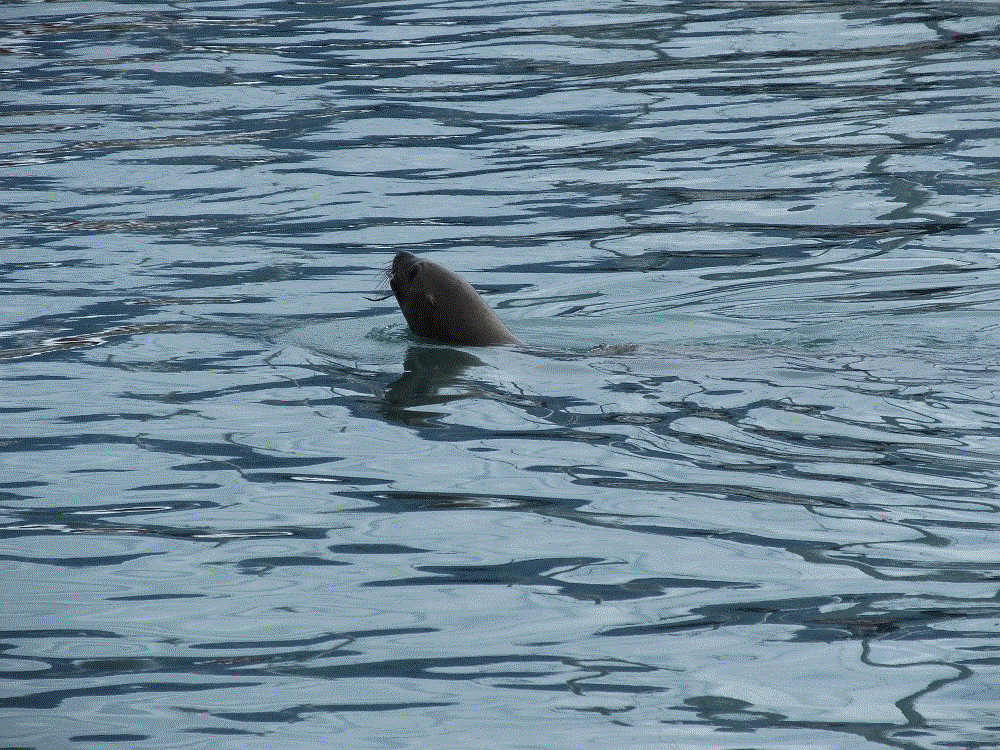
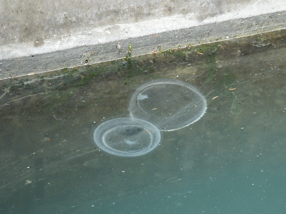
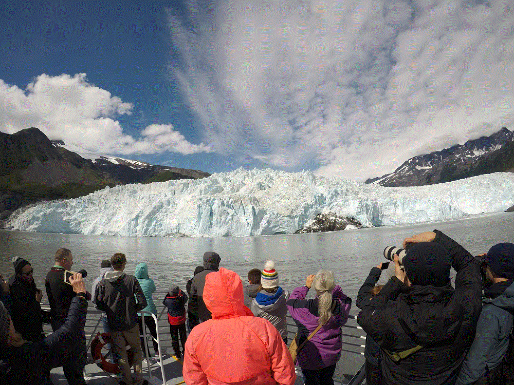
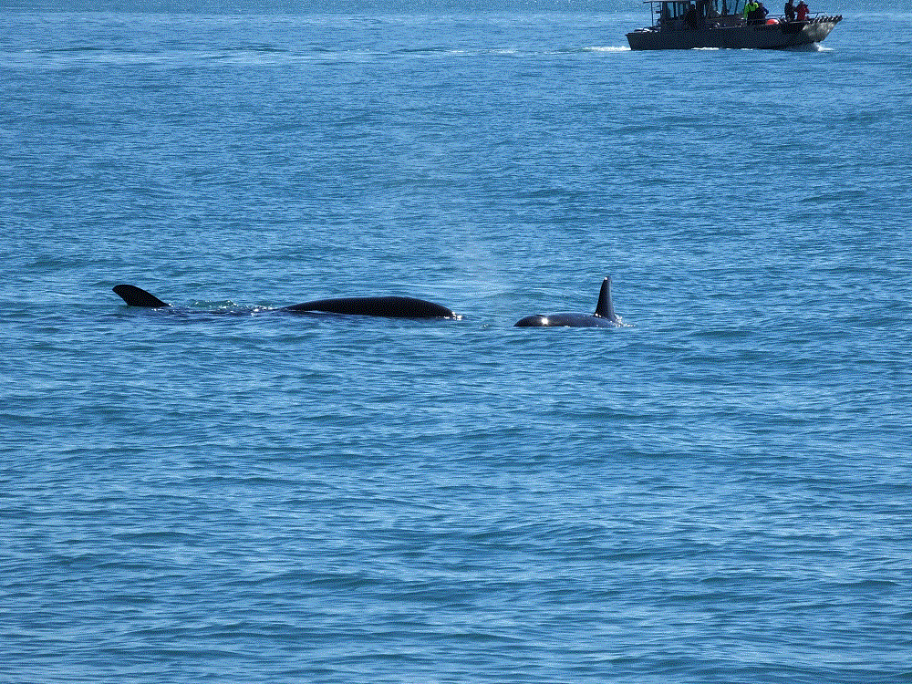
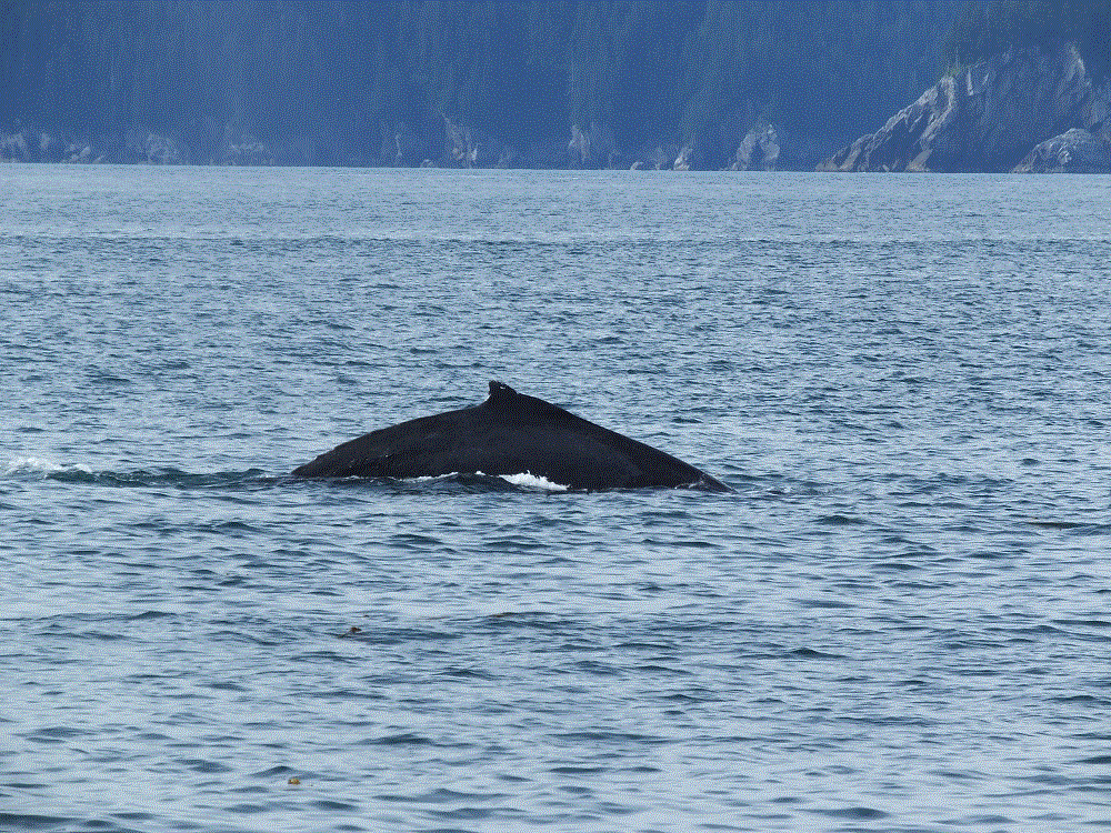
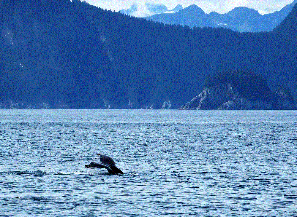
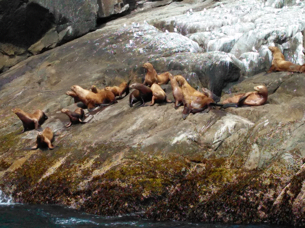
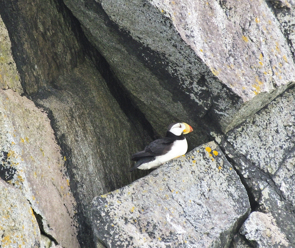
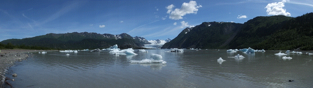
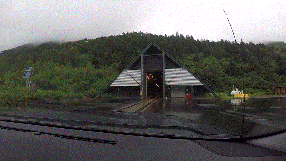
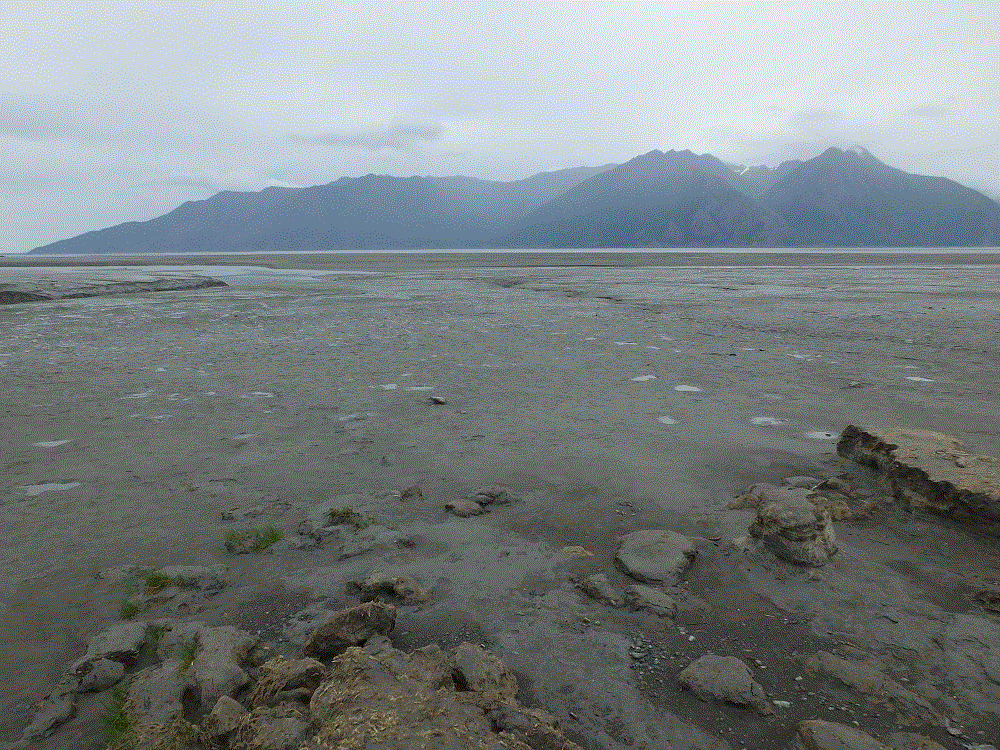
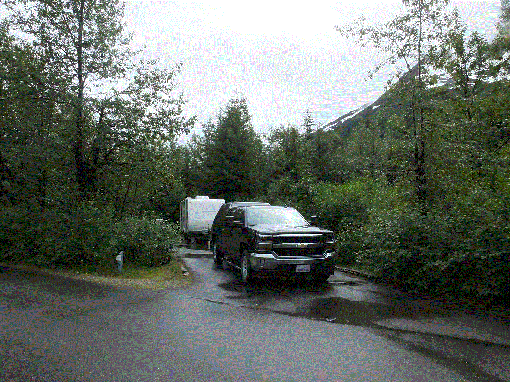
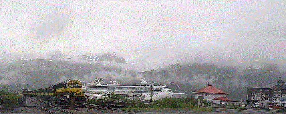
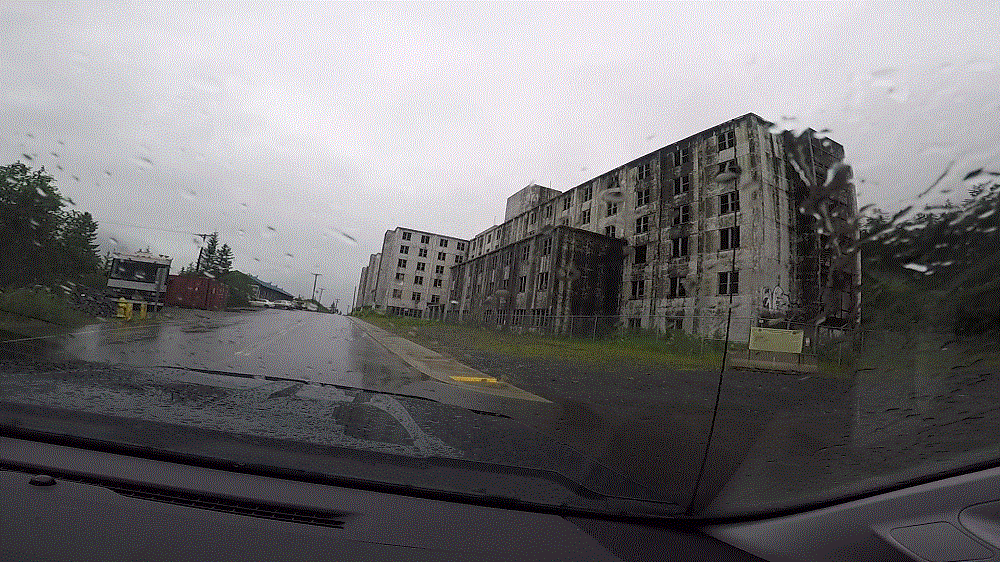
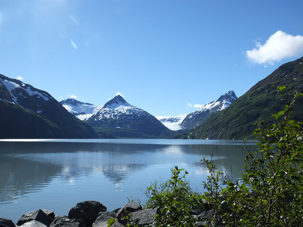
As we left, we reflected on two wet days in the area.  We now refer to Whittier as wettier and we find the meaning of Williwaw to be rather ironic.  A williwaw is a sudden violent squall blowing offshore from a mountainous coast.

      Ahead – we learn what all the spitting is about in Homer…