Fiona, Falls and French Canada

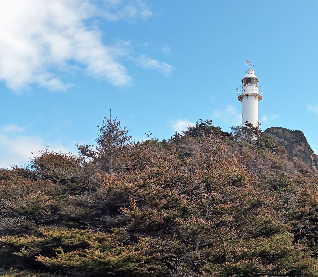
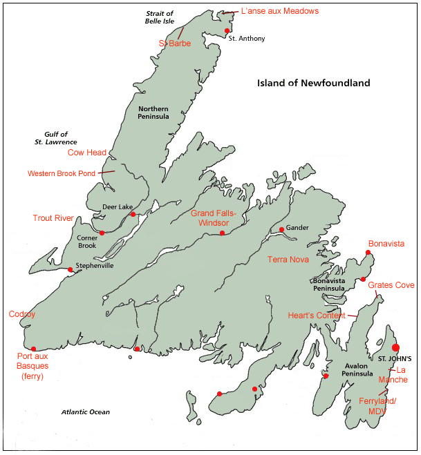
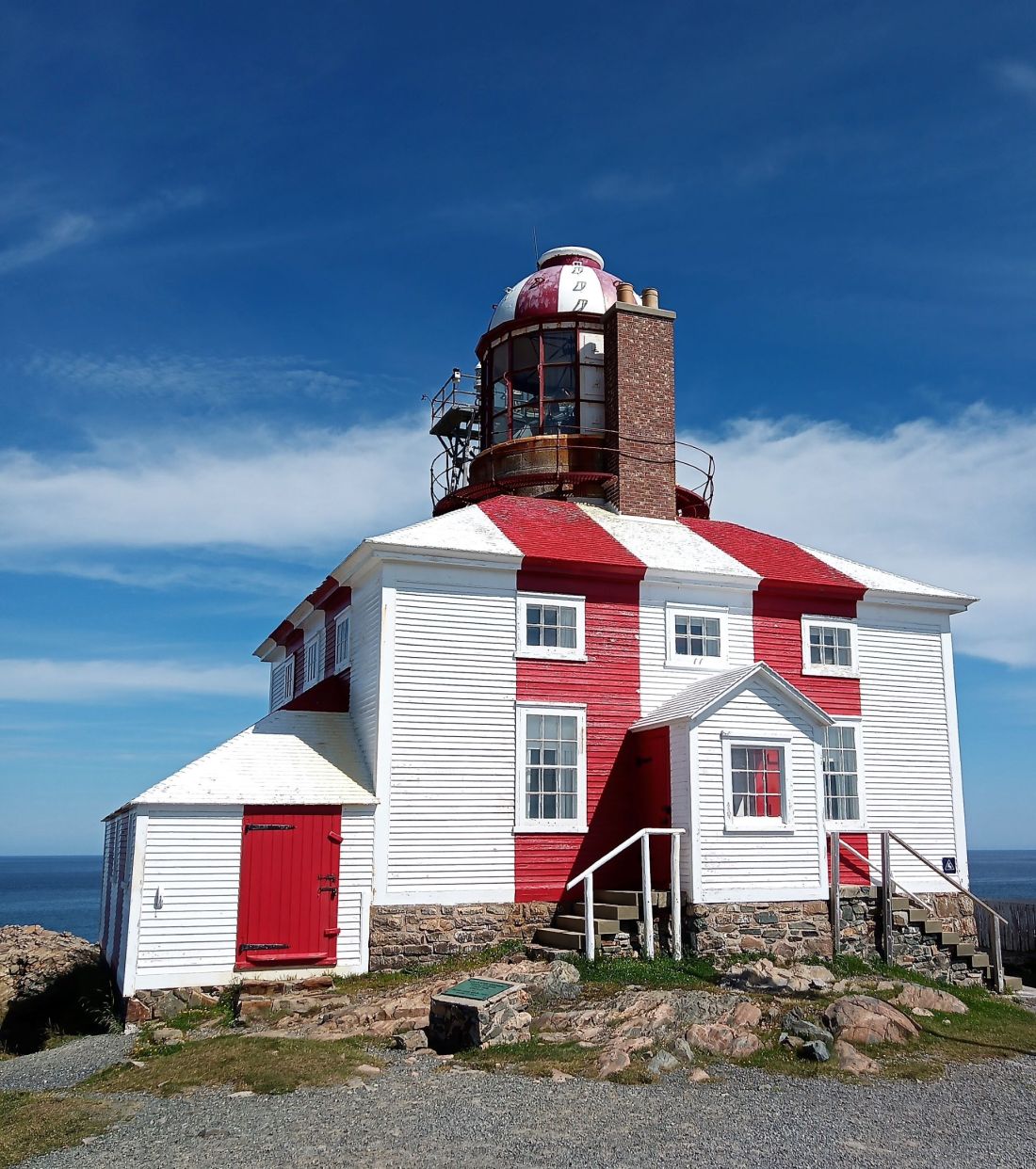
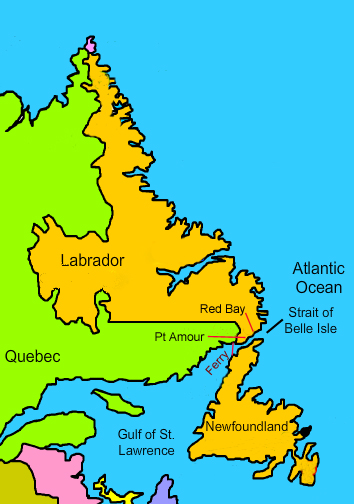
(2022 Newfoundland Ep 16)

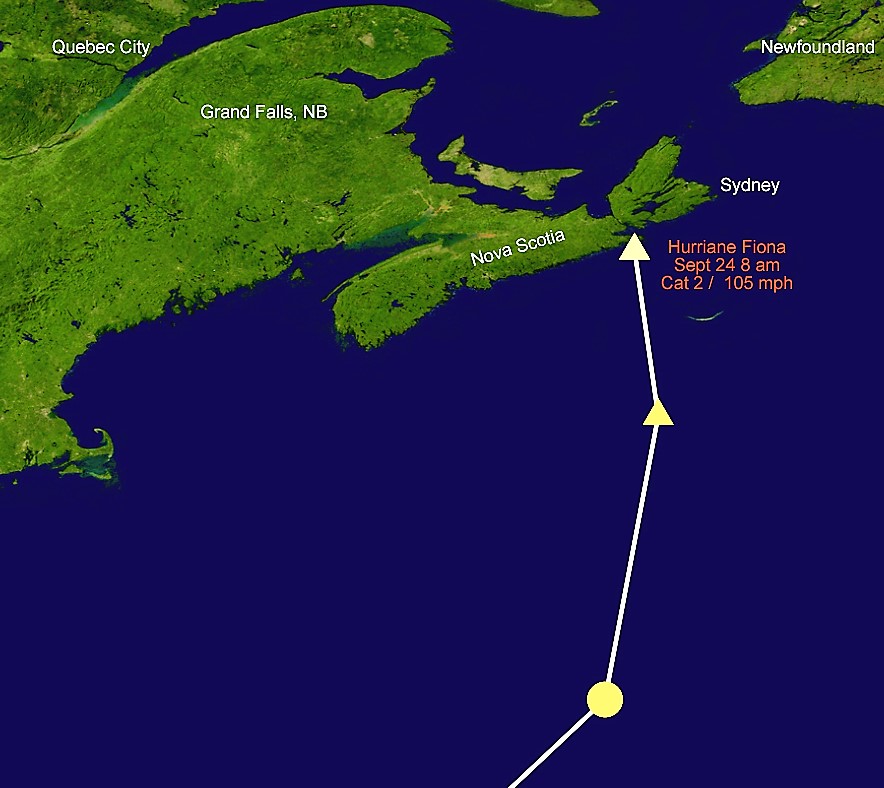
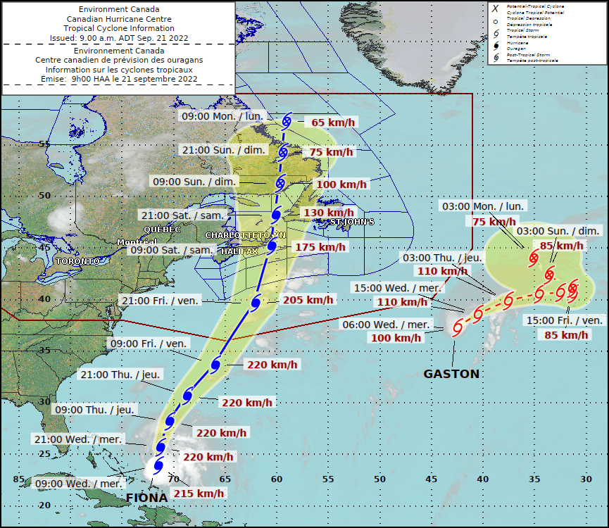
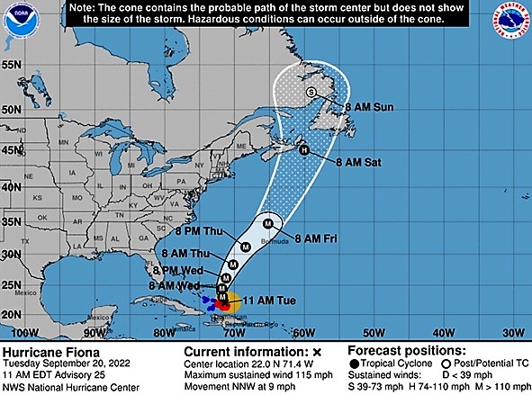
With Max repaired, we left eastern Nova Scotia on Thursday, September 22. as Hurricane Fiona was set to strike after a destructive and deadly path across the Caribbean.

We were surprised that traffic on the Trans-Canada highway, the main east-west route across Nova Scotia, was light.   This was unlike Florida’s major highways that would be bumper-to-bumper two days (or more) before an approaching hurricane.

Fiona made landfall near Whitehead, Nova Scotia, 150 miles southwest of Sydney, early Saturday, September 24.  The category 2 storm had sustained winds of around 105 mph and Fiona was regarded to be the strongest such storm in Canadian history. 

By then, we were safely camped 550 miles away near Grand Falls, New Brunswick.  We were thankful for light rain and a few moderate gusts, and our prayers were for the people of Nova Scotia and Newfoundland in the storm’s path.

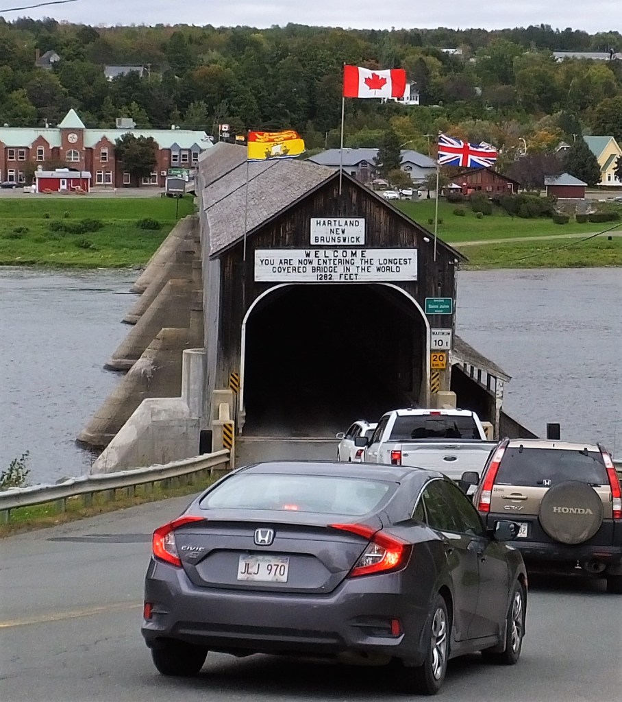
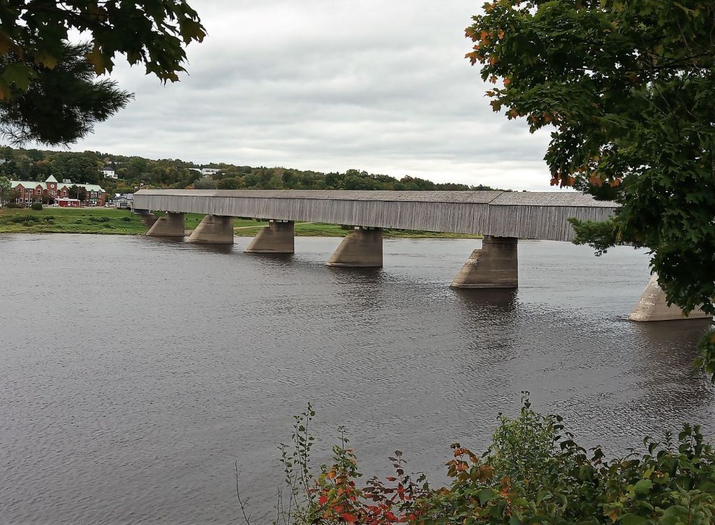
We stopped to see the world’s longest covered bridge in Hartland, NB as we traveled.  We drove down a steep road that led to the 1282-foot-long single lane bridge where it crossed the St John River.  As we neared the bridge, we realized the bridge had a height limit of 10 feet.  We had to do some quick rerouting – Oscar is 11 feet 6 inches tall!

Waiting to cross the RV-unfriendly covered bridge
The covered bridge keeps going and going….for 1282 feet!

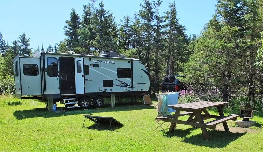
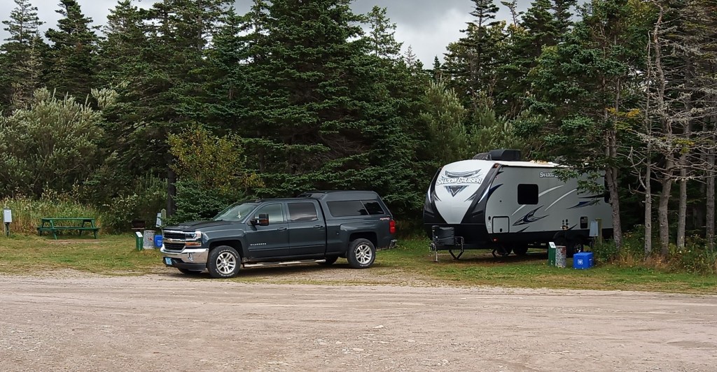
That afternoon, we were surprised to find out the campgrounds in Grand Falls had closed for the season.  We finally found a campground several miles away that kept a few campsites available for fall travelers. 

Grand Grand Falls

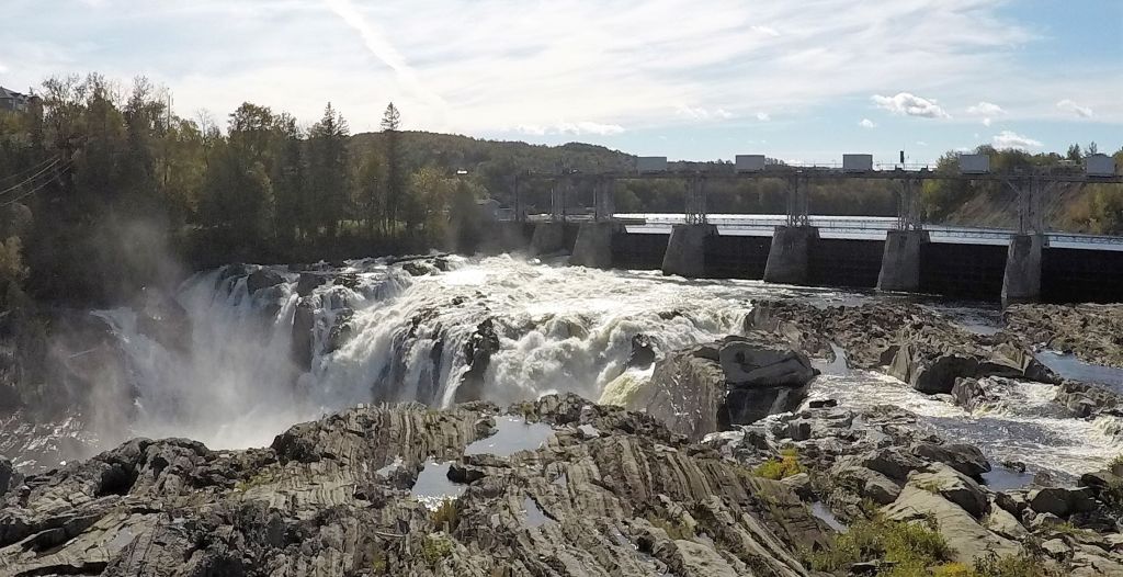
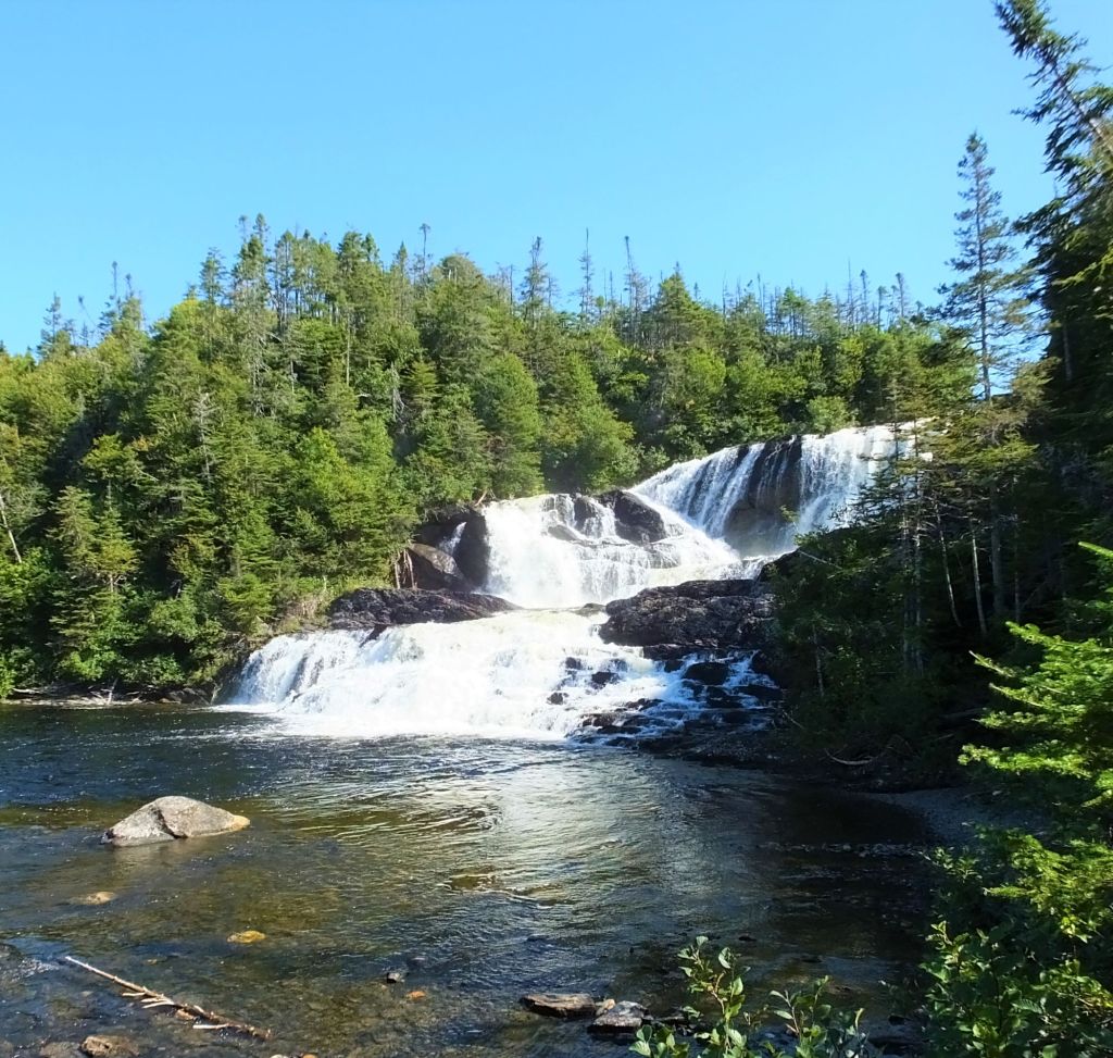
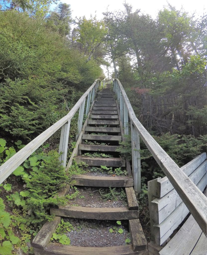
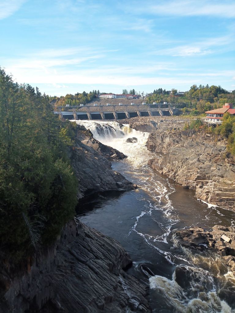
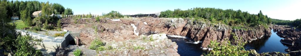
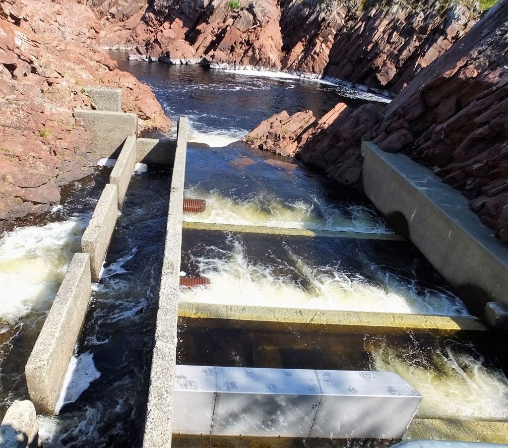
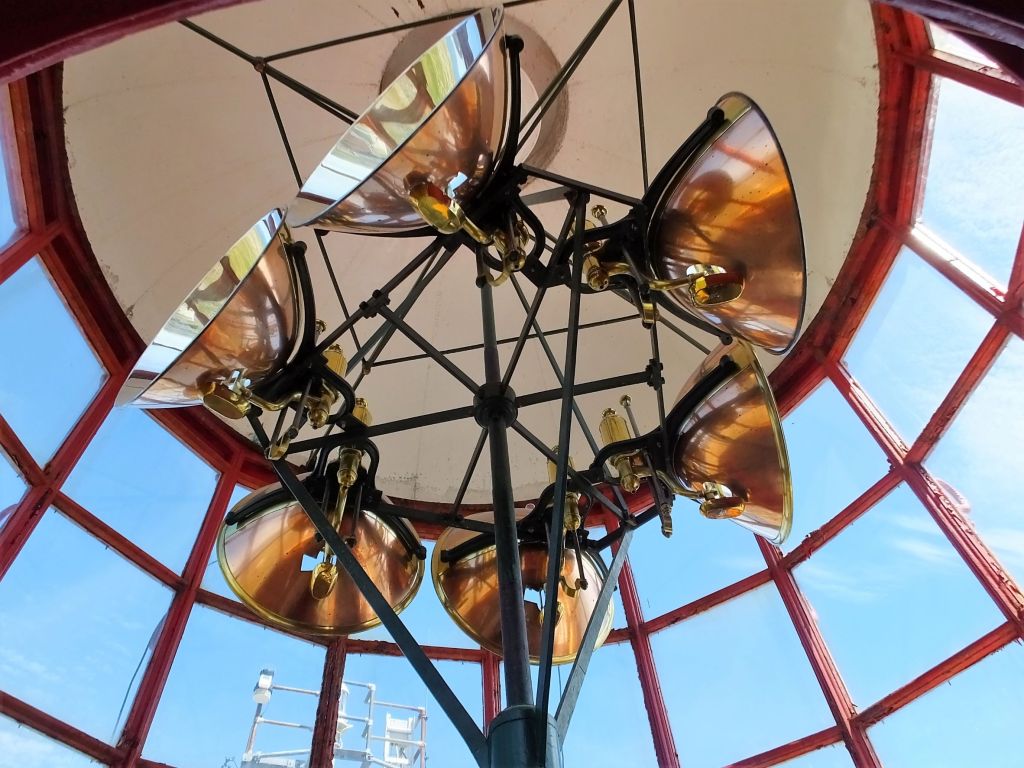
We hiked to several viewpoints of Grand Falls and then along the gorge downstream.  At 75 feet, the falls are third highest major waterfall in eastern North America after Niagara Falls and Quebec’s Montmorency Falls.    During the spring runoff, the volume of water flowing over Grand Falls is nearly 2/3 that of Niagara Falls!

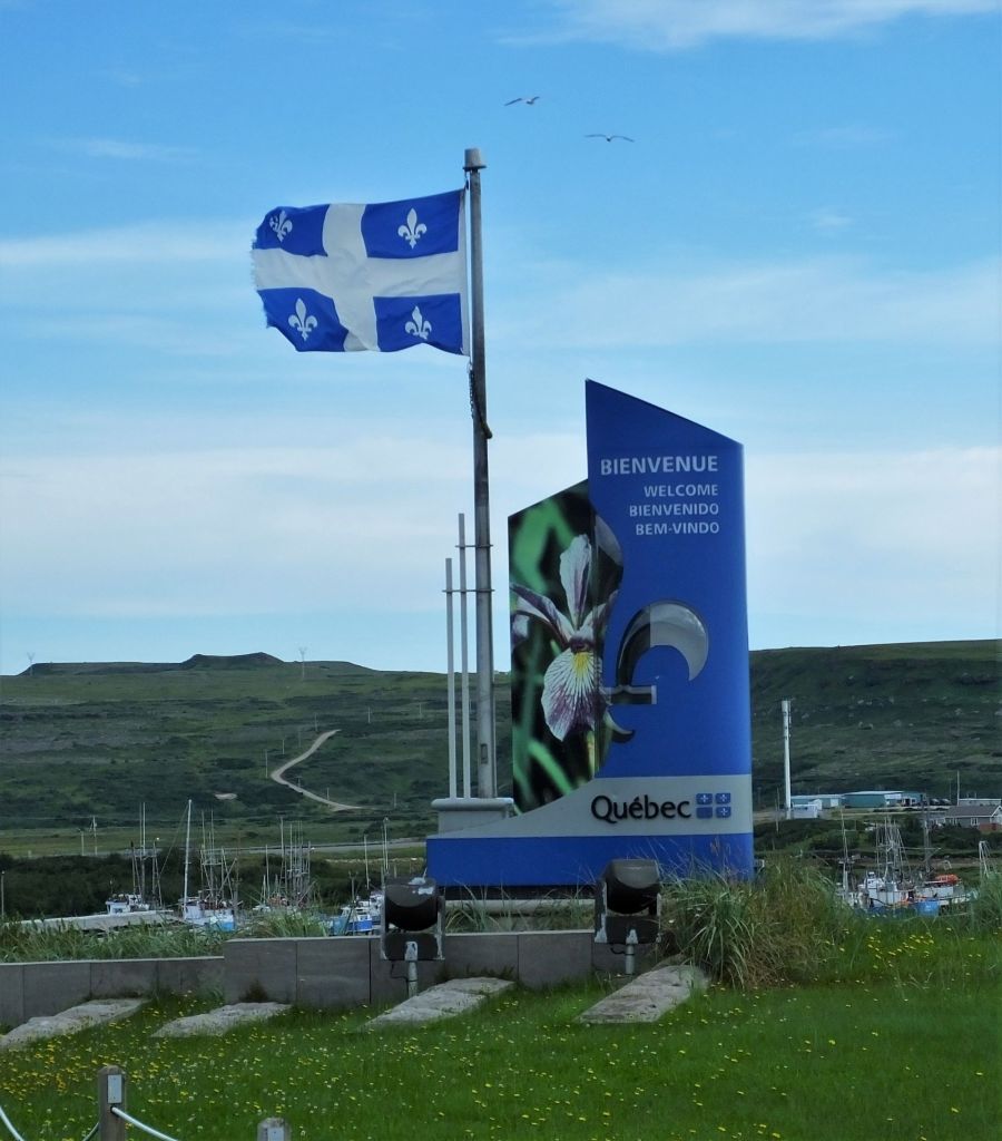
From Grand Falls, we drove north to the Gulf of St Lawrence and then west to a campground near Quebec City.  It was there we wished we had learned French when we were in school.

Windy Gulf of St Lawrence with Quebec’s Laurentian Mountains beyond

The campground office was closed when we arrived, so we called a phone number posted at the entry gate for assistance.  The man who answered did not speak English – he only spoke French!  Several minutes later he pulled up on a golf cart.  We showed him our reservation email and after trying to communicate via various hand signals and pidgin English/French, he let us in and showed us to a campsite.  We were glad the campground was not full.

One of the entry gates into Old Quebec City

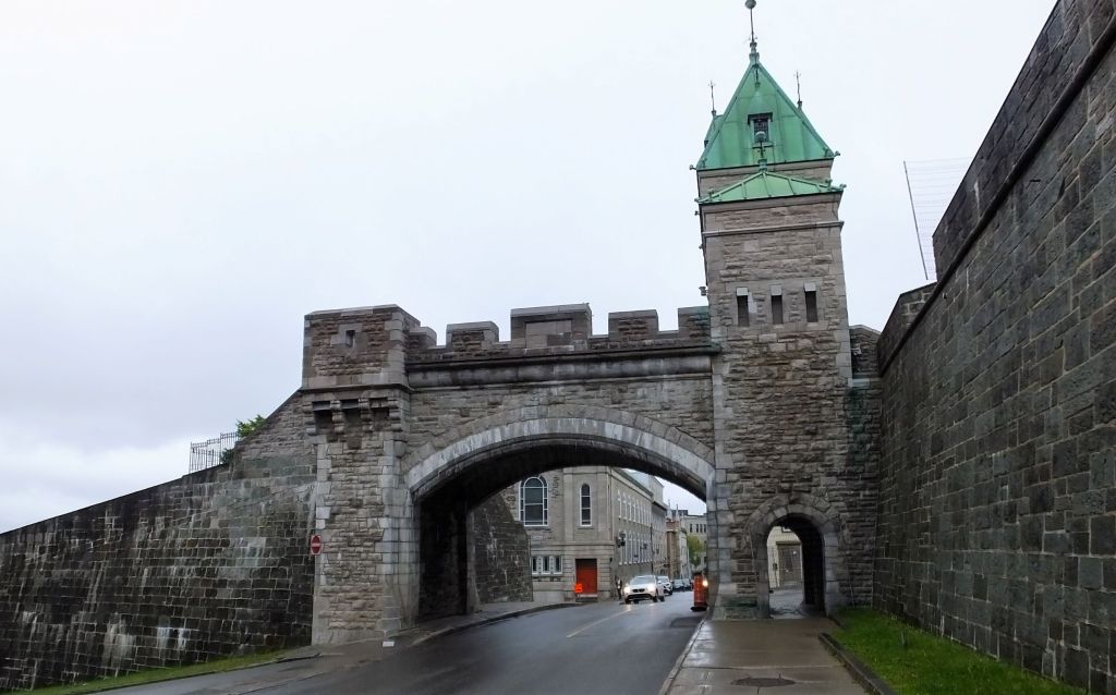
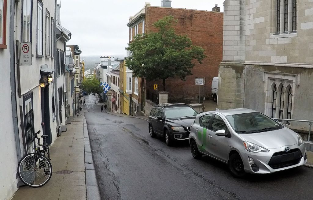
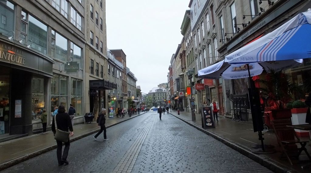
We toured Old Quebec City the next day to take in over 400 years of history in the birthplace of French North America. 

Coffee at Paillard

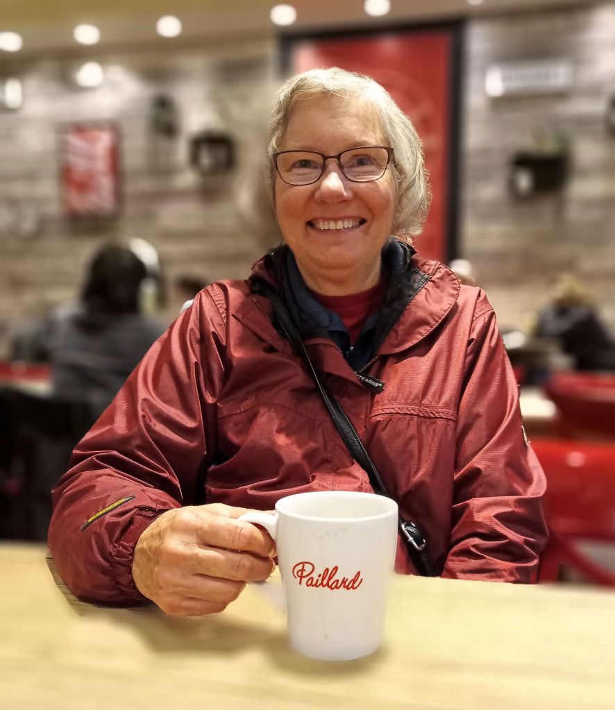
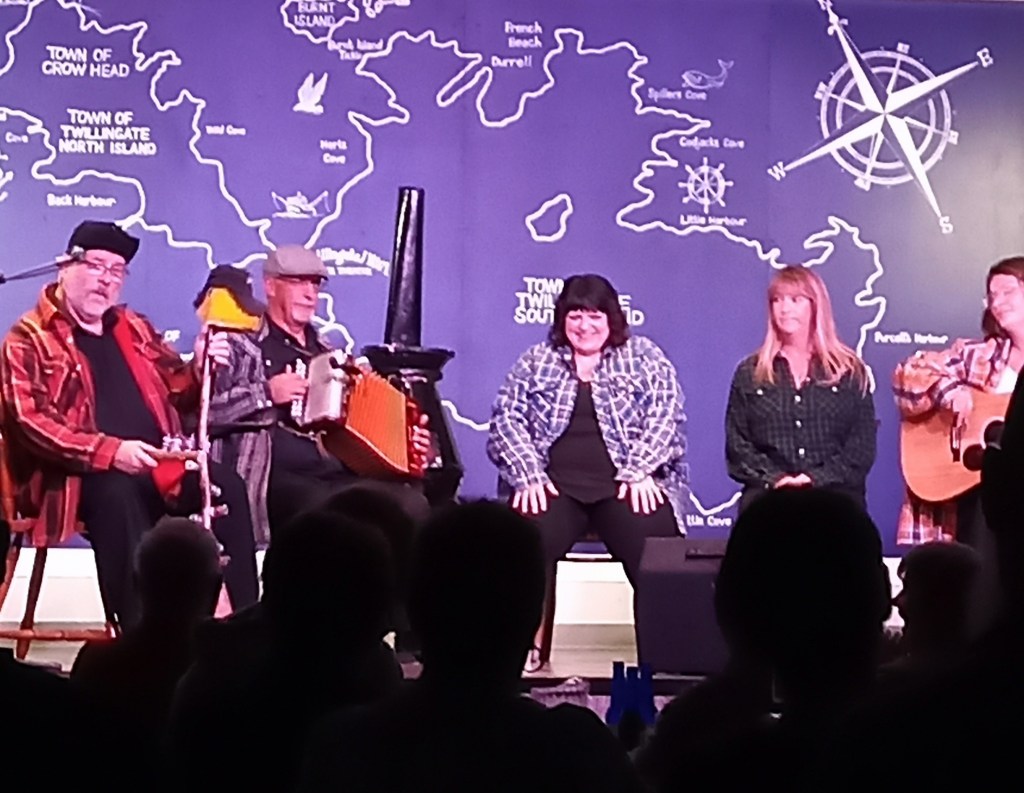
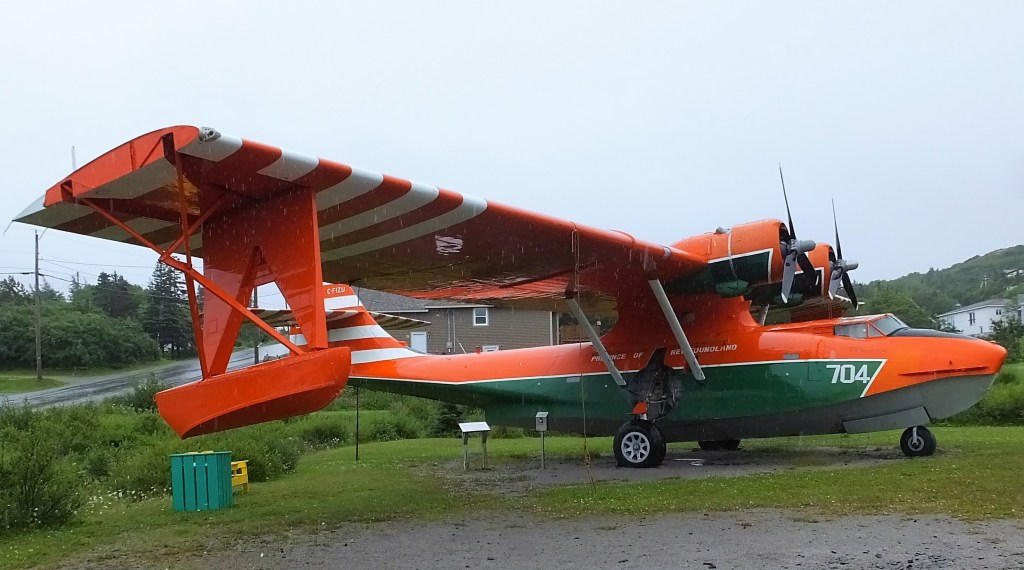
At the recommendation of two travelers we met at Crow’s Nest Café in Twillingate, Newfoundland, we started our day with coffee and amazing French pastries at Paillard Pastry Shop in the Old City.  It was raining lightly when we finished.  

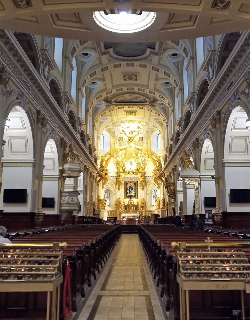
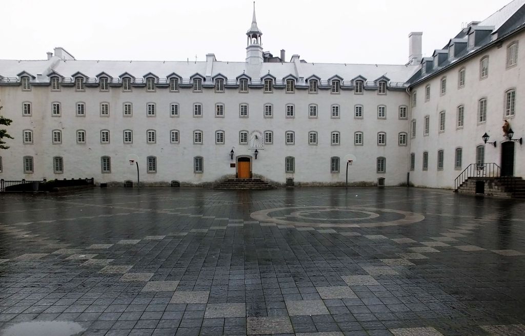
We walked down narrow streets, stopping to shop in a quaint district with interesting souvenir shops. Then we visited the magnificent Notre-Dame de Quebec Basilica-Cathedral and Seminaire de Quebec next door.  The Seminaire had a large courtyard that reminded us of a scene from the movie Papillon. 

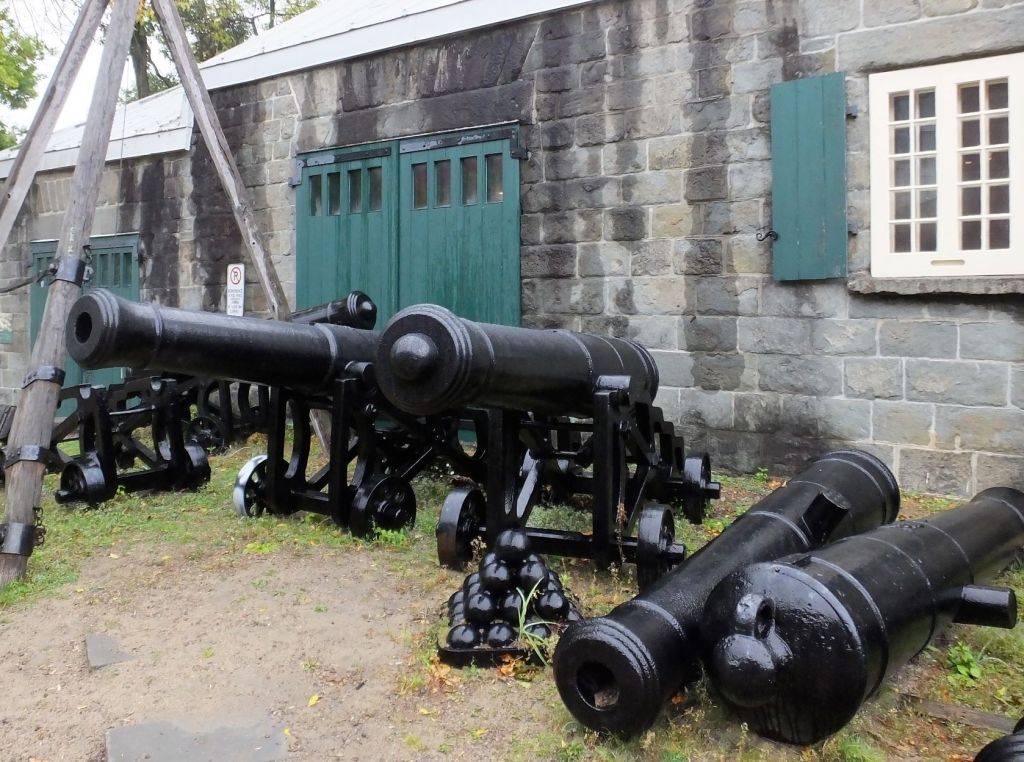
We continued a short ways to ledges high above the St Lawrence River displaying various restored cannons that once defended the city.  At least four cruise ships were docked on the waterfront below and we surmised many of the visitors we saw that day were from those ships. 

Quebec City has lots of narrow streets
Shopping district – not very crowded on a rainy morning
Notre-Dame de Quebec Basilica-Cathedral
Seminaire de Quebec Courtyard
Fairmont Le Chateau Frontenac

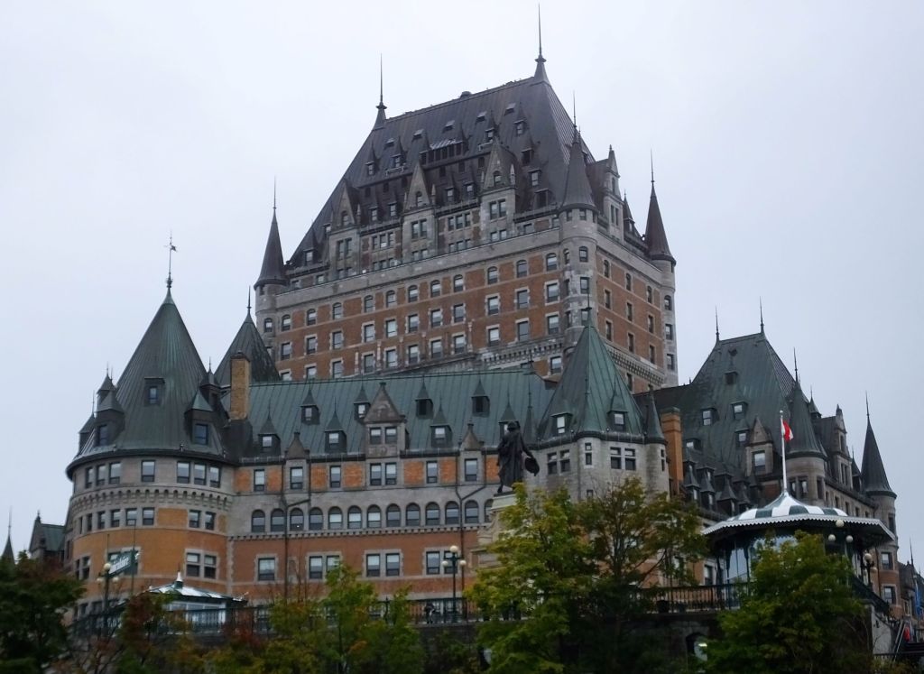
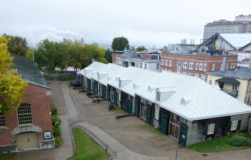
At Dufferin Terrace we signed up for a two-hour walking tour of historical fortifications in the city.  We walked past Fairmont Le Chateau Frontenac, an impressive hotel, and toured inner sections of La Citadelle de Quebec, a historic fort that is still an active military outpost.  Our tour finished in Artillery Park, where there was large scale production of munitions during WWII.

(traveler tip – Parks Canada tours cost considerably less than comparable commercial tours)

Charcuterie dinner at Le Petit Coin Latin that included shredded rabbit (center)

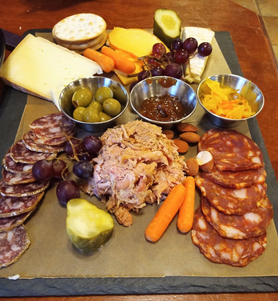
Our Old Quebec City visit came to an end, and we stopped for a light supper at Le Petit Coin Latin, a cozy little café close to where we parked Max.  We dined on a delicious charcuterie board with various savory meats, cheeses, fruits, nuts and crackers.  It was nice end to a very full day.

Despite the rain, we had a wonderful time in Old Quebec City and hope to visit again. 

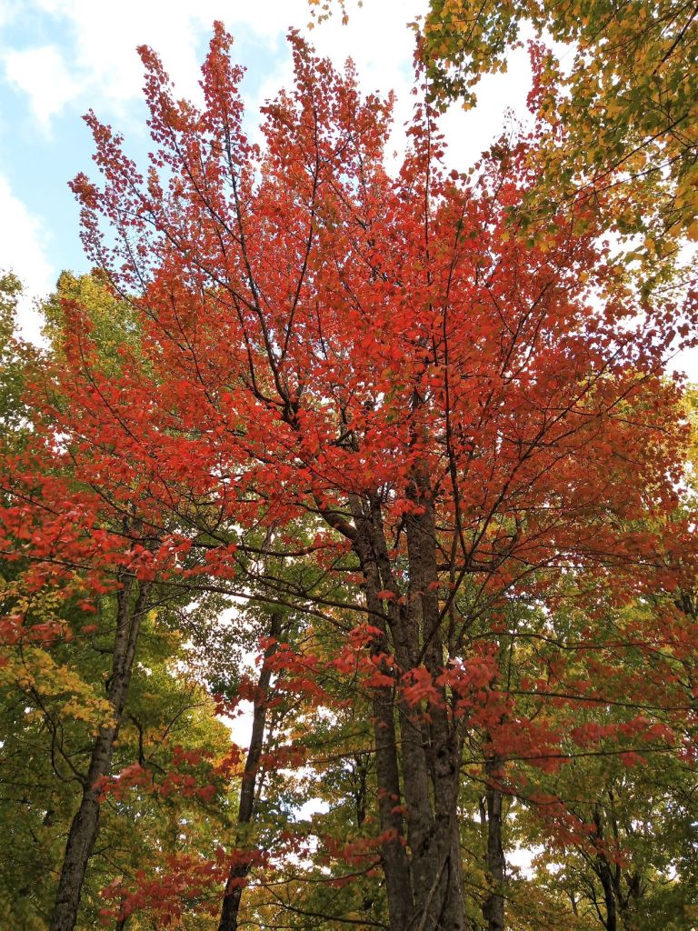
Next week:  we visit Montmorency Falls, the second highest waterfall in eastern North America, a few miles outside Quebec City.  Then we drive to a remote provincial park a few miles south where the fall colors were on glorious display!

Newfoundland Reflections

(2022 Newfoundland Ep 15)

During our six weeks on Newfoundland we traveled nearly 3000 miles.  We camped in 17 different locations including five national park, four provincial and two city campgrounds, three private campgrounds, two Harvest Host/Boondockers Welcome locations and even a pull-off on the side of the road. 

Here are some reflections on our visit:

Oscar at Trout River Pond Campground

Favorite campgrounds:  all three campgrounds in Gros Morne NP (Trout River Pond, Shallow Bay and Berry Hill).  Although only one of the three had water/electrical hookups, all three had spacious campsites with good privacy, clean and modern washrooms, and reasonably fast wifi.  Each was close to interesting and challenging hiking trails and towns with restaurants and other services.

Reflections on the Western Brook Pond

Favorite place visited:  Pat’s was Western Brook Pond. We had amazing views during a two-hour boat trip on this steep-walled freshwater fjord in Gros Morne NP.  My choice was St John’s – lots to see and do from hiking near Cabot Tower/Signal Tower to sunrise at Cape Spear to quirky Quidi Vidi.

Hiking the North Head Trail near Signal Hill

Best hike:  we did lots of hiking during our NF visit. Our favorite was the North Head Trail that descended steep stairs from Signal Hill and followed a cliffside trail.  The views of the St. John’s harbor were great!

Folk tunes on Western Brook Pond

Memorable cultural moment:  (Ed) NF folk tunes performed by the boat crew on the Western Brook Pond boat trip.  Pat’s was local humor and music at the Twillingate Dinner Theatre.  Both experiences gave us a sample of the free spirited and fun Newfoundlanders.

Best meal in a restaurant:  Fish and chips at Chuck’s Restaurant in Happy Adventure.  We enjoyed battered, crunchy pieces of white fish with a mountain of chips (fries).  Honorable mention:  coffee and a toasted bagel (or donut) at just about any Tim Horton’s.  TH can be found nearly everywhere on NF!

Control room at the Transatlantic Cable Museum

Favorite attraction:  (Ed) the North Atlantic Aviation Museum in Gander, a small museum that tells a big story about Gander.   Pat’s was the Transatlantic Cable Museum in Heart’s Content – a true RabbiTRAIL experience with historical significance that is remarkably well preserved.

Most amazing view:  as we were eating dinner at Trout River Pond Campground, we looked out the back window of Oscar. Beyond the colorful fireweed and other fall flowers immediately behind our camper, a sea of golden sunshine shone through broken clouds on the mountains across the pond.  When we stepped outside, we noticed other campers were caught up in the moment as well!

Momma and baby NF moose; the others were hiding

Biggest NF surprise:  (both) a surprising lack of wildlife.  We saw only four moose, no caribou and just a few other small animals and birds.  The forests were quiet and the roads were free of roadkill.

Ferryland Lighthouse

Best RabbiTRAIL:  for me it was the Transatlantic Cable Museum above.  Pat enjoyed the Ferryland Lighthouse south of St John’s.  We had a great views of the lighthouse and seacoast, and then thick fog rolled in. 

Cape Spear sunrise on August 30

Most unique thing we did:  (Pat) the first sunrise in North America on August 30 at Cape Spear near St John’s.  Mine was leaving NF for an overnight stay on Labrador.

Next week – we flee Hurricane Fiona and endure language challenges in Quebec.

Final Days on NF

(2022 Newfoundland Ep 14)

Our time on NF was coming to a close.  After six weeks on the island, we had just a few days before we were scheduled to leave via ferry.

In early August we camped in Gros Morne NP, three days at the southern area of the park at Trout River Pond and three days at Cow Head to the north.  It was mid-September and to round out our visit to Gros Morne, we camped for three additional days in the middle of the park. 

Lobster Cove Head Light

We started with the small town of Rocky Harbor where we shopped for supplies and souvenirs.  Nearby we visited the Lobster Cove Head Light for views of the harbor and distant seacoast. 

Baker’s Brook Falls
Waiting to share our lunch…

The next morning we endured the longest hike of our trip through meadows and balsam fir forest to Baker’s Brook Falls.  We enjoyed the beautiful stairstep falls and had two aggressive birds join us for lunch!   

On the hike back from the falls, we visited an interesting moose ‘ex-closure’ to observe the impact of moose grazing on area vegetation. Inside a 100-meter-square fenced area, the trees and undergrowth were dense and lush.  Outside, there were scattered trees, grasses and limited undergrowth.  Though we didn’t see many moose during our NF travels, their impact in the area was very evident!

Outside the moose ‘ex-closure’

We saw our final views of Gros Morne and the distant coast from atop Berry Hill after hiking up a short and steep trail.  It was a scenic end to our visit.

Stairs on Berry Hill Trail, a steep climb of more than 400 feet
Panorama from Berry Hill: Gros Morne Mountain is the bump on the right
A critter at Barachois Pont

We camped at Barachois Pond Provincial Park midway on our final 200 miles to Port aux Basques.   During an evening bike ride and hike, we saw a shadowy critter scurrying along the edge of the pond. It was likely a wet otter, not a NF chupacabra.

Barachois Pond was a remote and quiet ending to our time on NF. We were ready to return to Nova Scotia and begin the long drive home.

Under the Rainbow – a final view of NF

Little did we know then how we would spend the next week: making truck repairs and dodging Hurricane Fiona

Two very hungry birds
A few squirrels
A wet otter

Next week – NF reflections and recollections!

A Central NF State of Mind

(2022 Newfoundland Ep 13)

After driving about a third of the way back across NF, we camped for the night in Gander, a small town with a large airport. 

Camping among planes at the North Atlantic Aviation Museum

At the North Atlantic Aviation Museum, we learned about the interesting history of the town and airport.

Gander NF street layout – like a gander’s head!

The Gander Airport was built in the late 1930s, then the most easterly airport in North America.  During WWII, the airport was a refueling stop for Allied aircraft flying to and from Europe.  It was considered a vital military asset during the war.

The town grew in the 1950s, as commercial flights between North America and Europe refueled at Gander.  With longer flight distances possible by the early 1960s, there was less of need for refueling at Gander. Meanwhile, Communist-bloc airlines began to use Gander as they flew between Russia, Eastern Europe and Cuba.

Decades later, on September 11, 2001, US airspace was shut down following the attacks on the World Trade Center and other US locations.  42 aircraft with nearly 6700 passengers were grounded at Gander, nearly doubling the town’s population of 10000 with passengers from around the world.  Many of the ‘plane people’ did not know what was going on, how long they would be stranded or even where Gander was located! 

Gander and surrounding communities opened their hearts and doors to the passengers by collecting food, toiletries and other necessities, and by providing makeshift shelters in a number of locations.  The phone company even set up phones so passengers could call their families.  The museum has a display of letters from grounded passengers thanking the community for their care during the incident.

From Gander we drove a few miles north to camp near Twillingate, a popular summer NL vacation destination. 

Long Point Lighthouse – looks like a salt shaker!

We fueled up with coffee and muffins at the Crow’s Nest Café before visiting the Long Point Lighthouse and hiking down stairs and a steep trail to Nanny’s Hole and Sleepy Cove. 

Trail to Sleepy Cove
Pat at Nanny’s Hole

At the café owner’s suggestion, we ate dinner and enjoyed spirited NL music and skits at the Twillingate Dinner Theater that evening.

Songs and skits at the Twillingate Dinner Theatre
It’s an Ugly Stick: a traditional NF percussion instrument made with household items.

Early the next morning we took a ferry to Fogo Island, an ‘island off an island.’  It is said Fogo Island is not so much a place as a state of mind with bright-colored clapboard houses, sea-cliff footpaths and a most unusual (perhaps out of place) hotel, the 29-room Fogo Island Inn.  From a vista overlooking the inn, we picked handfuls of Fogo Island blueberries that we enjoyed in pancakes the next morning. 

Fogo Island village
Fogo Island Inn

Before ferrying back to NL, we hiked to the top of Brimstone Head, said to be one of the four corners of the flat earth.  From the stony crest, we had an amazing view of the island’s northwestern rocky coast and a small town far below.

Climbing Brimstone Head
Brimstone Head view

A few squirrels and chipmunks
Lots of sea birds

Next week:  we visit Gros Morne NP for a second time during our last few days on NF.

We Took the Long LONG ROAD

(2022 Newfoundland Ep 12)

As the end of August neared, we could tell the NF weather was about to change.  Days were becoming shorter, nights were getting cooler and we were having to wear sweatshirts and long pants more and more.

It was time to start back toward Port aux Basques for the ferry ride to Nova Scotia.

From St Johns we drove south on the Avalon Peninsula to La Manche Provincial Park. The park is named for a nearby fishing village that was abandoned following a severe winter storm in January 1966.   Most of the remote town was washed away including a suspension bridge that connected both sides of the harbor.

La Manche ruins
New La Manche suspension bridge

We decided to visit the new bridge built by the East Coast Trail Association in 1999.   According to NF hiking time given to us by a park ranger, it was 20 minutes up a steep fire road to where the trail started and another 20 minutes down a rocky, moderately steep trail to the bridge and La Manche village ruins.  Actual hiking time was more than double that!

We hiked the fire road and met Marsha Tulk, who was picking blackberries.  Marsha is the coauthor of “Food, Culture, Place: Stories, Traditions and Recipes of Newfoundland.”  We wondered about what her plans were for the berries, and when we stopped to do our own berry picking as we returned to the campground, she was gone. Maybe we’ll find out in her next book!

The suspension bridge was an unexpected sight on the narrow, steep-sided harbor.  “La Manche” means “the sleeve” in French and seems to be a fitting name for the town.

Together on the La Manche suspension bridge

The next day, as we drove a few miles south of La Manche, we stopped at Best Friends Restaurant and Giftshop.  The owner recommended visiting Ferryland Lighthouse and enjoying the food and view from the Million Dollar View Restaurant nearby.  (tip – ask locals about the best sights and places to eat) 

Ferryland Lighthouse

We hiked across a narrow causeway to the island location of the lighthouse.  Like many other NF lighthouses, the rugged coastline view was breathtaking.  As we returned to the parking lot, we found bushes loaded with blueberries and picked nearly a quart of berries in just a few minutes.  At the causeway, thick fog was rolling in. It was a good time to be leaving.

Million Dollar View

We stopped for dinner and to check out the view at the Million Dollar View Restaurant.  It was worth every Loonie!

Cross section of transatlantic cable

The next day, we began the drive back across NF and camped near Greens Harbor for several nights.  We found a most unexpected RabbiTRAIL nearby:  in the town of Heart’s Content the first transatlantic telegraph cable linking Europe and North America was landed in 1866.  A portion of the Cable Station Provincial Historic Park is a small museum with information about the communications cable.  Most of the building houses the original electric equipment used to operate the cable.  Several large control rooms are full of components in remarkable condition!

One of the transatlantic cable control rooms

When we continued, we decided to take an unimproved (e.g. dirt) road along the western coast of the peninsula and a paved highway back along the eastern coast.  After several miles of dusty and somewhat bumpy roads, a road sign warned “This Road Not Maintained by Department of Transportation and Works.  Use at Own Risk.”  The road ahead resembled a goat path, with deep ruts and rocks.  Based on two VERY stressful experiences driving on four-wheel drive roads in Utah in 2021 (where Max’s step rails were bent), we decided not to follow this NF RabbiTRAIL!

Stressful four-wheeling with Max – Canyonlands NP Sept 2021
Thumbs down on this RabbiTRAIL – a wise choice in 2022!

We backtracked to the paved highway and drove the long road to the tip of the peninsula.  We were intrigued by stone walls that marked off historical sustenance gardens in the small fishing village of Grates Cove.  We drove through the town but did not see the walls.  At a small park on the edge of town we found a trail up a hillside to an overlook.   From that vantagepoint we saw the walls!

Stone walls at Grates Cove

A pod of porpoises (at least 5)
Two black rabbits

Next week:  A 9-11 Story and We Leave the Island Again

St John’s: City Sights and Sunrises

(2022 Newfoundland Ep 11)

(Last week’s special blog post was about our challenges dodging Fiona.  This week, we are praying for family, friends and the many persons in Florida and the Carolinas affected by Hurricane Ian) 

We return now to blog time and our arrival at St John’s, NF.

We arrived at St John’s (right side of map above) more than three weeks and 2000 miles after coming to Port aux Basques.  Despite having only 115,000 residents, St John’s feels like a BIG CITY.  There are lots of stores, a few high-rise buildings, and busy highways.  Downtown St John’s was especially crowded because of two large cruise ships that were docked for the weekend.

St John’s is very hilly.  Colorful townhouse-style residences line many of the narrow downtown streets – these streets are often described as ‘jellybean rows.’

An uphill ‘jellybean row’

A couple miles to the east, Signal Hill overlooks the city, and 50 foot Cabot Tower sits atop the hill.  The tower was built around the turn of the 20th century to commemorate the 400th anniversary of the discovery of NF by Italian explorer John Cabot. 

A cruise ship leaves St John’s with Signal Hill and Cabot Tower above
Cabot Tower
Cabot Tower signal flags

Signal Hill has an interesting history.  Flags were flown on the hill as ships approached the harbor from the early 1700s through the mid-20th century.  In 1901, Guglielmo Marconi received the first wireless message from England on the hill (the Morse Code letter ‘S’), and in 1920, one of the first transatlantic transmissions of the human voice was made there.

Cliffside trail at base of signal hill
St John’s harbor from cliffside trail

After touring Cabot Tower, we descended a steep series of stairs and then hiked along an amazing cliffside trail overlooking the Atlantic Ocean.   The trail continued along the narrow inlet to the St John’s harbor with views of the downtown and cruise ships.  A short section of the trail followed a very narrow cliffside ledge.  We were glad for chains to hold on to!  This trail would definitely be on our top 10 list of most scenic hikes!

Posing at Cape Spear Lighthouse

We got up at 4 am the next morning for a 30-minute drive to Cape Spear to see where the sun rises first in North America.  We weren’t disappointed – it was a pleasant morning with a few colorful clouds on the horizon. 

North America’s first sunrise on August 29
Cape Spear sunrise BC (*before coffee)

After welcoming the new day, we returned to town and stopped at Tim Horton’s for breakfast.  ‘Timmy H’, as we call it, is a Canadian institution that serves great coffee and donuts. They are located throughout NF and Canada.

Quidi Vidi

Our time in St John’s ended with a little downtown shopping and a visit to Quidi Vidi, a quirky and picturesque fishing village nearby.   At the Quidi Vidi Brewery Company, visitors get ‘screeched’ to become honorary NF citizens.  When we heard this involved drinking rum and kissing a codfish, we respectfully declined the ceremony!

One rabbit at the campground
(not many critters in the city unless you count 6000 cruise ship passengers)

Next week:  we spend a few days on the Avalon Peninsula south of St Johns and begin traveling back to Port aux Basques.  Enroute, we follow one amazing RabbiTRAIL and decline another.

We Interrupt this Blog For A Special Update

(2022 Newfoundland Ep 10)

Hello all, as with most travel blogs, RabbiTRAILS postings lag real time by several weeks.  In blog time, the next post will be about St Johns, NF. 

Meanwhile, it is Sept 24 real time and we’re safely back on ‘mainland’ Canada close to the Maine border.

The last eight days have been tough.  We’ve prayed, we’ve been patient and we’ve been blessed.

Max and Oscar, last day in Newfoundland

On Friday, Sept 16 we rose early to prepare to board the seven hour ferry back to Nova Scotia, after six weeks on Newfoundland.  When I started Max to hitch to Oscar, I heard an unusual tapping sound in the engine.  The tapping continued as I revved the engine.  Then the check engine light came on. 

Pat and I prayed for wisdom about what we should do.  We didn’t want to give up our reserved slot on the ferry as a number of people at the campground had been waiting for several days after several recent ferry cancellations (including the ferry from the prior evening).  In addition, the Chevy dealer in Port aux Basques (ferry departure town) was very small and we were concerned about repair timeframes and availability of parts. 

We decided to ride the ferry and take Max to a dealer Sydney, Nova Scotia, a sizeable town near the ferry landing. We tried to make an appointment online with the dealer as we waited to board the ferry – the next available appointment was Sept 26.  So, we called and left a message on the service department voice mail explaining our desperate situation.  A few minutes later they returned our call and we set an appointment for 9:30 am on Monday, Sept 19.   

As we drove onto the ferry, the tapping continued but the check engine light was no longer on.

Final view of Newfoundland

The ferry arrived at North Sydney early Friday evening.  We camped nearby and didn’t drive Max over the weekend. 

Meanwhile, Hurricane Fiona was in the news. After hitting Puerto Rico and the Dominican Republic, the storm was forecast to remain in the Atlantic, to intensify and to possibly impact Canada late in the coming week.

Engine valve lifter

On Monday morning, the Chevy service advisor gave us bad news about Max.  The valve lifters for #1 and #4 cylinders were damaged and needed to be replaced.  They recommend replacing all eight valve lifters. 

The lifters weren’t in stock but we were told a dealer in Halifax, NS might have them.  The Sydney dealer hoped to complete the repairs by late Tuesday . 

A little later the service advisor told us the parts weren’t available after all and couldn’t be located elsewhere.  The dealer would have to order the parts and it could take two days to two weeks (or longer) for the parts to come in.

Monday’s updated Fiona projection was a track toward Sydney, at the northeast tip of Nova Scotia, sometime late Friday evening or early Saturday morning.

Pat and I prayed, and then called the Chevy dealer in Halifax.  They located the parts at two other Chevy dealers in eastern Nova Scotia.  The parts were available at the first dealer we called and by mid-afternoon the parts were ordered!  They would be picked up Tuesday morning and delivered by the end of the day.

We decided to leave Max at the dealer and the service manager, Dennis, graciously shuttled us to our campground more than 20 miles away.

By Tuesday Fiona intensified and was projected to hit Sydney late Friday with sustained winds of more than 110 mph!  We were stranded with no vehicle and no way to move Oscar.

The parts did not arrive at the dealer until after closing on Tuesday.  Early Wednesday morning the dealer texted us the parts had come in and repairs were underway!

The repairs were finished by 3 pm, and again, Dennis kindly picked us up at the campground to retrieve Max.

Meanwhile, Fiona continued toward Sydney with no significant change in projected path or strength.  The storm was projected to have devastating impact on the area. 

We left Thursday morning with Max happily purring and were surprised the highways weren’t crowded.  We drove nearly 500 miles westward over the next two days, and we have been in Grand Falls, New Brunswick, as Fiona hit Nova Scotia early this morning.   It’s been very windy and cold all day. Skies began to clear this afternoon.

Grand Falls, New Brunswick

Fiona is said to be the worst hurricane ever to strike Canada.  Many on Nova Scotia, Prince Edward Island and western Newfoundland have lost power, and there has been widespread wind and flood damage.  Please join with us as we pray for the many persons affected by Fiona in Canada and the Caribbean.

Pat and I praise God for His provision and protection over the last eight days:  

  • we had just completed a six week, 3000-mile trip across Newfoundland, much of it in very remote locations.  The problems didn’t occur until our the last day on the island.
  • we were able to quickly locate available parts.
  • Dennis and others at the Chevy dealerships worked to successfully resolve our dilemma.
  • the campground manager was remarkably flexible as we renewed our site several times and great campground facilities made five days of being stranded bearable
  • friends and family who prayed for our situation and offered timely encouragement.

We’re thankful for the opportunities God gives us to trust Him and develop faith, and pray that our thoughts, attitude and actions bring Him glory!  This was true for Max’s repairs and Hurricane Fiona, and is true now for Ian, as it targets Florida this coming week.

Next week:  we return to blog time for Jellybeans, a cliff trail and a first sunrise in North America during our St. Johns visit.

Fish Facts, A Lighthouse and More

(2022 Newfoundland Ep 9)

After two weeks exploring western NF and Labrador, we decided it was time to head to the east side of the island. 

We drove the Trans Canada Highway (TCH), the main road that zig zags across NF toward St Johns.  No guesswork on the route to take – the TCH is the only highway that crosses the island.

Atlantic Salmon at Grand Falls

The mountains of western NF gave way to rocky hills and freshwater lakes of central NF.  We camped several nights along the Exploits River in Grand Falls-Windsor and visited the Salmonid Interpretation Center, where we learned about (almost) all things Atlantic salmon.

Grand Falls panorama

Leon, a guide at the center, provided lots of interesting details.

Grand Falls fish ladder

Unlike their Pacific brethren, Atlantic salmon do not die after spawning.  After the salmon fry swim to the ocean to mature, they return to the section of river where they were born several times to spawn.  The fish have a salt-filled gland that makes it like they never left the ocean.

In 1984, someone had the idea to turn the Exploits River, NF’s longest, into a world class salmon river.  The salmon could not reach the river above the falls so fish ladders were built to help them swim up and downstream. 

Salmon viewing tank

The center monitors the fish as they come and go from the upper river in an underground viewing room. The salmon population is thriving.

Leon also explained that all Atlantic salmon ordered in restaurants or purchased in grocery stores are farmed – Atlantic salmon are not ‘wild’ like those caught in the Pacific.

Salmon seen from underground observation room

Hiking at Terra Nova National Park

Leaving fish trivia behind, we continued eastward to Terra Nova National Park.  Over the next few days, we hiked a number of trails typical to the area.  The trails often start by skirting freshwater lakes or streams, continue through dense fir and spruce forests, then up steep hills (often with many stairs) to views of the rugged coast or freshwater lakes. 

Dense fir and spruce forests on a typical Terra Nova hike
View of Southwest Arm from top of Malady Head Trail
Ripe blueberries along the Louil Hill Trail

We crossed a boggy area on one trail with plentiful blueberry bushes and stopped for a few minutes to pick ripe berries. For the next couple days, we enjoyed them in pancakes and with yogurt.  We were blessed by the find, as most of the blueberry bushes in the area had already passed their prime.

Bonavista lighthouse

Bonavista Lighthouse

From Terra Nova we drove to a remote lighthouse on the Bonavista Peninsula, another one of the must-see destinations in NF. 

Unusual light reflectors in the Bonavista Lighthouse

In 1997, we visited the Bonavista Lighthouse with our children, Liz and Phil, and while climbing the lighthouse, we saw whales breaching in the waters nearby. This time we were not so fortunate to see whales, but we did see multitudes of cute puffins, nesting in and flying around rugged rock cliffs near the lighthouse. We also saw two moose along the road a few miles before we reached the lighthouse. 

In 1497, Venetian explorer John Cabot made landfall in the Bonavista area while seeking a passage to Asia
2022 explorers from Florida
Dungeon rock formation

We also visited a provincial park a short distance away to see the Dungeon, a collapsed rock formation with two wave-carved sea caves that resemble the eye sockets of a skull.  It was an unexpected and interesting sight!

Fish and NF-style chips

Fish and Chips

Before leaving to complete our eastward trek to St Johns, we enjoyed fish and chips at Chucky’s, a restaurant that overlooks a picturesque, secluded harbor.  Since coming to Canada, we have tried fish and chips several times and Chucky’s was by far the best.  The chips were prepared ‘Newfoundland’ style – with dressing (dry breadcrumbs) and gravy.  The restaurant was a bit hard to find (even with Google Maps) in a town aptly named “Happy Adventure!”

Two moose (a momma and her baby)
Hundreds of cute puffins
Atlantic salmon
A few squirrels

Next week:  Jellybeans, a cliff trail and a first sunrise in North America as we visit St. Johns

We Leave Newfoundland

Labrador and Newfoundland

(2022 Newfoundland Ep 8)

After learning about Vikings exploring L’Anse aux Meadows, we decided to do some exploring of our own (kind of). 

We left Oscar in NF and took a two hour ferry voyage across the Strait of Belle Isle to Labrador.

Part of the Canadian province of NF and Labrador, Labrador extends almost to the North Pole and is nearly three times the size of NF.  It is sparsely populated with 26,500 persons compared to more than 500,000 in NF.

Florida is a little more than half the size of Labrador with more than 21 million residents!

Welcome to Blanc Sablon, Quebec
Welcome to Labrador, the Big Land

Our ferry arrived in the small town of Blanc Sablon, in a remote corner of Quebec.  All of the signs were French-English.  After a short drive, we crossed into Labrador and the signs were English-French!

We drove along the coast to Red Bay, site of a long-abandoned settlement where, in the 17th and 18th centuries, whale oil was produced and shipped to fill the lamps of Europe.  Over time, the whale population declined and production ended.

Relic mounds where the Red Bay whaling community used to be

We hiked a short loop trail on Saddle Island to see the faded relics of the oil production.  There were mounds where stoves rendered the oil and where barrels to hold the oil were assembled.

Dried urchins looked like eggshells

Portions of the trail were littered with what appeared to be egg shells.  Closer examination revealed they were actually dried sea urchin shells.  Nearby, seagulls were dropping live urchins on the rocks, eating the contents and leaving the shells to dry in the sun.

Closeup of an urchin-eating seagull

Bakeapple berries

A bit further, we met Jennifer, a Labrador native, who showed us her half-full bucket of yellow-orange bakeapple berries.  Getting enough berries to make jam is a lot of work considering each bakeapple plant produces only one raspberry-sized berry.

In case you are wondering, bakeapple jam is very tart!

Point Amour Lighthouse
Pat climbing the Point Amour Lighthouse

Later that afternoon we climbed 132 steps to the top of the Point Amour Lighthouse.  At 33 meters, the lighthouse is the second tallest in Canada.  It is historically significant to the south Labrador seacoast as one of four lighthouses that guided mid-1800s ships sailing through the ice flows and strong currents of the Strait of Belle Isle.

Unlike many lighthouses we have climbed, we were able to enter the very top of the lighthouse, where the light and lens are located. The view below was amazing!

At the top of the lighthouse

The coastal route we followed eventually connects with the 750-mile Trans Labrador Highway that continues west across Labrador to Quebec.  Because the highway is very remote, you are provided a satellite phone in case of problems.  We considered driving the highway, but with up to 300 miles between gas stations (our range is 225-250 miles towing Oscar) and uncertain road conditions, we decided on an overnight visit to Labrador instead.

Grenfell B&B in Forteau, Labrador

We spent the night at Grenfell Bed and Breakfast in Forteau.  The B&B was originally a nursing hospital built in 1946 by the International Grenfell Association.  The association was founded by Wilfred Grenfell, a British medical missionary who devoted his life to improving the health of residents of coastal communities in Labrador and NF.

A wonderful breakfast spread

After a restful night, our host, Peggy, offered a spread of breads and pastries, homemade jellies and jams, and other items for breakfast.  (BTW, if you are interested in operating a B&B, Peggy says the B&B is for sale!)

Camping by a seaside cliff

We ferried back to St Barbe later that day, where we were reunited with Oscar.  That night we boondocked in a pulloff next to the ocean near Gros Morne NP. We continued south the next morning on the Northern Peninsula and then east toward central NF.

Two whales
Several small squirrels
Ravens and seagulls

Next week: something’s fishy in central NF!

Viking Horns and Moose Antlers

(2022 Newfoundland Ep 7)

From Gros Morne, we traveled on a very rainy day toward the L’anse aux Meadows (LAM) National Historic Site.  LAM is one of those ‘you have to visit’ places in NF.   We took numerous potholed sections of the highway a little more slowly than normal and arrived at Viking Campground near LAM late in the afternoon. 

It was raining the next morning, so we drove a few miles into St Anthony, the largest town on the north tip of the peninsula.  Although we decided not to hike several of the interesting looking trails in the area (guess we are fair weather hikers), we did avail ourselves of several civilized amenities such as a grocery store and gas station!  We were intrigued by a restored plane in a small city park.  The plane, a water bomber, is a memorial to two local pilots who lost their lives several years ago in a similar plane while dropping water on a forest fire out west. This was touching and unexpected RabbiTRAIL.

A nicely restored CAS water bomber

By evening, the rain stopped, and we contemplated our visit to LAM.

L’anse aux Meadows view

At the visitor center we learned LAM is the only confirmed Viking settlement in North America, dating to about 1000 years ago.  The turf structures excavated at the site resemble those in Norse Greenland and Iceland of that timeframe.  There is evidence of woodworking and iron production, likely for ship repair.  LAM represents the connection of eastward migrating peoples across North America with those from Europe.

Current excavation

The visitor center overlooks the site, where there are several mounds and depressions of where the settlement was located.  One is currently being excavated.  The site is a short distance from the Strait of Belle Isle shoreline.  Across the strait is Labrador, and during the spring and early summer, icebergs are often seen.   We visited in mid-August and the ‘bergs were gone by then.

Recreated Viking longhouse – no Hobbits present

A Viking longhouse, recreated based on findings from the nearby mounds, can be toured at the site.  The longhouse is a bit reminiscent of the Hobbit houses in Lord of the Rings. 

Longhouse visitors

We hiked a two-mile trail around the site, enjoying views of the shoreline and berry-filled meadows.  The trail ended atop a small hill where a steel sculpture of Vikings overlooks the site.

Seashore near LAM, where the sea meets the sky
Becoming part of the LAM Viking sculpture
Wild berry flavored ice cream

Later that afternoon, we visited several small towns along the seashore.  There were fishing boats, lobster traps and such, a reminder of daily life in the area.  At Emily’s Crafts and Jams, within eyesight of LAM, we bought crowberry jelly and learned that while all of the owner’s children live and work in the area, her grandchildren have moved away to work in larger towns and cities.  Other Newfoundlanders share similar stories – a harbinger that NF’s small towns will get ever smaller due to our changing way of life.

We stopped at Dark Tickle Company in Saint Lunaire-Griquet. where they produce jams, sauces, chocolates and more from wild berries of NL and Labrador.  ‘Dark Tickle’ refers to a nearby narrow channel (tickle) surrounded by high hills.  We sampled scoops of berry-flavored ice cream – blueberry, partridgeberry and bakeapple.  Each has a distinctive color and taste.

The Moose and Python Conundrum

What do moose and pythons have in common?  They are invasive species!

Two of 120,000 NF moose

As pythons are to Florida, Moose are to NF.  The antlered mammals, largest member of the deer family, are not native to the island – they were introduced in 1878 and 1904.  Since then, like Burmese pythons in south Florida, moose have multiplied rapidly.  Today NF has an estimated moose population of 120,000.

NF has native caribou, but no deer like the ones throughout the US.   We wondered why, then, there is a sizeable town near Gros Morne named Deer Lake.  I asked several Newfoundlanders about this and got different answers from each person.  One thought the name was related to deerflies that proliferate in the area, another thought it had to do with the indigenous people and their name for caribou, and a third (and apparently correct) was caribou are similar to the reindeer in Europe.  Thus, it was decided to name the town Deer Lake, not Caribou Lake.  There are likely other name theories.      

We (actually Pat) saw our first NF moose, a momma and her baby, while on the Western Brook Boat Tour at Gros Morne.  Going forward, we will include a moose and other critter count in RabbiTRAILS.

Two moose
Lots of seagulls, a few ravens and other birds

Next Week:  we decide to leave NF