Gators in Colorado?

(2025 Balloons and Beyond Ep 10)
View of the Collegiate Peaks from Buena Vista

Buena Vista

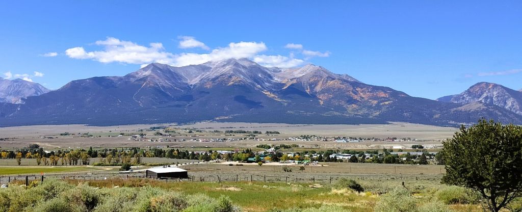
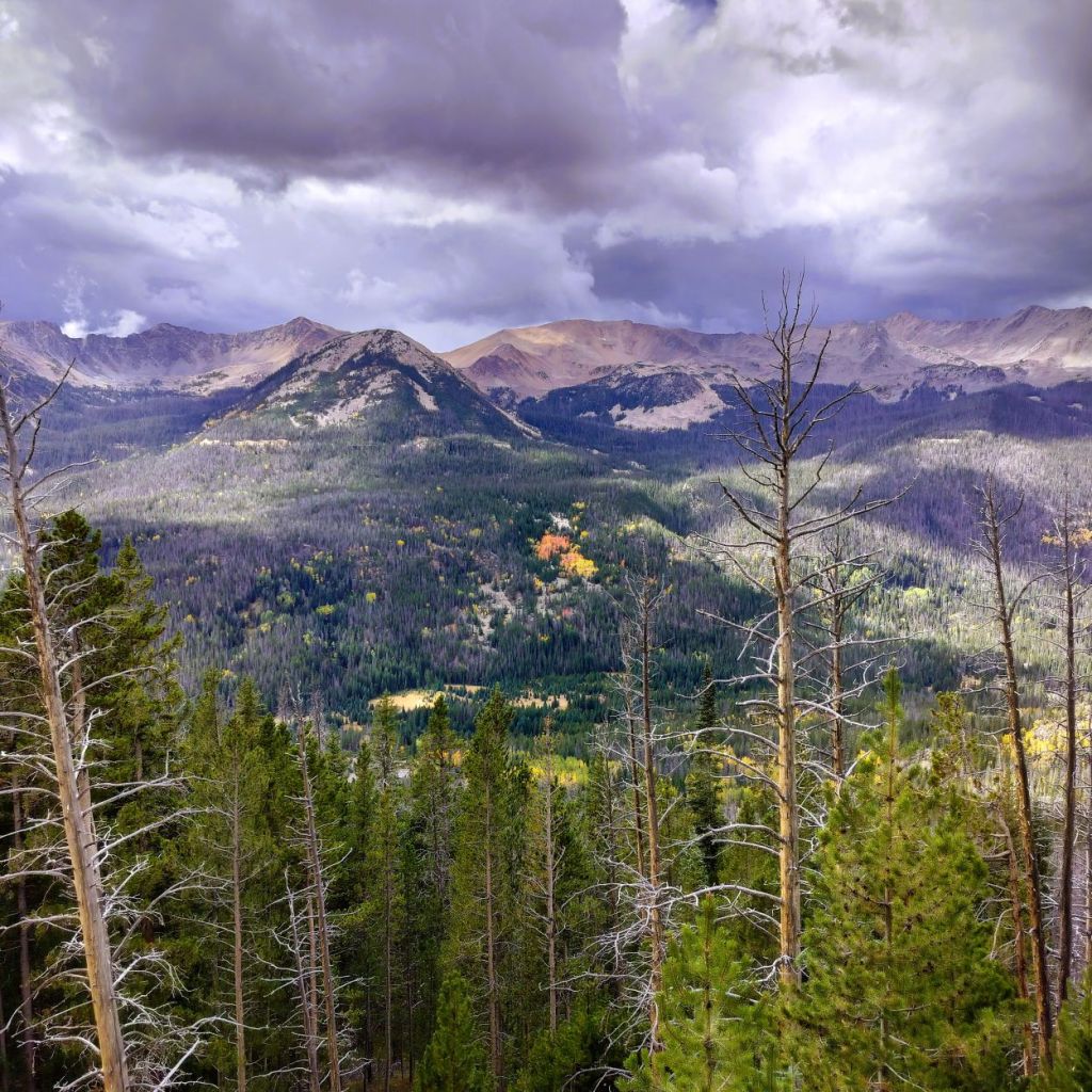
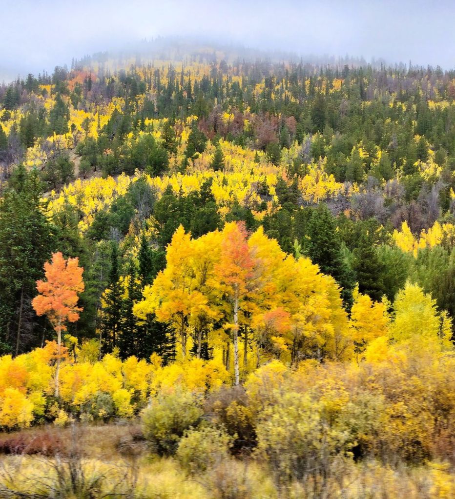
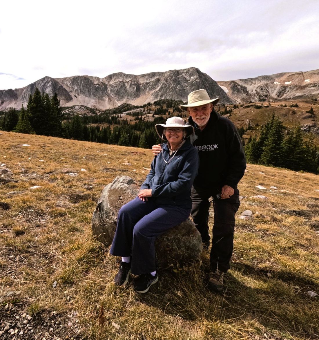
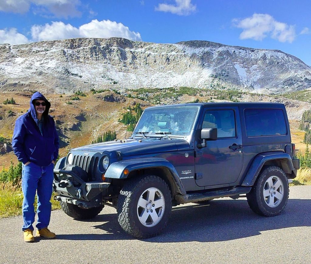
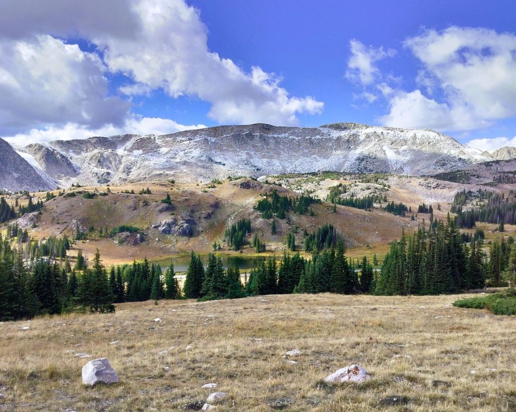
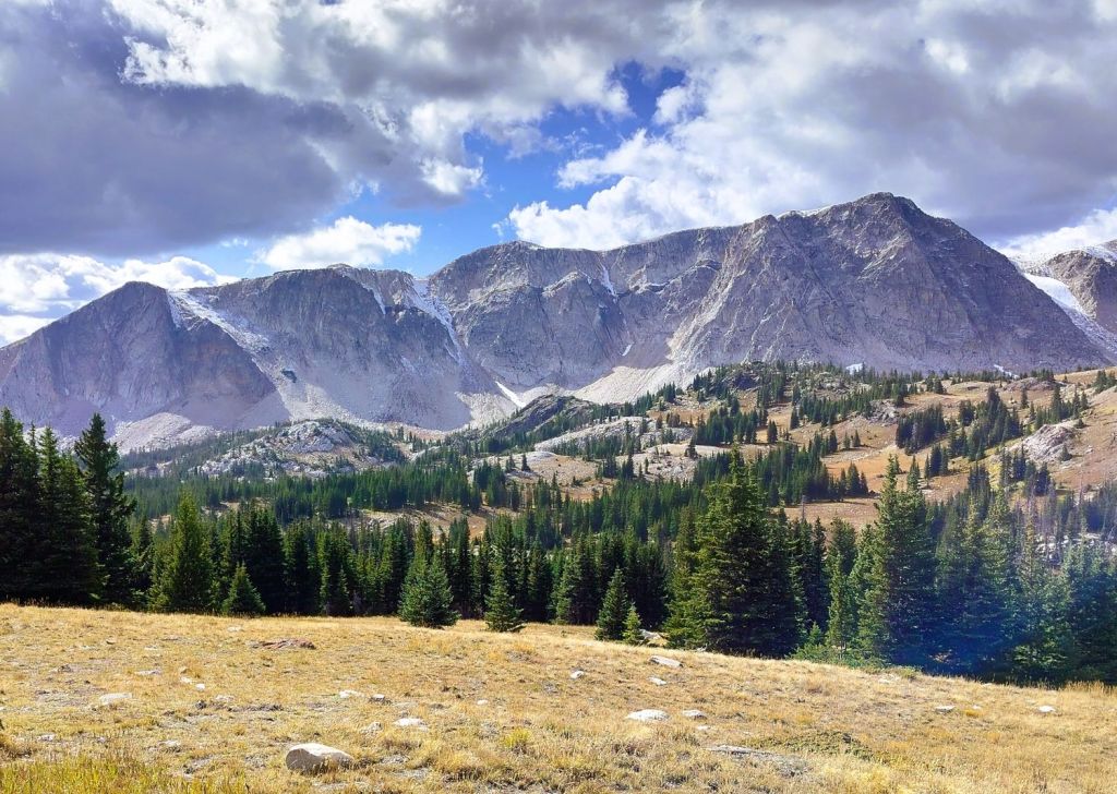
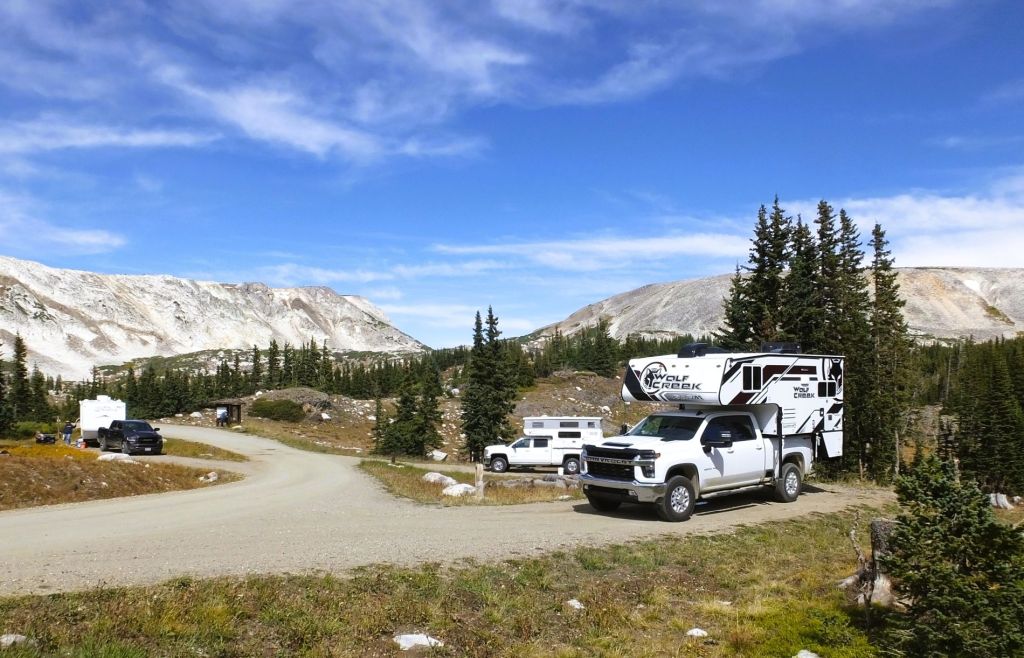
Bad weather and early snows behind us, we continued south through central Colorado.  We spent the night and did laundry in the small town of Buena Vista, where we were awed by incredible views of the Collegiate Peaks.  Princeton, Yale and Harvard are three of fifteen 14ers (mountains over 14,000 feet) in the range across the valley. 

We had a true Buena Vista (good view).

Great Sand Dunes from afar

Alligators in Colorado?

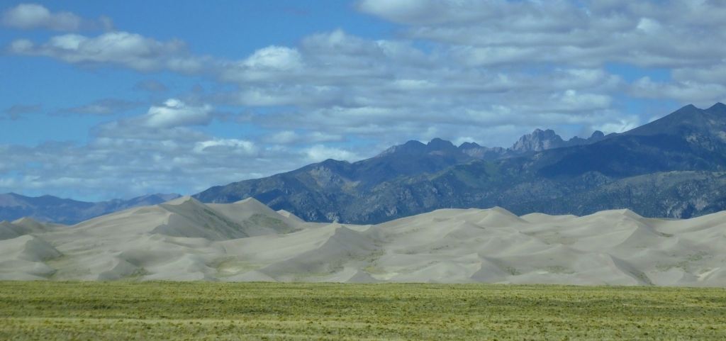
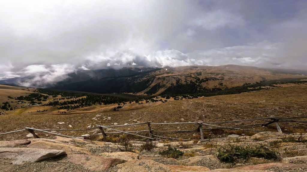
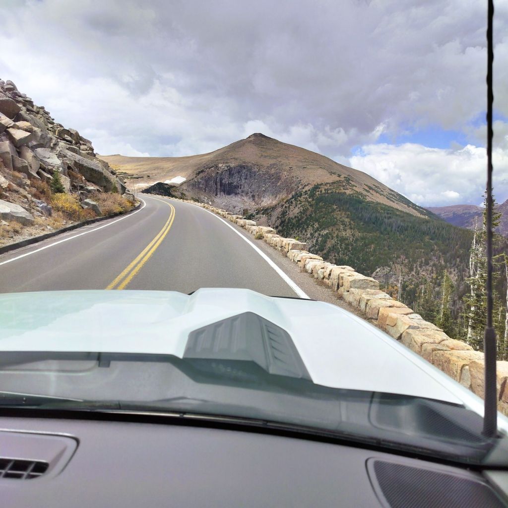
The next morning, we drove Colorado route 17 southward toward the cutoff for Great Sand Dunes National Park and Preserve.  To our left were the jagged peaks of the Sangre de Cristo mountains.  We saw a brownish blur at the base of the mountains and realized it was the dunes – more than 30 miles away. 

A road sign caught our attention, and we turned around for a closer look. 

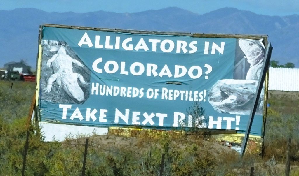
How could there be gators in Colorado?  A tunnel from the Everglades?  Holdovers from prehistoric times?

Nope. 

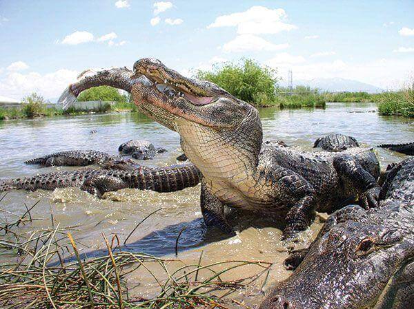
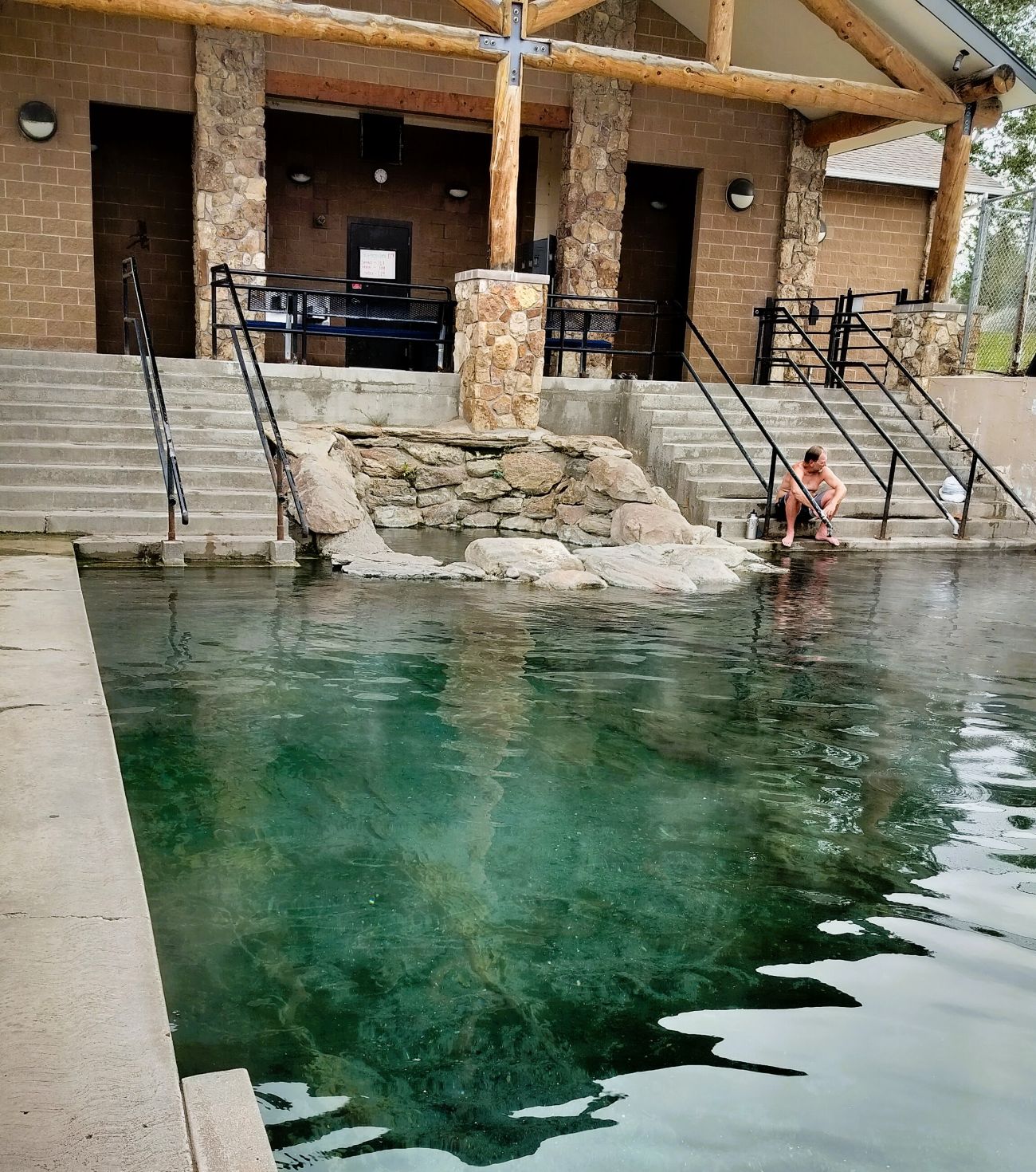
The gator haven, located north of Alamosa, CO, started as a tilapia farm in 1977.  In 1987, 100 one-year old gators were purchased to dispose of fish-processing waste.  The fish (and gators) flourished in the 87-degree water from a 2050 foot deep geothermal well, and as the gators grew, visitors wanted to see them. 

Gators in the snow (from Reptile Park website)

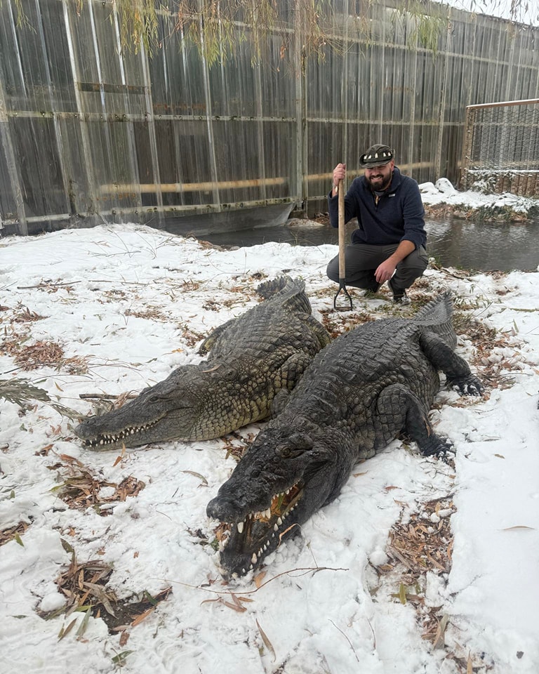
The farm, now the Colorado Gators Reptile Park, was opened to the public in 1990 and has become a home of unwanted, abused and even dangerous gators and other reptiles.

Great Sand Dunes 

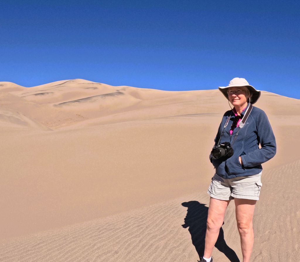
An hour or so later we arrived at Great Sand Dunes National Park and Preserve.

The dunes were just beyond our campsite
A beautiful sunset

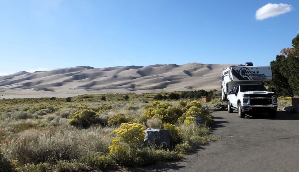
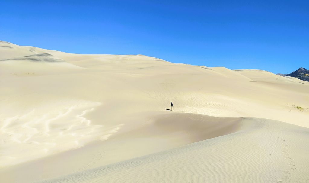
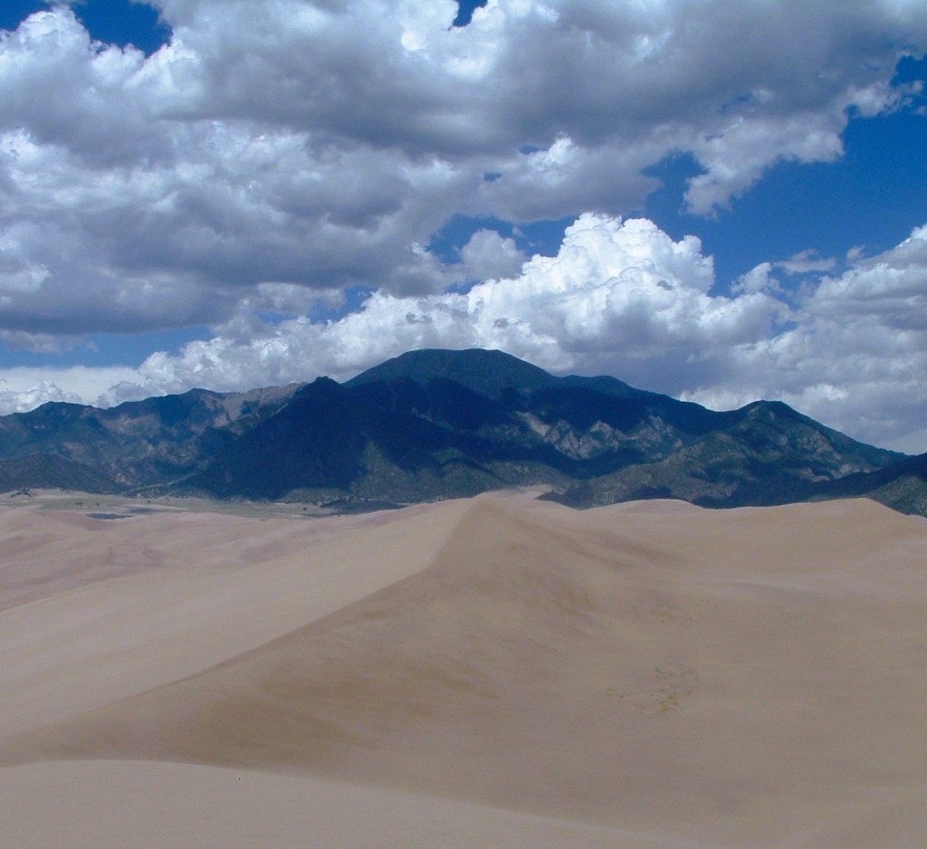
From our campsite we could see the dunes, the tallest sand dunes in North America, some as high as 750 feet! 

The dunes were formed from sediments from surrounding mountains blown by southwest winds toward the base of the Sangre de Cristo mountains.  The dunefield is approximately 30 square miles in size!

We started our dune hike along the top of a ridge

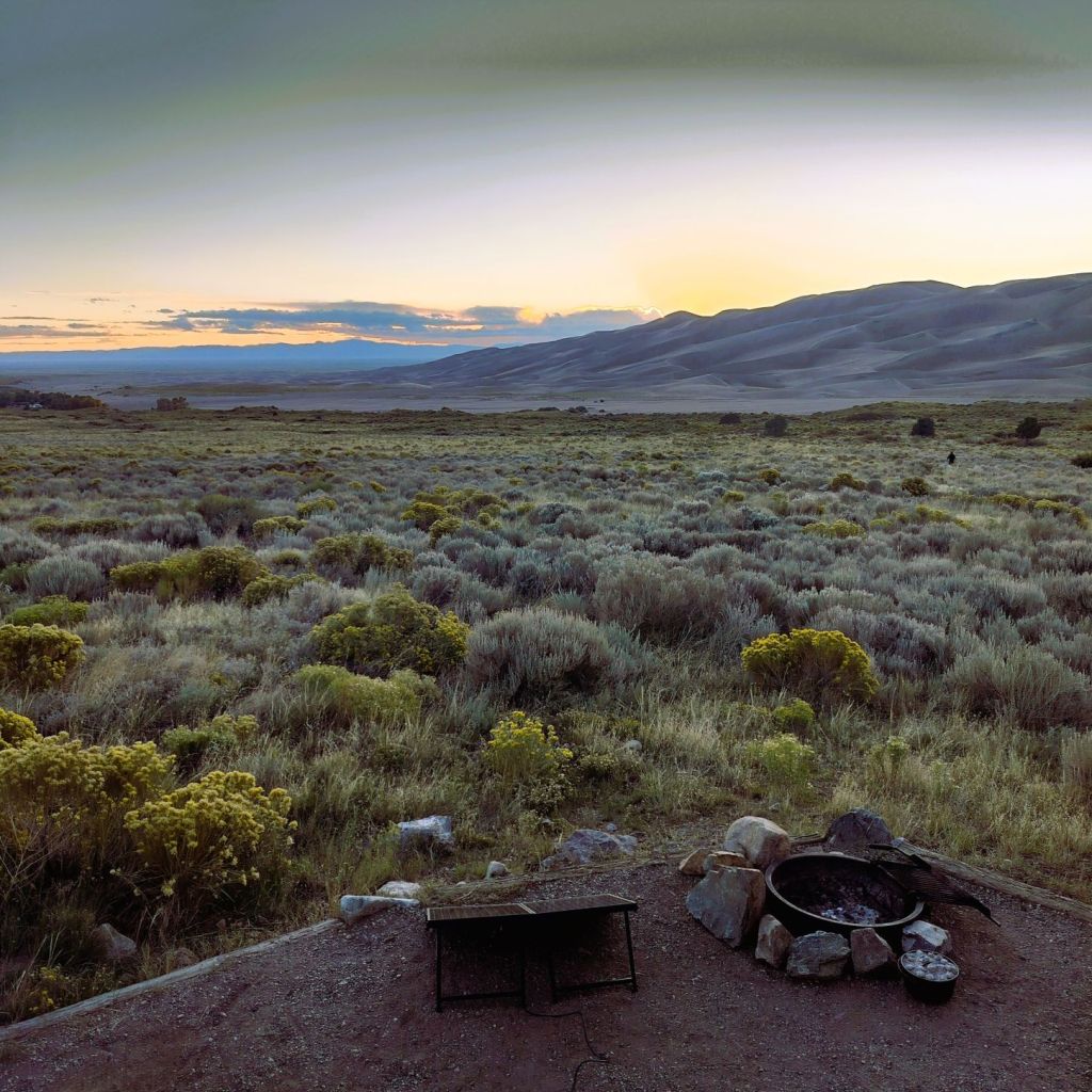
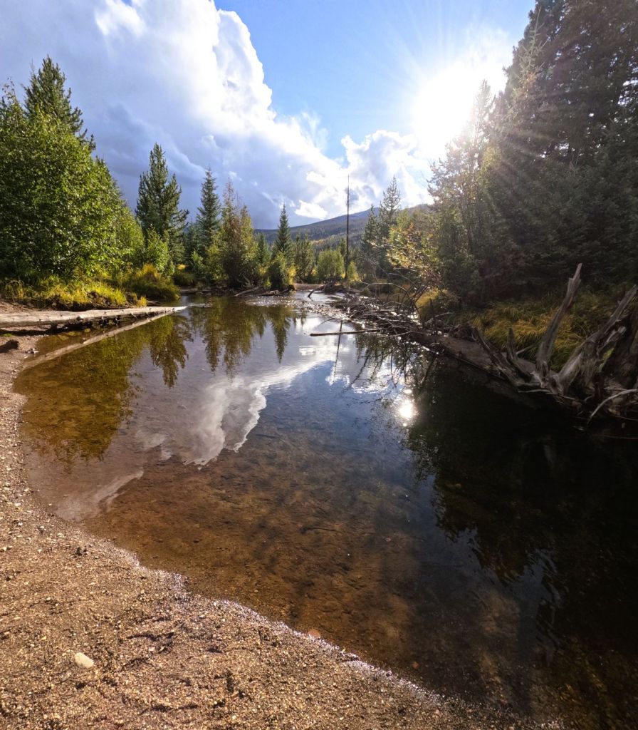
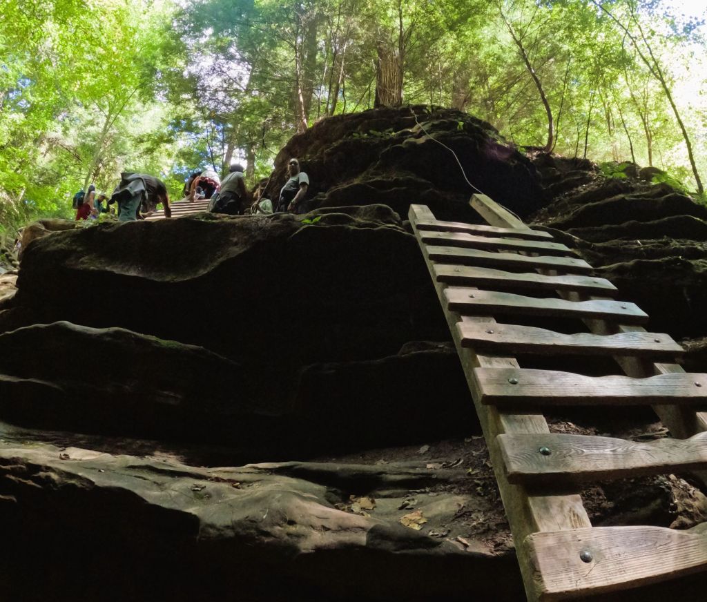
The next morning we hiked a half mile to the dunes.  In the spring and early summer, the Medano Creek flows along the base of the dunes and visitors must wade across the shallow creek to reach the dunes.  It was late September during our visit, and the sandy creek bed was dry as we began our hike. 

Pat surveys the dunes

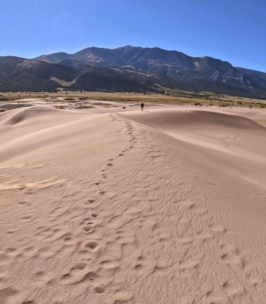
We hiked up several ridges and spotted tiny Pap and Percy far off in the campground.  As we topped each dune, still higher dunes appeared.  People above us were making their way to the top.

Continuing along a higher dune ridge
Although we had climbed nearly 300 feet, it was still a long way to the top

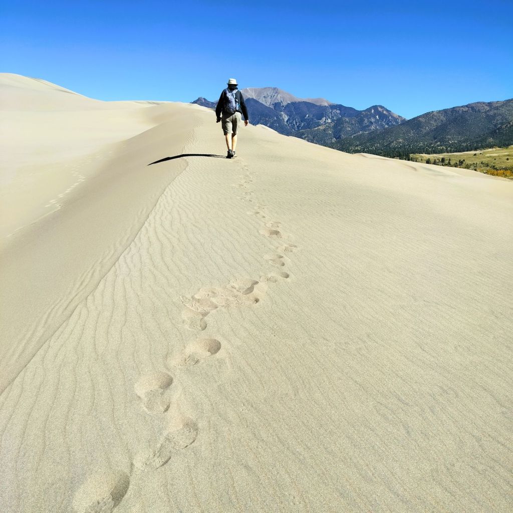
During a visit to the park in 2004, our son, Phil, took some beautiful pictures from the top of the dunes.  The dunes are best photographed in the early morning and late afternoon when the shadows make the dunes stand out from the tall mountains beyond.
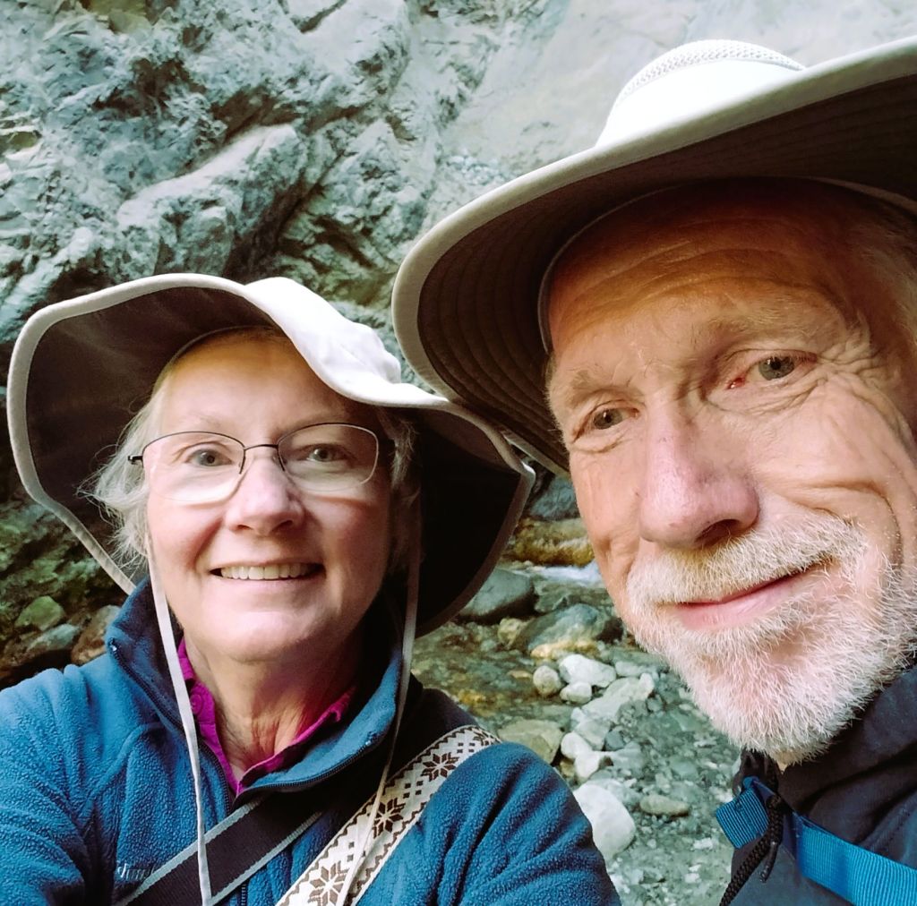
A photo from the top of the dunes taken by our son, Phil. in 2004

Viva Zapata!

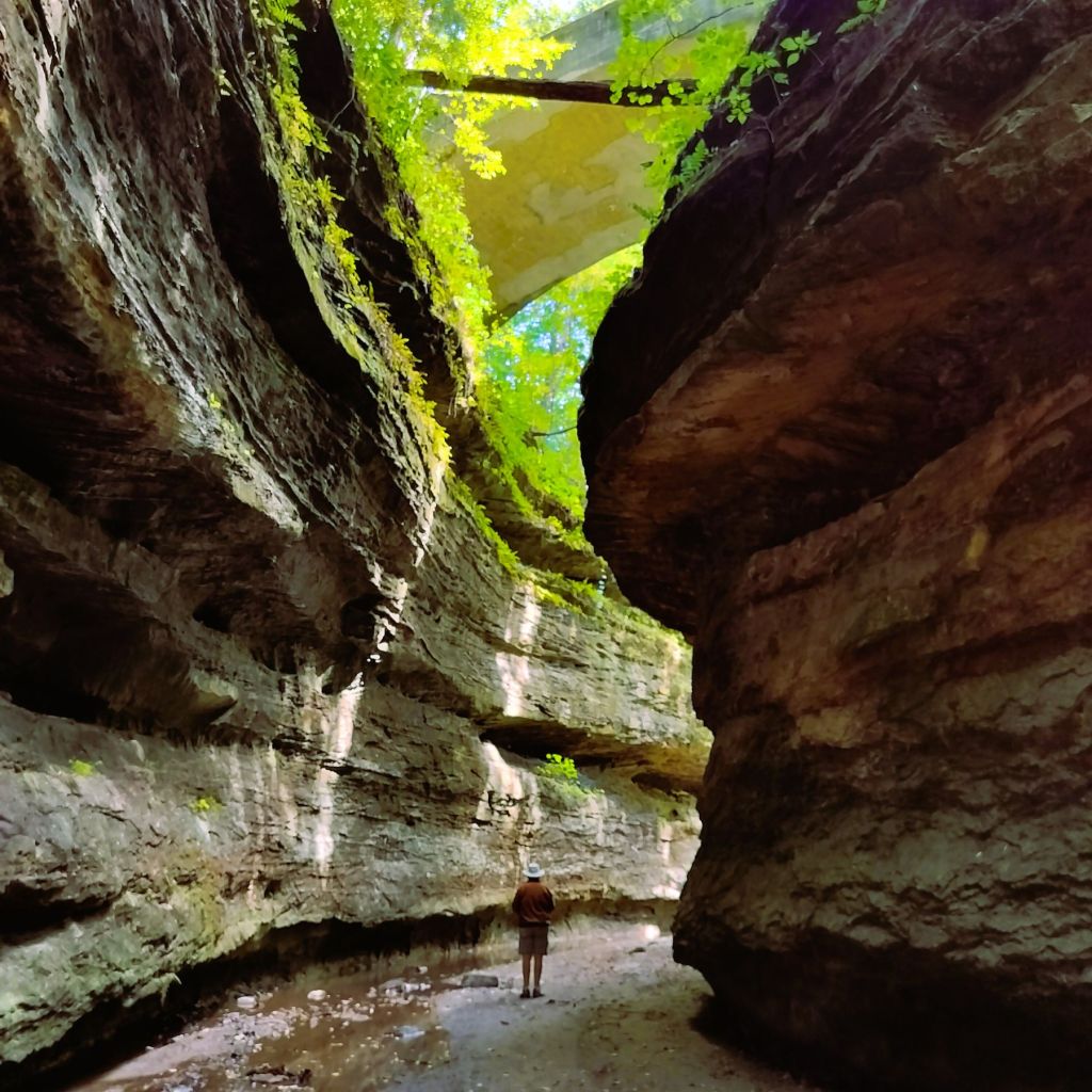
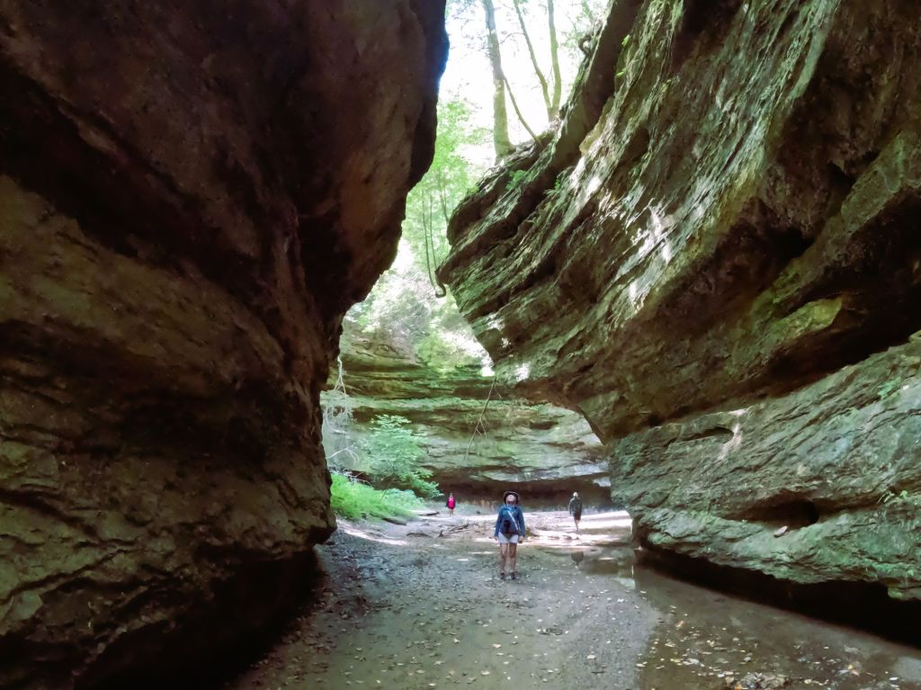
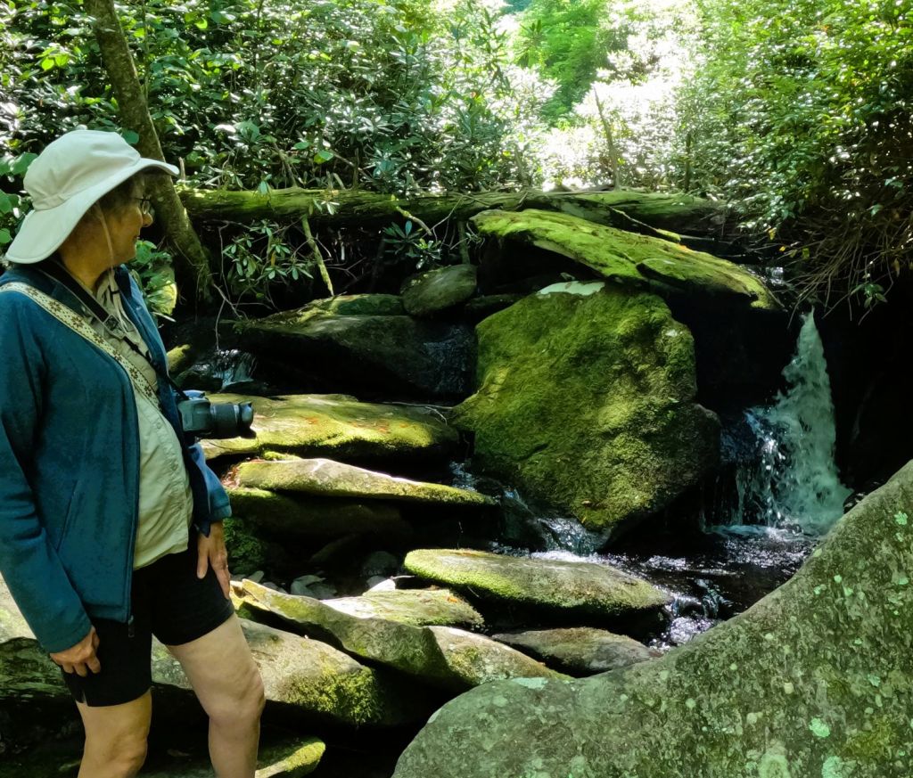
A ranger at the visitor center recommended a nearby hike to Zapata Falls.  The falls’ Spanish name refers to a settlement in the San Luis Valley started by Mexican families in 1864.

Wading the cold waters of South Zapata Creek

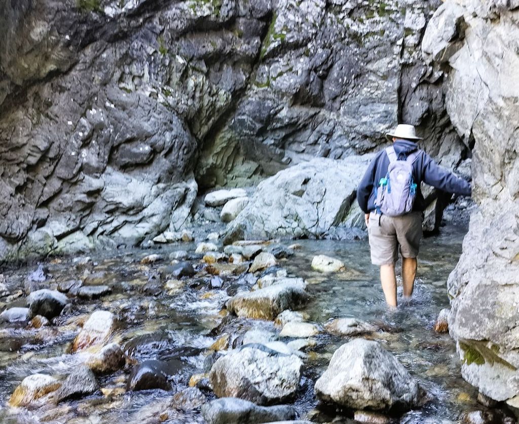
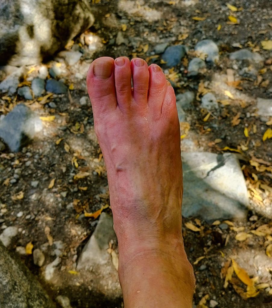
We hiked a half mile up a steep and rocky trail to South Zapata Creek.  For the final 75 yards, we scrambled over rocks and waded through the VERY cold creek.

Taking a video of the rugged gorge and falls
Zapata Falls

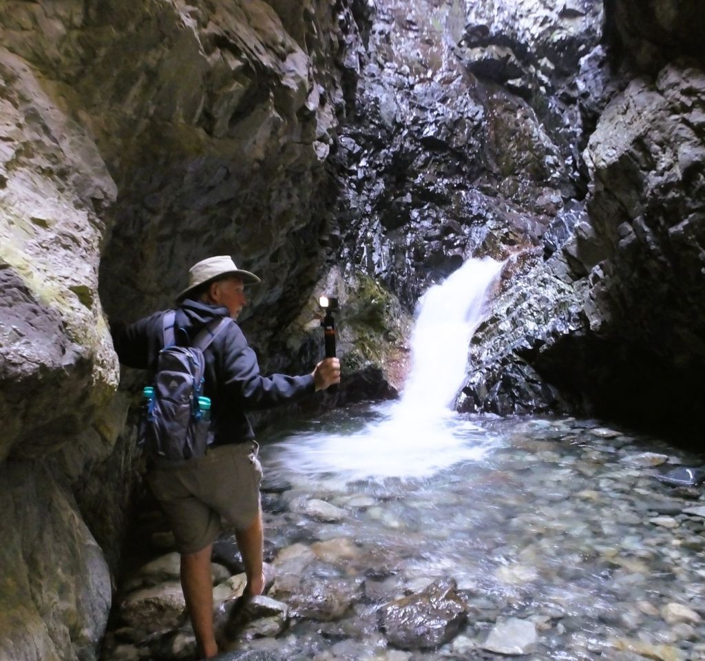
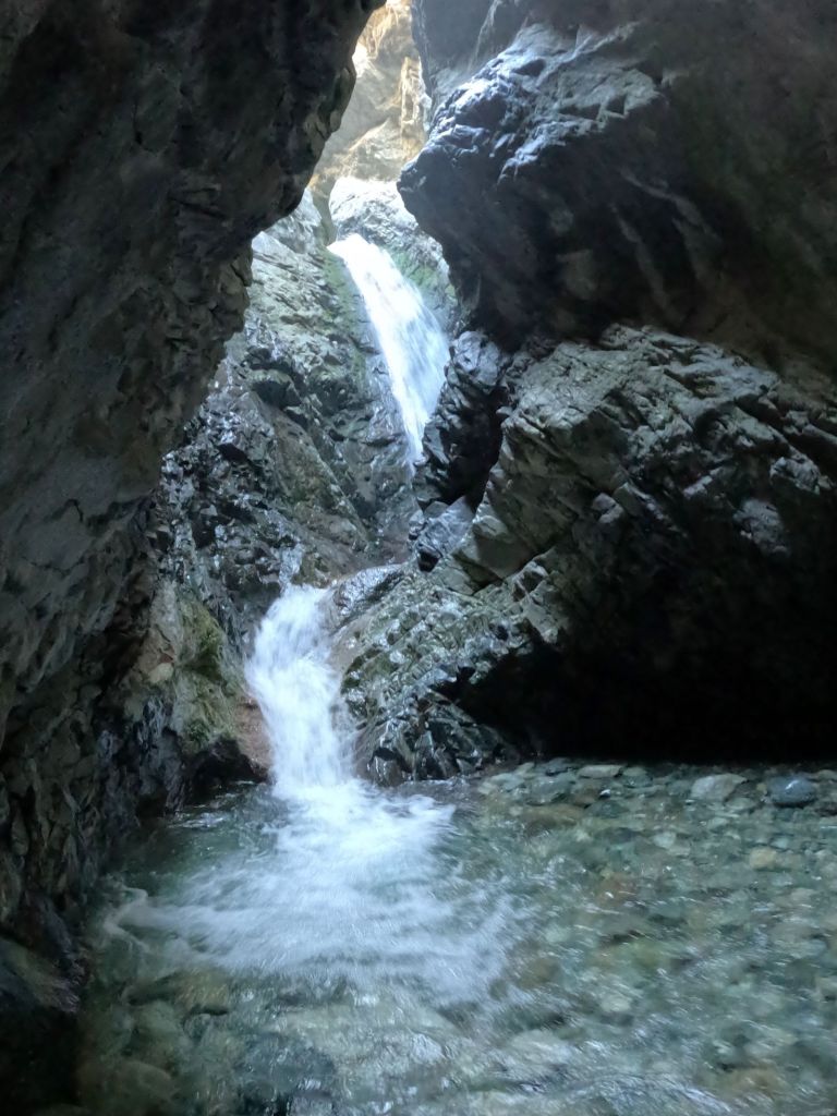
The marvelous 30-foot falls are hidden in a narrow, shaded gorge.   

We thought about how refreshing the falls must be on a hot summer day and how stunningly beautiful they must be when frozen during winter.    

Pat makes her way downstream

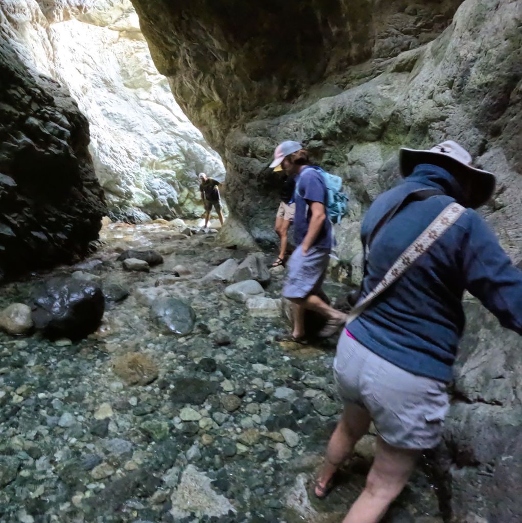
Our main concerns, however, were carefully hiking down the creek from the falls and thawing our feet when we changed from water shoes back to hiking boots.

Pat’s feet were pink from the VERY cold water
Happy to have warm feet as we returned to the parking lot

Next Week

We visit Black Canyon National Park, a deep and narrow gorge in central Colorado.

Mountain Highs and Elk Cries

(2025 Balloons and Beyond Ep 9)

With the Fiesta balloons packed and ready for future hot air events, we return to the beyond portion of the RabbiTRAILS 2025 Balloons and Beyond series.   We continue to Rocky Mountain National Park.

Rocky Mountain National Park

The park is about two hours northwest of Denver, CO in the Rocky Mountains.  It is one of the most visited US National Parks, featuring rugged mountains often covered with snow, alpine lakes and abundant wildlife.

Our Harvest Host location on the east side of Rocky Mountain National Park

After a night at a Harvest Host location near Estes Park near the park entrance, we bypassed the popular east side of the park that we have visited before and drove the Trail Ridge Road toward the western side of the park instead. 

There was little snow at higher elevations, but approaching rain clouds would change that

White Knuckles on the Trail ridge Road

Low walls along the Trail Ridge Road resulted in white-knuckled driving

The 48-mile Trail Ridge Road is the highest continuous paved road in North America, reaching an elevation of 12,183 feet.    It is above the tree line in the upper elevations. I nervously gripped the steering wheel because the road is narrow, the guardrails are low or non-existent, the winds are strong, and it is a LONG way to the bottom!  Despite this, the drive is wonderfully beautiful!

Elk herd in an alpine meadow at the top of the Rockies

We stopped at the Alpine Visitor Center near the top of the drive to eat lunch and enjoy the mountain views.  It was windy and cold, and storm clouds were approaching from the west. 

In an alpine valley we spotted a bull elk with massive antlers and his harem of nearly a dozen elk cows.  The alpine ground cover had hues of yellow, orange and red, indicating fall had arrived and winter would soon follow.

Fall colors in the Rockies

On the west side of the park the road quickly descends.   We soon arrived at Timber Creek Campground, our home for several nights. 

Colorado River at its headwaters in western Rocky Mountain National Park

Bugle Calls Across the Colorado

After setting up, we followed a nearby trail to a small creek no more than 20 feet wide.  Imagine our surprise to learn that we were at the headwaters of the mighty Colorado, the river that goes through the Grand Canyon and over Hoover Dam!

A woman whipped a flyfishing line back and forth, gently landing a small, feathered fly in the stream.  She had no bites or strikes.    

The fish were quiet but a nearby bull elk wasn’t.   Although he was hidden in the undergrowth, we could hear him bugle hauntingly beautiful whistle sounds to call his elk lady friends.  It was the elk rut.

Getting ready for a bugle call

We quietly waited in waist high grass as the bull elk called again and again. The bushes on the far side of the Colorado began to shake and out stepped the magnificent elk.  Behind him followed several elk cows.

Two of the bull elk’s harem

Rain and Snow on the Way

The weather changed.  Passing clouds produced cold rain showers.  Rain was forecast the next day with snow expected in the upper elevations. The park announced the Trail Ridge Road would be closed after 6 pm.

Snow caught up with us at Freemont Pass as we drove south

With that, we decided to leave a day early for Great Sand Dunes National Park to the south.  One unexpected challenge was ahead – as we crossed Freemont Pass between Copper Mountain (a big ski resort on I-70) and Leadville, the rain turned to snow.   Fortunately, the roads over the 11,316 foot pass were clear, but wet snow was accumulating on the trees, bushes and hillsides.  It was a beautiful sight, but we were ready for warm, clear weather.            

Next Week

Nestled up to the base of Colorado’s Sangre de Cristo mountains are massive dunes more than 700 feet tall.  They can be seen from more than 30 miles away! 

We explore the dunes and then hike to Zapata Falls nearby where we wade through frigid waters to view an unexpected double chasm.    

Balloon Fiesta Finale

(2025 Balloons and Beyond Ep 8)

Today was the final day of the 2025 Albuquerque International Balloon Fiesta. 

Friday’s mass ascension

From an elevated vantage point several miles east of the Fiesta grounds, we could see the cloud-covered Sandia Mountains to the east of Albuquerque and occasional shafts of sunlight peeking through to the ground. 

A light rain was falling at the balloon launch area, so the final event of the Balloon Fiesta was a scrub.

A Perfect Friday

We are thankful to have enjoyed a perfect Balloon Fiesta day on Friday. We got up close and personal to the balloon crews as they inflated and launched their balloons, something that makes the Albuquerque Balloon Fiesta unique and special.  

Here are photos of a few more of the specially shaped balloons. Let us know in the comments your favorites of the 30+ specially shaped balloons we posted.

Guests for Breakfast and Church

We were invited to a special Balloon Fiesta breakfast and outdoor church service at Rio Rancho New Life Church near Albuquerque.  By the time the service ended, the skies had cleared, and we enjoyed the beautiful day as we left for Texas.

We were welcomed to a Balloon Fiesta breakfast and outdoor service at New Life Church

A New Hobby?

Because we enjoyed the Balloon Fiesta so much, we’re considering a new hobby.  What do you think?   

Next Week

We pick up where we left off on the 2025 Balloons and Beyond blog timeline.  Having overcome the flu, cold temperatures and high altitude in Wyoming, we continue south to Rocky Mountain National Park.

Shapes, Flickers and Flexibility

(2025 Balloons and Beyond Ep 7)

Specially shaped balloons are a favorite of Balloon Fiesta attendees.  Balloons shaped like animals, cartoon characters and even a concrete truck capture spectators’ attention and bring smiles to their faces.

We hope some of the following balloons do the same for you!

Fantastic Fiesta Friday

Yesterday (Friday) was a great day at the Fiesta.  Weather conditions for the morning’s mass ascension were perfect, and we were awestruck as hundreds of balloons were launched in clear and calm skies.

The evening program included a balloon glow/flicker, drone show and fireworks.  We were glad the weather was great considering Thursday’s evening program was rained out!

During the glow/flicker, hundreds of balloons were fully inflated but not launched.  They stood tall across the Fiesta grounds. 

Balloons glow and blink

As thousands of attendees counted down, the balloon pilots responded with coordinated bursts of flaming propane that made the balloons glow.  Some countdowns were followed by short propane bursts that made the balloons flicker.

We were impressed with the images created during the drone show

The glow/flicker was followed by a drone show.  We were impressed with how well the 500+ drones flew in formation to create various images – images that moved, changed color and told a story.

Friday’s fireworks finale from two sides of the Fiesta grounds

The drone show morphed into a spectacular firework finale for the evening – from the north and west sides of the Fiesta grounds.

Today (Saturday) Required Flexibility

This morning, we woke to raindrops tapping on our camper roof.  Although the Dawn Patrol and mass ascension were cancelled, attendees were treated to a static balloon display instead.  Balloons were fully inflated but not launched like a balloon glow/flicker.  Seeing hundreds of balloons on the field during the daytime was interesting, much different than the normal mass ascension when balloons are inflated and launched in groups.

Saturday’s static display – balloons didn’t launch due to rain
Fiesta attendees enjoying Saturday’s static display
More shapes seen during Saturday’s static display

Check Out – Pap and Percy on the Move

Our time at the Fiesta campground ended Saturday morning.   We left to spend Saturday night at a church several miles away with an elevated view of the Fiesta grounds.

Saturday Evening Flexibility

This evening, we watched from afar as balloon pilots performed candlestick burns. Winds were too strong to set up and inflate the balloons for the glow/flicker, so pilots ignited their propane burners from their upright gondolas casting tall flaming flumes into the sky.   

Tomorrow

We will be joining members of the church for breakfast as the final mass ascension of the 2025 Balloon Fiesta takes place.  We’ll let you know tomorrow evening how things go as we wrap up the balloons portion of this RabbiTRAILs Balloons and Beyond series.    

It’s Balloon Fiesta Time!

(2025 Balloons and Beyond Ep 6)

We interrupt this week’s RabbiTRAILS blog to take you live (almost) to the 53rd  Albuquerque International Balloon Fiesta in New Mexico!  It’s Balloon Fiesta time!

AIBF is the largest celebration of hot air ballooning in the world with more than 600 traditional and special shape balloons participating in this year’s fiesta that runs from Sat, Oct 4 – Sun, Oct 12.

This is our second balloon fiesta.  It is a unique event – we and thousands of other spectators can get within a few feet of balloons as they are inflated and launched.

Fiesta Camping – Close to the Action

We arrived the afternoon of Thurs, Oct 9 and set up in the West VIP camping area that is on AIBF grounds, right next to the International Balloon Museum.  After a short wait to check in, we were guided to our campsite – a small patch of asphalt normally part of the museum parking lot. 

We’re camping rally style, a highfalutin way of saying no hookups (electricity, water or sewer) and parking so close to other RVs that the drone of their generators is soothing white noise.  Generators must be turned off during quiet time (10 pm – 3:30 am) so there is a tiny bit of quiet relief!

Despite the noise and crowded conditions, we are a five-minute walk from where the balloon events take place.

RVs line up to check in at one of the AIBF campgrounds
Rally style camping – close together with no hookups

Mass Ascensions, Glows and Flickers

Events during the fiesta include daily mass ascensions during which hundreds of balloons launch just after sunrise, to evening balloon glows/flickers where balloons are inflated but not launched shortly after sunset.  The balloons glow and blink as pilots ignite the propane jets that fill the balloons with hot air. It is quite a spectacle!

Seek Shelter – Rain Is Coming!

As we wandered the grounds after getting set up, we saw balloon chase crew help was needed.  We signed up and were eagerly anticipating an interesting experience during the Thursday evening glow.

An ominous rain cloud approached the fiesta grounds as we waited for our balloon pilot to arrive.  The evening events were cancelled, and our balloon crew experience was not to be.  And we got soaked as we hastily made our way to a protected area.

Things are Looking Up!

This (Friday) morning we were up at 5:15 for the mass ascension.  

Dawn Patrol balloons check out wind currents before the mass ascension of hundreds of balloons

At 6 am, the Dawn Patrol was launched. Six balloons took off beneath a nearly full moon to check wind currents for the hundreds of balloons set to launch an hour later.   The wind currents and morning weather were perfect!

How to Launch 600 Hot Air Balloons

Balloon crews are assigned where to launch on the massive AIBF grounds.  The grounds are laid out in a grid of 193 locations, each large enough to launch several balloons.

These trucks ready for balloon launch

From balloon support vehicles/trailers, balloons, gondolas, fans and other items are unloaded.  Large tarps are spread at each launch location and balloons are removed from bags more than four feet in diameter and spread out on the tarps.

Each balloon is carefully spread out over a large tarp

High powered fans connected to gasoline motors are started, and the balloons are inflated with cold air.

Large fans are used to fill the balloons with cold air

A gondola tipped on its side is attached to each balloon.  When the balloon is fully inflated, the pilot ignites a propane jet at the top of the gondola to shoot VERY hot air into the balloon.  The propane is ignited in three-to-four second bursts so as not to melt/burn the balloon fabric.

Once filled with cold air, propane jets fill balloons with hot air

The balloon rises in a matter of minutes as it fills with hot air, and the gondola is eventually tipped upright to be ready for launch.  The pilot and passengers climb on board.

Hot air causes a balloon to rise and the gondola is raised to an upright position

The launch sequence of each balloon is controlled by zebras, persons dressed in special striped clothing, who communicate with the launch controller and give each balloon pilot several whistle blasts to let them know when it is time to launch.

Zebras control the sequence of balloon launches

Each pilot continues with propane bursts until their gondola starts to lift.  A tether line is then released and the balloon takes off!

This balloon is ready for launch
The balloon rises into the sky

A chase crew is then dispatched to follow and retrieve the balloon, pilot and passengers when the balloon lands.

An Unforgettable Spectacle

Watching hundreds of balloons launching and soaring into the sky is amazing. Below are some views of this morning’s (October 10) mass ascension.

Tomorrow

The RabbiTRAILS balloon fiesta blog continues with photos of the balloon glow/flicker event this evening, photos of the amazing special balloon shapes, and more.      

Snowy Range and Flu Pains

(2025 Balloons and Beyond Ep 5)

Leaving the hills, mesas and pioneer landmarks of western Nebraska behind, we arrived in Wyoming.    There were broad vistas and mountains to the southwest as we passed Cheyenne and Laramie.

Lincoln Monument in Wyoming?

We continued west on I-80, stopping at the Summit Rest Area a few miles from Laramie.

Wyoming’s Lincoln Monument

There we found the Abraham Lincoln Memorial Monument, erected in 1959 to mark the president’s 150th birthday.  The monument is a 13.5 ft bronze bust of Lincoln created by Wyoming artist Robert Russin.  It sits atop a 35-foot granite pedestal.

The monument was originally located nearby on US 30.  Better known as the Lincoln Highway, US 30 was the first transcontinental highway.  It was completed in 1923 and ran 3389 miles coast to coast – from Times Square to the Golden Gate Bridge. 

The monument was moved to its current location on I-80 in 1969 when the Interstate was completed.

Exploring Medicine Bow

West of Laramie, we camped in Saratoga, a small town near the Snowy Range Scenic Byway and Medicine Bow National Forest.

Saratoga is known for Hobo Hot Springs along the North Platte River. Unfortunately, we were unable to enjoy the springs.

Perhaps you remember Medicine Bow as the fictional town and setting of the Virginian, a 1960s television series that focused on the activities at the Shiloh Ranch in the late 19th century.

(The Medicine Bow area actually got its name from Native Americans who came to the area to cut mountain mahogany, water birch and juniper for making bows)

James poses with his Jeep and the Snowy Range

We decided to explore the area.  James skillfully drove his Jeep up narrow gravel roads as we ascended into Medicine Bow National Forest.  We drove through an area devastated by the East Troublesome Fire in October 2020.  Amidst the charred stalks of once robust pine and fir trees were low bushes and small aspen trees.  It will take many years for the forest to recreate itself.

Our route took us through an area devastated by a forest fire in 2020
Aspens growing in the burned areas displayed amazing fall colors

We followed a route suggested by Google and started up a steep, narrow road that became impassible.  We backtracked and asked three camouflaged elk hunters for directions.

Backtracking along a narrow road as we made our way across the Medicine Bow National Forest

We eventually made it to Centennial WY where we turned back toward Saratoga on the Snowy Range Scenic Byway.  We crossed the Snowy Range pass at 10847 ft and were breathless –  from the elevation and from an amazing view of the Snowy Range.  The tops of the mountains were covered with fresh snow from the prior evening.

Snowy Range view 1
Snowy Range view 2. Medicine Bow Peak is the tallest mountain on the right

The tallest mountain in the range is Medicine Bow Peak.  At 12018 ft, it is the highest point in southern Wyoming.

Happy Birthday, James!

That evening we celebrated James’ birthday!

Flu Pains

That night I (Ed) awoke with severe chills and fever.  This repeated for two more evenings along with nearly a week of dry coughing spells.  Although Pat was spared from flu symptoms, she felt the effects of a bad cold.  We extended our stay in Saratoga to six days as we finally began to recover.

We said goodbye to James as he continued to Jackson WY and Grand Teton NP. 

The next day we finally made our way up the Snowy Range Scenic Byway to spend a chilly night at Sugarloaf Campground.  The campground is situated near three lakes at the base of the Snowy Range and Sugarloaf Mountain.   At 10800 ft, the campground is one of the highest in the United States.

High altitude camping at Sugarloaf Campground with the Snowy Range in the background

We took it easy, limiting ourselves to several short hikes.  The effects of the flu, cold temperatures and high elevations would linger with us for more than another week.

Critter Count

Our biggest critter surprise was along the Snowy Range Scenic Byway.  As we neared a parking area for a short hike, a bull moose and cow were hastily crossing a field beyond the parking area.  As we parked, another moose cow was making her way through the woods toward the other two moose.  This was the first Bullwinkle (our name for a bull moose) we have seen in all our travels including Alaska and Newfoundland!

Bullwinkle on the run
…followed by a moose cow
  • Mule deer- 14
  • Pronghorn antelope – many
  • Bald eagle – 1
  • Moose – 1 bullwinkle and 2 cows
  • Grouse – 1

Next Week

Bugle players at Rocky Mountain NP.

SAC, Tracks and Seafood Snacks

(2025 Balloons and Beyond Ep 4)

After nearly three weeks and more than 2500 miles, we were joined near Kansas City by Pat’s brother, James.  He is also a truck camper owner who brings his Jeep along.

James’ truck camper and Jeep
We enjoyed dinner outdoors one pleasant Nebraska evening

As we have done on several past trips, we visited Pat’s and James’ aunt and uncle in Shawnee, KS, near Kansas City.  We enjoyed catching up with them and agreed connecting with family is an important part of travelling.

We had an enjoyable visit with Aunt Martha and Uncle David near Kansas city

A Strategic Visit

Leaving Kansas, we toured the Strategic Air Command Museum near Omaha, NE.  The museum has extensive aircraft and other exhibits on display.  The SAC, formed in 1946, was responsible for the US strategic bomber and intercontinental ballistic missile forces that were intended to deter aggressors and, if necessary, execute strategic nuclear attacks.  In 1992 the SAC was disbanded, and its various functions were transferred to other military commands.  

Entrance to the Strategic Air Command Museum near Omaha, NE
Dozens of planes are on display in the SAC Museum, including a SR-71 Blackbird supersonic reconnaissance aircraft
Cabbage, Really?    

We were hungry after visiting the Kool-Aid Museum in Hastings, NE (see last week Ep 3), so we decided to lunch on a Nebraska staple – a runza.  Originating from German and Russian cuisine, a runza is a baked bread pocket sandwich filled with seasoned ground beef, onions and cabbage.  Our savory runzas were delicious.

Runzas are yum-za!
Cabbage on a ground beef-filled pocket sandwich makes for a savory combination

North Platte – Tanks and Trains

Tankers on the North Platte River (from Google)

Continuing west in Nebraska, we spent the night in North Platte, a sizeable town not far from the river of the same name.  We hoped to go tanking, where we would float a few miles down the river in a large livestock water tank.  We were disappointed when we learned the tanking season was over for the year.  Perhaps on a future trip…

Leaving North Platte, we visited the Golden Spike Tower and Visitor Center.   From the tower we could see the Union Pacific Bailey Yard, said to be largest rail yard in the world.  The rail yard is an interesting spectacle with dozens of locomotives and more than a thousand rail cars all moving at once on miles of rail lines!

Organized chaos – the Union Pacific Bailey Rail Yard bustled with activity
Aerial view of Union Pacific Bailey Yard from a museum exhibit – the rail yard is the largest in the world

Chewy Seafood

Later that day we stopped at Ole’s Big Game Steakhouse and Lounge in Paxton, NE.  Rosser O. Herstedt, otherwise known as Ole, was a big game hunter who collected the more than 200 big game trophies that adorn the restaurant walls. The trophies include moose, elk, a polar bear, a jackelope and MANY more.  

Beneath a large elk, we sampled a local seafood appetizer, otherwise known as Rocky Mountain Oysters.   We tried not to think of the source of the crispy breaded and deep-fried meat filets as we dipped them in ketchup and chewed/swallowed them quickly.

Awaiting our Rocky Mountain seafood appetizer and lunch entrees
Rocky Mountain Oysters – once is MORE than enough!

Truck Campers Ho!    

Continuing west, Nebraska’s flat endless fields of corn became rolling hills covered with grass, and then distant rocky mesas.  Like 1800s pioneers following the Oregon Trail, we watched for Chimney Rock, a significant landmark that rises more than 300 feet above the surrounding landscape.

Getting ready to get a closer view of Chimney Rock
At more than 300 feet, Chimney Rock can be seen for miles. It was a landmark followed by pioneers on the Oregon Trail (and by us!)

Next Week

From Chimney Rock, we continue westward to Wyoming, looking forward to the Cowboy State’s rugged, untamed beauty.                                 

Sliced Bread and Kool-Aid!

(2025 Balloons and Beyond Ep 3)

Do you have childhood memories of bread slathered with layers of peanut butter and jelly, downed with glasses of icy cold cherry Kool-Aid?  Our red mustaches revealed what our tastebuds were feeling: ‘Ooh Yeah’!

Ooh Yeah!

But First…

We made it through another week and nearly 1000 miles in the beyond portion of our trip with no Pap mishaps.  For those of you who don’t know my bride, the title photo of Pat with a thumbs down scowl isn’t like her at all (unless I do something like drive Pap through a narrow tunnel).

Signs, Signs and More Signs 

A genie greets us at the entrance to Cincinnati’s American Sign Museum

Our continued route west took us thru Cincinnati OH.   The area is memorable to us as we had the only flat tire of our trip to Alaska in 2018 with Max and Pancake.  We visited the Ark Encounter attraction and the Creation Museum nearby in northern Kentucky.

This time we continued to the west side of Cincinnati for a tour of the American Sign Museum.  The museum holds more than 800 signs and other objects spanning over 100 years of American history. 

Recognize any of these signs?
More signs along the museum’s sign avenue
Over 99 billion sold – that’s a lot of hamburgers!

We walked along the museum’s cleverly designed indoor central avenue and were overwhelmed by a barrage of blinking bulbs, flashing lights, and bright colors: McDonalds, Holiday Inn, Phillips 66, Goodyear Tires, Frisch’s Big Boy, Rock City and many more.

Camp Washington or Skyline?

Getting ready for lunch at Camp Washington Chili

Near the museum we spotted our lunch stop for the day – Camp Washington Chili. 

We ordered bowls of spaghetti noodles, topped with meaty chili and cheddar cheese.  They added diced onions to mine, and gave us each several small bags of oyster crackers as a garnish.

Yummy lunch – no Tums needed

Our selections were delicious – the chili was mild and the proportions of toppings were perfect!

Now we have an unfortunate dilemma: friends from Cincinnati in our church fellowship group served Skyline chili several times over the years when our group joined them for dinner.  Skyline chili is said to be a little different, more saucy with a mild undertone of cinnamon.

Apparently, there is a big fan base for each style of chili.  How will we explain that we may have gone over to the chili dark side?  

Covered Bridges and ‘Gorge’ous Hikes

In Indiana, we camped several nights near Rockville. 

A typical small-town courthouse is surrounded by stores and restaurants in the center of Rockville

Different ways of visiting Rockville – motor cycles at the Thirty Six Saloon and an Amish family on their way to town

The area is noted for 31 covered bridges. We learned while walking around the town’s central square that more than two million people attend the town’s 10-day Covered Bridge Festival in October.  We could not fathom the crowds as thousands of covered-bridge geeks follow established routes through the countryside to see the bridges. 

Some of the covered bridges near Rockville

We visited three bridges and found them to be interesting relics of the past.  They are nicely restored and in very good condition.  The overhead clearance of the bridges is about 10 feet. With Pap being 12 feet tall, this was definitely a NADA moment.

Nada Means NADA!

The next day we visited Turkey Run SP. 

Kayakers on Sugar Creek paddling through Turkey Run SP

The highlight of our visit was hiking a couple of the beautiful trails that follow sandstone cliffs along Sugar Creek and traverse deep side ravines.  The park has 11 trails from .5 mile to 3 miles that range from easy to very rugged. 

Ed leads the way through a ravine
Waiting for others to climb the second of three ladders on our challenging hike. Notice the worn footboards!
Pat surveys the rugged ravine walls

We hiked a 1.7 mile very rugged trail that included lots of ups and downs, three 20-foot ladders, hundreds of steps and a final slippery descent down a stream bed back to Sugar Creek.

We were tired after the hikes, and have an appreciation of the beauty of the area. 

Our westward quest yielded a couple interesting RabbiTRAILS not far off our planned route.

Chillicothe Baking Company – location of America’s first sale of pre-sliced bread!

Sliced Bread

On July 7, 1928, sliced bread was first offered for sale in Chillicothe, MO when Chillicothe Baking Company began using a bread slicing machine invented by Otto Rohwedder.  The pre-sliced bread was placed on the bakery’s shelves and instantly changed the way consumers bought bread.  The five feet long and two feet high machine was turned down by numerous bakeries before being offered to the Chillicothe bakery’s owner, Frank Bench. 

Today, the building pictured is a museum and visitor center, and was unfortunately closed on the day of our visit.

Ooh Yeah – It’s Kool-Aid!

We continued to Hastings, NE where we visited the Hastings Museum of Natural and Cultural History.  There, among buggies and cars, guns and a large variety of animal and bird displays, we found what we had come to see – the Kool-Aid:  Discover the Dream exhibit.

Kool-Aid merch

Hastings is the birthplace of Kool-Aid. The wonderfully sweet fruit-flavored soft drink that kids (of all ages!) enjoy was the brainchild of Edwin Perkins. Pursuing his dream through hard work and ingenious marketing. Perkins created and sold many products, but in 1927 he developed Kool-Aid.

Fruit Smack was a predecessor to Kool-Aid. The little Kool-Aid packets we all know and love were one of Edwin Perkin’s ingenious ideas

Perkins created an earlier version of Kool-Aid, called Fruit Smack, in his mother’s kitchen.  Once in production, it was corked and sold in bottles, which was very messy.   A powdered drink was more appealing to consumers, and in 1927 Perkins’ company created Kool-Ade, later renamed Kool-Aid.

Next Week

Pat’s brother joins us in Missouri.  After visiting their aunt and uncle near Kansas City, we spend five days following RabbiTRAILS across Nebraska before arriving in Saratoga, WY. 

Our travels include the Strategic Air Command, runzas, Golden Spike rail yard, Chimney Rock and some Rocky Mountain seafood. 

See you next week!

Nada Means NADA!

(2025 Balloons and Beyond Ep 2)

With a name like Nada, we (Ed actually) should have known better.  And a caution from a passing pickup driver should have been MORE than enough warning.

More on this in a bit, but first things first…

Driving in to the Moonlite drive-in

Movies at the Moonlite

Not too many years ago,  baby boomers packed their kids and snacks in the car, and headed to the local drive-in theatre for the latest double feature. 

There were once thousands of drive in theatres across the nation.  Our hometown, Lake City, FL, had two.  Our first date was at the Lake City Drive-in where we saw Roger Moore as James Bond in The Spy who Loved Me.

Fewer than 300 drive in theatres are still operating today.  

On our way to New River Gorge NP in West Virginia, we learned there is an active drive in theatre that is also a Harvest Host location.  So we booked a site, arrived in the late afternoon and set up Pap.  That evening we watched Jurassic World Rebirth, the latest installment in the Jurassic Park movie series, and a special 50th Anniversary version of Jaws. 

Ready for the movies – we listened on Pap’s FM radio

We watched dinosaurs and sharks scurry and swim from the comfort of our truck camper. Our second drive in theatre date was very memorable!

Grand view of the New River

New River and Coal Country

Our travels continued northward and from a campsite in Beckley WV, we made day trips to nearby New River Gorge National Park and Preserve.  At Grandview, we overlooked the New River 1400 feet below as it makes a broad curve within the five-year-old park. 

US 19 bridge across the New River
Panorama of New River Bridge and river far below
Crossing the New River with a view of the New River Gorge Bridge above

A few miles away we visited the US 19 bridge where it crosses the New River Gorge.  We marveled at the 3,030-foot steel arch span that is 876 feet above the river.  Consider this – if you placed two Statues of Liberty on top of the Washington Monument there would be 20 feet to spare!

The historic Thurmond trail station is also an Amtrak stop
Abandoned downtown Thurmond buildings are just a few feet from the train tracks

Railroad tracks follow the river through the gorge.  Early in the 20th century coal mining towns were all along the river. Trains were frequent – there were five or more passenger trains daily and a freight train every 15 minutes. 

We drove to the bottom of the gorge to see historic Thurmond, a once bustling coal mining town that is now mostly abandoned.  The four remaining residents of the town are trying to preserve the town’s interesting legacy.

Our coal mine tour guide, Gerald, points to a layer of coal as he explains how coal was extracted and loaded onto ore wagons
Wagons full of coal followed rails to the surface

Back in Beckley, we toured a coal mine.  Gerald, a coal miner for more than 40 years, drove us in a coal car more than a quarter mile underground through the dark passages of a vintage coal mine. He explained historic and modern coal mining methods and equipment. 

Gerald pointed to a sign labeled “Brad Paisley / The Medicine Will / May 4, 2023.”   The popular country performer made a music video in the mine that is a moving story of coal mining communities dealing with various addictions, and their attempts to work together to overcome those challenges.  The video is worth watching.

Hillbilly Heartburn

From Beckley, we traveled through the West Virginia mountains and passed Charleston, where we saw the gold domed state capital building from the highway. 

Hillbilly Hot Dogs serves flavorful hot dogs amidst funky yard treasures

We stopped for lunch at Hillbilly Hot Dogs, a quirky roadside eatery made famous by Guy Fieri on Diners, Drive-ins and Dives.  HHD, as it is otherwise known, recently celebrated 25 years of Love and Weenies.

Their menu includes the homewrecker (a 15-inch one-pound weenie with two pounds of toppings) and the widowmaker (a 30-inch two-pound weenie with four pounds of toppings).  We eyed the homewrecker challenge – finish in less than 12 minutes to get a special t-shirt / beat the record and it’s free. 

Hillbilly feast to be followed by Tums

Not wanting to risk eternal heartburn, we opted for a hillbilly dog (deep fried weenie, chili sauce, mustard and onions), a West Virginia dog (weenie, chili sauce, mustard, onions and cole slaw) and onion rings. These were well within the acid neutralizing power of a few Tums.

Pondering at the Nada Tunnel entrance

Nada Means NADA

We left West Virginia bound for an overnight stop near Lexington, KY.  We detoured through the Red River Gorge, a National Wild and Scenic River in Daniel Boone National Forest, to drive through the Nada Tunnel, an old railroad tunnel that is reported to be 12 foot wide, 13 foot tall and 900 foot long.

Pap is a bit over 8 feet wide, 11 feet 9 inches tall and 24 feet long, so we figured we could drive through the tunnel with plenty of room to spare.  Although the pickup driver recommended taking a bypass around the tunnel, I thought we would easily fit.

As we approached the tunnel it looked to be plenty tall. It did appear to be a little narrower than 12 feet, however.  We continued on, entering the tunnel and driving VERY slowly while carefully watching our mirrors to avoid hitting the sides of the tunnel.

This is when we learned an unfortunate lesson: old tunnels are not uniform or square.  Some parts are taller, some shorter, some wider and some narrower.

Creeping along, we heard a grinding noise as Pap scraped the side of the tunnel.  This was not good!

So we slowed even more and made our way out of the tunnel with no further contact.

Traffic backup at the other end of the Nada Tunnel

Exiting the tunnel we stopped to check things out.  There was a three-foot scrape along Pap’s passenger side roof rail.  The roof material was wrinkled and cut in several spots. 

That evening we performed emergency repairs with a special RV roof sealant.    Additional repairs will be needed when we get home.

For hard-headed and unnecessary risk takers like me (Ed), it was a painful lesson. 


Going forward, we’ll keep Pap out of railroad tunnels on narrow roads and (hopefully) avoid other risky endeavors.  And, Pat will remind me that Nada means NADA!

Pat says Nada means NADA!

Next Week

Skyline or Fort Washington chili? Cincinnati natives have their favorite way chili is served over spaghetti with shredded cheese and other toppings. After checking out Cincinnati’s American Sign Museum with its multitude of vintage signs that are truly Americana, we stopped for lunch to determine our own chili preferences.

Speaking of Americana, our travels continued to an area west of Indianapolis known for lots of covered bridges. We visited a few and also hiked some interesting trails in Turkey Run State Park.

October in August!

(2025 Balloons and Beyond Ep 1)

After enduring brutal summer heat in Florida, we left home on a rainy Saturday to visit family in Georgia. We often do this when we travel.

We enjoyed visits with Henry, Josh, Emilia and Liz, and with my sister, Kitty, and her husband, Mike.

Christmas in July.  Breakfast for dinner.  October in August?

Family visits behind us, we were surprised the next morning with brisk temps (50 degrees) as we camped in Cherokee National Forest near Knoxville, TN.   We fired up Pap’s furnace, arose and cooked breakfast to begin the day. Out came our jackets!

From our remote campsite on the North River we moved to Indian Boundary Campground, just 16 miles away, for the next three nights.    On the way, we stopped to enjoy Baby Falls and Bald River Falls, and later rode our bicycles around Indian Boundary Lake.  We continued to wear jackets in the cool October in August weather!     

Bald River Falls in Cherokee National Forest

Pick a Parkway

Perhaps you have driven the Blue Ridge Parkway, a 469-mile scenic highway that winds through the Appalachian Mountains in North Carolina and Virginia, or perhaps the Skyline Drive as it continues another 105 miles from the end of the Parkway through Shenandoah National Park, just 70 miles west of Washington DC.  

How about the Cherohala Skyway?  It connects Tellico Plains, TN and Robbinsville, NC through Cherokee NF in Tennessee and Nantahala NF in North Carolina.  The 43-mile scenic road rises to more than a mile high with mountain vistas, numerous overlooks and sweeping curves popular with motorcycle riders! (it’s very close to the well-known Tail of the Dragon motorcycle route) 

Pat views the small waterfall after our steep downhill descent

At one overlook, we hiked three miles to a small waterfall. Nearing the falls, we tightly held onto tree branches, roots and rocks as we descended the final quarter mile.  We ate lunch to the sounds of rushing water and gave thanks for God’s wonderful creation!

Cades Cove

The Cable mill and homestead area in Cades Cove includes a blacksmith demonstration

The next day we left for a two-day visit to Cades Cove in Great Smoky Mountains National Park.  The Cove is known for its 11-mile loop road with historic homesites and churches, and diverse wildlife (see Critter Count below). 

A misty early morning sunrise along the Cades Cove Loop Road

We have visited and camped at the Cove several times in the past, and although the loop road and campground were busy this time with Labor Day visitors, we enjoyed our two drives around the loop road.

A number of historic cabins and houses (above) and barns (below) can be toured in Cades Cove

Critter Count

Deer – 8
Black bear – 2 (plus a couple other we just missed as evidenced by two bear jams)
Turkeys – 10
Glow worms (bioluminescent larvae of fungus gnats) – lots
(faintly glowing on the ground at North River Campground)

Deer and black bear were among the critters we saw in Cades Cove

Next Week

Our travels continue to a deep and very ancient gorge, and we watch dinosaurs and sharks under the moonlight.