Waterfall Views and Mountain Hues

Featured
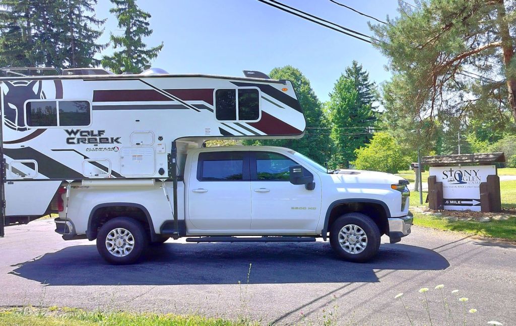
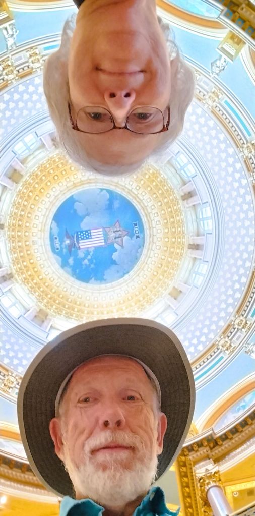
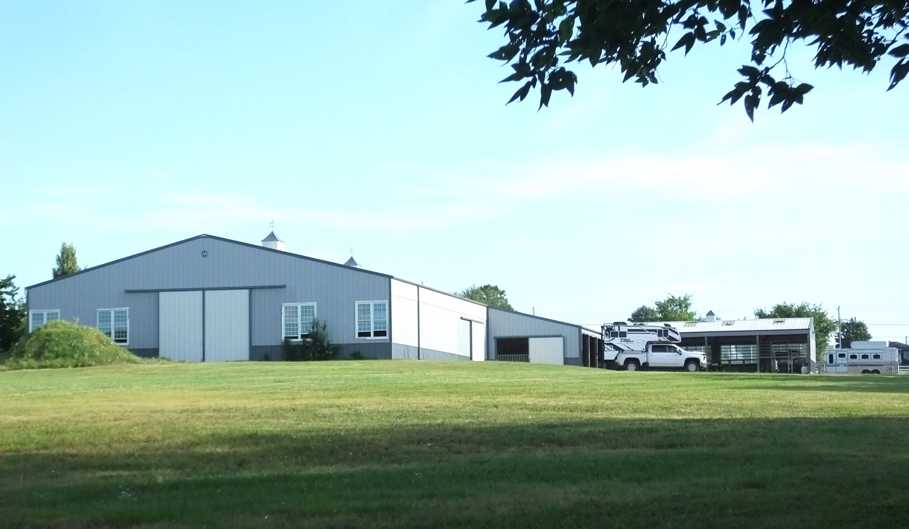
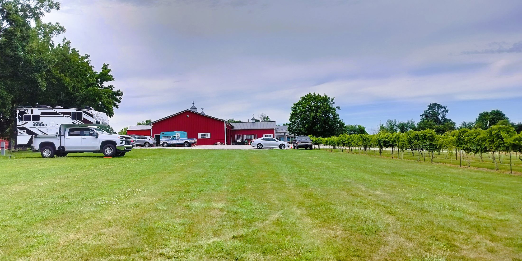
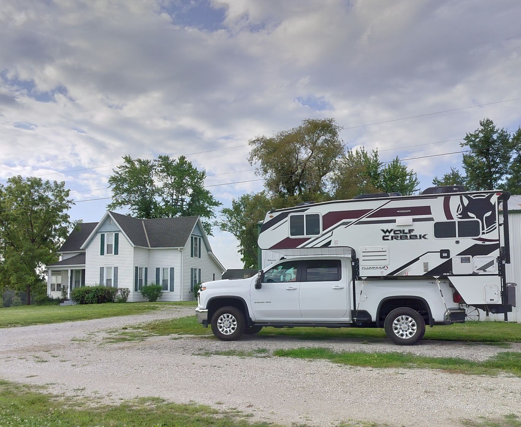
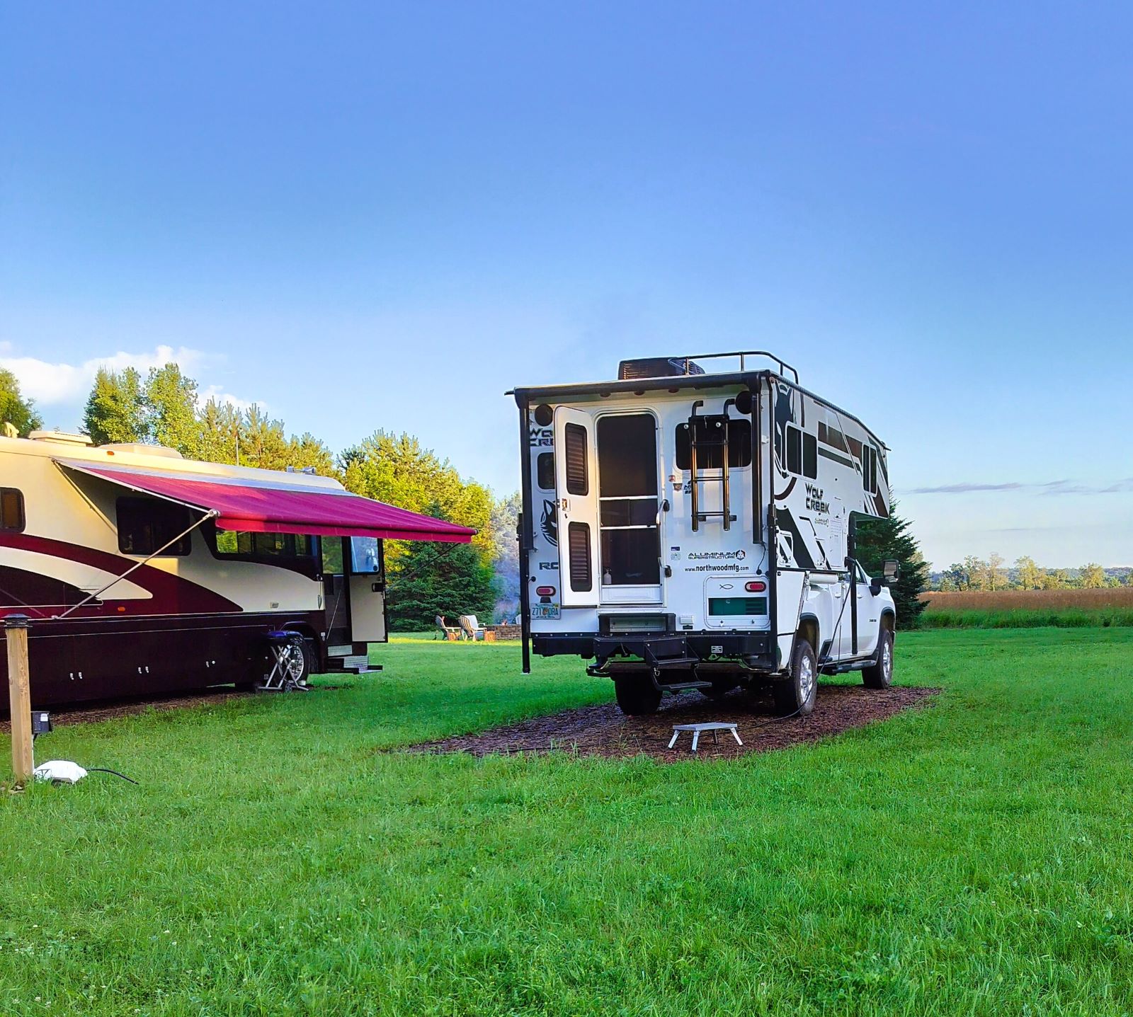
(2024 Heartland Ep 13)

We left New England enjoying the warm, hazy days and cool nights of mid-August. 

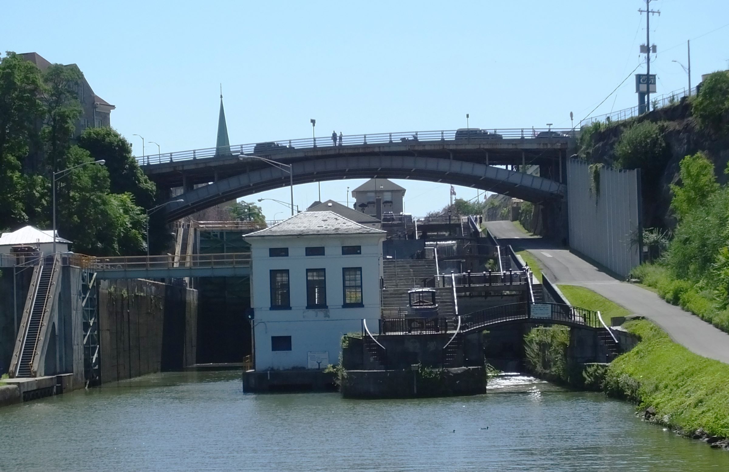
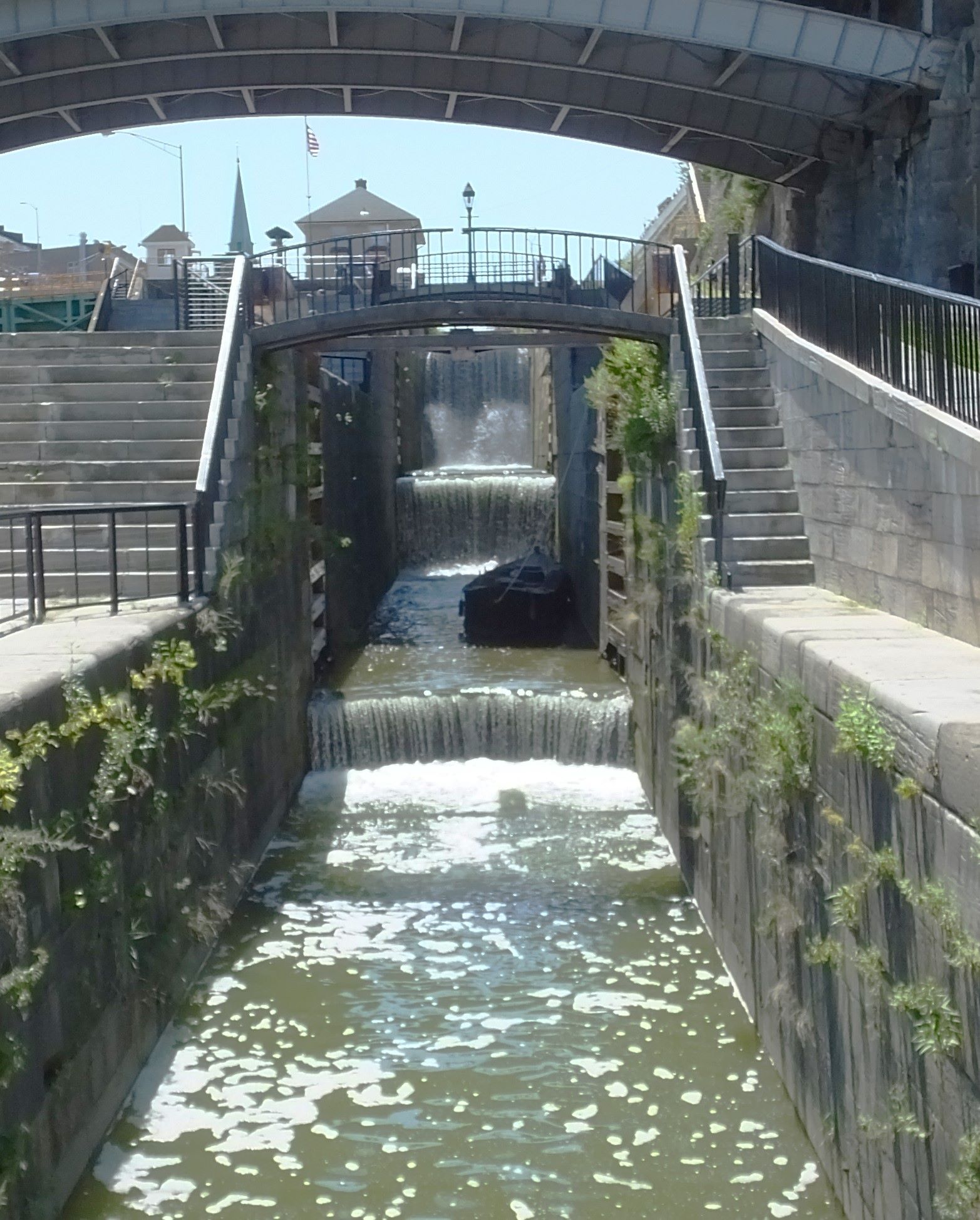
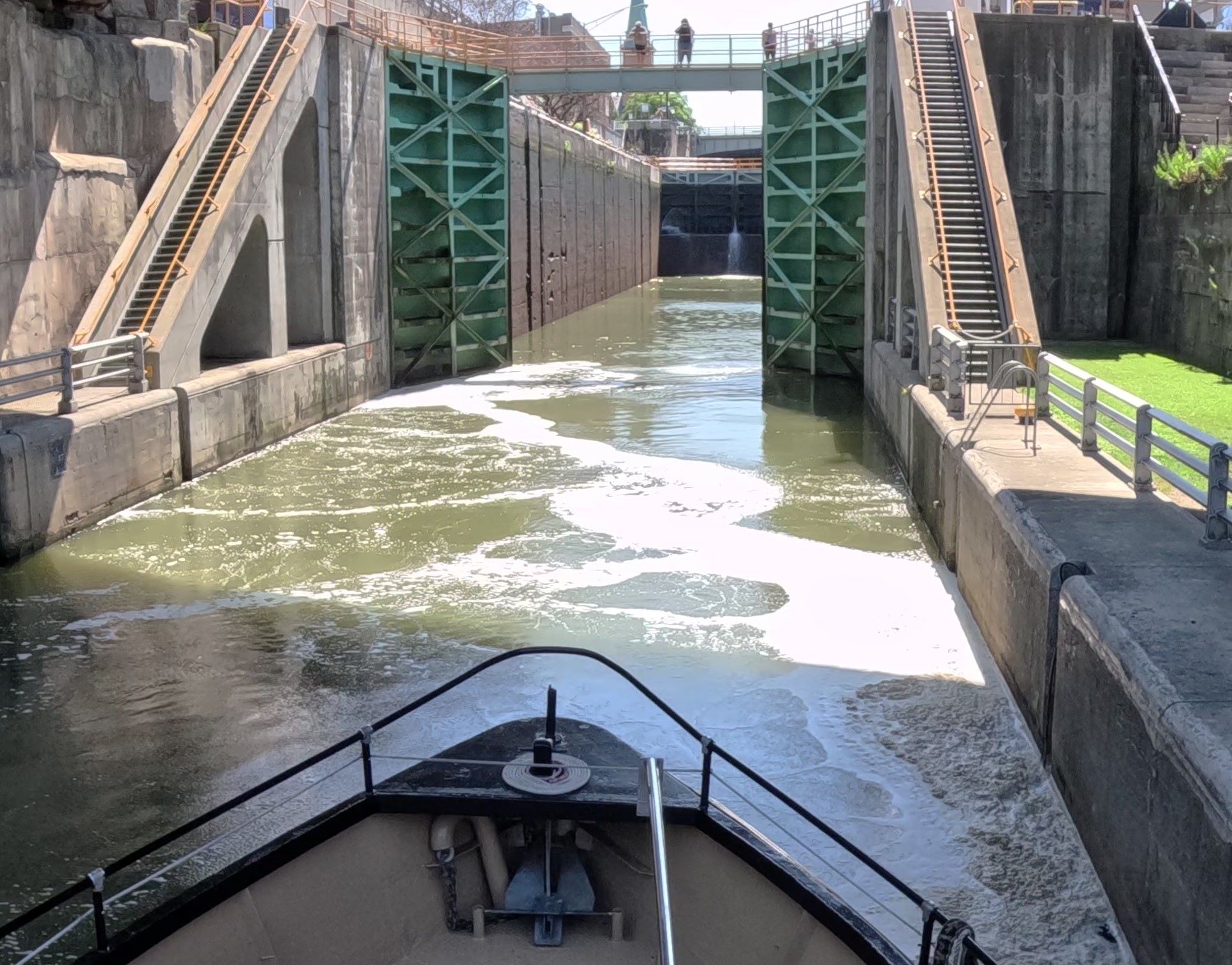
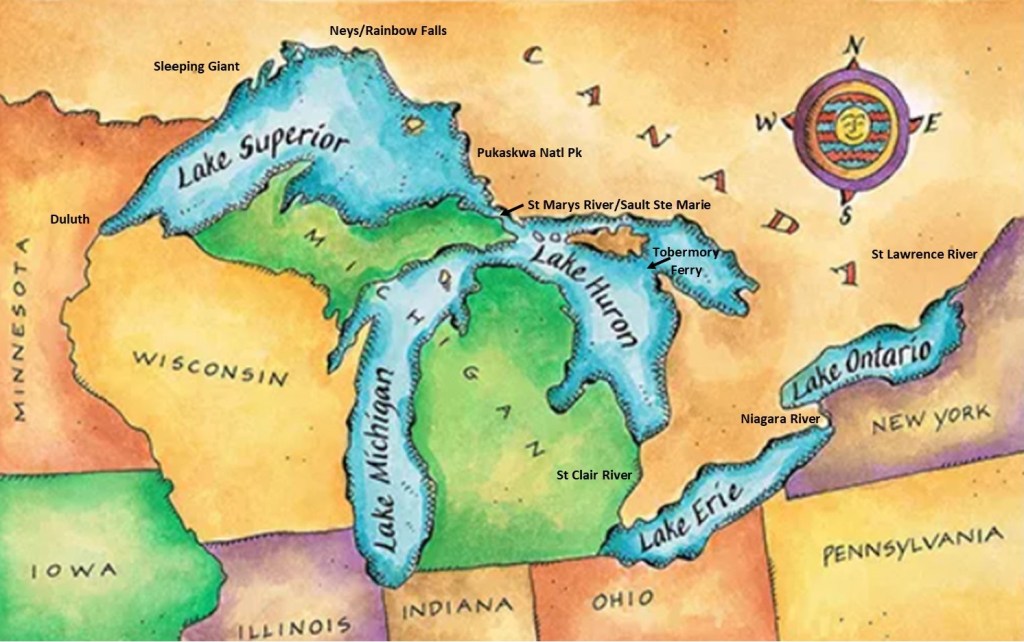
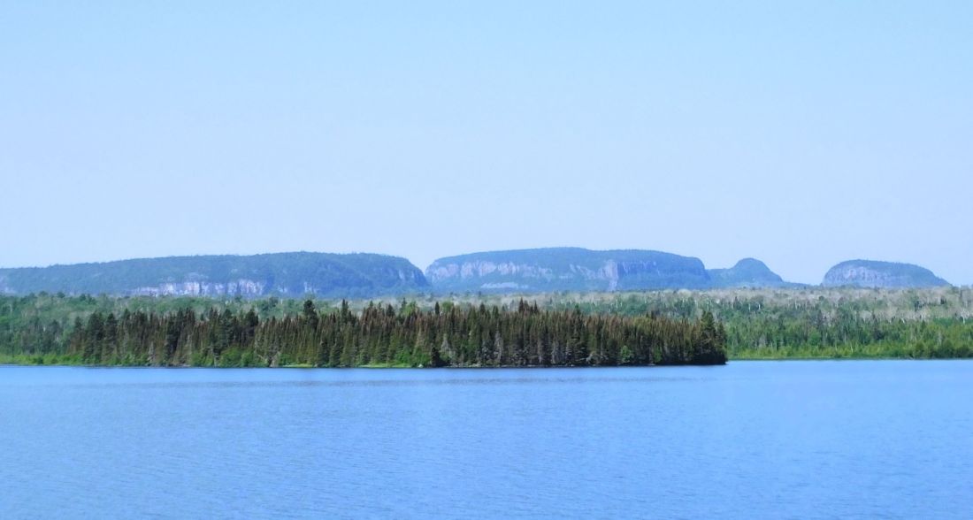
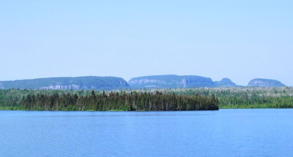
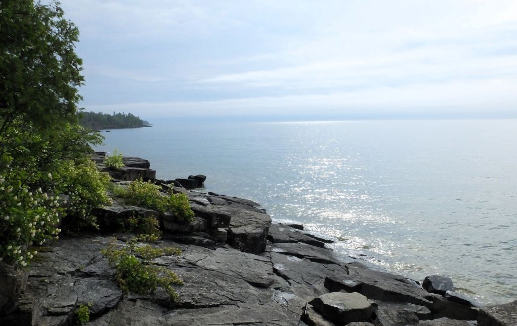
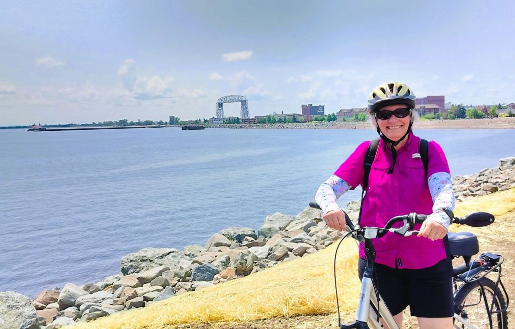
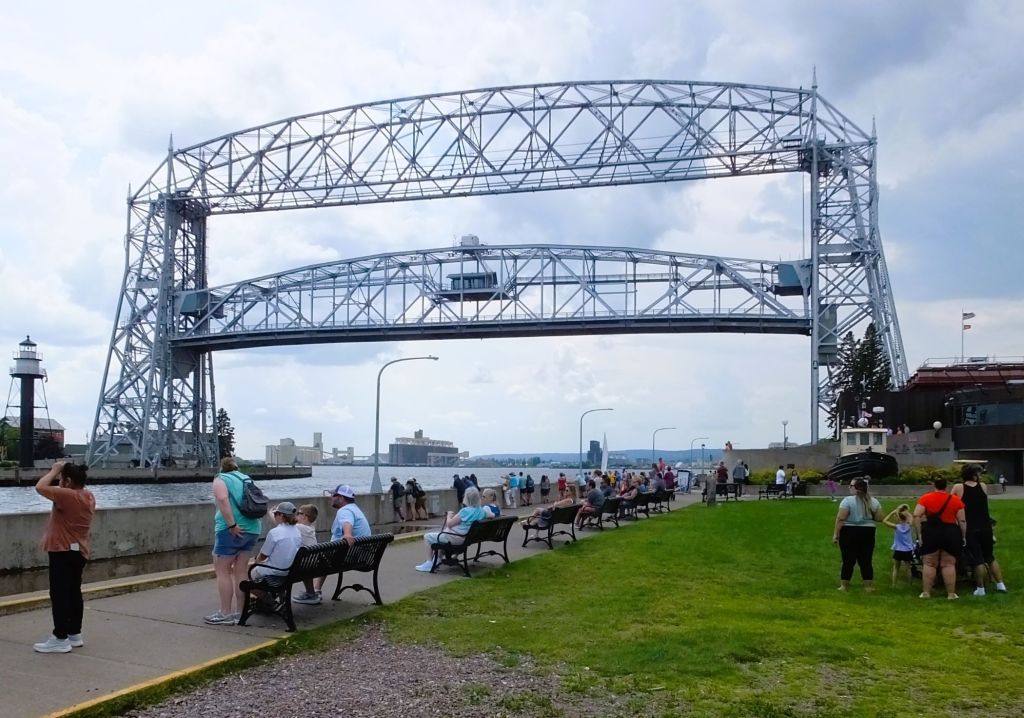
We endured several days of heavy rainfall as we crossed Vermont and New York. While camping on the St. Lawrence River, we watched big ships and wondered if any would be traveling nearly 2500 miles across the Great Lakes to Duluth, MN, a stop we made earlier this summer.

Camping on the St Lawrence River. The far shore is Ontario, Canada.

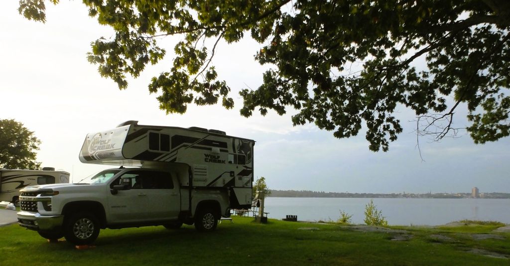
The next night we camped close to where the St Lawrence flows out of Lake Ontario.  Our campground was covered with large puddles and the ground was squishy everywhere.  We left our shoes on the back step of Pap to avoid tracking mud into the camper!
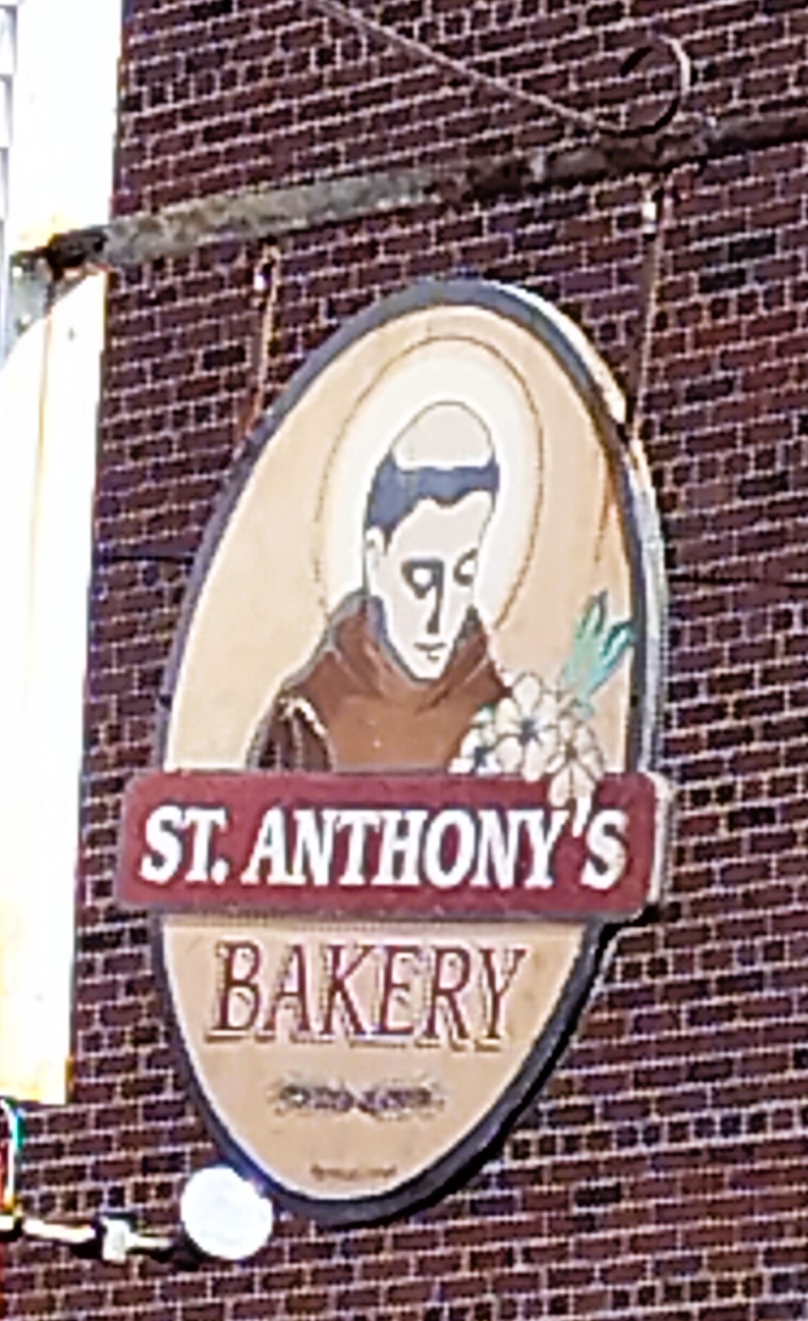
Fishes and Falls

The next morning, we visited a fish hatchery nearby on the Salmon River.  The hatchery was opened in 1981 to raise king and silver salmon and trout. 

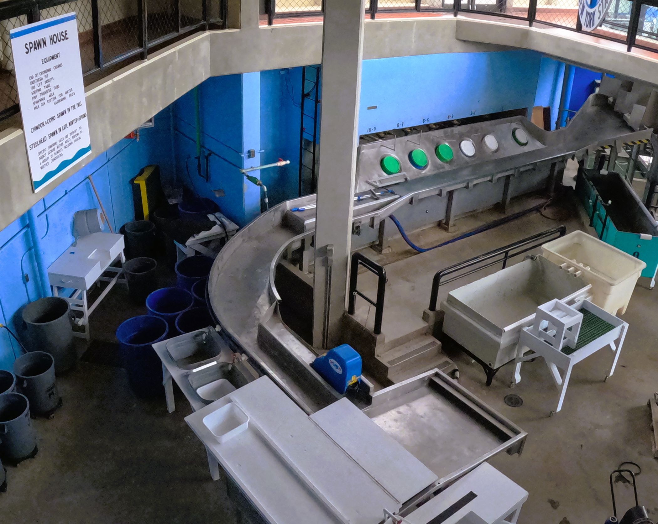
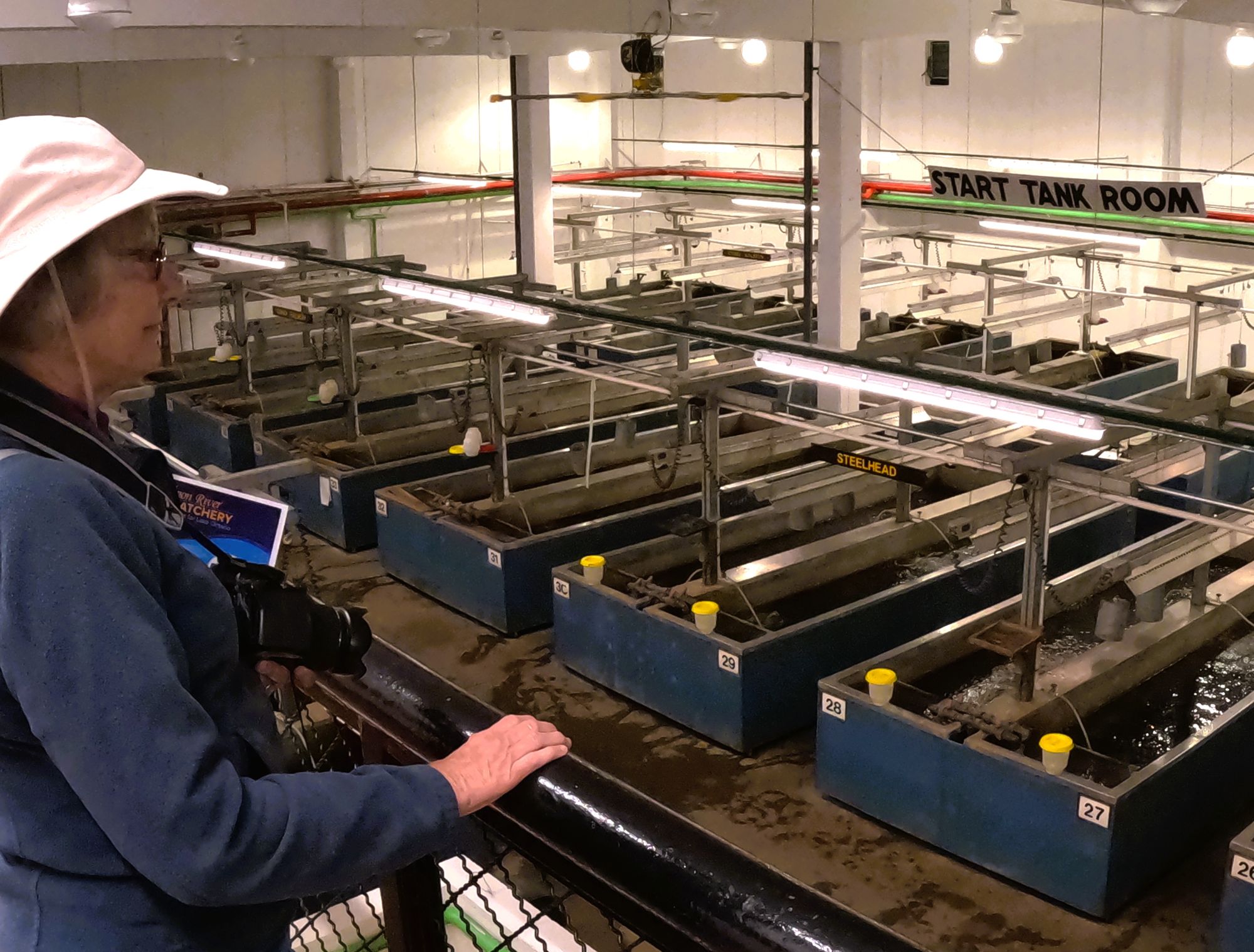
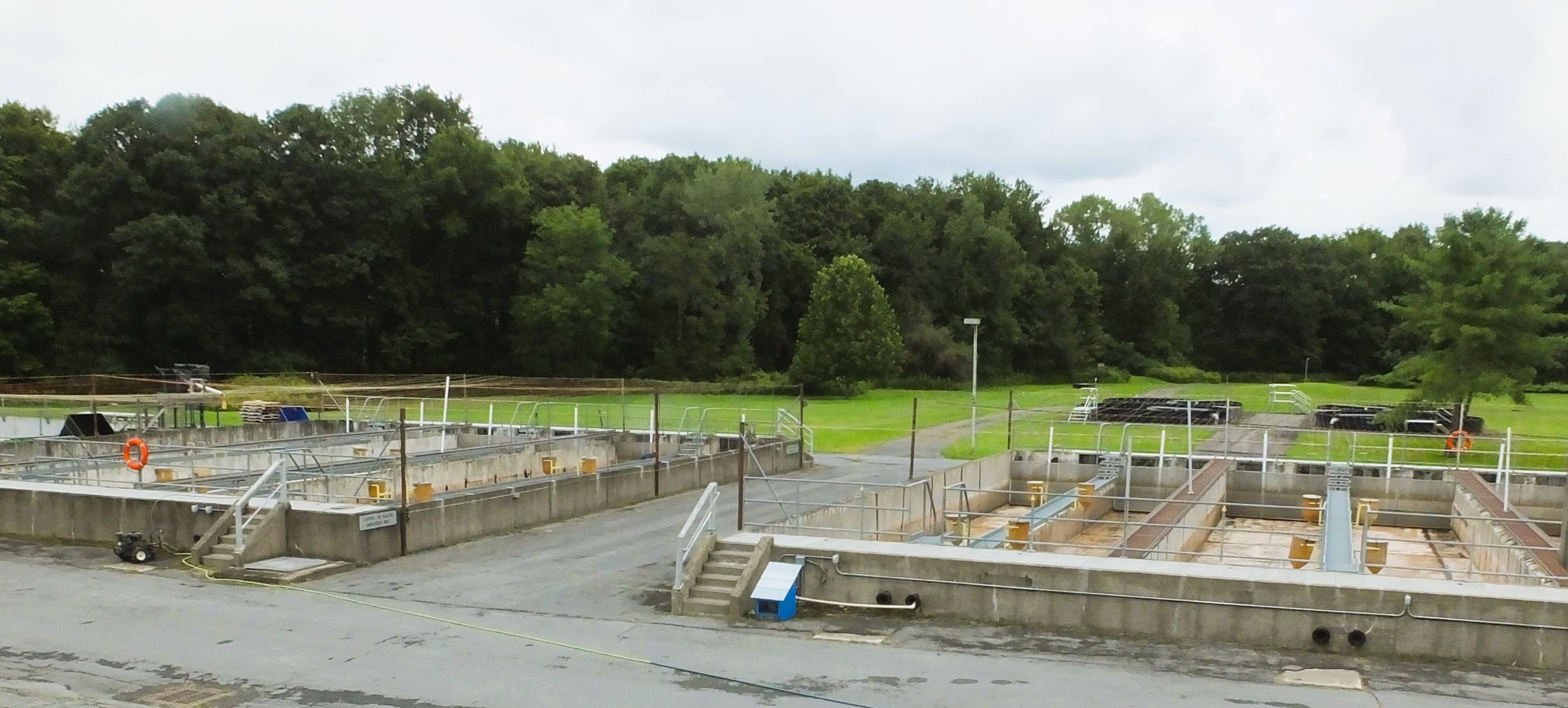
Salmon River Fish hatchery: stream where fish are directed to fish ladder, room where eggs and milt are harvested, developing fish are raised in indoor tanks and then transferred to outdoor tanks before being released

Millions of eggs are collected from adult fish, hatched, raised and released throughout New York’s Great Lakes and the rest of the state.  Egg harvesting takes place in the spring and fall, so it was quiet during our visit (mid-August).  We were reminded of hatcheries visited on past trips to Alaska and Oregon.

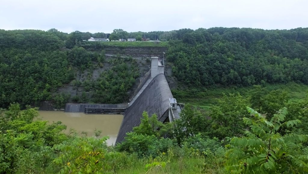
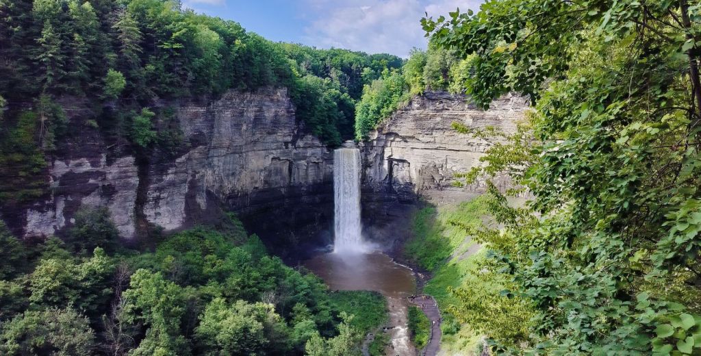
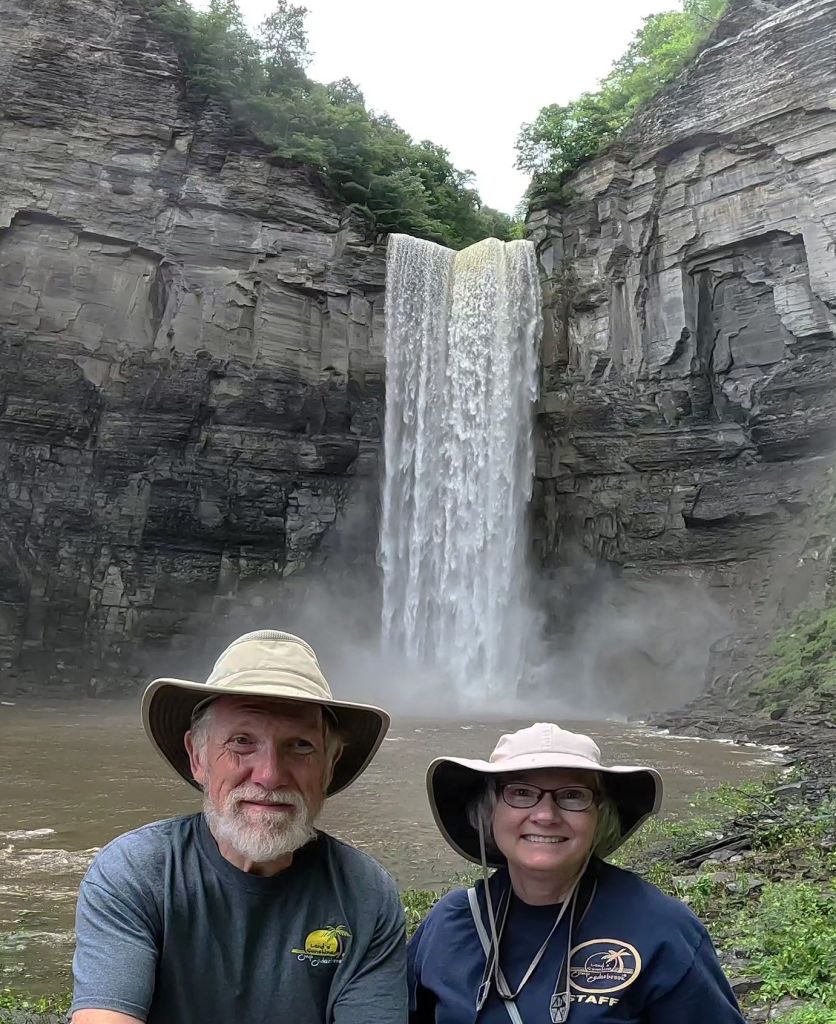
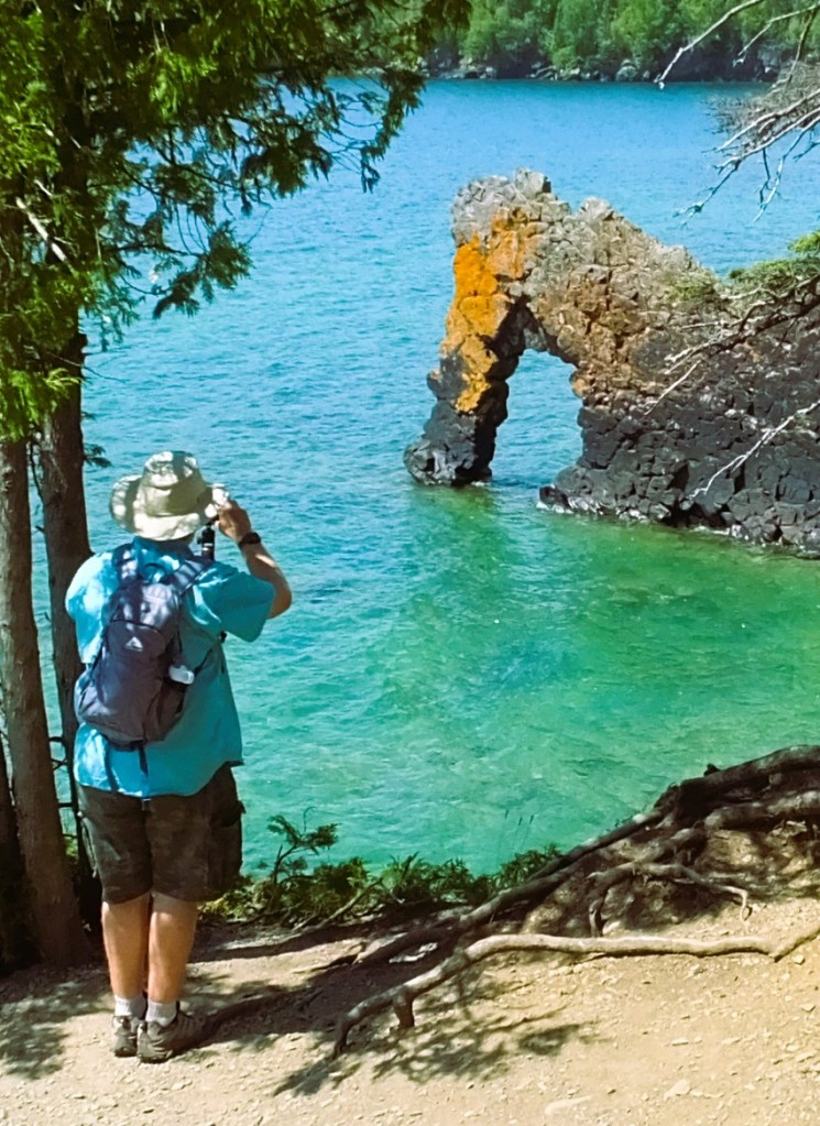
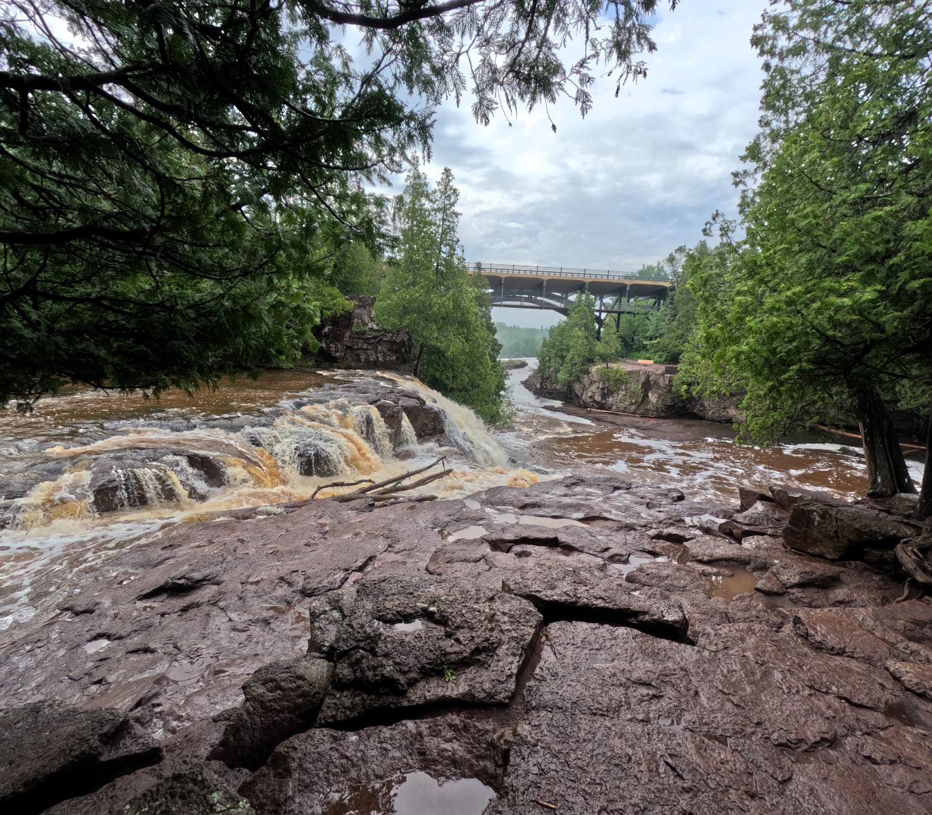
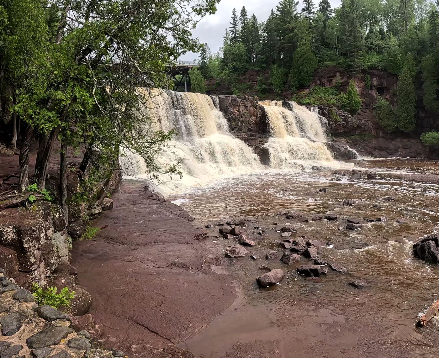
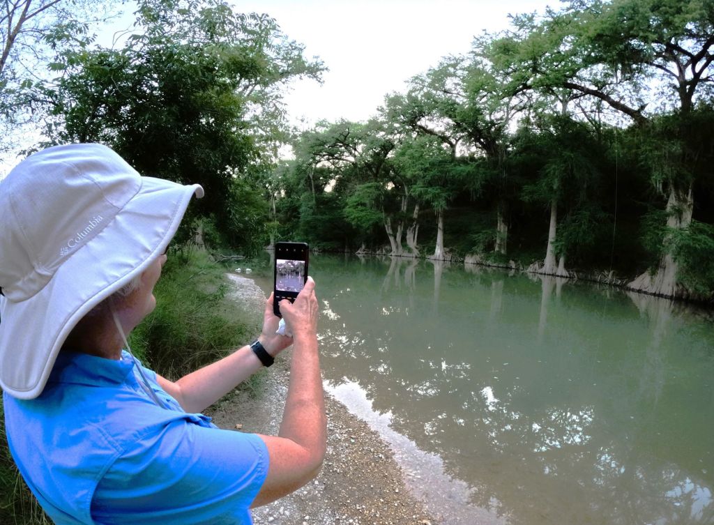
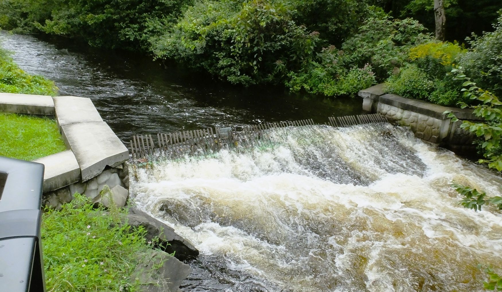
The Salmon River Falls were nearby, and we decided to check them out. 

Salmon River Falls, swollen by the recent heavy rains

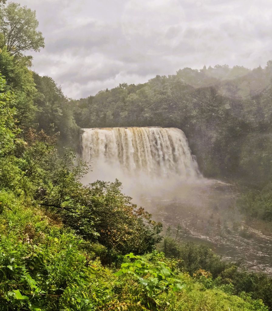
The falls were amazing!  Swollen from the recent rains, we could hear the falls nearly a mile away.  We carefully walked down a steep trail towards the base of the 110-foot falls but had to turn back to avoid being soaked by the falls’ mist cloud!

Salmon River Falls at normal water levels

More Waterfalls

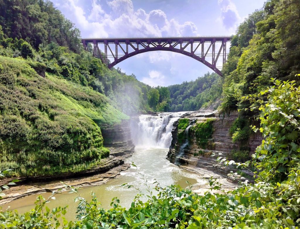
Our travels continued south into Pennsylvania, enroute to Ricketts Glen State Park.

Percy and Pap posing at Tunkhannock Creek Viaduct
Aerial view of the viaduct (image from Google)

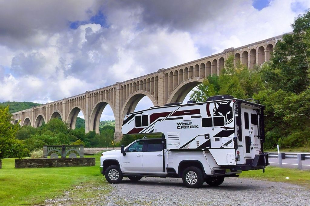
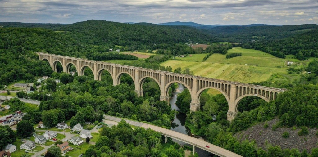
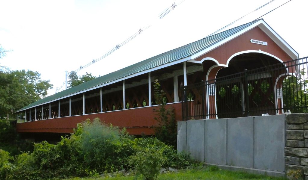
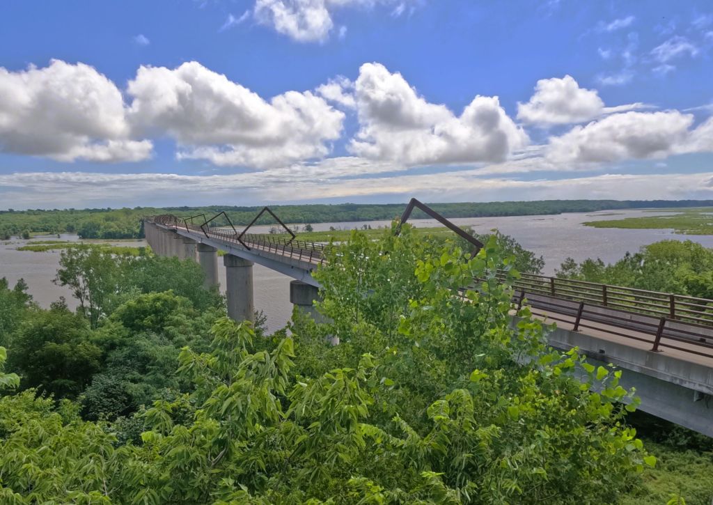
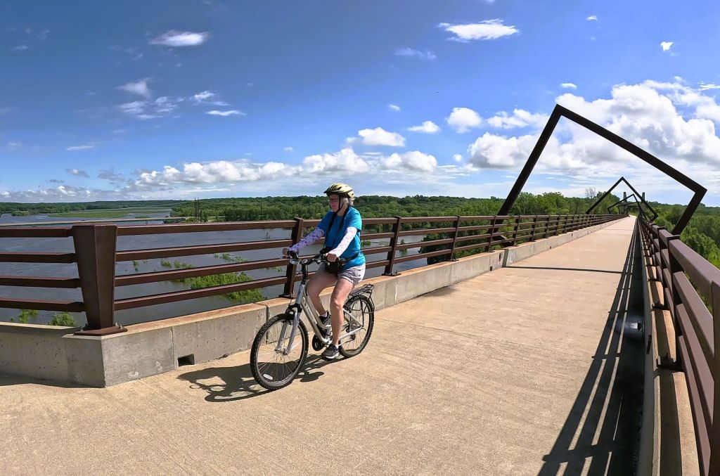
Passing through Nicholson, PA, we stopped at the Tunkhannock Creek Viaduct.  Completed in 1915, the half-mile long viaduct was the largest concrete bridge in the world at the time and regarded by some as the ninth wonder of the world.  The impressive structure is nearly 300 feet tall and still in use by Norfolk Southern freight trains. 

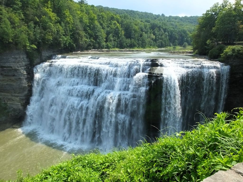
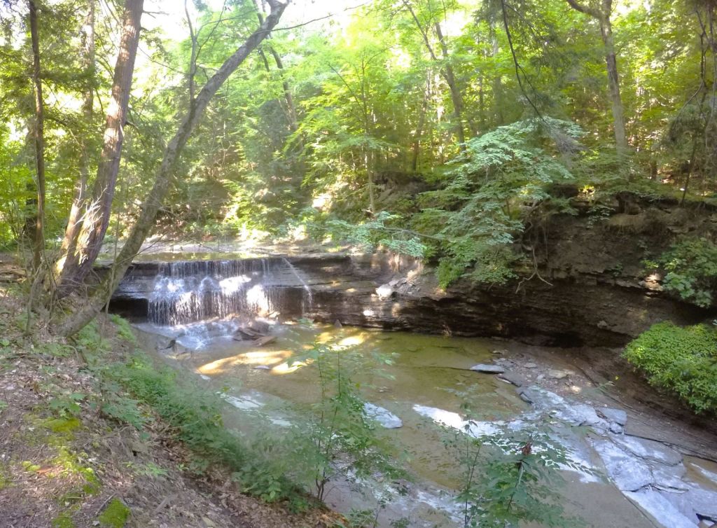
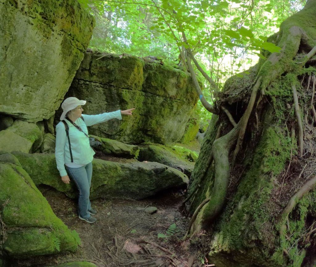
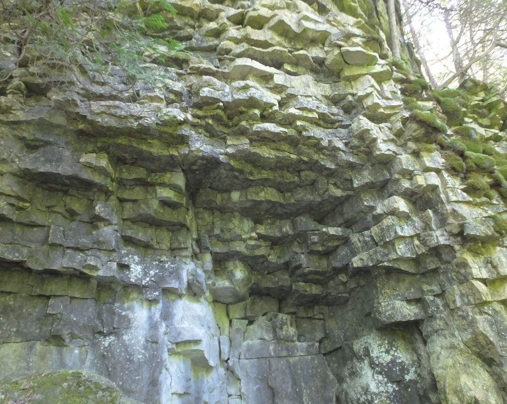
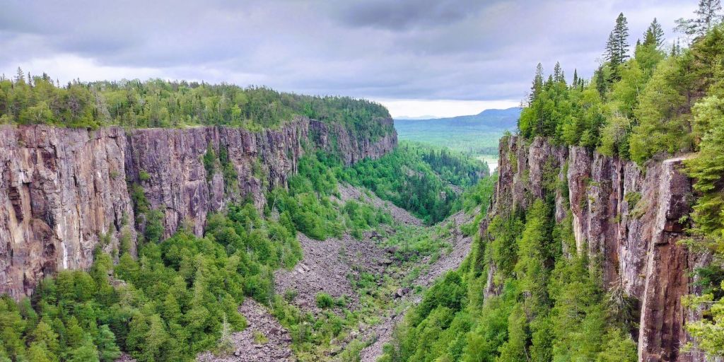
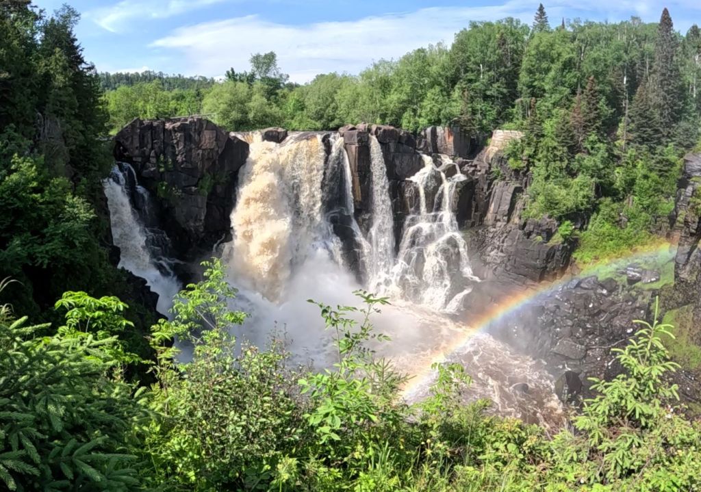
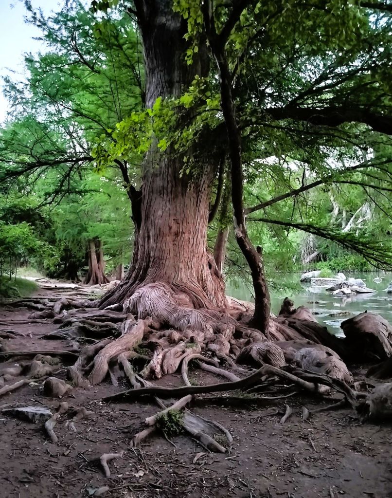
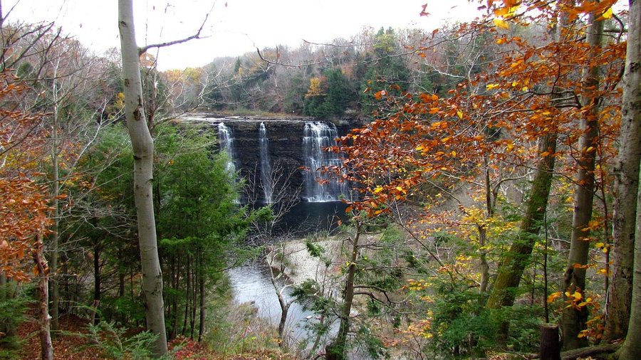
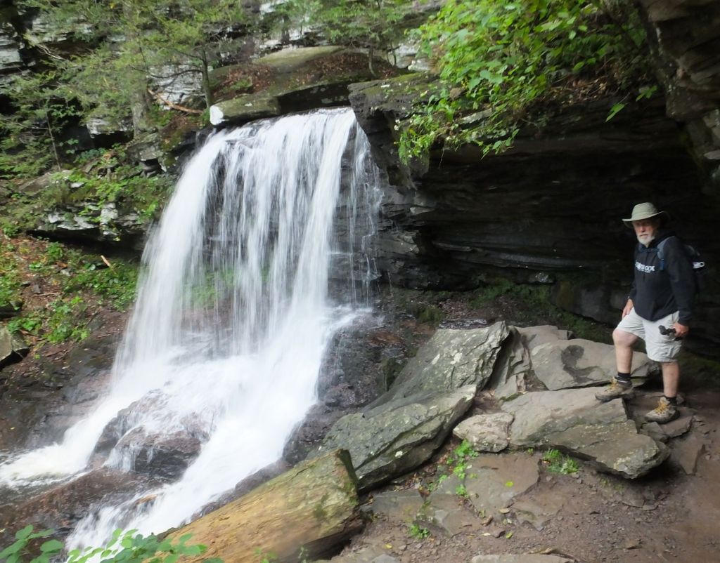
22 Falls at Ricketts Glen

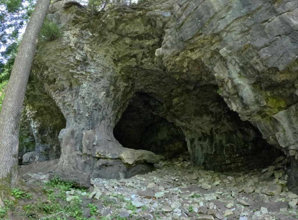
If you have a wish to see waterfalls, Ricketts Glen SP is the place for you.  In just over five miles of rocky, steep trails you can view 22 named waterfalls.  At 94 feet, the park’s tallest waterfall isn’t the size of Niagara (or Salmon River) Falls, but it and the other falls are beautiful.

Waterfall hiking at Ricketts Glen

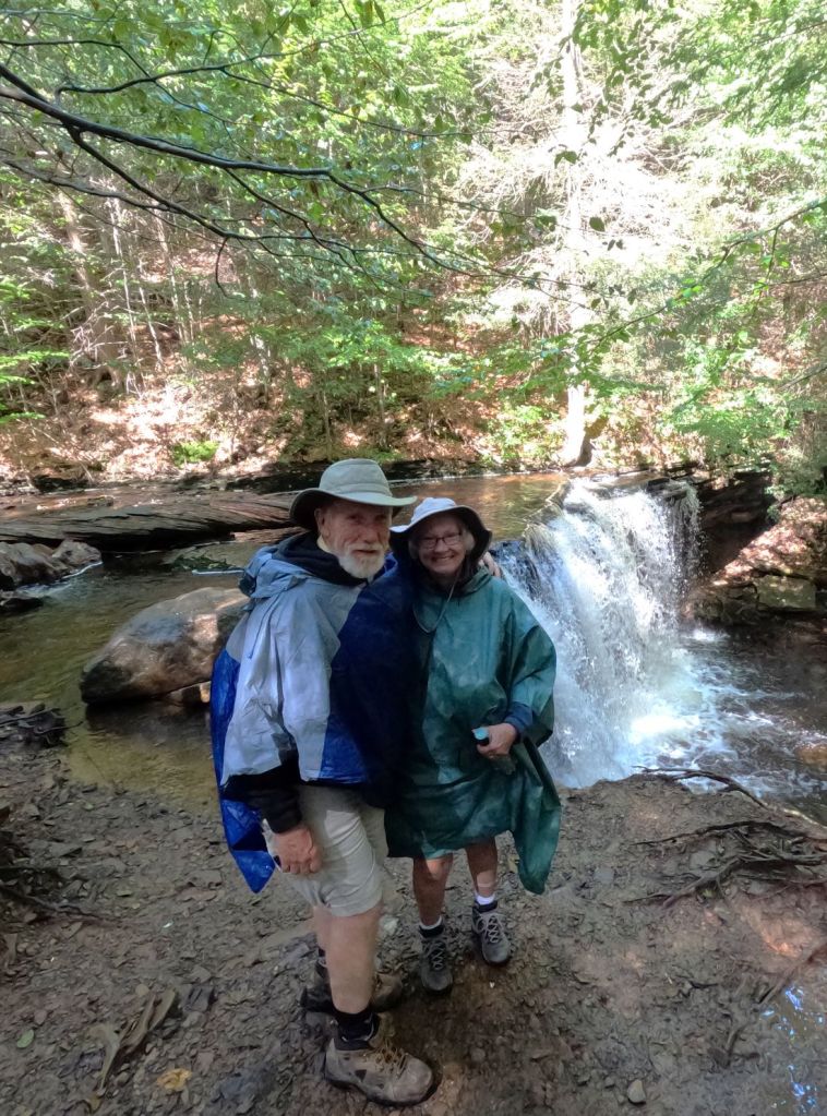
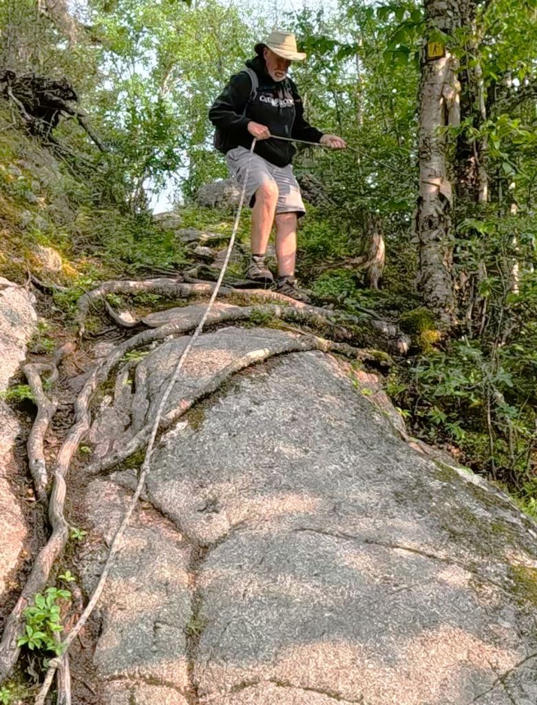
Our 3.5-mile waterfall hike went past 18 of the falls (the others are on a side trail that we didn’t take).  It was raining when we started, so we carefully descended nearly 500 feet down steep slick stairs and across large boulders. The falls were various sizes, and we stopped at each to enjoy the peaceful tranquility. 

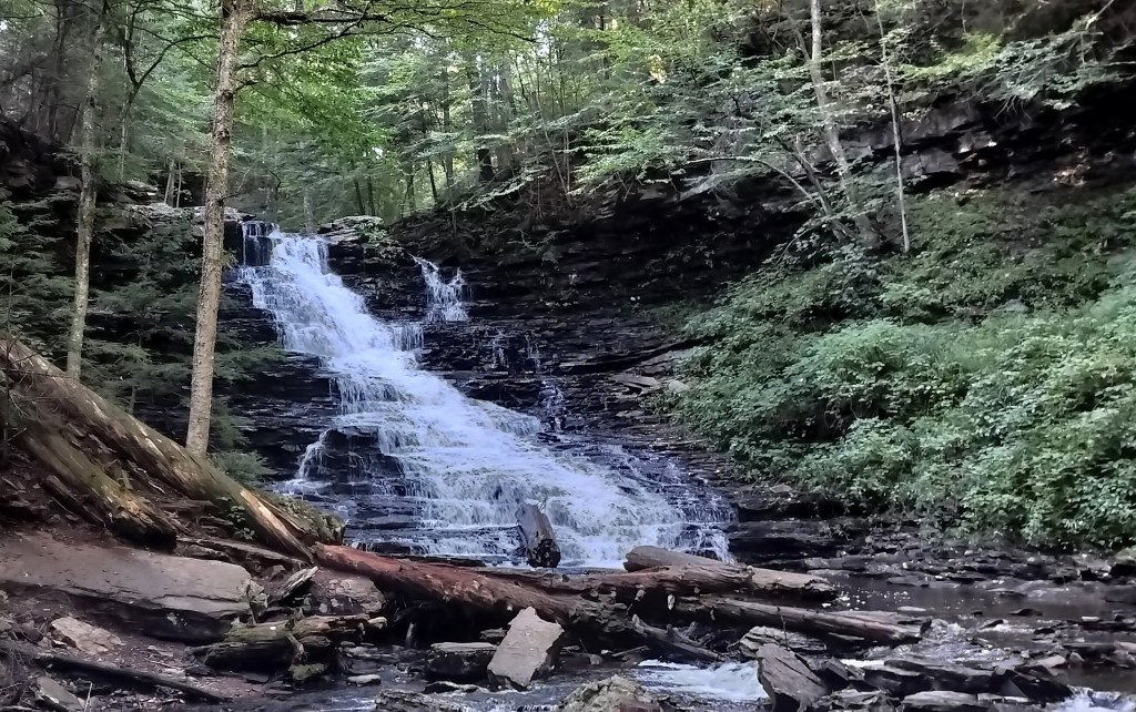
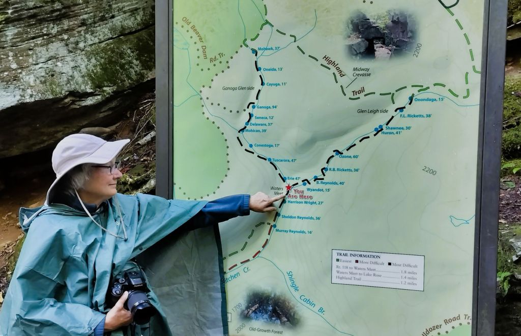
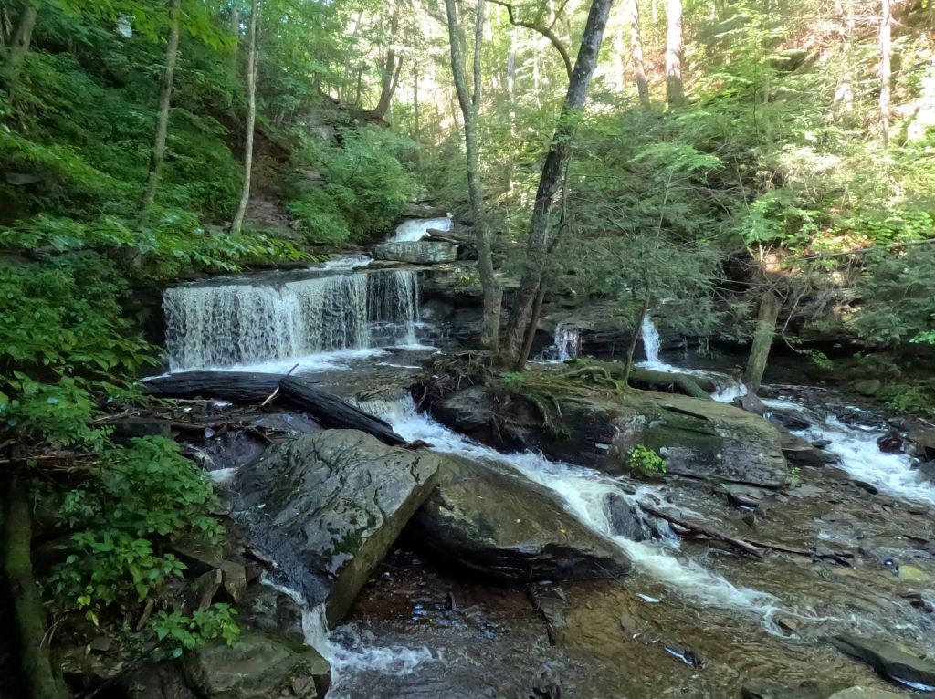
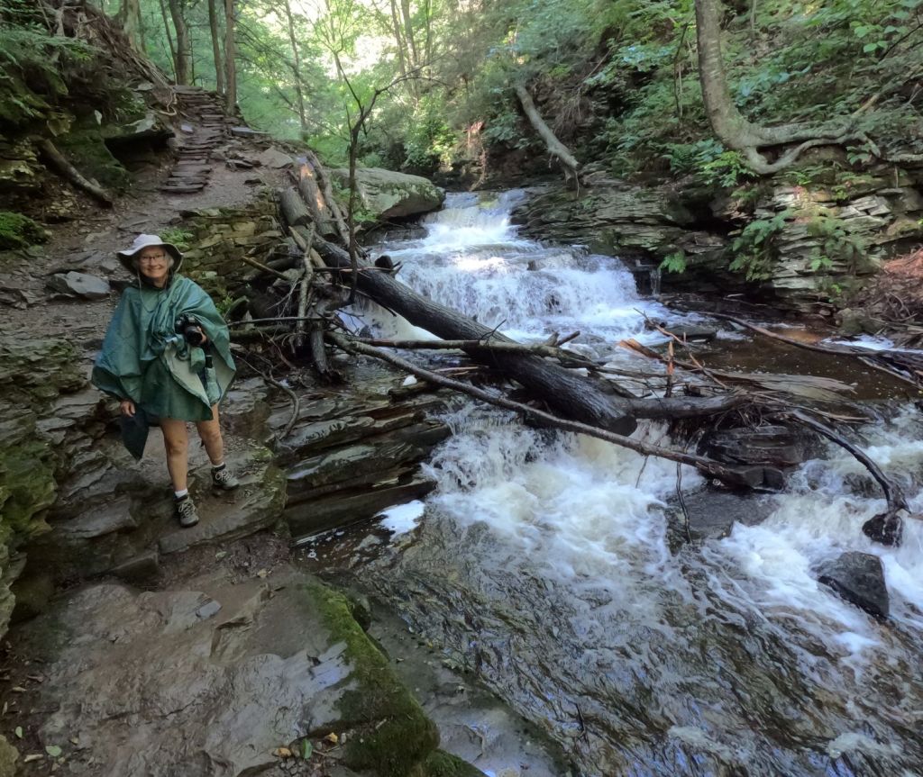
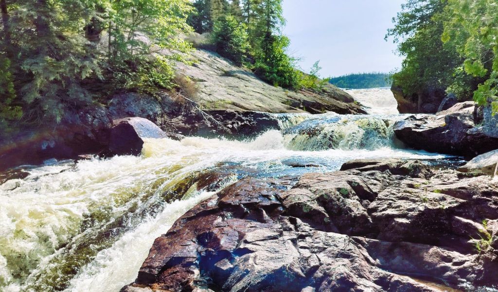
Various photos of our hike to 18 waterfalls at Ricketts Glen SP

The rain had stopped by the time we reached the bottom of our descent. We paused for a snack and enjoyed talking with other hikers, comparing the falls and reviewing trail conditions.

Stopping to look at another beautiful waterfall

The return part of the trail was a little easier.  Conditions were drier and, for us anyway, it always seems easier to climb a steep trail and stairs than the opposite.

The park has other trails and a nice lake. It is well worth a visit if you travel through central Pennsylvania.

Harper’s Ferry

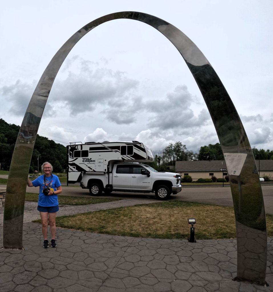
We drove southward from Pennsylvania into Maryland, then a tiny bit of Virginia and finally West Virginia. 

Harpers Ferry, WV (image from Google)

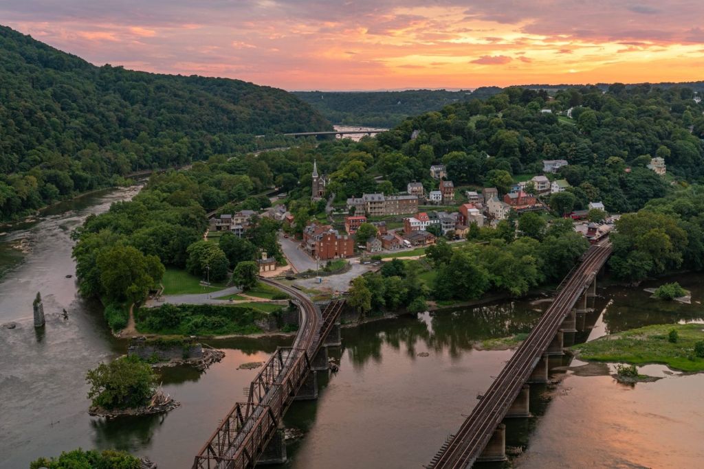
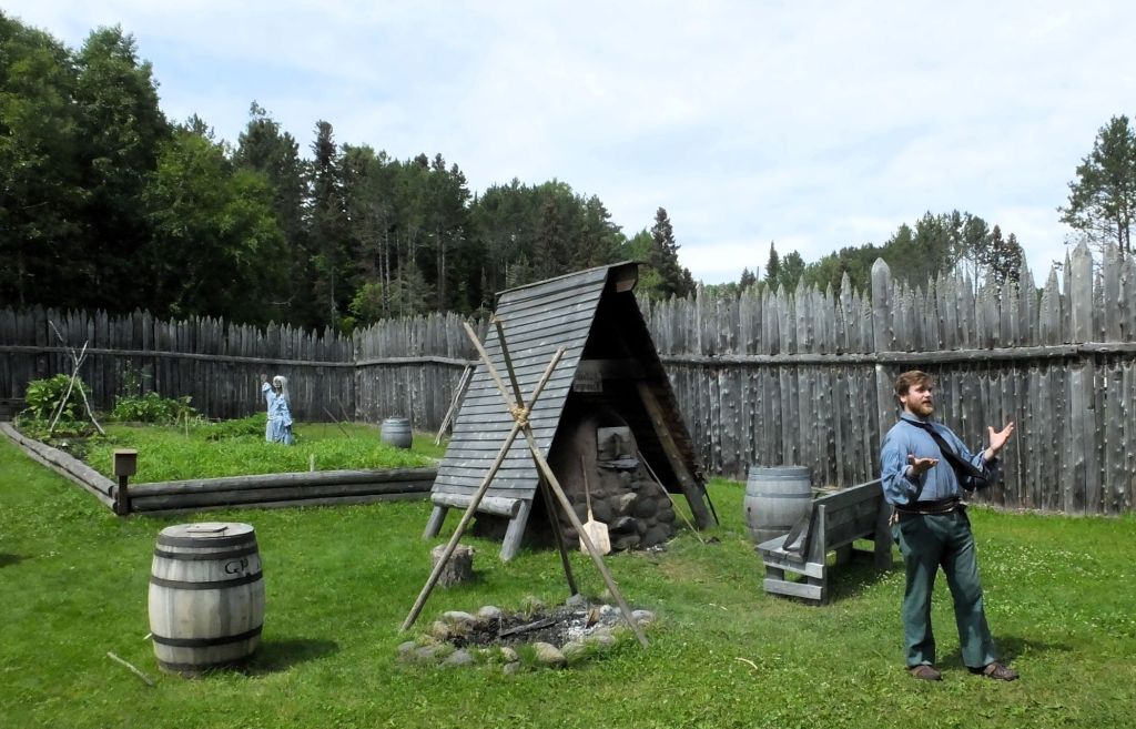
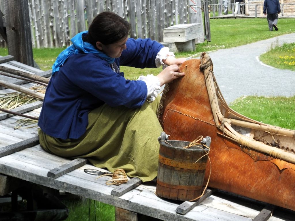
We visited Harpers Ferry National Historic Park at Harpers Ferry, WV.  The town is at the confluence of the Potomac and Shenandoah Rivers where Maryland, Virginia and West Virginia meet.  It is interesting looking around the well-preserved historic area. 

We learned the town was the northernmost point of the Confederacy during the Civil War.  It is also where abolitionist John Brown led a raid on the federal armory in 1859, hoping to start a slave rebellion.       

1993 Visit to Big Meadows with Pat’s sister and family

Driving the Shenandoah Skyline

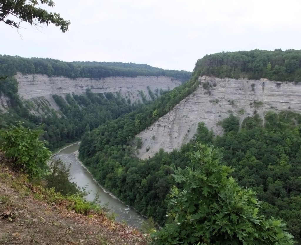
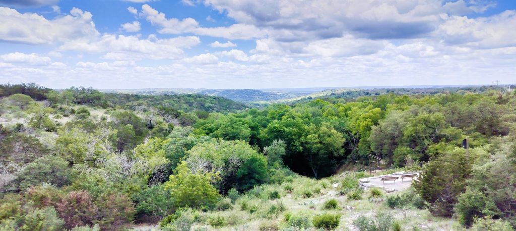
Some of our favorite vacations over the years have been driving the Skyline Drive in Virginia’s Shenandoah National Park and the Blue Ridge Parkway in Virginia and North Carolina.

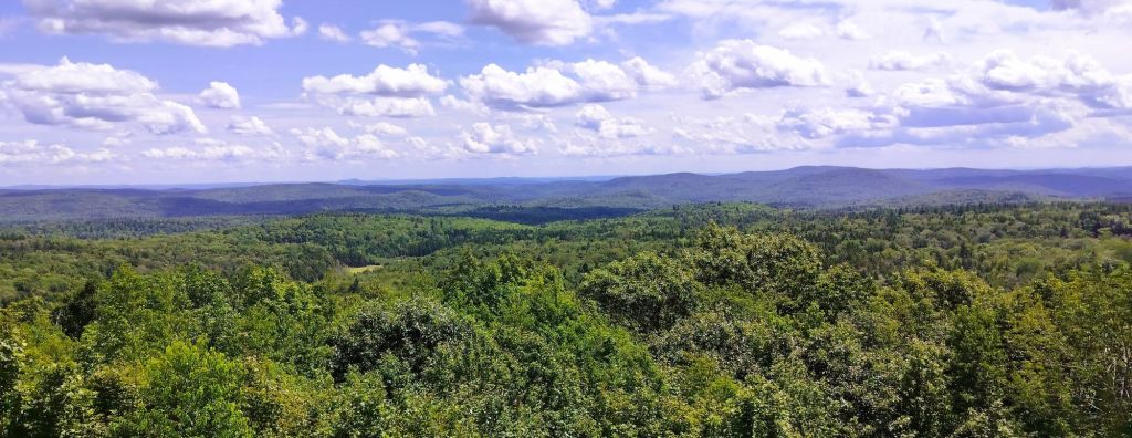
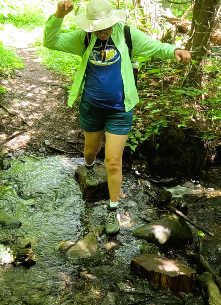
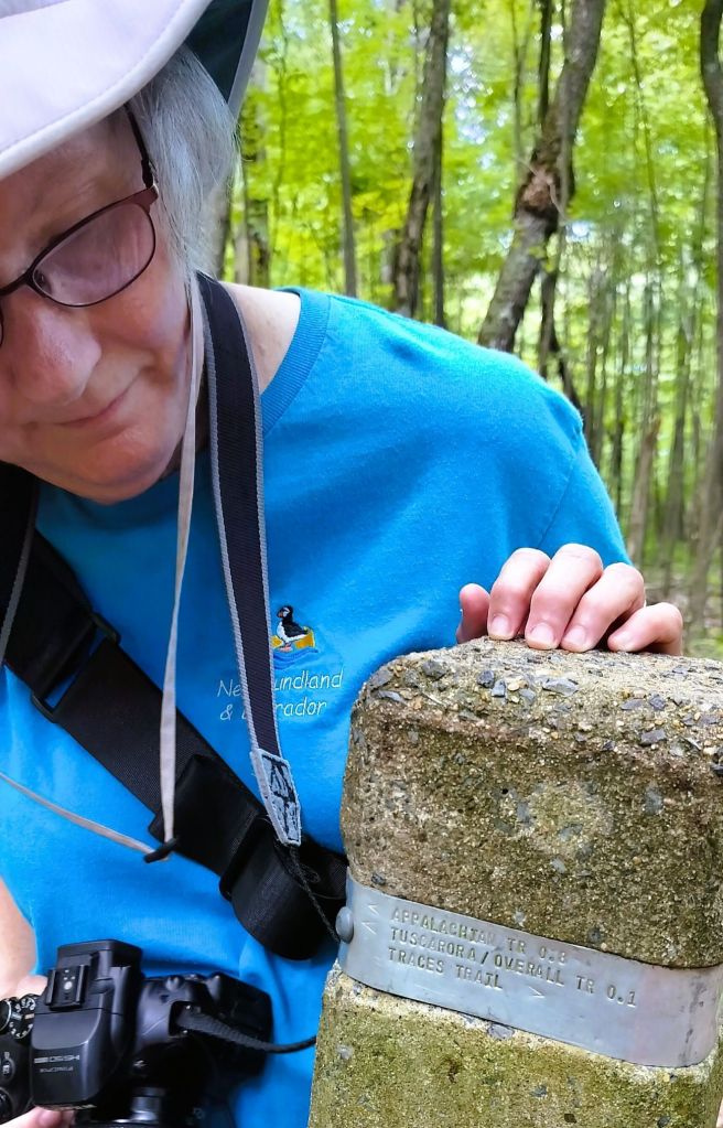
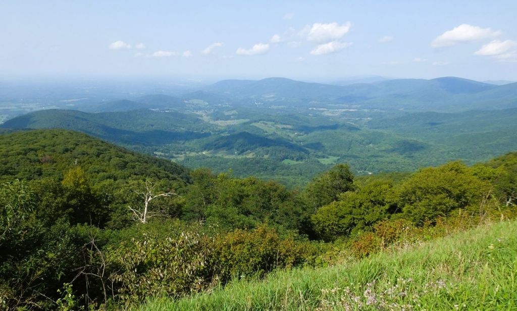
This trip we camped several nights at Matthew’s Arm campground at the northern end of the drive.  We hiked several short trails that took us along the Appalachian Trail.  The views of nearby valleys and distant mountains were nice, but not spectacular due to haze from fires in the far west.

Pat examines a band imprinted with trail information
This hazy view of the valley and distant mountains was still beautiful

We stopped for lunch at Big Meadows, midway on the drive, as we continued south.  Maintained by periodic burning, the 136-acre meadow is the largest open area in the park.  It is covered with a variety of flowering plants as well as blueberry and blackberry bushes.

Making blueberry jam at Big Meadows in 1989

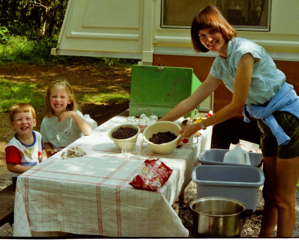
We recalled a trip with our children 35 (!) years ago when we picked blueberries and made jam at our campsite. 

Bearfence rock scramblers, 1993

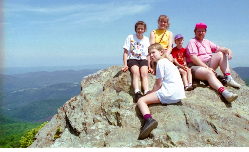
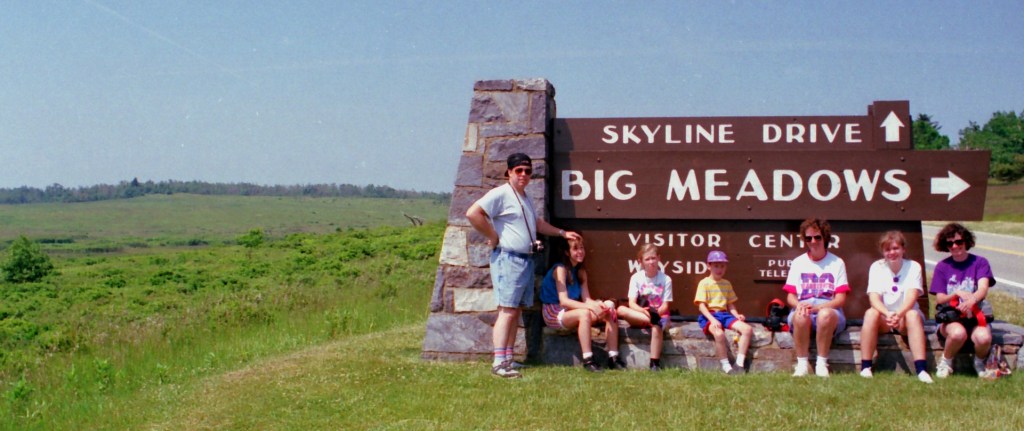
Further along we passed the trail to Bearfence. Over the years we scrambled over large, exposed boulders to a magnificent view of the distant mountains and Shenandoah Valley.   One rock scaling adventure in 1993 is captured above with a photo of our children and nieces.

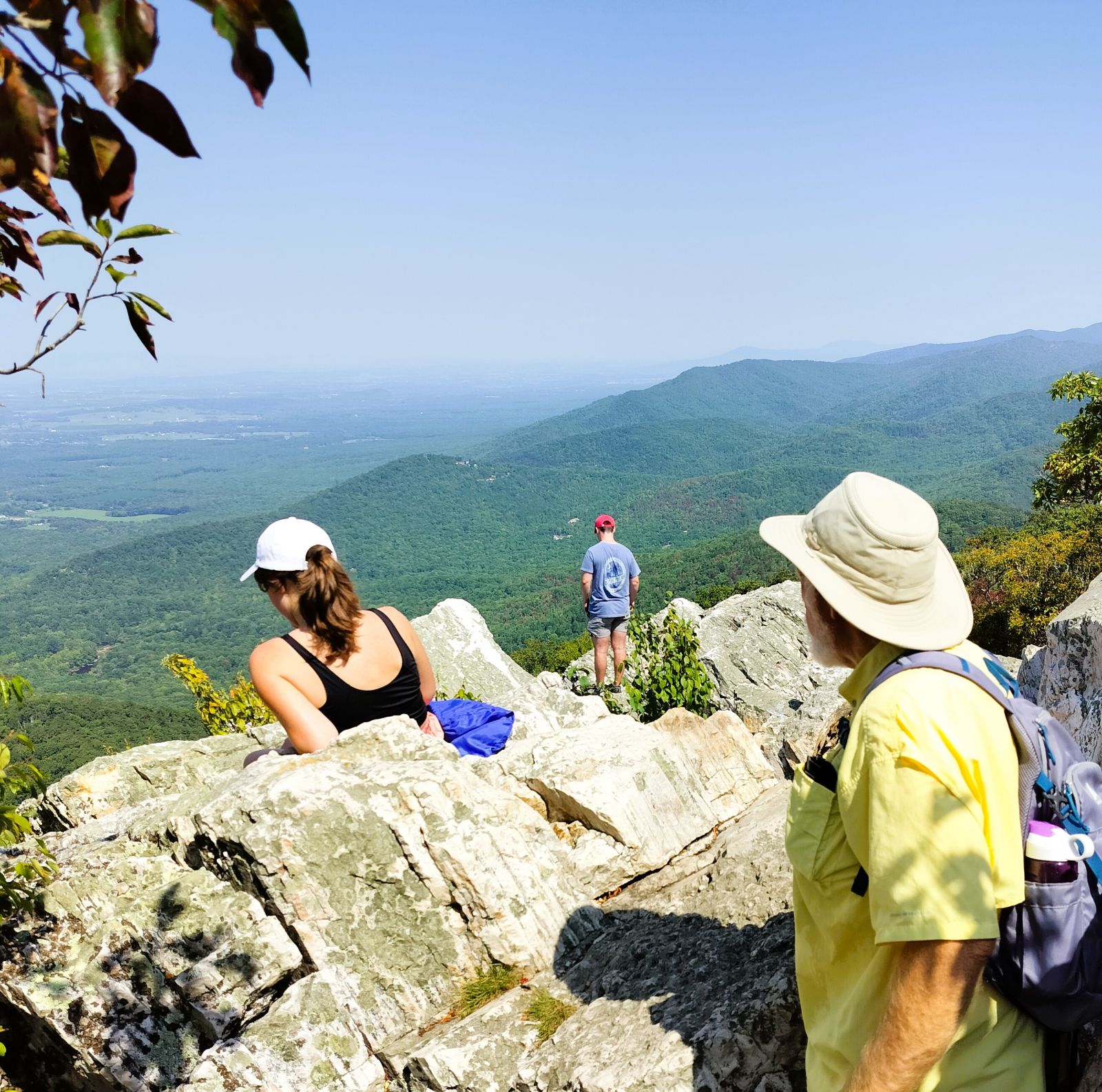
We spent a night at Lewis Mountain Campground, a new campground to us. The next day we ended our tour of the Skyline Drive with a hike to Turk Mountain.  The 2.2-mile trail was steep with a 690-foot elevation gain. It ended with a short rock scramble to an outcropping with wonderful valley views.  We caught up with a group of college students who passed us earlier and learned about their plans for the future. One of them took our picture to prove we made it all the way!

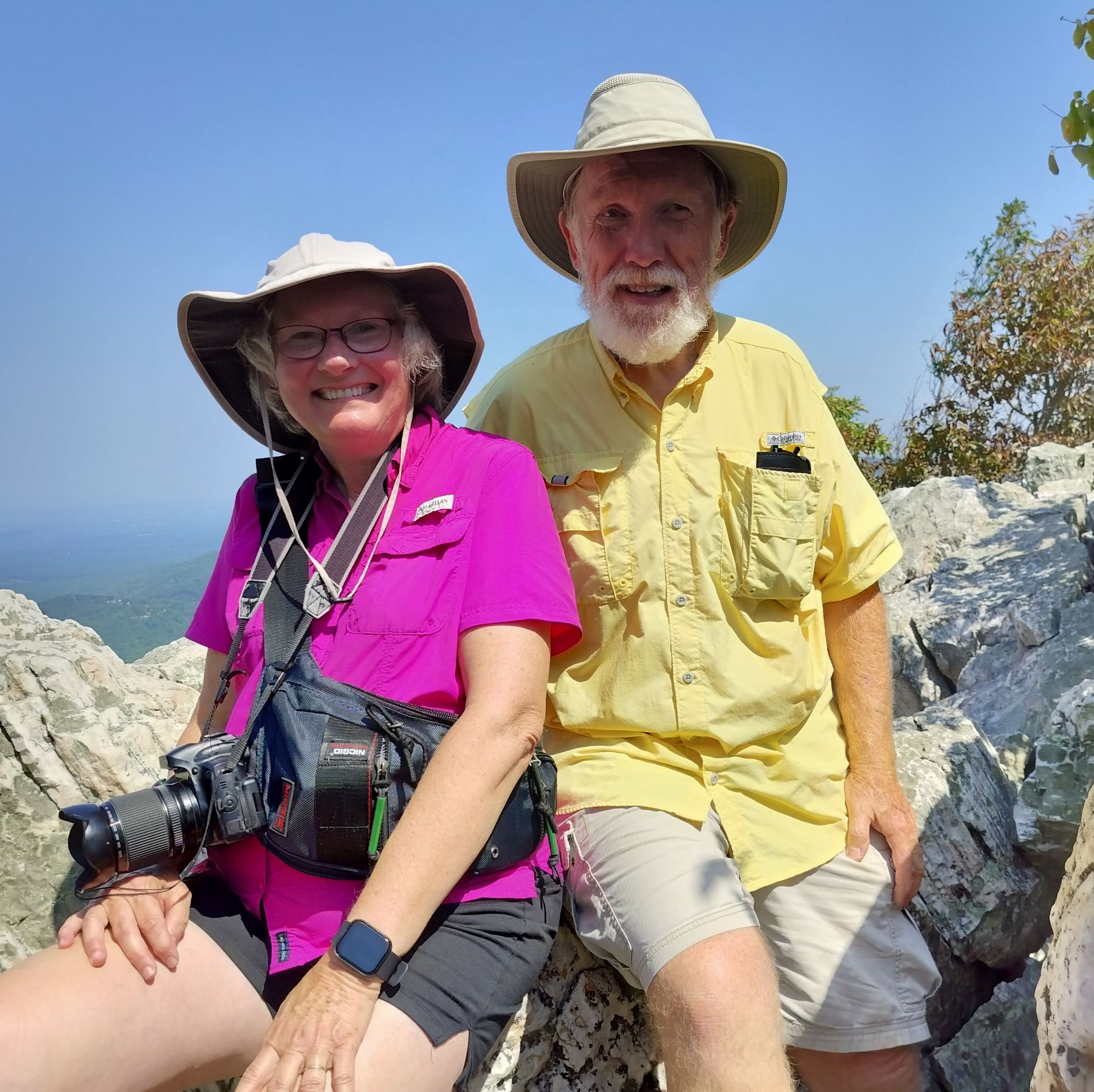
Photos taken at Turk Mountain viewpoint

Skylines to Blue Ridges

At the end of the 105-mile Skyline Drive the 469-mile Blue Ridge Parkway begins. 

Iconic Mabry Mill at MP 176 on the Blue Ridge Parkway

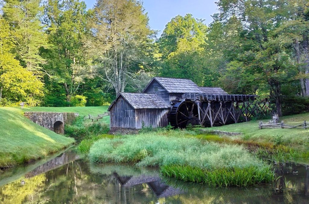
We stopped at several favorite landmarks as we drove south on the parkway and made an early morning stop at picturesque Mabry Mill.  The iconic landmark was built more than 100 years ago and was both a sawmill and grist mill. It is one of the most visited sites on the parkway.

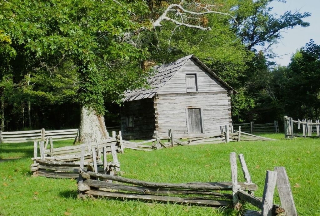
Our final stop on the parkway was at Puckett Cabin.  We marveled at the story of “Aunt” Orelena Hawks Puckett, who lived in the cabin during the latter half of her 102-year life.  She had a long career of midwifery, where she assisted at the births of more than 1000 babies.  What an impact she had on the people in that area!

Puckett’s Cabin at MP 189 on the Blue Ridge Parkway

A few miles beyond the cabin, we left the parkway to begin the two-day trip home. 

Our original plans were to spend more time in New England before returning home in late September or early October. Because of hazy conditions throughout the east, we moved more quickly than expected though.

Accustomed to longer trips, we wondered if we were going home early for some reason.  We found out soon enough.

A few days after our return, intense weather struck our area.

After two evenings of considerable rainfall, the small creek in our back year rose above its banks. The creek flooded our backyard and continued to rise until it crossed the road next to our house. This has happened only one other time in nearly 40 years.

Although the rising creek never hit the house, rising groundwater began to seep into our semi-basement downstairs room. The sump pump we installed years ago (and tested right before our trip) had failed.

After an emergency late evening trip to Lowes to purchase a drill-powered pump, we drained the sump pit and began the timely process of drying out the room over the next week.

Had we not returned earlier than expected, water would have covered floor of the room. Carpet and furniture would have been damaged, and we would likely have had to deal with mold and mildew.

Giving Thanks

We are thankful!

God is our refuge and fortress in whom we trust for safety and protection – during our 2024 Heartland travels, trips in the past and journeys yet to come!

Bridges, Buns and UFOs

Featured
(2024 Heartland Ep 12)
More than friends…brothers in Christ!

After crossing Vermont and New Hampshire, we stopped near the coast to visit a longtime friend, Norm MacLean.  More than 40 years ago, we worked in the same Prudential department, ate lunch together and played racquetball with several other guys.  Norm was even an usher at our wedding in 1980.  His friendship and spiritual mentoring have profoundly affected my life.

Norm moved to Massachusetts, and then New Hampshire, in the ‘90s. We have enjoyed several visits with him over the years. 

Evening photo on the Squamscott

We took a short walk from Norm’s apartment to downtown Exeter. The small village is situated on the Squamscott River, a few miles from Portsmouth. We passed Jailhouse Spring, where several locals were filling water jugs from the historied spring.     

George Washington was entertained in this building on November 4, 1879. Watching YouTube by candlelight?

We admired several historic churches in the center of the town and Norm pointed out the prestigious Phillips Exeter Academy several blocks away.  The school is the alma mater of three Nobel Prize winners and Meta (Facebook) founder and CEO Mark Zuckerberg.

Incident in Exeter

In addition to the numerous colonial-era landmarks in the area, Exeter was the location of one of the best-documented and publicized UFO sightings that occurred in 1965.  Today, the town hosts an annual UFO festival that marks the incident and raises funds for several children’s charities in the area. Unfortunately, we were too early for this year’s festival that occurred at the end of August.  

Norm was our tour guide for the day and took us to a variety of nearby attractions. 

Norm hangs ten in the chilly NH surf!

We stopped at Jenness State Beach, where wetsuit-adorned Norm surfs from time to time, and continued along the scenic coast, passing through Portsmouth and into Maine. We stopped at Chauncey Creek Lobster Pier for lunch and watched several frisky lobsters skittering around a small tank. We decided on fish and shrimp instead, enjoying our meals at an outdoor picnic table overlooking the creek.

It was a warm and sunny day to enjoy lunch at Chauncey Creek
Banded lobsters waiting to be someone’s dinner

A while later we walked a short trail around Steedman’s Woods. We accessed it via Wiggly Bridge, a short span that crosses a swift flowing arm of Barrell’s Millpond. The bridge is said to be the smallest suspension bridge in the world. Regardless, it is definitely wiggly!

From there, we made a late afternoon stop at Nubble Lighthouse (photo at top of blog post). Sitting atop a tiny island near York, ME, the 41-foot lighthouse was built in 1879.

The Bush Compound at Kennebunkport

Our day came to an end as we passed through Kennebunk, ME bound for Blowing Cave Park.  Beyond the park’s crashing waves and misty sea spray, is Walker’s Point Estate, summer retreat of the Bush family.  It was the home of George HW (#41) and Barbara Bush. 

Several vehicles were parked in front of the house. We wondered if George W (#43) and Laura Bush were visiting.

Covered Bridges

There are LOTS of beautiful covered bridges throughout New England. They are reminders of quieter and simpler times. We wonder if there is a blog dedicated to covered bridges that includes a route to the best bridges in New England.

Today, some of the bridges have been closed to vehicle traffic. Others have been rebuilt. There are even new covered bridges that resemble the old bridges. Our journey took us by (and across) several of them. We had to detour several times because Pap was too tall!

Enjoy our covered bridge photos below.

White Horse Villa
White Horse Villa in 1930 (from an old post card)

In 1954 my dad retired from the US Navy and purchased the White Horse Villa in North Conway, NH.

The Villa was built in the 1800s. It is located near White Horse Ledge, a glacier-carved 800-foot granite cliff, and an oxbow on the swift-flowing Saco River.

My dad, mom and brothers spent the next six years renovating the old place. I was born in 1957.

The house was sold in 1960 to a ski club from the Boston area (they still own the property) and our family moved to Florida.

White Horse Villa (from a family photo)
White Horse Villa in 2024
Best Cinnamon Buns in Exeter

Before embarking on our coastal tour, Norm took us to two delightful cafes in downtown Exeter to sample their cinnamon buns.

St. Anthony’s is a classic kind of place, with friendly staff and great coffee. We split our fresh flaky bun three ways, enjoying the nice cinnamon flavor and rich frosting.

A few blocks away, Me and Ollies has a more modern coffee shop vibe, where they serve up specialty coffees and baked goods. Their bun had soft and pillowy coils of a biscuit-like dough with icing drizzled on top.

The buns were unique and very good – 4s on a scale of 5!

Next Week

Our 2024 Heartland blog series wraps up with stops in Pennsylvania, West Virginia and Virginia.

We returned home several weeks earlier than originally planned. The timing was perfect, however.

Camping Tales and Hurricane Gales

Featured
(2024 Heartland Ep 11)

(It’s been a rather eventful month since we returned home.  We’ve endured Helene and Milton, two major hurricanes, and seepage in our downstairs, when our sump pump failed during heavy rains before the storms.  Dried out and thankful for minimal impact from the severe weather, we hope you’ll join us as we keep those affected in prayer)    

Following our second week of summer camp, we stopped in nearby Madison, Ohio to catch up on laundry and to start the drive east toward New Hampshire.  We planned to visit a close friend in Exeter, NH and to continue to Conway, NH where Ed was born and where we would visit the White Horse Villa, an old boarding house that Ed’s parents once owned.

We camped that night in a parking area behind Warren Free Methodist Church in Warren, PA. 

Pat and Pap pose under the Baby Arch in Warren, PA
Baby Arch

During a grocery run to a nearby Walmart, we stopped to see the 14-foot Baby Arch erected to recognize area workers who fabricated the stainless-steel pieces used to construct the Gateway Arch in St Louis, MO.   They intricately measured, cut and ground wedge-shaped pieces to fit with other segments of the arch. The pieces were shipped via trains and semi-trucks to St Louis where the 630-foot arch contains more than 900 tons of stainless steel.

Pat takes a photo under the St Louis Gateway Arch in August 2021

After church the next morning, we continued north to New York.

Upper Falls and Genesee Bridge at Letchworth State Park

At Letchworth State Park, we hiked to three waterfalls on the Genesee River as it winds through a canyon that is up to 550 feet deep. Letchworth is renowned as the Grand Canyon of the East.  

Middle Falls at Letchworth State Park
Letchworth’s Grand Canyon of the East is up to 550 feet deep

The next afternoon we toured Mt Morris Dam, several miles downriver from the waterfalls.  The dam, 1028 feet long and 230 foot above the riverbed, does not have a reservoir.  Instead, it is the largest concrete gravity flood control structure east of the Mississippi River.  It holds excess flows of the Genesee River to prevent flooding of agricultural land and the city of Rochester, NY, 35 miles away.  

Genesee River floods are prevented by the Mt Morris Dam

The visitor center at the dam has photos of repeated floods of Rochester before the dam was completed in 1954.   In 1972, flood waters from Hurricane Agnes nearly crested the dam as it protected Rochester from serious flooding. We found that amazing considering the height of the dam!

Debby’s track was just to the east of where we were camped in western New York
In the Path of Debby

Fast forward to 2024. We learned that Hurricane Debby had struck the Big Bend area of Florida and was headed up the east coast toward us.  With a forecast of heavy rain and gusty winds and a track somewhat near where we were camped, we decided to stay in the Finger Lakes area in western New York for a few days to let the storm pass. 

Hurricanes and RabbiTRAILS

Since retiring in 2018 have our travels distanced us from the threat of hurricanes?  Nope. 

Hurricane Michael struck Panama City, FL in 2018 as we returned from Alaska.  We took multiple trips to the Florida Panhandle to help with Samaritan’s Purse relief efforts.

Two years later, our travels were affected by two hurricanes – by Delta, as we camped near Roanoke, VA, and a few weeks later, by Zeta north of Atlanta, GA. 

In 2022, we were stranded with truck engine problems in North Sydney, Nova Scotia as Hurricane Fiona approached from the south. We escaped just in time to a safe campground a couple hundred miles away in New Brunswick. Then, after returning home, we again worked with Samaritan’s Purse in Ft. Meyers after it was devastated by Hurricane Ian.

If you’re from Florida, dealing with hurricanes is how it rolls.

Western New York – Gardens and Locks

Our New York travels continued with a visit to the Buffalo Botanical Gardens. The gardens, competed at the end of the 19th century, include a magnificent glass covered conservatory that houses tropical and other plant species and several small ponds of colorful koi fish.

We also visited locks on the Erie Canal in nearby Lockport. During a sunny afternoon cruise, we learned the history of the locks and 363 mile canal that goes from the Hudson River westward to Buffalo and Lake Erie. Completed in 1825, the canal, sometimes called our nation’s first superhighway, was 40 foot wide and four foot deep. Today, the enlarged canal is mainly used by recreational watercraft.

There are two sets of locks at Lockport – to the right is the Flight of Five, five narrow locks originally on the canal.
Those locks were replaced by two wider and taller locks in 1918.
Taughannock Falls
We enjoyed a short walk to Taughannock Falls. The falls plunge 215 feet over rocky cliffs that tower nearly 400 feet above the gorge.

Thankful for moderate rainfall and no strong winds from Debby, we continued east through Vermont and New Hampshire.

Our first view of mountains in Vermont – likely spectacular during October’s fall colors
We enjoyed a cool Saturday afternoon at a roadside flea market in New Hampshire
Next Week

Visits to old bridges, an old house and a friend of more than 45 years in the Granite State.

What’s Better Than A Week of Camp?

Featured

Read to the end to find out

(2024 Heartland Ep 10)

(We’ve been taking a break from blogging to return home and recover from our travels. Rested and nearly caught up on everything, we return to our 2024 Heartland journey…)

Arriving at CCO for a second week of camp

As July came to an end, we arrived at Madison, Ohio for a week on staff at Cedarbrook Camp of Ohio.

This was our second week at a Cedarbrook camp this summer.  There are a dozen Cedarbrook camps across the US that seek to provide a Christ-centered, safe and fun camping experience.  

We served at the Land o’ Sunshine (Florida) Camp Cedarbrook for more than 25 years and began serving at other Cedarbrook camps after the Florida camp was discontinued in 2016.

Cedarbrook Camps

Like many other summer camps, Cedarbrook camps offer various activities like archery, riflery, camping skills, nature, crafts, swimming, canoeing and lots more.   What attracts us to Cedarbrook camps is their emphasis on Christian principles in all aspects of camp and the development of practical life skills for campers.  The camps are staffed by adult volunteers who view camp as personal ministry.

Scenes from CCO – waterfront area used for swimming, canoeing, kayaking and fishing, archery targets, and getting a watermelon ready for a fun game of greased watermelon football at the lake!
Similar…

Cedarbrook camps have many similarities.   All have individual morning devotions and counselor-led Bible studies.  Evening programs include fun age-specific and all-camp activities followed by singing and an evening campfire/talk.  Singing ranges from traditional fun camp songs to worship and praise songs.  One evening each week cabin groups cook their evening meal over a campfire. 

And many Cedarbrook camps offer intense multi-year counselor leadership training for older campers.

…And Different

There are some interesting differences in the camps as well.

Heat and humidity are a challenge at camp in Texas, so the cabins and other camp buildings are air conditioned. Evening programs don’t always include a campfire.

At Ohio camp, days are mostly pleasant and nighttime temps can even get chilly (at least by Florida/Texas standards). There is no air conditioning and floor fans are sufficient.

Daily flag raising

Like Texas camp, Ohio has a morning flag raising ceremony with traditional bugle calls (played on a trumpet and saxophone), the Pledge of Allegiance and the national anthem.

Peaceful waterfall at the bottom of the glen

The Ohio camp uses facilities at Stony Glen Camp located 35 miles east of Cleveland.  The large site is situated along the Grand River.  There is a nice pond for swimming and fishing, and several ravines offering challenging hikes to scenic waterfalls.

Cabin groups eat their meals family-style (Texas meals are served cafeteria-style), and, in addition to the dinner cookout each week, Ohio campers cook their breakfast over a campfire.  Canned-biscuit donuts cooked in hot oil and rolled in sugar are a favorite!

Fresh-cooked donuts are a favorite at the morning cookout

Ohio camp is held for four weeks, with three weeks for girls and one week for boys.

Practicing fire building skills in a string-burning contest
How We Served

Pat and I taught fire-building and outdoor cooking to third/fourth grade boys, assisted with other activities and helped close camp for the summer.

We were blessed to serve at Texas and Ohio camps this summer, and hope to return in the future.

The Friday night campfire was a highlight of the week
Next Week

We head east from Ohio, with stops in Pennsylvania and New York, and hunker down for a couple days to allow Hurricane Debby to pass.

So, what’s better than a week at camp?

Flying Saucers and NFL Pigskins

Featured
(2024 Heartland Ep 9)

As our travels across the north shore of Lake Superior came to a close, we made a brief overnight trip across the US-Canada border to Sault Ste. Marie, Michigan.   There, we purchased gas and groceries because they were much less expensive than in Canada.

We returned to Canada and continued across the top of Lake Huron, the second largest of the great lakes. 

Some Great Lakes geography (see map): 

Lake Superior, at 21 feet higher elevation, flows into Lake Huron via the St Mary’s River at Sault Ste. Marie.   Lake Huron and Lake Michigan are the same level connected by the five-mile-wide Straits of Mackinac.  Some consider the two lakes to be a single lake. 

Lake Huron flows south into Lake Erie via the St. Clair River near Detroit.  Lake Erie empties into Lake Ontario via the Niagara River, and Lake Ontario continues on to the Atlantic Ocean via the St Lawrence River.

Back to the USA!

We cut our Lake Huron tour in half by taking a ferry across Lake Huron to Tobermory, Ontario.  At nearby Wiarton, we hiked to Bruce’s Cave burrowed underneath the Niagara Escarpment. The escarpment runs from Wisconsin to New York and is the same formation associated with Niagara Falls.

Bruce’s Cave, near Wiarton, Ontario
Our escarpment hike included hiking through narrow passages and rock scrambling amidst interesting rock layers

We drove south to Port Huron, Michigan and Ohio. It was about a week before our second planned week on staff at Cedarbrook Camp of Ohio, so we decided to visit the Air Force Museum near Dayton, Ohio. 

Our Ada, Ohio chicken ambassadors laid multicolored eggs
Eggs and Footballs in Ada

Halfway to Dayton, we spent the night at a Harvest Host location in Ada, Ohio.  Our host’s home was located a mile out of town, surrounded by soybean and corn fields.   The owner had several laying hens, and we purchased a dozen multicolored farm fresh eggs that we enjoyed for breakfast over the next several mornings. 

The colorful eggs tasted the same to us.

Touring the football production facilities in Ada

Eggs aside, Ada has the interesting distinction of having a Wilson Sporting Goods factory where every leather official-size NFL football has been handcrafted since 1955.

Super Bowl footballs on display, including one from Super Bowl XXXIX

We toured the busy football manufacturing plant, watching large pieces of leather being cut into four-piece football-shaped stacks.  The stacks are sewn together with a special liner. An inflatable bladder is then inserted into each ball before it is stitched, and various lettering and logos are applied.  Each football includes an RFID chip used to track the ball’s location during NFL games.   

Pat examines an inside-out football; as each ball is turned right-side out, an inflatable bladder is inserted and the ball is stitched
National Museum of the US Air Force

From Ada, we traveled to Dayton, Ohio where we spent two days touring the amazing National Museum of the US Air Force.

Two days are hardly enough to walk through the museum that is housed in four large hangars on Wright-Patterson Air Force Base.  Hundreds of planes, helicopters, drones, missiles, a space shuttle mockup and more are displayed.

One hangar is dedicated to the history of air flight from the Wright Brothers to WWII

The museum is divided into four main sections – history of flight from the Wright Brothers to WWII, Korea and Vietnam, the Cold War era and the modern Air Force. 

WWII bombers including the B-17 Memphis Belle and a B-25 Mitchell
For more than 60 years, the B-52 Stratofortress has been the backbone of the US strategic bomber force; a B-52 cockpit is filled with levers and instruments
The C-130 Hercules is a medium-sized multi-role transport aircraft that supports military operations world-wide; Josh, our son-in-law, and James, Pat’s brother, worked on these aircraft at Warner-Robins AFB in Georgia
A 1960s prototype of the supersonic XB-70 Valkyrie; B1 and B2 stealth aircraft are also on display
The museum includes displays of an assortment of Air Force missiles and rockets
The museum included a 1950s prototype VZ-9AV Avrocar; it resembled ‘flying saucers’ from movies of that time period

Several airplanes used by US presidents were on display, including the customized Boeing 707 that was in service when Lyndon Johnson was sworn into office following the assassination of President John F. Kennedy on November 22, 1963.

SAM26000, the customized Boeing 707 used by several US Presidents, was in service thru 1990
Next Week

We spend our second week on staff at Cedarbrook Camp of Ohio, about an hour east of Cleveland.

Pap Becomes a Tripod

Featured
(2024 Heartland Ep 8)

Our earlier overnight stops along Lake Superior provincial parks were at Sleeping Giant, where we attempted a challenging hike to the top of the giant and learned about a silver mine on a tiny island in the lake.  At Rainbow Falls, we viewed a nice waterfall and hiked several short trails to nice vistas above the lake.

Signs warned us of moose – we never saw any!
Beach view at Neys Provincial Park
A Superior POW Camp

Our travels continued eastward to Neys Provincial Park, midway across the top of Lake Superior. Much of the park is at lake level with scenic sandy beaches and a rocky shoreline.

We learned Neys was the site of a prisoner of war camp during WWII – one of 26 POW camps in Canada during the war.  The first POWs were German Officers transferred from Britain starting in January 1941.  Captured enemy merchant seamen were at the camp from November 1941 to December 1943, and high-level Nazi sympathizers were there thru the end of war.

A fourth group of Japanese Canadians were housed at the camp after the war as they were repatriated into Canadian communities. 

A park ranger tells us about the WWII POW Camp at Neys; metal pieces from a water tower are what little remains of the camp

A park ranger led us on a short hike where she told us about the camp and pointed out the locations of buildings and other camp facilities.  Camp buildings were removed after the camp closed in 1946 and, except for displays and artifacts at the visitor center, there are few remains that reflect the unique history of the park.

White River, Ontario is where Winnie-the-Pooh began
Winnie-the Pooh and Ed Too

At White River, a small town on the Lake Superior north shore drive, we visited a larger-than-life monument to Winnie-the-Pooh.

In 1914 an army lieutenant on his way overseas purchased a small back bear and named it after Winnipeg, his hometown. He left Winnie at the London Zoo during WWI, and the beloved bear became the basis for the Winnie-the-Pooh story by A.A. Milne in 1926.

Enjoying an elevated view of Lake Superior at Pukaskwa National Park
Pukaskwa National Park

We spent two nights at Pukaskwa National Park where we hiked two challenging (and shorter) trails that climbed to amazing views of Lake Superior.   We were reminded of some of the beautiful coastline and islands in Maine and Newfoundland and kept expecting to see whales breeching.  There are no whales in the fresh water of Lake Superior we reminded ourselves!

Islands in Lake Superior, reminiscent of Maine and Newfoundland

In case you were wondering, Pukaskwa is pronounced like Arkansas (e,g, puck-a-shaw).

We often stopped at Tim Hortons for coffee and donuts; Ed was perplexed by the reminder ‘Always Fresh’ above a men’s room urinal at one location
Pap Becomes a Tripod

Shortly after leaving Pukaskwa we heard something dragging under the truck.  We quickly stopped and found the rear driver side camper jack leg dragging on the road.  The jack motor was continuing to operate, pushing the rear end of the camper and truck higher and higher.  I scrambled to cut the power to the jack.  

The jack leg was bent and could not be retracted. It took several minutes to figure out how to remove the jack from the side of Pap.  

Pap’s injured leg
Camper jack control box – the loose power connector was at the bottom left (+12 VDC); the power connector was snipped when installed

The cause:  the ‘hot’ wire on the box that controls the camper jacks slipped off a loose screw and directly contacted the connector for the rear driver side jack. 

We are thankful the only apparent damage was to the jack itself.  And we praise God for His protection because had we been going at regular speed the entire back corner of the camper could have been ripped off!

A new camper leg is waiting for us at home.  This will be Pap’s second leg replacement.    :>(           

Next Week

Colored eggs, footballs and an impressive collection of flying things.

Superior Hikes and Black Fly Bites

Featured
(2024 Heartland Ep 7)

We left the North Shore Scenic Drive and Grand Portage behind and crossed the border into Canada, looking forward to nine nights at several provincial parks and a national park on the north shore of Lake Superior.  It would prove to be a memorable experience in several ways.

The sleeping giant. From left, legs, torso, Adams apple and head. We didn’t wake him up!
Letting the Sleeping Giant Lie

After a restful night at Sleeping Giant Provincial Park, we undertook an ambitious hike to the top of the sleeping giant the next morning. 

Who would think a little fly could create such grief

Minutes after starting out we were SWARMED by black flies.  We hastily pulled out the Deep Woods Off, spraying it generously on our legs, hands and faces (we were wearing long sleeve shirts thankfully). 

The bug juice helped…some.

In all our travels we experienced worse bugs only one time – last summer when driving to Chena Hot Springs in Alaska.  When we stopped to take a short hike, the mosquitoes were so bad we got back in our truck and kept going!

That wasn’t an option this time, so we kept moving, swishing and swatting as we moved along. 

We hiked up and down a series of hills for nearly three miles and came to a junction with two trails to the top of the giant.  We were told one trail was extremely steep and the other was slightly longer but not nearly as steep.  We chose the second one.

Pat carefully crosses a creek as we ascend to see the sleeping giant

The trail narrowed and followed a small creek.  We crossed the creek several times, hopping across rocks attempting to keep our feet dry.  The trail was very steep in places and at mile five, we reached the final junction to the trail to the top.  Ahead was a boulder field that we would have to scramble to keep going.

Stopped by a boulder field and steep climb!

We were covered with bug bites and already weary from the hike, so we let the sleeping giant lie and turned back. :<(

One of the small rocky islands beyond the Silver Islet General Store contained a thousand foot deep silver mine
The World’s Richest Silver Mine                   

We finally reached the parking lot, climbed into our truck and drove to Silver Islet, a small town near the park.  We were in search of something to comfort our sore feet and aching muscles. 

At Silver Islet General Store, we purchased a couple of their ‘famous’ cinnamon buns (review below) and learned about the Silver Islet mine.

In 1868, a silver vein was discovered on a barren rock just offshore from the store.  A mine shaft more than 1000 feet beneath the ice waters of Lake Superior was constructed, and more than $3.25 million (nearly $75 million today) in silver was extracted before the mine was closed in 1884.  It was the richest silver mine in the world at the time.

Rocky shoreline of Lake Superior

Later, we redeemed ourselves a bit with a shorter hike to the Sea Lion formation on the edge of Lake Superior.  The formation, which resembled a sea lion at one time, was formed by an intrusion of molten rock through thick layers of sedimentary rock.

A successful hike to the Sea Lion formation
Ouimet Canyon
1000 Kilometers Deep?

The next morning, we followed a RabbiTRAIL to Ouimet Canyon, a provincial park not far from Sleeping Giant.  The canyon is an impressive gorge, cut into the rock of Lake Superior’s northern shore by ice, wind and rain.  

A sign at one of the canyon viewing platforms claims it is more than 1000 kilometers to the canyon’s bottom.

Although the actual depth is about 100 meters, the sign refers to the climate at the canyon’s bottom.  The steep canyon walls protect the bottom from sun and weather, and Arctic plants found there closely resemble those at Hudson Bay, nearly 1000 kilometers to the north!

We found the rugged 150 meter wide and two kilometer long canyon to be quite stunning!

Upper portion of Rainbow Falls
Rainbow Falls

Our bug bites began to heal, and we continued our journey along Lake Superior arriving at Rainbow Falls Provincial Park.  The park is named for a series of waterfalls that flow across colorful rock layers to Lake Superior. 

Getting ready to descend a short rock face using a rappelling rope

We hiked a couple trails to several beautiful vistas of the lake.  Although the bugs were not as bad as at Sleeping Giant, Pat did not take any chances.  She wore a head covering that protected her from the bugs any time she was outside the camper!

A Tesla Cybertruck in the wild

At the end of one hike we had our first close encounter with a Tesla Cybertruck.  The EV is as large as Percy, our pickup.  We wondered about the vehicle’s range and the location of the closest charging station!

A ‘eastern’ style cinnamon bun
Cinnamon Bun Review

The Silver Islet General Store doesn’t ice their buns – they sprinkle them with sugar.  We were told this is ‘eastern’ style.  The buns resembled coiled biscuits which made them a little dry.  They had good cinnamon flavor however.

Our preference is iced buns with pillowy (raised?) dough.

Score – 3 out of 5.  Braeburn Lodge has nothing to be worried about.           

Next Week

A POW camp and leg injury – our Lake Superior park travels continue.

Gichi-gami Voyageurs and Donut Connoisseurs

Featured
(2024 Heartland Ep 6)

We left Duluth on a crisp Sunday morning bound for Canada and the north shore of Lake Superior.  Our route was Minnesota Highway 61 and the North Shore Scenic Drive with its 154 miles of lake views, waterfalls, historic sites, a donut shop that makes lofty claims and much more.

Shoreline view of Lake Superior

We stood on the rocky shore a few miles from Duluth and were awed by the size of Lake Superior.  As Floridians, a body of water that large should be salty, with seashells, sharks, jellyfish and other such things. 

Lake Superior IS Superior

Consider these amazing stats:

Lake Superior is 350 miles long and 160 miles wide and borders two countries and three states. It covers 31,700 square miles, about the size of South Carolina.

The lake contains 10% of the world’s fresh water – 440 trillion cubic feet. That’s enough to fill more than one BILLION Olympic swimming pools.  Superior has enough water to fill the other four Great Lakes combined!

The average depth is 439 feet (deepest is 1333 feet) with an average temperature of 40F.  The lake rarely freezes over completely – only twice in the last 100 years, 1973 and 1996 did this occur.

The lake has seen waves over 40 feet and through the years about 550 shipwrecks have occurred with over 1000 lives lost.

The Ojibwe name for the lake is gichi-gami meaning ‘great sea.’  Longfellow used this name as ‘gitche gumee’ in the poem ‘The Song of Hiawatha,’ as did Gordon Lightfoot in his ballad ‘The Wreck of the Edmund Fitzgerald.’

Falling Waters

The rivers that flow into Lake Superior have beautiful waterfalls.  There are at least ten spectacular falls worth seeing on the drive.          

Two of the five waterfalls at Gooseberry Falls State Park

We stopped at Gooseberry Falls State Park about an hour from Duluth and hiked to four of the five falls in the park.  The water, muddy from recent rains, cascaded over several large drops and down steep inclines.  We moved quickly, trying to avoid being breakfast for hungry mosquitoes and blackflies.  This was a hint of what was to come in Canada.

Rugged High Falls at Grand Portage State Park

That afternoon, we hiked to magnificent High Falls in Grand Portage State Park.  At 120 feet, they are Minnesota’s tallest waterfall.  Located on the Pigeon River on the US-Canada Border, they can be seen from several great viewpoints along the trail.

The Great Carrying Place – Grand Portage

A few miles from the US-Canada border, we stopped to learn about the fascinating history of Grand Portage at the Grand Portage National Monument.

The Heritage Center at Grand Portage NM has live demonstrations of the North West Company operations and the Voyageurs and Montrealers who exchanged goods at the annual Rendezvous. The wall that surrounded the company buildings was for protection from the traders, NOT the native peoples nearby!

In the closing years of the 18th century, fur-trading companies labored to meet European demand for beaver skins. Fur covered hats were all the rage.

Late each spring French-Canadian Voyageurs traded for furs from native peoples living west of the Great Lakes. Using large birchbark canoes, they paddled eastward to the North West Company headquarters on Lake Superior.  Trade goods and supplies were paddled westward across the Great Lakes by men from Montreal. 

To construct a birchbark canoe, strips of birchbark are attached to a wooden frame and made watertight with pitch

At an annual mid-summer Rendezvous in Grand Portage, furs and goods were exchanged, with the furs bound for Montreal and the goods and supplies for the native peoples. 

The routes of the Voyageurs totaled nearly 3000 miles and included around 100 portages.  None were more than 13 miles in length.  The final or ‘Grand Portage’ to the Rendezvous was 8.5 miles, requiring the Voyageurs to make several trips carrying 90-pound packs. The portage was necessary due to waterfalls like High Falls and other rapids on the Pigeon River.

Samples of various animal furs exchanged in the compound

With the depletion of beavers and introduction of silk covered hats in Europe, the North West Company ceased operations in 1803.

What could be better than a maple bacon long john?

World’s Best Donuts?

At Grand Marais, midway along scenic drive, we waited in line to see if this was true.

The verdict? The donuts are good but not the world’s best. 

You must admit, however, they have a great marketing scheme!

Name a place ‘Joe’s Donuts’ and you’ll get the usual traffic of people seeking something sweet to have with coffee.  But name it ‘World’s Best Donuts’ and people (like us and dozens of others) will come from afar and wait in line to see if the claim is true.  

Next Week

Lake Superior’s north shore – black flies, sore feet and the world’s richest silver mine.

Des Moines and Duluth, Two Heartland Cities

Featured
(2024 Heartland Ep 5)

Our route took us across the American heartland from south to north, through Kansas, Missouri, Iowa and Minnesota.  The rolling landscape was covered with corn, beans and hay fields.  There weren’t many farmers and mechanical implements to be seen, however, as it was between planting and harvest.

Des Moines

We came to Des Moines, Iowa, a small (population 225,000) city somewhat in the center of the heartland and the capitol of Iowa.  Friends of ours, Steve and Audra, chronicled their visit to Des Moines in 2023 on their YouTube channel.  Based on their positive review, we decided to spend a couple days looking around.

The Des Moines River bisects the city and was near flood stage during our visit due to heavy rains to the north.  We saw numerous signs about road closures due to flooding in low areas.

Gold in the Sky
Iowa’s gold-domed state capitol is covered with 100 ounces of 23-karat gold leaf and is replaced about every 30 years

The Iowa capitol building has a magnificent gold covered dome.  Inside, the view upward into the dome is equally as impressive.

A view inside the dome. It rises more than 275 feet above us!

We joined a group touring the building and learned essential facts about Iowa state government and the building itself.  Completed in 1886, the capitol has two ornate main chambers – one for Iowa’s 50 senators and the other for their 100 representatives.  Another chamber for the state supreme court is no longer in use with completion of a nearby judicial branch building in 2003.

All was quiet in the ornate senate chamber – the Iowa state legislature is in session January-April.

Our tour took us to various other parts of the building, including the Iowa state law library with its intricate ‘Victorian’-style architecture and spiral staircases at each end of the library. 

One of two spiral staircases in the Iowa state law library.

We also ascended a steep circular staircase to the whisper chamber high up in the dome. There, we could clearly hear our guide’s whispered comments all the way across the dome.

Botanical Gardens
Pat surveys Des Moines’ tropical garden

From the capitol building we drove several minutes to the Des Moines Botanical Garden.  Inside a large dome structure was an assortment of tropical plants that included various types of palms, orchids, ferns and many other tropical plants.  We have some of the same plants in our yard at home!

The garden includes outdoor sculptures and sitting areas amidst native plants, shade trees and several water features

There are various nicely landscaped garden areas and water features outside as well, with plenty of shaded benches to enjoy the setting.  The Des Moines River is adjacent to the gardens.

Better Sculptures, Better Art…Pappajohn!
Two of the sculptures with Des Moines city buildings in the background

Our Des Moines visit ended with a walk through the Pappajohn Sculpture Park.  Opened in 2009, the 4.4-acre park has more than 30 sculptures by world-celebrated artists and was made possible by the generosity of John and Mary Pappajohn and other donors. 

Some of the sculptures were inspiring.  Others were difficult to understand and appreciate!

Riding the Trestle Bridge
High trestle bridge across the Des Moines River

We left Des Moines the next morning and detoured a few miles to ride a portion of the High Trestle Rail Trail. 

The highlight of the trail is a nearly half-mile long converted trestle railroad bridge 13 stories above the Des Moines River.  The bridge, originally built in the 1970s and retired in the early 2000s, has a series of decorative rotating rectangle structures.

Pat takes a sunny ride above the Des Moines River
Trouble on the Horizon

During our drive north toward Minneapolis, the sky darkened. We drove through heavy rain showers and Pat spotted a small funnel cloud. We were thankful the funnel quickly disappeared.

Duluth
We rode along Lake Superior and were rewarded with a great view of Duluth

Before continuing north to Canada and the north side of Lake Superior, we stopped at Duluth, Minnesota for a couple nights.  Percy was due for an oil change and tire rotation – road trips are not always sunshine and rainbows!

Duluth’s iconic aerial lift bridge was partially lifted so a small sailboat could pass

From downtown Duluth, we rode several miles along the shore of Lake Superior and returned to Canal Park, home of the Aerial Lift Bridge, which raises for ships entering the harbor area from Lake Superior.  A schedule with information about daily arrivals and departures of the nearly 1000 vessels that use the canal each year is posted at the Lake Superior Maritime Visitor Center.

We didn’t see any large ships during our visit but were told a 1000-ft ship passing through the canal is quite a spectacle.                        

Next Week

The world’s best donuts and spectacular waterfalls along the Lake Superior North Shore Highway.  Is Lake Superior really all that superior?

Family, Food, Favorites and Fun

Featured
(2024 Heartland Ep 4)

Our journey shifted to the five weeks between the Texas and Ohio Cedarbrook camps. We traveled through the American heartland and took time to do important things close to our hearts.

Visiting Family in Boerne

We headed west to Boerne, a small town about 30 minutes from San Antonio. There, we would visit Jim and Bobbi, my brother and his wife, and Dawn, our niece. 

It was good to catch up on life since our last visit two years ago.

Visiting the Thompsons in Boerne

We camped nearby at Guadalupe River State Park.  The river snakes 230 miles from the Texas Hill Country near Boerne to the Gulf of Mexico.  In the park, there are swift flowing rapids and calm water stretches surrounded by steep limestone bluffs. 

Images from Guadalupe River State Park

Seeking relief from the relentless Texas heat, people waded and swam in the cool water. Nearby, twisted cypress trees grew along both sides of the river.

Revisiting Favorites

My brother and wife used to own a B&B and wine tour business in nearby Fredericksburg, so we’ve visited the area numerous times.  We returned to some of our favorite places:

Old Tunnel State Park – millions of Mexican freetail bats live in an abandoned railroad tunnel between Fredericksburg and Comfort. They exit each summer evening to consume millions of insects.   From a viewing area at the top of a hill, we hiked down to see the tunnel. Inside, there were hundreds of bats flying about in the tunnel, presumably getting ready for their evening flight.

A view of the Old Tunnel, an abandoned railroad tunnel between Comfort and Fredericksburg
At sunset during summer months, millions of Mexican freetail bats exit the Old Tunnel, swirling upward from the dark area in the center of this photo

Alamo Springs Cafe – we were disappointed the restaurant adjacent to the tunnel was closed that day. We were craving the best jalapeno burgers in Texas (so we think). We considered driving to Llano, north of Fredericksburg, for amazing Texas BBQ at Cooper’s Old-Time Pit Bar-B-Que, but the round trip was more than 100 miles and our time was short.

So, at the enthusiastic recommendation of a friend, we tried Mary’s Tacos in Boerne. Mary’s street tacos are amazingly fresh and delicious.

Mary’s Tacos – best street tacos in Boerne

We now have a new restaurant to revisit on our next Texas visit.

Rustlin’ Robs – a visit to Fredericksburg wouldn’t be complete without grazing RR’s free samples of jellies, salsas and sauces spooned on little crackers.

There’s lots more to see and do in the area, but this is all we had time for this time around.

More Family Visits

Our next stop would be near Tulsa, Oklahoma for a visit with Pat’s cousins and their families. We haven’t seen them for more than 20 years,

We continued north to the Kansas City area to visit Pat’s aunt and uncle, whom we saw last year on our trip to Alaska.  Married more than 71 years, they have an enduring testimony.

Visits with Pat’s cousins and families in Claremore, OK and Pat’s Aunt and Uncle in Shawnee, Kansas

We try to make reconnecting with family a priority.  Each visit has proven to be an incredible blessing to us both!

Harvest Hosts – Camping in the Heartland  

We often stop at Harvest Hosts locations during our travels.  Hosts are homeowners, farms, vineyards, churches, museums and more that make their properties available for travelers to camp overnight, often free or for a small fee. 

Various Harvest Hosts we have stopped at during our Heartland travels

We’ve stayed on dairy farms, vineyards, several museums and even a flower farm!  Gracious homeowners have allowed us to stay on their properties, where we enjoyed getting to know each other.

A couple hours north of Kansas City, we stopped at one HH location in Missouri, where we visited with hosts Ken and Robin for nearly two hours.  We learned we have much in common as Christ-followers and RVers, and enjoyed Robin’s fresh cookies as we learned about interesting things to do in the area.

Mail Delivery Across the West
Pony Express monument in downtown St Joseph

At their suggestion, we detoured the next morning to St Joseph, MO, location of the Pony Express Museum and starting point of the Pony Express.   Starting in April 1860, Pony Express riders carried mail nearly 2000 miles from St Joseph to Sacramento, California.  They exchanged horses at relay stations every 10-15 miles and new riders took over every 75-100 miles.    Mail could be delivered in 10 days for $5, a considerable price at that time.

Detailed map of the Pony Express route from St Joseph, Missouri to Sacramento, California, nearly 2000 miles

A bold and storied part of the American past, the Pony Express existed for only 18 months – it was replaced by the telegraph.

Quick RabbiTRAILS

As we drove America’s heartland, there were plenty of interesting stops.  Here are a few:     

World’s largest Bowie knife in Bowie, Texas – it stands 20 ft 6 inches. That’s bigger than Pap!
Will Rogers birthplace near Claremore, Oklahoma. We wondered if he made use of the privy…
We sampled a cherry limeade Frostie soda at the Pops 66 roadside attraction on Route 66 near Oklahoma City;
the soda bottle in background is 66 foot tall!
Hundreds of huge windmills can be seen throughout the heartland – each can power up to 940 homes at a cost of $2-4 million
Here’s Johnny! Johnny Carson’s birthplace at Corning, Iowa – October 23, 1925
Next Week

We visit Des Moines, Iowa, in the heart of the heartland.