Yellowstone never disappoints with an amazing diversity of wildlife. And the reaction of visitors to the wildlife is sometimes more interesting than the wildlife itself.
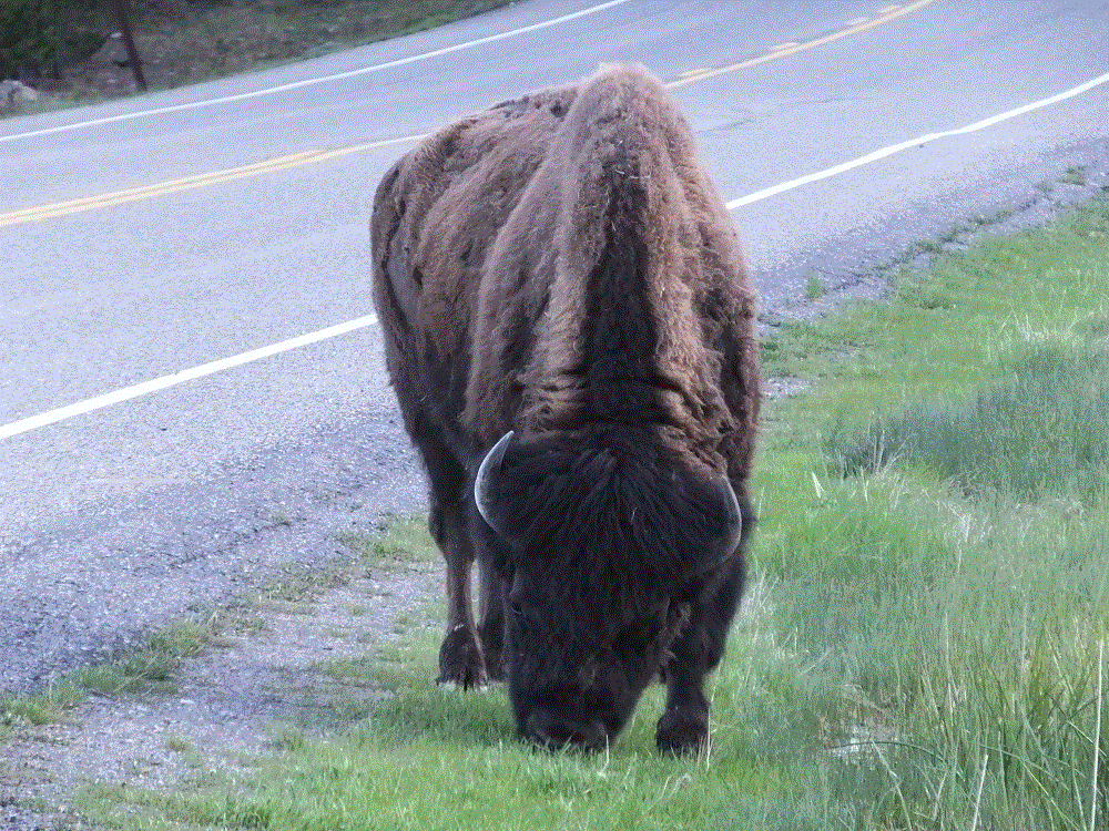
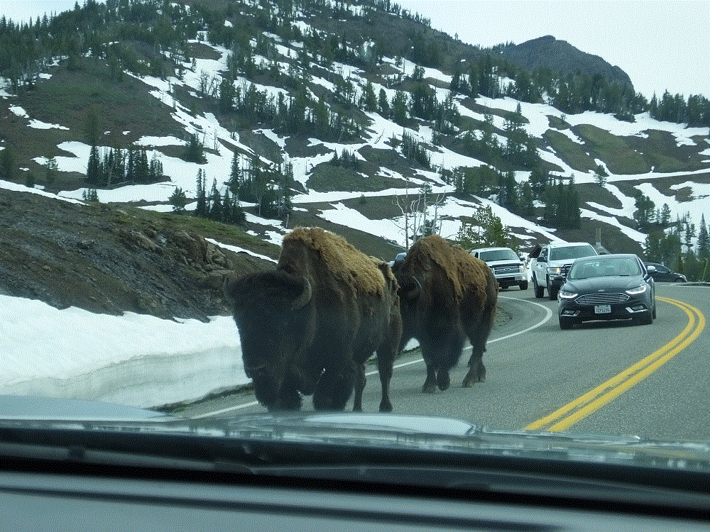
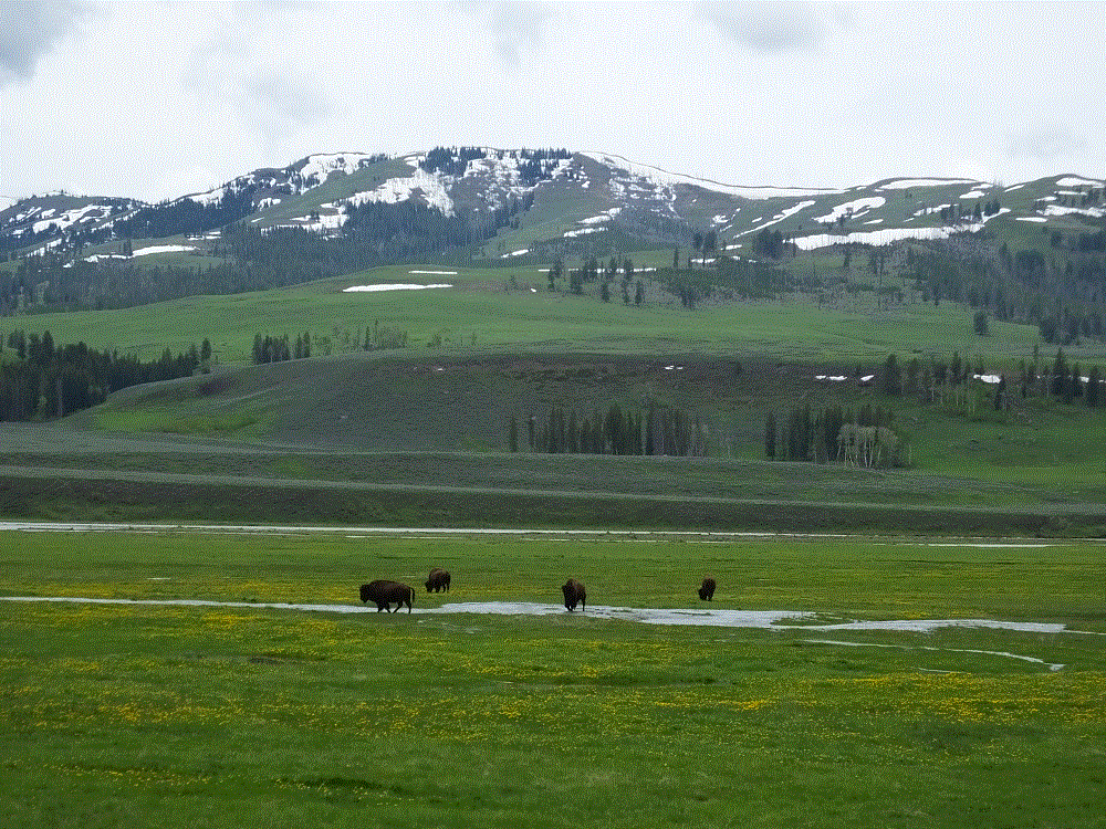
More than our previous visits to Yellowstone, buffalo could be seen throughout the park – singles on hillsides, groups of a few walking down the road, larger groups grazing in the meadows and so on. In fact, unless there was a danger to traffic or walkers/hikers, it seemed the reaction of most persons to the buffalo was pretty much ho-hum.
The buffalo were everywhere, or at least the telltale signs of buffalo were everywhere. One buffalo below seems to be viewing a hot spring near Mud Volcano (below). When we were camping at Madison, a fellow camper stopped by to remark the biggest buffalo he had seen spent the day in our campsite. Wish I had a picture of that to share.
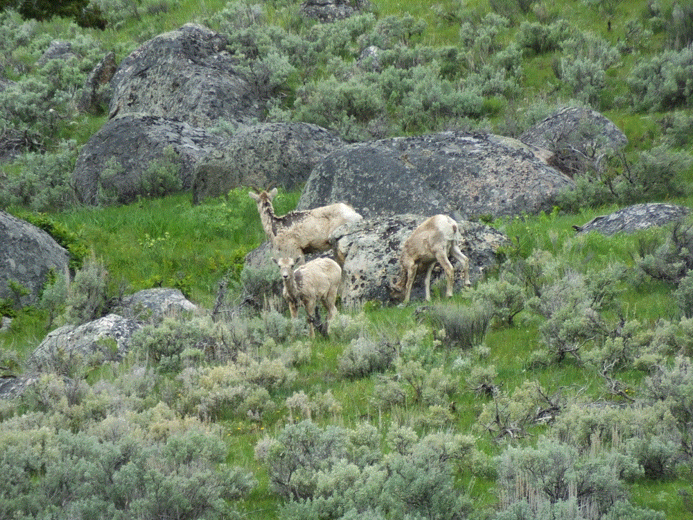
We didn’t see moose or wolves during our visit, but we did see a coyote and several big horn sheep.
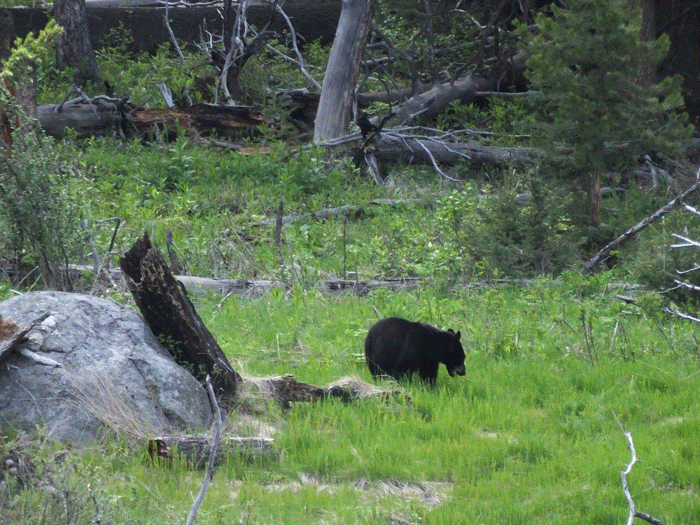
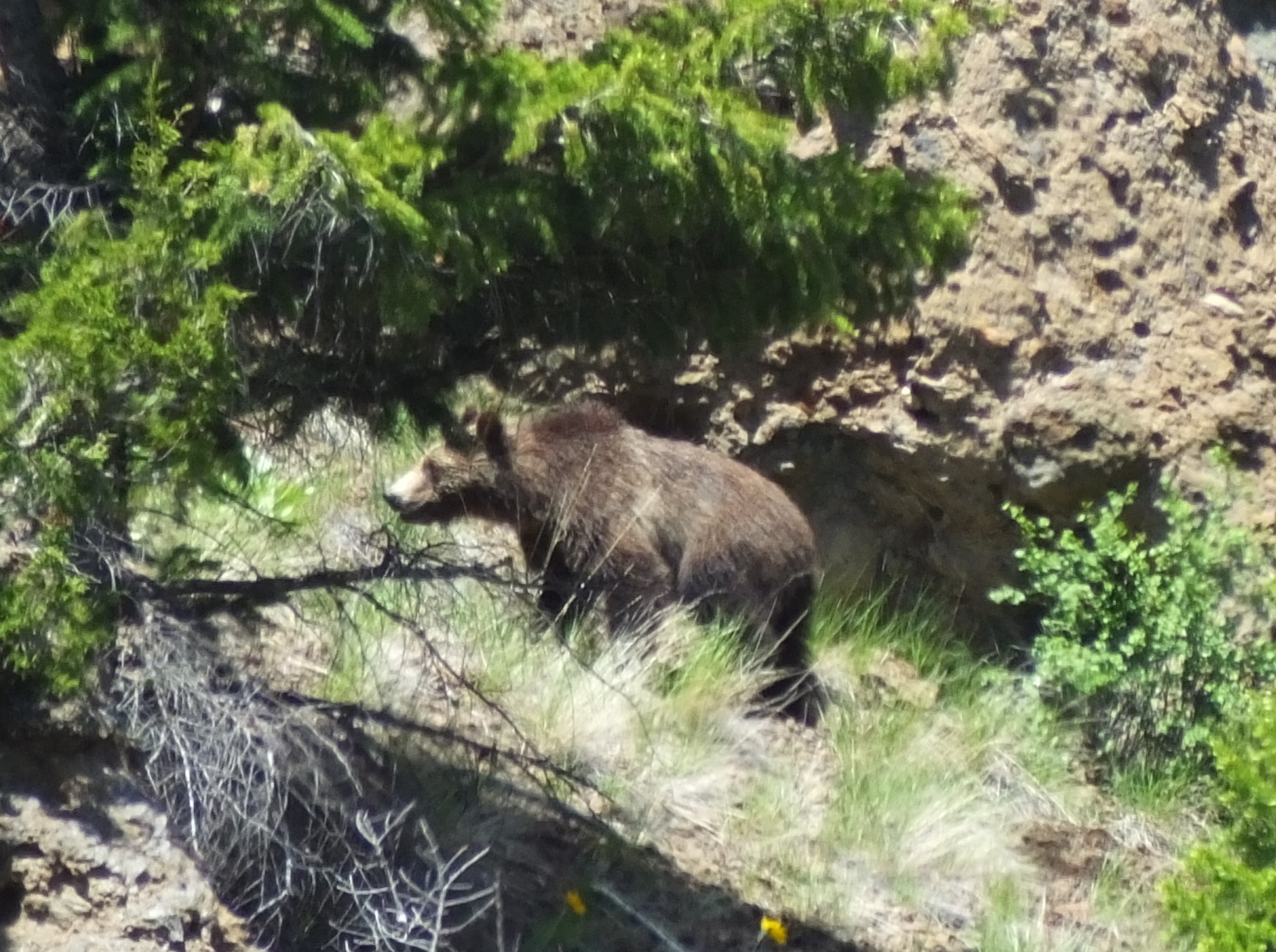
What created the most excitement were bears.
Anytime cars were stopped in the middle of the road, people were crossing with cameras and binoculars with no heed to oncoming traffic and waving at their family members to do the same, a bear had been sighted.
Fortunately, both bears we saw were a long distance away and no danger to anyone. We only had to worry about the crazy drivers…
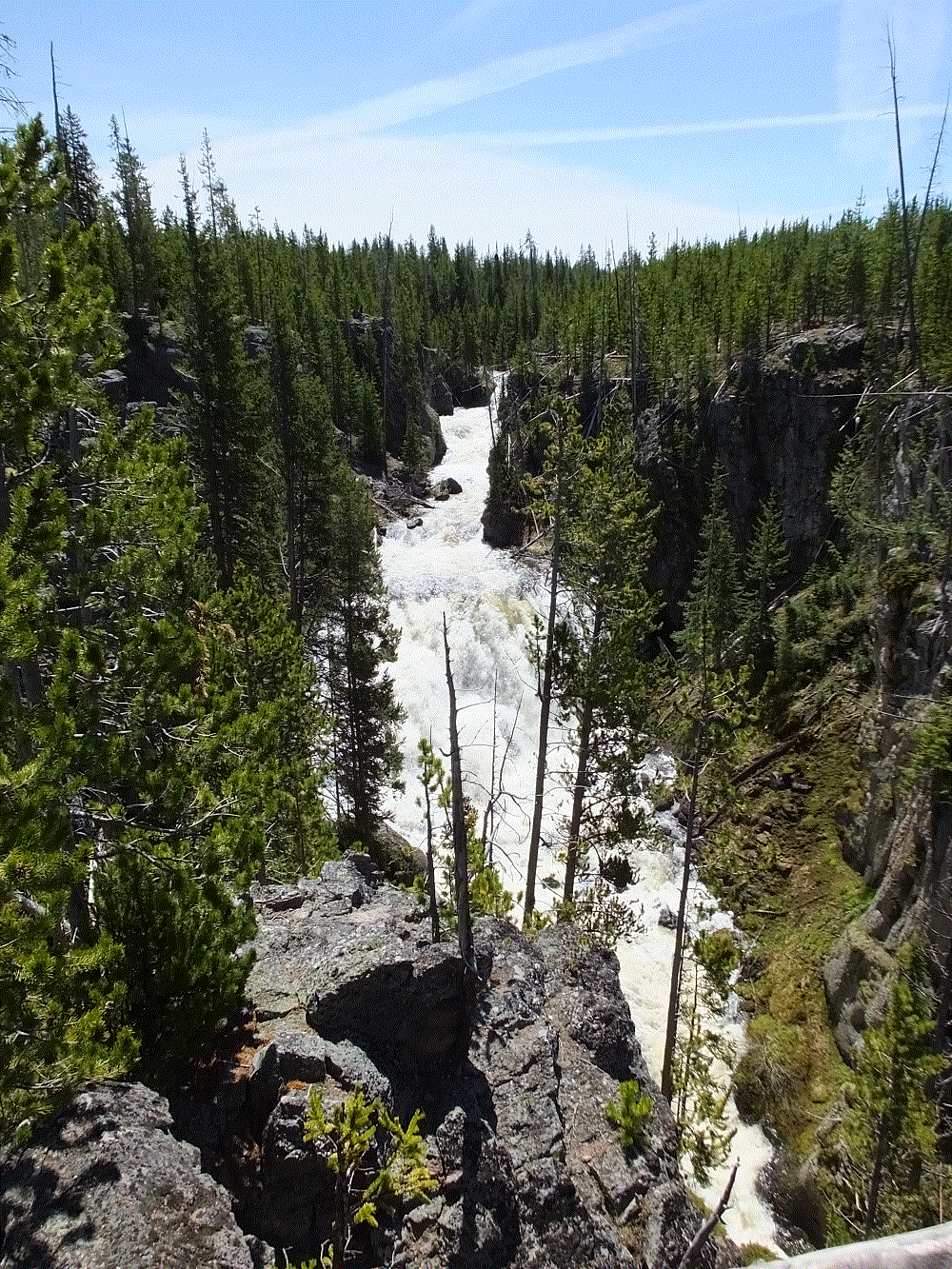
People come to Yellowstone to view fascinating geothermal features. Although these features are located throughout the park, many of the features are located close together in areas called basins – these are the areas most park visitors frequent.
There are various types of thermal features – fumaroles (steam vents), geysers, hot springs, mudpots and travertine terraces (the link above has details about each).
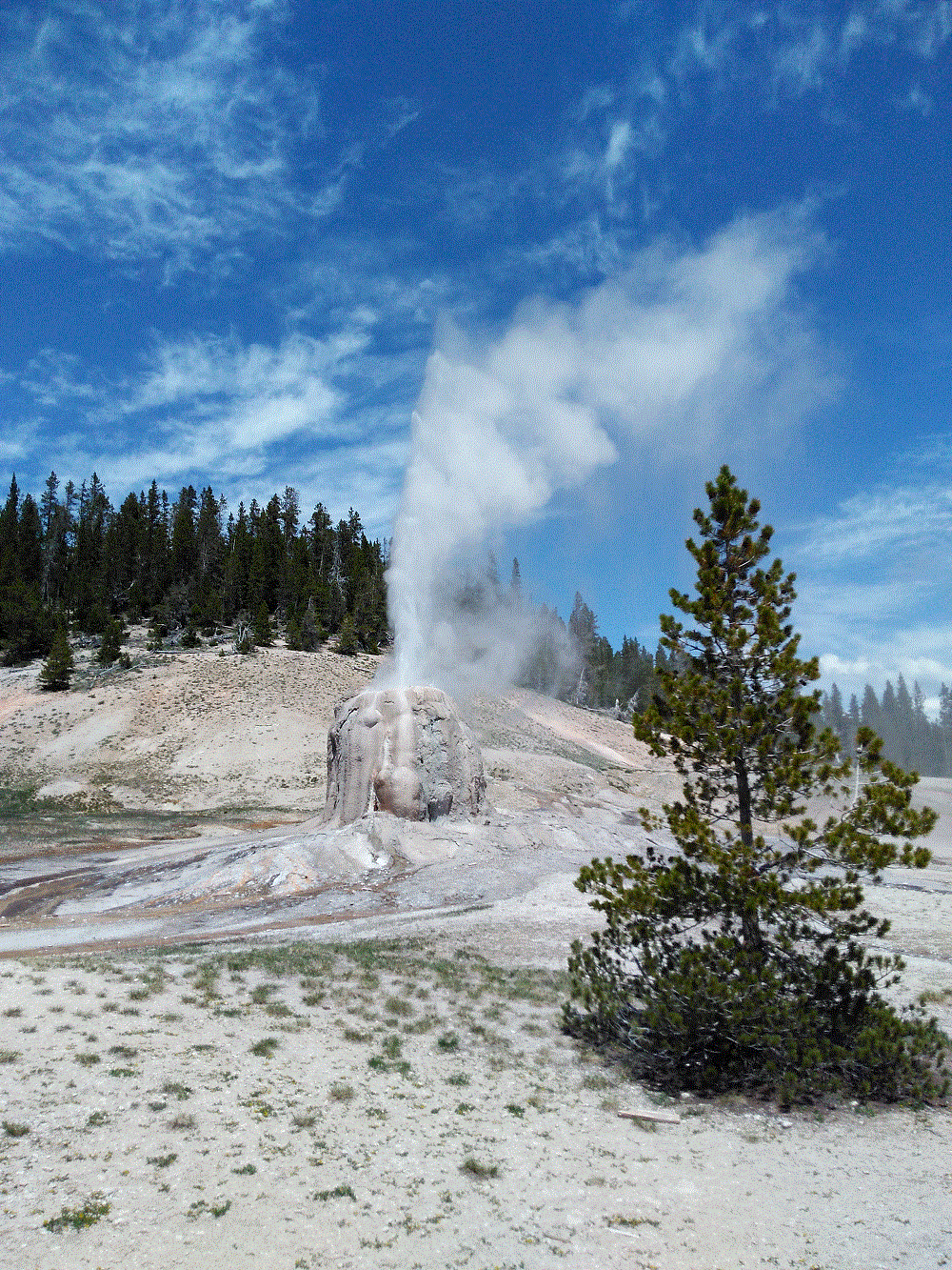
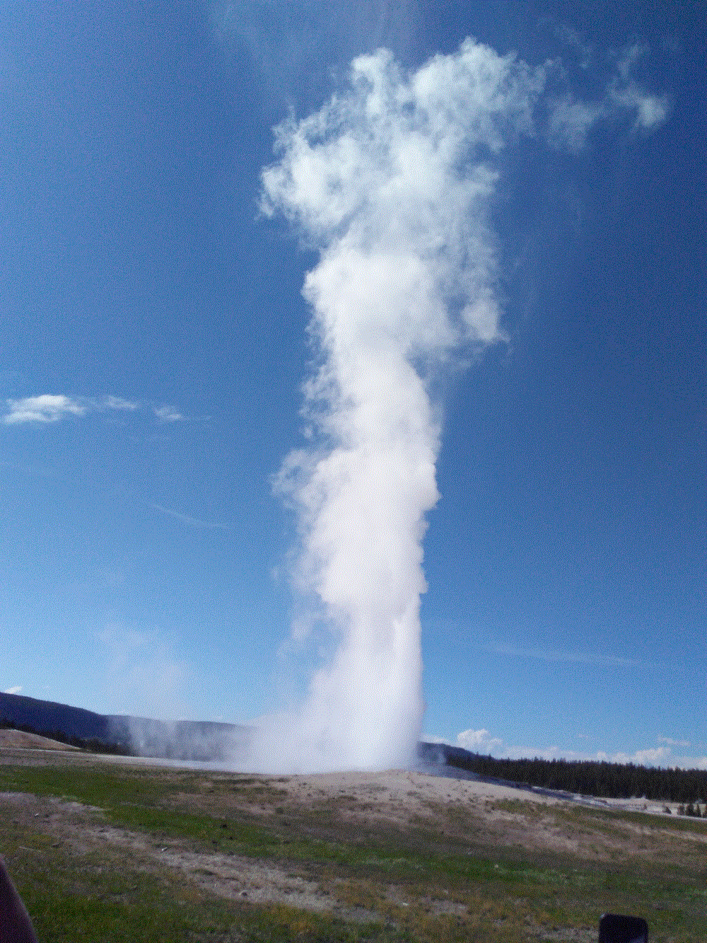
What would a visit to Yellowstone be without seeing Old Faithful! Contrary to what you might think, Old Faithful doesn’t erupt hourly – it is more like every 90 minutes.
The rangers have gotten pretty good at predicting the time of the next eruption. Although we missed one eruption when it occurred 10 minutes early, we enjoyed an eruption later in the day that occurred exactly when predicted!
What this photo doesn’t show is the wide boardwalk along one side of Old Faithful that includes benches and standing areas for hundreds of people. Behind that is Old Faithful Lodge, stores, restaurants, a gas station, huge parking areas and more. Everyone wants to see this iconic piece of Yellowstone.
We saw another geyser erupt while driving Firehole Lake Drive, a couple miles from Old Faithful. It was starting to rain, but White Dome Geyser didn’t disappoint.
You may have seen recent news about another Yellowstone geyser that has erupted eight times this year after infrequent eruptions in recent years. Steamboat Geyser’s eruptions are much larger than Old Faithful. Unfortunately we weren’t there when it erupted – we missed it by three days.
Another interesting thermal feature several miles away from Old Faithful is the Mud Volcano. This feature is pretty tame now, but in the past it eruptions were a lot more vigorous, like a volcano!
You can hike a short trail from the viewing area to see several interesting hot springs and the impressive Dragon’s Mouth fumarole. This feature sounds (and smells) like a dragon’s mouth!There are MANY more thermal features in Yellowstone – 10,000 by one estimate. We are blessed to have such a place to visit. Even without the amazing scenery and wildlife, the thermal features make a visit to Yellowstone a must!
(we’ll share some additional photos in upcoming Yellowstone blog posts)
At practically every turn Yellowstone offers inspiring beauty.
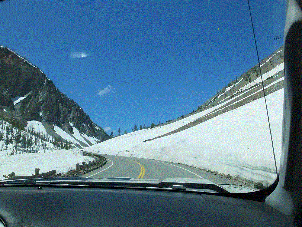
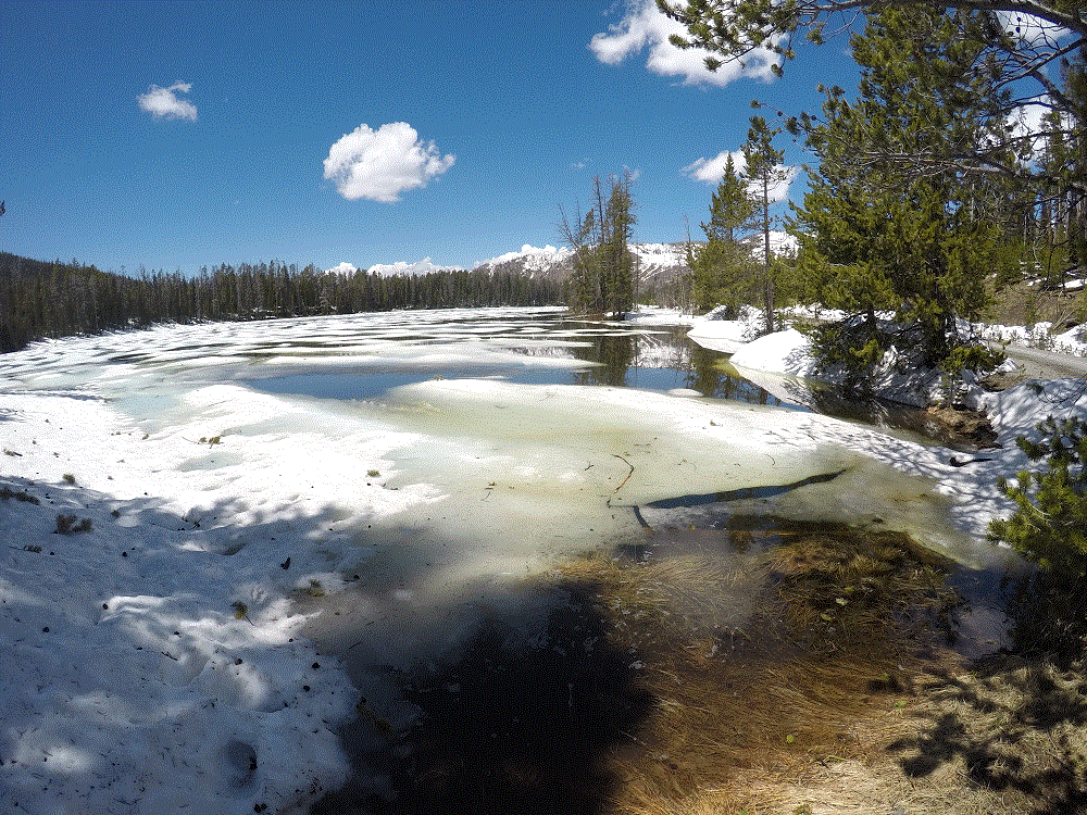
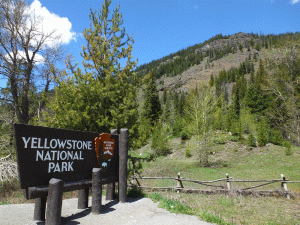
We arrived on a sunny Friday afternoon after driving west from Cody. After entering the park from the eastern entrance (park map), we were reminded that parts of the park were still emerging from winter. Throughout our week in Yellowstone, the remnants of the past winter’s snowfall were just about everywhere and temperatures were chilly – most days in the 50s/60s and nights in the 30s. Rather cool for us Floridians!
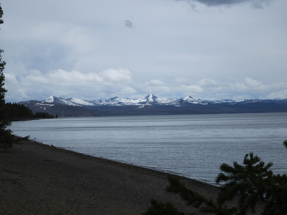
Soon we were passing by Yellowstone Lake and looked back to see the snow covered mountains we has just driven through.
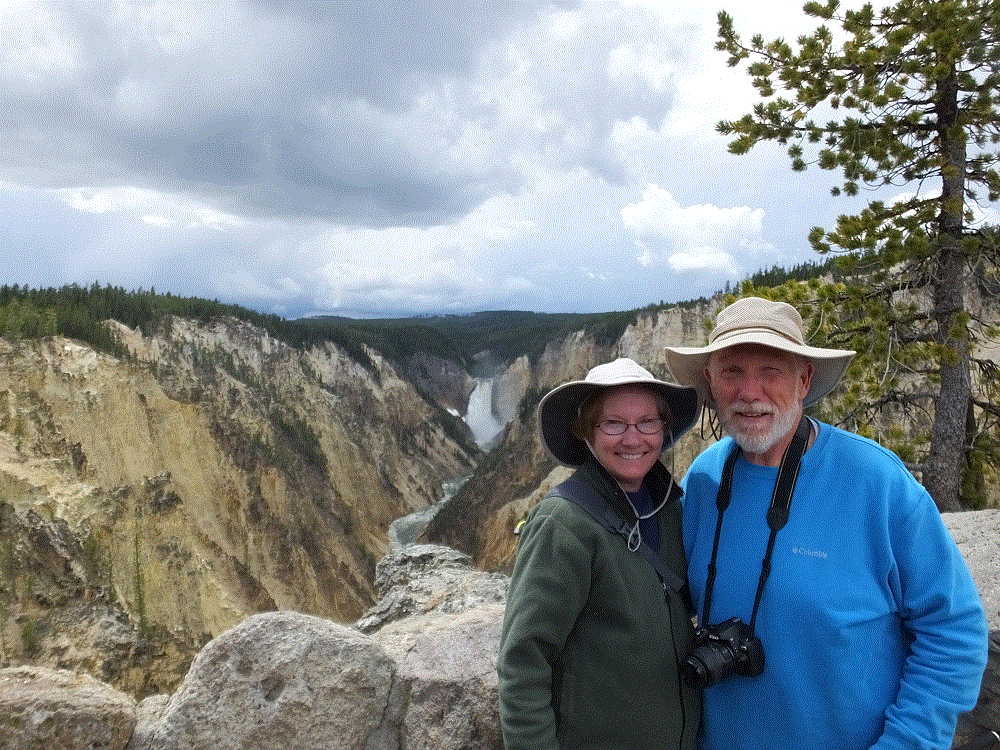
Yellowstone River flows out of Yellowstone Lake. Several miles downstream it cascades over Yellowstone Falls and continues through the Grand Canyon of the Yellowstone. The falls are impressive – the 308-foot drop of lower Yellowstone Falls is nearly twice that of Niagara Falls!
View from Artist’s Point
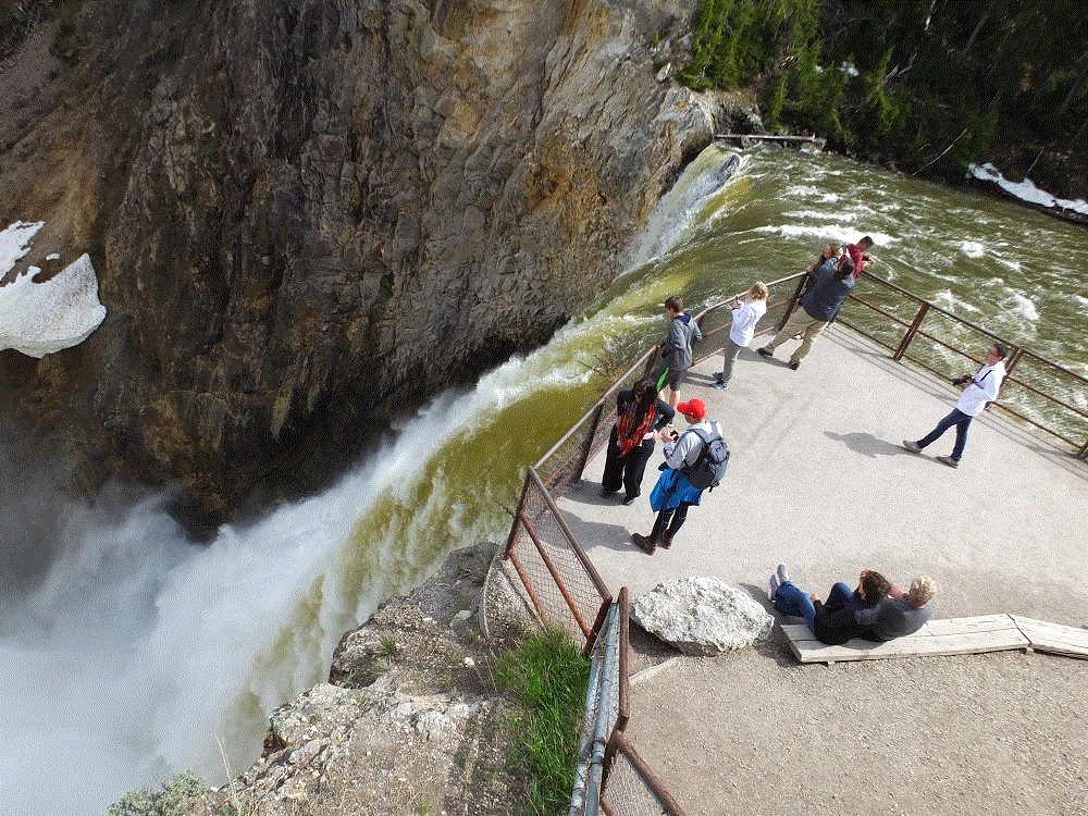
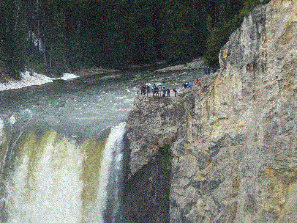
We tested our endurance by walking down a trail to the brink of the lower falls – the drop was equal to a 60-story building. We were rewarded with a different perspective of the falls that made the hike back up the trail worth it!
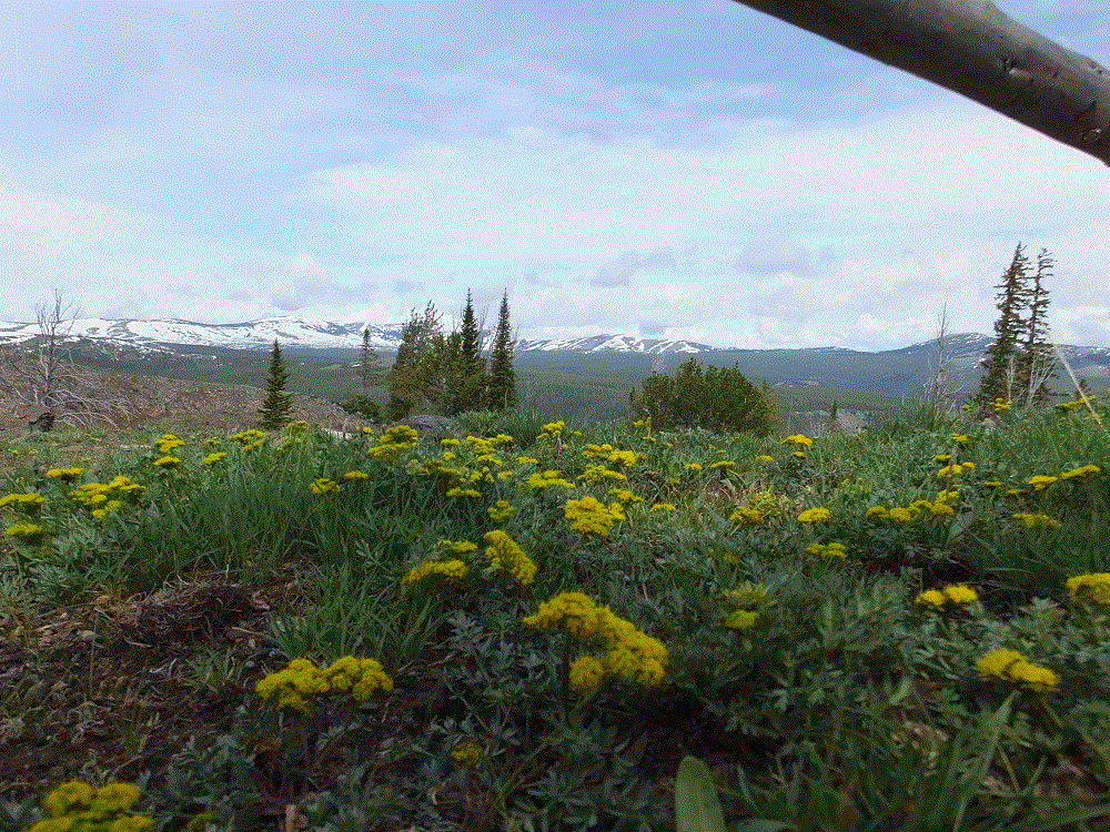
Yellowstone has stunning mountain vistas…
…and broad valleys where wildlife abounds.
Hopefully this gives you an idea of the scenery we enjoyed during our visit.
You might be wondering about the Yellowstone fires that burned almost 800,000 acres or more than 1/3 of the park in 1988. Pat and I were amazed at the recovery of the burned areas – thick new stands of lodgepole pines and other trees are more than 20 feet tall in many areas. The forest is well on its way to recovery after 30 years!
New forest growth near Old Faithful
Of course, there is much more to Yellowstone than scenery. We’ll cover thermal features and animals in upcoming blog posts, as well as some of the hiking and biking we enjoyed.
(Sorry for the delay in blog posts. There is no (free) wifi in Yellowstone and cell service is voice only in very limited areas)
We’ve just returned from a great week in Yellowstone National Park.
Yellowstone was established as America’s first national park in 1872, and is widely held to be the world’s first national park.
Yellowstone is treasured by Americans and visited by persons from all over the world. We met persons from numerous US states and from Canada, Japan, China and India. They were as awestruck with the scenery, thermal features and animals as we were!
This is our fifth visit to Yellowstone since we were married 38 years ago.
Cooking dinner after a busy day touring Yellowstone…Dutch oven chili with cornbread.
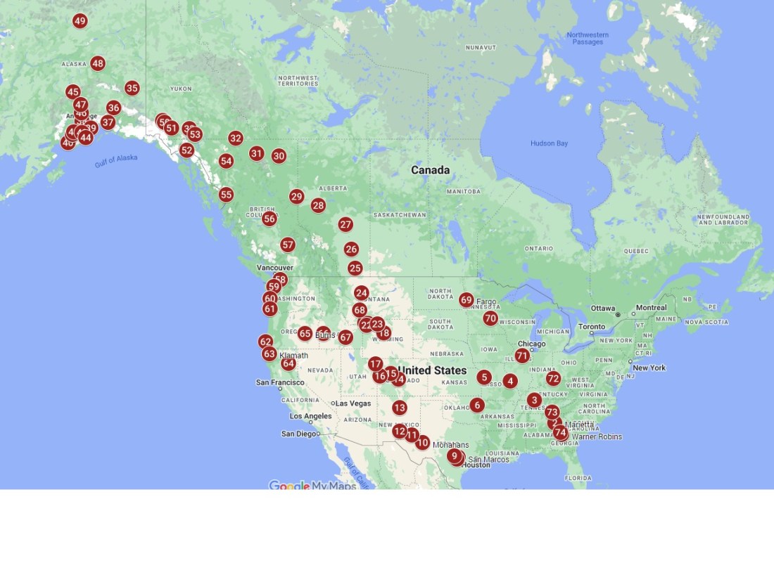
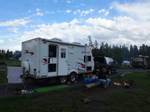
This time we stayed in three different campgrounds inthe park (RabbiTRAILS Alaska Map pts #20-22). This allowed us to spend less time driving to/from hotels and campgrounds outside the park and more time in the park seeing Yellowstone.
Watch for upcoming blog posts about Yellowstone scenery, thermal features, animals, hiking and biking, and our list of things we like and don’t like about Yellowstone.
We’ve been at Cody, Wyoming (RabbiTRAILS Alaska Map pt #19) for the past four days. Tomorrow we head to Yellowstone National Park for eight days. After Yellowstone, a quick return to Cody for a couple nights and then ON TO ALASKA!
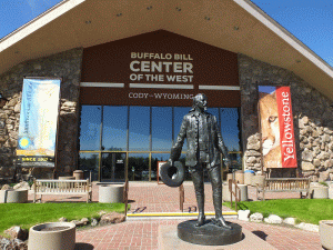
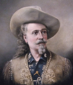
Buffalo Bill Museum – tells about the life of William Cody, aka Buffalo Bill – Army scout, entrepreneur, showman, founder of Cody and American icon.
Whitney Western Art Museum – western-themed paintings and sculpture, with originals from Remington, Proctor, Sharp and many more.
Cody Firearms Museum – impressive historical firearms collections from many manufacturers – Smith and Wesson, Winchester, Colt and others.
Plains Indian Museum – exhibits of Plains Indian peoples, their cultures, traditions, values, and histories, and the impact these on their lives today.
Draper Natural History Museum – immersive, informative and inspiring displays about the greater Yellowstone ecosystem, from alpine regions to the plains.
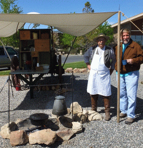
In front of the museum, in keeping with the western theme, was a chuckwagon and gentleman who was making coffee in an old time coffee pot, campfire beans from scratch and sourdough biscuits.
Anyone who stopped by got free samples and a bit of cowboy cooking history.
Never one to turn down free food and VERY INTERESTED in Dutch oven cooking, this was a highlight of my day!
It took us two full days to see the museums. If you are ever in the area, be sure to visit this great museum!
We spent the other days doing more mundane things getting ready for Yellowstone: cleaning the camper and truck, laundry, haircuts, adjusting camper tire pressure and checking lug nuts, grocery shopping, buying hiking boots…and of course, a couple hours walking downtown Cody looking for neat western souvenirs!
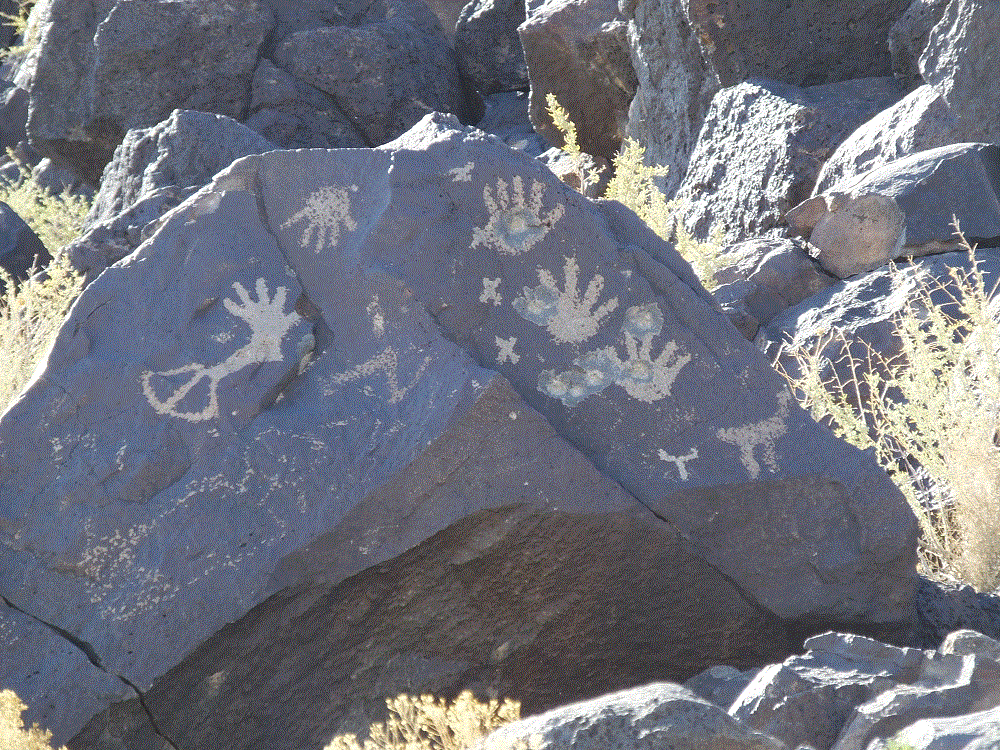
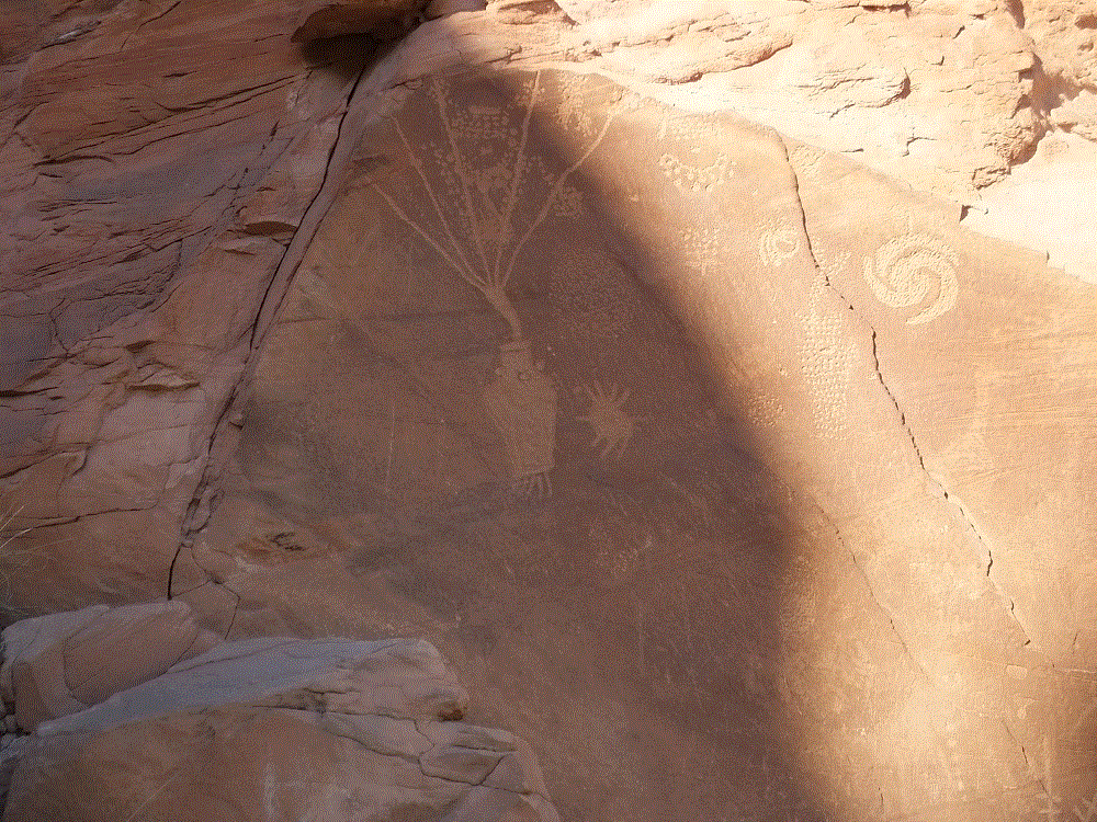
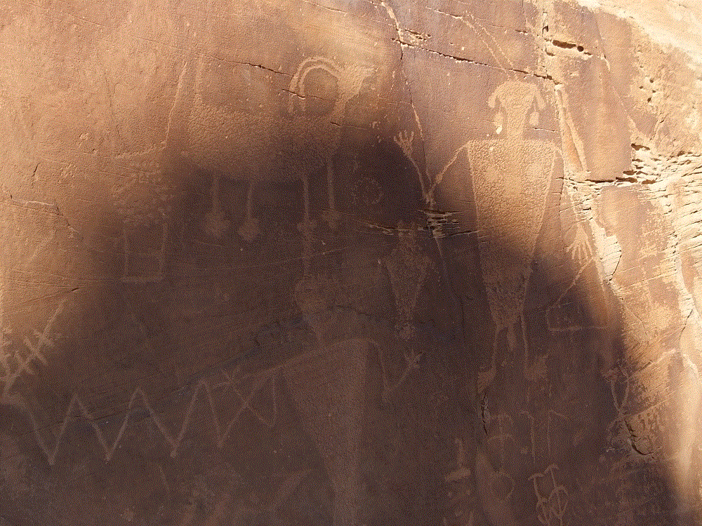
A fascinating part of our travels has been to visit several locations with petroglyphs. Some 400-700 (or perhaps more) years ago, people chipped away the thin desert varnish on rock faces to reveal the lighter gray rock underneath – this left lasting marks we wonder about and enjoy today.
The marks certainly had cultural significance – they give clues about what was on the minds of the people at that time. Some say they have religious significance as well.
We visited Petroglyph National Monument in Albuquerque (RabbiTRAILS Alaska Map pt #13). The sprawl of the city now encircles the monument. Hundreds of petroglyphs can be viewed in three main areas. We endured a very warm couple mile hike to one – Piedras Marcadas Canyon. It was worth it!
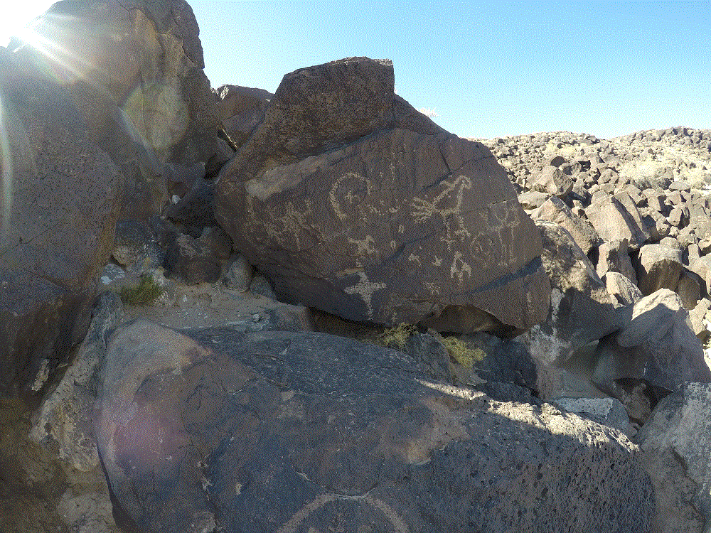
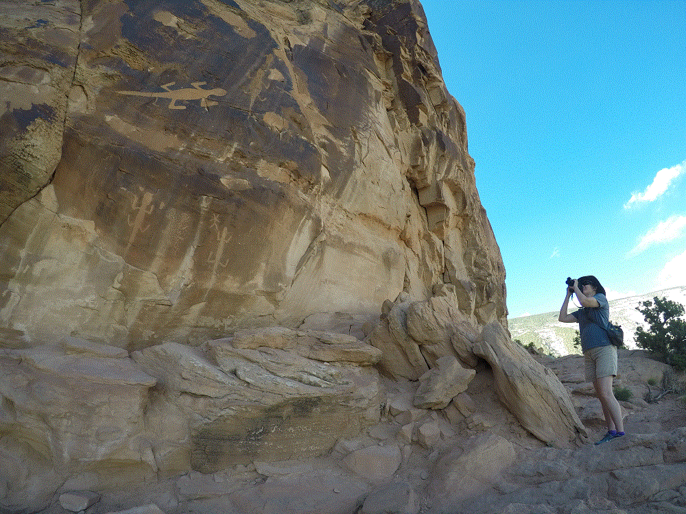
A few days later we visited another site within Dinosaur National Monument (Map pt #17). Actually there is a lot to do there besides dinosaur stuff.
There were a number of lizards on one rock face. We wondered how the large lizard was etched, considering it is nearly 15 feet above the ledge below.
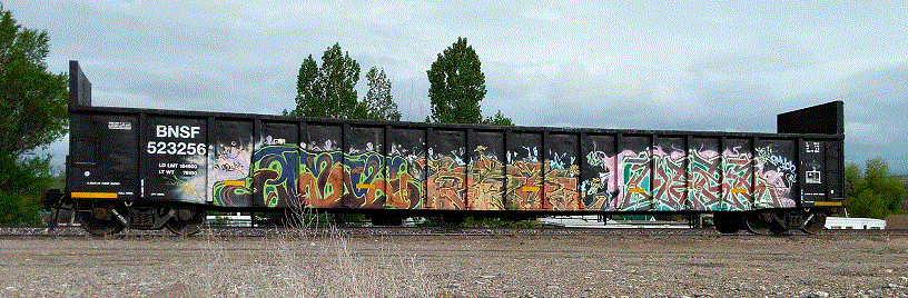
Finally, when we were in Thermopolis (Map pt #18), we saw a modern petroglyph. Perhaps today’s graffiti will be studied and valued hundreds of years from now!
A few years ago, we became interested old train lines that have been converted to recreational bicycle trails. Many of our camping trips, including this one, involve riding these and other recreational bike trails.
We’re not skinny tire, spandex britches, 60-miles-in-a-day sorts of riders. Our bikes have wider tires, we wear comfortable clothes and our rides are usually 15-20 miles. This gives us something healthy and fun to do while camping.
Our bikes and associated gear travel in the back of our truck. Here are some rides we’ve done so far:
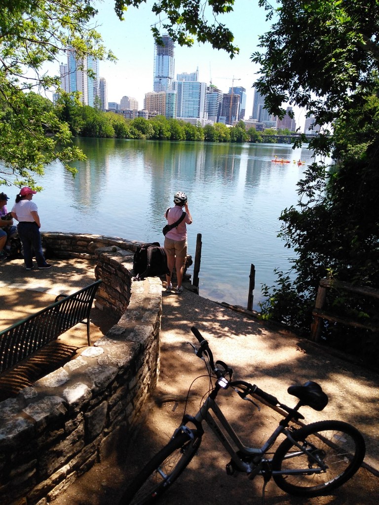
Austin: Ann and Roy Butler Trail at Lady Bird Lake
(RabbiTRAILS Alaska trip pt #8) We were amazed at the number of riders, walkers and runners enjoying this trail in the middle of a workday. The trail circles Lady Bird Lake adjacent to downtown Austin (click for more). The trail is mostly shaded and an easy ride.
This ride was a welcome diversion while our camper was being repaired.
Santa Fe: Arroyo De Los Chamisos Trail
(Map pt #13) Our ride in Santa Fe was disappointing and brief. Although this trail is a good connector to a number of other bike trails in Santa Fe, it was not easily accessible from our campground. In addition, parking in Santa Fe was a challenge.
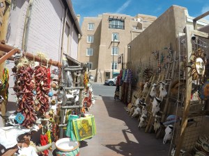
So, we enjoyed walking the streets of historic downtown Santa Fe instead. There are many colorful shops and vendors selling jewelry and other items in the historic town square area.
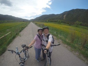
Carbondale: Rio Grande Bike Trail
(Map pt #15) The Rio Grande Trail is a 42-mile rail trail that follows the Aspen Branch of the historic Denver and Rio Grande Western Railroad. It parallels the beautiful Roaring Fork River in numerous places.
We rode from the campground a short distance to downtown Carbondale and loaded our bikes on a public bus. The bus took us about 15 miles up the valley towards Aspen. The ride back to Carbondale and our campground was mostly downhill!
The day was an 11 on a scale of 10! Our ride took us past yellow-flowered fields and dense wooded areas in a valley between mountain ranges. We ate a packed lunch overlooking the Roaring Fork River.
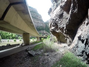
Glenwood Springs: Glenwood Canyon Trail
(Map pt #15) Interstate 70 spans Colorado east-west. After crossing the Rocky Mountains west of Denver, the highway passes through Glenwood Canyon for 12.5 miles on its way to Grand Junction and beyond. The highway is an amazing engineering accomplishment, with extensive viaducts and elevated roads as it winds through the steep-walled canyon. It follows the Colorado River (that eventually reaches the Grand Canyon!), a Union Pacific rail line and includes a paved bike trail.
An outfitter in Glenwood Springs transported us and our bikes up the canyon and dropped us off for the mostly downhill 16-mile ride back to Glenwood Springs. We got to to see I-70 engineering from the bottom, rafters on the Colorado River, an Amtrak train and much more.
We’ve driven nearly 5000 miles and have many to go before we reach Alaska.
Overall, the roads and related traffic have been good. The scenery has been outstanding. Construction has been infrequent for very short distances.
There are always interesting things to see along the road. Like a sign in Oklahoma Hitchhikers Could be Inmates, or the town of No Name near Glenwood Springs, Colorado. Here are some more:
On an Interstate highway near Dallas, a rest area had silos for men’s and women’s bathrooms. I wonder what the windmill was for?
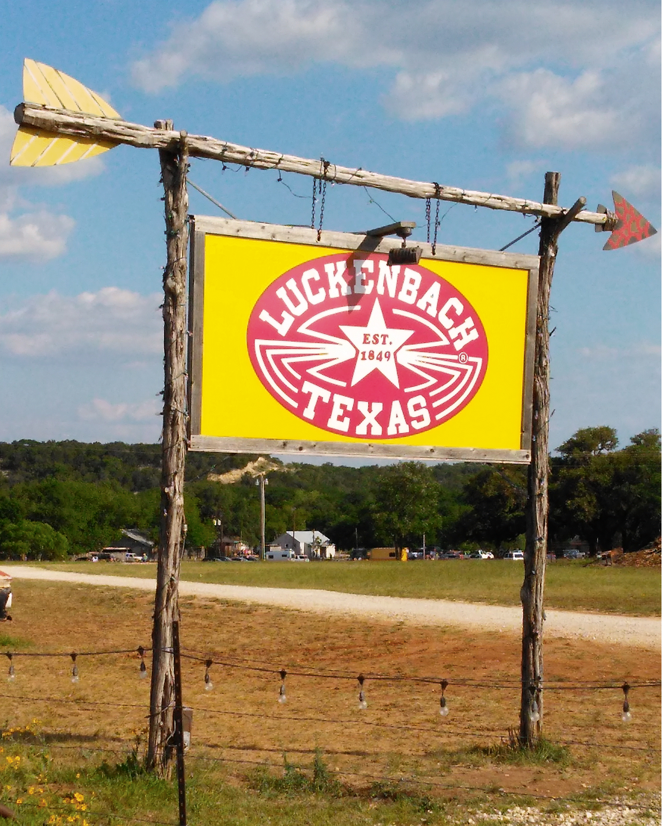
For you country music fans, we passed by Luckenbach, Texas, made famous by the late Waylon Jennings (click to hear). Ain’t nuthin much in the area, except a couple sound stages, a gift shop and lots of laid back country attitude. Closest decent-sized town is Fredericksburg, Texas, about 15 miles away.
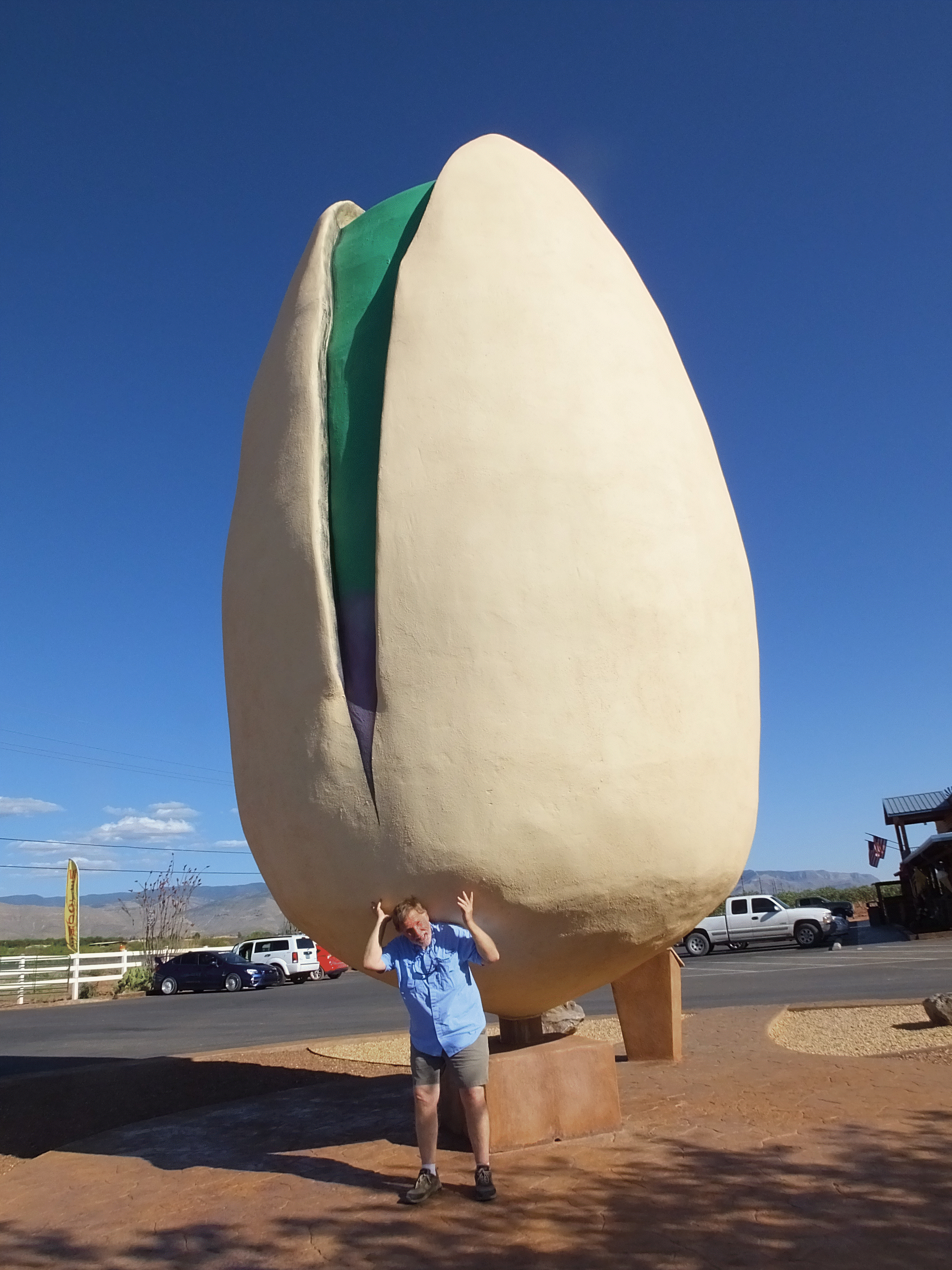
Here is the world’s largest pistachio nut. There are numerous groves of pistachio and pecan trees in the New Mexico desert north of White Sands/Alamogordo.
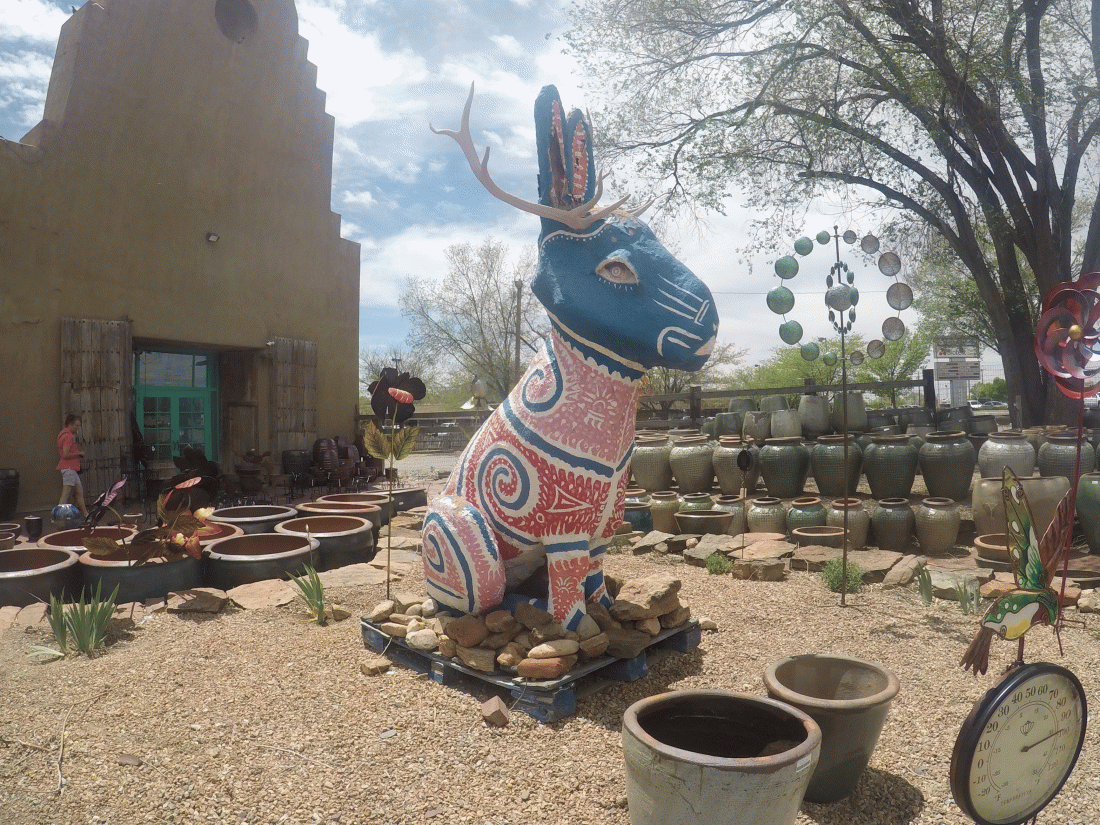
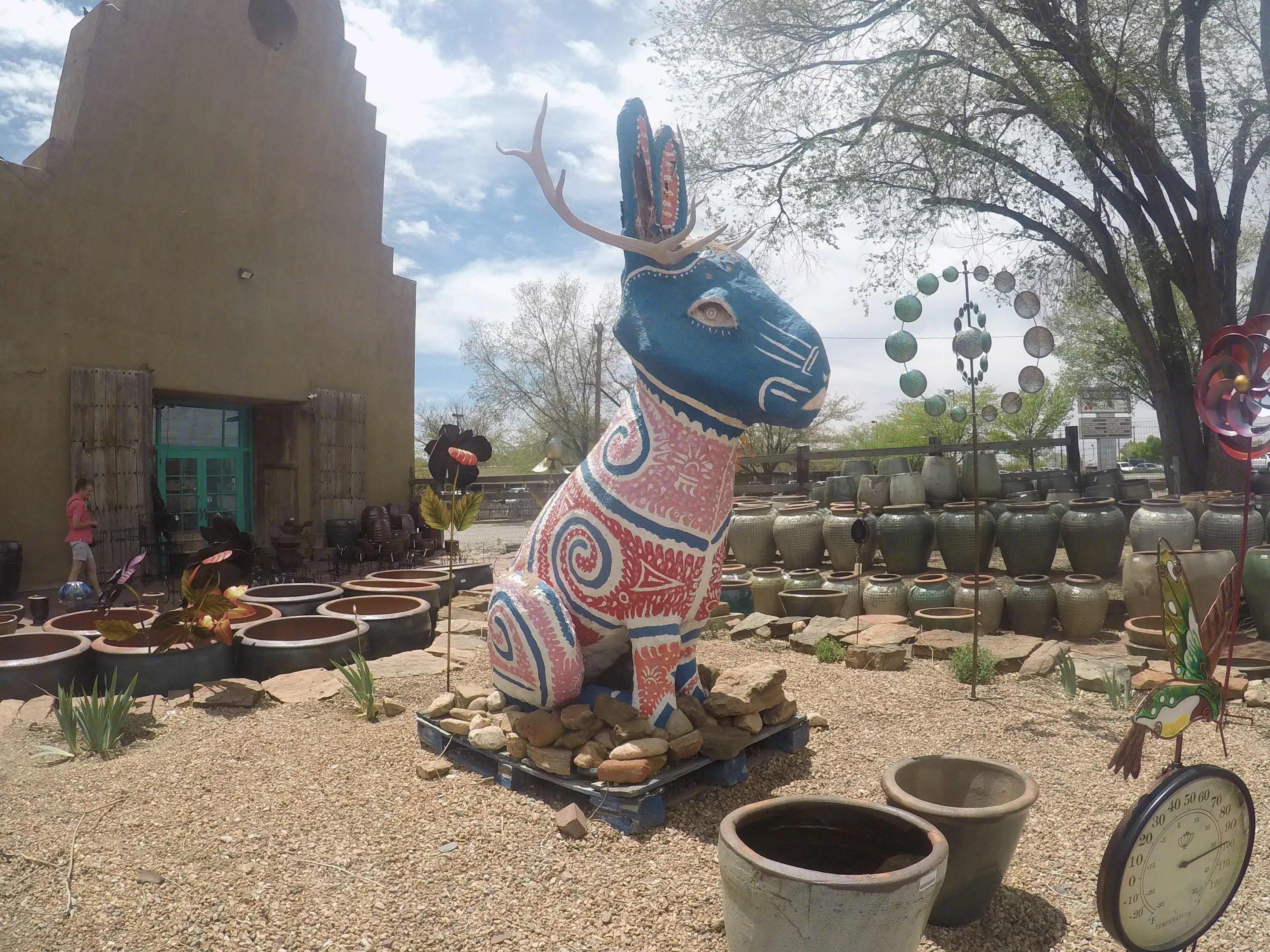
We saw a jackelope (mythical jackrabbit with antelope horns) at a roadside stand in Santa Fe, New Mexico.
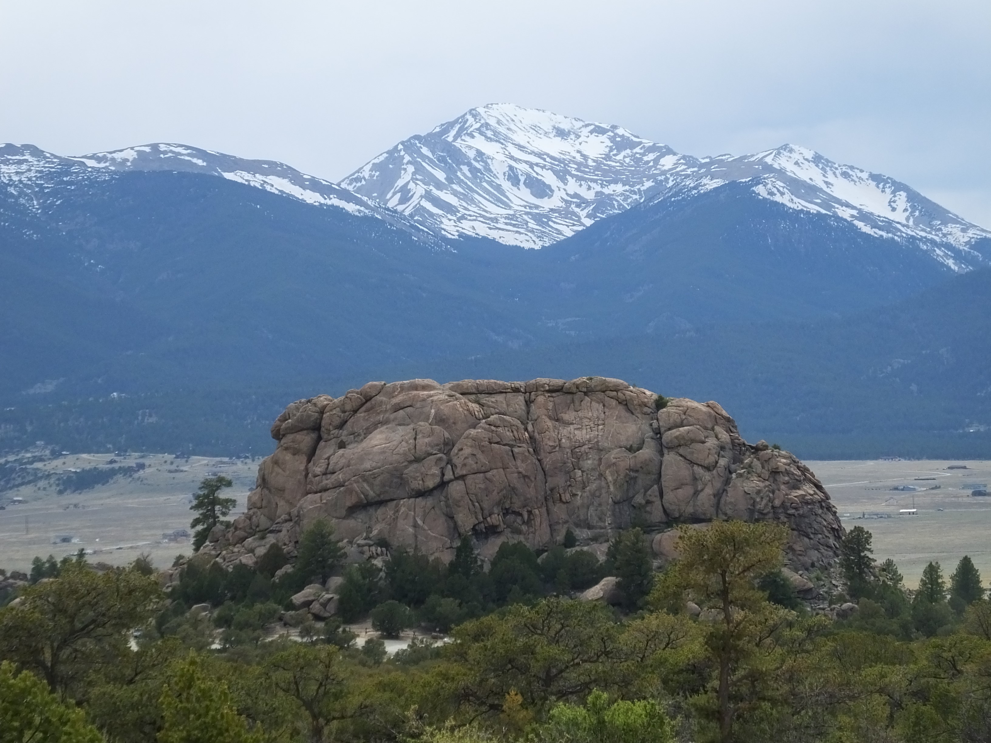
Finally, we camped near a turtle-shaped rock in the Colorado mountains near Buena Vista, Colorado. It was a beautiful vista indeed!
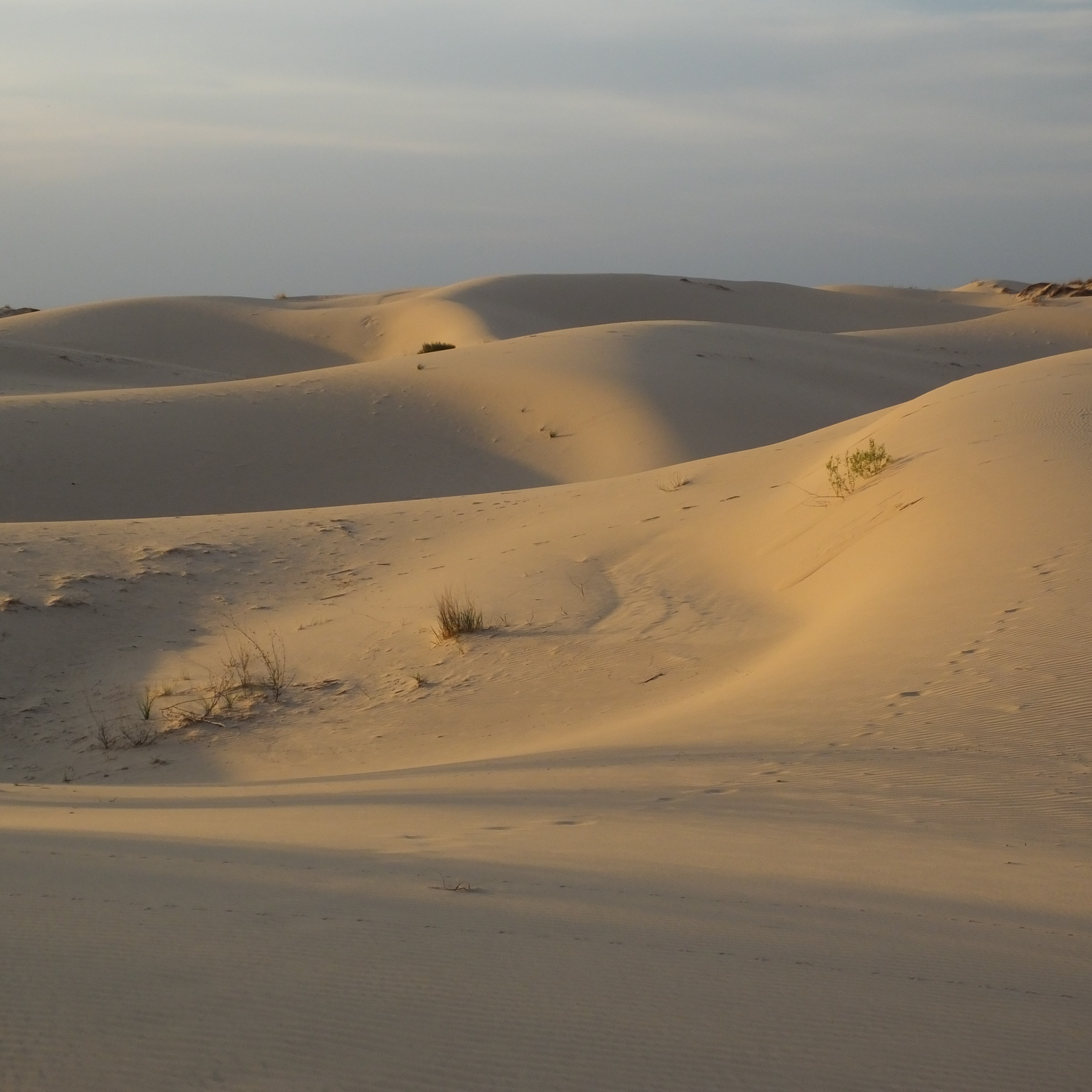
The drive was a bit too far for one day, so we spent the night at a west Texas state park known for its large sand dunes. They don’t call then dunes however – at Monahans State Park they are known as sandhillls.
One theory is the Monahans Sandhills were formed by remnants of the Rocky Mountains in New Mexico that eroded in the Pecos River. The sand was eventually blown by the wind into the area.
The sandhills are located atop the Permian Basin, one of the largest oil-producing areas in the world.
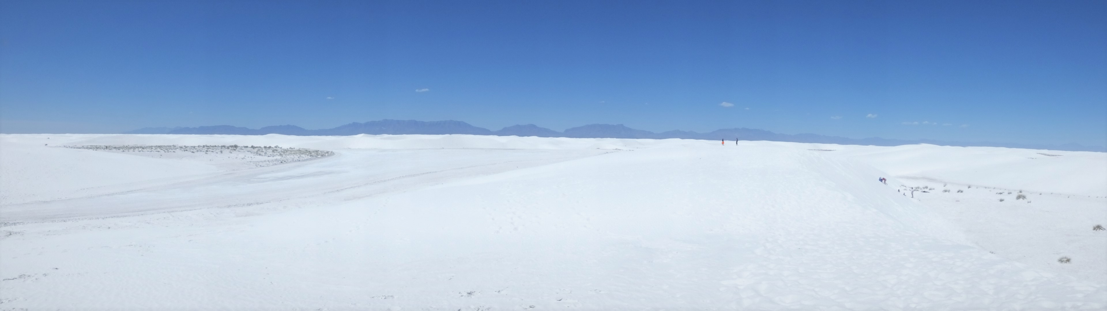
We visited some world class dunes in New Mexico also. Outside of Alamogordo is White Sands National Monument. The dunes are indeed brilliant white.
White Sands is the largest gypsum dunes on earth (275 square miles), the dunes are clearly visible from space and they are constantly moving – some as many as 32 feet year!
A couple interesting facts:
The White Sands dunes, created from eroding mountains to the west, are only about 10,000 years old.
In many areas, the water table is just a few feet below the dunes.
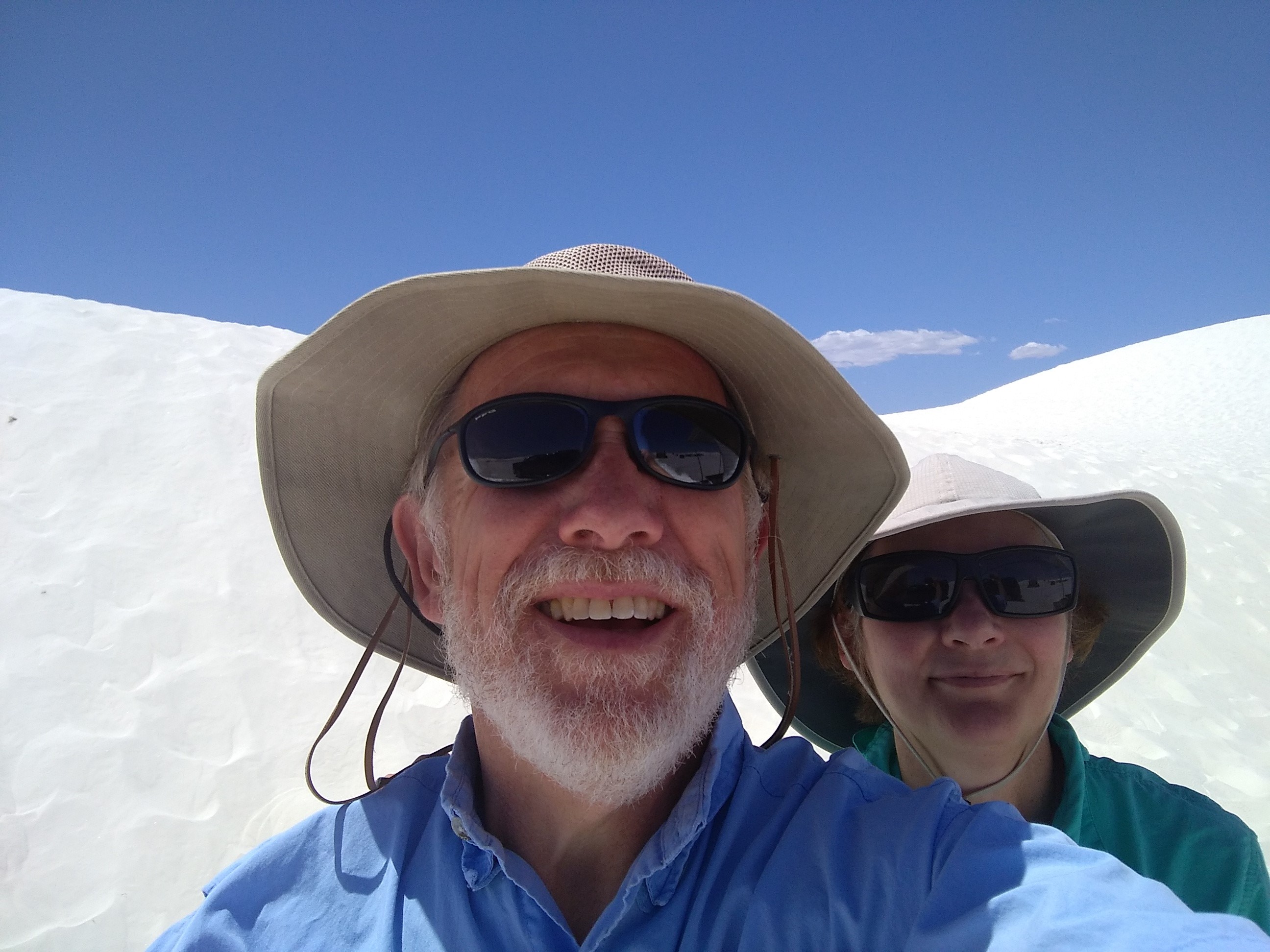
A dune selfie…hats and sunglasses are essential equipment at White Sands!


 The buffalo were everywhere, or at least the telltale signs of buffalo were everywhere. One buffalo below seems to be viewing a hot spring near Mud Volcano (below). When we were camping at Madison, a fellow camper stopped by to remark the biggest buffalo he had seen spent the day in our campsite. Wish I had a picture of that to share.
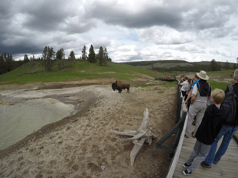 We didn’t see moose or wolves during our visit, but we did see a coyote and several big horn sheep.
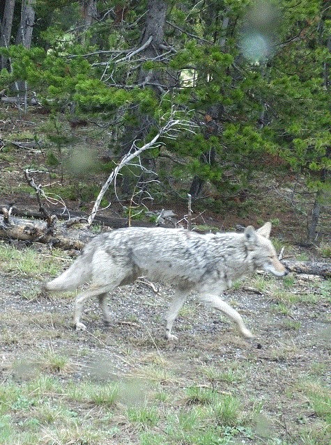
 What this photo doesn’t show is the wide boardwalk along one side of Old Faithful that includes benches and standing areas for hundreds of people. Behind that is Old Faithful Lodge, stores, restaurants, a gas station, huge parking areas and more. Everyone wants to see this iconic piece of Yellowstone.
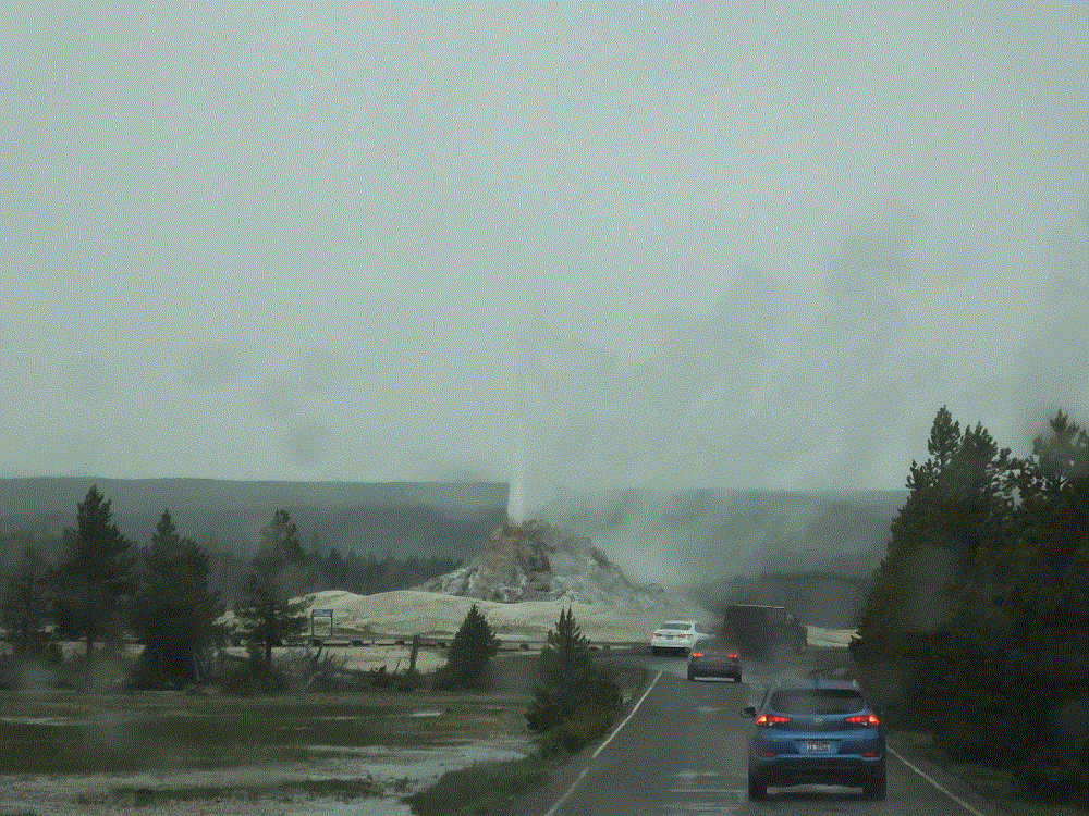 You may have seen recent news about another Yellowstone geyser that has erupted eight times this year after infrequent eruptions in recent years. Steamboat Geyser’s eruptions are much larger than Old Faithful. Unfortunately we weren’t there when it erupted – we missed it by three days.
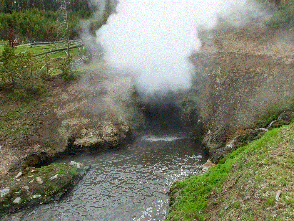 There are MANY more thermal features in Yellowstone – 10,000 by one estimate. We are blessed to have such a place to visit. Even without the amazing scenery and wildlife, the thermal features make a visit to Yellowstone a must!
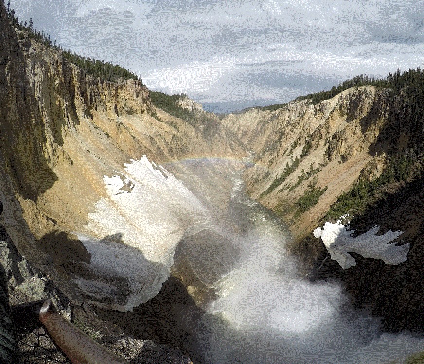


 , aka Buffalo Bill – Army scout, entrepreneur, showman, founder of Cody and American icon.