
(2018 Alaska Ep 36)
On July 12, we headed to the Kenai Peninsula for nearly a month (RabbiTRAILS Alaska Map, pts 40-44).
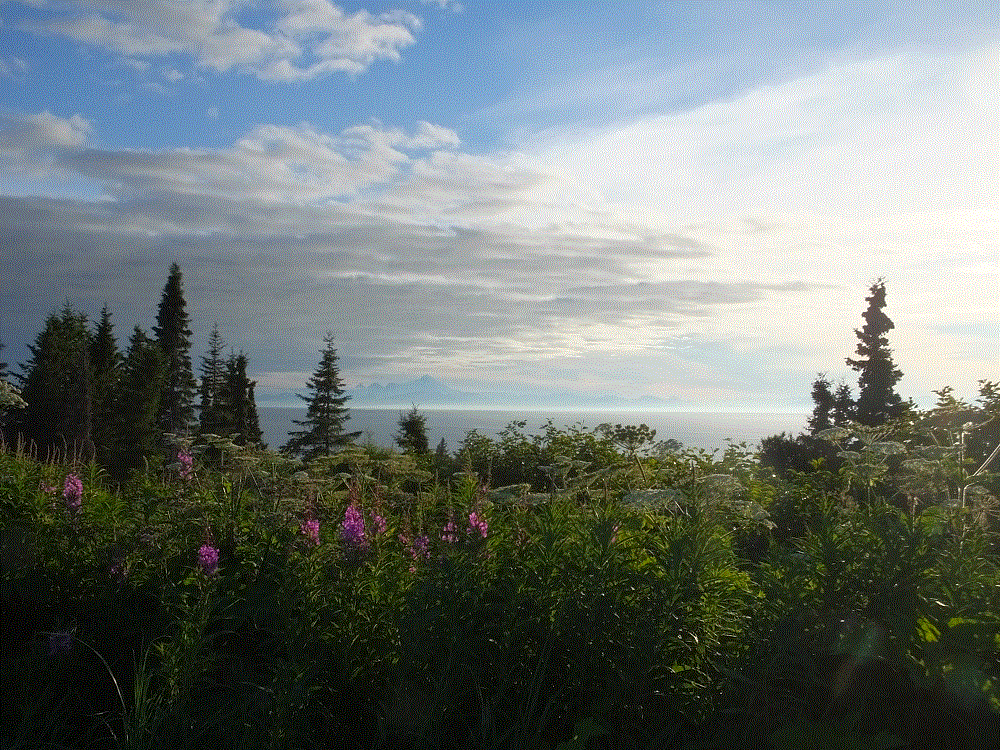
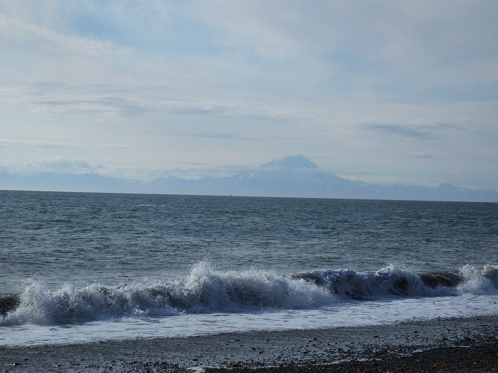
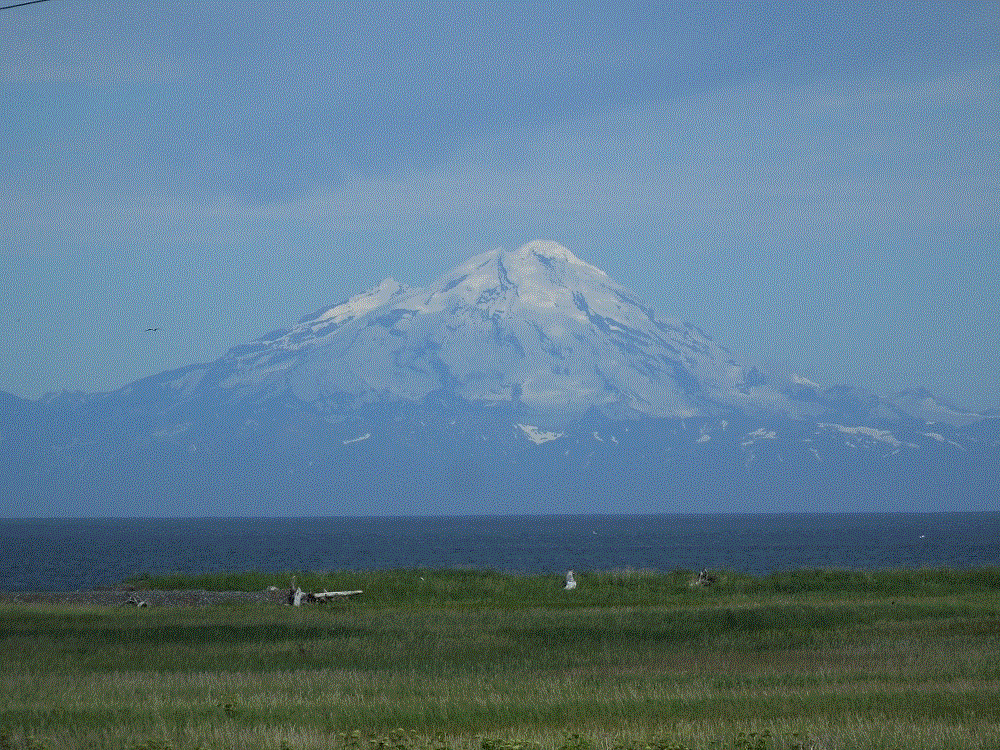
We drove across amazing mountains which run north-south along the east and central portion of the Kenai, and along the famed Kenai River, to the west coast of the Kenai peninsula. The western portion is flat-to-slightly hilly, and as we headed south toward Homer, we could see across the Cook Inlet to a distant mountains that included Redoubt, Iliamna and St Augustine volcanoes. Snow-covered Redoubt is the most dramatic at 10197 feet. It’s quiet now, the last eruption occurring in March 2009.
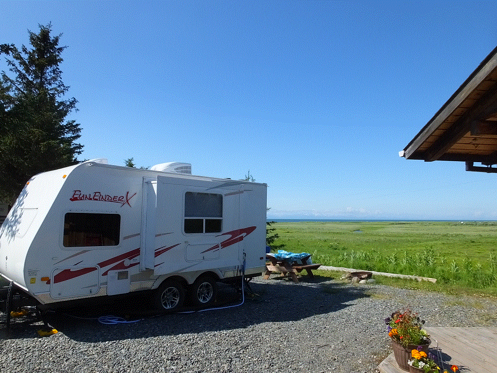
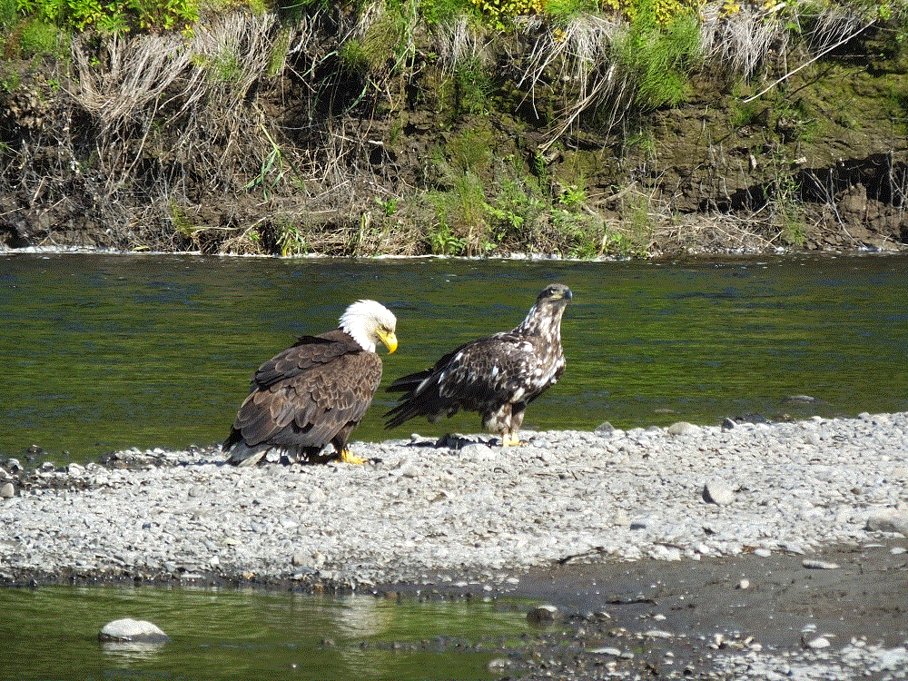
We camped for a week north of Homer at Anchor Point (map pt. #40). Our campsite was along the Anchor River, with a view of Mt. Redoubt. We were told moose frequented the area but didn’t see any. We did we a number of bald eagles however.
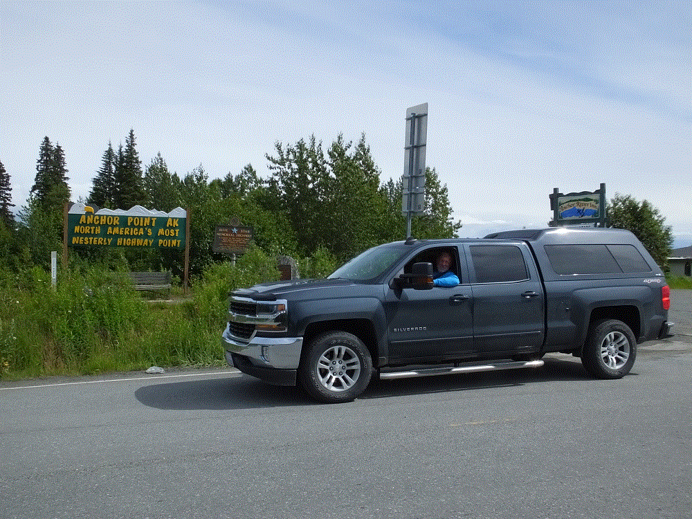
Anchor Point has the distinction of being North America’s most westerly highway point.
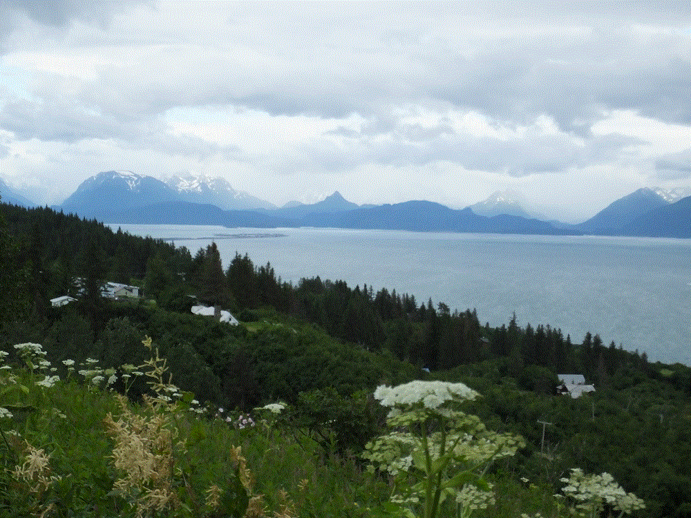
We made several visits to Homer, a 20-minute drive away. As the road winds down a bluff to the town, there is a pulloff where one can see Kachemak Bay and mountains across the bay, and the Homer Spit.
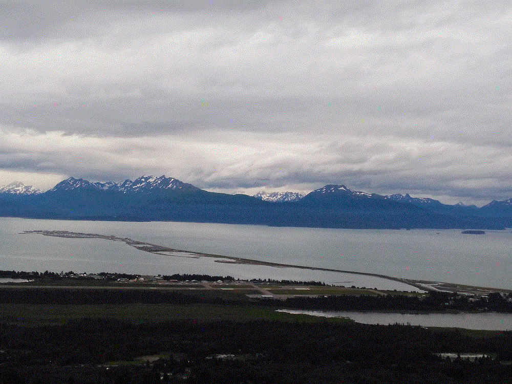
Homer Spit is a finger of land that extends four and a half miles from the Kenai coast into Kachemak Bay. It is intensely developed with campgrounds, a marina, gift shops, restaurants and the like. There are LOTS of boats and fishing charter businesses, and Homer claims to be the halibut fishing capital of the world.
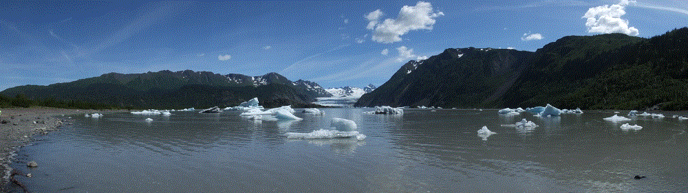
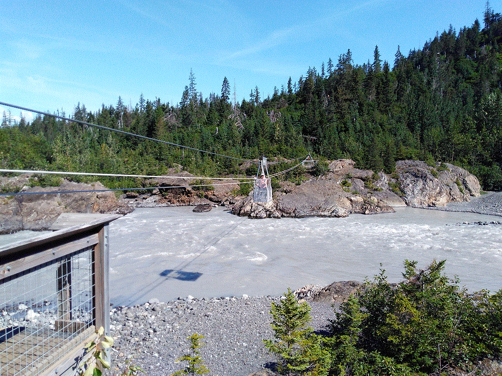
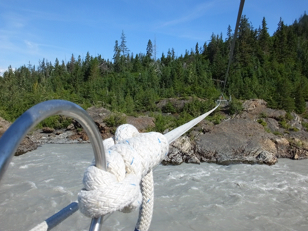
We didn’t go fishing. Instead we took a water taxi to Kachemak State Park across the bay, where we endured a seven mile hike to an iceberg-filled lake at the base of Grewingk Glacier. We also crossed the outflow river from the glacier on a cable-suspended-tram manually operated by pull rope.
We headed north to Soldotna (map pt. #42), a town on the Kenai River. July is prime salmon fishing season and banks of the river were lined with fishermen snagging and dip-netting the fish.
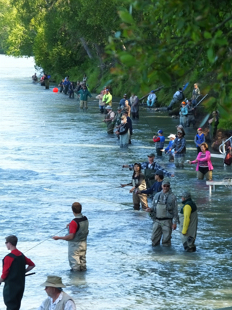
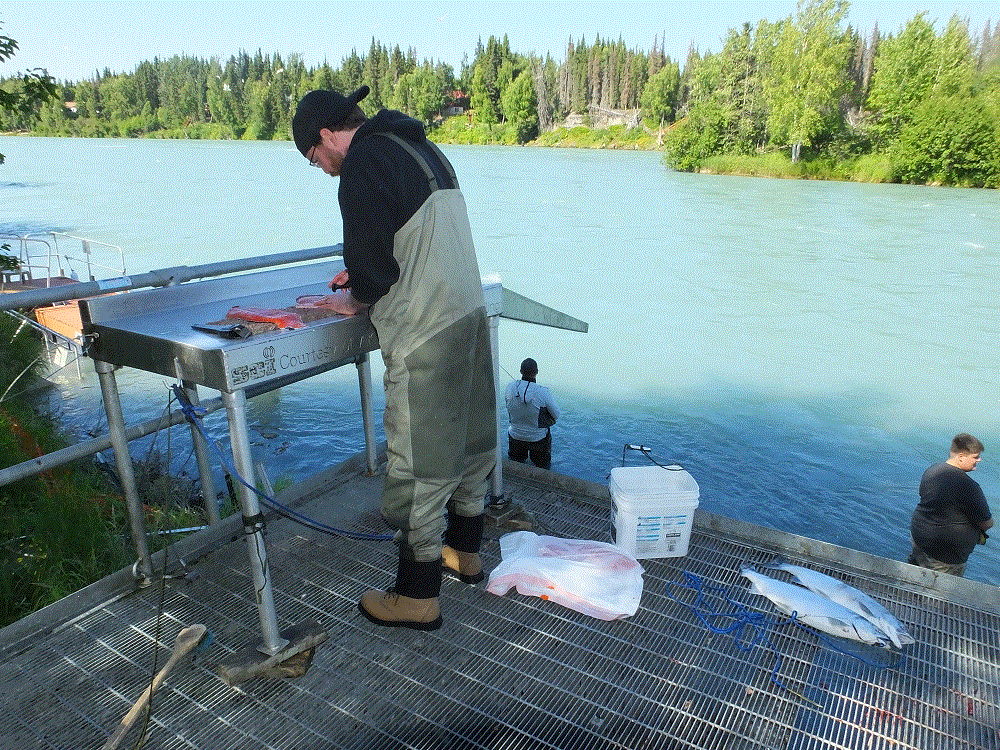
There are five kinds of salmon, each making their spawn run up rivers and streams at different times during the summer. As non-natives, we find the distinctions between each type of salmon rather confusing. Fishing regulations are especially rigorous – the booklet with various limit, size and date guidelines is almost 100 pages!
From Soldotna we travelled back across the peninsula to Seward (map pt. #44). Seward is similar to Valdez, a port circled with beautiful mountains. Cruise ships dock at Seward and passengers travel to destinations further into Alaska via the Alaska Railroad.
Our Kenai stay will end in a few days as we head back to Anchorage to meet our son Phil, who is joining us from Orlando. He will spend a week as we visit Denali National Park and take a short glacier-wildlife cruise.
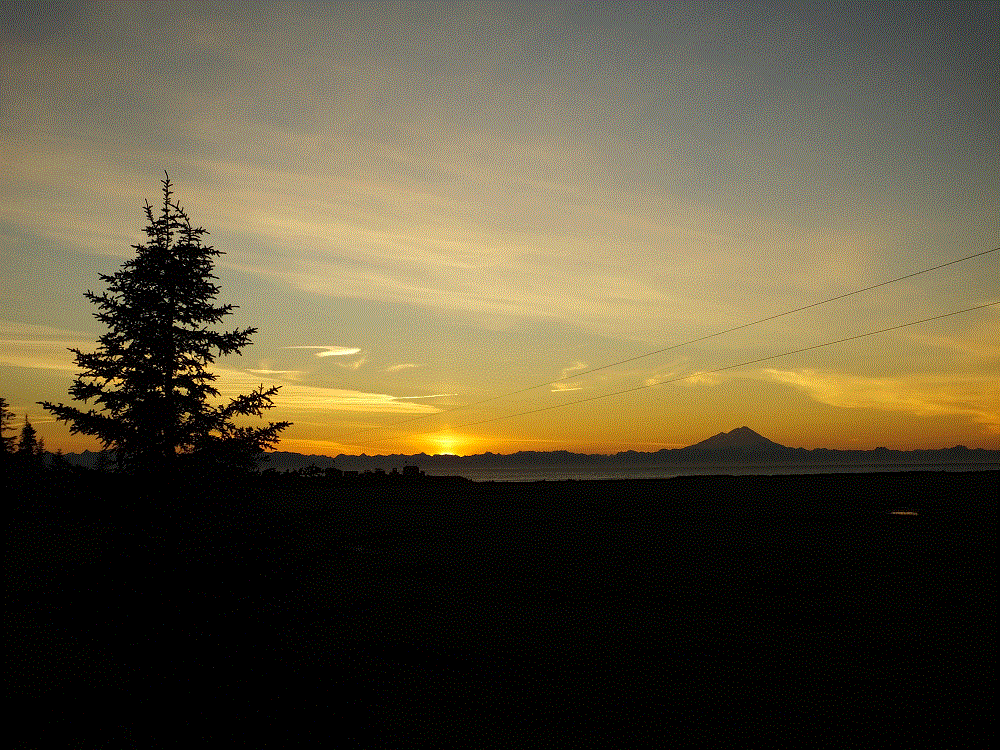
Views on the Kenai are beautiful, particularly across the Cook Inlet. Some closing photos:

One thought on “A Month on Kenai”